![]()
![]()
![]()
![]()
![]()
![]()


MY MAPS
Regions:
![]()
Browse the website:
Latest Acquisitions
A Brief History of Cartography
The Cartographers
Events on ancient maps
Accimo editions
Brochure MB
Contacts
Glossary
Sitemap
Search by author name : ""
|
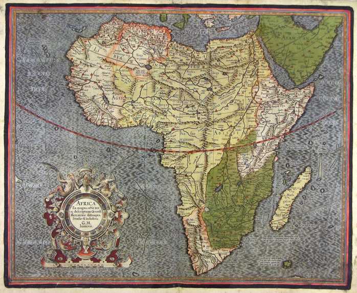
11-AFRICA .
The map belongs to the Atlas sive Cosmographicae Meditationes de Fabrica Mundi et Fabricati Figura, published in 1664 in Duisburg.
Dimensions: 47 x 37 cm Author: Gerardo Mercatore
Duisburg,1664 |

|
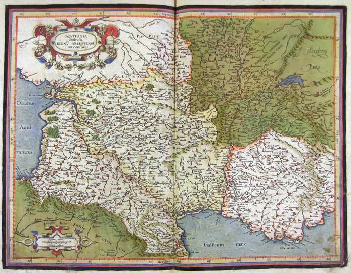
12-Aquitania .
The map is found in the Atlas sive Cosmographicae Meditationes de Fabrica Mundi et Fabricati Figura, published to Duisburg in the 1611. Dimensions: cm 47,5 x 36,3 Author: Gerardo Mercatore
Duisburg. ,1611 |
|
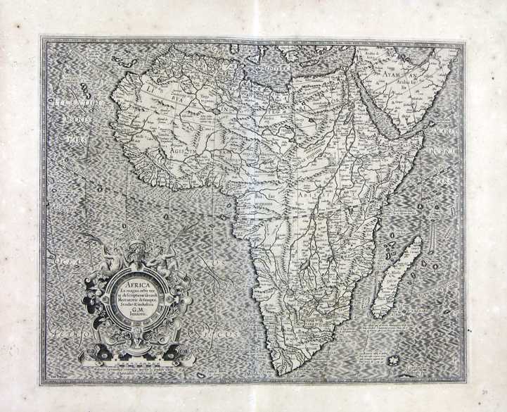
13-Africa .
The map was printed in 1611 and its design measures 37,2 x 46,3 cm. There is a decorating picture on the ocean. A remarkable intresting design taken from a fine precise engraving. Author: Gerardo Mercatore
Amsterdam,1611 |
|
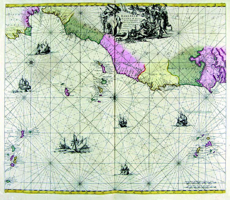
14-Barbariae Guineae - Africa .
The map is in the Atlas de la Navigation et du Commerce qui se fait dans touts the Parties du Monde, published in 1715 in Amsterdam. Map obtained from an excellent engraving decorated with elegant designs Author: Louis Rernard
Amsterdam,1715 |
|
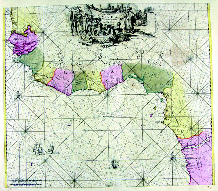
15-Guineae .
The map is in the Atlas de la Navigation et du Commerce qui se fait dans touts the Parties du Monde, published in 1715 in Amsterdam. Map obtained from an excellent engraving decorated with elegant designs. Author: Louis Renard
Amsterdam,1715 |
|
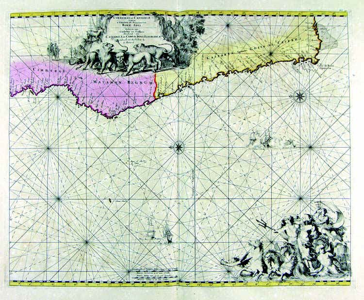
16-Cifferas e Caffaria (Capo di Buona Speranza) - Africa .
The map is in the Atlas de la Navigation et du Commerce qui se fait dans touts the Parties du Monde, published in 1715 in Amsterdam. Map obtained from an excellent engraving decorated with elegant designs. Author: Louis Renard
Amsterdam,1715 |
|
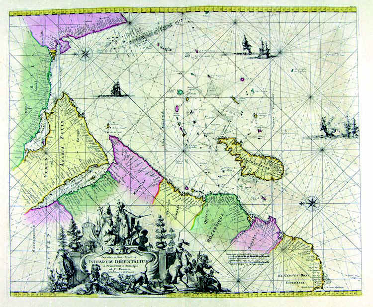
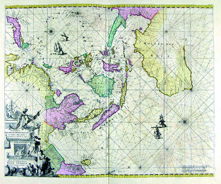
17-Indiarum Orientalium - Africa .
The map is in the Atlas de la Navigation et du Commerce qui se fait dans touts the Parties du Monde, published in 1715 in Amsterdam. Map obtained from an excellent engraving decorated with elegant designs. Author: Louis Renard
Amsterdam,1715 |
|
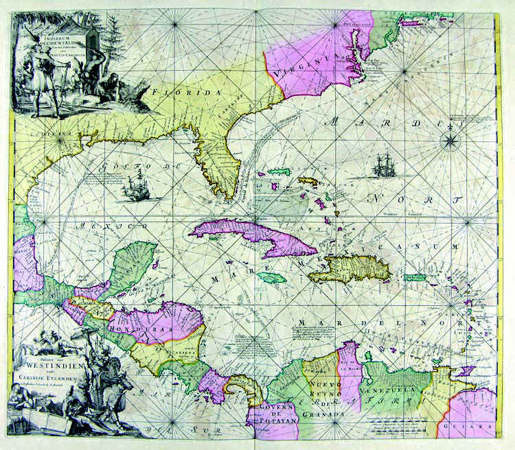
18-Westindien .
The map is in the Atlas de la Navigation et du Commerce qui se fait dans touts the Parties du Monde, published in 1715 in Amsterdam. Map obtained from an excellent engraving decorated with elegant designs. Author: Louis Renard
Amsterdam. ,1715 |
|
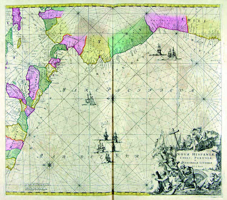
19-Novae Hispaniae .
The map is in the Atlas de la Navigation et du Commerce qui se fait dans touts the Parties du Monde, published in 1715 in Amsterdam. Map obtained from an excellent engraving decorated with elegant designs. Author: Louis Renard
Amsterdam. ,1715 |
|
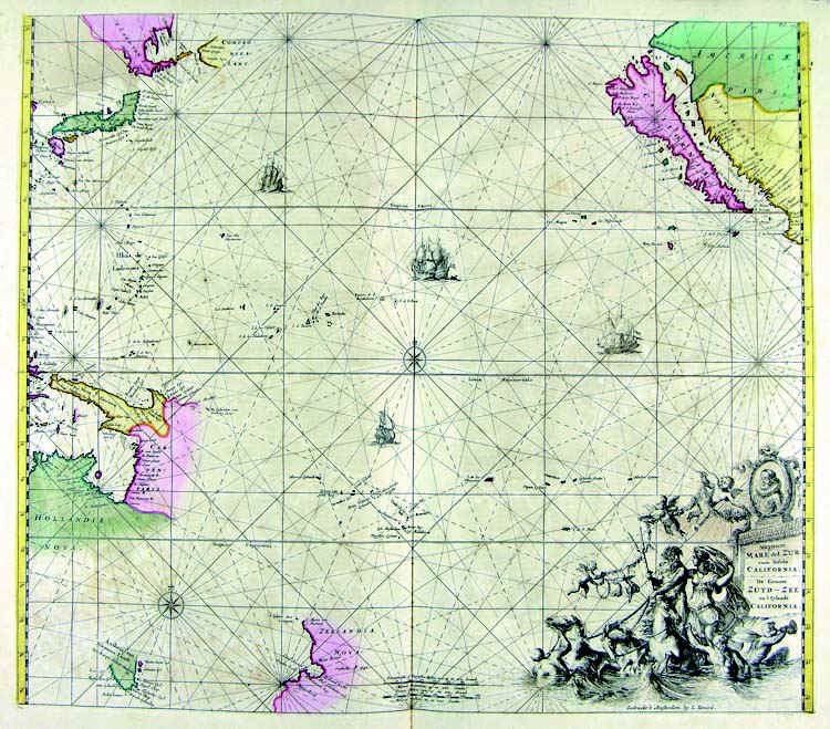
20-Mare del Zur .
The map is in the Atlas de la Navigation et du Commerce qui se fait dans touts the Parties du Monde, published in 1715 in Amsterdam.
Dimensions : cm 57,4 x 49,5 Author: Louis Renard
Amsterdam. ,1715 |
|
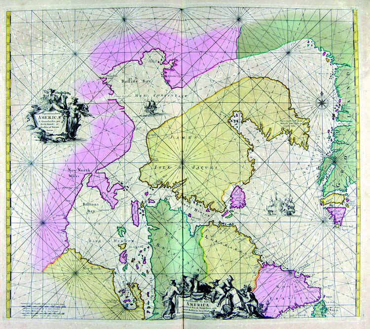
21-Americae .
The map is in the Atlas de la Navigation et du Commerce qui se fait dans touts the Parties du Monde, published in 1715 in Amsterdam.
Dimensions : cm 55,1 x 48 Author: Louis Renard
Amsterdam. ,1715 |
|
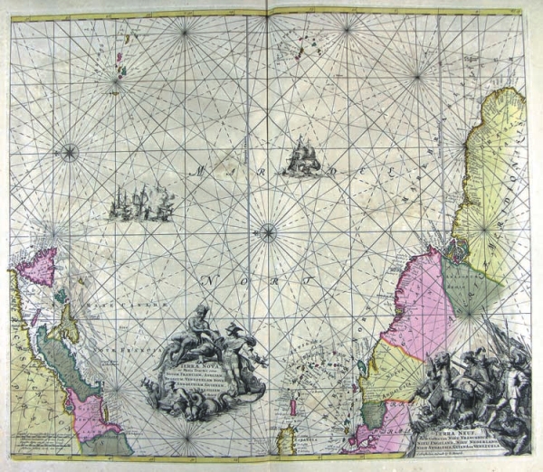
22-Terranova .
The map is in the Atlas de la Navigation et du Commerce qui se fait dans touts the Parties du Monde, published in 1715 in Amsterdam.
Dimensions : cm 56 x 48,5 Author: Louis Renard
Amsterdam. ,1715 |
|
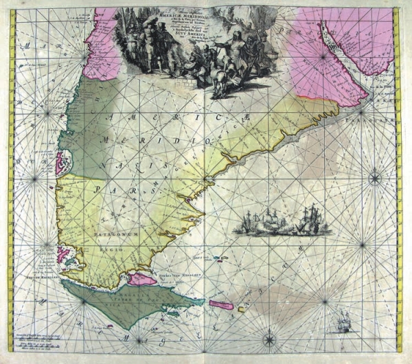
23-Meridionalis .
The map is in the Atlas de la Navigation et du Commerce qui se fait dans touts the Parties du Monde, published in 1715 in Amsterdam.
Dimensions : 55,6 x 49 cm Author: Louis Renard
Amsterdam. ,1715 |
|
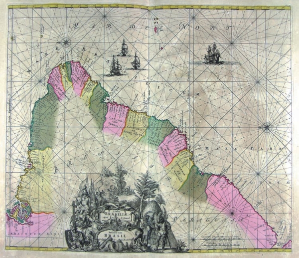
24-Brasiliae .
The map is in the Atlas de la Navigation et du Commerce qui se fait dans touts the Parties du Monde, published in 1715 in Amsterdam.
Dimensions : cm 56,4 x 49 Author: Louis Renard
Amsterdam. ,1715 |
|
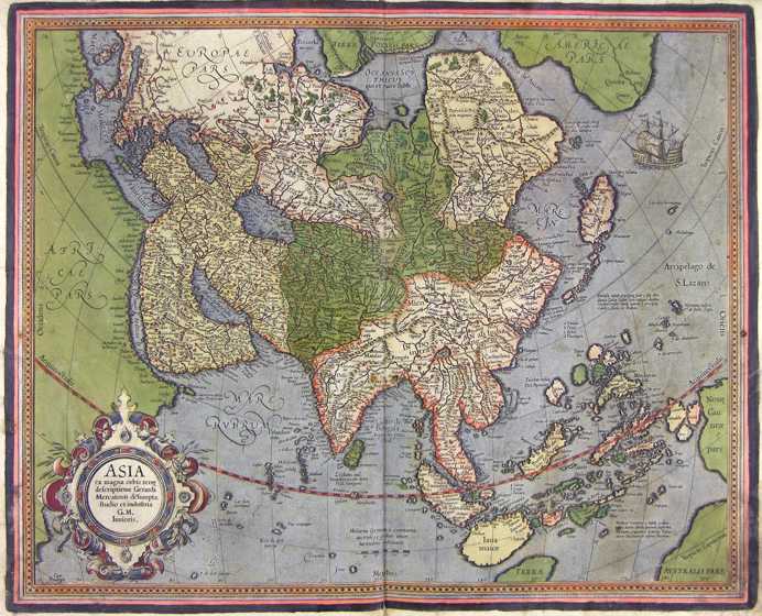
25-Asia .
The map belongs to the Atlas sive Cosmographicae Meditationes de Fabrica Mundi et Fabricati Figura, published in 1644 in Duisburg.
Dimensions: cm 47 x 37.
Author: Gerardo Mercatore
Duisburg ,1644 |
|
26-Oceania, Borneo e Australia .
The map is in the Atlas de la Navigation et du Commerce qui se fait dans touts the Parties du Monde, published in 1715 in Amsterdam. The map is decorated with a fine cartouche, from an exquisite engraving. Author: Louis Renard
Amsterdam. ,1715 |
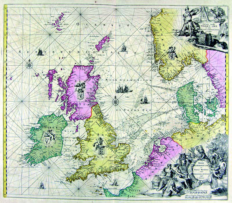
|
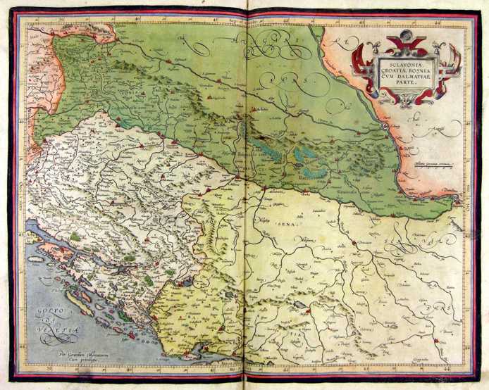
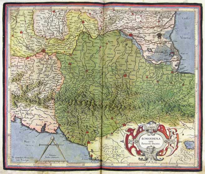
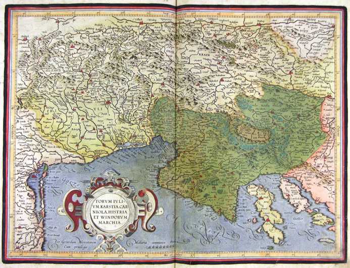
Slovenia, Croatia-Bosnia, cum Dalmatiae parte .
The document belongs to the Atlas sive Cosmographicae Meditationes de Fabrica Mundi et Fabricati Figura, published in 1644 in Duisburg. Dimensions: 47 x 37 cm. Author: Gerardo Mercatore
Duisburg. ,1644 |
|
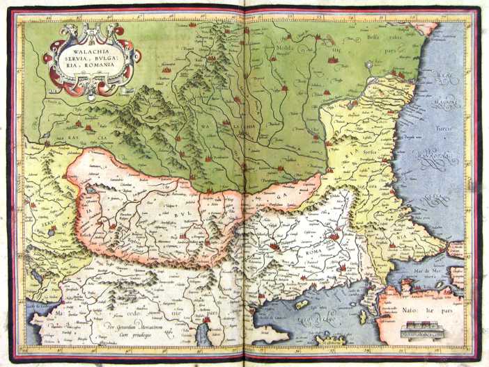
28-Walachia, Serbia, Bulgaria, Romania .
The document belongs to the Atlas sive Cosmographicae Meditationes de Fabrica Mundi et Fabricati Figura, published in 1644 in Duisburg. Dimensions : cm 47,5 x 35,8 Author: Gerardo Mercatore
Duisburg. ,1664 |
|
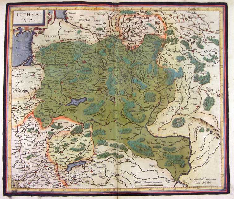
30-Lithuania - Lituania .
The map belongs to the Atlas sive Cosmographicae Meditationes de Fabrica Mundi et Fabricati Figura, published in 1644 in Duisburg. Dimensions: cm 45,3 x 38,5 Author: Gerardo Mercatore
Duisburg. ,1644 |
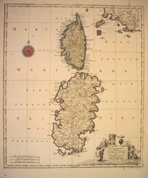
|
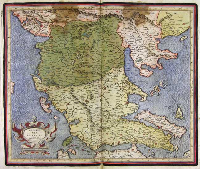
29-Macedonia, Epirus et Achaia .
The document belongs to the Atlas sive Cosmographicae Meditationes de Fabrica Mundi et Fabricati Figura, published in 1644 in Duisburg.
Dimensions : cm 43,5 x 36,8
Author: Gerardo Mercatore
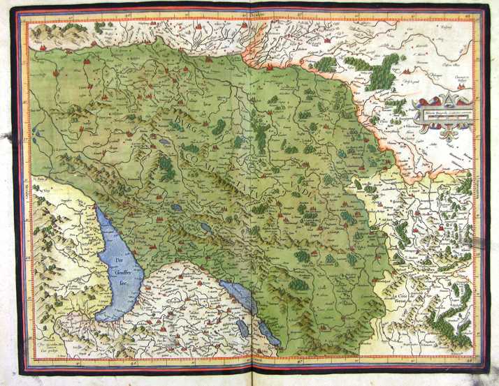
Duisburg. ,1664 |
|
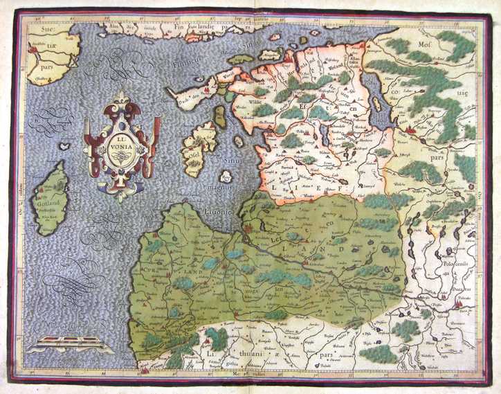
31-Livonia - Lettonia .
The map belongs to the Atlas sive Cosmographicae Meditationes de Fabrica Mundi et Fabricati Figura, published in 1644 in Duisburg. Dimensions : cm 48,5 x 36 Author: Gerardo Mercatore
Duisburg. ,1644 |
|
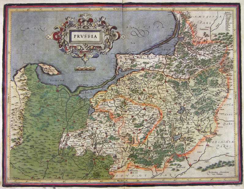
32-Prussia .
The map belongs to the Atlas sive Cosmographicae Meditationes de Fabrica Mundi et Fabricati Figura, published in 1644 in Duisburg. Dimensions : 50 x 37,5 cm Author: Gerardo Mercatore
Duisburg. ,1644 |
|
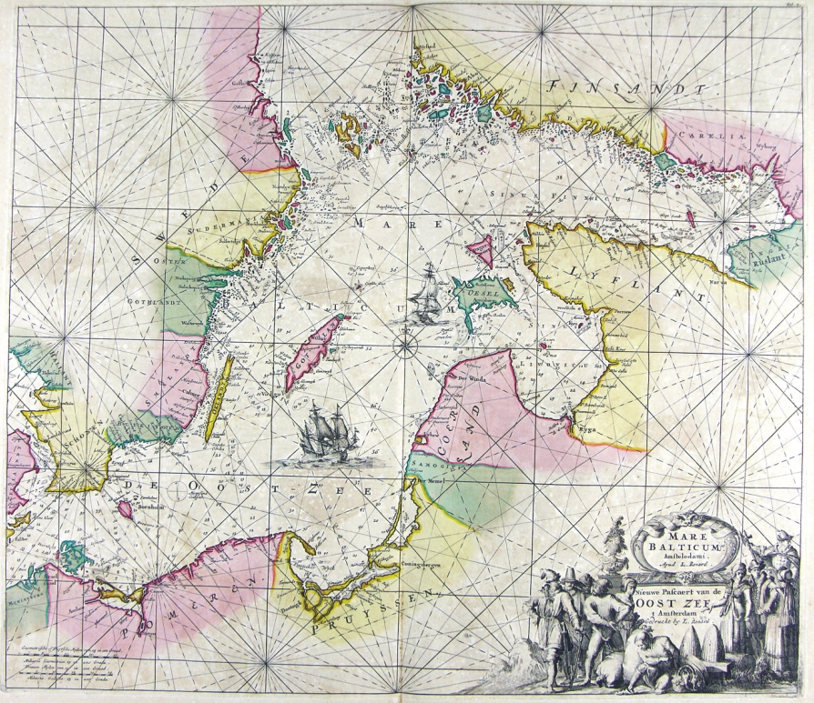
33-Mare Balticum - Mar Baltico .
The map belongs to the Atlas de la Navigation et du Commerce qui se fait dans toutes les Parties du Monde, published in 1715 in Amsterdam. The document has an elegant design taken from a precious engraving.
Dimensions : cm 57,5 x 49,5 Author: Louis Renard
Amsterdam. ,1715 |
|
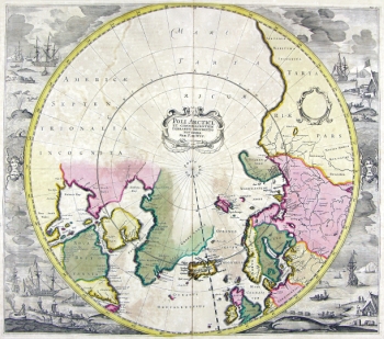
34-Poli Artici .
The map belongs to the Atlas de la Navigation et du Commerce qui se fait dans toutes les Parties du Monde, published in 1715 in Amsterdam.
taken from a fine engraving and decorated with a lot of drawings. Dimensions: 48,6 x 43 cm Author: Louis Renard
Amsterdam,1715 |
|
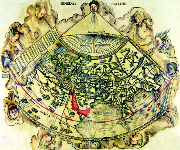
35-Carta del Mondo .
The map belongs to table 2 of the atlas Ptolomeus Auctus restitutus et maculatus cum tabulis veteribus ac novis. Typis Joannis Scoti . It contains very beautiful documents.This ecumenic planiphere summarizes the antique geographic knowledges. Author: Claudio Tolomeo
Strasburgo. ,1520 |
|
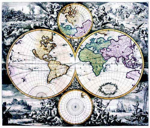
36-Terrarum Orbis .
The map belongs to the Atlas de la Navigation et du Commerce qui se fait dans toutes les Parties du Monde and was printed in 1715 in Amsterdam chez Louis Renard, Marchant libraire. It's one of the best atlas of the 18th century. The planisphere is colored and measures 48,5 x 57 cm. It's very finely engraved and decorated with representations of mythological scenes, seamonsters, scenes of country and warlife. Framed it will have a big effect. Very interesting map for amateurs of antique geography. Author: Louis Renard
Amsterdam ,1715 |
|
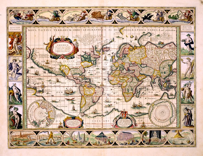
37-Nova et Accuratissima Totius Terrarum Orbis Tabula .
The map is part of the atlas Geographia, quae is Cosmographiae Blauianae pars prima, qua orbisterrae tabulis ante oculus ponitus et descriptionibus illustratur di Ioannis Blaeu. It was printed in 1665 in Amsterdam. The world map is richly ornamented with mythological figures and exotic. Dimensions: 53.5 x 40 cm
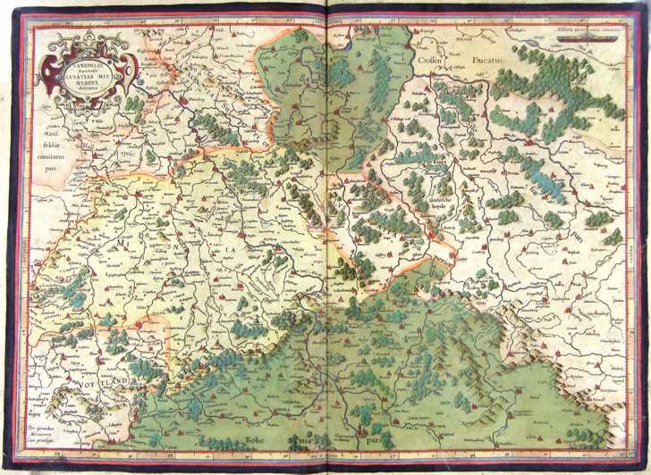
Author: Ioannis Blaeu
Amsterdam,1665 |
|
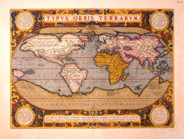
38-Typus Orbis Terrarum .
This planisphere, printed in the 16 th century in the Blaeu workshop in Amsterdam shows some differences from the Blaeu edition of 1662. Author: Abramo Ortelio
Amsterdam. ,1665 |
|
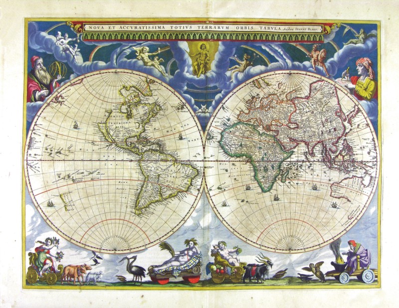
Nova Totius Terrarum Oorbis Geographica ac Hydrographica Tabula .
This finely-executed map shows splendid mythological figures, the moon and the planets at the top, the four elements of Nature on the left, the four Seasons on the right and the seven Wonders of the World at the bottom. There also are three pictures, a wind rose, the poles, several sailing vessels and sea monsters. The drawing of this map measures 54 x 41 cm and the borders 7,5 cm. It comes from an atlas of the 17th century, probably printed in 1630 in the Blaeu workshop in Amsterdam. Author: Ioannis Blaeu
Amsterdam,1630 |
|
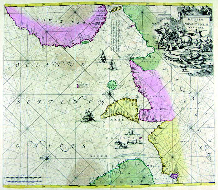
40-Russia e Nova Zemla .
The map belogs to the Atlas de la Navigation et du Commerce qui se fait dans toutes les Parties du Monde, published in 1715 in Amsterdam. It has an elegant design taken from a precious engraving. Dimensions : cm 56,5 x 50 Author: Louis Renard
Amsterdam. ,1715 |
|
41-Russia e Mar Nero .
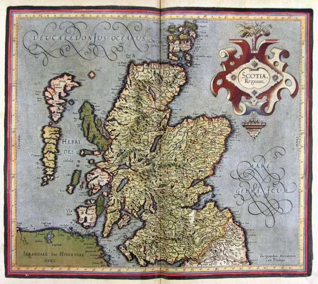
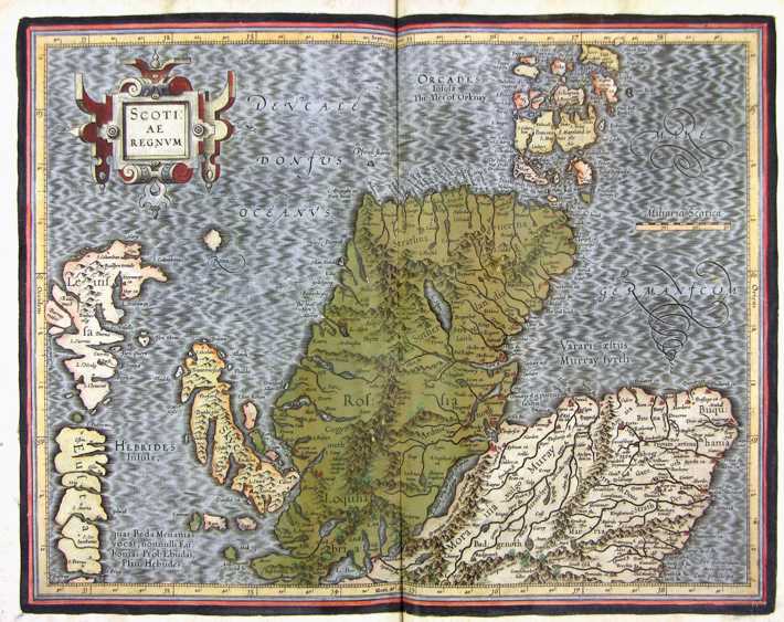
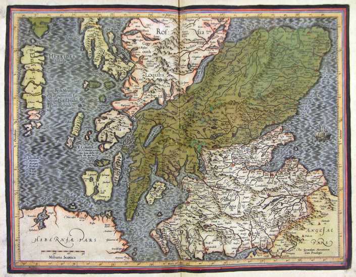
The map belongs to the Atlas sive Cosmographicae Meditationes de Fabrica Mundi et Fabricati Figura, published in 1644 in Duisburg. Dimensions: 40,5 x 32 cm. Author: Gerardo Mercatore
Duisburg. ,1644 |
|
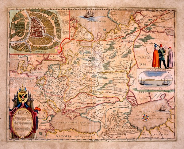
42-Russia .
The European Russia. A picture of Moscou by Fedori Borisowitsi appears at the top and a view of Archangelsckagoroda with a graphic scale in Germanic miles and three exotic figures are on the right. This map of 1614 is dedicated to Hesselo Gerardo and measures 54 x42,5cm. Author: Fedori Borisowitsi
,1614 |
|
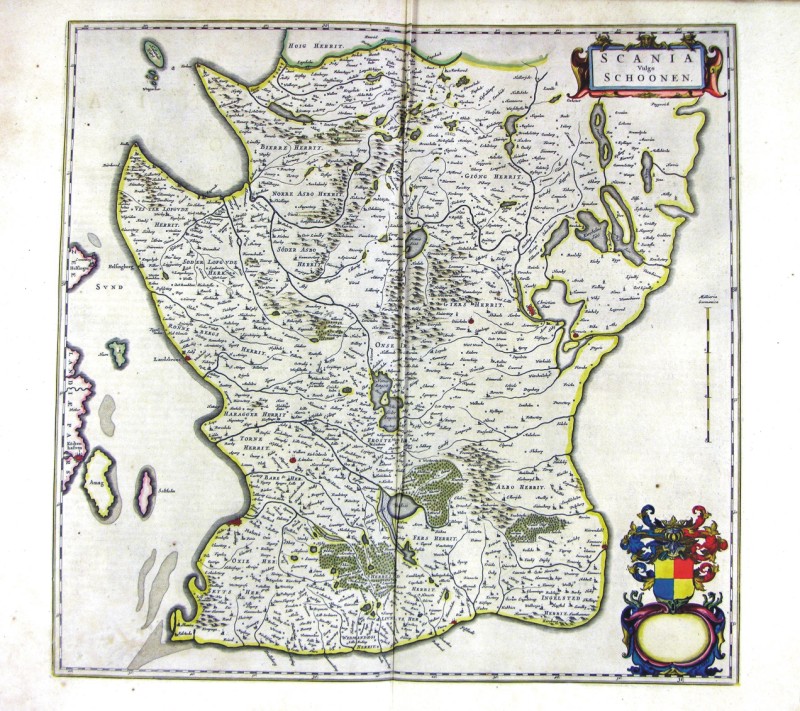
50-Scania - Svezia .
The map belongs to Geographia, quae est cosmographiae Blauianae pars prima, qua orbisterrae tabulis ante oculus ponitus et descriptionibus illustratur, published in 1665 in Amsterdam. Dimensions : cm 51 x 49,0 Author: Ioannis Blaeu
Amsterdam,1665 |
|
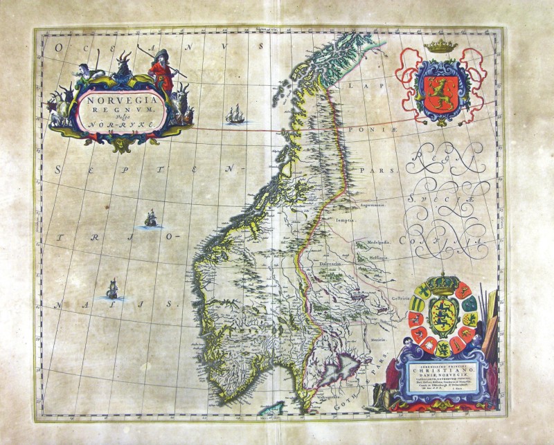
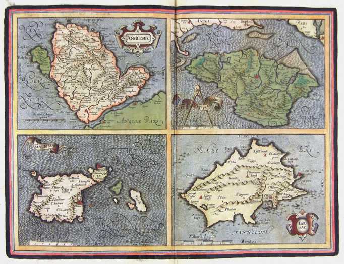
43-Norvegia Regnum - Norvegia .
The map belongs to Geographia, quae est cosmographiae Blauianae pars prima, qua orbisterrae tabulis ante oculus ponitus et descriptionibus illustratur, published in 1665 in Amsterdam. Dimensions: cm 49 x 40,6 Author: Ioannis Blaeu
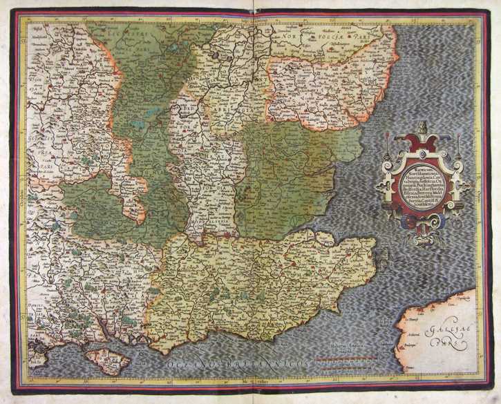
Amsterdam,1665 |
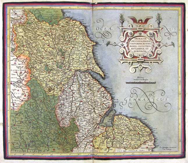
|
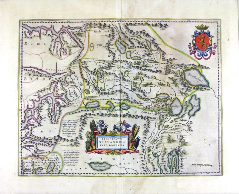
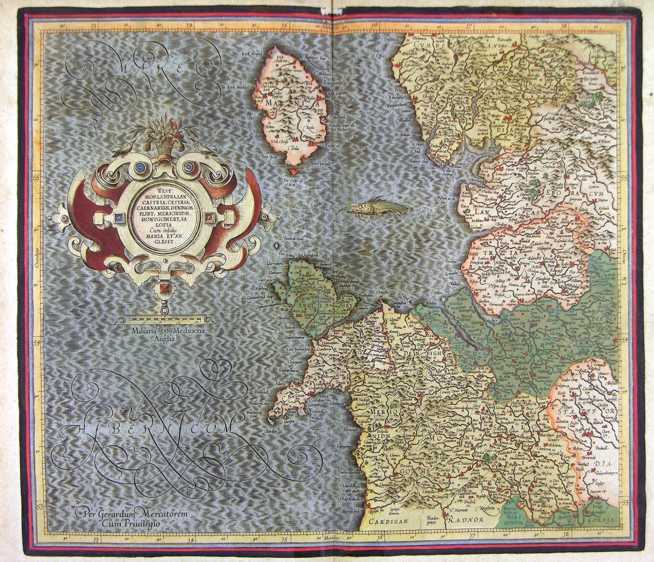
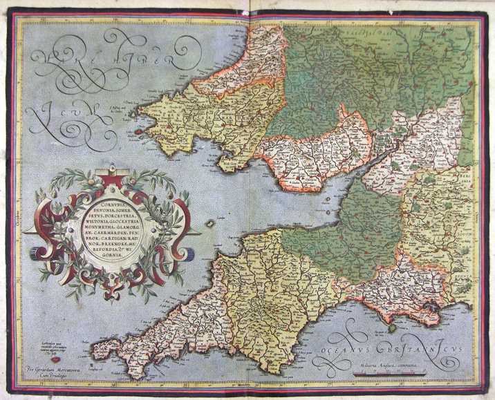
44-Episcopatus Stavangriensis Pars Borealis - Norvegia .
The map belongs to Geographia, quae est cosmographiae Blauianae pars prima, qua orbisterrae tabulis ante oculus ponitus et descriptionibus illustratur, published in 1665 in Amsterdam. Dimensions : cm 50 x 36,4 Author: Ioannis Blaeu
Amsterdam,1665 |
|
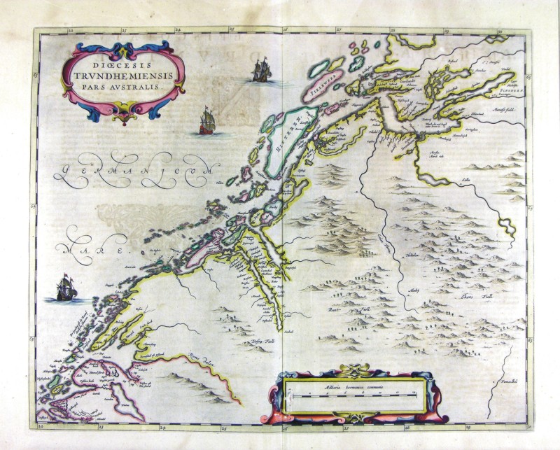
45-Diocesis Trundhemiensis - Norvegia .
The map belongs to Geographia, quae est cosmographiae Blauianae pars prima, qua orbisterrae tabulis ante oculus ponitus et descriptionibus illustratur, published in 1665 in Amsterdam. Dimensions : cm 52,5 x 41,9 Author: Ioannis Blaeu
Amsterdam,1665 |
|
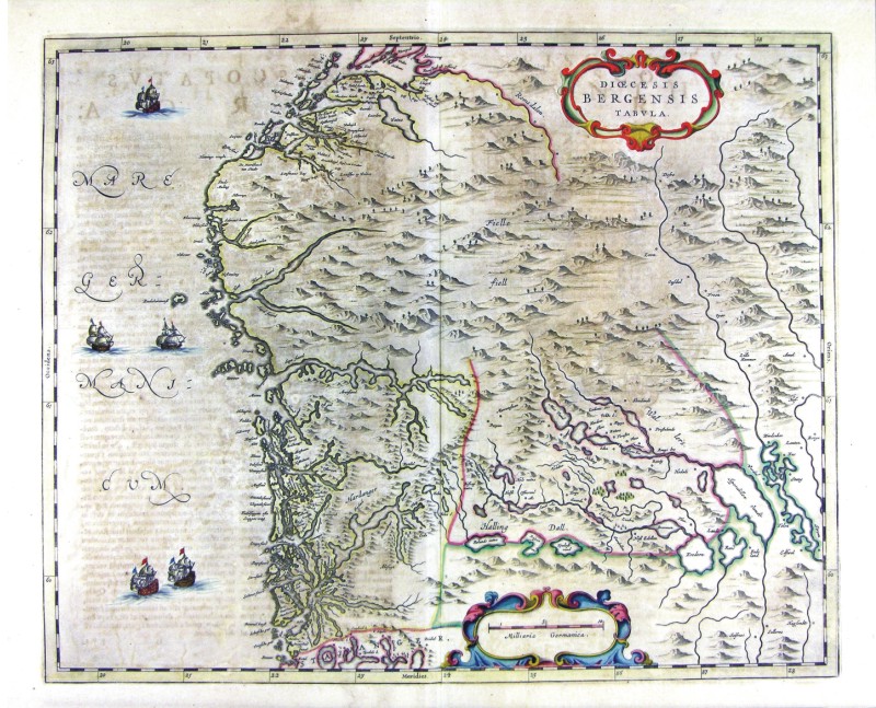
46-Diocesis Bergensis - Norvegia .
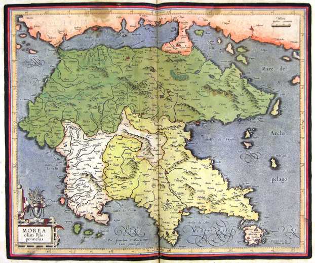
The map belongs to Geographia, quae est cosmographiae Blauianae pars prima, qua orbisterrae tabulis ante oculus ponitus et descriptionibus illustratur, published in 1665 in Amsterdam. Dimensions : cm 52,5 x 41 Author: Ioannis Blaeu
Amsterdam,1665 |
|
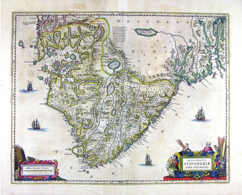
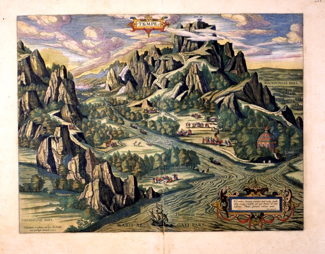
47-Episcopatus Stavangriae Pars Australis - Norvegia .
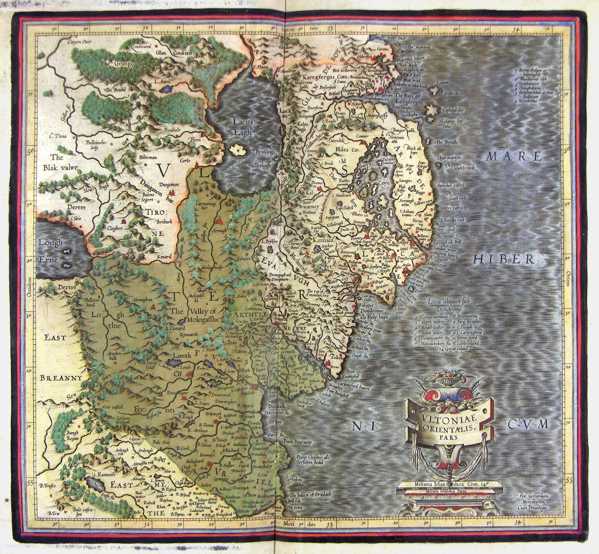
The map belongs to Geographia, quae est cosmographiae Blauianae pars prima, qua orbisterrae tabulis ante oculus ponitus et descriptionibus illustratur, published in 1665 in Amsterdam. Dimensions : cm 52,5 x 41 Author: Ioannis Blaeu
Amsterdam,1665 |
|
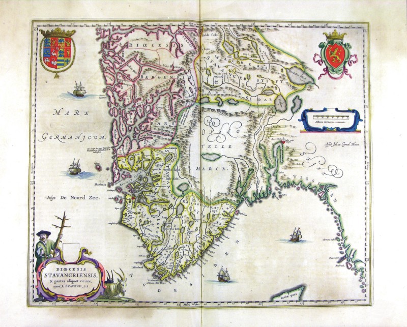
48-Diocesis Stavangriensis - Norvegia .
The map belongs to Geographia, quae est cosmographiae Blauianae pars prima, qua orbisterrae tabulis ante oculus ponitus et descriptionibus illustratur, published in 1665 in Amsterdam. Dimensions : cm 49,5 x 41,2 Author: Ioannis Blaeu
Amsterdam,1665 |
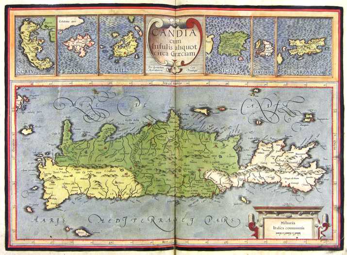
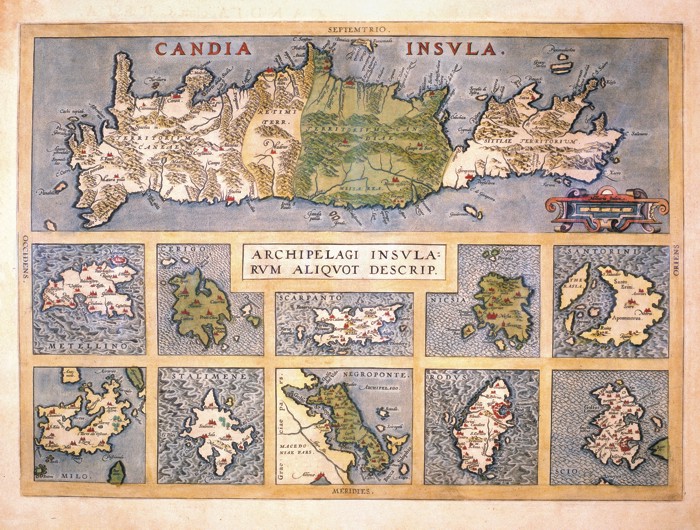
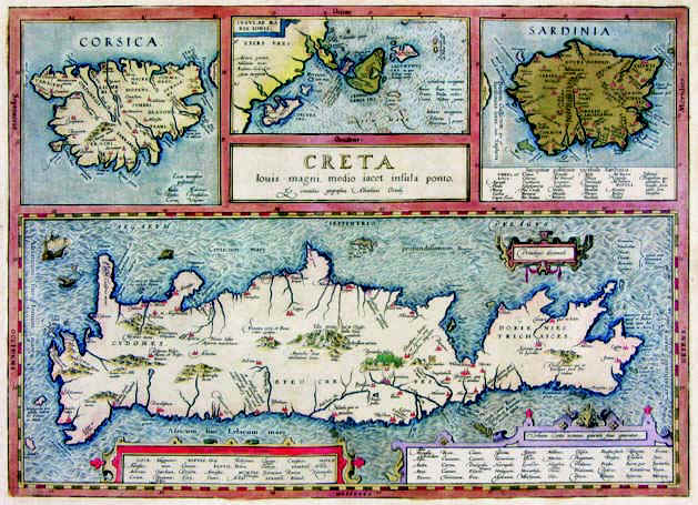
|
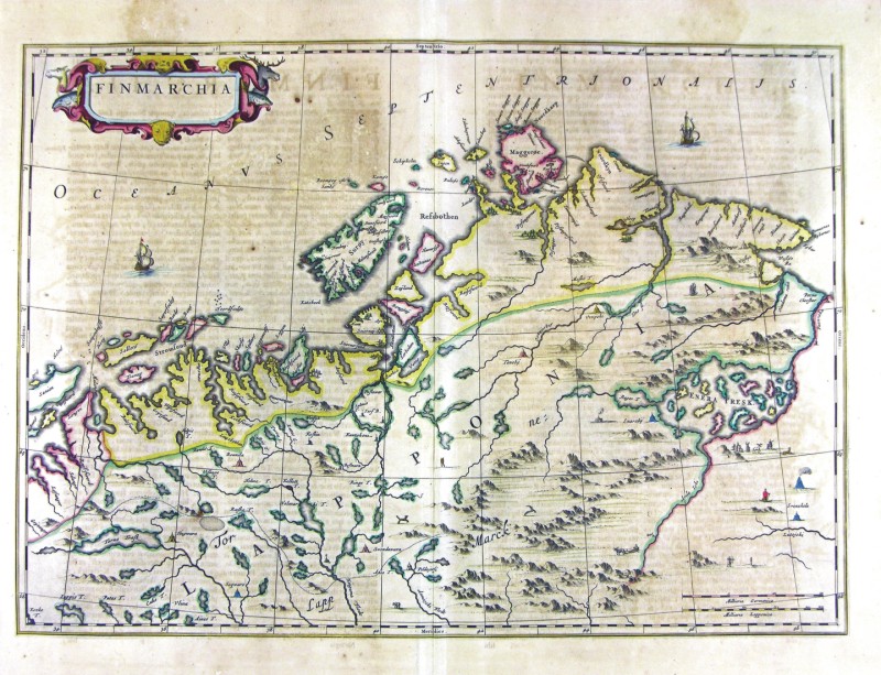
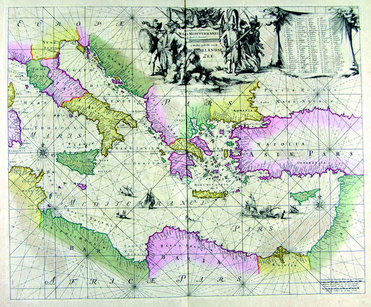
49-Finmarchia - Norvegia .
The map belongs to Geographia, quae est cosmographiae Blauianae pars prima, qua orbisterrae tabulis ante oculus ponitus et descriptionibus illustratur, published in 1665 in Amsterdam. Dimensions : cm 55 x 39,1 Author: Ioannis Blaeu
Amsterdam,1665 |
|
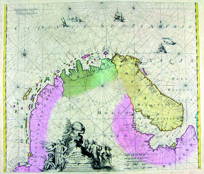
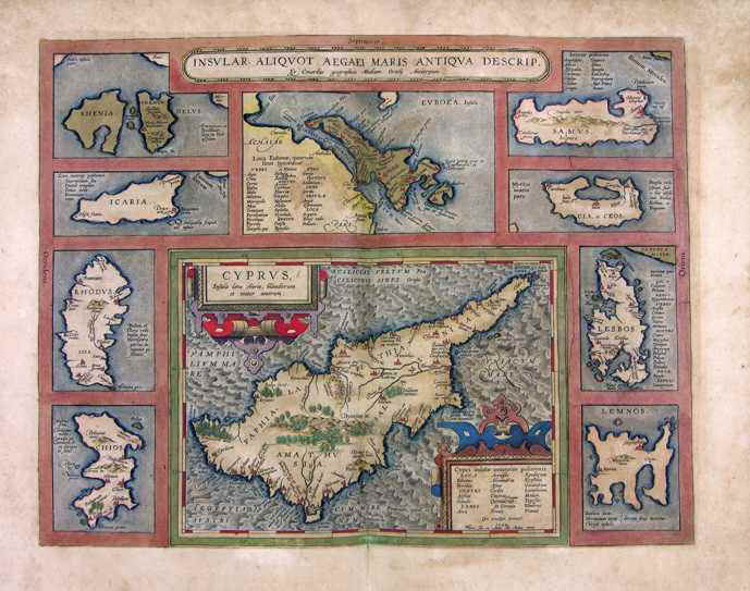
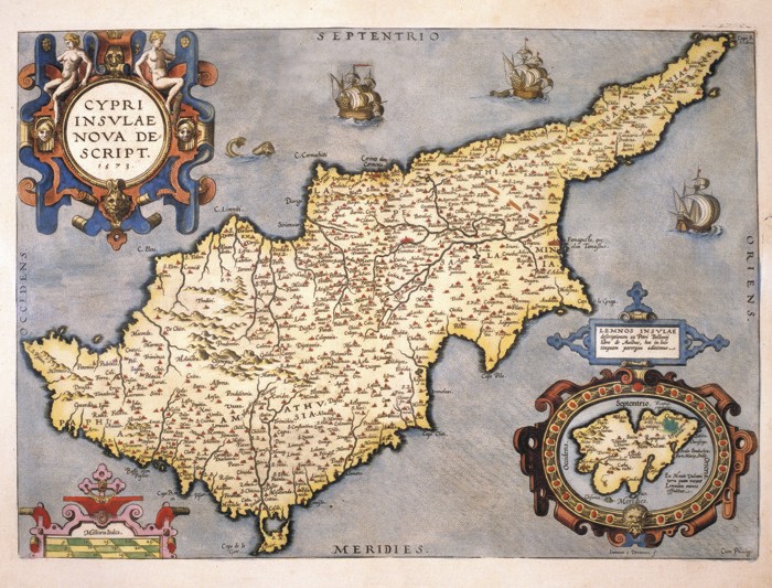
51-Finmarchia & Laplandia .
The document belongs to Atlas de la Navigation et du Commerce qui se fait dans toutes les Parties du Monde, published in 1715 in Amsterdam. Dimensions : cm 57,6 x 50 Author: Louis Renard
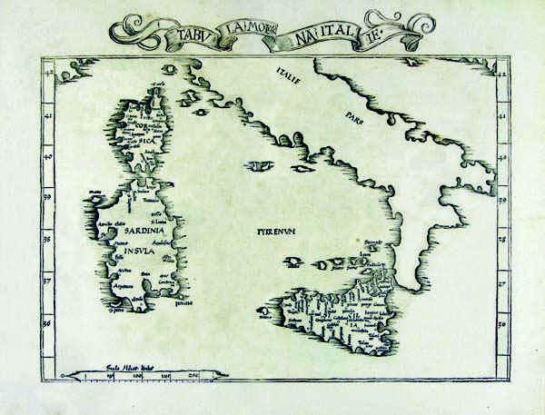
Amsterdam,1715 |
|
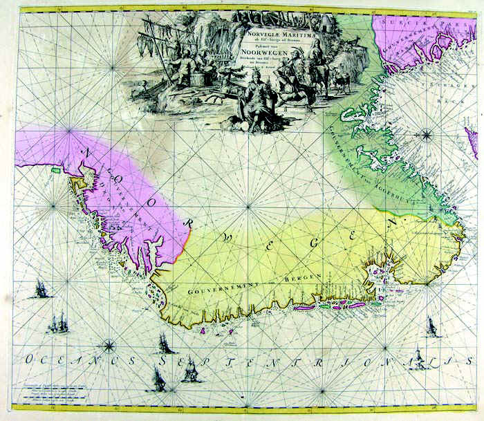
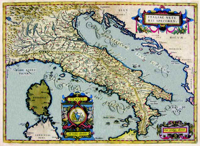
52-Norvegiae Maritima - Norvegia .
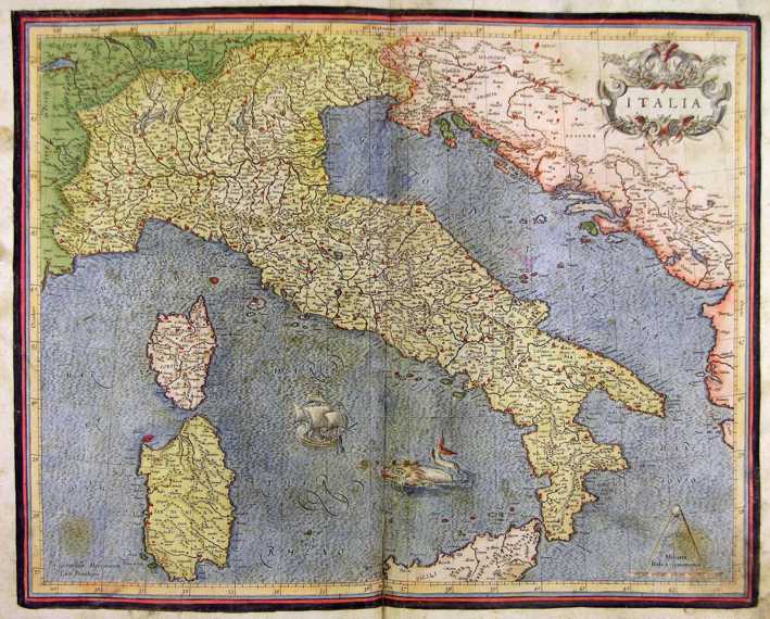
The document belongs to Atlas de la Navigation et du Commerce qui se fait dans toutes les Parties du Monde, published in 1715 in Amsterdam. Dimensions : cm 56,9 x 50 Author: Louis Renard
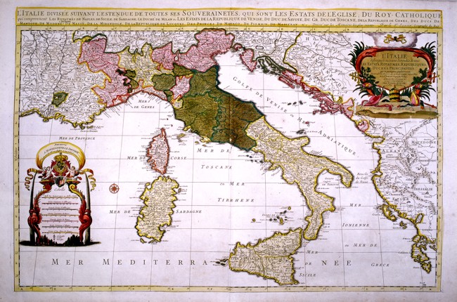
Amsterdam,1715 |
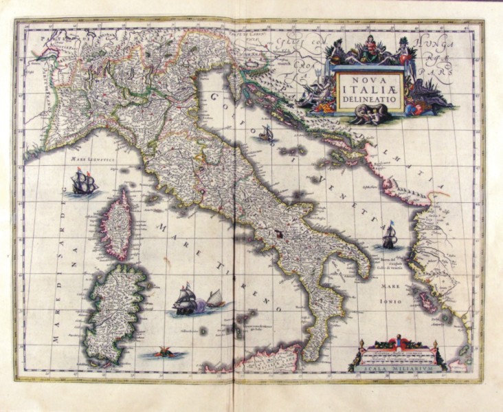
|
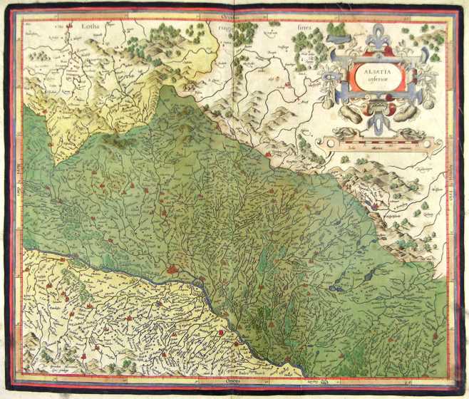
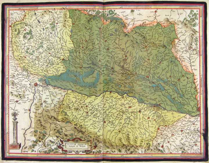
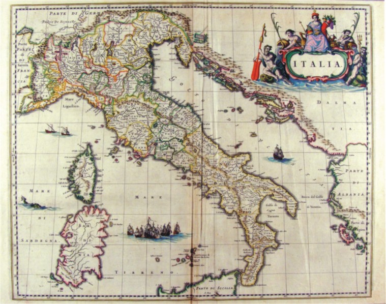
126-Alsazia inf. - Germania .
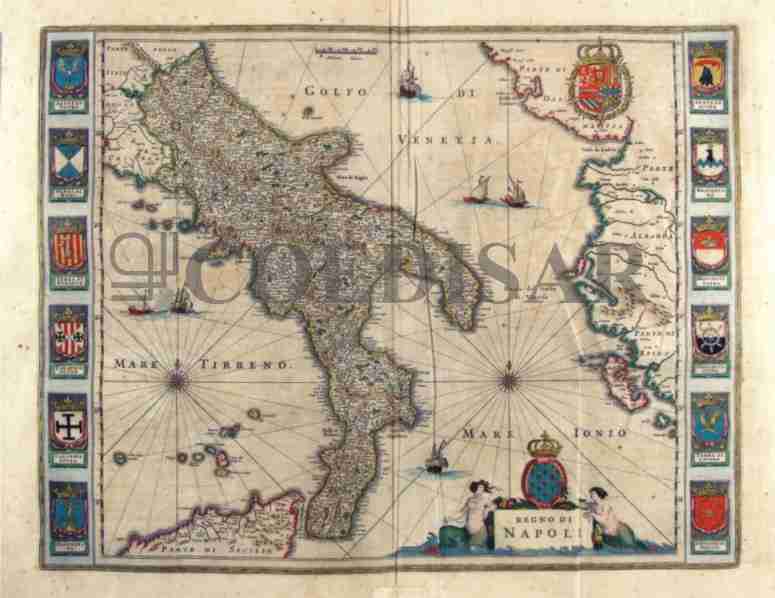
The map belongs to the Atlas sive Cosmographicae Meditationes de Fabrica Mundi et Fabricati Figura, published in 1611 in Duisburg. Author: Gerardo Mercatore
Duisburg,1611 |
|
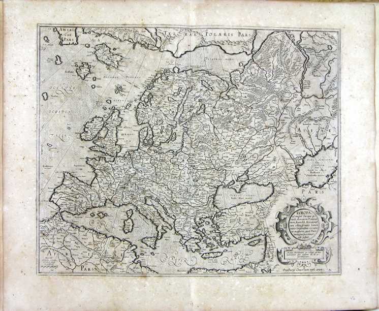
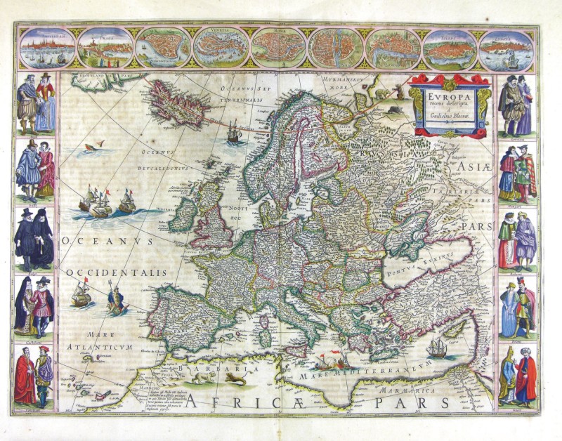
54-Europa .
The map belongs to the Atlas sive Cosmographicae Meditationes de Fabrica Mundi et Fabricati
Dimensions : cm 47,5 x 57 Author: Gerardo Mercatore
Duisburg,1644 |
|
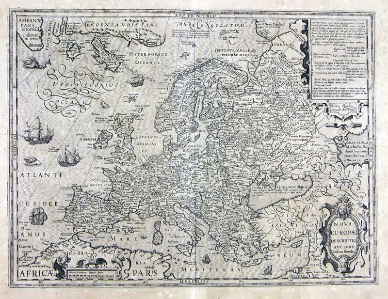
55-Nuova Europa .
The map was printed in 1611, measures 37 x 49,2 cm and has several sailing-ship decorations. It expose Europe from Greenland to the Mediterranean Sea and, at east, to the Caspian Sea. Author: Iodoco Hondio
,1611 |
|
56-Europa recens descripta .
Measuring 55,5 x 41 cm, this map was printed at the beginning of the 16th century in Amsterdam with the same matrix of the preceding map. It shows some differences in the colours and the figures of the surrounding squares.
Author: Guglielmo Blaeu
Amsterdam,0 |
|
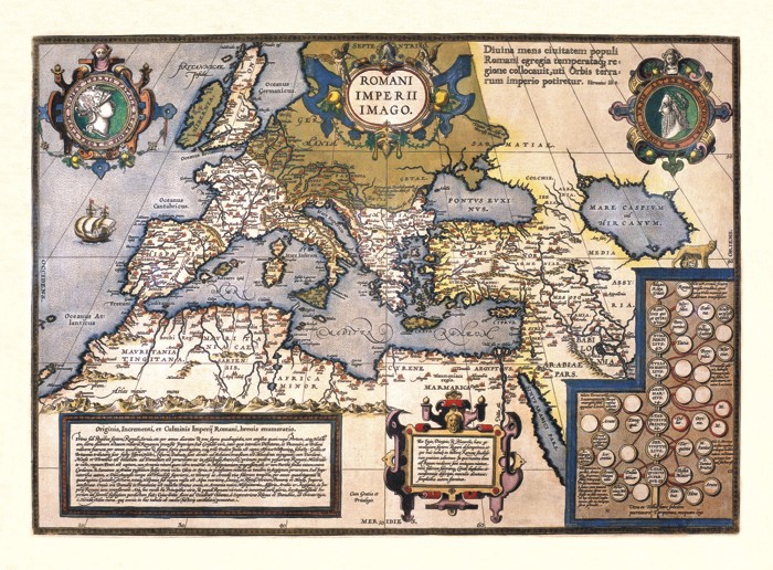
57-Romani Imperi Imago .
The map belong to the Atlas Theatrum Orbis Terrarum. Published in 1592 in Anversa.
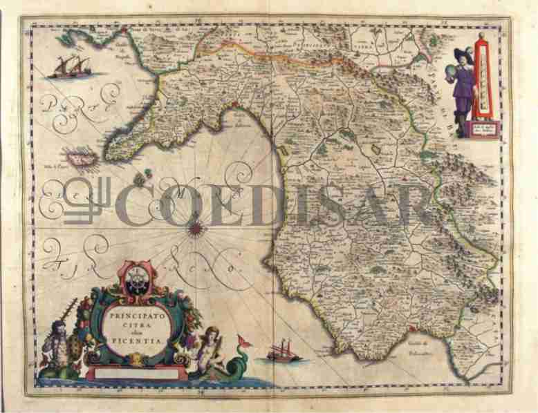
Author: Abramo Ortelio
Anversa,1592 |
|
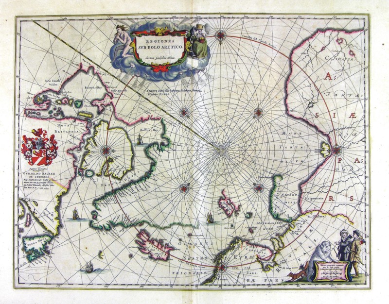
58-Regiones Sub Polo Artico .
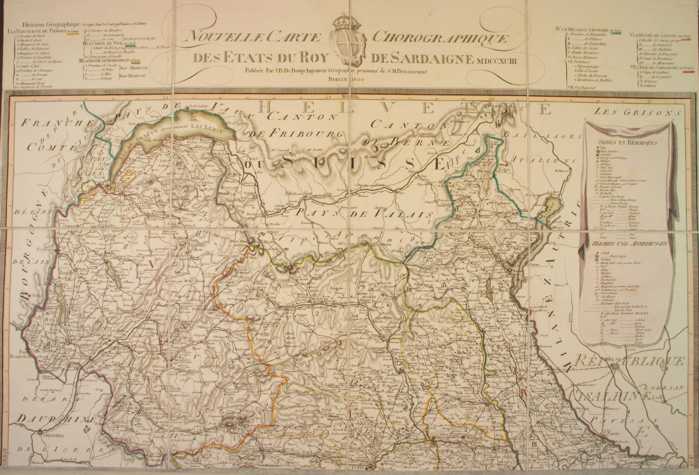
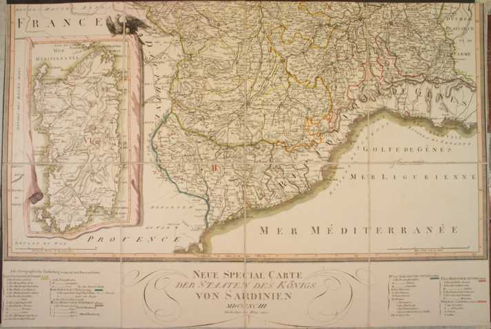
The map belongs to the Geographia, quae est cosmographiae Blauianae pars prima, qua orbisterrae tabulis ante oculus ponitus et descriptionibus illustratur, published in 1665 in Amsterdam. Dimensions: 53 x 48,5 cm. Author: Ioannis Blaeu
Amsterdam,1665 |
|
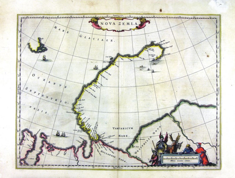
58-Nova Zemla .
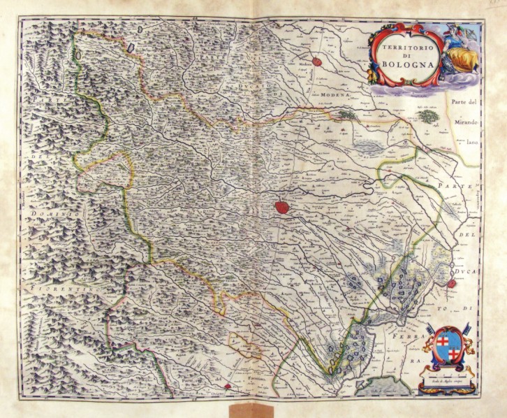
The map belongs to the Geographia, quae est cosmographiae Blauianae pars prima, qua orbisterrae tabulis ante oculus ponitus et descriptionibus illustratur, published in 1665 in Amsterdam. Dimensions : cm 49,5 x 37,5 Author: Ioannis Blaeu
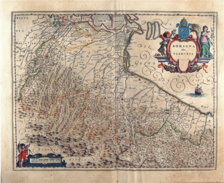
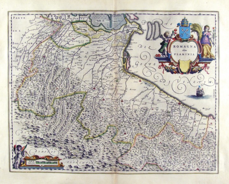
Amsterdam,1665 |
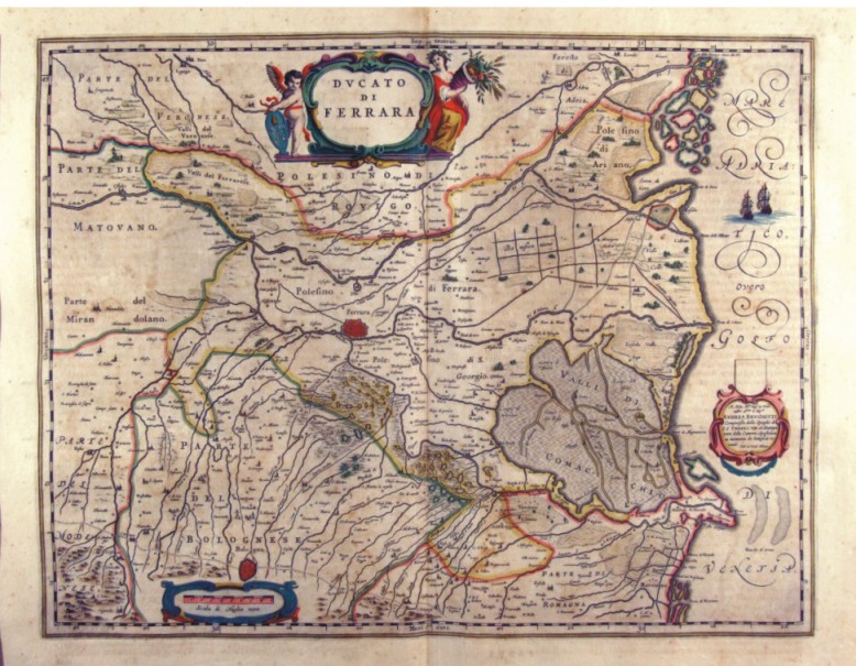
|
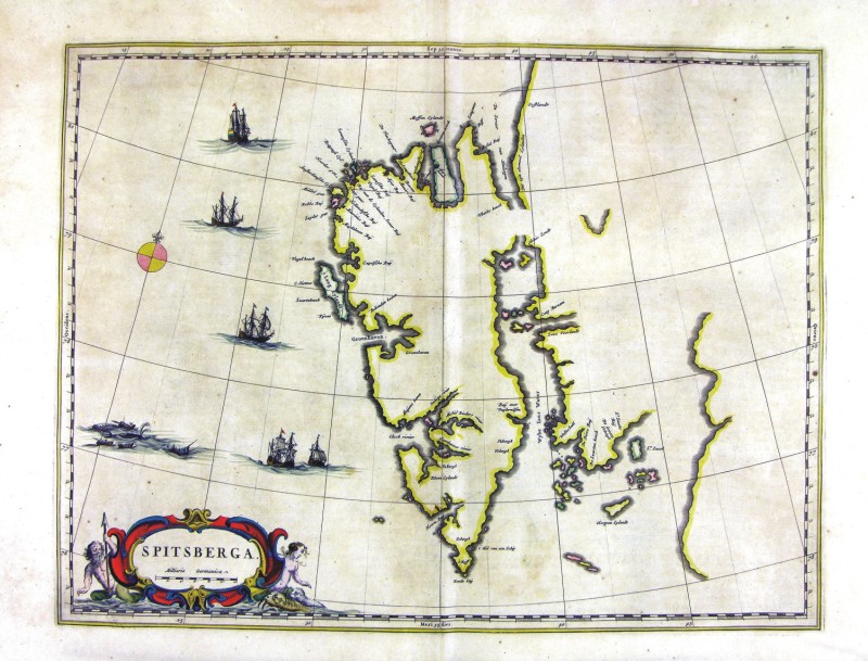
60-Spitsberga .
The map belongs to the Geographia, quae est cosmographiae Blauianae pars prima, qua orbisterrae tabulis ante oculus ponitus et descriptionibus illustratur, published in 1665 in Amsterdam. Dimensions : cm 48,5 x 36,8 Author: Ioannis Blaeu
Amsterdam,1665 |
|
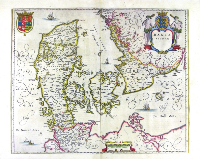
61-Dania Regnum - Danimarca .
The map belongs to the Geographia, quae est cosmographiae Blauianae pars prima, qua orbisterrae tabulis ante oculus ponitus et descriptionibus illustratur, published in 1665 in Amsterdam. Dimensions : cm 52 x 42 Author: Ioannis Blaeu
Amsterdam,1665 |
|
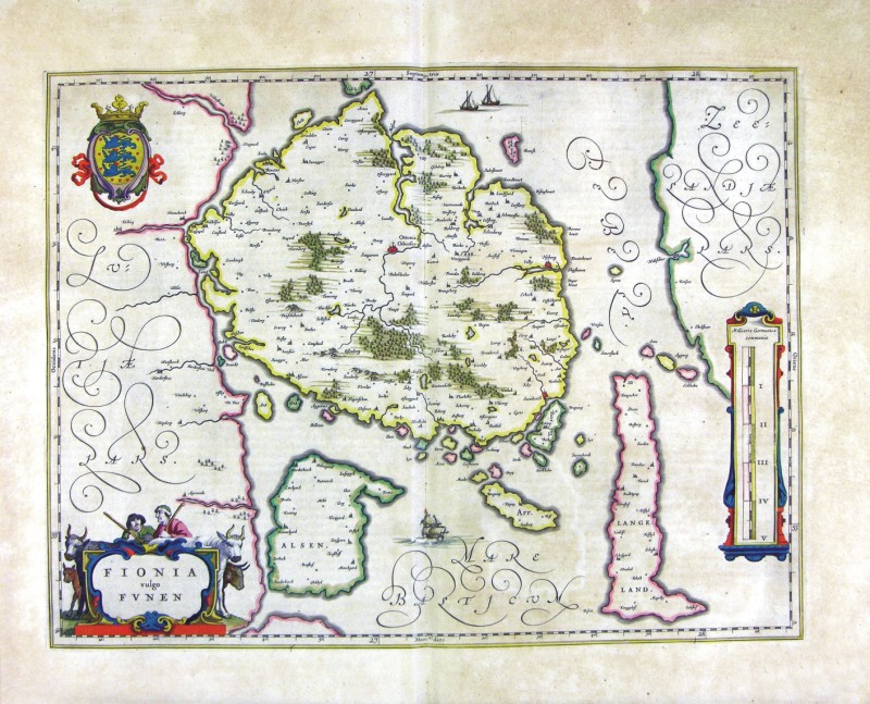
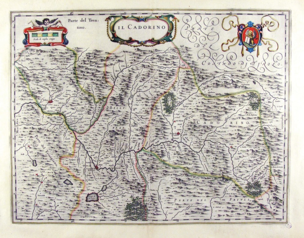
62-Fionia - Danimarca .
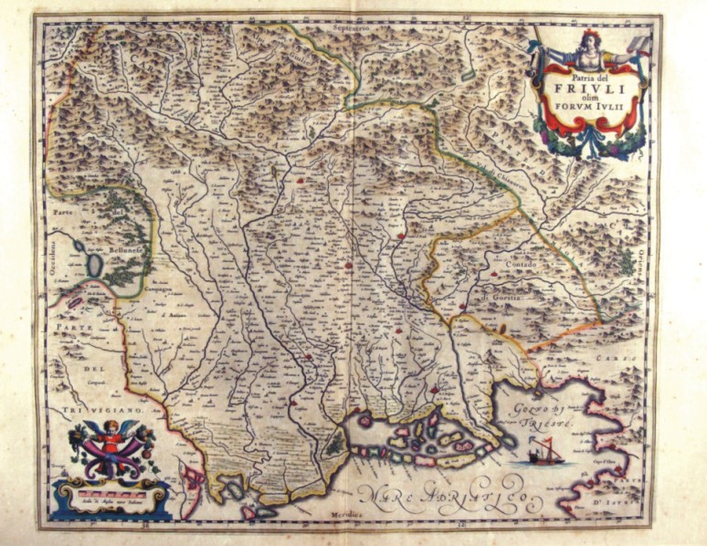
The map belongs to the Geographia, quae est cosmographiae Blauianae pars prima, qua orbisterrae tabulis ante oculus ponitus et descriptionibus illustratur, published in 1665 in Amsterdam. Dimensions : cm 49,5 x 37,5 Author: Ioannis Blaeu
Amsterdam,1665 |

|
63-Helgelandia - Danimarca .
The map belongs to the Geographia, quae est cosmographiae Blauianae pars prima, qua orbisterrae tabulis ante oculus ponitus et descriptionibus illustratur, published in 1665 in Amsterdam. Dimensions : cm 42,5 x 27,7 Author: Ioannis Blaeu
Amsterdam,1665 |
|
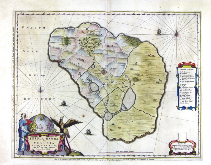
64-Insula Huaena five Venusia - Danimarca .
The map belongs to the Geographia, quae est cosmographiae Blauianae pars prima, qua orbisterrae tabulis ante oculus ponitus et descriptionibus illustratur, published in 1665 in Amsterdam. Dimensions : cm 52 x 40,8 Author: Ioannis Blaeu
Amsterdam,1665 |
|
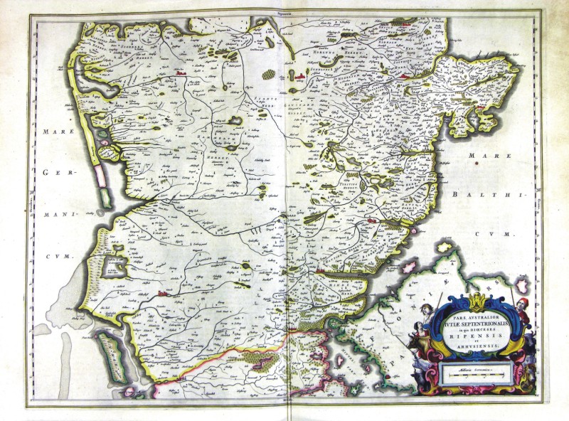
65-Pars Australior Iutiae Septentrionalis - Danimarca .
The map belongs to the Geographia, quae est cosmographiae Blauianae pars prima, qua orbisterrae tabulis ante oculus ponitus et descriptionibus illustratur, published in 1665 in Amsterdam. Dimensions : cm 57,5 x 47,8 Author: Ioannis Blaeu
Amsterdam,1665 |
|
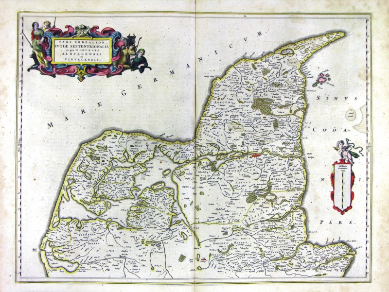
66-Pars Borealior Iutiae Septentrionalis - Danimarca .
The map belongs to the Geographia, quae est cosmographiae Blauianae pars prima, qua orbisterrae tabulis ante oculus ponitus et descriptionibus illustratur, published in 1665 in Amsterdam. Dimensions : cm 57 x 43,4 Author: Ioannis Blaeu
Amsterdam,1665 |
|
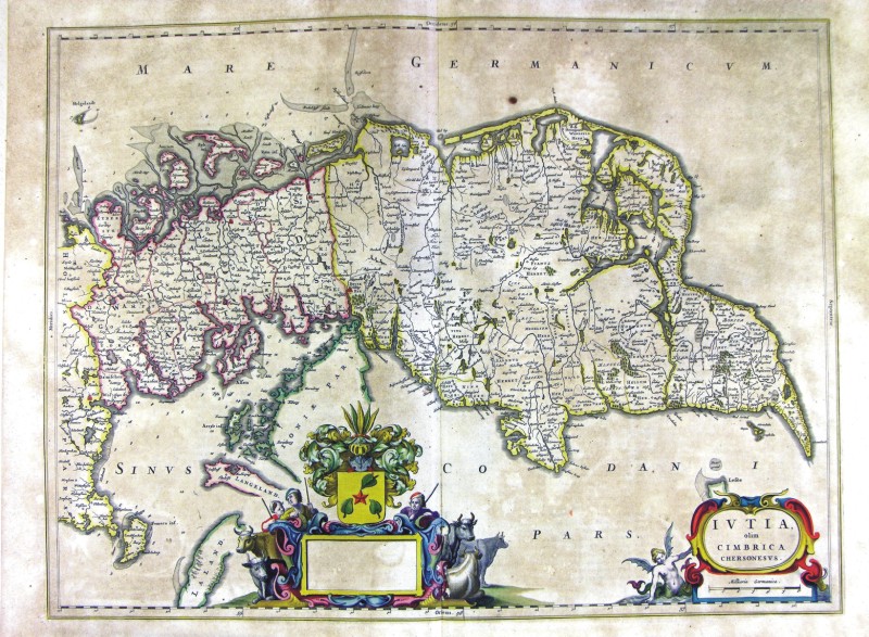
67-Iutia olim cimbrica chersonesus Danimarca .
The map belongs to the Geographia, quae est cosmographiae Blauianae pars prima, qua orbisterrae tabulis ante oculus ponitus et descriptionibus illustratur, published in 1665 in Amsterdam. Dimensions: cm 57,5 x 43 Author: Ioannis Blaeu
Amsterdam,1665 |
|
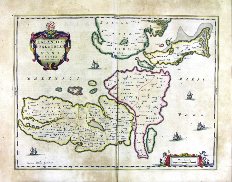
68-Lalandria, Falstria et Mona insule in Mare Baltico - Danimarca .
The map belongs to the Geographia, quae est cosmographiae Blauianae pars prima, qua orbisterrae tabulis ante oculus ponitus et descriptionibus illustratur, published in 1665 in Amsterdam. Dimensions : cm 51 x 38,5 Author: Ioannis Blaeu
Amsterdam,1665 |
|
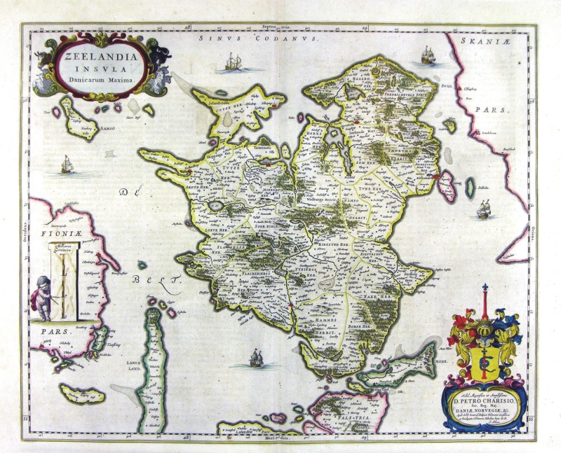
69-Zeelandia Insula - Danimarca .
The map belongs to the Geographia, quae est cosmographiae Blauianae pars prima, qua orbisterrae tabulis ante oculus ponitus et descriptionibus illustratur, published in 1665 in Amsterdam. Dimensions: cm 53,5 x 43,1 Author: Ioannis Blaeu
Amsterdam,1665 |
|
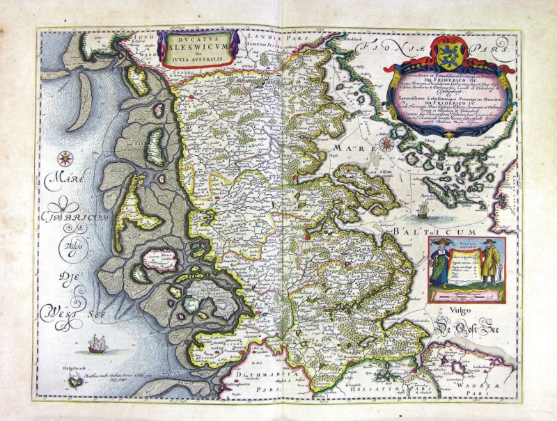
70-Ducatus Sleswici Iutia Australis - Danimarca .
The map belongs to the Geographia, quae est cosmographiae Blauianae pars prima, qua orbisterrae tabulis ante oculus ponitus et descriptionibus illustratur, published in 1665 in Amsterdam. Dimensions : cm 55 x 41,6 Author: Ioannis Blaeu
Amsterdam,1665 |
|
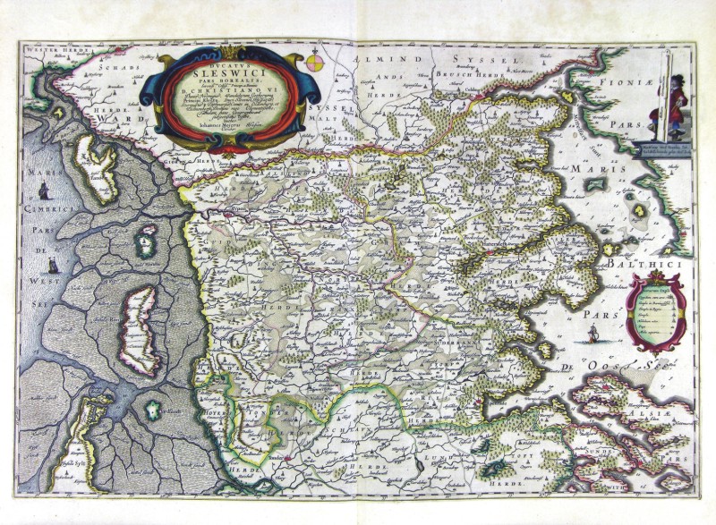
71-Ducatus Sleswici Pars Borealis - Danimarca .
The map belongs to the Geographia, quae est cosmographiae Blauianae pars prima, qua orbisterrae tabulis ante oculus ponitus et descriptionibus illustratur, published in 1665 in Amsterdam. Dimensions : cm 61 x 40,6 Author: Ioannis Blaeu
Amsterdam,1665 |
|
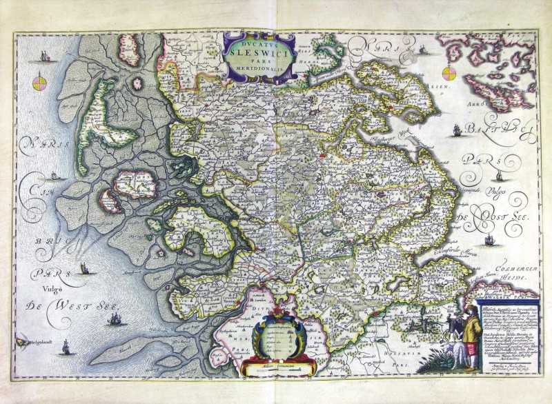
72-Ducatus Sleswici Pars Meridionalis - Danimarca .
The map belongs to the Geographia, quae est cosmographiae Blauianae pars prima, qua orbisterrae tabulis ante oculus ponitus et descriptionibus illustratur, published in 1665 in Amsterdam. Dimensions : cm 61,5 x 40,2 Author: Ioannis Blaeu
Amsterdam,1665 |
|
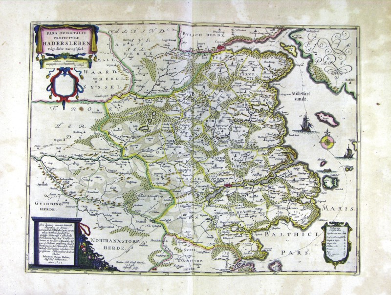
73-Pars Orientalis Praefecturae Hadersleben - Danimarca .
The map belongs to the Geographia, quae est cosmographiae Blauianae pars prima, qua orbisterrae tabulis ante oculus ponitus et descriptionibus illustratur, published in 1665 in Amsterdam. Dimensions: cm 53,5 x 39,7 Author: Ioannis Blaeu
Amsterdam,1665 |
|
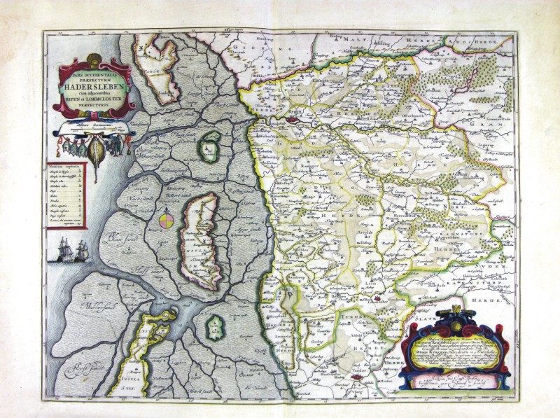
74-Pars Occidentalis Praefecturae Hadersleben - Danimarca .
The map belongs to the Geographia, quae est cosmographiae Blauianae pars prima, qua orbisterrae tabulis ante oculus ponitus et descriptionibus illustratur, published in 1665 in Amsterdam. Dimensions: cm 53 x 41,1 Author: Ioannis Blaeu
Amsterdam,1665 |
|
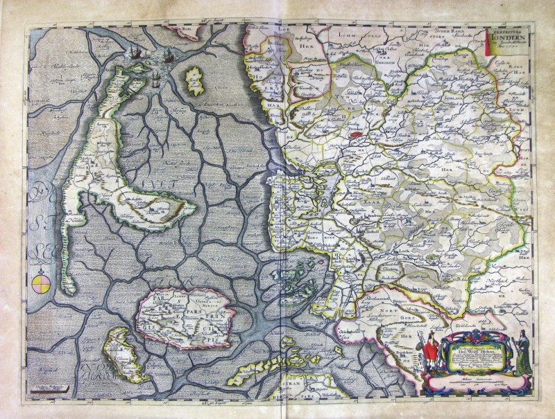
75-Prefetura Tondern - Danimarca .
The map belongs to the Geographia, quae est cosmographiae Blauianae pars prima, qua orbisterrae tabulis ante oculus ponitus et descriptionibus illustratur, published in 1665 in Amsterdam. Dimensions : cm 58 x 42,6 Author: Ioannis Blaeu
Amsterdam,1665 |
|
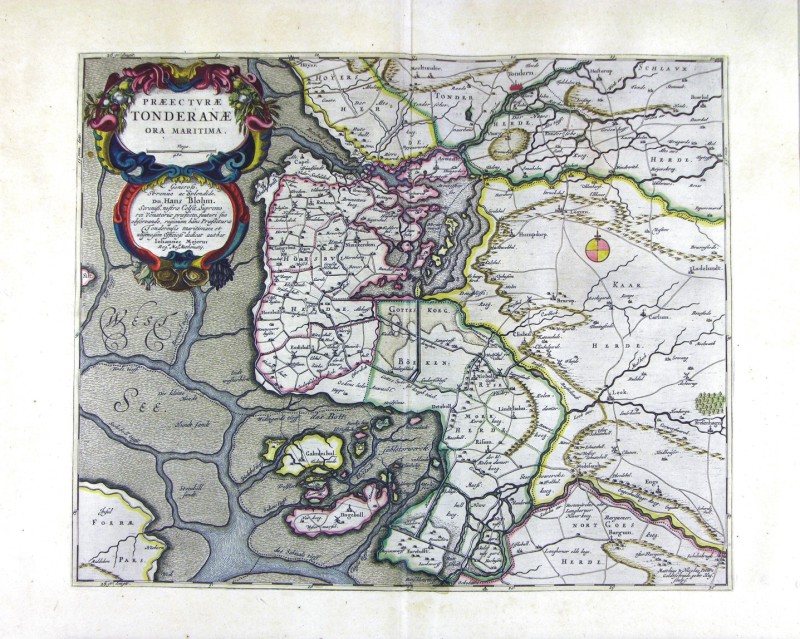
76-Prefetura Tonderane - Danimarca .
The map belongs to the Geographia, quae est cosmographiae Blauianae pars prima, qua orbisterrae tabulis ante oculus ponitus et descriptionibus illustratur, published in 1665 in Amsterdam. Dimensions : cm 48 x 38,7 Author: Ioannis Blaeu
Amsterdam,1665 |
|
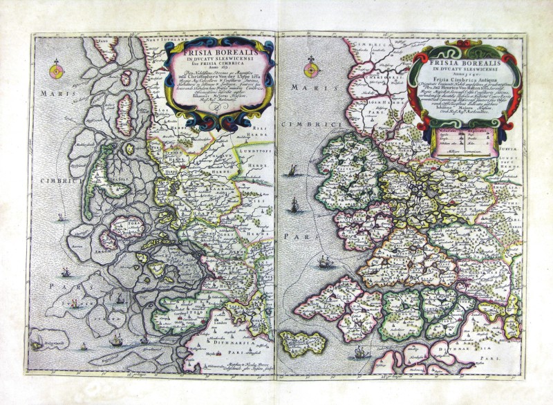
77-Frisia Borealis in Ducatus Sleswicensi - Danimarca .
The map belongs to the Geographia, quae est cosmographiae Blauianae pars prima, qua orbisterrae tabulis ante oculus ponitus et descriptionibus illustratur, published in 1665 in Amsterdam. Dimensions: cm 57 x 39,3 Author: Ioannis Blaeu
Amsterdam,1665 |
|
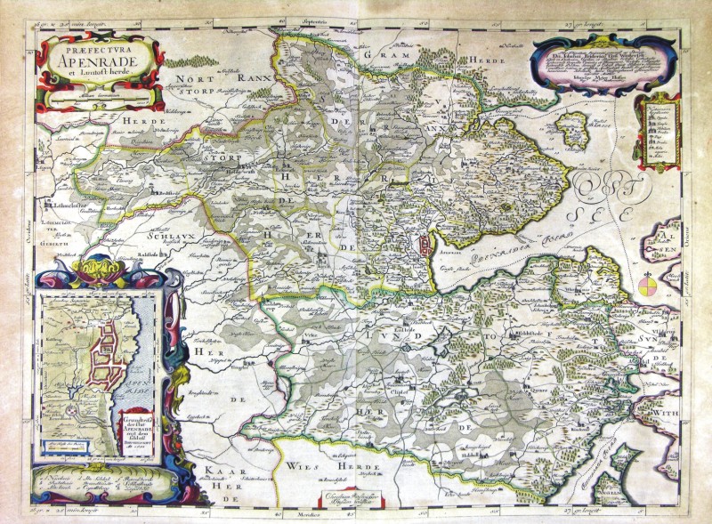
78-Praefetura Apenrade - Danimarca .
The map belongs to the Geographia, quae est cosmographiae Blauianae pars prima, qua orbisterrae tabulis ante oculus ponitus et descriptionibus illustratur, published in 1665 in Amsterdam. Dimensions: cm 60 x 44,7 Author: Ioannis Blaeu
Amsterdam,1665 |
|
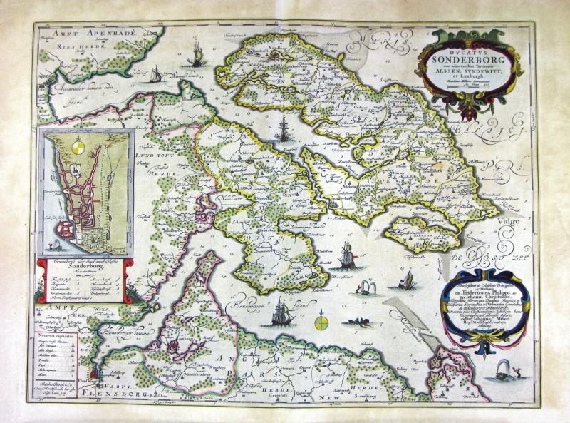
79-Ducatus Sonderborg - Danimarca .
The map belongs to the Geographia, quae est cosmographiae Blauianae pars prima, qua orbisterrae tabulis ante oculus ponitus et descriptionibus illustratur, published in 1665 in Amsterdam. Dimensions: cm 56,5 x 42,3 Author: Ioannis Blaeu
Amsterdam,1665 |
|
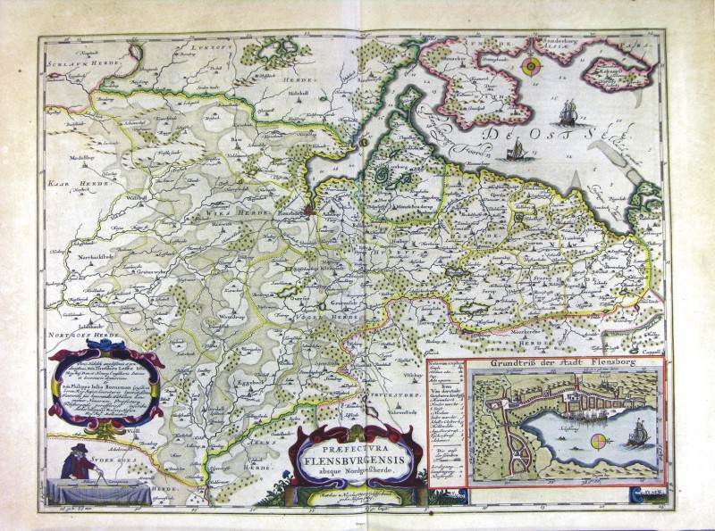
80-Praefetura Flensburgensis - Danimarca .
The map belongs to the Geographia, quae est cosmographiae Blauianae pars prima, qua orbisterrae tabulis ante oculus ponitus et descriptionibus illustratur, published in 1665 in Amsterdam. Dimensions: cm 56 x 42,6 Author: Ioannis Blaeu
Amsterdam,1665 |
|
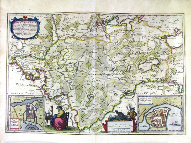
81-Praefetura Gottorpiensis - Danimarca .
The map belongs to the Geographia, quae est cosmographiae Blauianae pars prima, qua orbisterrae tabulis ante oculus ponitus et descriptionibus illustratur, published in 1665 in Amsterdam. Dimensions: cm 56,5 x 37,8 Author: Ioannis Blaeu
Amsterdam,1665 |
|
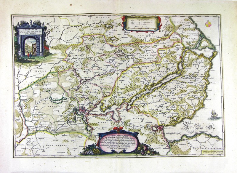
82-Praefetura Gottorpiensis pars Australis - Danimarca .
The map belongs to the Geographia, quae est cosmographiae Blauianae pars prima, qua orbisterrae tabulis ante oculus ponitus et descriptionibus illustratur, published in 1665 in Amsterdam. Dimensions: cm 59,5 x 40 Author: Ioannis Blaeu
Amsterdam,1665 |
|
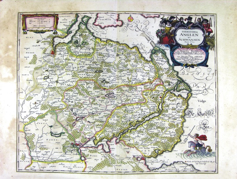
83-Territoriae Anglen et Schwansen - Danimarca .
The map belongs to the Geographia, quae est cosmographiae Blauianae pars prima, qua orbisterrae tabulis ante oculus ponitus et descriptionibus illustratur, published in 1665 in Amsterdam. Dimensions : cm 53 x 42 Author: Ioannis Blaeu
Amsterdam,1665 |
|
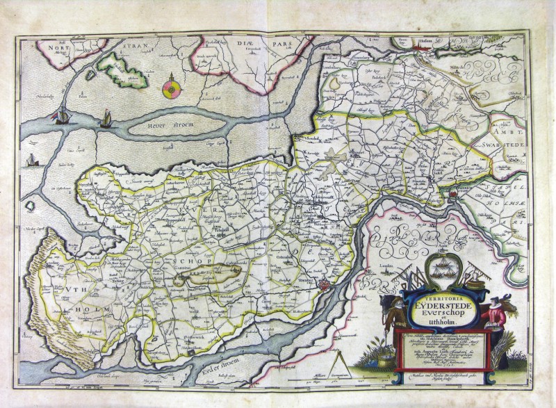
84-Territoriae Eyderstede, Everschop et Uthholm - Danimarca .
The map belongs to the Geographia, quae est cosmographiae Blauianae pars prima, qua orbisterrae tabulis ante oculus ponitus et descriptionibus illustratur, published in 1665 in Amsterdam. Dimensions : cm 61 x 42,3 Author: Ioannis Blaeu
Amsterdam,1665 |
|
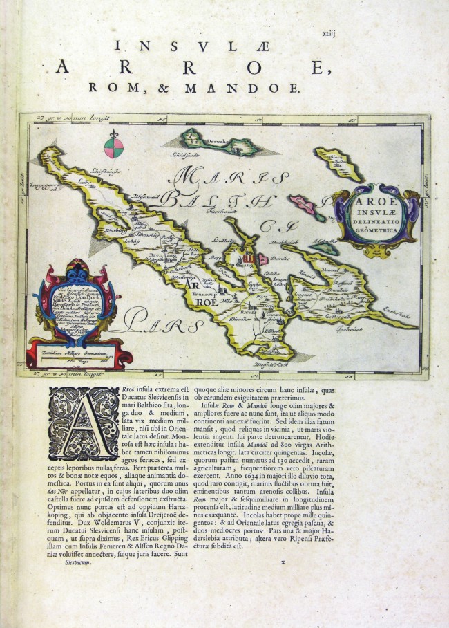
85-Aroae Insulae - Danimarca .
The map belongs to the Geographia, quae est cosmographiae Blauianae pars prima, qua orbisterrae tabulis ante oculus ponitus et descriptionibus illustratur, published in 1665 in Amsterdam. Dimensions : cm 30,2 x 19,5 Author: Ioannis Blaeu
Amsterdam,1665 |
|
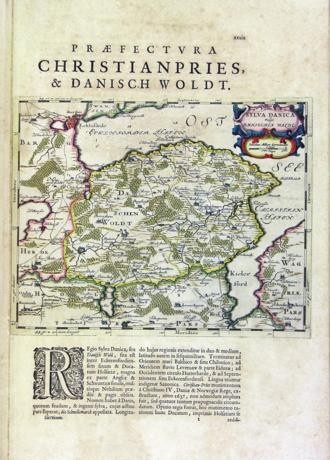
86-Sylva Danica - Danimarca .
The map belongs to the Geographia, quae est cosmographiae Blauianae pars prima, qua orbisterrae tabulis ante oculus ponitus et descriptionibus illustratur, published in 1665 in Amsterdam. Dimensions : cm 49,5 x 37,5 Author: Ioannis Blaeu
Amsterdam,1665 |
|
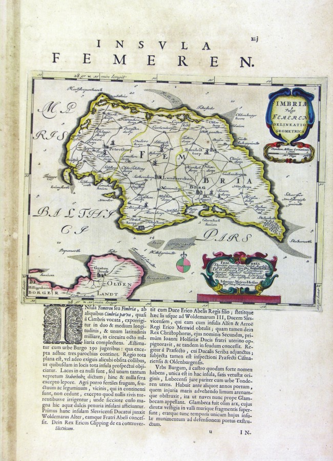
87-Fimbria - Danimarca .
The map belongs to the Geographia, quae est cosmographiae Blauianae pars prima, qua orbisterrae tabulis ante oculus ponitus et descriptionibus illustratur, published in 1665 in Amsterdam. Dimensions: cm 29,4 x 23 Author: Ioannis Blaeu
Amsterdam,1665 |
|
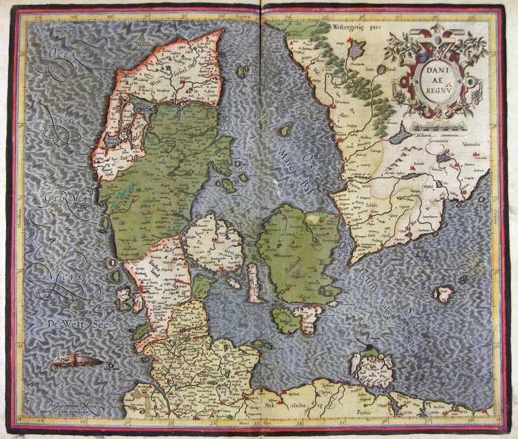
88-Dania Regnum - Danimarca .
The map belongs to the Atlas sive Cosmographicae Meditationes de Fabrica Mundi et Fabricati Figura, published in 1664 in Duisburg. Dimensions: 45,5 x 38,5 cm. Author: Gerardo Mercatore
Duisburg,1664 |
|
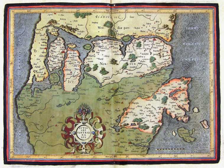
89-Yutia Septentrionalis - Danimarca .
The map belongs to the Atlas sive Cosmographicae Meditationes de Fabrica Mundi et Fabricati Figura, published in 1664 in Duisburg. Dimensions: cm 40,5 x 28,9 Author: Gerardo Mercatore
Duisburg,1664 |
|
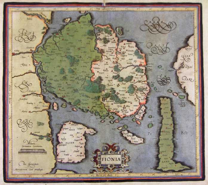
90-Fionia - Danimarca .
The map belongs to the Atlas sive Cosmographicae Meditationes de Fabrica Mundi et Fabricati Figura, published in 1664 in Duisburg. Dimensions : cm 41,8 x 37 Author: Gerardo Mercatore
Duisburg,1664 |
|
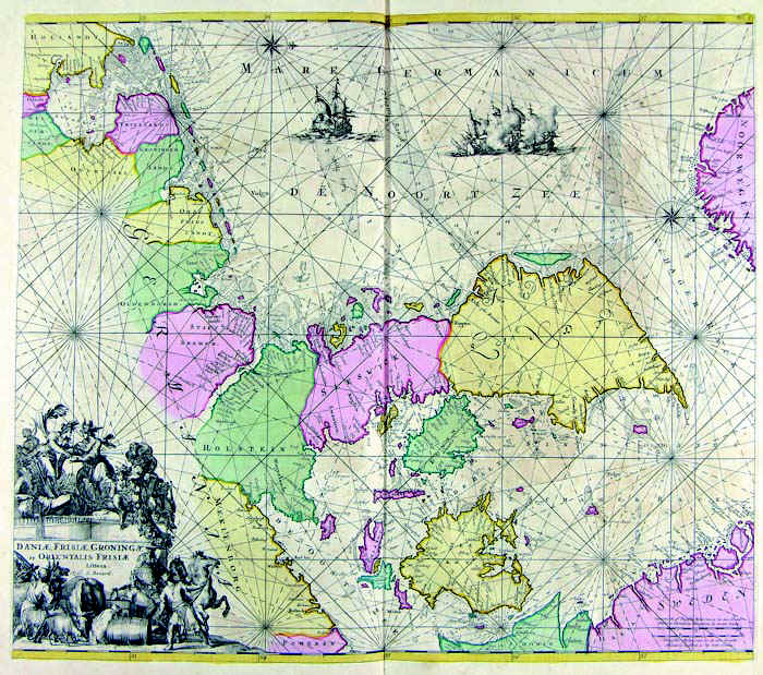
91-Dania, Frisia, Groningae et Orientalis Frisiae .
The map belongs to the Atlas de la Navigation et du Commerce qui se fait dans toutes les Parties du Monde, published in 1715 in Amsterdam. Dimensions: 56,8 x 50 cm. Author: Louis Renard
Amsterdam,1715 |
|
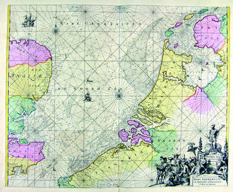
92-Mare Germanicum .
The map belongs to the Atlas de la Navigation et du Commerce qui se fait dans toutes les Parties du Monde, published in 1715 in Amsterdam. The document was taken from a precious engraving. Dimensions : cm 58,2 x 47 Author: Louis Renard
Amsterdam,1715 |
|
93-Inghilterra, Olanda, Danimarca .
The document belongs to the Atlas de la Navigation et du Commerce qui se fait dans toutes les Parties du Monde, published in 1715 in Amsterdam. The fine drawed map is decorated with two elegant pictures. Dimensions: 56,8 x 49,5 cm.
Author: Louis Renard
Amsterdam,1715 |
|
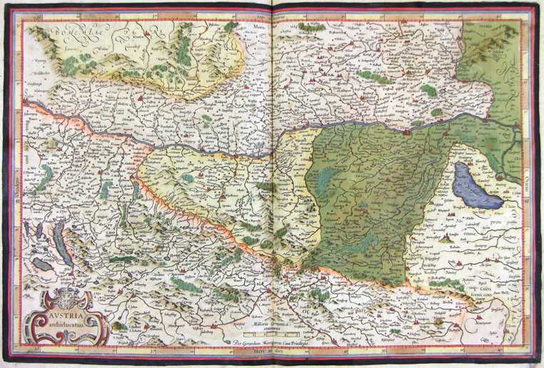
94-Austria .
The map belongs to the Atlas sive Cosmographicae Meditationes de Fabrica Mundi et Fabricati Figura, published in 1644 in Duisburg. Dimensions: 49,5 x 33,2 cm. Author: Gerardo Mercatore
Duisburg,1644 |

|
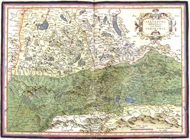
95-Salisburgo - Austria .
The map belongs to the Atlas sive Cosmographicae Meditationes de Fabrica Mundi et Fabricati Figura, published in 1644 in Duisburg. Author: Gerardo Mercatore
Duisburg,1644 |

|
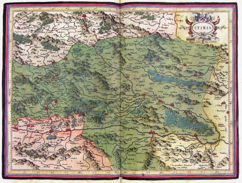
96-Stiria - Austria .
The map belongs to the Atlas sive Cosmographicae Meditationes de Fabrica Mundi et Fabricati Figura, published in 1644 in Duisburg.
Author: Gerardo Mercatore
Duisburg,1644 |
|
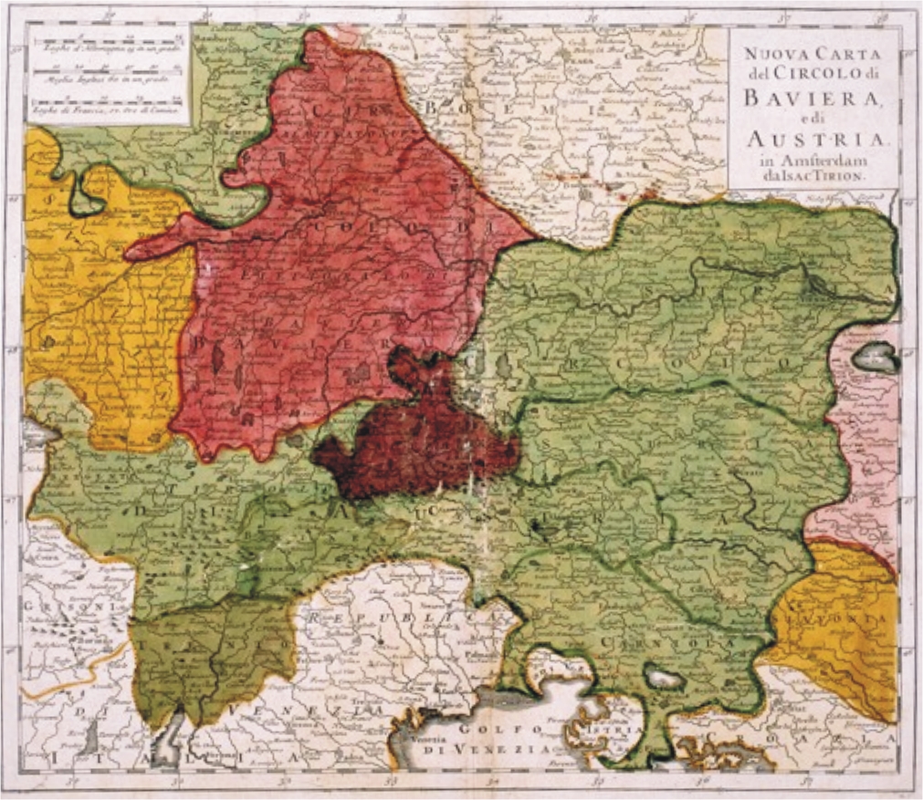
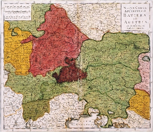
97-Nuova Carta del Circolo di Baviera e di Austria .
This map, drawn in Amsterdam by Isac Tirion, is written in Italian, measures 32,5 x 28 cm and shows with different colours the European regions Svavia Aviera, Austria with Tyrol, Trentino, Carnia and Slavonia in the East. Author: Isac Tirion
Amsterdam,1740 |
|
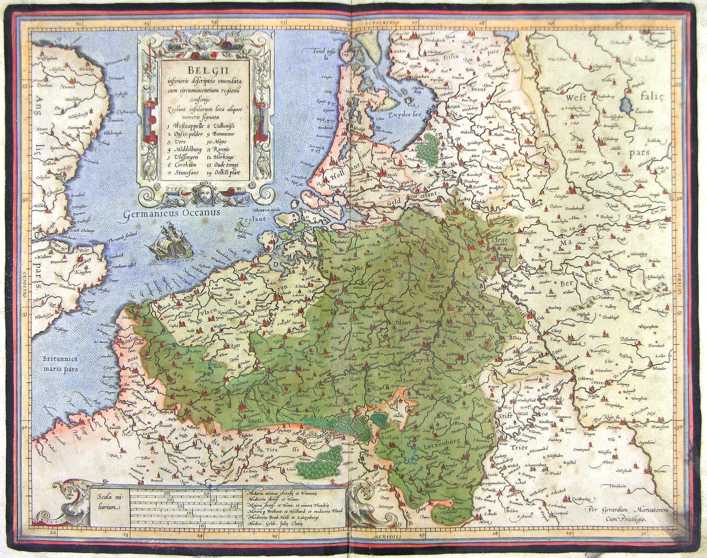
98-Belgii - Belgio .
The map belongs to the Atlas sive Cosmographicae Meditationes de Fabrica Mundi et Fabricati Figura, published in 1644 in Duisburg.
Author: Gerardo Mercatore
Duisburg,1644 |
|
99-Belgio .
The map belongs to the Atlas sive Cosmographicae Meditationes de Fabrica Mundi et Fabricati Figura, published in 1644 in Duisburg. Author: Gerardo Mercatore
Duisburg,1644 |
|
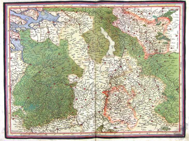
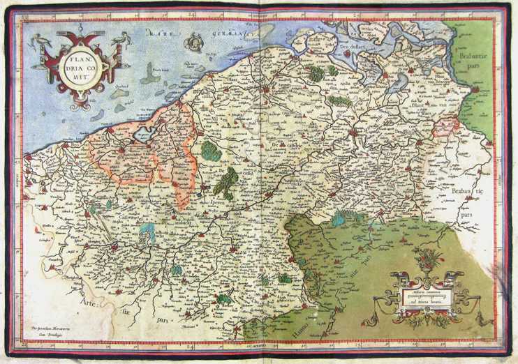
100-Flandria comit - Belgio .
The map belongs to the Atlas sive Cosmographicae Meditationes de Fabrica Mundi et Fabricati Figura, published in 1644 in Duisburg.
Author: Gerardo Mercatore
Duisburg,1644 |

|
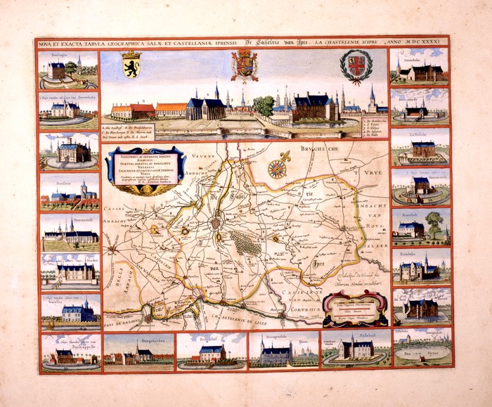
101-Nova et Exacta Tabula Salae et Castellanae Iprensis .
The map created by Antonius Saderus in 1641, measuring 48.4 x 39 cm. At the top you can see the city and 3
coat of arms.
To the inside 2 cartouche and a rose of the winds are found. Map of notable graphic effect. Author: Antonius Saderus
,1641 |
|
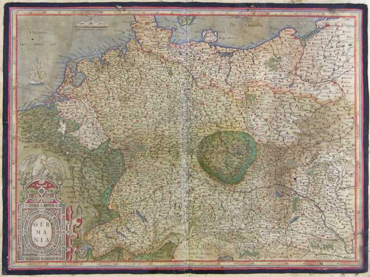
125-Germania .
The map belongs to the Atlas sive Cosmographicae Meditationes de Fabrica Mundi et Fabricati Figura, published in 1611 in Duisburg.
Dimensions 51 x 38 cm. Author: Gerardo Mercatore
Duisburg,1611 |
|
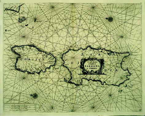
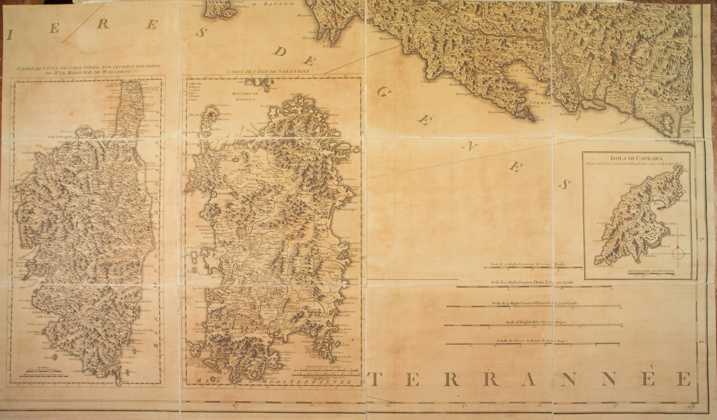
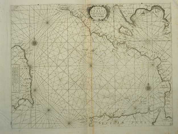
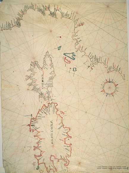
103-Le Coste Marittime delle Isole di Sardegna e Corsica .
The map belongs to the atlas Prima parte dello Specchio del Mare published in 1664 in Genoa by F.M. Levanto. It was taken from a copper plate engraving and proposes a sector of the Mediterranean Sea with Sardinia, Corsica, Elba and other small Islands of the Tuscan Archipelago and the Promontory of Piombino. Author: Francesco Maria Levanto
Genova ,1664 |
|
104-Regna Sive Insulas Sardiniae ac Corsicae .
The colored map measures 56,7 x 48,6 cm. It belongs to the Atlas Novus of T.C. Lotter, printed in 1764 in Augsburg. At the top on the right are exposed the islands of the Tuscan Archipelago ,on the left there is a beautiful wind rose and on the right below a decorating picture.
Author: Tobiae Conradi Lotter
Augsburg ,1764 |

|
105-Sardiniae Antiquae et Corsica Antiquae Descriptio .
PH Cluverio in 1619 by Tobias Conradi Lotter of 1764.
Author: Tobiae Conradi Lotter
,1619 |
|
106-Carta di Sardegna e Corsica .
The map was printed in 1784 and belongs to the cartographic map collection of Genoa's Republic, which is composed of 8 documents. Dimensions: 52 x 47 cm. Author: Ives Gravier
Genova ,1784 |

|
422-Insula Maien .
Author: Blaeu
Geografia blaviana,1665 |
|
107-Sardegna e Corsica .
The map was printed in 1611 and exposes each island in a square measuring 22,5 x 33,8 cm. Together they have the dimensions of 50 x 44 cm.
Author: Gerardo Mercatore
Duisburg,1611 |
|
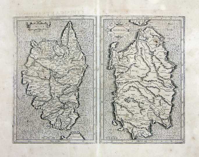
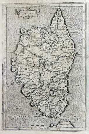
108-Corsica .
The map-drawing measures 22,5 x 38 cm and the whole 27,5 x 44 cm. It can be found on page 280 in the 4th edition of the Atlas sive Cosmographicae Meditationes de Fabrica Mundi et Fabricati Figura, published in 1611 in Duisburg. Author: Gerardo Mercatore
Amsterdam,1611 |
|
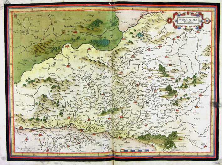
109-Burgundia - Francia .
The map belongs to the Atlas sive Cosmographicae Meditationes de Fabrica Mundi et Fabricati Figura, published in 1611 in Duisburg.
Dimensions: 46,4 x 36,5 cm.
Author: Gerardo Mercatore
Duisburg,1611 |
|
110-Aquitania - Francia .
The map belongs to the Atlas sive Cosmographicae Meditationes de Fabrica Mundi et Fabricati Figura, published in 1611 in Duisburg.
Dimensions: 47,5 x 36,3 cm. Author: Gerardo Mercatore
Duisburg,1611 |
|
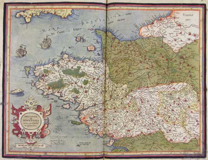
111-Britannia e Normandia - Francia .
The map belongs to the Atlas sive Cosmographicae Meditationes de Fabrica Mundi et Fabricati Figura, published in 1611 in Duisburg.
Dimensions: 47,5 x 36 cm. Author: Gerardo Mercatore
Duisburg,1611 |
|
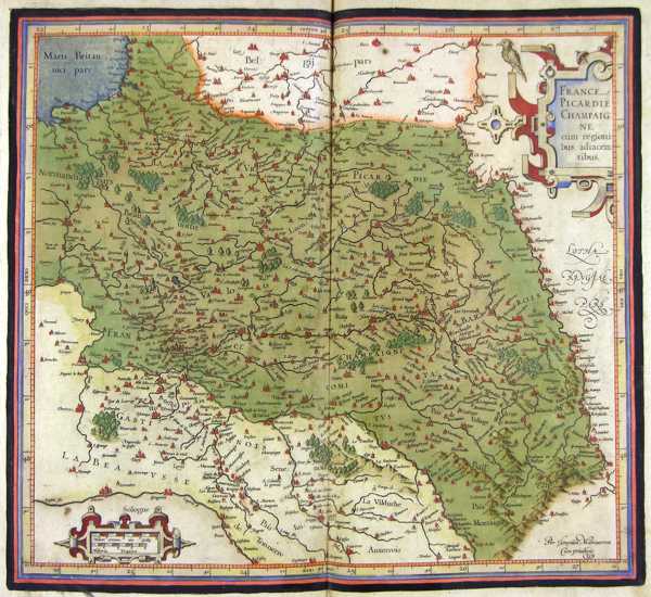
112-Picardie Champagne - Francia .
The map belongs to the Atlas sive Cosmographicae Meditationes de Fabrica Mundi et Fabricati Figura,published in 1611 in Duisburg.
Dimensions: 41 x 37 cm. Author: Gerardo Mercatore
Duisburg,1611 |
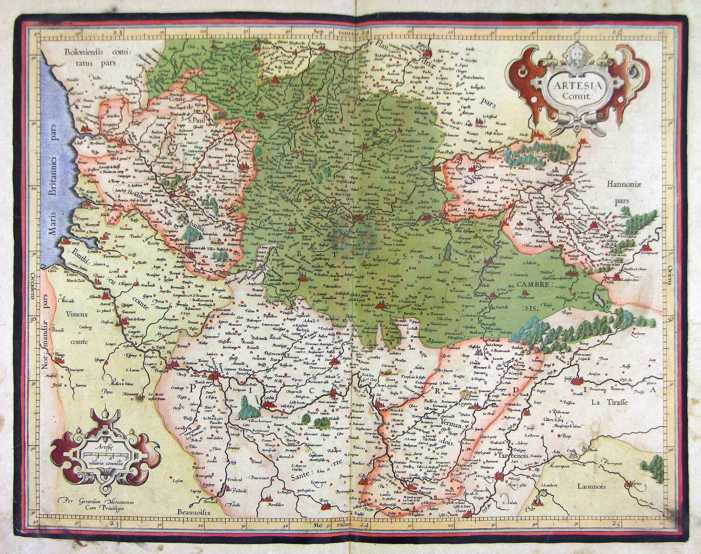
|
113-Artesia - Francia .
The map belongs to the Atlas sive Cosmographicae Meditationes de Fabrica Mundi et Fabricati Figura, published in 1611 in Duisburg.
Dimensions: 46 x 36 cm.
Author: Gerardo Mercatore
Duisburg,1611 |
|
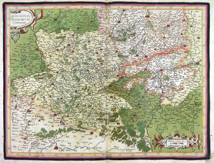
114-Hannonia - Francia .
The map belongs to the Atlas sive Cosmographicae Meditationes de Fabrica Mundi et Fabricati Figura, published in 1611 in Duisburg.
Dimensions: 47,5 x 36,4 cm.
Author: Gerardo Mercatore
Duisburg,1611 |
|
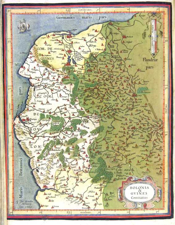
115-Bolonia e Guines - Francia .
The map belongs to the Atlas sive Cosmographicae Meditationes de Fabrica Mundi et Fabricati Figura, published in 1611 in Duisburg.
Dimensions: 33 x 26 cm. Author: Gerardo Mercatore
Duisburg,1611 |
|
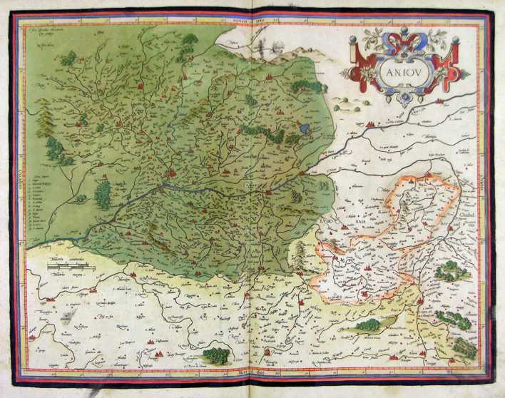
116-Aniou - Francia .
The map belongs to the Atlas sive Cosmographicae Meditationes de Fabrica Mundi et Fabricati Figura, published in 1611 in Duisburg.
Dimensions: 47 x 36,5 cm. Author: Gerardo Mercatore
Duisburg,1611 |
|
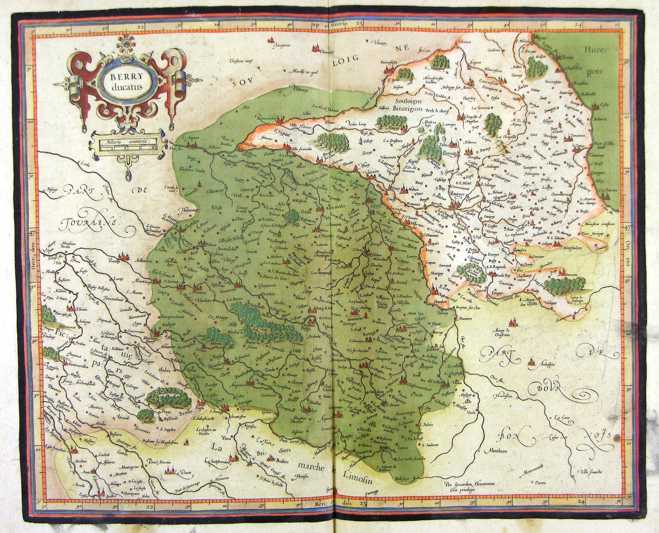
117-Berry - Francia .
The map belongs to the Atlas sive Cosmographicae Meditationes de Fabrica Mundi et Fabricati Figura, published in 1611 in Duisburg.
Dimensions: 42,6 x 36 cm. Author: Gerardo Mercatore
Duisburg ,1611 |
|
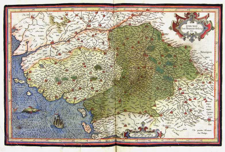
118-Poictou - Francia .
The map belongs to the Atlas sive Cosmographicae Meditationes de Fabrica Mundi et Fabricati Figura, published in 1611 in Duisburg.
Dimensions: 46 x 30 cm. Author: Gerardo Mercatore
Duisburg,1611 |
|
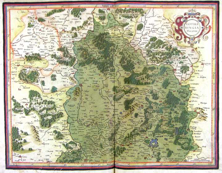
119-Lotharingia - Francia .
The map belongs to the Atlas sive Cosmographicae Meditationes de Fabrica Mundi et Fabricati Figura, published in 1611 in Duisburg.
Dimensions: 47 x 37 cm. Author: Gerardo Mercatore
Duisburg,1611 |
|
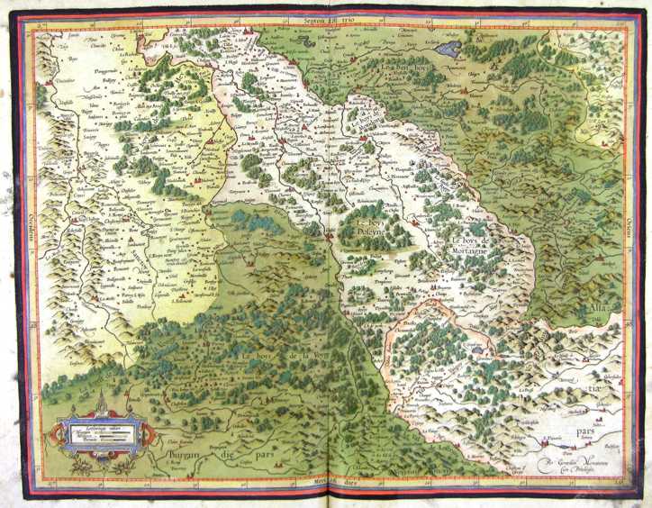
120-Lotharingia - Francia .
The map belongs to the Atlas sive Cosmographicae Meditationes de Fabrica Mundi et Fabricati Figura, published in 1611 in Duisburg.
Dimensions: 46,8 x 37 cm. Author: Gerardo Mercatore
Duisburg,1611 |
|
121-Burgundia - Francia .
The map belongs to the Atlas sive Cosmographicae Meditationes de Fabrica Mundi et Fabricati Figura, published in 1611 in Duisburg. Author: Gerardo Mercatore
Duisburg,1611 |
|
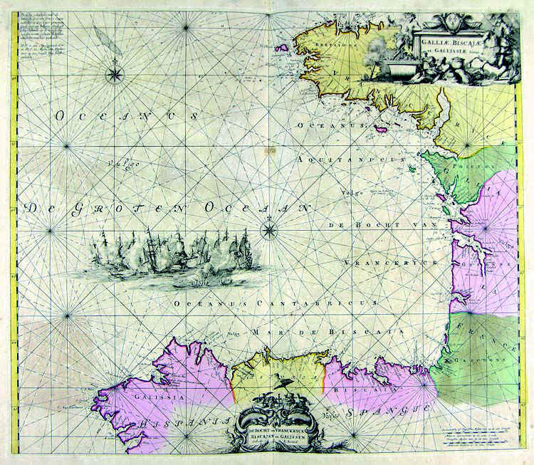
122-Golfo di Biscaglia .
The map belongs to the Atlas de la Navigationet du Commerce qui se fait dans touts le Parties du Monde, published in 1715 in Amsterdam.
Dimensions: 56,6 x 48,5 cm. Author: Louis Renard
Amsterdam,1715 |
|
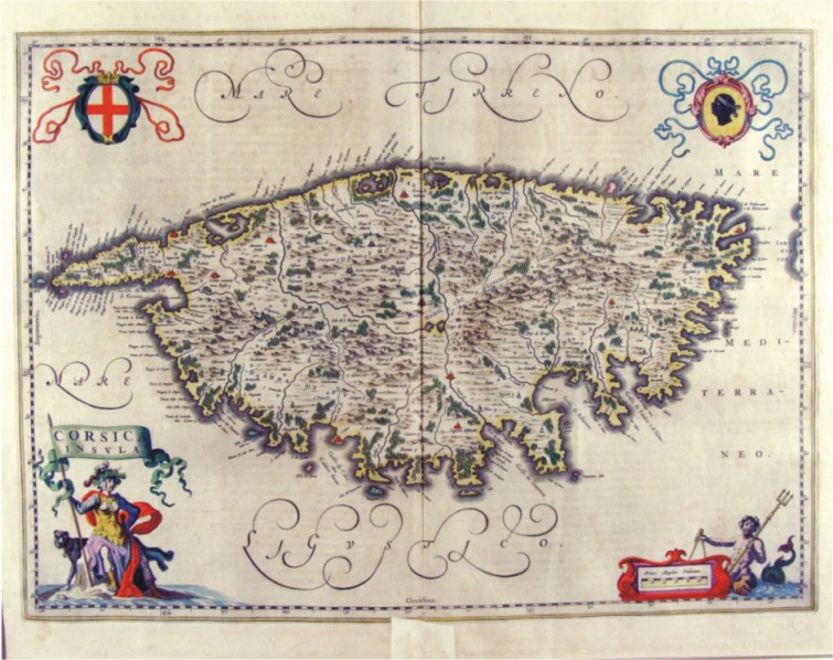
123-Corsica Insula - Francia .
The map belongs to the Atlas Geographiae Blavianae volumen octavum Quo Italia quae est Europae Liber XVI di Blaeu. Published in 1662 in Amsterdam. The map, which is decorated with four cartouches with the Moor at the top right of the flag at the bottom of the scale, the cross at the top right of the republic of Genoa and bottom of a figure with a banner which is contained in the title. The menu offers an island of Corsica full of place names, with the cities represented with red design perspective, many forests and with a good representation of orography and hydrography.
Author: Ioannis Blaeu
Amsterdam,1662 |
|
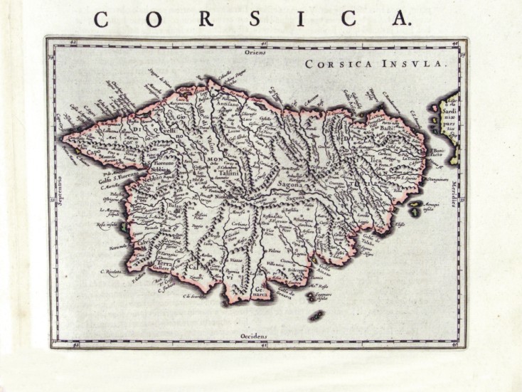
124-Corsica - Francia .
The map measures 24 x 17,8 cm and belongs to the atlas Theatrum Orbis Terrarum sive Atlas Novus - pars tertia - Guilelmus et Ioannis Blaeu, printed in 1650 in the Blaeu's family workshop in Amsterdam. Corsica is exposed in a small scale, but with plenty of citynames. The island also has a schematic representation of the hydrography and the orography. Author: Ioannis Blaeu
Amsterdam,1650 |
|
127-Alsazia sup. - Germania .
The map belongs to the Atlas sive Cosmographicae Meditationes de Fabrica Mundi et Fabricati Figura, published in 1611 in Duisburg.
Author: Gerardo Mercatore
Duisburg,1611 |
|
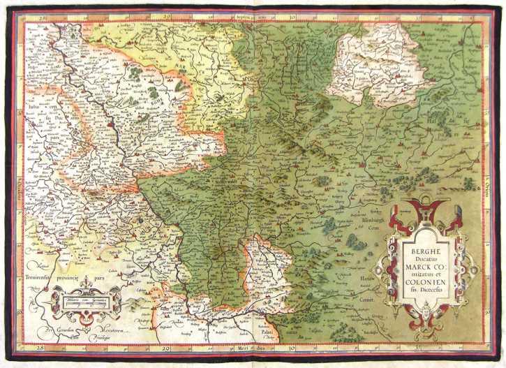
128-Berghe, Colonien - Germania .
The map belongs to the Atlas sive Cosmographicae Meditationes de Fabrica Mundi et Fabricati Figura, published in 1611 in Duisburg.
Author: Gerardo Mercatore
Duisburg,1611 |
|
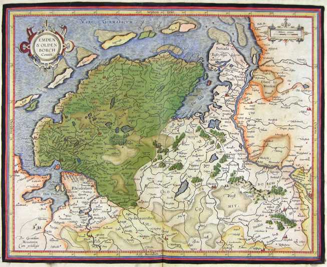
129-Emden e Olden - Germania .
The map belongs to the Atlas sive Cosmographicae Meditationes de Fabrica Mundi et Fabricati Figura, published in 1611 in Duisburg.
Author: Gerardo Mercatore
Duisburg,1611 |
|
130-Bavaria - Germania .
The map belongs to the Atlas sive Cosmographicae Meditationes de Fabrica Mundi et Fabricati Figura, published in 1611 in Duisburg. Author: Mercatore
Duisburg,1611 |
|
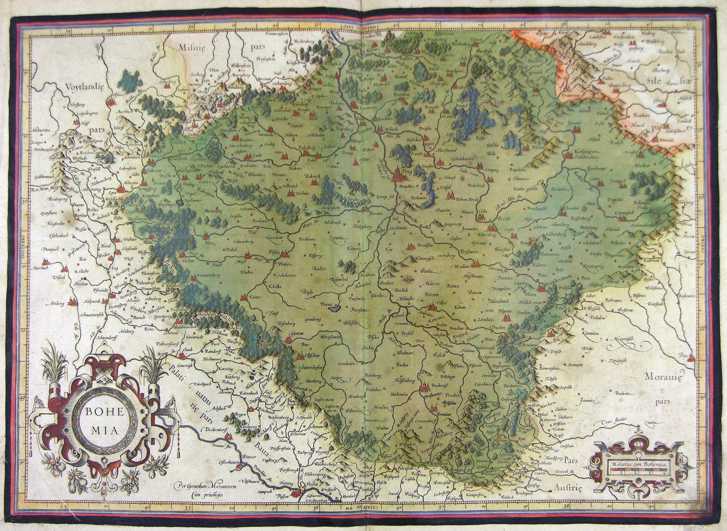
131-Boemia - Germania .
The map belongs to the Atlas sive Cosmographicae Meditationes de Fabrica Mundi et Fabricati Figura, published in 1611 in Duisburg.
Author: Gerardo Mercatore
Duisburg,1611 |
|
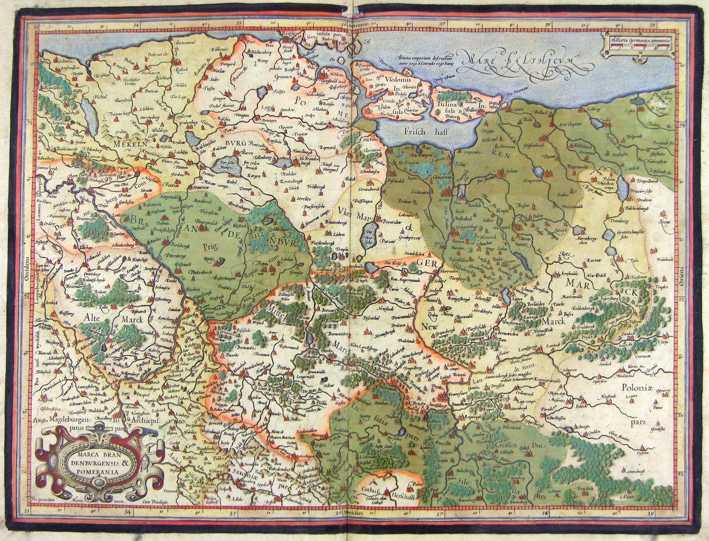
132-Marca Brandeburghensis e Pomerania - Germania .
The map belongs to the Atlas sive Cosmographicae Meditationes de Fabrica Mundi et Fabricati Figura,published in 1611 in Duisburg.
Author: Gerardo Mercatore
Duisburg,1611 |
|
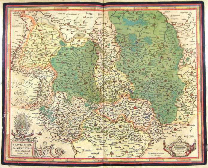
133-Braunswych e Mexdburg - Germania .
The map belongs to the Atlas sive Cosmographicae Meditationes de Fabrica Mundi et Fabricati Figura, published in 1611 in Duisburg.
Author: Gerardo Mercatore
Duisburg,1611 |
|
134-Frisia - Germania .
The map belongs to the Atlas sive Cosmographicae Meditationes de Fabrica Mundi et Fabricati Figura, published in 1611 in Duisburg.
Author: Gerardo Mercatore
Duisburg,1611 |
|
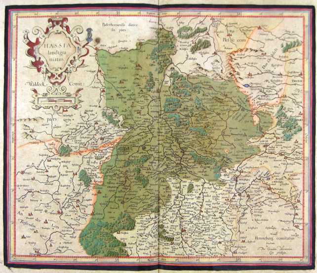
135-Hassia - Germania .
The map belongs to the Atlas sive Cosmographicae Meditationes de Fabrica Mundi et Fabricati Figura, published in 1611 in Duisburg.
Author: Gerardo Mercatore
Duisburg,1611 |
|
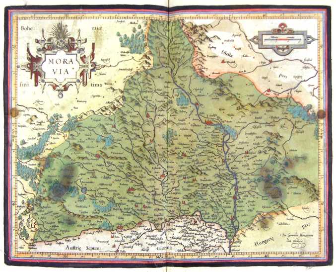
136-Moravia - Germania .
The map belongs to the Atlas sive Cosmographicae Meditationes de Fabrica Mundi et Fabricati Figura, published in 1611 in Duisburg.
Author: Gerardo Mercatore
Duisburg,1611 |
|
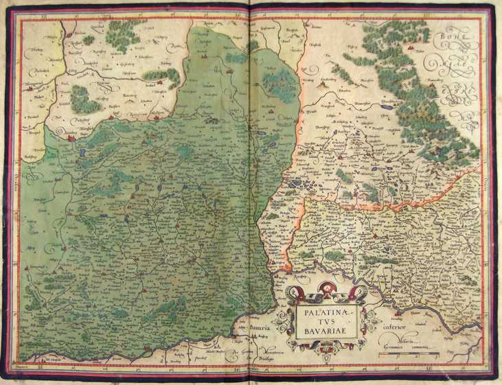
137-Palatinatus Bavaria - Germania .
The map belongs to the Atlas sive Cosmographicae Meditationes de Fabrica Mundi et Fabricati Figura, published in 1611 in Duisburg.
Author: Gerardo Mercatore
Duisburg,1611 |
|
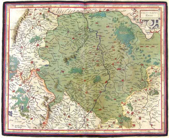
138-Palatinatus Reno - Germania .
The map belongs to the Atlas sive Cosmographicae Meditationes de Fabrica Mundi et Fabricati Figura, published in 1611 in Duisburg.
Author: Gerdardo Mercatore
Duisburg,1611 |
|
139-Sassonia e Lusatiae - Germania .
The map belongs to the Atlas sive Cosmographicae Meditationes de Fabrica Mundi et Fabricati Figura, published in 1611 in Duisburg.
Author: Gerardo Mercatore
Duisburg,1611 |
|
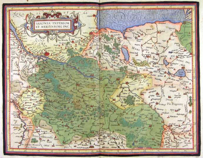
140-Sassonia inf. e Meklenbor - Germania .
The map belongs to the Atlas sive Cosmographicae Meditationes de Fabrica Mundi et Fabricati Figura, published in 1611 in Duisburg.
Author: Gerardo Mercatore
Duisburg,1611 |
|
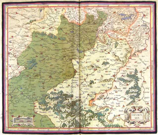
141-Turingia - Germania .
The map belongs to the Atlas sive Cosmographicae Meditationes de Fabrica Mundi et Fabricati Figura, published in 1611 in Duisburg.
Author: Gerardo Mercatore
Duisburg,1611 |
|
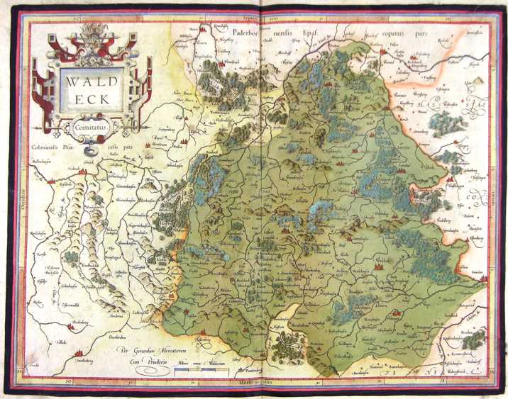
142-Waldeck - Germania .
The map belongs to the Atlas sive Cosmographicae Meditationes de Fabrica Mundi et Fabricati Figura, published in 1611 in Duisburg.
Author: Gerardo Mercatore
Duisburg,1611 |
|
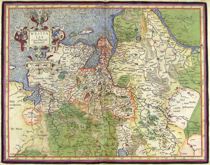
143-Westfalia - Germania .
The map belongs to the Atlas sive Cosmographicae Meditationes de Fabrica Mundi et Fabricati Figura, published in 1611 in Duisburg.
Author: Gerardo Mercatore
Duisburg,1611 |
|
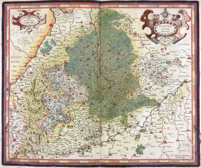
144-Wirtenberg - Germania .
The map belongs to the Atlas sive Cosmographicae Meditationes de Fabrica Mundi et Fabricati Figura, published in 1611 in Duisburg.
Author: Gerardo Mercatore
Duisburg,1611 |
|
145-Germania .
The map belongs to the Atlas sive Cosmographicae Meditationes de Fabrica Mundi et Fabricati Figura, published in 1611 in Duisburg.
Author: Gerardo Mercatore
Duisburg,1611 |
|
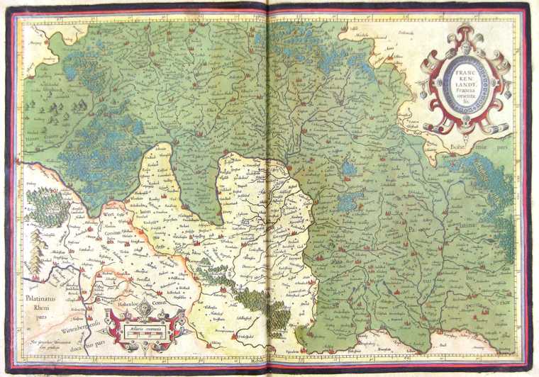
146-Francia Orientalis - Germania .
The map belongs to the Atlas sive Cosmographicae Meditationes de Fabrica Mundi et Fabricati Figura, published in 1611 in Duisburg.
Author: Gerardo Mercatore
Duisburg,1611 |
|
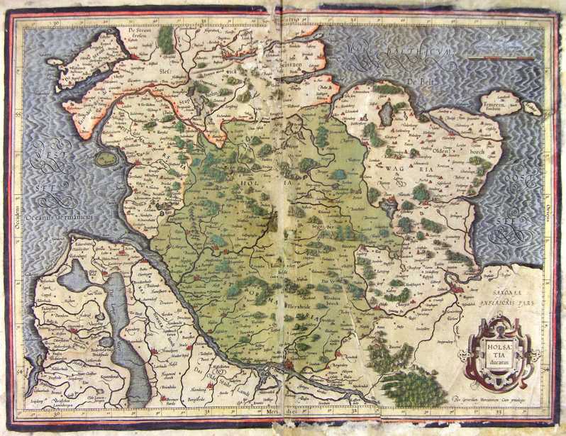
147-Holsazia - Germania .
The map belongs to the Atlas sive Cosmographicae Meditationes de Fabrica Mundi et Fabricati Figura, published in 1611 in Duisburg.
Author: Gerardo Mercatore
Duisburg,1611 |
|
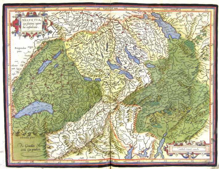
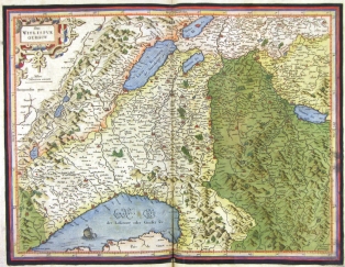
148-Helvetia - Svizzera .
The map belongs to the Atlas sive Cosmographicae Meditationes de Fabrica Mundi et Fabricati Figura, published in 1644 in Duisburg. Author: Gerardo Mercatore
Duisburg,1644 |
|
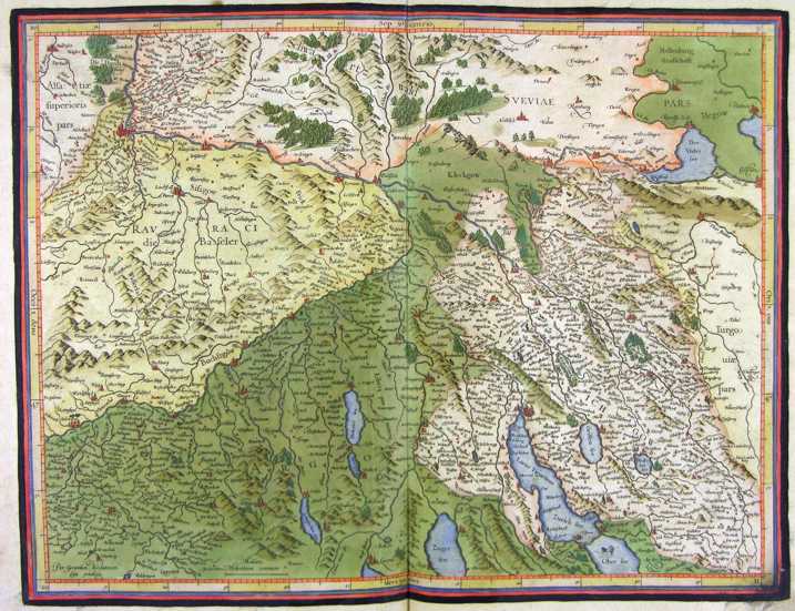
149-Helvetia - Svizzera settentrionale .
The map belongs to the Atlas sive Cosmographicae Meditationes de Fabrica Mundi et Fabricati Figura, published in 1644 in Duisburg.
Author: Gerardo Mercatore
Duisburg,1644 |
|
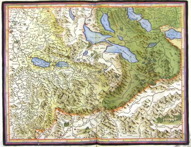
150-Helvetia - Svizzera centrale .
The map belongs to the Atlas sive Cosmographicae Meditationes de Fabrica Mundi et Fabricati Figura, published in 1644 in Duisburg.
Author: Gerardo Mercatore
Duisburg,1644 |
|
151-Wiflispur - Svizzera occidentale .
The map belongs to the Atlas sive Cosmographicae Meditationes de Fabrica Mundi et Fabricati Figura, published in 1644 in Duisburg.
Author: Gerardo Mercatore
Duisburg,1644 |
|
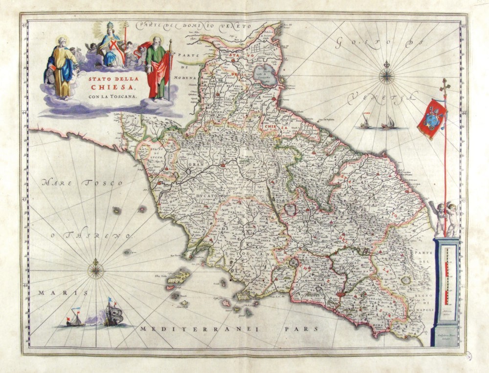
152-Stato della Chiesa .
The Map of the Dukedom of Toscany and the Church States, from Romagna to Latium, showing a picture of sacred images surrounding the title and a metric scale residing in a boundary stone with two babies holding the Papal flag.This map measures 49,2 x 38 cm and is taken from the atlas Theatrum Orbis Terrarum sive Atlas Novus - pars tertia - Guilelmus et Ioannis Blaeu, printed in 1650 in the Blaeu family workshop in Amsterdam.. Author: Ioannis Blaeu
Amsterdam,1650 |
|
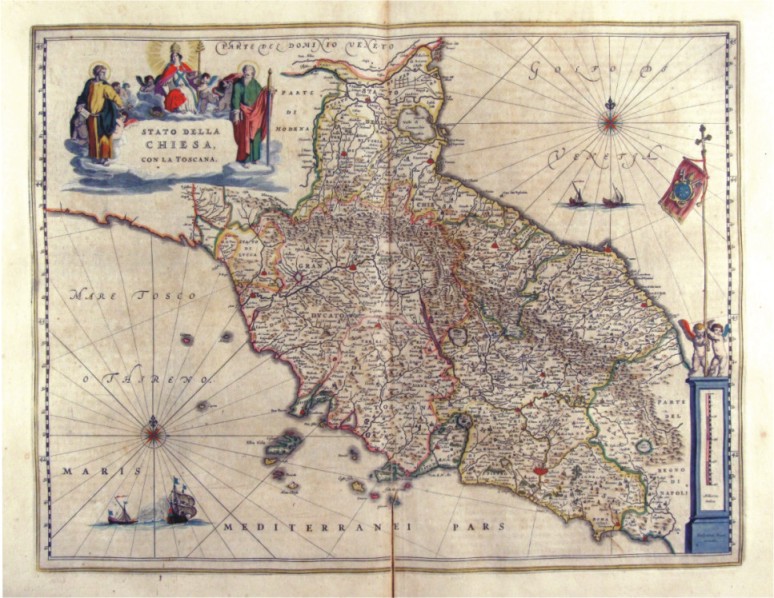
153-Stato della Chiesa .
The Map belongs to the atlas Geographiae Blavianae volumen octavum Quo Italia quae est Europae Liber XVI di Blaeu, printed in 1592 in Amsterdam. Author: Ioannis Blaeu
Amsterdam,1662 |
|
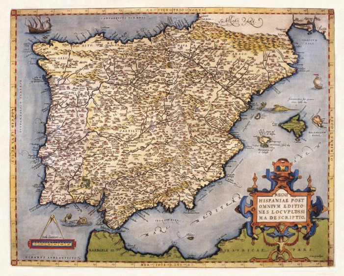
154-Iberian Peninsula .
The Map belongs to the atlas Theatrum Orbis Terrarum, printed in 1592 in Antwerp. Author: Abramus Ortelius
Anversa,1592 |
|
155-Scotiae Regnum - Scozia .
The map belongs to the Atlas sive Cosmographicae Meditationes de Fabrica Mundi et Fabricati Figura, published in 1644 in Duisburg.
Author: Gerardo Mercatore
Duisburg,1644 |
|
156-Scotiae Regnum - Nord - Scozia .
The map belongs to the Atlas sive Cosmographicae Meditationes de Fabrica Mundi et Fabricati Figura, published in 1611 in Duisburg.
Author: Gerardo Mercatore
Duisburg,1644 |
|
157-Scotiae Regnum - Sud - Scozia .
The map belongs to the Atlas sive Cosmographicae Meditationes de Fabrica Mundi et Fabricati Figura, published in 1644 in Duisburg. Author: Gerardo Mercatore
Duisburg,1644 |
|
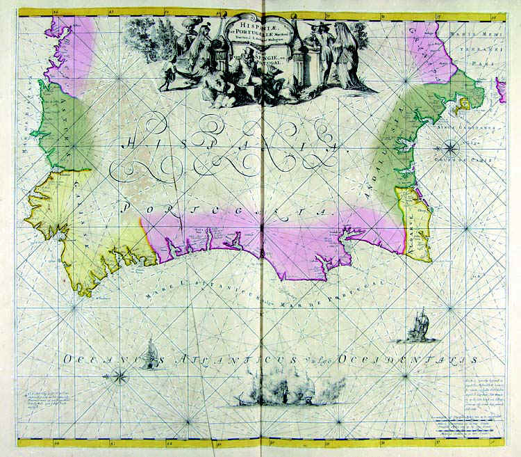
158-Hispaniae et Portugalliae - Portogallo e Spagna .
The map belongs to the Atlas de la Navigationet du Commerce qui se fait dans touts le Parties du Monde, published in 1715 in Amsterdam. Author: Louis Renard
Amsterdam,1715 |
|
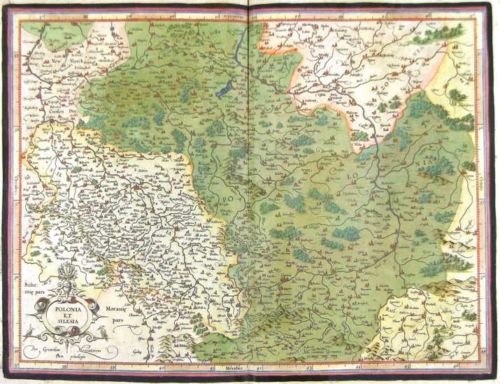
159-Polonia et Silesia - Polonia .
The map belongs to the Atlas sive Cosmographicae Meditationes de Fabrica Mundi et Fabricati Figura, published in 1644 in Duisburg.
Author: Gerardo Mercatore
Duisburg,1644 |
|
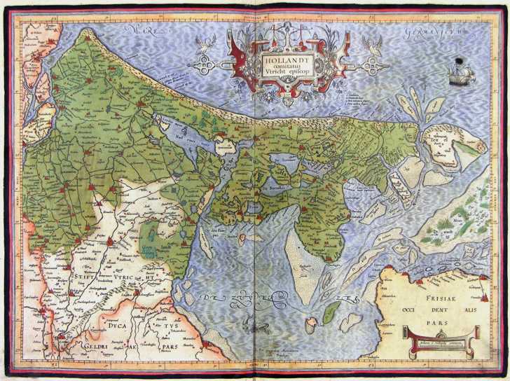
160-Hollandt - Olanda .
The map belongs to the Atlas sive Cosmographicae Meditationes de Fabrica Mundi et Fabricati Figura, published in 1644 in Duisburg. Author: Gerardo Mercatore
Duisburg,1644 |
|
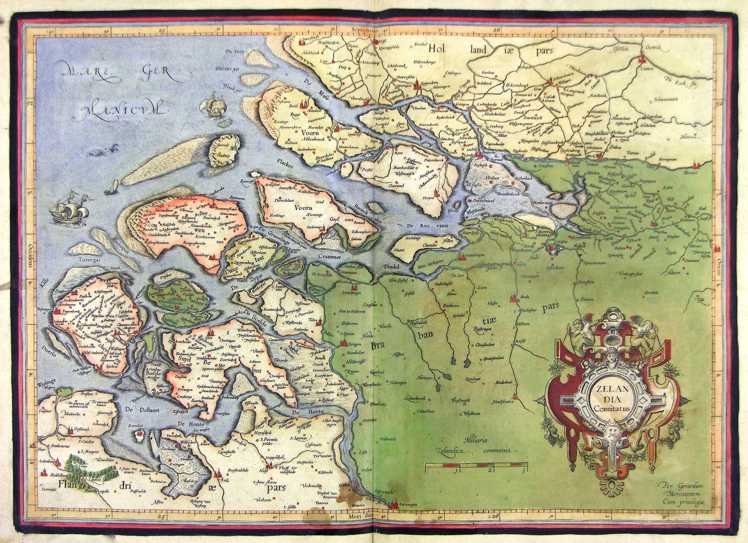
161-Zelandia - Olanda .
The map belongs to the Atlas sive Cosmographicae Meditationes de Fabrica Mundi et Fabricati Figura, published in 1644 in Duisburg. Author: Gerardo Mercatore
Duisburg,1644 |
|
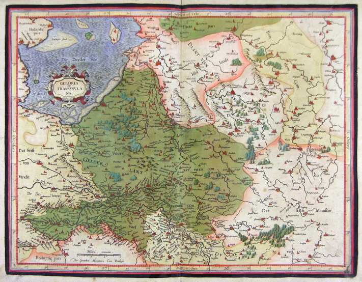
162-Geldria et Transysulana - Olanda .
The map belongs to the Atlas sive Cosmographicae Meditationes de Fabrica Mundi et Fabricati Figura, published in 1644 in Duisburg.
Author: Gerardo Mercatore
Duisburg,1644 |
|
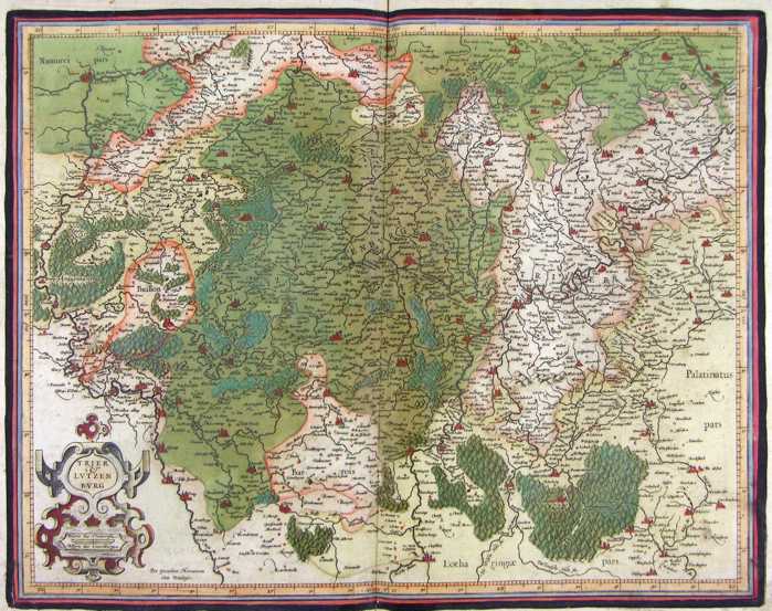
163-Trier et Lutzemburg - Lussemburgo .
The map belongs to the Atlas sive Cosmographicae Meditationes de Fabrica Mundi et Fabricati Figura, published in 1644 in Duisburg. Author: Gerardo Mercatore
Duisburg,1644 |
|
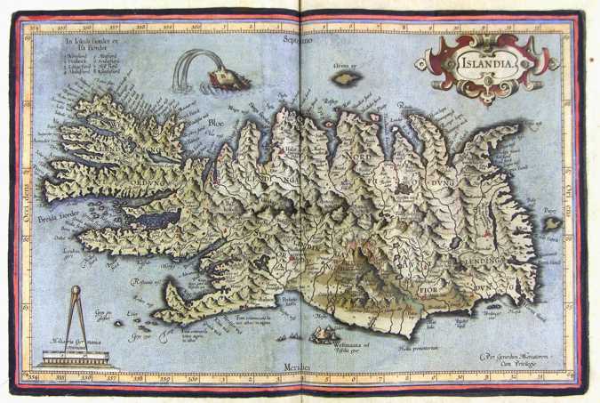
164-Islandia - Islanda .
The map belongs to the Atlas sive Cosmographicae Meditationes de Fabrica Mundi et Fabricati Figura, published in 1644 in Duisburg. Author: Gerardo Mercatore
Duisburg,1644 |
|
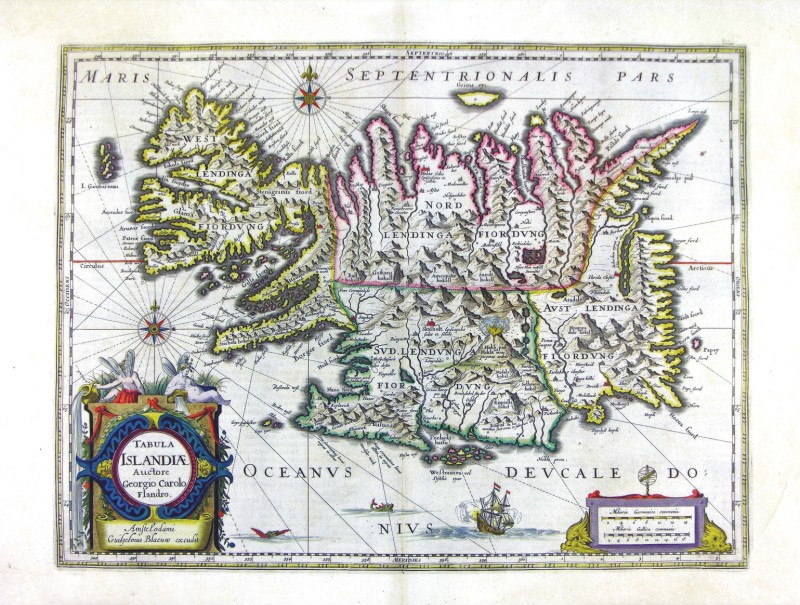
165-Tabula Islandiae - Islanda .
The map belongs to the Atlas sive Cosmographicae Meditationes de Fabrica Mundi et Fabricati Figura, published in 1644 in Duisburg.
Author: Ioannis Blaeu
Amsterdam,1665 |
|
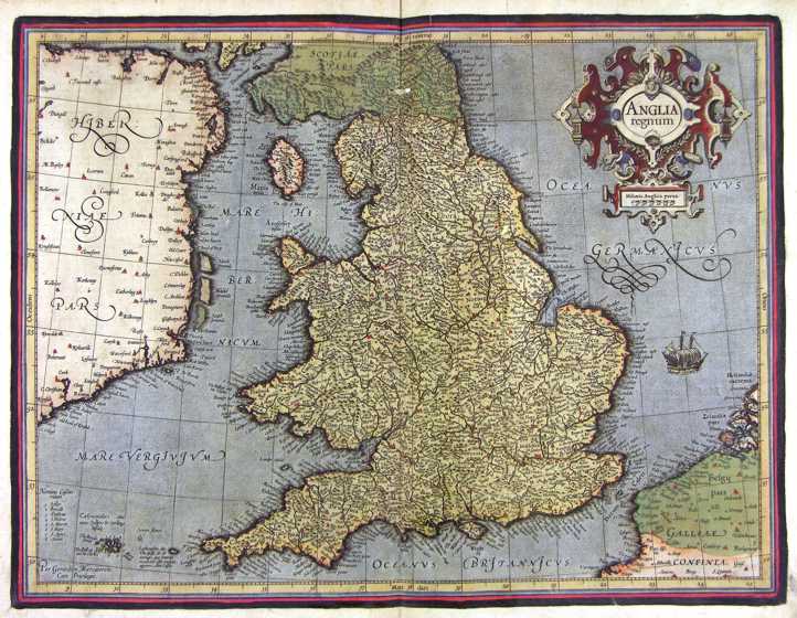
166-Anglia Regnum - Gran Bretagna .
The map belongs to the Atlas sive Cosmographicae Meditationes de Fabrica Mundi et Fabricati Figura, published in 1644 in Duisburg.
Author: Gerardo Mercatore
Duisburg,1644 |
|
167- Isole Inglesi - Gran Bretagna .
The map belongs to the Atlas sive Cosmographicae Meditationes de Fabrica Mundi et Fabricati Figura, published in 1644 in Duisburg.
Author: Gerardo Mercatore
Duisburg,1644 |
|
168-Gran Bretagna Sud Orientale .
The map belongs to the Atlas sive Cosmographicae Meditationes de Fabrica Mundi et Fabricati Figura, published in 1644 in Duisburg.
Author: Gerardo Mercatore
Duisburg,1644 |
|
169-Gran Bretagna Centro Orientale .
The map belongs to the Atlas sive Cosmographicae Meditationes de Fabrica Mundi et Fabricati Figura, published in 1644 in Duisburg.
Author: Gerardo Mercatore
Duisburg,1644 |
|
170-Gran Bretagna Centro Occidentale .
The map belongs to the Atlas sive Cosmographicae Meditationes de Fabrica Mundi et Fabricati Figura, published in 1644 in Duisburg.
Author: Gerardo Mercatore
Duisburg,1644 |
|
171-Gran Bretagna Sud Occidentale .
The map belongs to the Atlas sive Cosmographicae Meditationes de Fabrica Mundi et Fabricati Figura, published in 1644 in Duisburg.
Author: Gerardo Mercatore
Duisburg,1644 |
|
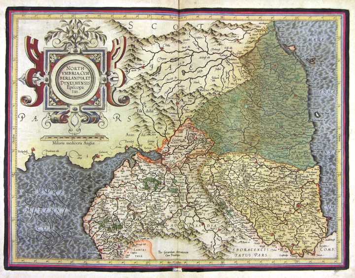
172-North Umbria - Gran Bretagna .
The map belongs to the Atlas sive Cosmographicae Meditationes de Fabrica Mundi et Fabricati Figura, published in 1644 in Duisburg.
Author: Gerardo Mercatore
Duisburg,1644 |
|
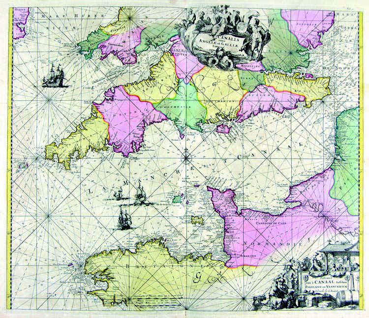
173-Stretto della Manica .
The map belongs to the Atlas de la Navigationet du Commerce qui se fait dans touts le Parties du Monde, published in 1715 in Amsterdam. Author: Louis Renard
Amsterdam,1715 |
|
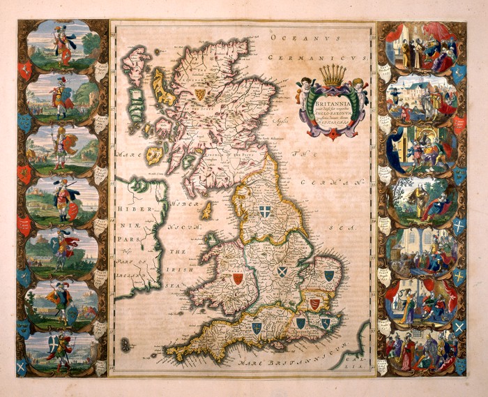
174-Bitannia .
Great Britain and a part of Ireland. This map of the 16thcentury measures 56 x 41 cm and distinguishes the island in seven regions, each of them with a blazon. There are fourteen historical scenes on the sides. The title picture on the right shows the inscription Prout divisa fuit temporibus Anglo-Saxonum praesertim durante illorum Heptarchia. Author: Willem and Ioannis Blaeu
Amsterdam,0 |
|
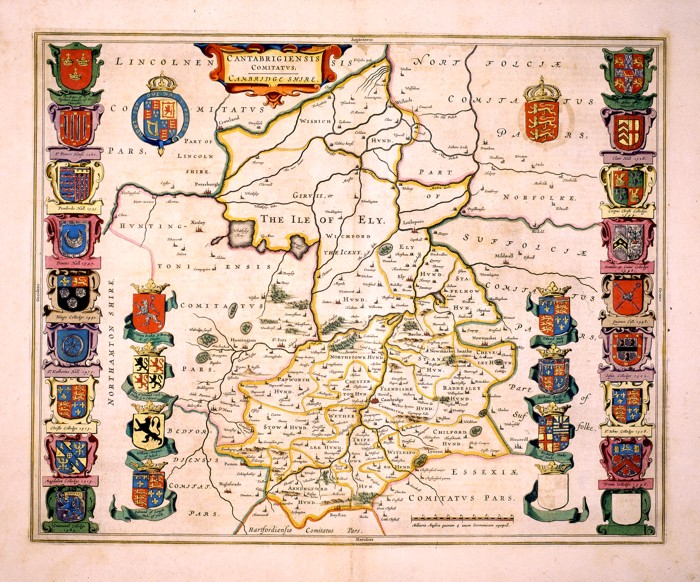
175-Cantabrigiensis Comitatus. Cambridge Shire .
The region of Cambridge in England. An important historical and geographical map, showing the precise borders of different regions, 28 blazons, a decorative title picture on the top right and a graphic scale at the bottom. This map of the 17th century measures 41,6 x 52cm. Author: Ioannis Blaeu
Amsterdam,0 |
|
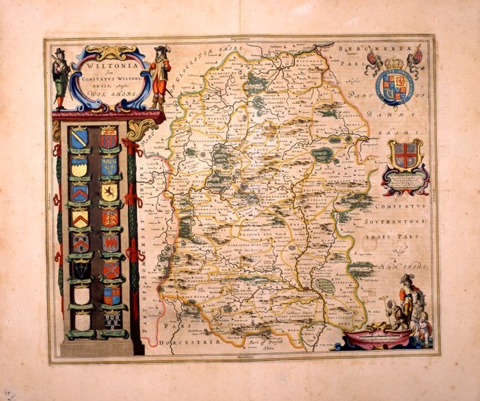
176-Wiltonia. Sive comitatus wiltoniensis; anglis wil shire .
This map of the 17 thcentury, measures 49,5 x 41 and shows a beautiful title picture standing over a column of sixteen blazons on the left and two decorative pictures and a graphic scale with scenes of that epoch on the right. The water courses are precisely drawn, however the hills are approximatively distributed all over the whole region. Author: Ioannis Blaeu
Amsterdam,0 |
|
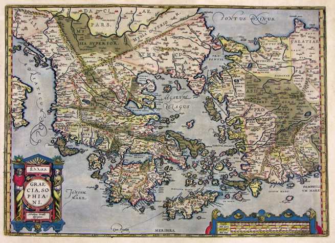
177-Graeciae Sophiani .
The map measures 33 x 49,2 cm and can be found in the atlas Theatrum Orbis Terrarum, edition released in 1589. This very beautiful and colored map represents the South Balkans and the West Turkey. Author: Abramo Ortelio
Anversa,1589 |
|
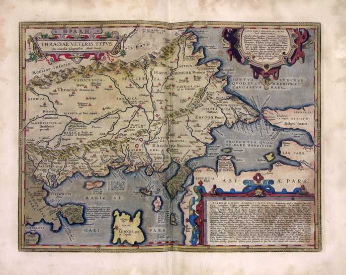
178-Traciae Veteris .
The well colored map measures 35 x 46,5 cm and can be found in the atlas Theatrum Orbis Terrarum, edition released in 1589. Author: Abramo Ortelio
Anversa,1589 |
|
179-Morea - Grecia .
The map belongs to the Atlas sive Cosmographicae Meditationes de Fabrica Mundi et Fabricati Figura, published in 1611 in Duisburg.
Author: Gerardo Mercatore
Duisburg,1611 |
|
180-Isole Greche .
The map belongs to the Atlas sive Cosmographicae Meditationes de Fabrica Mundi et Fabricati Figura, published in 1611 in Duisburg.
Author: Gerardo Mercatore
Duisburg,1611 |
|
181-Isole Greche .
The map belongs to the Atlas Theatrum Orbis Terrarum von Abramo Ortelio published in 1592 in Anversa. Author: Abramo Ortelio
Anversa,1592 |
|
182-Tempe. Tessaliae Pars .
Thessaly, Macedonia, the Aegean Sea and Mount Olympus with the Ark of Jupiter. The town Gonnum Urbs appears beneath Mount Olympus, close to the river Peneus. A beautiful drawing shows the Temple of Jupiter surrounded by festive rural scenes. This fine map contains a title picture at the top and at the bottom a citation of Ovid's Metamorphosis and the inscription Delinaetum et aeditum auctore Ab. Ortelio cum rivilegio decennali 1590.
Author:
,1590 |
|
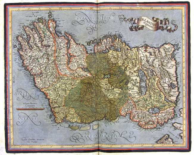
183-Irlandia Regnum - Irlanda .
The map belongs to the Atlas sive Cosmographicae Meditationes de Fabrica Mundi et Fabricati Figura, published in 1644 in Duisburg.
Author: Gerardo Mercatore
Duisburg,1644 |
|
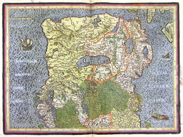
184-Irlandia Regnum - Nord - Irlanda .
The map belongs to the Atlas sive Cosmographicae Meditationes de Fabrica Mundi et Fabricati Figura, published in 1644 in Duisburg.
Author: Gerardo Mercatore
Duisburg,1644 |
|
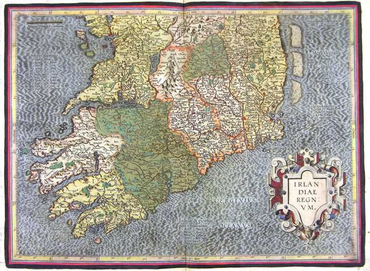
185-Irlandia Regnum - Sud - Irlanda .
The map belongs to the Atlas sive Cosmographicae Meditationes de Fabrica Mundi et Fabricati Figura, published in 1644 in Duisburg.
Author: Gerardo Mercatore
Duisburg,1644 |
|
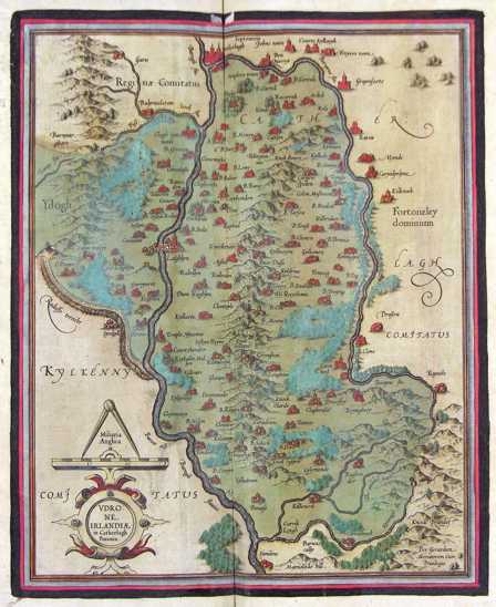
186-Udrone - Irlanda .
The map belongs to the Atlas sive Cosmographicae Meditationes de Fabrica Mundi et Fabricati Figura, published in 1644 in Duisburg.
Author: Gerardo Mercatore
Duisburg,1644 |
|
187-Ultoniae Orientalis - Irlanda .
The map belongs to the Atlas sive Cosmographicae Meditationes de Fabrica Mundi et Fabricati Figura, published in 1644 in Duisburg.
Author: Gerardo Mercatore
Duisburg,1644 |
|
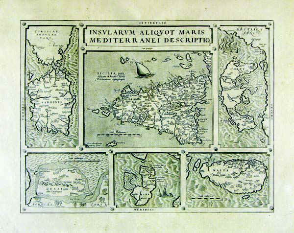
188-Insularum Aliquot Maris Mediterranei Descripto .
The paper is in the table "Mediterranean descriptio Insularum aliquot maris" inserted in the Atlas "Theatro del mondo of Abraham Ortelio from him little inanzi his death revised & new tables, et comment adorno, & enriched with life of the author. Translated language Tuscany by m. Filippo Pigafetta. In Antwerp below Young Baptist Urintio "1608". The paper derives from an engraving in copper and measure cm 36,5 x 48 and contains, all correctly oriented, those who were then considered the most important islands in the Western Mediterranean: Sicily Sardinia at the Centre, at the top and bottom left Gerba, Elba bottom centre, Malta below and Corfu top right. Author: Abramo Ortelio
Anversa,1608 |
|
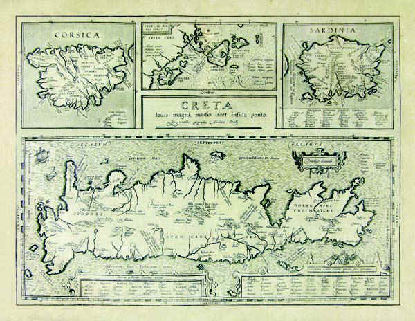
189-Creta .
The map belongs to the Theatrum Orbis Terrarum Parergon sive veteris geographiae tabulae. Commentaris geographicis et Historicis illustratae. Editio novissima. Tabulis aliquot aucta, et varie emendata atq innovata. Cura et Studio Balthasaris Moreti. Historiae ocuus geographia. Antuerpiae, ex officina Plantiniana, M.DC. XXIV".The drawing of the table measures 49 x 37 cm and represents Sardinia, Corsica, Crete and the Ionian Islands. Author: Abramo Ortelio
Anversa,1624 |
|
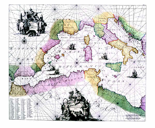
190-Maris Mediterranei .
The card, printed in 1715, is located in the Atlas de la Navigation et du Commerce qui se fait dans toutes les Parties du Monde, printed in Amsterdam chez Louis Renard, Marchand DCCXV libraire-M. Author: Louis Renard
Amsterdam,1715 |
|
191-Corsica, Sardinia, Ionian Islands and Crete .
The map belongs to the atlas Theatrum Orbis Terrarum, edition released in 1589.The drawing measures 34,8 x 48 cm. It's a very beautiful and well colored map. Crete occupies the half part below, Corsica, the Ionian Islands and Sardinia the upper part. Author: Abramo Ortelio
Anversa,1589 |
|
192-Insular Aliquot Aegei Maris .
The map resides on the table Insularum aliquot maris Mediterranei descriptio of the atlas Theatro del mondo di Abramo Ortelio, translated in Italian language by Philippo Pigefatta and printed in 1608 in Antwerp by Gio. Battista Urinto.
The document was taken from a copper plate engraving and measures 36,5 x 48 cm. It contains the most important islands of the West Mediterranean Sea at that time: Sicile is in the center, Sardinia at the top and Gerba is on the left bottom, Elba in the center below, Corfu at the top and Malta on the right bottom. Author: Abramo Ortelio
Anversa,1589 |
|
193-Mare Mediterraneo Orientale .
The map belongs to the Atlas de la Navigationet du Commerce qui se fait dans touts le Parties du Monde, published in 1715 in Amsterdam.
Author: Louis Renard
Amsterdam,1715 |
|
194-Cypri Insulae Nova Descript - Isola di Cipro .
The map belong to the Atlas Theatrum Orbis Terrarum. Published in 1592 in Anversa.
Author: Abramo Ortelio
Anversa,1592 |
|
195-Tabula Moderna Italiae .
The map belongs to the atlas Claudi Ptolomaei Geographicae enarrationis - Libri Octo-Annotationes Ioannis de Regio Monte in errores commissos a Iacobo Angelo in translatione sua.
The black and white document was taken from a woodcut and measures 27,6 x 39,8cm. It comes from one of the tolemaic maps contained in the Wilibald Pirchheimer's (1470 - 1530) edition. Author: Claudio Tolomeo
Strasburgo,1525 |
|
196-Italia Antiqua .
The map was created in 1640 by Melchior Tavernier and resides in the cartography collection of different authors established in the 18th century.
Tavernier worked for a long time for Sanson, Jansson, Hondius, Dankerts, Tassin, Bertius. He also was hydrographer, engraver and typographer of the King of France and produced very fine quality maps. On the let top there is a decorated picture with the title Antiquorum Italiae et Illyrici Occidentalis Episcopatuum Geographica Descriptio Parisiis apud M.Tavernier. Author: Melchior Tavernier
Parigi,1640 |
|
197-Italia Antiqua cum Insulis Sardinia, Sicilia & Corsica .
The map measures 40,5 x 52,5 cm. It exposes Italy and a part of Europe with in the West, the Rhone Valley and the Alps, and in the East, Istria and the Balkans. Exept from the Balkans, the document proposes the sector of the South Europe according to Cluverius' representation in 1619. But Cluverius exposed Sardinia in a preciser way. This one is the typical drawing of Sanson based on Magini's knowledges. The map has in particular a historical interest. Author: Nicolas Sanson
Amsterdam,1679 |
|
198-Italiae Veteris Specimen .
The drawing of the map measures 40,5 x 52,5 and resides in the atlas Theatrum Orbis Terrarum. It's a very beautiful and well colored map with two decoreted pictures. One of them above contains the inscription: Italiae Veteris Specimen.
Author: Abramo Ortelio
Anversa,1592 |
|
199-Italia .
The map belongs to the Atlas sive Cosmographicae Meditationes de Fabrica Mundi et Fabricati Figura, published in 1644 in Duisburg.
Author: Gerardo Mercatore
Duisburg,1644 |
|
200-L'Italie .
Part of Europe from the mouth of the Rh�ne in the West to the Island of Zante in the South East of Greece. This map of the 17th century, drawn by Sanson, printed in Paris by H. Jaillot and sold in Amsterdam by Pierre Mortier measures 89 x 50 cm. It shows all the states of Italy at that time.
On the top right is a splendid title picture and on the left a decorative picture contains different graphic scales. Author: Hubert Iaillot
Parigi,1669 |
|
201-Nova Italiae Delineatio di Ioannis Blaeu .
The map measures 49 x 38 cm and belongs to the atlas Theatrum Orbis Terrarum sive Atlas Novus - pars tertia - Guilelmus et Ioannis Blaeu, printed in 1650 in the Blaeu's family workshop in Amsterdam. The document shows the Italian peninsula with the islands of Sardinia and Corsica, a part of Sicily and Dalmatia. A beautiful decorating picture exposes the title and several sailing ships enrich the graphic aspect. Author: Giovanni Blaeu
Amsterdam,1650 |
|
202-Italia .
The Map belongs to the atlas Geographiae Blavianae volumen octavum Quo Italia quae est Europae Liber XVI di Blaeu, printed in 1662 in Amsterdam. The title is contained in a cartouche decorated with mythological figures, while the seas are several astimenti and sea monsters.
Author: Ioannis Blaeu
Amsterdam,1662 |
|
203-Regno di Napoli - Italia .
The Map, that measures the sketch at cm 49,5 xes 38,5, is to be found in the atlas Geographiae Blavianae volume octavum Quo Italy east quae Europae Liber XVI of Blaeu printed in Amsterdam in 1662.
Author: Ioannis Blaeu
Amsterdam ,1662 |
|
204-Le Grand Theatre de Guerre en Italie .
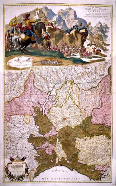
North Italy, from Liguria to the borders of Switzerland, with Milan in the centre. At the top a coloured picture of war scenes in Cremona shows the entrance of the Prince of Savoy with three thousand men.
The map also includes a fine description of the mountains, of the water courses, of the borders of the states and of the main roads. This splendid vertical map, drawn by the engineers in Eugenio of Savoy’s army, was printed in Amsterdam by Pierre Mortier and measures 97 x 59,5 cm. Author: Pierre Mortier
Amsterdam ,0 |

|
205-Austria .
The map belongs to the Atlas sive Cosmographicae Meditationes de Fabrica Mundi et Fabricati Figura, published in 1644 in Duisburg.
Author: Gerardo Mercatore
Duisburg,1644 |
|
209-Salisburgo - Austria .
The map belongs to the Atlas sive Cosmographicae Meditationes de Fabrica Mundi et Fabricati Figura, published in 1644 in Duisburg.
Author: Gerardo Mercatore
Duisburg,1644 |
|
210-Stiria - Austria .
The map belongs to the Atlas sive Cosmographicae Meditationes de Fabrica Mundi et Fabricati Figura, published in 1644 in Duisburg.
Author: Gerardo Mercatore
Duisburg,1644 |
|
211-Nuova Carta del Circolo di Baviera e di Austria .
The Map, realized in Amsterdam by Isac Tirion, it is in Italian language, measure in the sketch cm 32,5x28 and it represents, with different colors, the various regions of that part of Europe understood among Swabia aviera, Austria, with under the Tirol, the Trentino and, to East, Carnia and Slavonia.
Author: Isac Tirion
Amsterdam,0 |

|
212-Belgii - Belgio .
The map belongs to the Atlas sive Cosmographicae Meditationes de Fabrica Mundi et Fabricati Figura, published in 1644 in Duisburg. Author: Gerardo Mercatore
Duisburg,1644 |

|
213-Belgio .
The map belongs to the Atlas sive Cosmographicae Meditationes de Fabrica Mundi et Fabricati Figura, published in 1644 in Duisburg. Author: Gerardo Mercatore
Duisburg,1644 |

|
214-Flandria comit - Belgio .
The map belongs to the Atlas sive Cosmographicae Meditationes de Fabrica Mundi et Fabricati Figura, published in 1644 in Duisburg.
Author: Gerardo Mercatore
Duisburg,1644 |
|
215-Nova et Exacta Tabula Salae et Castellanae Iprensis .
The region of Ypres in Belgium with its twenty castles, a view of the city and three blazons at the top. This detailed map shows two decorative pictures and a wind rose. Drawn by Antonius Saderus, it measures 48,4 x 39 cm. Author: Antonius Sanderus
Amsterdam,1641 |
|
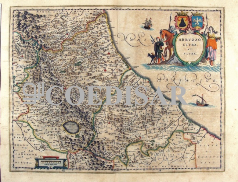
216-Abruzzo citra et ultra - Abruzzo - Italia .
The Charter, which measures cm 49,5 x 38.5 is to be found in Atlas Geographiae Blavianae volume octavum Quo Italy quae est Europae Liber XVI of Blaeu printed in Amsterdam in 1662.
Author: Ioannis Blaeu
Amsterdam. ,1662 |
|
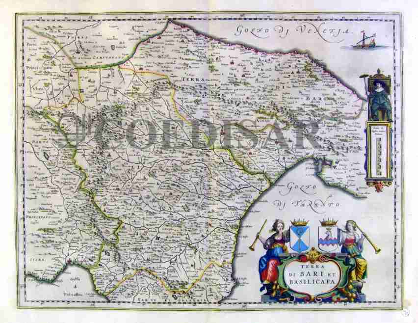
217-Terra di Bari et Basilicata - Italia .
The Charter, which measures cm 50 x 38.5, is to be found in the Atlas Geographiae Blavianae volume octavum Quo Italy quae est Europae Liber XVI of Blaeu printed in Amsterdam in 1662.
Author: Ioannis Blaeu
Amsterdam ,1662 |
|
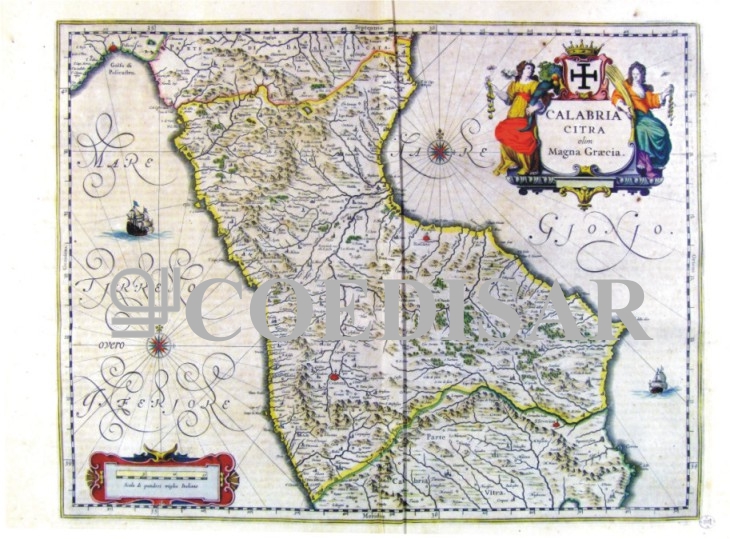
218-Calabria citra olim Magna Graecia - Calabria - Italia .
The Charter, which measures cm 49 x 38, is to be found in the Atlas Geographiae Blavianae volume octavum Quo Italy quae est Europae Liber XVI of Blaeu printed in Amsterdam in 1662.
Author: Ioannis Blaeu
Amsterdam ,1662 |
|
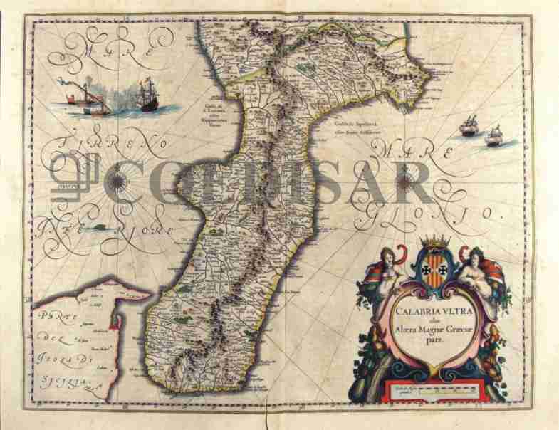
219-Calabria ultra olim Alterae Magnae Graeciae pars - Calabria - Italia .
The Charter, which measures 50.4 x 39 cm, is to be found in the Atlas Geographiae Blavianae volume octavum Quo Italy quae est Europae Liber XVI of Blaeu printed in Amsterdam in 1662 Author: Ioannis Blaeu
Amsterdam ,1662 |
|
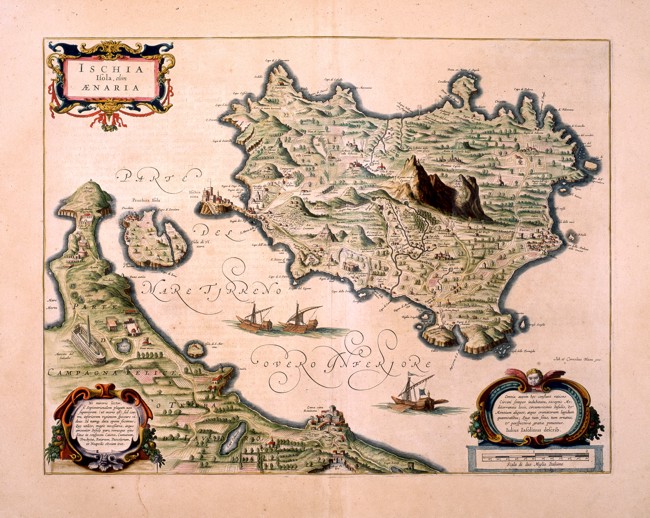
220-Ischia - Isola Olim Aenaria .
The Island of Ischia with the Peninsula of Capo Miseno and the little Island of Procida in the centre. The title picture appears on the top left. Two decorative pictures contain some information written in Latin, a metric scale of two Italian miles is on the bottom right. There is a exact description of the mountains: the Monte Epomeo is in the centre next to the Monte della Custodia. The Island seems to be intensively cultivated and is coloured a beautiful green. Three sailing ships are on the sea.
There are castles and fortifications, the villages are indicated with white walls and red roofs. The little town of Ischia lies on a big rock connected to the rest of the island by a bridge. The map shows water courses everywhere and springs of hot water, called sudatory. The Villa of Lucullo and the Roman Theatre appear on the mainland. Measuring 49 x 37,5 cm, this map is taken from the Blaeu altlas Theatrum Orbis Therrarum, printed in the 17th century in Amsterdam.
Author: Ioannis Blaeu
Amsterdam,1662 |
|
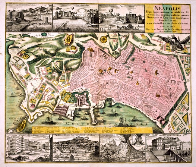
221-Neapolis .
This map of Naples is surrounded by seven views of the town: At the top are the Molo, the Castel Nuovo and the Castel dell'Ovo, at the bottom appear the Piazza del Mercato, the Castello di Sant'Elmo, the Mount Vesuvius and the Palazzo del Viceré. It offers precise information of the town. The most important buildings, the port in front of Castel Nuovo and numerous sailing boats are drawn on the map. It measures 58 x 49,5 cm and comes from a Blaeu atlas of the 17 th century.
Author: Ioannis Blaeu
Amsterdam,1662 |
|
222-Principato Citra olim Picentia - Campania - Italia .
The Charter, which measures 49.2 x 38,5 cm, is to be found in the Atlas Geographiae Blavianae volume octavum Quo Italy quae est Europae Liber XVI of Blaeu printed in Amsterdam in 1662. Author: Ioannis Blaeu
Amsterdam ,1662 |
|
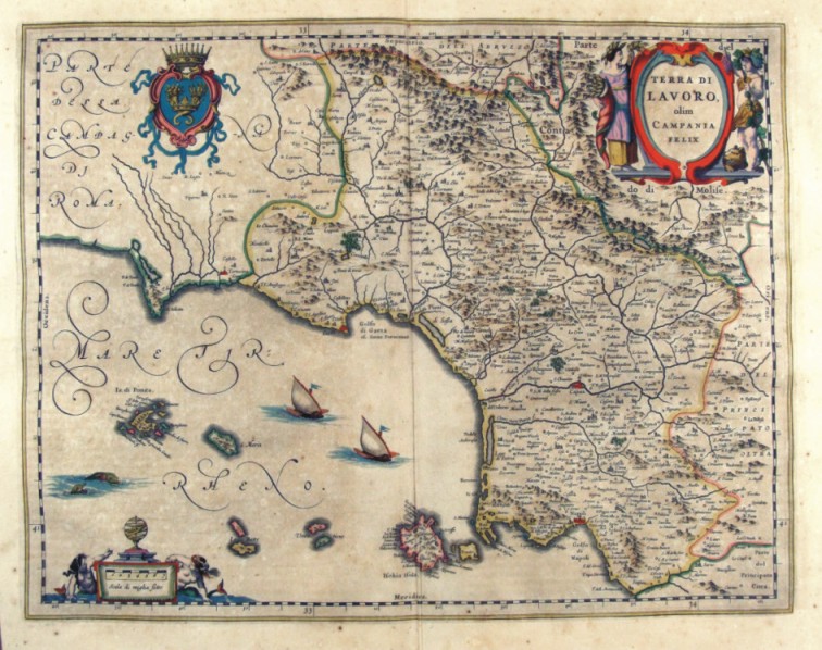
223-Terra di Lavoro olim Campania Felix - Campania - Italia .
The Charter, which measures 48.8 x 38, is to be found in the Atlas Geographiae Blavianae volume octavum Quo Italy quae est Europae Liber XVI of Blaeu printed in Amsterdam in 1662. Author: Ioannis Blaeu
Amsterdam ,1662 |
|
224-La costa d'Italia da Porto Hercole sino a C. dell'Arme .
The map measures 40 x 50,6 cm and belongs to the atlas Prima parte dello Specchio del Mare, published in 1664 in Genoa by F.M. Levanto. It offers an exhaustive view of the South Thyrrenian Sea. Author: Francesco Maria Levanto
Genova ,0 |
|
225-Thyrrenian Sea .
The map measures 46,5 x 65,6 cm and represents a large part of the Thyrrenian Sea. Down on the right are reported the author's name, the place and the date of the map's redaction: Iacobus Maiolus fecit cartam Genue anno domini 1567 diem ianuarii XXX. Further on the right we can see a very beautiful wind rose from which depart 32 directions crossing in 9 different points. It's a typical nautical chart, very beatiful even if very schematic. It shows the coast profil and gives a lot of interesting informations for the navigation. There is no description of the inside area.
Author: Jacobus Maiolus
Genova ,1567 |
|
226-New chorographic map of the Sardinian's Empire States .
The map, printed in 1793, measures 74 x 69 cm and is on scale 1:500 000. It exposes Savoy, the Aosta Valley and a sector of the Piedmont. Author: J. B. Bouge
Berlino ,1793 |
|
227-New special map of the Sardinia's States .
The map, printed in 1793, measures 74 x 69 cm and shows Liguria with a sector of the South Piedmont. Sardinia is exposed in a square. Author: J. B. Bouge
,1793 |
|
228-Romandiola - Italia .
The map belongs to the Atlas sive Cosmographicae Meditationes de Fabrica Mundi et Fabricati Figura, published in 1644 in Duisburg.
Dimensions: cm 44 X 37 Author: Gerardo Mercatore
Duisburg ,1644 |

|
229-Italia Gallica sive Gallia Cisalpina - Italia .
The document is taken from the Atlas Theatrum Orbis Terrarum printed in Antwerp in 1592. Author: Abramo Ortelio
Anversa,1592 |
|
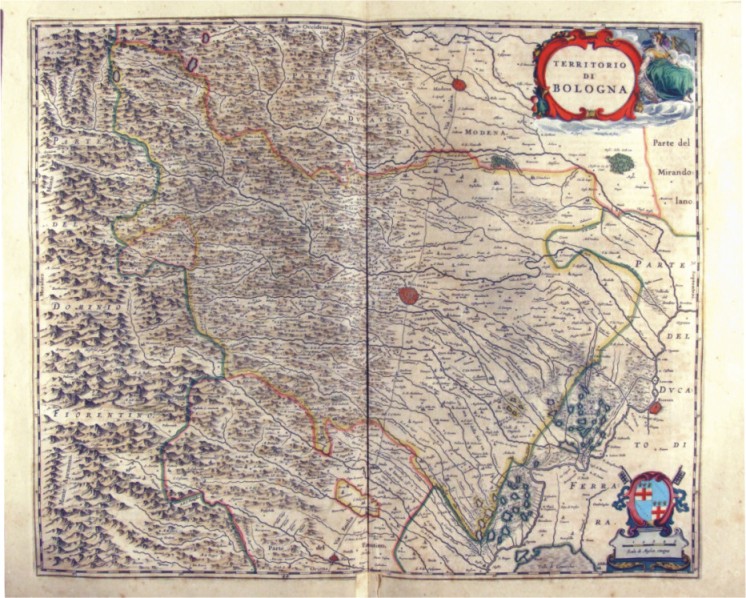
230-Territorio di Bologna - Emilia Romagna - Italia .
The Charter, which measures ' 53.4 x 44 is located in the Atlas Theatrum Orbis Terrarum sive Atlas Novus-tertia pars of Guilelmus et Ioannis Blaeu, printed in Amsterdam in the workshop of Giovanni Blaeu in 1650. Offers Emilia, Appennines until Polesine and, to the North, the city of Modena Author: Ioannis Blaeu
Amsterdam ,1650 |
|
231-Romagna olim Flaminia - Emilia Romagna - Italia .
The Charter, which measures ' 49.2 x 38 is located in the Atlas Theatrum Orbis Terrarum sive Atlas Novus-tertia pars of Guilelmus et Ioannis Blaeu, printed in Amsterdam in the workshop of Giovanni Blaeu in 1650. The card offers the Romagna, from Imola to West to the Adriatic coast of Rimini Author: Ioannis Blaeu
Amsterdam ,1650 |
|
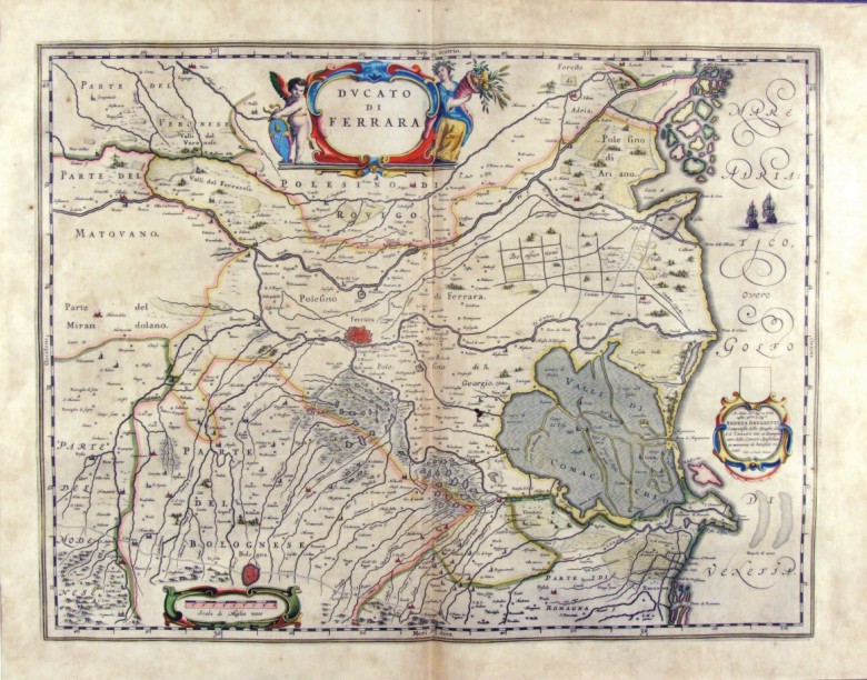
232-Ducato di Ferrara - Emilia Romagna - Italia .
The card, measuring 49.7 x 38 cm is located in the Atlas Theatrum Orbis Terrarum sive Atlas Novus pars Tertia is to Guilelmus et Ioannis Blaeu, printed in Amsterdam in the workshop of Giovanni Blaeu in 1650. The paper proposes the Polesine Ferrara with its surroundings and the lagoons of Comacchio Valley and is of considerable historical importance because it suggests the limits of many territories and possessions. In the lower right is shown a dedication and Jhoannem Cornelium Blaeu Andrea Brugiotti. Author: Ioannis Blaeu
Amsterdam ,1650 |
|
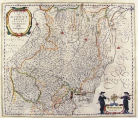
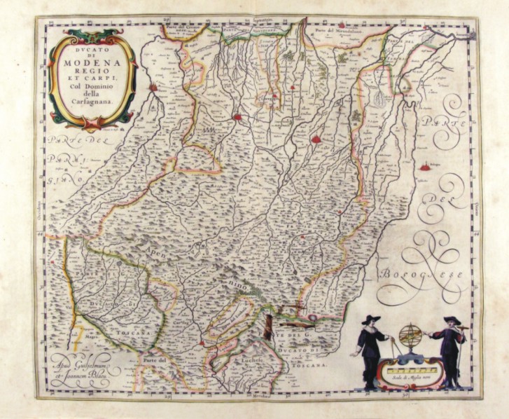
233-Ducato di Modena Reggio et Carpi - Emilia Romagna - Italia .
The paper, which measures 47 x 40 cm is located in the Atlas Theatrum Orbis Terrarum sive Atlas Novus - tertia pars of Guilelmus et Ioannis Blaeu, printed in Amsterdam in the workshop of Giovanni Blaeu in 1650. The paper proposes the area of the Po valley bordering the Apennines and is enriched by two scrolls, the first of which, at the top contains the title, while the bottom right, contains the metric scale and is adorned with the figures of two geographers Author: Ioannis Blaeu
Amsterdam ,1650 |
|
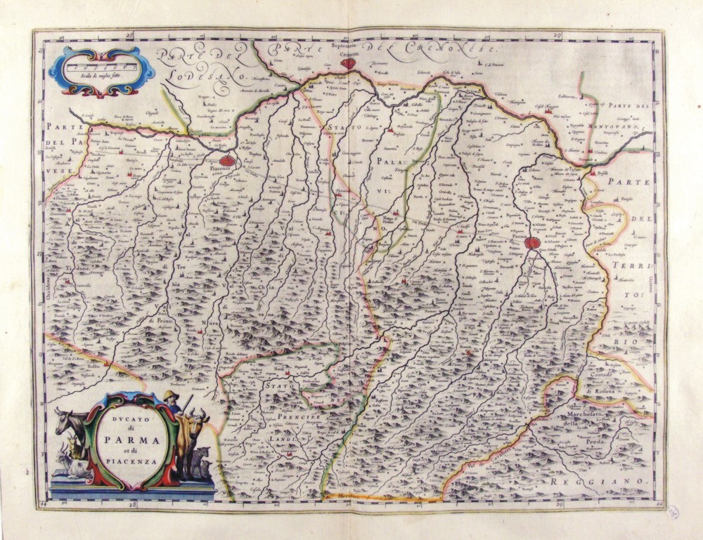
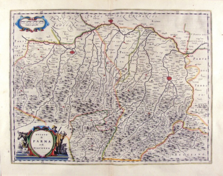
234-Ducato di Parma et di Piacenza - Emilia Romagna - Italia .
The paper, which measures 50 x 38 cm is located in the Atlas Theatrum Orbis Terrarum sive Atlas Novus - tertia pars of Guilelmus et Ioannis Blaeu, printed in Amsterdam in the workshop of Giovanni Blaeu in 1650. The paper proposes the territory of the ancient Duchy enclosing a part of the Po Valley and the northern sector of the Apennines.
Author: Ioannis Blaeu
Amsterdam ,1650 |
|
235-Ducato di Modena Reggio et Carpi - Emilia Romagna - Italia .
The card, measuring 46.7 x 40.5 cm in the drawing is contained in the atlas Geographiae Blavianae volumen octavum Quo Italy quae est Europae Liber XVI Blaeu printed in Amsterdam in 1662. Author: Ioannis Blaeu
Amsterdam ,1662 |
|
236-Ducato di Parma et di Piacenza - Emilia Romagna - Italia .
The paper, which measures 50 x 38.5 cm in design, is contained in the atlas Geographiae Blavianae volumen octavum Quo Italy quae est Europae Liber XVI Blaeu printed in Amsterdam in 1662. Author: Ioannis Blaeu
Amsterdam ,1662 |
|
237-Ducato di Ferrara - Emilia Romagna - Italia .
The paper, which measures 50 x 38.5 cm in design, is contained in the atlas Geographiae Blavianae volumen octavum Quo Italy quae est Europae Liber XVI Blaeu printed in Amsterdam in 1662. Author: Ioannis Blaeu
Amsterdam ,1662 |
|
238-Territorio di Bologna - Emilia Romagna - Italia .
The paper, which measures 53 x 44 cm in the design, is contained in the atlas Geographiae Blavianae volumen octavum Quo Italy quae est Europae Liber XVI Blaeu printed in Amsterdam in 1662.
Author: Ioannis Blaeu
Amsterdam ,1662 |
|
239-Romagna olim Flaminia - Emilia Romagna - Italia .
The Charter, which measures in the drawing cm 49 x 38, is contained in the Atlas Geographiae Blavianae volumen octavum Quo Italy quae est Europae Liber XVI of Blaeu printed in Amsterdam in 1662 Author: Ioannis Blaeu
Amsterdam ,1662 |
|
240-Friuli Venezia Giulia , Istria - Italia .
The map belongs to the Atlas sive Cosmographicae Meditationes de Fabrica Mundi et Fabricati Figura, published in 1644 in Duisburg.
Author: Gerardo Mercatore
Duisburg ,1644 |
|
241-Il Cadorino - Friuli Venezia Giulia - Italia .
The Charter, which measures ' 49,7 x 38 is located in the Atlas Theatrum Orbis Terrarum sive Atlas Novus-tertia pars of Guilelmus et Ioannis Blaeu, printed in Amsterdam in the workshop of Giovanni Blaeu in 1650. The Charter represents the northern sector of Friuli, which borders the Tyrol.
Author: Ioannis Blaeu
Amsterdam ,1650 |
|
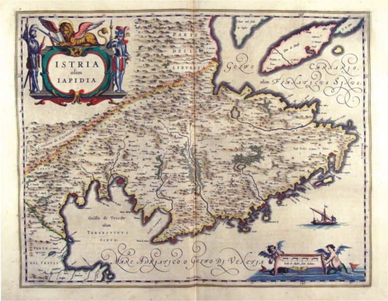
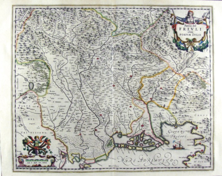
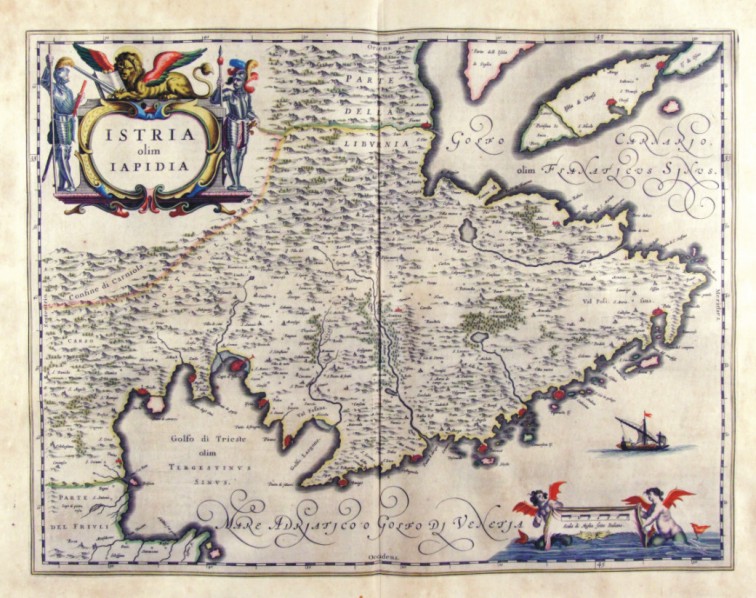
242-Patria del Friuli - Friuli Venezia Giulia - Italia .
The Charter, which measures ' 49,7 x 41 is located in the Atlas Theatrum Orbis Terrarum sive Atlas Novus-tertia pars of Guilelmus et Ioannis Blaeu, printed in Amsterdam in the workshop of Giovanni Blaeu in 1650. The card offers the North Eastern region of Italy between the Bellunese and karst with The countryside of Gorizia, part of Treviso, Trieste and its Gulf.
Author: Ioannis Blaeu
Amsterdam ,1650 |
|
243-Istria olim Iapidia - Friuli Venezia Giulia - Italia .
The Charter, which measures ' 49,7 x 38 is located in the Atlas Theatrum Orbis Terrarum sive Atlas Novus-tertia pars of Guilelmus et Ioannis Blaeu, printed in Amsterdam in the workshop of Giovanni Blaeu in 1650. The Charter represents Istria with the Trieste Gulf to the West and the Gulf of Carnaro to East, with the town of Pula.
Author: Ioannis Blaeu
Amsterdam ,1650 |
|
244-Patria del Friuli - Friuli Venezia Giulia - Italia .
The Charter, which measures in the drawing ' 49.6 x 41 is contained in the Atlas Geographiae Blavianae volumen octavum Quo Italy quae est Europae Liber XVI of Blaeu printed in Amsterdam in 1662.
Author: Ioannis Blaeu
Amsterdam ,1662 |
|
245-Istria olim Iapidia - Friuli Venezia Giulia - Italia .
The Charter, which measures in the drawing cm 49,5 x 38.5, is contained in the Atlas Geographiae Blavianae volumen octavum Quo Italy quae est Europae Liber XVI of Blaeu printed in Amsterdam in 1662.
Author: Ioannis Blaeu
Amsterdam ,1662 |
|
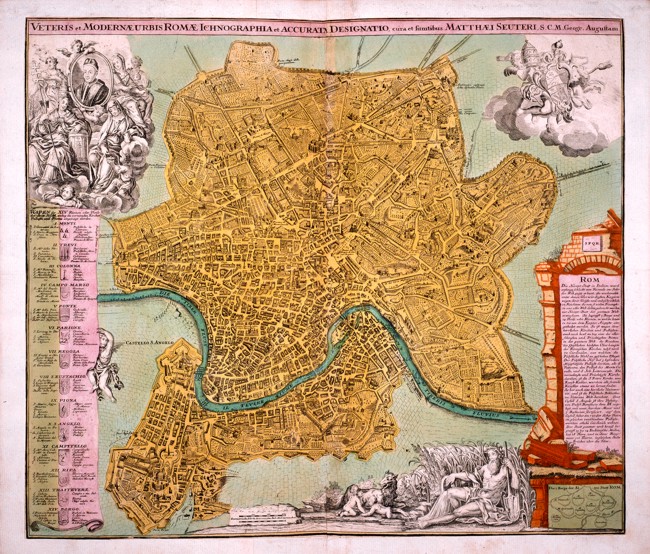
246-Roma - Veteris et modernae urbis romae - Ichnographia et accurati designatio � cu .
This map of Rome, drawn by Matthaeus Seutter, is written in German and contains useful indications of fourteen districts, the subdivision of the hills and other different information. It has many beautiful drawings and figures. It measures 57,5 x 49,5 cm.
Author: Matteo Seutter
,0 |
|
247-Campagna di Roma - Lazio - Italia .
The Charter, which measures in the drawing cm 50 x 39, is contained in the Atlas Geographiae Blavianae volumen octavum Quo Italy quae est Europae Liber XVI of Blaeu printed in Amsterdam in 1662.
Author: Ioannis Blaeu
Amsterdam ,1662 |
|
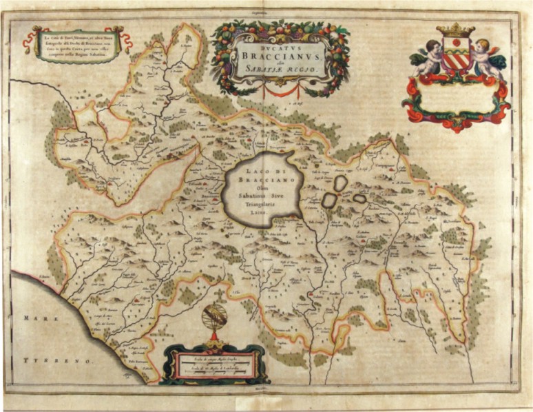
248-Ducatus Braccianus - Lazio - Italia .
The Charter, which measures in the drawing 56.4 x 42 cm, is contained in the Atlas Geographiae Blavianae volumen octavum Quo Italy quae est Europae Liber XVI of Blaeu printed in Amsterdam in 1662.
Author: Ioannis Blaeu
Amsterdam ,1662 |
|
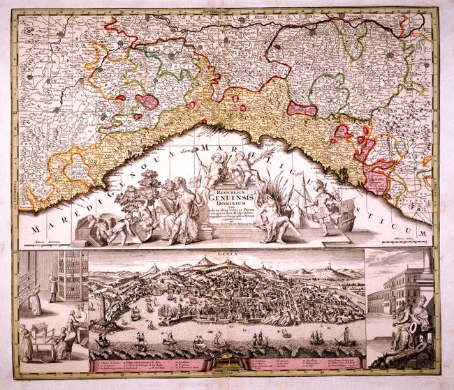
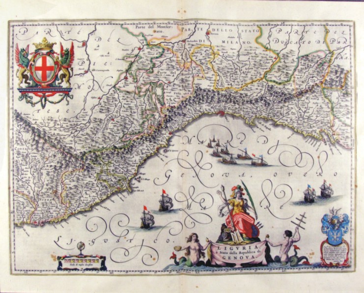
Republicae Genuensis Dominium .
Liguria from Ventimiglia in the West to the Dukedom of Massa in the East. There is a very beautiful title picture in the centre and a splendid drawing of the town of Genoa at the bottom. This well-drawn map is an interesting geographical and historical document and measures 56,8 x 49 cm. Author: Seutter Matteo
Augusta ,1740 |
|
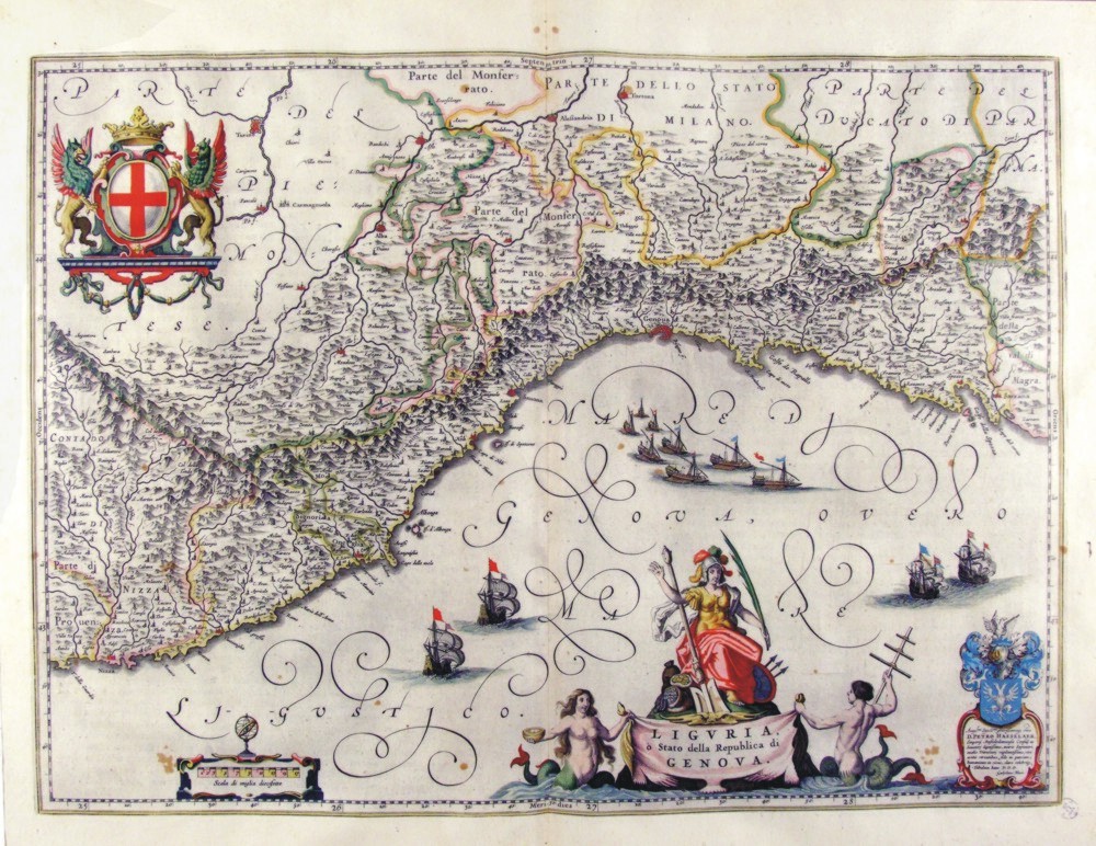
250-Liguria o Stato della Repubblica di Genova - Liguria - Italia .
The Charter, which measures ' 50.5 x 37.5 is located in the Atlas Theatrum Orbis Terrarum sive Atlas Novus-tertia pars of Guilelmus et Ioannis Blaeu, printed in Amsterdam in the workshop of Giovanni Blaeu in 1650. Charter graphically pleasing enriched by l±d and drawing with a large number of vessels sailing in the Gulf of Genoa. Liguria is surrounded by a circle montano and North is a part of Monferrato and the rule of Milan.
Author: Ioannis Blaeu
Amsterdam ,1650 |
|
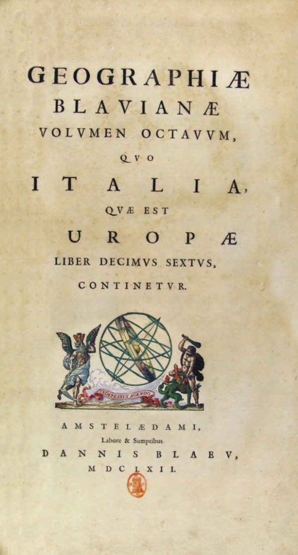
540-GEOGRAPHIAE BLAVIANAE .
Autore : Blaeu Author:
,1662 |
|
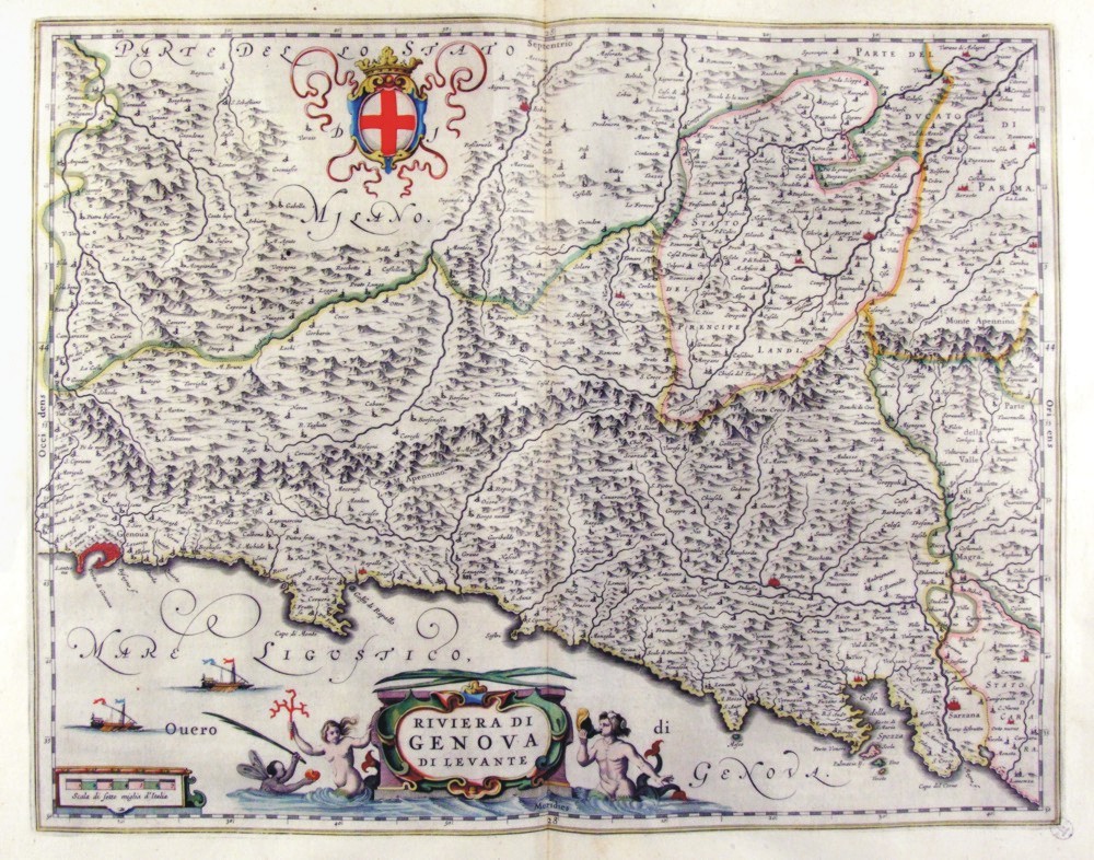
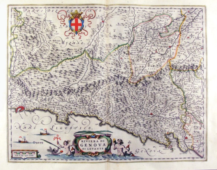
252-Riviera di Genova di Levante - Liguria - Italia .
The Charter, that measure cm 49 x 39 is located in the Atlas Theatrum Orbis Terrarum sive Atlas Novus-tertia pars of Guilelmus et Ioannis Blaeu, printed in Amsterdam in the workshop of Giovanni Blaeu in 1650. Charter graphically pleasing that offers Liguria Eastern scale greater than the previous, the Southern Piedmont. The title is contained in a nice title block adorned by mythological figures. A nice lable top offers the cross of the Republic of Genoa. Author: Ioannis Blaeu
Amsterdam ,1650 |
|
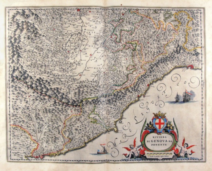
253-Riviera di Genova di Ponente - Liguria - Italia .
The Charter, which measures ' 48.7 x 38 is located in the Atlas Theatrum Orbis Terrarum sive Atlas Novus-tertia pars of Guilelmus et Ioannis Blaeu, printed in Amsterdam in the workshop of Giovanni Blaeu in 1650. Charter graphically pleasing that offers the western Liguria to larger scale than the previous, Piedmont meridioneale. The title is contained in a nice lable. Author: Ioannis Blaeu
Amsterdam ,1650 |
|
254-Riviera di Genova di Ponente - Liguria - Italia .
The Charter, that measure cm 49 x 38, is contained in the Atlas Geographiae Blavianae volumen octavum Quo Italy quae est Europae Liber XVI of Blaeu printed in Amsterdam in 1662. Charter graphically pleasing that offers the western Liguria to larger scale than the previous, Piedmont meridioneale. The title is contained in a nice lable. Author: Ioannis Blaeu
Amsterdam ,1662 |
|
255-Riviera di Genova di Levante - Liguria - Italia .
The Charter, that measure cm 49 x 39, is contained in the Atlas Geographiae Blavianae volumen octavum Quo Italy quae est Europae Liber XVI of Blaeu printed in Amsterdam in 1662. Charter graphically pleasing that offers Liguria Eastern from Genoa up in Sarzana. The title is contained in a nice title block adorned by mythological figures. A nice lable top offers the cross of the Republic of Genoa. Author: Ioannis Blaeu
Amsterdam ,1662 |
|
256-Lombardia - Italia .
The map belongs to the Atlas sive Cosmographicae Meditationes de Fabrica Mundi et Fabricati Figura, published in 1644 in Duisburg. Author: Gerardo Mercatore
Duisburg ,1644 |
|
258-Brescia e Milano - Lombardia - Italia .
The map belongs to the Atlas sive Cosmographicae Meditationes de Fabrica Mundi et Fabricati Figura, published in 1644 in Duisburg.
Author: Gerardo Mercatore
Duisburg ,1644 |

|
257-Lombardia e Veneto - Italia .
The map belongs to the Atlas sive Cosmographicae Meditationes de Fabrica Mundi et Fabricati Figura, published in 1644 in Duisburg. Author: Gerardo Mercatore
Duisburg ,1644 |
|
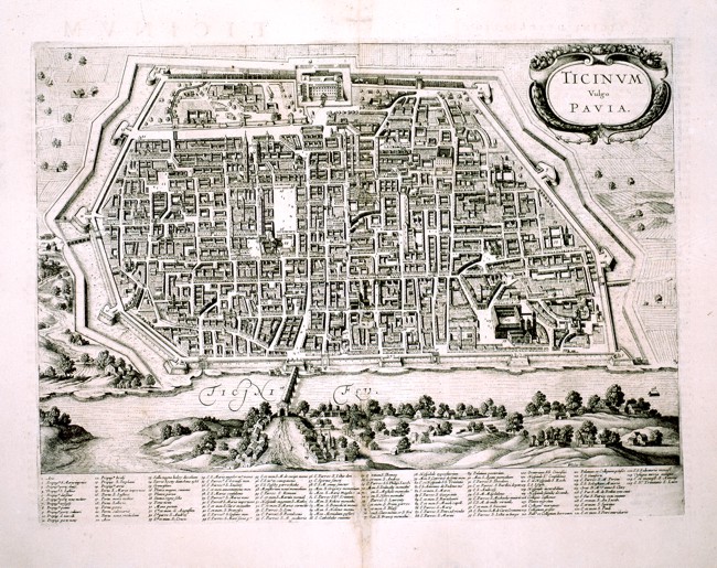
259-Ticinum Vulgo - Pavia .
A nice perspective view of the town of Pavia, measuring 44,5 x 33 cm. At the bottom beneath the river Ticino, the map shows the names of the churches and the most important buildings.
Author:
,0 |
|
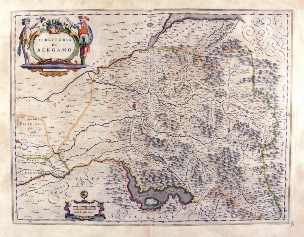
260-Territorio di Bergamo - Lombardia - Italia .
The map measures 50 x 38 cm and belongs to the atlas Theatrum Orbis Terrarum sive Atlas Novus - pars tertia - Guilelmus et Ioannis Blaeu, printed in 1650 in the Blaeu's family workshop in Amsterdam. Author: Ioannis Blaeu
Amsterdam ,1650 |
|
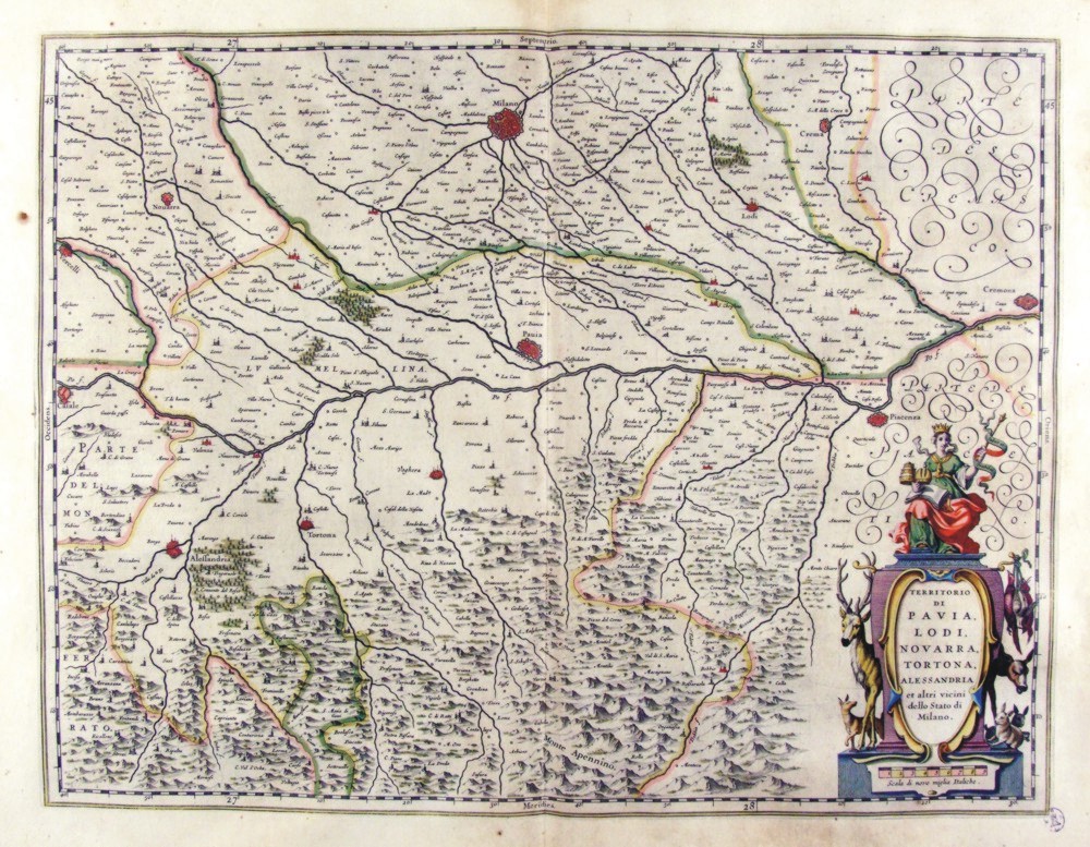
261-Territorio di Pavia, Lodi, Novarra, Tortona e Alessandria - Lombardia - Italia .
The Charter, to what extent 50.5 x 38,5 cm is located in the Atlas Theatrum Orbis Terrarum sive Atlas Novus is tertia pars of Guilelmus et Ioannis Blaeu, printed in Amsterdam in the workshop of Giovanni Blaeu in 1650. The card offers the Po Valley from Casale in Cremona. Author: Ioannis Blaeu
Amsterdam ,1650 |
|
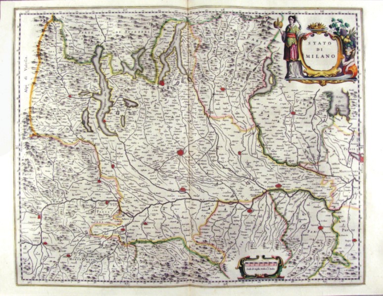
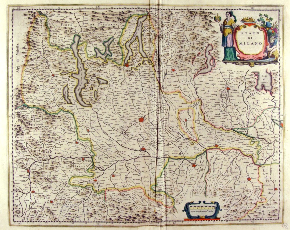
262-Stato di Milano - Lombardia - Italia .
The Charter, to what extent 52.3 x 41.5 cm is located in the Atlas Theatrum Orbis Terrarum sive Atlas Novus-tertia pars of Guilelmus et Ioannis Blaeu, printed in Amsterdam in the workshop of Giovanni Blaeu in 1650. The card offers the Lombardia Author: Ioannis Blaeu
Amsterdam,1650 |
|
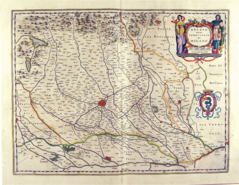
263-Ducato ovvero Territorio di Milano - Lombardia - Italia .
The Charter, to what extent 50.5 x 38,5 cm is located in the Atlas Theatrum Orbis Terrarum sive Atlas Novus-tertia pars of Guilelmus et Ioannis Blaeu, printed in Amsterdam in the workshop of Giovanni Blaeu in 1650. The Charter represents Milan and its territory and is adorned by two Scrolls one of which contains the title and the other the biscione. Author: Ioannis Blaeu
Amsterdam ,1650 |
|
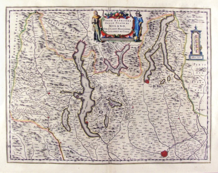
264-Parte Alpestre dello Stato di Milano - Lombardia - Italia .
The Charter, to what extent 50.5 x 38,5 cm is located in the Atlas Theatrum Orbis Terrarum sive Atlas Novus-tertia pars of Guilelmus et Ioannis Blaeu, printed in Amsterdam in the workshop of Giovanni Blaeu in 1650. The Charter represents the Northern Lombardy with the Alps and lakes. Author: Ioannis Blaeu
Amsterdam ,1650 |
|
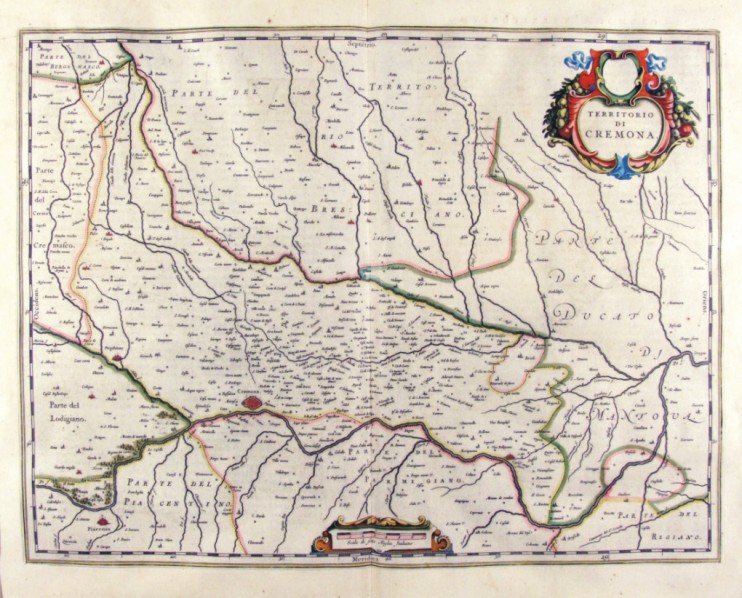
265-Territorio di Cremona - Lombardia - Italia .
The Charter, that measure cm 50 x 38 is located in the Atlas Theatrum Orbis Terrarum sive Atlas Novus-tertia pars of Guilelmus et Ioannis Blaeu, printed in Amsterdam in the workshop of Giovanni Blaeu in 1650. The card offers the Po Valley in the area of Cremona that extends from the Lodgiano to Duchy of Mantovena with a part of the Duchy of Mantova. Author: Ioannis Blaeu
Amsterdam ,1650 |
|
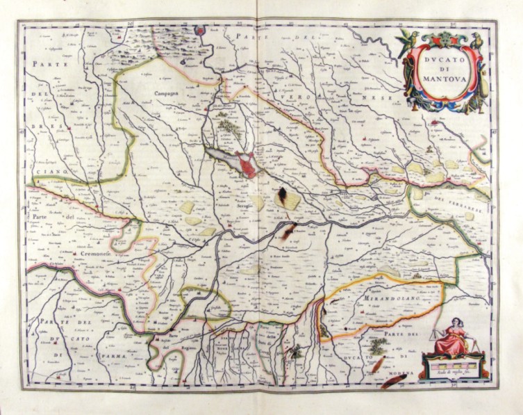
266-Ducato di Mantova - Lombardia - Italia .
The Charter, that measure cm 49 x 38 is located in the Atlas Theatrum Orbis Terrarum sive Atlas Novus-tertia pars of Guilelmus et Ioannis Blaeu, printed in Amsterdam in the workshop of Giovanni Blaeu in 1650. The card offers the Po Valley in the area of Mantova until Ferrarese. Author: Ioannis Blaeu
Amsterdam ,1650 |
|
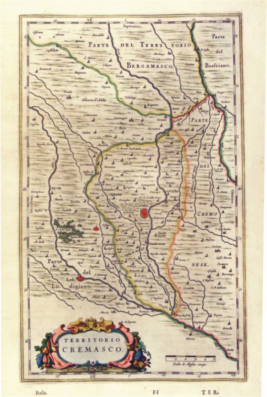
267-Territorio di Cremona - Lombardia - Italia .
The Charter, to what extent in 38 x 23.4 cm drawing is contained in the Atlas Geographiae Blavianae volumen octavum Quo Italy quae est Europae Liber XVI of Blaeu printed in Amsterdam in 1662. Author: Ioannis Blaeu
Amsterdam,1662 |
|
268-Stato di Milano - Lombardia - Italia .
The Charter, which measures in the drawing cm 52 x 41.5 is contained in the Atlas Geographiae Blavianae volumen octavum Quo Italy quae est Europae Liber XVI of Blaeu printed in Amsterdam in 1662. The Charter, whose title is contained in a lable place above right, decorated with figures rappresennati abundance of agricultural products, offers the Lombardy Alps, lakes and southern Switzerland. Author: Ioannis Blaeu
Amsterdam,1662 |
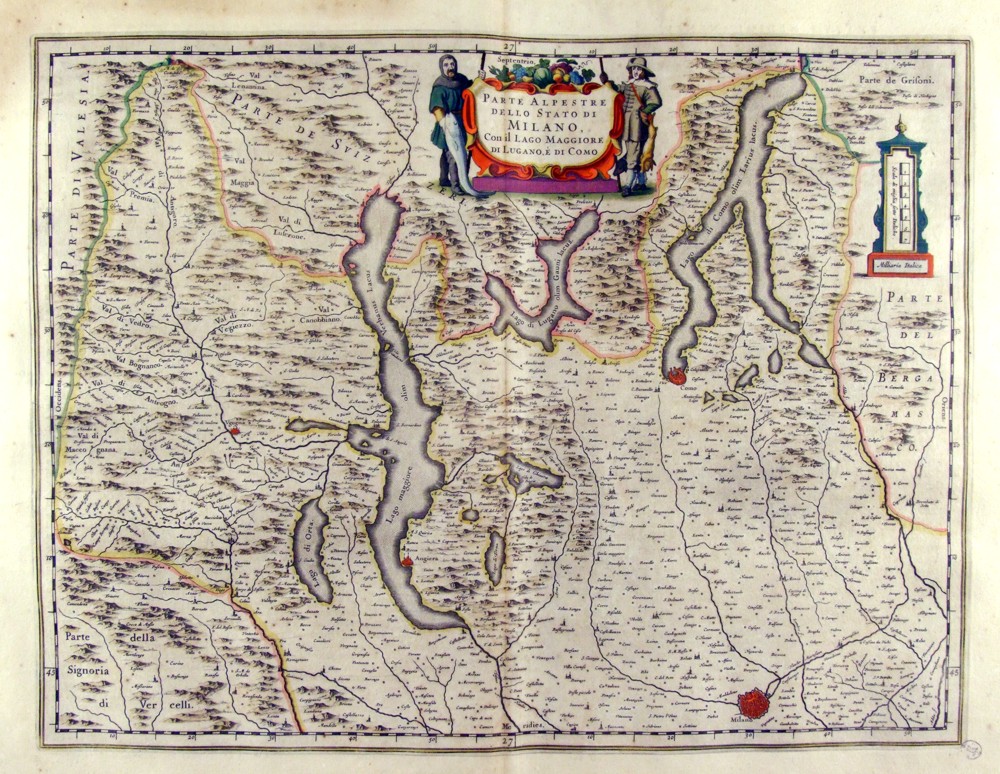
|
269-Parte Alpestre dello Stato di Milano - Lombardia - Italia .
The Charter, which measures in the drawing 50.5 x 38,5 cm is contained in the Atlas Geographiae Blavianae volumen octavum Quo Italy quae est Europae Liber XVI of Blaeu printed in Amsterdam in 1662. The Charter represents the Northern Milan Lombardy with the bass and the Alps and lakes in the Centre. The title is contained in a lable supported by two men and topped with a copious quantities of agricultural products Author: Ioannis Blaeu
Amsterdam,1662 |
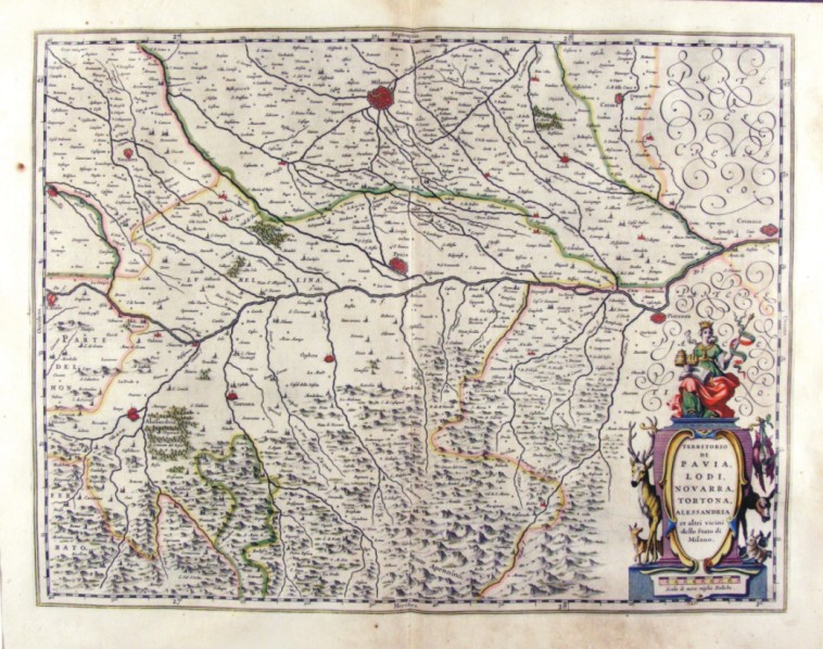
|
270-Territorio di Pavia, Lodi, Novarra, Tortona e Alessandria - Lombardia - Italia .
The Charter, which measures in the drawing 50.2 x 38,5 cm is contained in the Atlas Geographiae Blavianae volumen octavum Quo Italy quae est Europae Liber XVI of Blaeu printed in Amsterdam in 1662. The card offers the Po Valley from Casale in Cremona with Milan top and Alexandria in the lower right. The paper is crossed by the river Po and its tributaries and is decorated according to the right by a scroll bearing the title. Author: Ioannis Blaeu
Amsterdam,1662 |
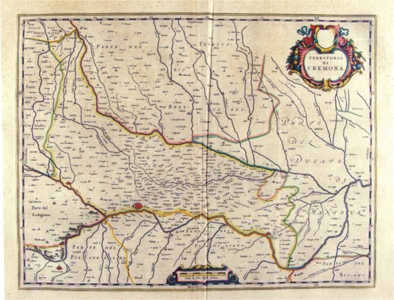
|
271-Territorio di Cremona - Lombardia - Italia .
The Charter, which measures in the drawing 50.2 x 38,5 cm is contained in the Atlas Geographiae Blavianae volumen octavum Quo Italy quae est Europae Liber XVI of Blaeu printed in Amsterdam in 1662. The card offers the Po Valley in the area of Cremona that extends from the Lodigiano to Duchy of Mantova Author: Ioannis Blaeu
Amsterdam,1662 |
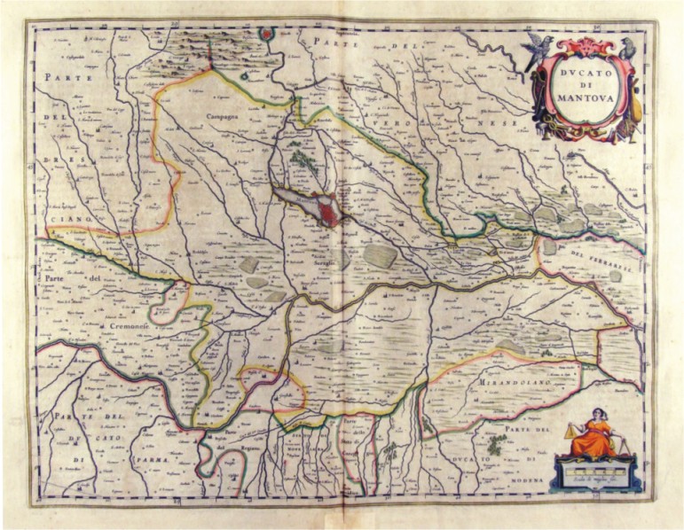
|
272-Ducato di Mantova - Lombardia - Italia .
The Charter, which measures in cm 50 x 38.5 drawing is contained in the Atlas Geographiae Blavianae volumen octavum Quo Italy quae est Europae Liber XVI of Blaeu printed in Amsterdam in 1662. Author: Ioannis Blaeu
Amsterdam,1662 |
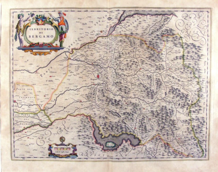
|
273-Territorio di Bergamo - Lombardia - Italia .
The Charter, which measures in cm 50 x 38.5 drawing is contained in the Atlas Geographiae Blavianae volumen octavum Quo Italy quae est Europae Liber XVI of Blaeu printed in Amsterdam in 1662. Author: Ioannis Blaeu
Amsterdam,1662 |
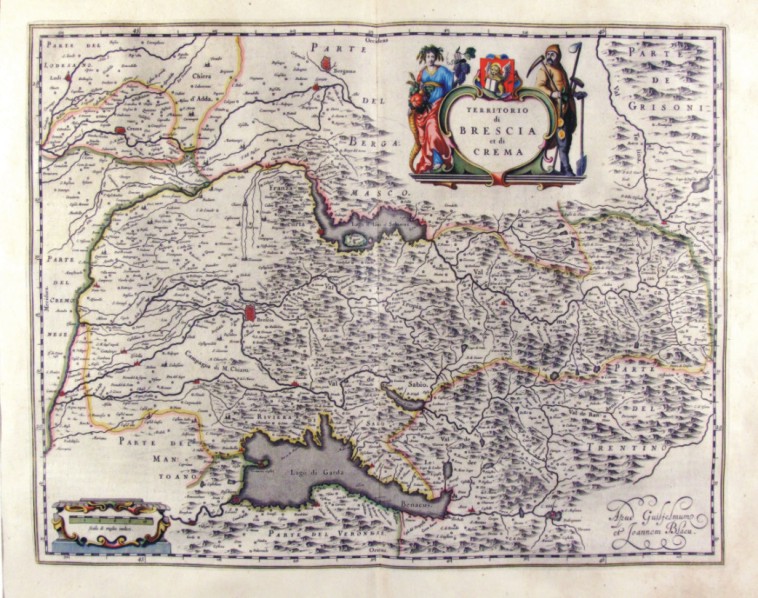
|
274-Territorio di Brescia et di Crema - Lombardia - Italia .
The Charter, which measures in cm 50 x 38.5 drawing is contained in the Atlas Geographiae Blavianae volumen octavum Quo Italy quae est Europae Liber XVI of Blaeu printed in Amsterdam in 1662. Author: Ioannis Blaeu
Amsterdam,1662 |
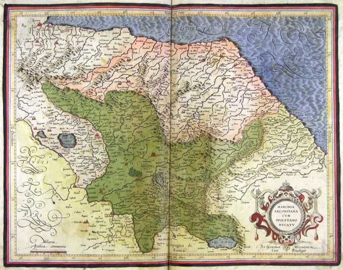
|
275-Marche, Umbria e Abruzzo - Italia .
The map belongs to the Atlas sive Cosmographicae Meditationes de Fabrica Mundi et Fabricati Figura, published in 1644 in Duisburg.
Author: Gerardo Mercatore
Duisburg ,1644 |
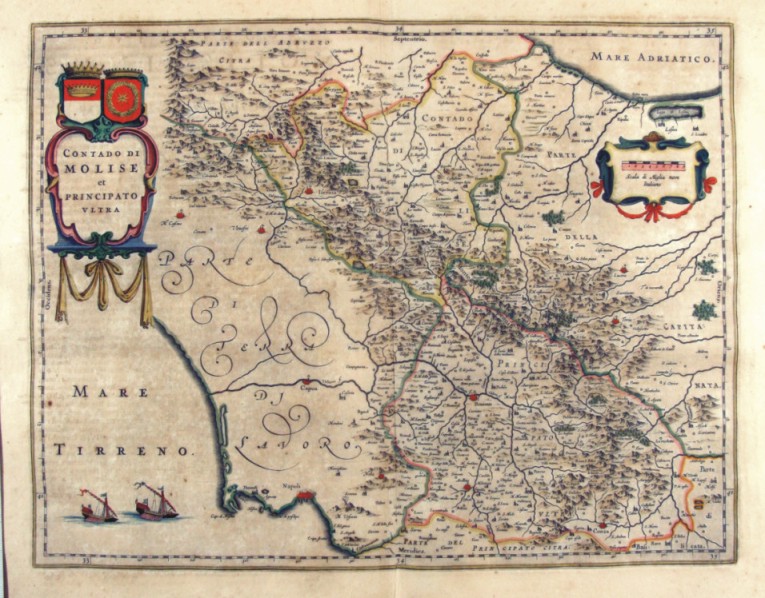
|
280-Contado di Molise et Principato ultra - Molise - Italia .
The Charter, which measures in the drawing ' 49.2 x 38, is contained in the Atlas Geographiae Blavianae volumen octavum Quo Italy quae est Europae Liber XVI of Blaeu printed in Amsterdam in 1662. Author: Ioannis Blaeu
Amsterdam,1662 |
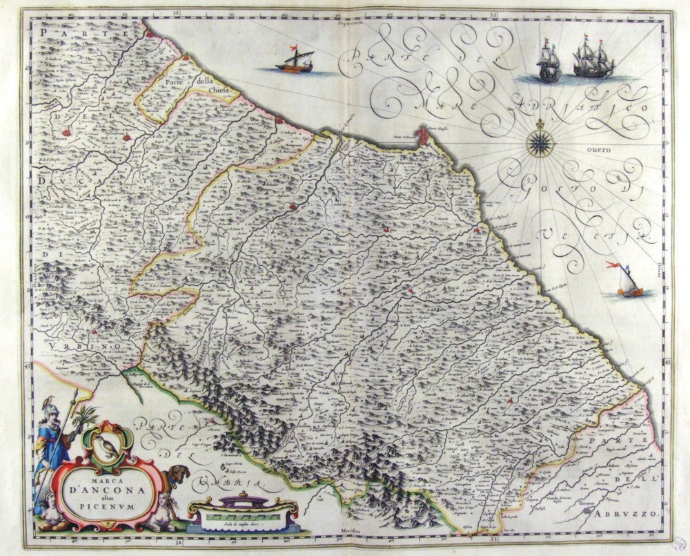
|
276-Marca d'Ancona olim Picenum - Marche - Italia .
The Charter, that measure cm 50 x 41 is located in the Atlas Theatrum Orbis Terrarum sive Atlas Novus-tertia pars of Guilelmus et Ioannis Blaeu, printed in Amsterdam in the workshop of Giovanni Blaeu in 1650. Author: Ioannis Blaeu
Amsterdam,1650 |
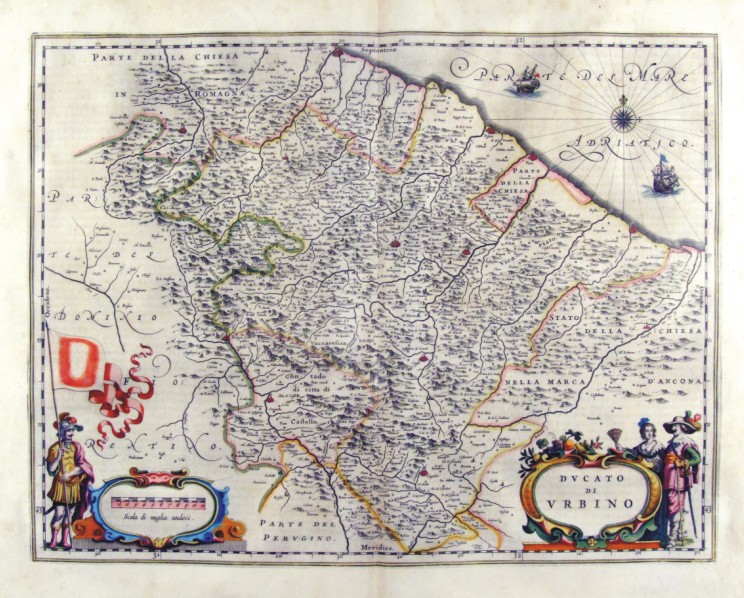
|
278-Ducato di Urbino - Marche - Italia .
The Charter, which measures in the drawing cm 49,5 x 38 is contained in the Atlas Geographiae Blavianae volumen octavum Quo Italy quae est Europae Liber XVI of Blaeu printed in Amsterdam in 1662. Author: Ioannis Blaeu
Amsterdam,1662 |
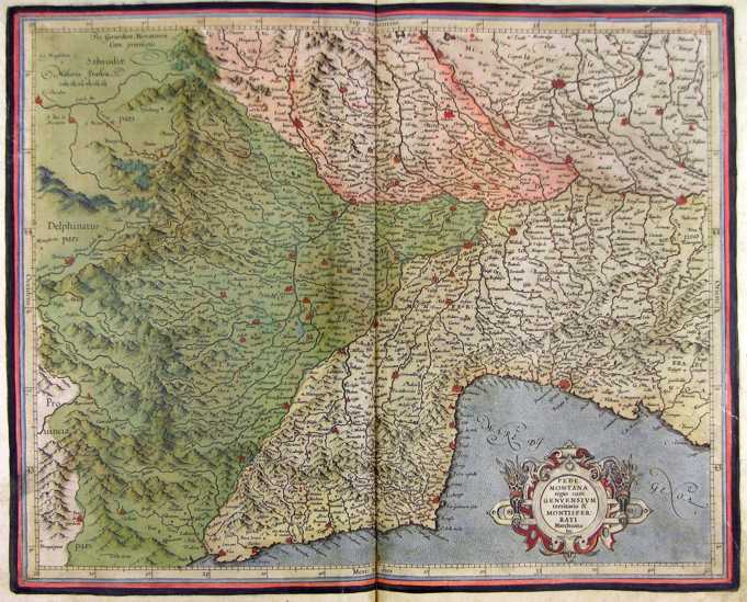
|
Piemonte - Italia .
The map belongs to the Atlas sive Cosmographicae Meditationes de Fabrica Mundi et Fabricati Figura, published in 1644 in Duisburg. Author: Gerardo Mercatore
Duisburg ,1644 |
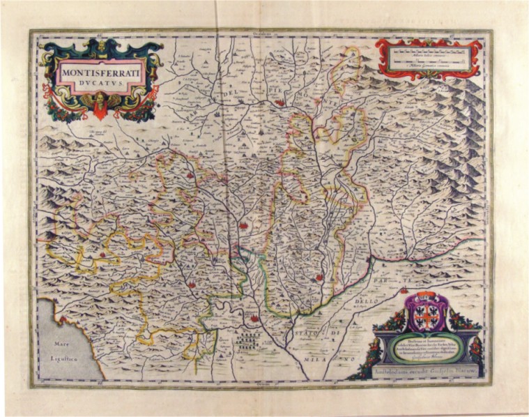
|
282-Montisferrati Ducatus - Piemonte - Italia .
The Charter, which measures 38 cm 49,5 x is located in the Atlas Theatrum Orbis Terrarum sive Atlas Novus-tertia pars of Guilelmus et Ioannis Blaeu, printed in Amsterdam in the workshop of Giovanni Blaeu in 1650. Offers the Monferrato region with the boundaries of areas of political influence of the time. Author: Ioannis Blaeu
Duisburg,1650 |
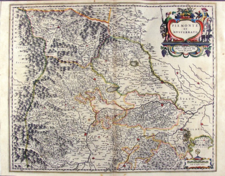
|
283-Piemonte et Monferrato - Italia .
The Charter, to what extent 52.4 x 42 cm, is contained in the Atlas Theatrum Orbis terrarum sive Atlas Novus is tertia pars of Guilelmus et Ioannis Blaeu, printed in Amsterdam in the workshop of Giovanni Blaeu in 1650. The document represents the States of mainland from Val d'Aosta and Piedmont to the borders to the South of Liguria and East State Milanese. Author: Ioannis Blaeu
Amsterdam,1650 |
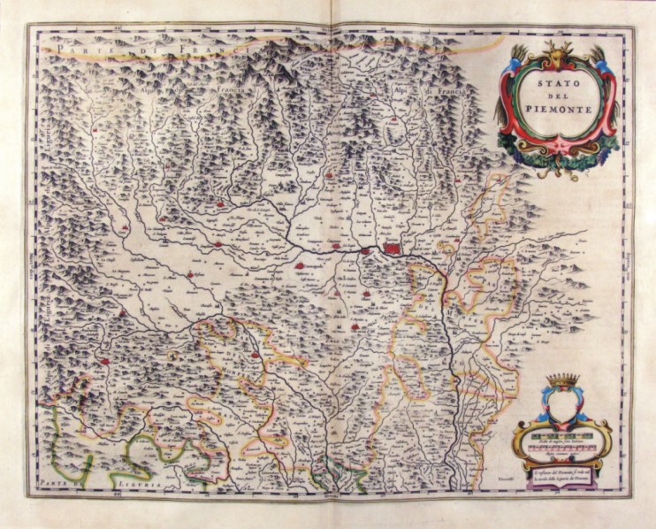
|
284-Stato del Piemonte - Italia .
The Charter, which measures ' 49.4 x 38.5 is located in the Atlas Theatrum Orbis terrarum sive Atlas Novus is tertia pars of Guilelmus et Ioannis Blaeu, printed in Amsterdam in the workshop of Giovanni Blaeu in 1650. Offers the western sector of Piedmont and is adorned by two l±d; the first top contains the title, the second bottom is surmounted by a Crown and contains two scales graphics. Author: Ioannis Blaeu
Amsterdam,1650 |
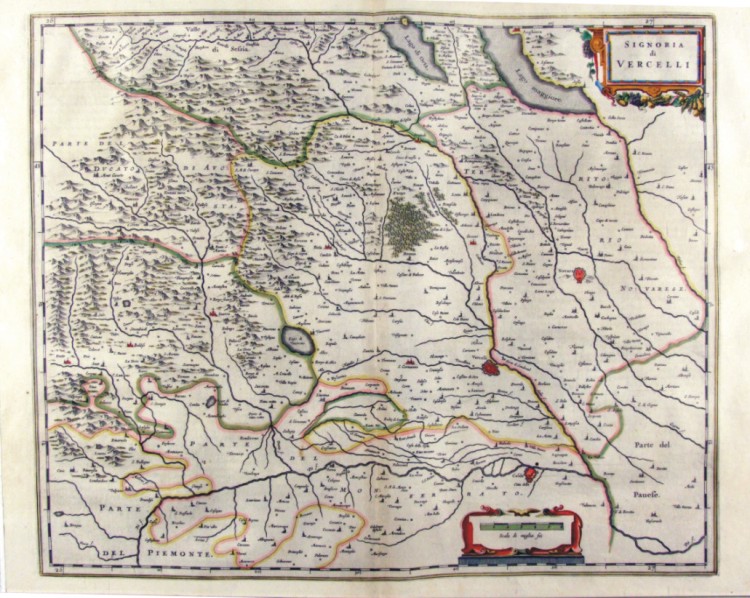
|
285-Signoria di Vercelli - Piemonte - Italia .
The Charter, which measures ' 50.5 x 41.5 is located in the Atlas Theatrum Orbis Terrarum sive Atlas Novus is tertia pars of Guilelmus et Ioannis Blaeu, printed in Amsterdam in the workshop of Giovanni Blaeu in 1650. Represents the area east of Piedmont with the towns of Vercelli and Novara. Author: Ioannis Blaeu
Amsterdam,1650 |
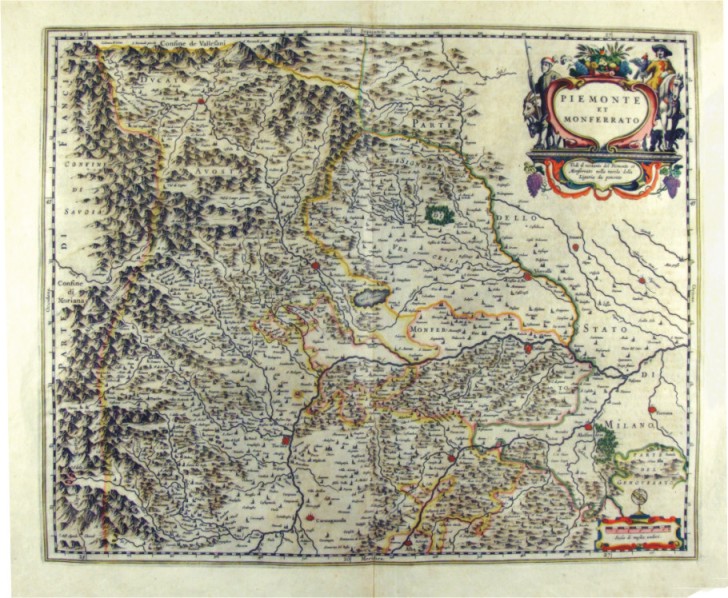
|
286-Piemonte et Monferrato - Italia .
The map is contained in the Atlas Geographiae Blavianae volumen octavum Quo Italy quae est Europae Liber XVI of Blaeu printed in Amsterdam in 1662. The document, which measures 52 x 42.5 cm, represents Piedmont Val d'Aosta and Monferrato. Author: Ioannis Blaeu
Amsterdam,1662 |
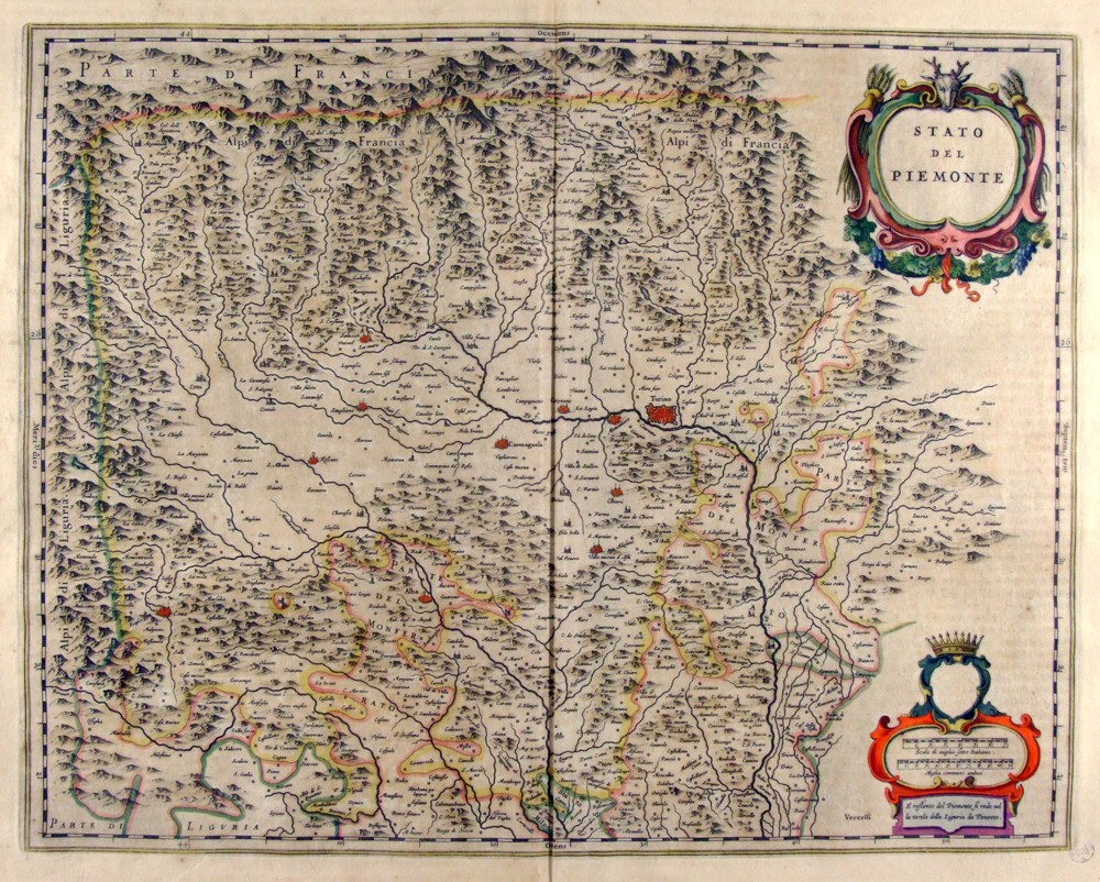
|
287-Stato del Piemonte - Italia .
The Charter, which measures in the drawing cm 49 x 38.5 is contained in the Atlas Geographiae Blavianae volumen octavum Quo Italy quae est Europae Liber XVI of Blaeu printed in Amsterdam in 1662. Represents the western sector of Reione and is adorned by two l±d; the top contains the title while the bottom contains two scales graphics in Italian and in miles miles. Author: Ioannis Blaeu
Amsterdam,1662 |
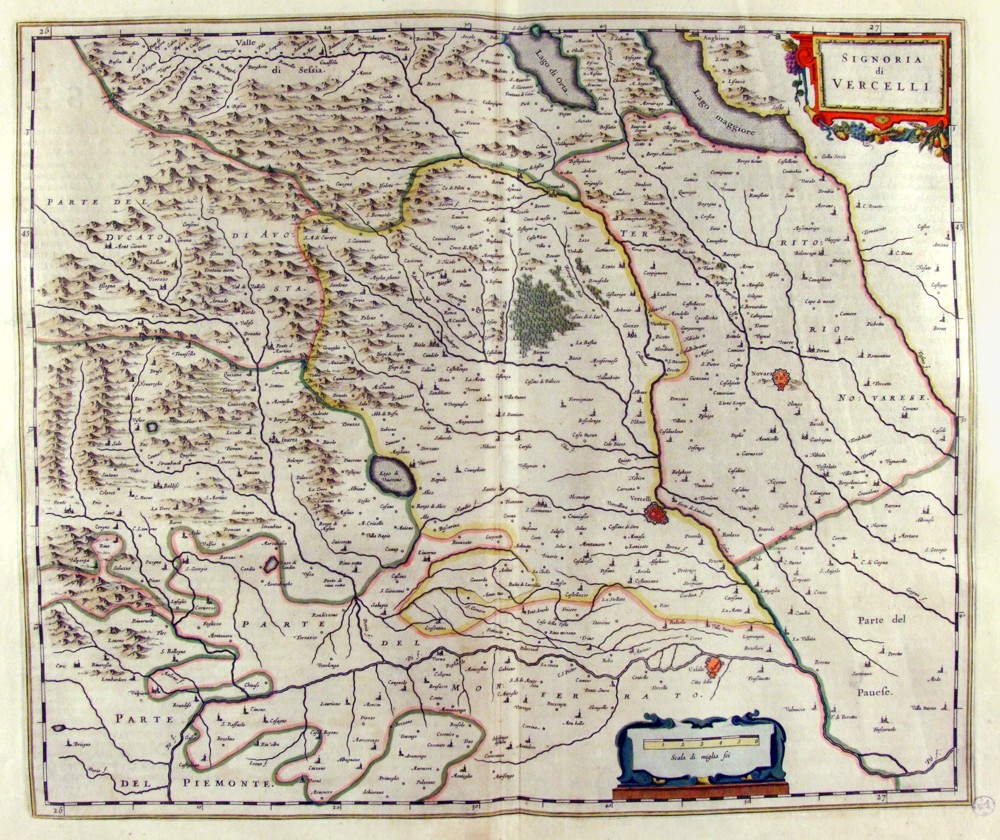
|
288-Signoria di Vercelli - Piemonte - Italia .
The Charter, which measures in the drawing cm 50 x 42 is contained in the Atlas Geogrphiae Blavianae volumen octavum Quo Italy quae est Europae Liber XVI of Blaeu printed in Amsterdam in 1662. The paper proposes the eastern area of Piedmont with the territories of Vercelli and Novara. Author: Ioannis Blaeu
Amsterdam,1662 |
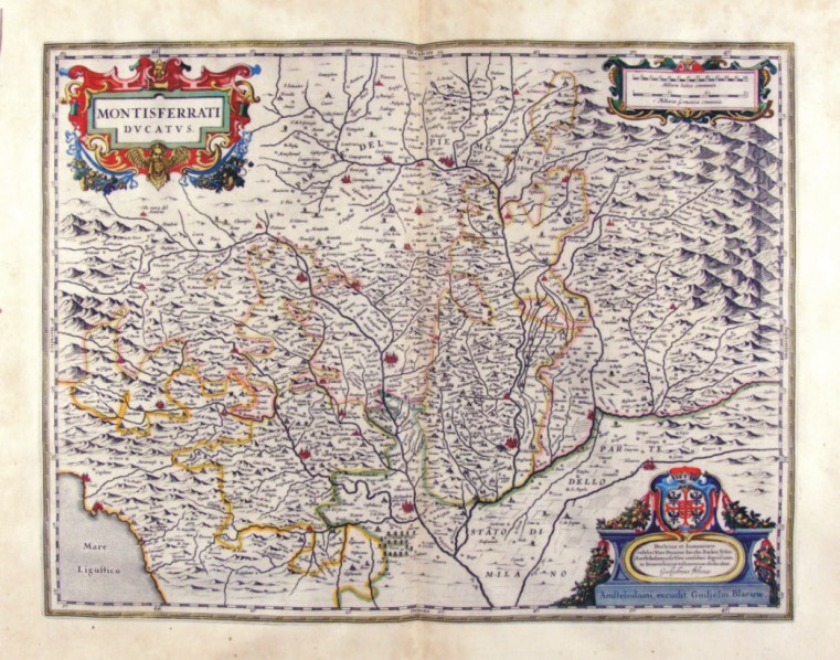
|
289-Montisferrati Ducatus - Piemonte - Italia .
The Charter, which measures in the drawing ' 48.1 x 37 is contained in the Atlas Geogrphiae Blavianae volumen octavum Quo Italy quae est Europae Liber XVI of Blaeu printed in Amsterdam in 1662. The Charter was realized by Guilelmus Blaeu, as indicated in the title block placed at the bottom right.
Author: Guilelmus Blaeu
Amsterdam,1662 |
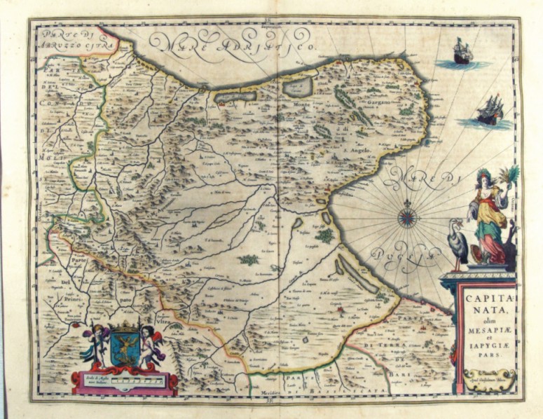
|
290-Capitanata olim mesapiae et iapygiae pars - Puglia - Italia .
The Charter, which measures in the drawing ' 49.2 x 38, is contained in the Atlas Geographiae Blavianae volumen octavum Quo Italy quae est Europae Liber XVI of Blaeu printed in Amsterdam in 1662.
Author: Ioannis Blaeu
Amsterdam,1662 |
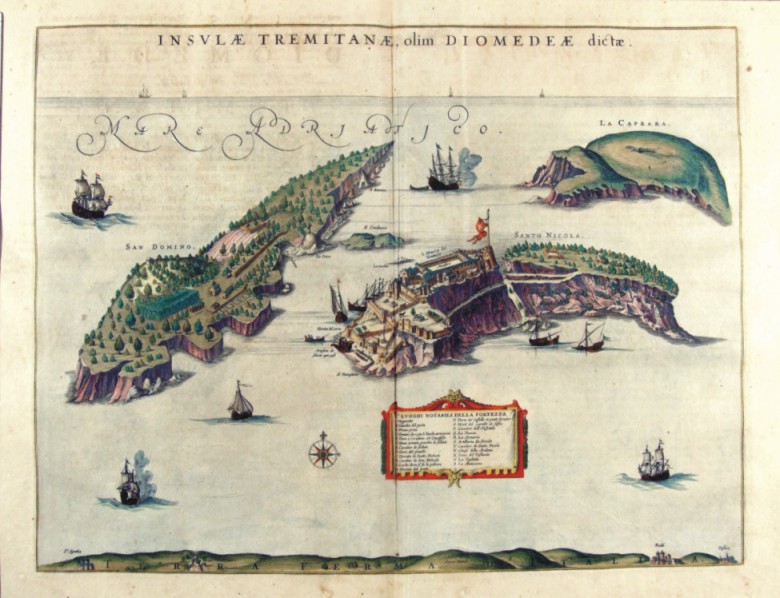
|
291-Insulae Tremitanae olim Diomedeae dictae - Puglia - Italia .
The Charter, which measures in the drawing 49.2 x 38,5 cm, is contained in the Atlas Geographiae Blavianae volumen octavum Quo Italy quae est Europae Liber XVI of Blaeu printed in Amsterdam in 1662.
Author: Ioannis Blaeu
Amsterdam,1662 |
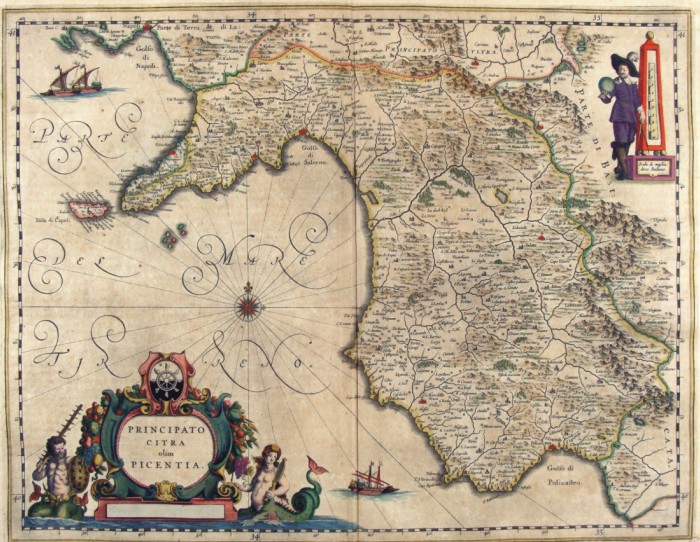
|
292-Capitanata olim mesapiae et iapygiae pars - Puglia - Italia .
The Charter, which measures in the drawing cm 49.2 x 38, is contained in the Atlas Geographiae Blavianae volumen octavum Quo Italy quae est Europae Liber XVI of Blaeu printed in Amsterdam in 1662.
Author: Jan Jansson
Amsterdam,1640 |
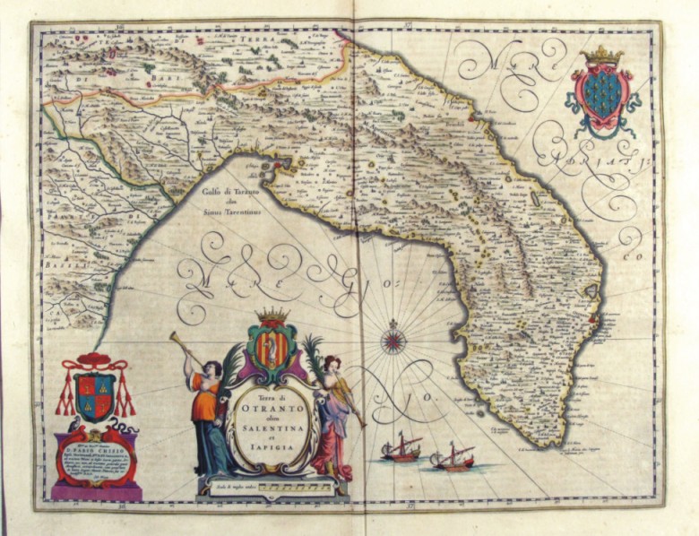
|
293-Terra di Otranto olim Salentina et Iapigia - Puglia - Italia .
The Charter, which measures in the drawing cm 50 x 38.5, is contained in the Atlas Geographiae Blavianae volumen octavum Quo Italy quae est Europae Liber XVI of Blaeu printed in Amsterdam in 1662.
Author: Ioannis Blaeu
Amsterdam,1662 |
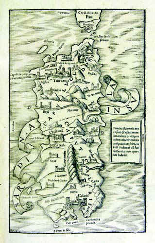
|
Sardinia Insula .
The map resides in Sebastiano Munster's atlas Cosmographiae universalis - Libri VI , edition released in 1554. It was taken from a woodcut and measures 25,5 x 15,5cm. In 1550 this atlas was published for the first time in latin. The document has no scale, parallels, meridians and it is not graduated in the margins. But we can see the cardinal points Occidens, Septentrio,Oriens, the South is missing. Author: Sigismondo Arquer
Basilea,1554 |
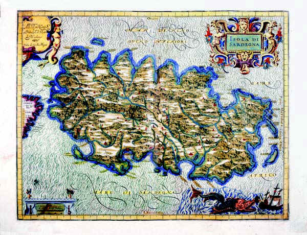
|
295-Island of Sardinia .
The map belongs to the atlas Italia di Gio Ant. Magini, published by the son of the author in 1620. It contains 61 maps. The 60th represents Sardinia and was realized before 1605. It's a colored map with graduated margins but no numerical references. The longitudes as well as the latitudes are subdivided in 1'. It measures 34,3 x 44,5 cm and it is on a scale of about 1:736 000. Author: Gio Antonio Magini
Bologna,1605 |
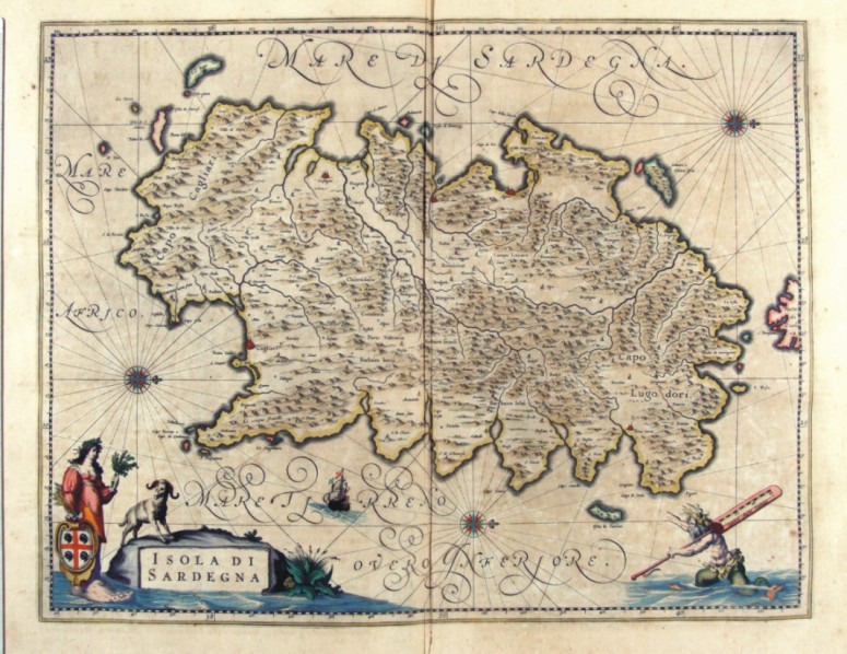
|
296-Isola di Sardegna .
The map of Sardinia, painted in water colours, has the West at the top, the North with a lily on the right and three wind roses over the sea. The more important towns like Cagliari, Oristagni, Bosa città , Algeri (Alghero), C. Aragonese (Castelsardo) and Terra Nuova (Olbia) are indicated with red perspective drawings, however the smaller places have just a little circle. The Gulf of Cagliari and the Gulf of Teulada are in the South, the Isola Rossa is indicated with a beautiful red colour. The islands of the Sulcis territory are correctly placed in the South West, Zamara o Asinara Isola, the Isola Piana and the Promontory of Monte Falco are in the North West, a non-existing group of islands (Isole Sanguinari), Serpentara and I Cavoli are in the South East.
A wonderful picture of an allegoric figure holding the blazon of the island (a shield with a red cross and four black Moors with a frontlet), includes the title. The figure is drawn with a large human foot refering to the Greek name of Sardinia Sandaliotis. On the bottom right a mythological figure over the sea holds a graduated scale of fifteen Italian miles on its shoulder.
Measuring 38 x 49,5 cm, this map comes from the atlas Geographiae Blavianae volumen octavum quo Italia quae est Europae liber sextus, continetur Amstelodami, Labore & Sumptibus Joannis Blaeu MDCLXII, printed in 1662 in Amsterdam.
Author: Ioannis Blaeu
Amsterdam,1662 |
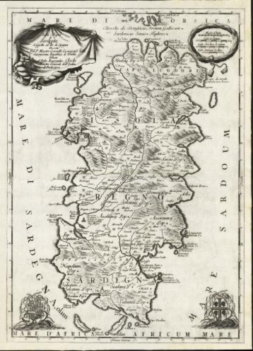
|
297-Isola Regno di Sardegna .
The mapbelongs to the atlas Isolario descrittione Geografico è Historica, Author: P. Maestro Coronelli
Venezia,1690 |
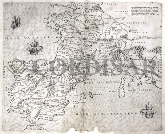
|
711-Europa occidentale 1554 .
Author:
,1554 |
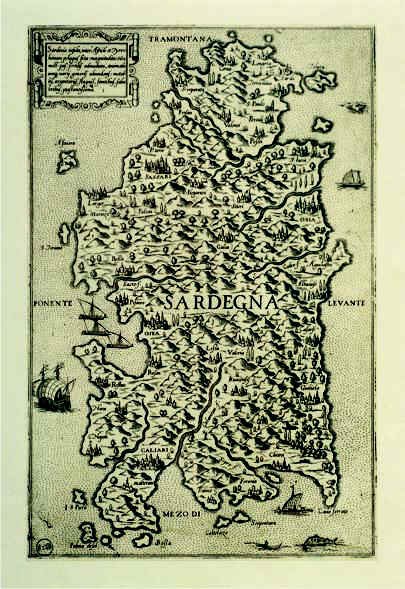
|
299-Sardinia Insula .
The map is in a free format and measures 29,8 x 19 cm. It was probably printed in 1550 in Veneto from Fabio Licinio's cupper plate engraving. At tha time the map had a certain success because of its rich graphical contents. Therefore it was often copied and inserted with few variations in other cartographic works of the 16 th century.
Author: Fabio Licinio
Veneto,1550 |
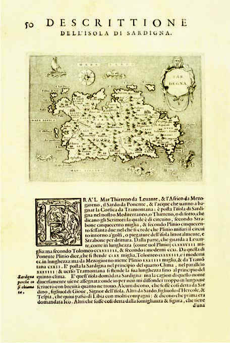
|
300-Descrittione dell'Isola di Sardegna .
The map measures 15,5 x19,2 cm, the drawing alone 10,3 x 14 cm. It resides in Porcacchi's and Arretino's atlas L'isole più famose del mondo, edition published in 1572 in Venice. The document was taken from Girolamo Porro's woodcut and proposes Gio. F. Camocio's map of 1571.
Author: Tommaso Porcacchi
Venezia,1571 |
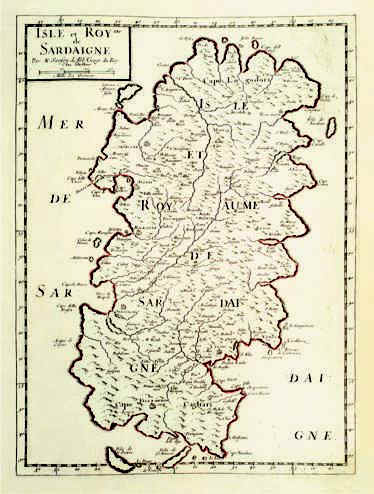
|
301-Isle et Royme de Sardaigne .
The map measures 39 x 28,7 cm and belongs to the atlas N. Sanson d'Abbeville Cartes generales de toutes le parties du monde, ou les empires, monarchies, republiques, etats, peuples et de l'Asie, de l'Afrique, de l'Amerique sont exactement remarques et distinguèes suivant leur estenduè, Paris, l'autheur, P. Mariette, 1658 . Considering the longitude of the major Island, the scale is about 1:760 000. The margins are graduated and subdivided in 2'30''. The numeral values are marked from 10' to 10'. Author: Nicola Sanson
Parigi,1658 |
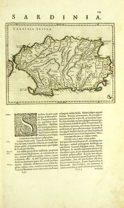
|
302-Sardinia .
The map measures 19,2 x 14,6 cm and belongs to the latin edition of G. and I. Blaeu's atlas Theatrum Orbis Tertrarum sive Atlas Novus, part III, printed in 1640 in Amsterdam. Considering the long side of the island, Sardinia is on a scale of 1:1 525 000 and exposed in horizontally position, with the North on the left. The coast profil is well delineated, the most important promontories are marked and the gulf of Cagliari is correctly oriented.
Author: Gulielmus e Ioannis Blaeu
Amsterdam,1640 |
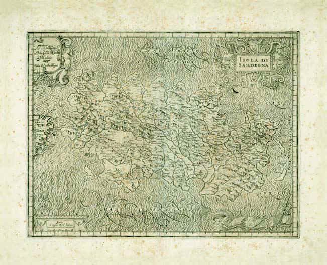
|
303-Island of Sardinia .
The map measures 34 x 44,5 cm and belongs to Magini's Atlas Italia, printed in 1620 in Bologna. Considering the long side of the island, the scale is about 1:736 000. The margins are graduated and subdivided in 1', but there are no numeral references.The edge beneath on the right is decorated with a seamonster tracking a sailing vessel. The other edges have three decorated pictures, the one above on the right contains the title Isola di Sardegna
Author: Giovanni Antonio Magini
Bologna,1620 |
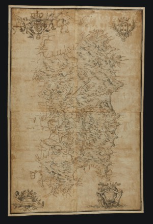
|
304-Nova et acurata Totius Sardiniae Tabula .
The rather big map, printed in 1720, measures 113,5 x 74 cm, has no gradueted margins but four decorated pictures. It's the first cartographic document realized by the House of Savoy after acquiring the Empire of Sardinia. Author: Domenico Colombino
,1720 |

|
305-Carta della Sardegna .
Printed in 1817, it represents the french fleet assault in 1792.
Author: Maina
,1817 |
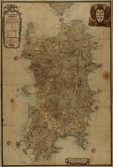
|
306-Contour of the Sardinia's Empire Map .
The map was probably drawn in 1788 from Maina's original design of 1746. Painted with watercolours, it measures 48 x 31,1 cm and has three decorated pictures and seven wind roses.
Author: Craveri
Cagliari,1788 |
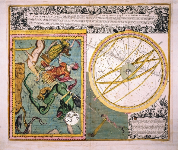
|
307-Carta celeste .
The whole universe with the comet and its movement, as appeared from the 13th to the 15th march, 1742. This exquisite map of the 17th century measures 58,2 x 49 cm and has splendid mythological figures.
Author:
,1742 |

|
CARTA ROUTI�RE .
Author: Alberto Lamarmora
,1860 |
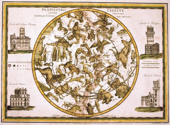
|
309-Planisfero Celeste Settentrionale .
The Northern planisphere with mythological figures. On the sides appear the most important astronomical observatories of Italy: on the top left is the Specola de Collegio Romano, on the right the Specola di Bologna, on the bottom left the Specola di Milano and on the right the Specola di Padova. This map, printed in 1742 in Rome by the engraver Gio Maria Casini, measures 45 x 32,5 cm. Author: Cassini Gio Maria
Roma,1742 |
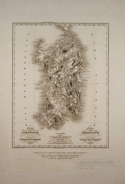
|
310-Carta della Sardegna .
The map measures 35 x 27 cm and holds an italian and french inscription indicating the same engraving plate of the 1838 edition. Author: Alberto Lamarmora
,1838 |
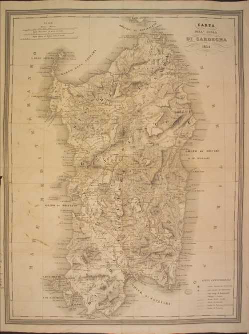
|
311-Carta dell' Isola di Sardegna .
The map measures 35 x 27 cm and holds an italian and french inscription indicating the same engraving plate of the 1838 edition. Author: Casalis
,1854 |
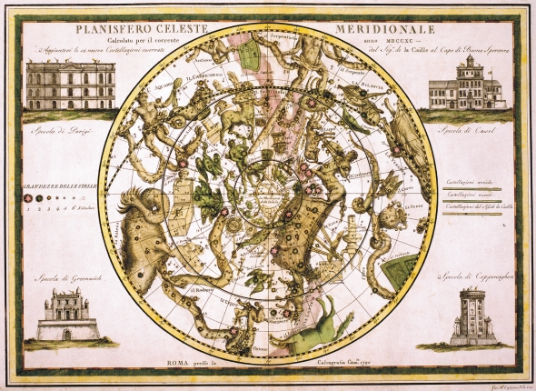
|
313-Planisfero Celeste Meridionale .
The Southern planisphere with the stellar constellations and mythological figures. On the sides appear the astronomical observatories of Greenwich, Paris, Copenhagen and Vassel. This map was printed in 1790 in Rome by Gio Maria Cassini and measures 45 x 32,5 cm. Author: Cassini Gio Maria
,1790 |
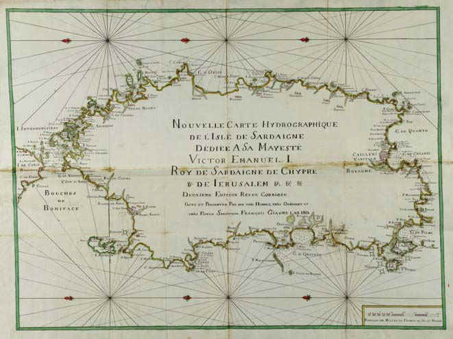
|
314-Sardaigne Hydrographique .
The colored map was printed in 1813 and measures 72 x 124 cm. There are neighter graduated margins nor geographic coordinates. Except from the title, the map inside is empty. But the coast contour is rich of names. It's the second edition of a map printed in 1785-88.
Author: Francois Giaume
,1813 |
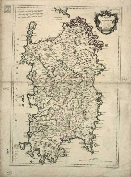
|
315-Le Royaume de Sardaigne .
The map was printed 1779 in Venice at Ramondini's workshop. It measures 42 x 66 cm, it is written in Italian and French and was taken from a cupper plate engraving,. It's a beautiful map with an orographic perspective representation. Author: P. Santini
Venezia,1779 |
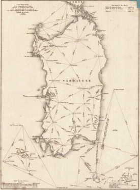
|
316-Carte demonstrative de la triangulation de 1er ordre executee en sardaigne de 1835 a .
The map is on a scale of 1:1 000 000, measures 35,2 x 26 cm and proposes the basis of the first topographic measurement of the Sardinia Island.
Author: Alberto Lamarmora
,0 |

|
317-Nova Totius Italiae .
Author:
,0 |

|
318-Corsicae e Sardiniae Antique Description .
Author:
,0 |

|
KARTE VON DEN STAATEN DES K�NIGS VON SARDINIEN .
Author:
,0 |
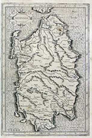
|
321-Sardegna .
The design measures 22,5 x 38 cm, the map 27,5x 44cm. It resides on page 280, 4th edition of the Atlas sive Cosmographicae meditationes de fabrica mundi et fabricati figura" ,printed in 1611 in Amsterdam. Author: Gerardo Mercatore
Amsterdam,1611 |
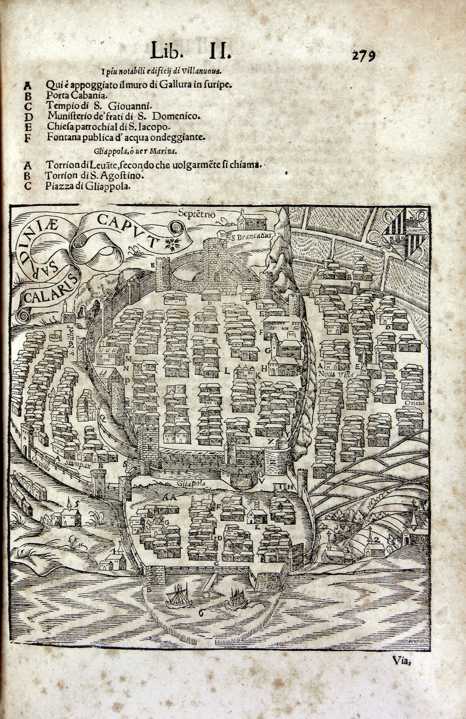
|
322-Map of Cagliari .
It measures 17,5 x 18,3 cm and resides on page 244 of Munster's atlas printed in 1775. Author: Sigismondo Arquer
,1575 |
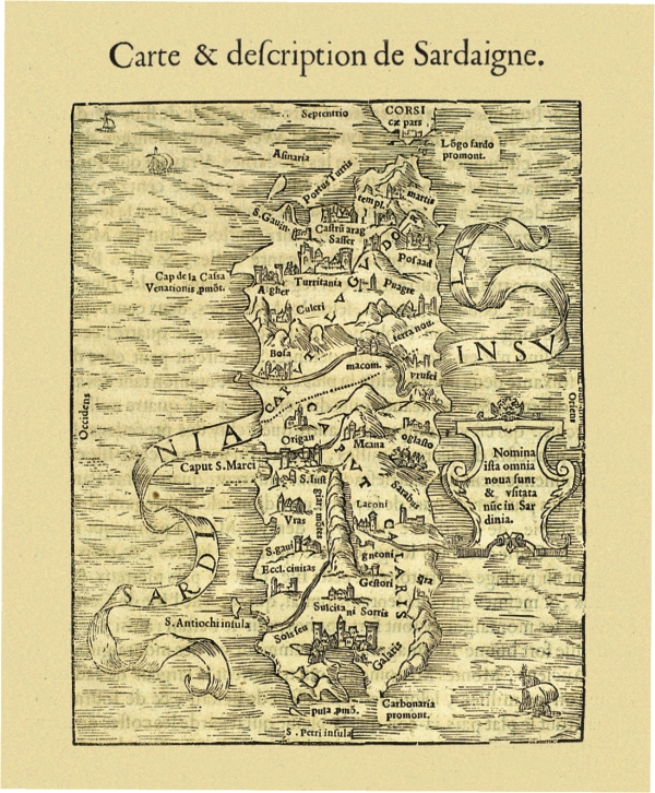
|
323-Carte & descripption de Sardaigne .
The paper measure cm 15,5 x 7.6, and is located at p. 213 Atlas Discours Historial de antique et illustre citè de Nismes En la Gaule Narbonoise, Avec les portraits des plus antiques et insignes bastimens du lieu dit, reduits to leur vraye mesure et proportion, ensemble de antique et moderne Ville is Par Jean Poldo Of Albenas, in Lyon, par Guillome Roville. Avec privilege pour dix ans 1560. On the last page however appears as date printed on 15th April 1564. This document map feature of Sardinia shows no significant new elements with respect to knowledge of the time and again, with a few insignificant variations, the paper made by Sigismondo Arquer and published by Munster in Latin language edition of his Atlas of 1550. Author: Antoine Du Pinet De Norot
,1560 |
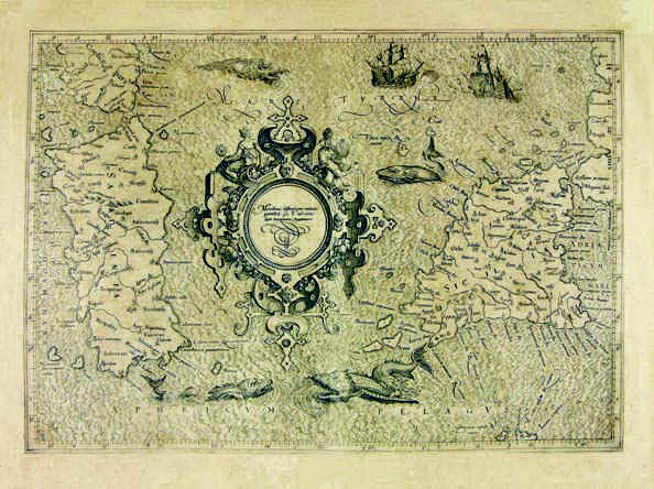
|
Sardinia .
The map was taken from the atlas Theatri Geographiae Veteris Tomus Prior in quo Cl. Ptol. Alexandrini Geographiae libri VIII, printed in 1619 in Amsterdam.
The map measures 32,3 x 45,8cm and represents Sardinia, South Corsica and a small sector of the South West of Italy which corresponds to South Calabria looking onto the Thyrrenian Sea , Sicily and the Aegadian and Aeolian Islands. Author: Pietro Bertio
Amsterdam,1619 |
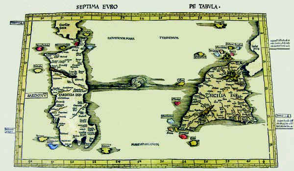
|
325-Septima Europe Tabula .
The map resides on table 9 of the atlas Ptolomeus Auctus restitutus et maculatus cum tabulis veteribus ac novis. Typus Joannis Scoti, printed in 1520 in Strassbourg. It also contains the map before.The colored document measures 54,5 x 32 cm, has an accurate and fine graphic art and represents a sector of the Earth with restriction in the North. The map is graduated with 1° intervals and shows the latitude from 35°,30' to 40°,30' and the longitude from 30° to 40°,30'.
Author: Claudio Tolomeo
Strasburgo,1520 |
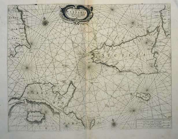
|
326-Le Coste della Barbaria da Capo Rosafino all'isola Chercheni con anche l'isola di Sic .
The map measures 40 x 50,6 cm and belongs to the atlas Prima parte dello Specchio del Mare, published in 1664 in Genoa by F.M.Levanto. It exposes the South of the Thyrrenian Sea with the channel of Sardinia and Sicily, a sector of Tunisia with Cap Bon, the islands of Sicily, Malta Lampedusa and East Sardinia with the gulf of Cagliari. Tabarca, at that time frequented by the Genoese navigators, is represented with its surrounding sea bed in a very detailed way on the sector below on the left. Author: Francesco Maria Levanto
Genova ,0 |
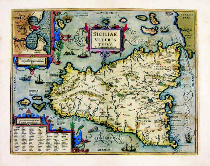
|
327-Siciliae Veteris .
The drawing of the map measures 36 x 47 cm and belongs to the atlas Theatrum Orbis Terrarum, edition of 1589. It's a very beaultiful and well colored map. Syracuse and its harbour are represented in a square above.
Author: Abramo Ortelio
Anversa,1584 |
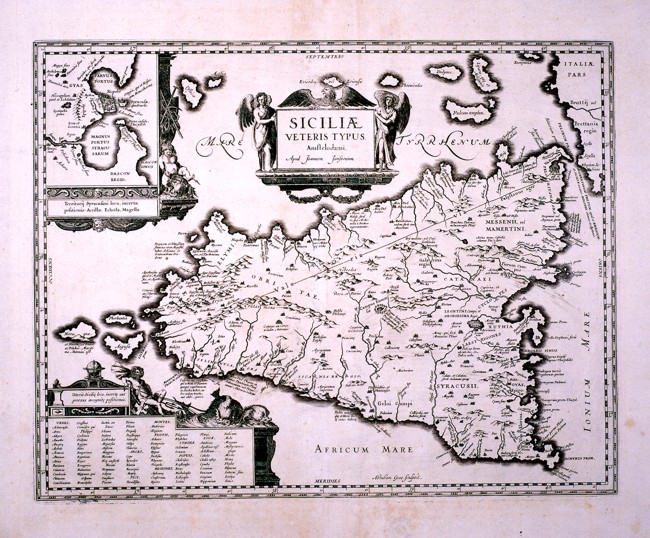
|
328-Siciliae e Veteris Tipus .
This map, drawn by Johannes Janssonius, comes from the same matrix as the map in the Ortelius atlas Theatrum Orbis Terrarum and shows only few differences. It measures 44 x 36 cm.
Author: Johannem Janssonium
,1589 |
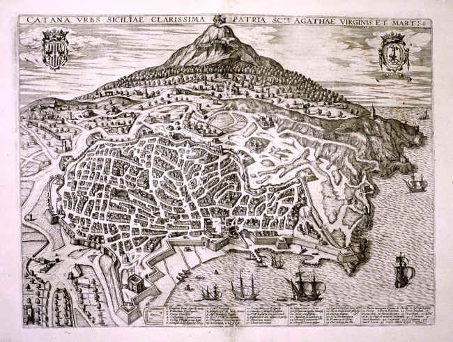
|
329-Catana Urbs Siciliae Clarissima .
A black and white perspective view of the town of Catania with Mount Vesuvius in the distance. There are two decorative pictures at the top and many ships in the harbour. The most important buildings are described at the bottom. This map measures 49 x 36,5 cm.
Author:
,0 |
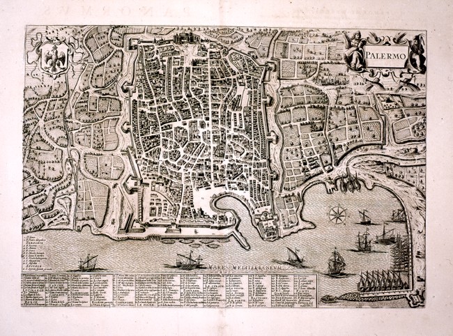
|
330-Palermo .
A black and white perspective view of the town of Palermo measuring 46 x 32 cm. There is a wind rose over the sea, two decorative pictures at the top and many ships at sea or in the harbour. At the bottom are described the most important buildings.
Author:
,0 |

|
Sicilia Regnum - Sicilia - Italia .
Author: Ioannis Blaeu
Amsterdam,1662 |
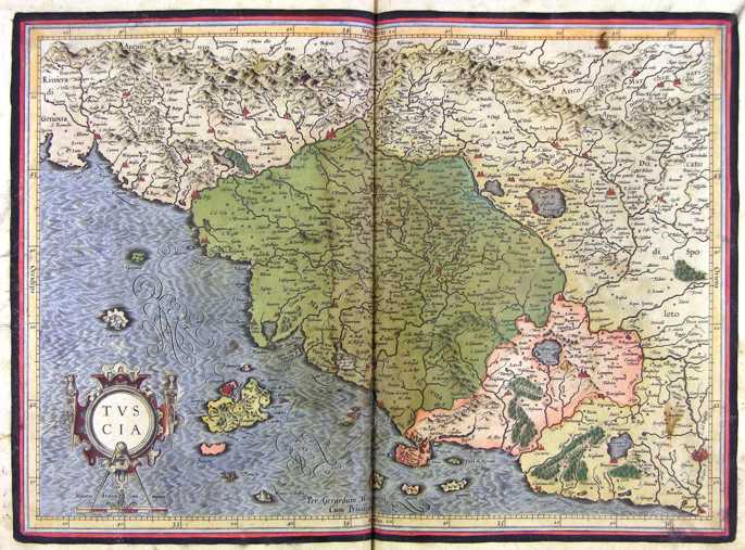
|
332-Toscana - Italia .
The map belongs to the Atlas sive Cosmographicae Meditationes de Fabrica Mundi et Fabricati Figura, published in 1644 in Duisburg.
Dimensions: 46 x 32 cm Author: Gerardo Mercatore
Duisburg,1644 |

|
333-Tusciae Antiquae - Italia .
The map belongs to the Theatrum Orbis Terrarum, printed in 1592 in Antwerp. Author: Abramo Ortelio
Anversa,1592 |
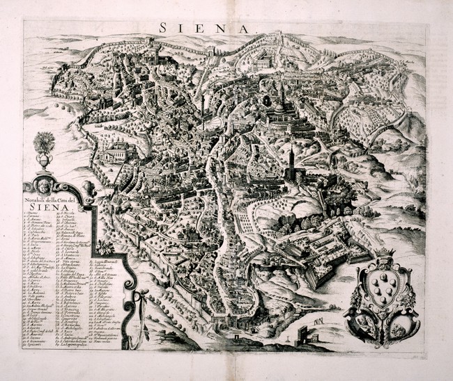
|
334-Siena .
A black and white perspective map of Siena. On the bottom right appears a decorative picture and on the left there are the names of the most important buildings and places. This map measures 44 x36 cm. Author:
,0 |
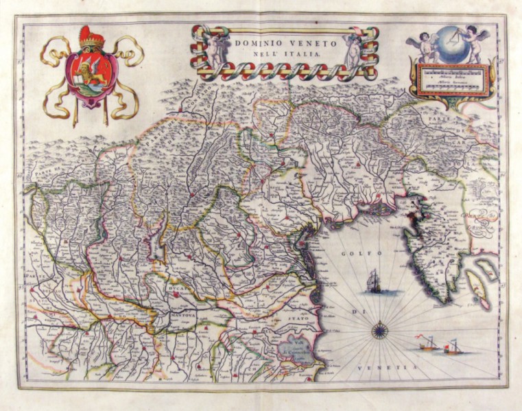
|
335-Dominio Fiorentino - Toscana - Italia .
The Charter, which measures in the drawing cm 50 x 38.5, is contained in the Atlas Geographiae Blavianae volumen octavum Quo Italy quae est Europae Liber XVI of Blaeu printed in Amsterdam in 1662.
Author: Ioannis Blaeu
Amsterdam,1662 |
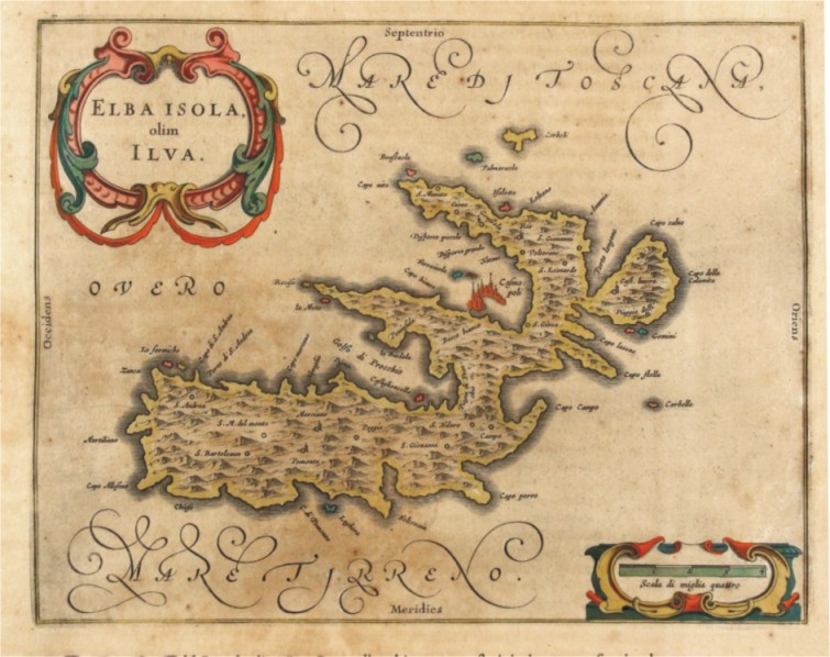
|
336-Elba Isola olim Ilva - Toscana - Italia .
The Charter, which measures in the drawing 24.5 x 19,5 cm, is contained in the Atlas Geographiae Blavianae volumen octavum Quo Italy quae est Europae Liber XVI of Blaeu printed in Amsterdam in 1662. Author: Ioannis Blaeu
Amsterdam,1662 |
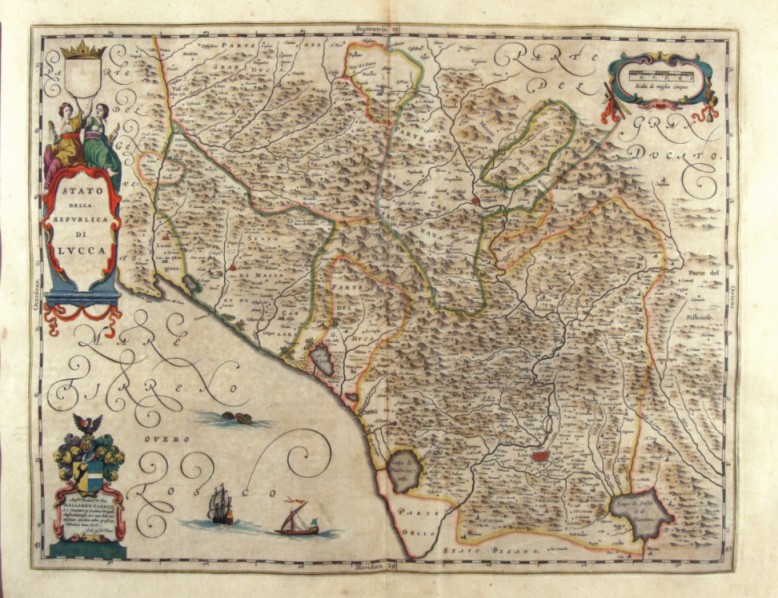
|
337-Stato della Repubblica di Lucca - Toscana - Italia .
The Charter, which measures in the drawing cm 49,5 x 38.5, is contained in the Atlas Geographiae Blavianae volumen octavum Quo Italy quae est Europae Liber XVI of Blaeu printed in Amsterdam in 1662.
Author: Ioannis Blaeu
Amsterdam,1662 |
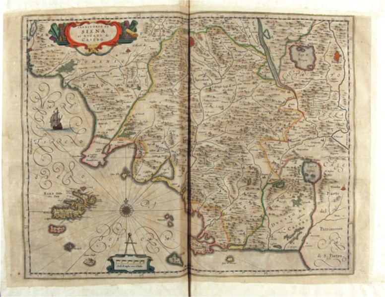
|
338-Territorio di Siena et Ducato di Castro - Toscana - Italia .
The Charter, which measures in the drawing cm 48 x 38, is contained in the Atlas Geographiae Blavianae volumen octavum Quo Italy quae est Europae Liber XVI of Blaeu printed in Amsterdam in 1662.
Author: Ioannis Blaeu
Amsterdam,1662 |
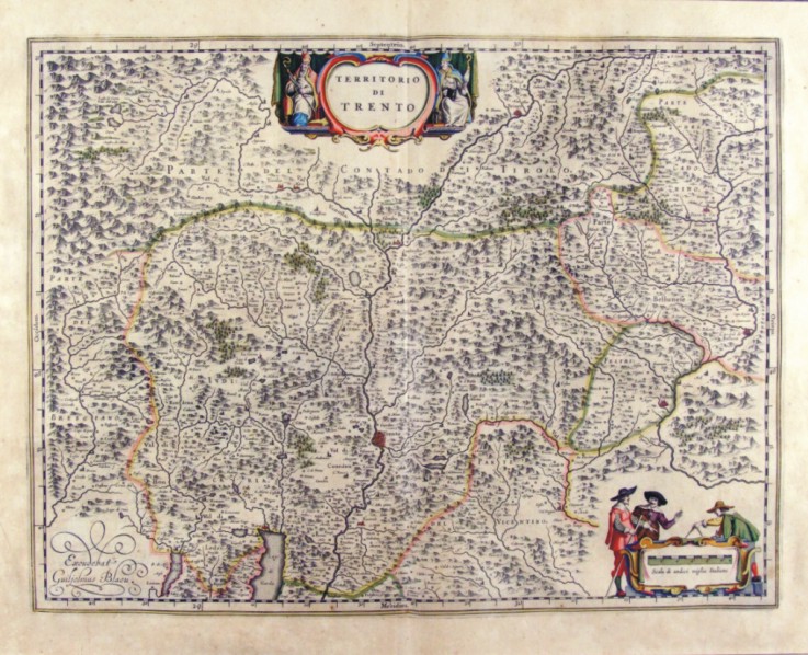
|
339-Territorio di Trento - Trentino Alto Adige - Italia .
The Charter, which measures cm 49,7 x 38 is located in the Atlas Theatrum Orbis Terrarum sive Atlas Novus-tertia pars of Guilelmus et Ioannis Blaeu, printed in Amsterdam in the workshop of Giovanni Blaeu in 1650. The card offers the mountain region of Trentino with a scroll at the top that contains the title and down the metric scale orbnata 3 figures of Surveyors.
Author: Ioannis Blaeu
Amsterdam,1650 |
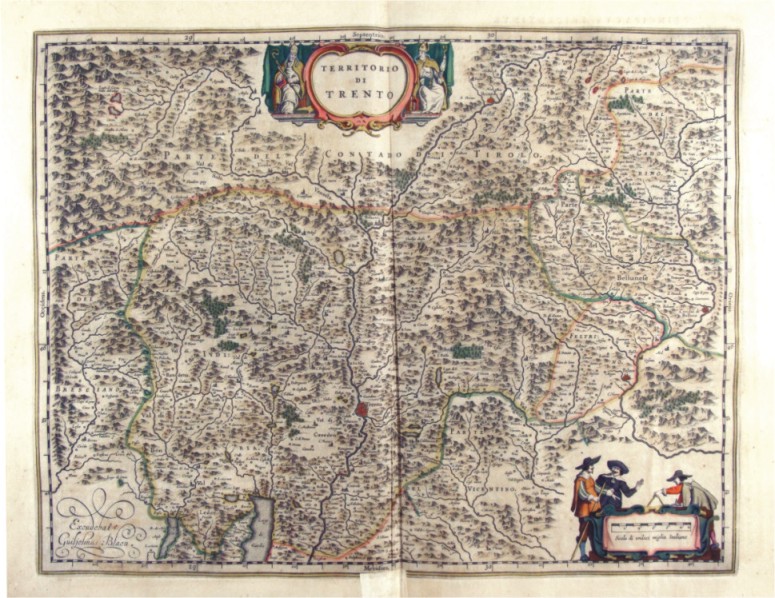
|
340-Territorio di Trento - Trentino Alto Adige - Italia .
The Charter, which measures in cm 50 x 38.5 drawing is contained in the Atlas Geographiae Blavianae volumen octavum Quo Italy quae est Europae Liber XVI of Blaeu printed in Amsterdam in 1662. Author: Ioannis Blaeu
Amsterdam,1662 |
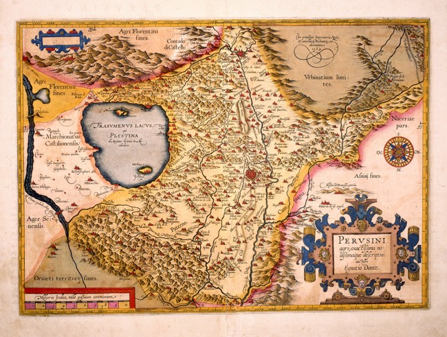
|
Perusini Agri .
Umbria with Perugia in the centre and the surrounding places, described with red perspective drawings. The water courses and Lake Trasimeno are intricately drawn, however the hills are approximatively distributed all over the whole region. The borders of the neighbouring territories are more intensively coloured, as are the territories of Urbino in the North East, Florence to the North, Siena to the West and Orvieto in the South. This detailed coloured map of the 17th century, is drawn by the cartographer Ignatius Dante and measures 46,5 x 32,8 cm.
Author: Dante Egnatio
Anversa,1584 |
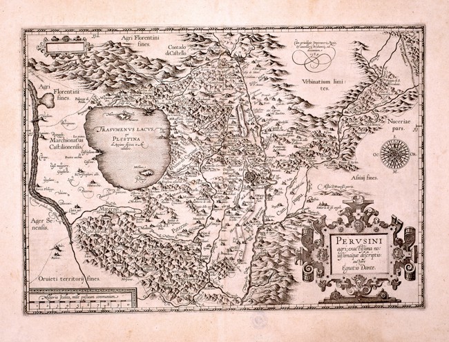
|
342-Perusini Agri .
This black and white map measures 40 x 33 cm and comes from the same matrix as the preceding map. On the top right appears the inscription Cum privilegio Imperatoris, Regis cancellerie Brabantie, ad decennium 1584. Author: Dante Egnatio
Anversa,1584 |
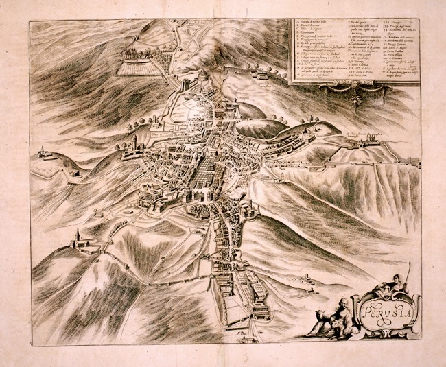
|
343-Perusia .
The city of Perugia and the surrounding territories. On the top right a square contains the information on the most important buildings. At the bottom a decorative picture shows the title and allegorical figures. This black and white map measures 43 x36 cm.
Author:
,0 |
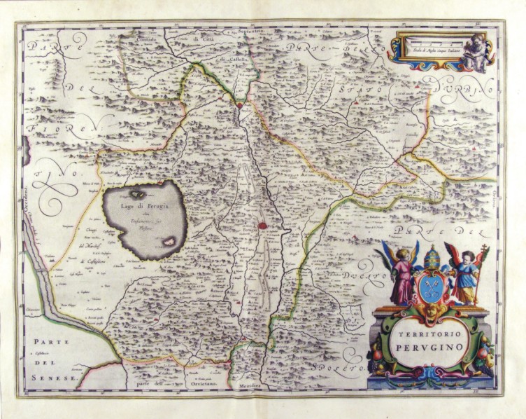
|
344-Territorio Perugino - Umbria - Italia .
The Charter, which measures 49,7 x 38 cm is located in the Atlas Theatrum Orbis Terrarum sive Atlas Novus is tertia pars of Guilelmus et Ioannis Blaeu, printed in Amsterdam in the workshop of Giovanni Blaeu in 1650 Author: Ioannis Blaeu
Amsterdam,1650 |
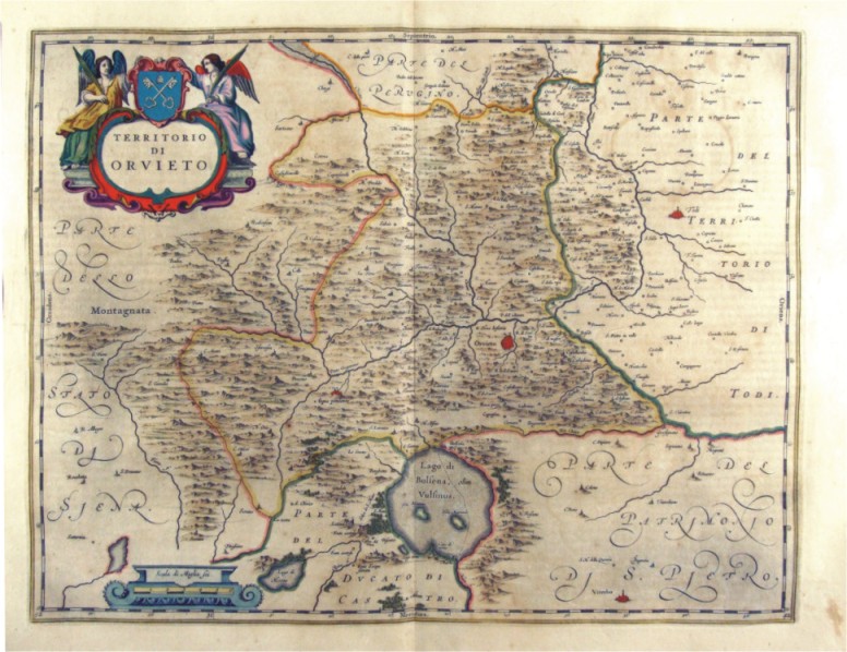
|
345-Territorio di Orvieto - Umbria - Italia .
The Charter, which measures in the drawing cm 49,5 x 38, is contained in the Atlas Geographiae Blavianae volumen octavum Quo Italy quae est Europae Liber XVI of Blaeu printed in Amsterdam in 1662. Author: Ioannis Blaeu
Amsterdam,1662 |
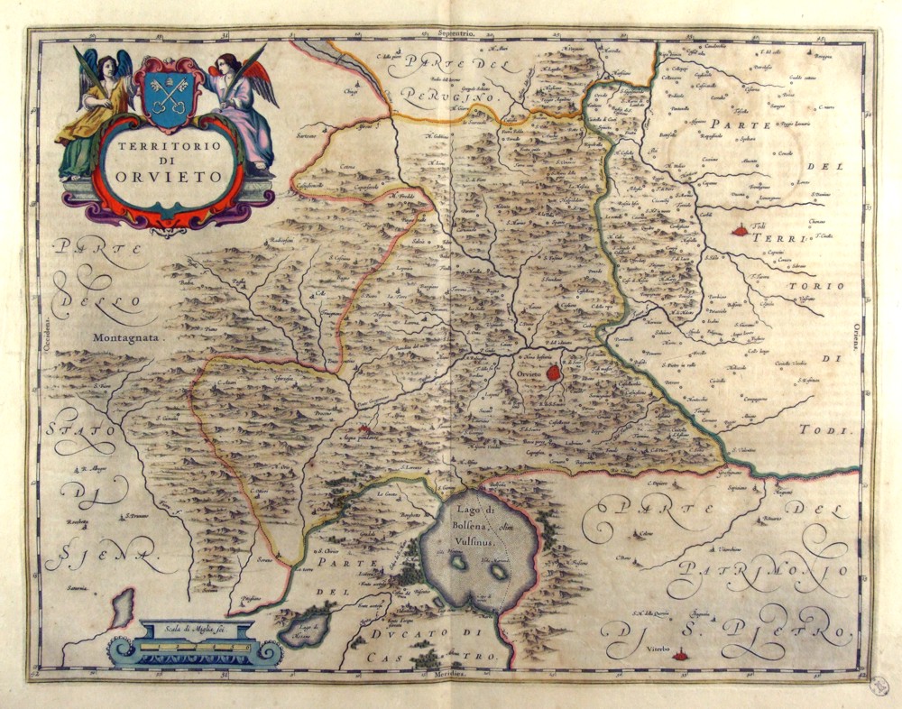
|
346-Territorio Perugino - Umbria - Italia .
The Charter, which measures in the drawing 49.2 x 38 cm, is contained in the Atlas Geographiae Blavianae volumen octavum Quo Italy quae est Europae Liber XVI of Blaeu printed in Amsterdam in 1662. Author: Ioannis Blaeu
Amsterdam,1662 |
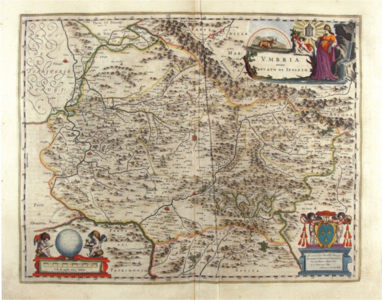
|
347-Umbria - Italia .
The Charter, which measures in the drawing cm 50 x 39, is contained in the Atlas Geographiae Blavianae volumen octavum Quo Italy quae est Europae Liber XVI of Blaeu printed in Amsterdam in 1662. Author: Ioannis Blaeu
Amsterdam,1662 |

|
348-Verona Vicenza - Italia .
The map belongs to the Atlas sive Cosmographicae Meditationes de Fabrica Mundi et Fabricati Figura, published in 1644 in Duisburg. Author: Gerardo Mercatore
Duisburg,1644 |
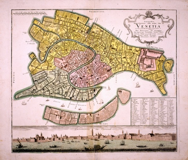
|
349-Venetia .
Town map of Venice with a nice view at the bottom. The districts are shown with different colours and in a square on the bottom right, appears a description of the most important buidings. This finely-executed and interesting map of the 17 th century measures 55 x 47,5 cm. Author:
,1700 |
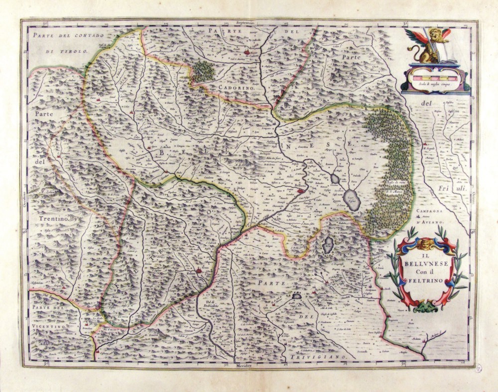
|
350-Il Bellunese con il Feltrino - Veneto - Italia .
The Charter, which measures 49,7 x 38 cm is located in the Atlas Theatrum Orbis Terrarum sive Atlas Novus-tertia pars of Guilelmus et Ioannis Blaeu, printed in Amsterdam in the workshop of Giovanni Blaeu in 1650. The Charter represents the area north of the domains of Earth Republica of Venice with the woods of the Bellunese reserved to cut to the oars of galleys.
Author: Ioannis Blaeu
Amsterdam,1650 |
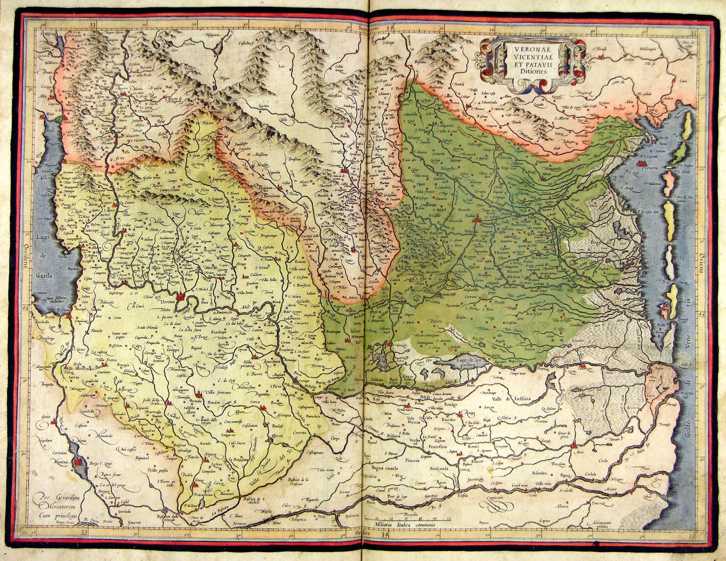
|
351-Verona Vicenza - Italia .
The map belongs to the Atlas sive Cosmographicae Meditationes de Fabrica Mundi et Fabricati Figura, published in 1644 in Duisburg.
Author: Gerardo Mercatore
Duisburg,1644 |
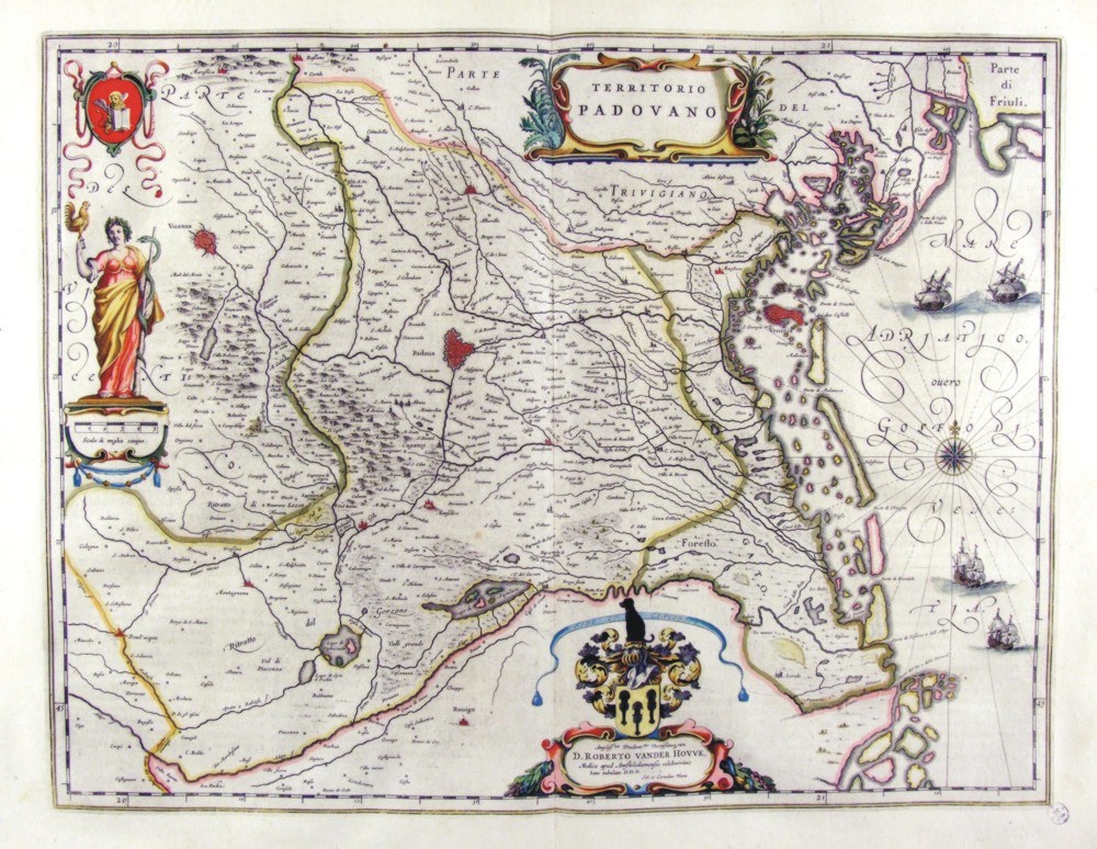
|
352-Territorio Padovano - Veneto - Italia .
The Charter, to what extent 49,7 x 38 cm is located in the Atlas Theatrum Orbis Terrarum sive Atlas Novus-tertia pars of Guilelmus et Ioannis Blaeu, printed in Amsterdam in the workshop of Giovanni Blaeu in 1650, but has been realized by Ihoannes and Cornelius Blaeu. Represents the eastern part of the Pianura Padana, sector of Verona and until March, and is enriched by various designs such as the lion of Venice, an allegorical figure with the serpent of Aesculapius a cartouche with dedication to the doctor d. Roberto Vander Hovve.
Author: Ioannis Blaeu
Amsterdam,1650 |
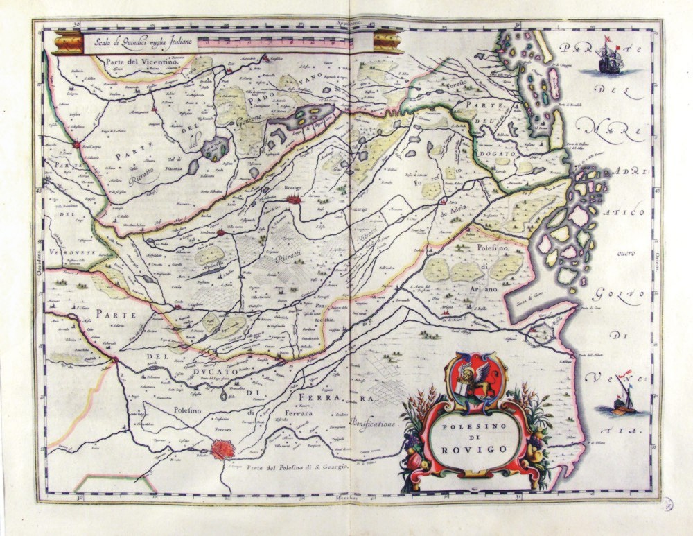
|
353-Polesino di Rovigo - Veneto Italia .
The map, which measures 49,7 x 38 cm is located in the Atlas Theatrum Orbis Terrarum sive Atlas Novus-tertia pars of Guilelmus et Ioannis Blaeu, printed in Amsterdam in the workshop of Giovanni Blaeu in 1650. The Charter represents the Polesine, which is the sector most depressed the Po with Rovigo to downtown and the Duchy of Ferrara at the bottom. On top is the proposal a metric scale and lower right a cartouche with the title. Author: Ioannis Blaeu
Amsterdam,1650 |
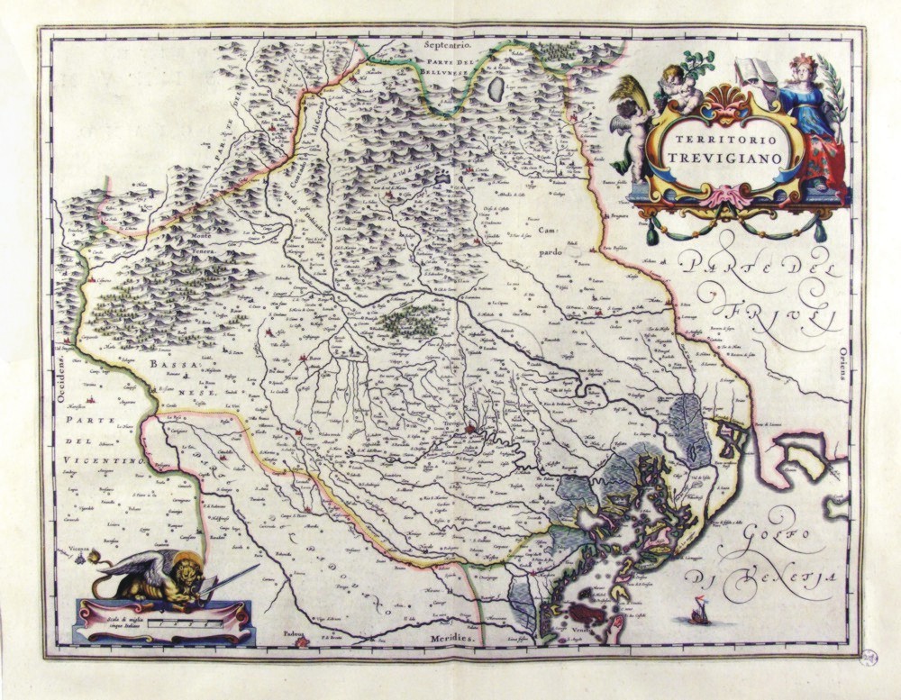
|
354-Territorio Trevigiano - Veneto - Italia .
The map, to what extent 49,7 x 38 cm is located in the Atlas Theatrum Orbis Terrarum sive Atlas Novus-tertia pars of Guilelmus et Ioannis Blaeu, printed in Amsterdam in the workshop of Giovanni Blaeu in 1650
Author: Ioannis Blaeu
Amsterdam,1650 |
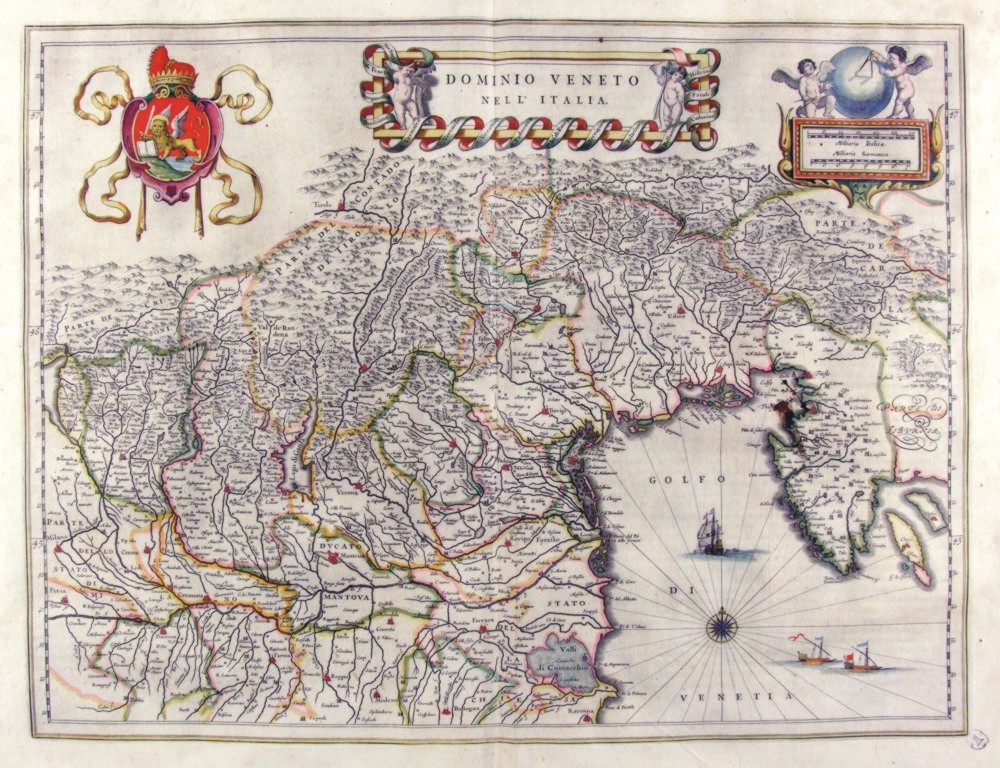
|
355-Dominio Veneto nell'Italia - Veneto - Italia .
The map measures 50 x 38 cm and belongs to the atlas Theatrum Orbis Terrarum sive Atlas Novus - pars tertia - Guilelmus et Ioannis Blaeu, printed in 1650 in the Blaeu's family workshop in Amsterdam. It's a historically interesting document exposing the dominions of the Republic of Venice in the North of Italy. A wonderful decorating picture shows the Lion of San Marco.
Author: Ioannis Blaeu
Amsterdam,1650 |
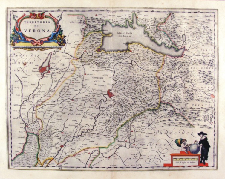
|
360-Territorio di Verona - Veneto - Italia .
The Charter, to what extent 49.7 x 38,5 cm is located in the Atlas Theatrum Orbis Terrarum sive Atlas Novus-tertia pars of Guilelmus et Ioannis Blaeu, printed in Amsterdam in the workshop of Giovanni Blaeu in 1650. The Charter, which proposes the lable with the title at the top and bottom right a cartographer with globe, represents the area of Verona, Mantua from Duchy to the countryside of Trento.
Author: Ioannis Blaeu
Amsterdam,1650 |
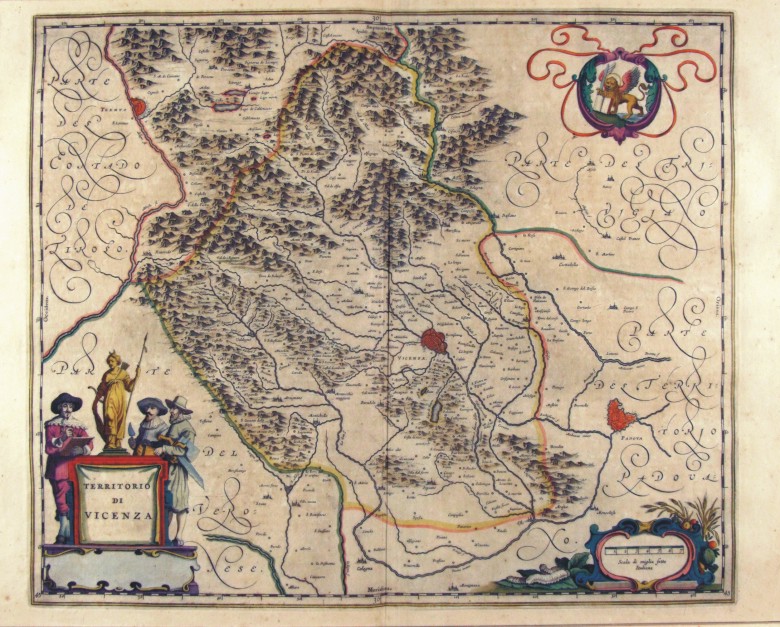
|
361-Territorio di Vicenza - Veneto - Italia .
The map, to what extent 49.7 x 41.5 cm is located in the Atlas Theatrum Orbis Terrarum sive Atlas Novus-tertia pars of Guilelmus et Ioannis Blaeu, printed in Amsterdam in the workshop of Giovanni Blaeu in 1650
Author: Ioannis Blaeu
Amsterdam,1650 |
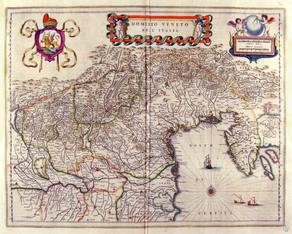
|
362-Dominio Veneto nell'Italia - Veneto - Italia .
The map, which measures in the drawing cm 49 x 38.5 is contained in the Atlas Geographiae Blavianae volumen octavum Quo Italy quae est Europae Liber XVI of Blaeu printed in Amsterdam in 1662.
Author: Ioannis Blaeu
Amsterdam,1662 |
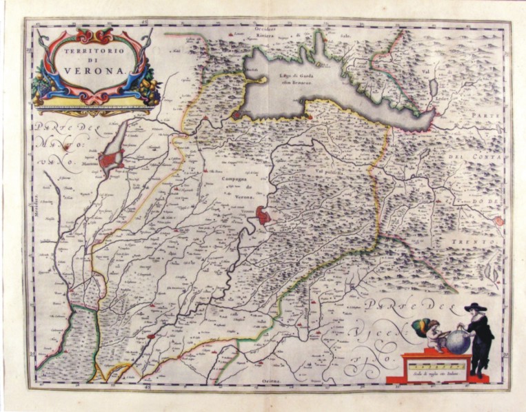
|
363-Territorio di Verona - Veneto - Italia .
The map, which measures in the drawing 50.2 x 38,5 cm is contained in the Atlas Geographiae Blavianae volumen octavum Quo Italy quae est Europae Liber XVI of Blaeu printed in Amsterdam in 1662.
Author: Ioannis Blaeu
Amsterdam,1662 |
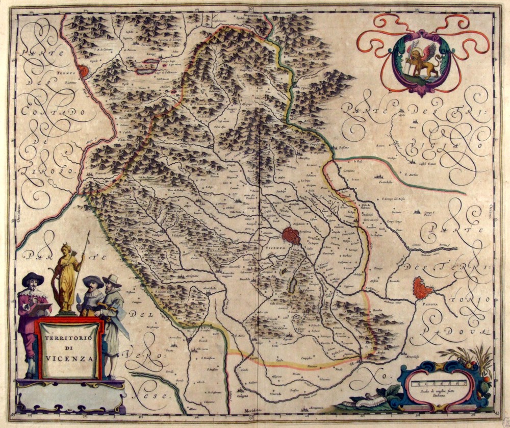
|
364-Territorio di Vicenza - Veneto - Italia .
The map, which measures in the drawing 49.6 x 41.5 cm is contained in the Atlas Geographiae Blavianae volumen octavum Quo Italy quae est Europae Liber XVI of Blaeu printed in Amsterdam in 1662.
Author: Ioannis Blaeu
Amsterdam,1662 |
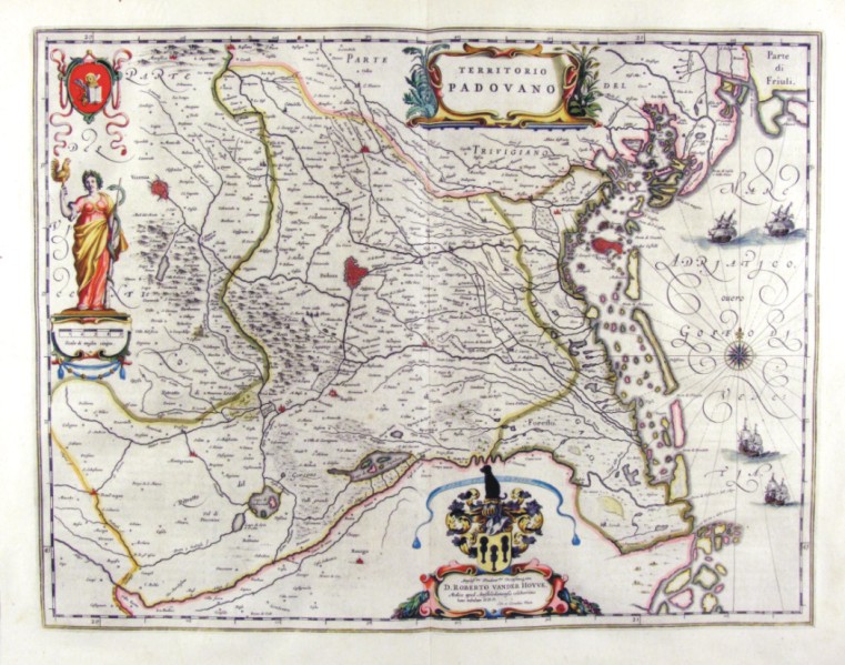
|
365-Territorio Padovano Veneto - Italia .
The map, which measures in the drawing 50.5 x 39 cm is contained in the Atlas Geographiae Blavianae volumen octavum Quo Italy quae est Europae Liber XVI of Blaeu printed in Amsterdam in 1662.
Author: Ioannis Blaeu
Amsterdam,1662 |
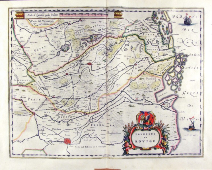
|
366-Polesino di Rovigo - Veneto - Italia .
The map, which measures in the drawing cm 49,5 x 38.5 is contained in the Atlas Geographiae Blavianae volumen octavum Quo Italy quae est Europae Liber XVI of Blaeu printed in Amsterdam in 1662.
Author: Ioannis Blaeu
Amsterdam,1662 |
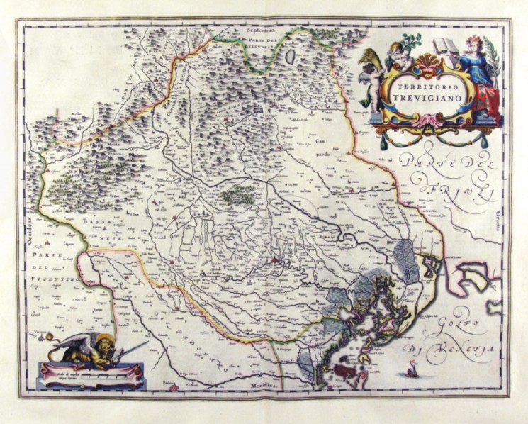
|
367-Territorio Trevigiano Veneto - Italia .
The map, which measures in the drawing 49.7 x 38,5 cm is contained in the Atlas Geographiae Blavianae volumen octavum Quo Italy quae est Europae Liber XVI of Blaeu printed in Amsterdam in 1662.
Author: Ioannis Blaeu
Amsterdam,1662 |
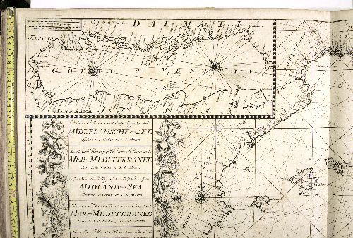
|
412-Mar Mediterraneo Van Keulen .
This map comes from the Ioannes van Keulen atlas Zee-Atlas ofte Water Waereld, printed in 1706 in Amsterdam. Author: Van Keulen
Amsterdam,1706 |
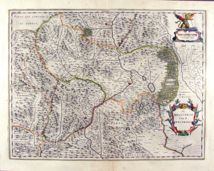
|
368-l Bellunese con il Feltrino - Veneto - Italia .
The map, which measures in cm 50 x 38.5 drawing is contained in the Atlas Geographiae Blavianae volumen octavum Quo Italy quae est Europae Liber XVI of Blaeu printed in Amsterdam in 1662.
Author: Ioannis Blaeu
Amsterdam,1662 |
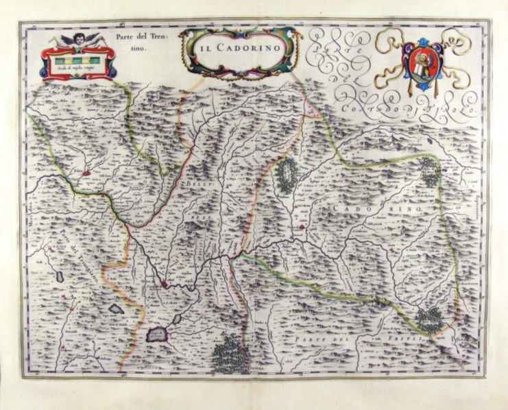
|
369-Il Cadorino Veneto - Italia .
The map, which measures in cm 50 x 38.5 drawing is contained in the Atlas Geographiae Blavianae volumen octavum Quo Italy quae est Europae Liber XVI of Blaeu printed in Amsterdam in 1662.
Author: Ioannis Blaeu
Amsterdam,1662 |
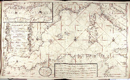
|
392-Mar mediterraneo Van Keulen .
This map comes from the Ioannes van Keulen atlas Zee-Atlas ofte Water Waereld, printed in 1706 in Amsterdam. Measuring 59 x 94 cm, it shows the Western basin of the Mediterranean Sea, from the Strait of Gibraltar to Malta.
The Adriatic Sea (Golfo di Venezia), from Venice to Otranto appears on a square at the top. Another square with festoons on the left, includes the title written in Dutch, English, French, Spanish and Italian.
At the bottom are four graphic scales in Dutch and Italian miles, in French, English and Spanish leagues. Beside these there is a circle with the author's indication Amsterdam by Ioannes van Keulen.
This graduated map has a central wind rose, situated between Sardinia and the Balearic Islands, which is connected with numerous other wind roses, but only three of them are visible.
Other two wind roses are over the Adriatic Sea. It is an exquisite nautical map. Author: Van Keulen
Amsterdam,1706 |
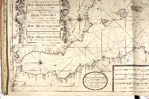
|
394-Stretto di Gibilterra Van Keulen .
This map comes from the Ioannes van Keulen atlas Zee-Atlas ofte Water Waereld, printed in 1706 in Amsterdam. Author: Van Keulen
Amsterdam,1706 |
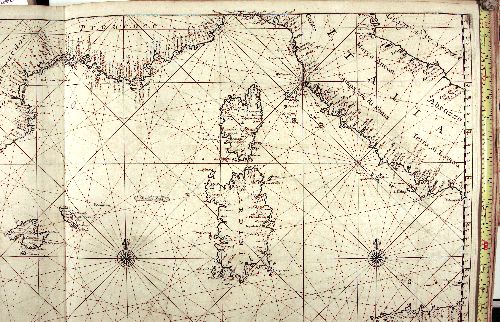
|
395-Sardegna e Corsica Van Keulen .
This map comes from the Ioannes van Keulen atlas Zee-Atlas ofte Water Waereld, printed in 1706 in Amsterdam. Author: Van Keulen
Amsterdam,1706 |
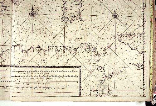
|
396-Coste nord Africa Van Keulen .
This map comes from the Ioannes van Keulen atlas Zee-Atlas ofte Water Waereld, printed in 1706 in Amsterdam. Author: Van Keulen
Amsterdam,1706 |
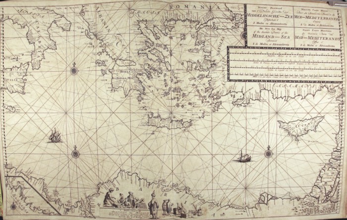
|
397-Grecia Van Keulen .
This map comes from the Ioannes van Keulen atlas Zee-Atlas ofte Water Waereld, printed in 1706 in Amsterdam. Measuring 59 x 94 cm , it shows the Eastern basin of the Mediterranean Sea. The title, written in Dutch, French, English and Italian appears on the top left, just above a square containing five graphic scales in Dutch and Italian miles, in English, French and Spanish leagues.
At the bottom, along the Libyan Coasts, a square surrounded by figures of European and Saracen merchants, includes the author's indication Amsterdam by Ioannes van Keulen. There is another square showing the Eastern part of the Tunisian Coasts and the Island of Gerba on the bottom left.
This graduated map is executed with several wind roses, but only three of them are visible. Some figures are drawn on the Libyan Coasts and two ships are at sea. Author: Van Keulen
Amsterdam,1706 |
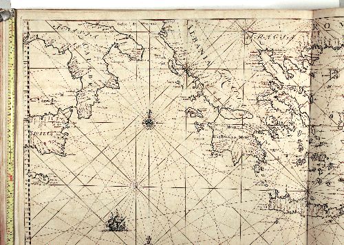
|
398-Sicilia,Calabria e Grecia Van Keulen .
This map comes from the Ioannes van Keulen atlas Zee-Atlas ofte Water Waereld, printed in 1706 in Amsterdam. Author: Johannes Van Keulen
Amsterdam,1706 |
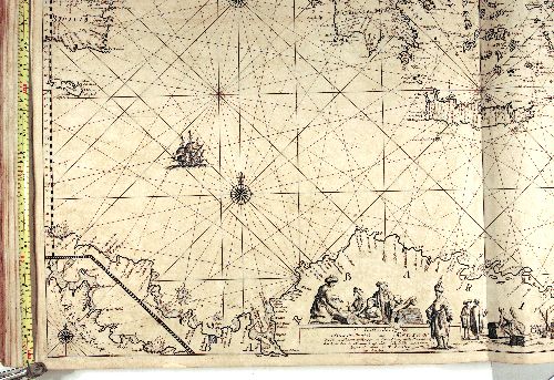
|
399 Mar Mediterraneo Van Keulen .
This map comes from the Ioannes van Keulen atlas Zee-Atlas ofte Water Waereld, printed in 1706 in Amsterdam. Author: Van Keulen
Amsterdam,1706 |
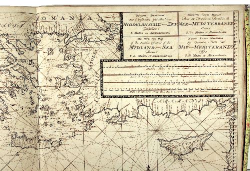
|
400-Isole Greche Van Keulen .
This map comes from the Ioannes van Keulen atlas Zee-Atlas ofte Water Waereld, printed in 1706 in Amsterdam. Author: Van Keulen
Amsterdam,1706 |
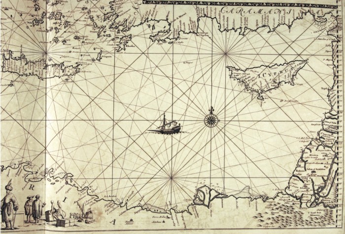
|
401-Creta e Cipro Van Keulen .
This map comes from the Ioannes van Keulen atlas Zee-Atlas ofte Water Waereld, printed in 1706 in Amsterdam. Author: Van Keulen
Amsterdam,1704 |
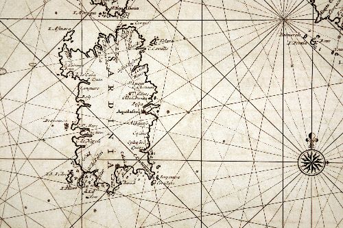
|
402-Sardegna Van Keulen .
This map comes from the Ioannes van Keulen atlas Zee-Atlas ofte Water Waereld, printed in 1706 in Amsterdam. Author: Van Keulen
Amsterdam,1706 |
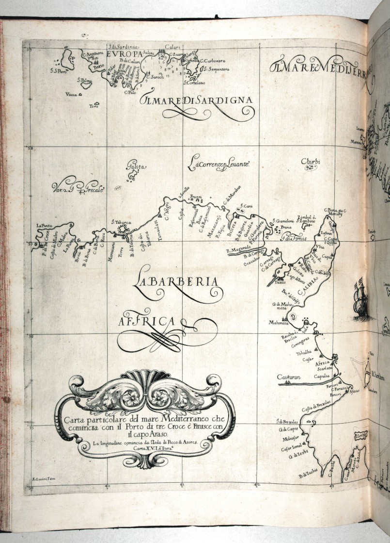
|
413-Corsica .
Author: Robert Dudley
Firenze,1661 |
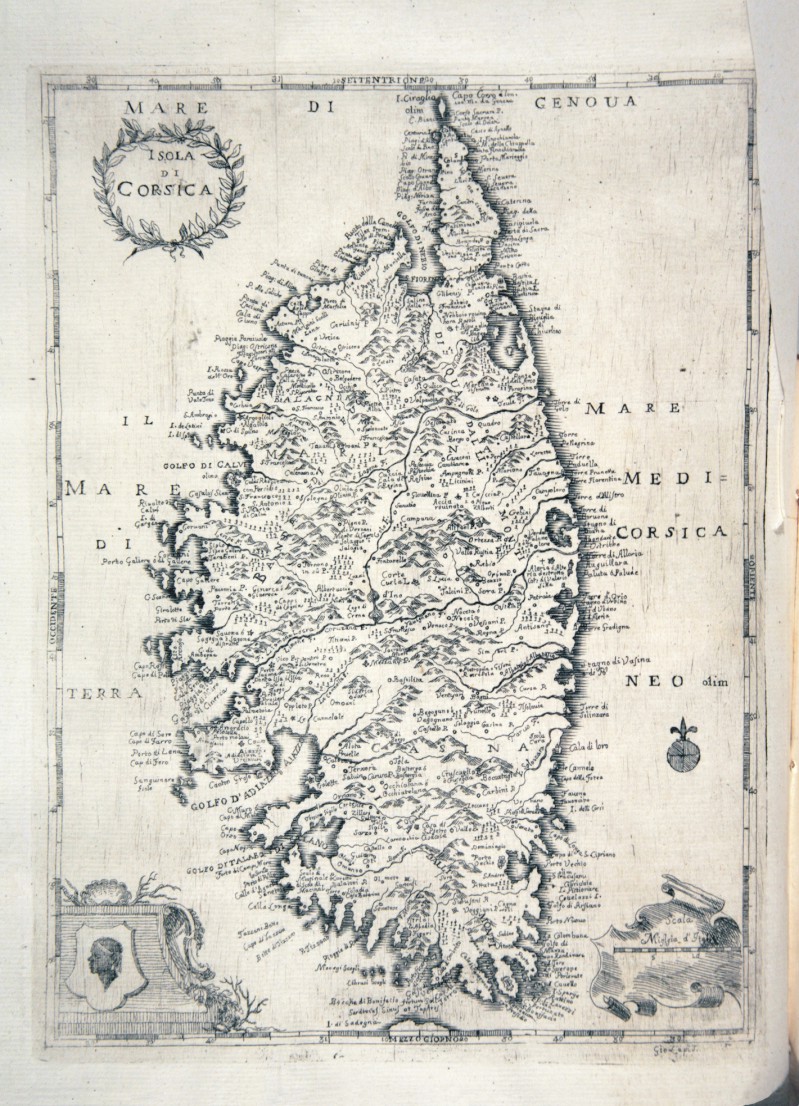
|
414-Corsica .
Author: Magazzino italiano
Livorno,1752 |
|
415-Giappone .
Author: Robert Dudley
Firenze,1646 |
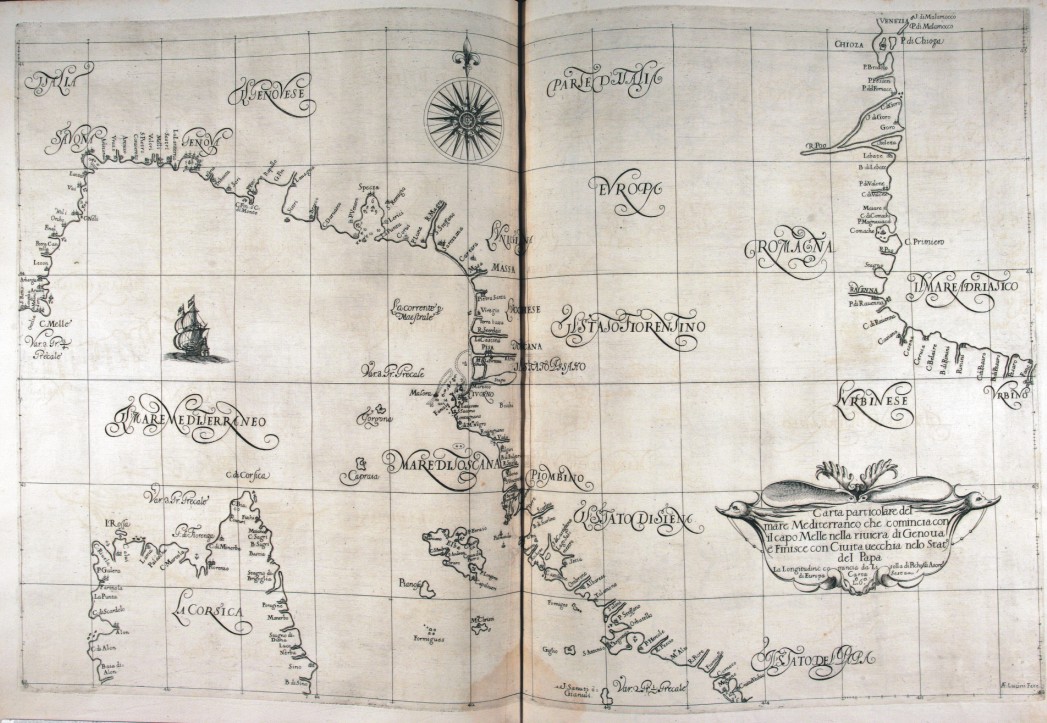
|
416-Italia settentrionale .
Author: Robert Dudley
Firenze,1661 |
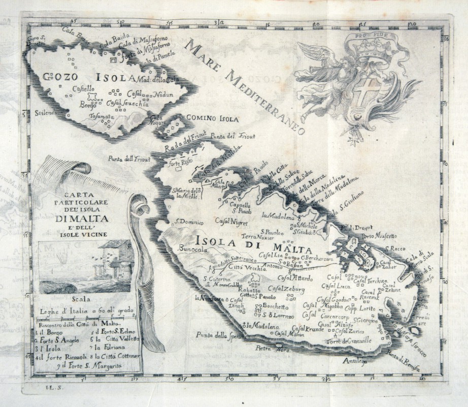
|
417-Malta .
Author: Magazzino italiano
Livorno,1752 |
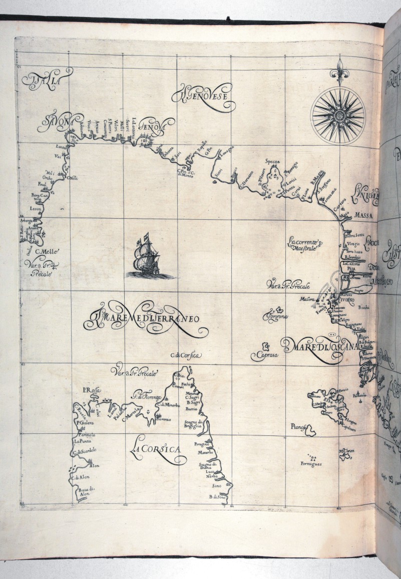
|
418-Mar Ligure .
Author: Robert Dudley
Firenze,1661 |
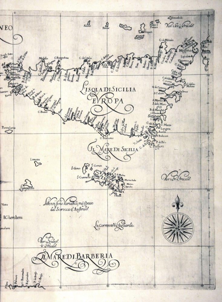
|
419-Sicilia .
Author: Robert Dudley
Firenze,1661 |
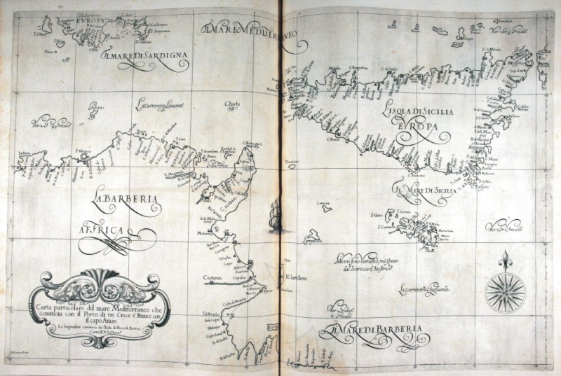
|
Sicilia e Tunisia .
Author: Robert Dudley
Firenze,1661 |
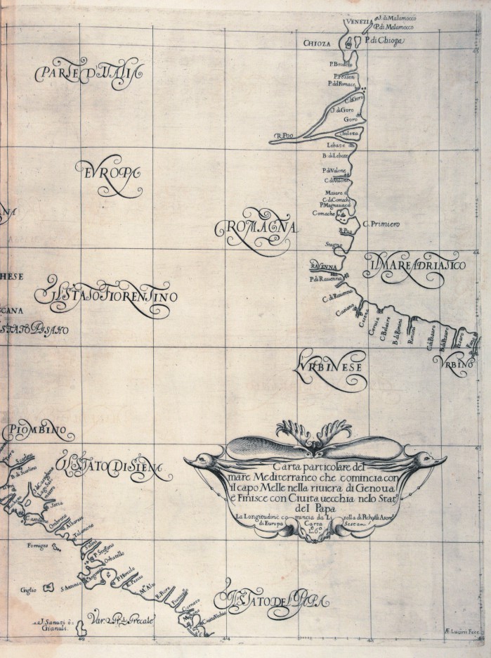
|
421-Sicilia e Tunisia .
Author: Robert Dudley
Firenze,1661 |
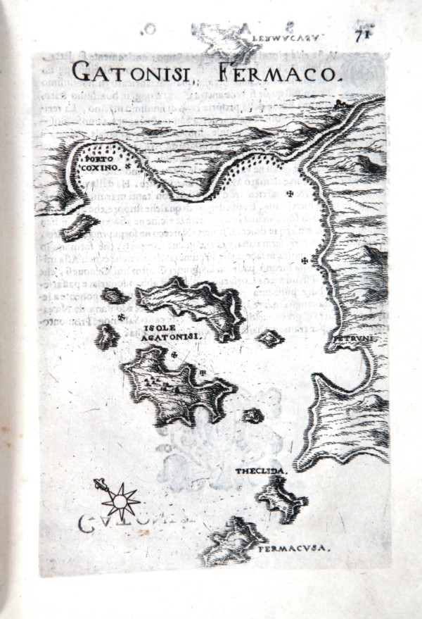
|
426-Gatonisti Fermaco .
Author: Marco Boschini
Venezia,1658 |
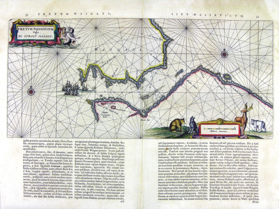
|
424-Fretum Nassovium .
Author: Ioannis Blaeu
Amsterdam,1660 |
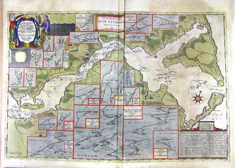
|
425-Sliae Fluminis .
Author: Ioannis Blaeu
Amsterdam,1674 |

|
427-Arcipelago Greco .
Author: Bordone
,0 |

|
428-Calamo .
Author: Boschini M.
,1648 |
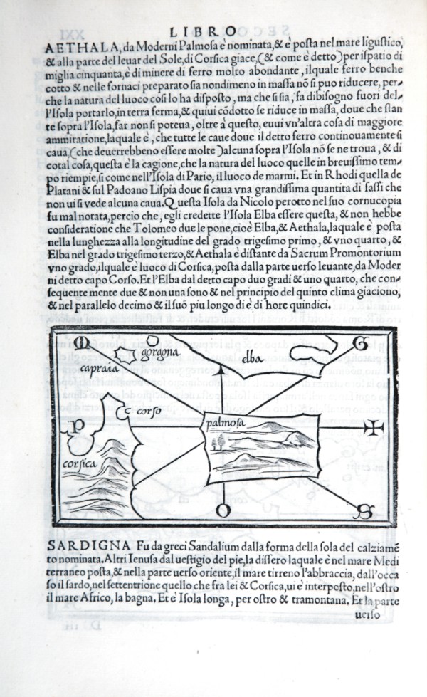
|
429-Arcipelago Toscano .
Author: Benedetto Bordone
,1528 |
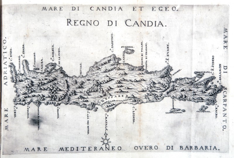
|
430-Mare di Candia et Regno di Candia .
The map, which measures 32x24 cm, represents the Greek island of Leros and the work is published in Venice in 1658, the archipelago with the islands, rocks, dry and shallow, with the seas, gulfs, breasts, ports , towns, and castles in form, which can be seen in the present tense, with a brief narrative of their names, stories & historie, ancient and modern. In the drawing above shows the title and right, the scale of 12 miles in a cartouche. The performance is remarkable for the dense and the terrain very place names found in the typical style. Author: Marco Boschini
Venezia,1658 |
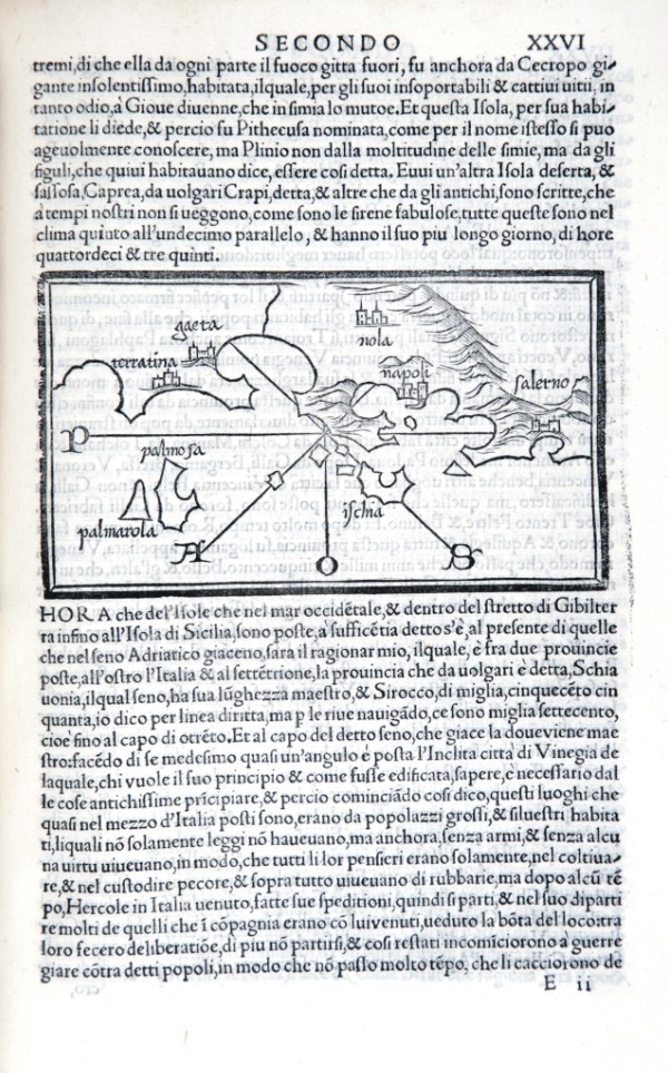
|
431-Ischia .
The map measures 8.4 x 14.6 cm in the design and the work is published in Venice in 1528 Libro di Benedetto Bordone nel qual si ragiona di tutte l’isole del mondo con li loro nomi antichi et moderni, historie, favole, et modi di loro vivere, et in qual parte del mare stanno, et in qual parallelo et clima giacciono con il breve di Papa Leone et gratia et pri vilegio della Illustrissima Signoria com’in quelli appare. MDXXVIII. Author: Benedetto Bordone
Venezia,1528 |

|
432-Isole Greche .
Author: Boschini
,1648 |
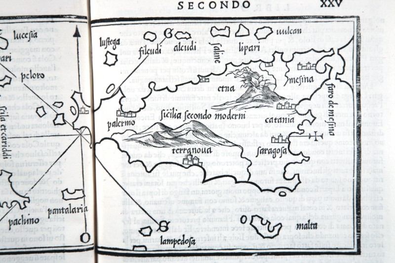
|
434-ISOLE SICILIA .
The map measures 14.6 x 8.4 cm in the design and the work is published in Venice in 1528 Libro di Benedetto Bordone nel qual si ragiona di tutte l’isole del mondo con li loro nomi antichi et moderni, historie, favole, et modi di loro vivere, et in qual parte del mare stanno, et in qual parallelo et clima giacciono con il breve di Papa Leone et gratia et pri vilegio della Illustrissima Signoria com’in quelli appare. MDXXVIII. Author: Benedetto Bordone
Venezia,1528 |
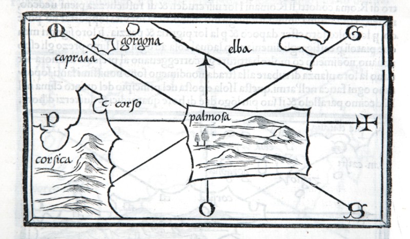
|
435-Isole toscana .
Author: Bordone
,0 |
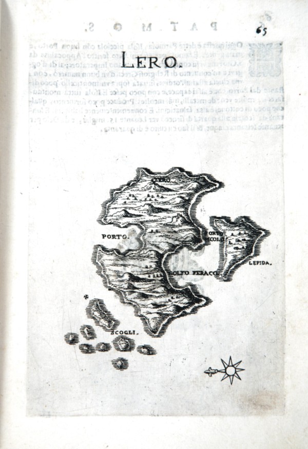
|
436-Lero .
The map which measures 17x24 cm, represents the Greek island of Leros and the work is published in Venice in 1658, the archipelago with the islands, rocks, dry and shallow, with the seas, gulfs, breasts, ports , towns, and castles in form, which can be seen in the present tense, with a succinct narrative Deio their names, stories & historie, ancient and modern. In the drawing above shows the title and right, the scale of 12 miles in a cartouche. The performance is remarkable for the dense and the terrain topography. Author: Marco Boschini
Venezia,1648 |
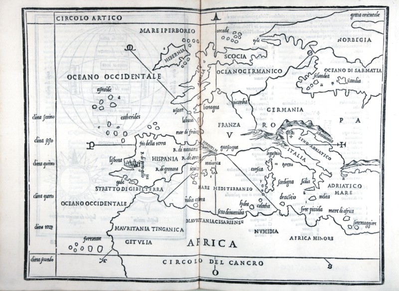
|
437-Mediterraneo occidentale .
The map measures 14.6 x 8.4 cm in the design and the work is published in Venice in 1528 Libro di Benedetto Bordone nel qual si ragiona di tutte l’isole del mondo con li loro nomi antichi et moderni, historie, favole, et modi di loro vivere, et in qual parte del mare stanno, et in qual parallelo et clima giacciono con il breve di Papa Leone et gratia et pri vilegio della Illustrissima Signoria com’in quelli appare. MDXXVIII. Author: Benedetto Bordone
Venezia,1528 |
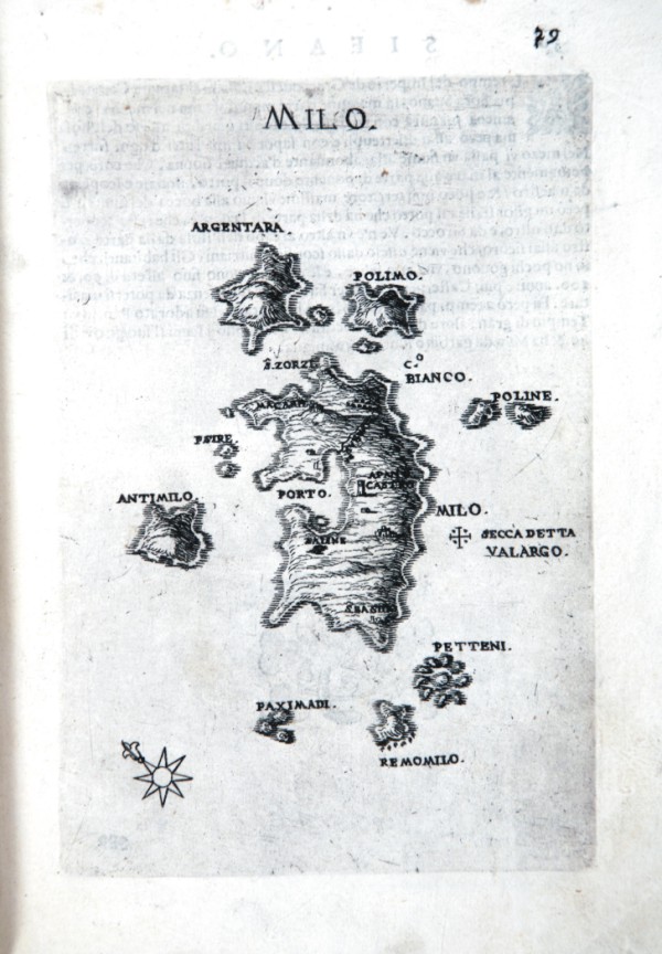
|
438-Milo .
The map which measures 17 x 24 cm, represents the Greek island of MILO and the work is published in Venice in 1658, the archipelago with the islands, rocks, dry and shallow, with the seas, gulfs, breasts, ports , towns, and castles in form, which can be seen in the present tense, with a succinct narrative Deio their names, stories & historie, ancient and modern. In the drawing above shows the title and right, the scale of 12 miles in a cartouche. The performance is remarkable for the dense and the terrain topography. Author: Marco Boschini
Venezia,1648 |
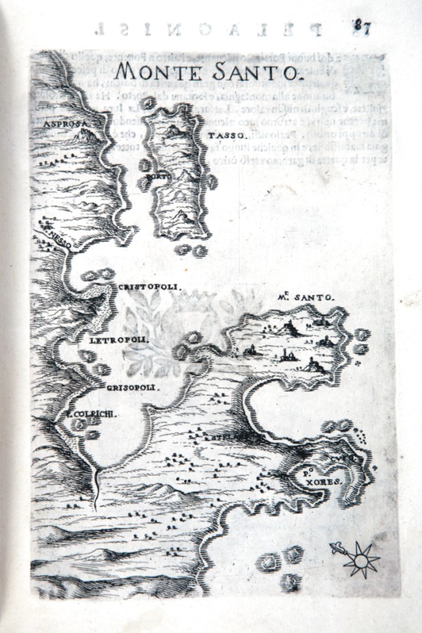
|
439-Monte Santo .
The map which measures 17x24 cm, represents th MONTE SANTO and the work is published in Venice in 1658, the archipelago with the islands, rocks, dry and shallow, with the seas, gulfs, breasts, ports , towns, and castles in form, which can be seen in the present tense, with a succinct narrative Deio their names, stories & historie, ancient and modern. In the drawing above shows the title and right, the scale of 12 miles in a cartouche. The performance is remarkable for the dense and the terrain topography. Author: Marco Boschini
Venezia,1658 |
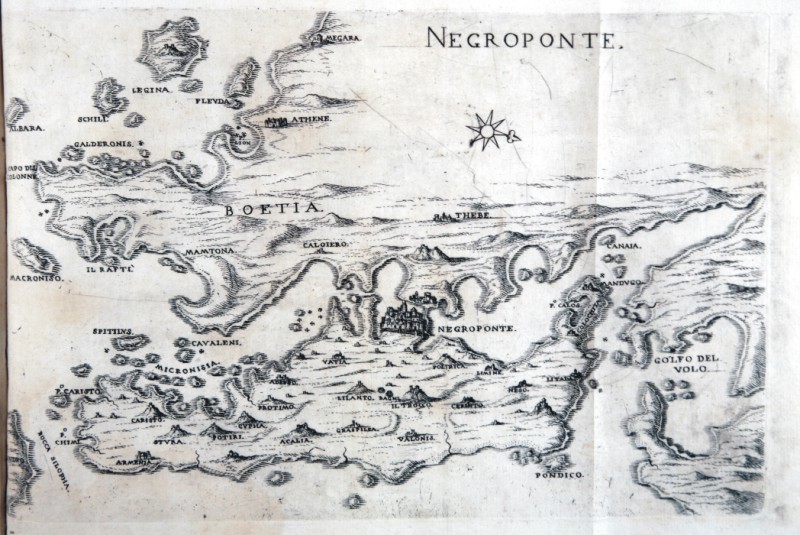
|
440-Negroponte .
The map which measures 17x24 cm, represents the Greek island of NEGROPONTE and the work is published in Venice in 1658, the archipelago with the islands, rocks, dry and shallow, with the seas, gulfs, breasts, ports , towns, and castles in form, which can be seen in the present tense, with a succinct narrative Deio their names, stories & historie, ancient and modern. In the drawing above shows the title and right, the scale of 12 miles in a cartouche. The performance is remarkable for the dense and the terrain topography. Author: Marco Boschini
Venezia,1648 |
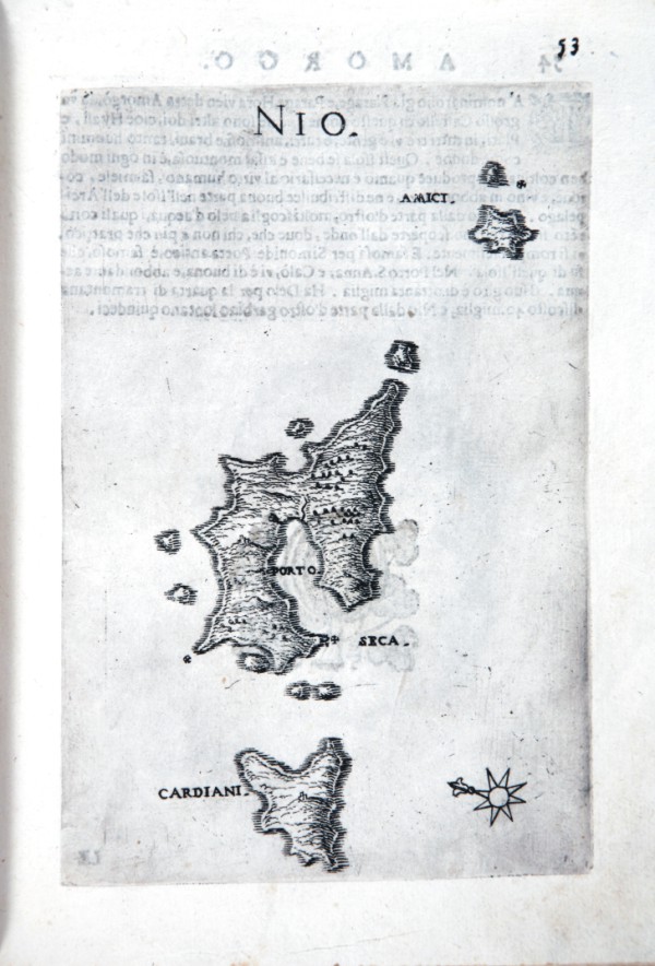
|
441-Nio isole greche .
The map which measures 17x24 cm, represents the Greek island of NIO and the work is published in Venice in 1658, the archipelago with the islands, rocks, dry and shallow, with the seas, gulfs, breasts, ports , towns, and castles in form, which can be seen in the present tense, with a succinct narrative Deio their names, stories & historie, ancient and modern. In the drawing above shows the title and right, the scale of 12 miles in a cartouche. The performance is remarkable for the dense and the terrain topography. Author: Marco Boschini
Venezia,1648 |
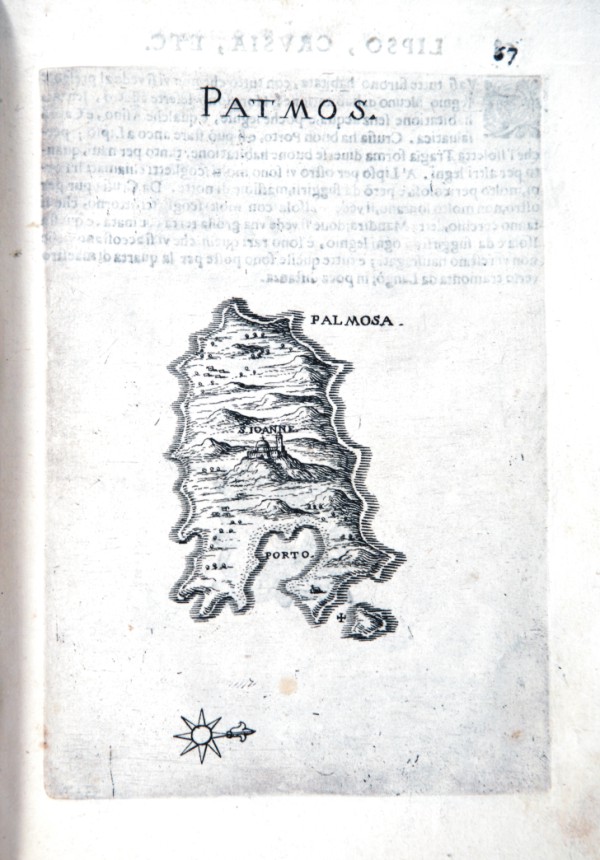
|
442-Pathmos .
The map which measures 17x24 cm, represents the Greek island of PATMOS and the work is published in Venice in 1658, the archipelago with the islands, rocks, dry and shallow, with the seas, gulfs, breasts, ports , towns, and castles in form, which can be seen in the present tense, with a succinct narrative Deio their names, stories & historie, ancient and modern. In the drawing above shows the title and right, the scale of 12 miles in a cartouche. The performance is remarkable for the dense and the terrain topography. Author: Marco Boschini
Venezia,1648 |
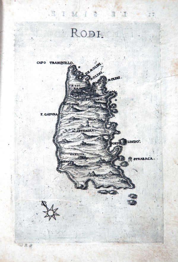
|
443-Rodi .
The map which measures 17x24 cm, represents the Greek island of RODI and the work is published in Venice in 1658, the archipelago with the islands, rocks, dry and shallow, with the seas, gulfs, breasts, ports , towns, and castles in form, which can be seen in the present tense, with a succinct narrative Deio their names, stories & historie, ancient and modern. In the drawing above shows the title and right, the scale of 12 miles in a cartouche. The performance is remarkable for the dense and the terrain topography. Author: Marco Boschini
Venezia,1648 |
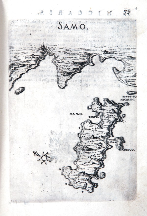
|
444-Samo isole greche .
The map which measures 17x24 cm, represents the Greek island of SAMO and the work is published in Venice in 1658, the archipelago with the islands, rocks, dry and shallow, with the seas, gulfs, breasts, ports , towns, and castles in form, which can be seen in the present tense, with a succinct narrative Deio their names, stories & historie, ancient and modern. In the drawing above shows the title and right, the scale of 12 miles in a cartouche. The performance is remarkable for the dense and the terrain topography. Author: Marco Boschini
Venezia,1648 |
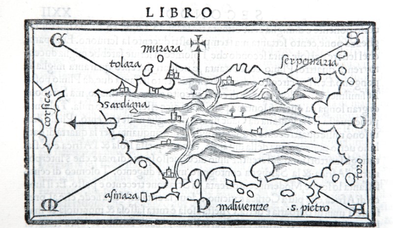
|
445-Sardegna Bordone Particolate .
Author: Bordone
Venezia,1534 |
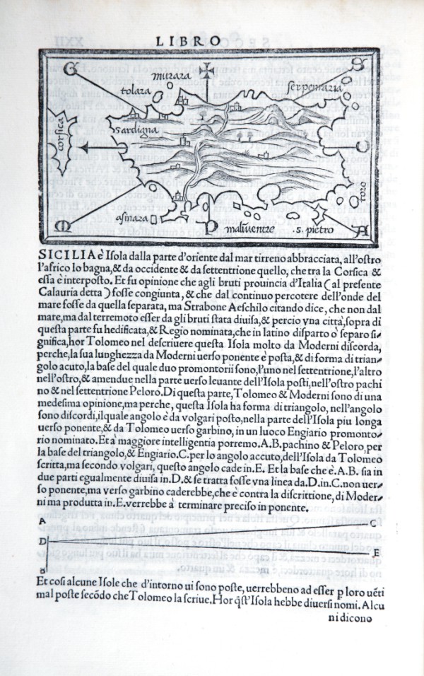
|
446-Sardegna di Bordone e descrizione di Sicilia .
The map measures 8.4 x 14.6 cm in the design and the work is published in Venice in 1528 Libro di Benedetto Bordone nel qual si ragiona di tutte l’isole del mondo con li loro nomi antichi et moderni, historie, favole, et modi di loro vivere, et in qual parte del mare stanno, et in qual parallelo et clima giacciono con il breve di Papa Leone et gratia et pri vilegio della Illustrissima Signoria com’in quelli appare. MDXXVIII.
the left, while overhead a cross indicates the East, presents the directions of the eight principal winds but does not accompany the graded edges, or to map grid, or of scale. The name of the island lies in the north-east and on the left is represented the extreme southern part of Corsica in the name of that island.
Author: Bordone
Venezia,1528 |
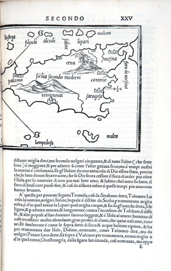
|
447-Sicilia 2 .
The map measures 8.4 x 14.6 cm in the design and the work is published in Venice in 1547 Libro di Benedetto Bordone nel qual si ragiona di tutte l’isole del mondo con li loro nomi antichi et moderni, historie, favole, et modi di loro vivere, et in qual parte del mare stanno, et in qual parallelo et clima giacciono con il breve di Papa Leone et gratia et pri vilegio della Illustrissima Signoria com’in quelli appare. Author: Benedetto Bordone
Venezia,1528 |
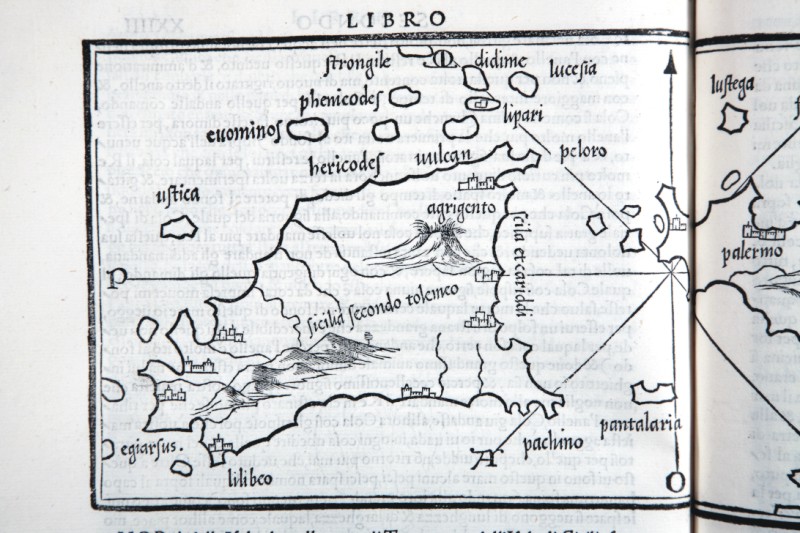
|
448-Sicilia particolare .
The map measures 14.6 x 8.4 cm in the design and the work is published in Venice in 1528 Libro di Benedetto Bordone nel qual si ragiona di tutte l’isole del mondo con li loro nomi antichi et moderni, historie, favole, et modi di loro vivere, et in qual parte del mare stanno, et in qual parallelo et clima giacciono con il breve di Papa Leone et gratia et pri vilegio della Illustrissima Signoria com’in quelli appare. MDXXVIII.
Author: Benedetto Bordone
Venezia,0 |
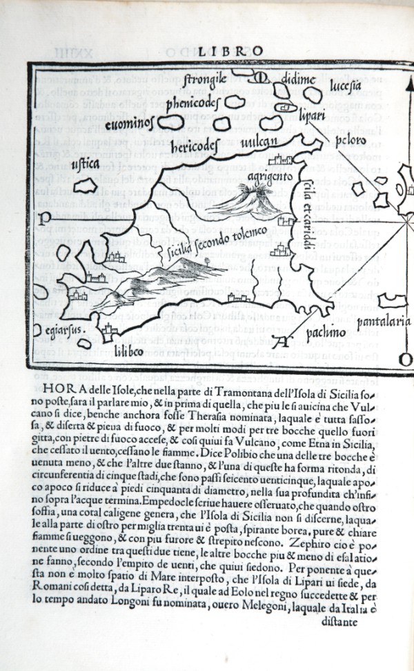
|
449-Sicilia di Bordone .
The map measures 14.6 x 8.4 cm in the design and the work is published in Venice in 1528 Libro di Benedetto Bordone nel qual si ragiona di tutte l’isole del mondo con li loro nomi antichi et moderni, historie, favole, et modi di loro vivere, et in qual parte del mare stanno, et in qual parallelo et clima giacciono con il breve di Papa Leone et gratia et pri vilegio della Illustrissima Signoria com’in quelli appare. MDXXVIII. Author: Benedetto Bordone
Venezia,1528 |
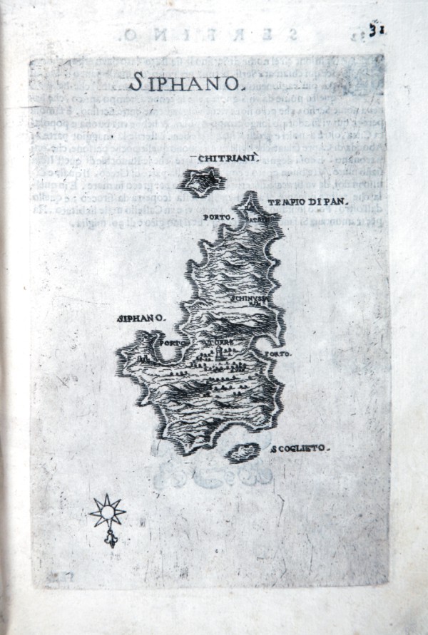
|
450-Siphano .
The map which measures 17x24 cm, represents the Greek island of SIPHANO and the work is published in Venice in 1658, the archipelago with the islands, rocks, dry and shallow, with the seas, gulfs, breasts, ports , towns, and castles in form, which can be seen in the present tense, with a succinct narrative Deio their names, stories & historie, ancient and modern. In the drawing above shows the title and right, the scale of 12 miles in a cartouche. The performance is remarkable for the dense and the terrain topography. Author: Marco Boschini
Venezia,1648 |
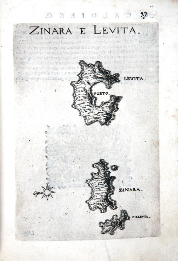
|
451-Zinara e Levita .
The map which measures 17x24 cm, represents the Greek island of ZINARA E LEVITA and the work is published in Venice in 1658, the archipelago with the islands, rocks, dry and shallow, with the seas, gulfs, breasts, ports , towns, and castles in form, which can be seen in the present tense, with a succinct narrative Deio their names, stories & historie, ancient and modern. In the drawing above shows the title and right, the scale of 12 miles in a cartouche. The performance is remarkable for the dense and the terrain topography.
Author: Marco Boschini
Venezia,1648 |
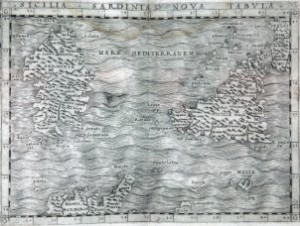
|
471-Sicilia Sardegna Nova Tabvla .
Author: Giacomo Gastaldi
Venezia,1548 |

|
455-Grecia parte del mar mediterraneo .
The map size cm. 61 x 45 and is contained in the atlas printed in Venice in 1696 “Isolario descrittione Geografico – Historica, Sacro-Profana, Antico-Moderna, Politica, Naturale e Poetica – Mari, Golfi, Seni, Piagge, Porti, Barche, Pesche, Promontori, Monti, Boschi, Fiumi, Laghi, Stagni, Bagni, Volcani, Miniere, Gemme, Ricchezze e Monete; Iscrittioni, Linguaggi, Governi, Forze Armate, Guerre, Alleanze, Acquisti, Perdite, Tregue, Trattati di Pace, Religioni Claustrali ed Equestri, Concilj e Missioni, Vescovadi, Arcivescovadi e Patriarcati; Leggi, Costumi, Habiti, Blasoni, Accademie, Huomini Illustri, ed ogni più esatta notitia di tutte l’ Isole Coll’osservationi degli scogli, sirti, scagni, secche del globo terracqueo. Aggiuntivi anche i Ritratti de Dominatori di esse. Ornato di Trecento-dieci tavole Geografiche, Topografiche, Corografiche, Iconografiche, Scenografiche, Idrografiche e Potamografiche. A maggiore dilucidazione ed uso della Navigatione. E in supplemento dei XIV Volumi del Bleau. Tomo II dell’Atlante Veneto. Opera e studio del P. Maestro Vincenzo Coronelli dei Minori Conventuali Cosmografo della Serenissima Republica di Venetia e Professore di Geografia, A spese dell’Autore Author: Coronelli
Venezia,1696 |

|
456-A CAMANTIS INSULA CIPRO .
Author: Coronelli
,0 |

|
457-Isola di Corfu .
The map size cm. 61 x 45 and is contained in the atlas printed in Venice in 1696 “Isolario descrittione Geografico – Historica, Sacro-Profana, Antico-Moderna, Politica, Naturale e Poetica – Mari, Golfi, Seni, Piagge, Porti, Barche, Pesche, Promontori, Monti, Boschi, Fiumi, Laghi, Stagni, Bagni, Volcani, Miniere, Gemme, Ricchezze e Monete; Iscrittioni, Linguaggi, Governi, Forze Armate, Guerre, Alleanze, Acquisti, Perdite, Tregue, Trattati di Pace, Religioni Claustrali ed Equestri, Concilj e Missioni, Vescovadi, Arcivescovadi e Patriarcati; Leggi, Costumi, Habiti, Blasoni, Accademie, Huomini Illustri, ed ogni più esatta notitia di tutte l’ Isole Coll’osservationi degli scogli, sirti, scagni, secche del globo terracqueo. Aggiuntivi anche i Ritratti de Dominatori di esse. Ornato di Trecento-dieci tavole Geografiche, Topografiche, Corografiche, Iconografiche, Scenografiche, Idrografiche e Potamografiche. A maggiore dilucidazione ed uso della Navigatione. E in supplemento dei XIV Volumi del Bleau. Tomo II dell’Atlante Veneto. Opera e studio del P. Maestro Vincenzo Coronelli dei Minori Conventuali Cosmografo della Serenissima Republica di Venetia e Professore di Geografia, A spese dell’Autore Author: Coronelli
,0 |
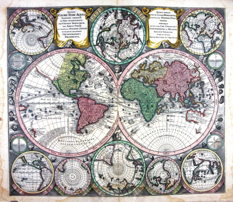
|
458-Globi Terr-Aqvei .
The map (cm 52,5 x 70,0), which is contained in the collection of cards Matthäus Seutter entitled Sphaerae artificiales of 1730, was printed in Augsburg in the publishing house of Jeremias Wolff. Cartouche in the upper right corner shows the title Italia secundum observationes Societatis Regiae Scientiarum quae est Parisiis nec non R.P.Riccioli Societatis Iesu aliorumque Astronomorum et diversorum Memorialium concinnata Per G. De L’Isle Geog.Parisiensem prostat nunc in Officina Ierem.Wolfii. Author: Seutter
Augusta,1730 |
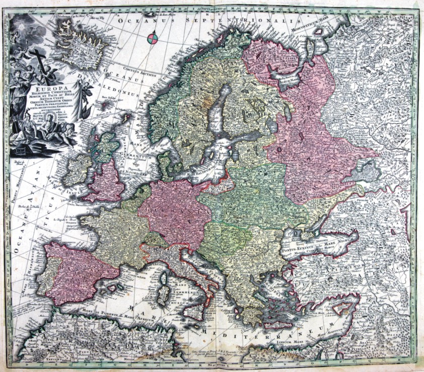
|
459-EUROPA .
The map (cm 52,5 x 70,0), which is contained in the collection of cards Matthäus Seutter entitled Sphaerae artificiales of 1730, was printed in Augsburg in the publishing house of Jeremias Wolff. Cartouche in the upper right corner shows the title Italia secundum observationes Societatis Regiae Scientiarum quae est Parisiis nec non R.P.Riccioli Societatis Iesu aliorumque Astronomorum et diversorum Memorialium concinnata Per G. De L’Isle Geog.Parisiensem prostat nunc in Officina Ierem.Wolfii. Author: Seutter
Augusta,1730 |
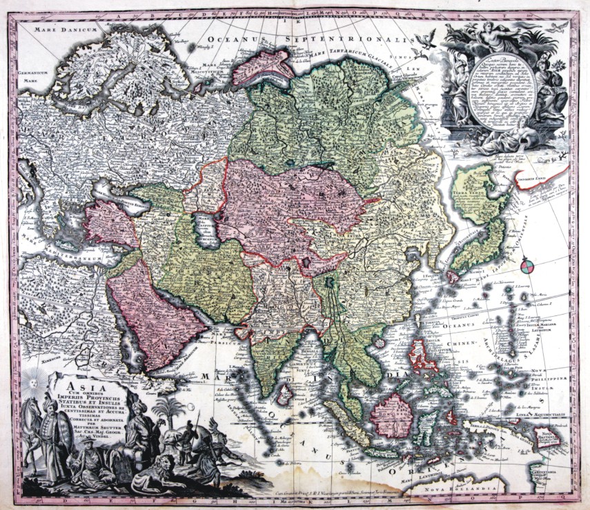
|
460-ASIA .
The map (cm 52,5 x 70,0), which is contained in the collection of cards Matthäus Seutter entitled Sphaerae artificiales of 1730, was printed in Augsburg in the publishing house of Jeremias Wolff. Cartouche in the upper right corner shows the title Italia secundum observationes Societatis Regiae Scientiarum quae est Parisiis nec non R.P.Riccioli Societatis Iesu aliorumque Astronomorum et diversorum Memorialium concinnata Per G. De L’Isle Geog.Parisiensem prostat nunc in Officina Ierem.Wolfii. Author: Matthäus Seutter
Augusta,1730 |
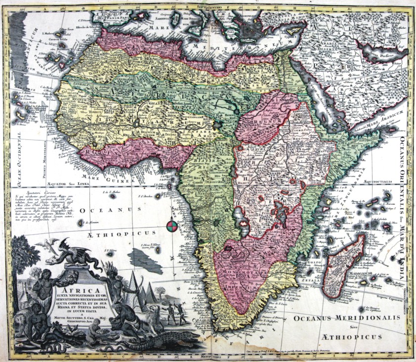
|
461-AFRICA .
The map (cm 52,5 x 70,0), which is contained in the collection of cards Matthäus Seutter entitled Sphaerae artificiales of 1730, was printed in Augsburg in the publishing house of Jeremias Wolff. Cartouche in the upper right corner shows the title Italia secundum observationes Societatis Regiae Scientiarum quae est Parisiis nec non R.P.Riccioli Societatis Iesu aliorumque Astronomorum et diversorum Memorialium concinnata Per G. De L’Isle Geog.Parisiensem prostat nunc in Officina Ierem.Wolfii. Author: Seutter
Augusta,1730 |
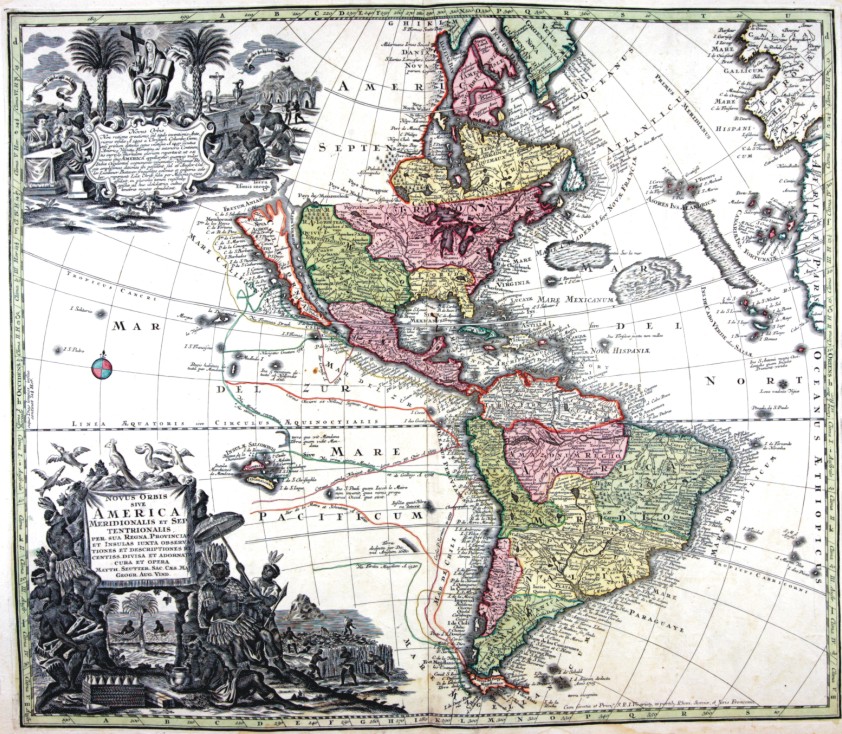
|
462-AMERICA .
The map (cm 52,5 x 70,0), which is contained in the collection of cards Matthäus Seutter entitled Sphaerae artificiales of 1730, was printed in Augsburg in the publishing house of Jeremias Wolff. Cartouche in the upper right corner shows the title Italia secundum observationes Societatis Regiae Scientiarum quae est Parisiis nec non R.P.Riccioli Societatis Iesu aliorumque Astronomorum et diversorum Memorialium concinnata Per G. De L’Isle Geog.Parisiensem prostat nunc in Officina Ierem.Wolfii. Author: Matthäus Seutter
Augusta,1730 |
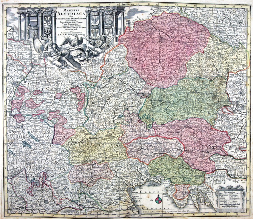
|
459-AUSTRIACA .
The map (cm 52,5 x 70,0), which is contained in the collection of cards Matthäus Seutter entitled Sphaerae artificiales of 1730, was printed in Augsburg in the publishing house of Jeremias Wolff. Cartouche in the upper right corner shows the title Italia secundum observationes Societatis Regiae Scientiarum quae est Parisiis nec non R.P.Riccioli Societatis Iesu aliorumque Astronomorum et diversorum Memorialium concinnata Per G. De L’Isle Geog.Parisiensem prostat nunc in Officina Ierem.Wolfii. Author: Matthäus Seutter
Augusta,1730 |
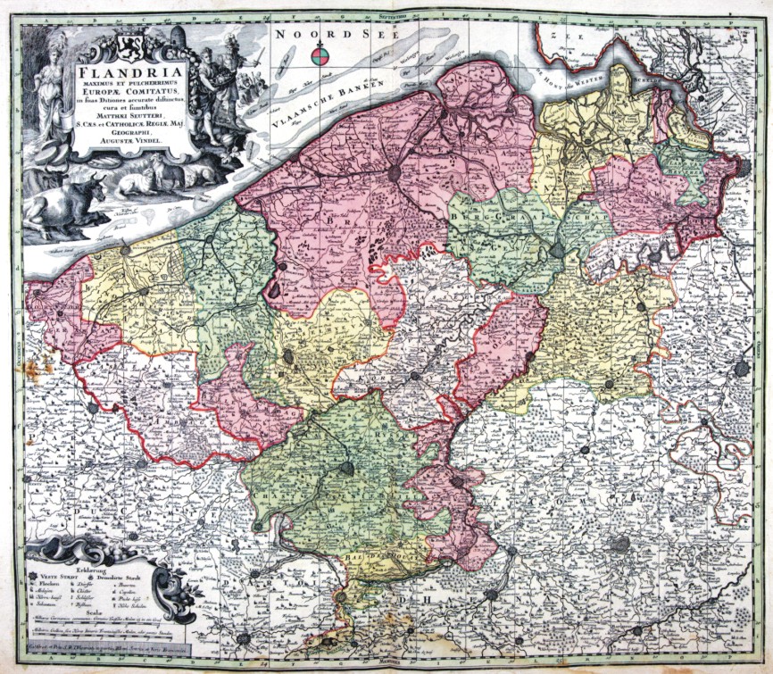
|
464-FLANDRIA .
The map (cm 52,5 x 70,0), which is contained in the collection of cards Matthäus Seutter entitled Sphaerae artificiales of 1730, was printed in Augsburg in the publishing house of Jeremias Wolff. Cartouche in the upper right corner shows the title Italia secundum observationes Societatis Regiae Scientiarum quae est Parisiis nec non R.P.Riccioli Societatis Iesu aliorumque Astronomorum et diversorum Memorialium concinnata Per G. De L’Isle Geog.Parisiensem prostat nunc in Officina Ierem.Wolfii. Author: Matthäus Seutter
Augusta,1730 |
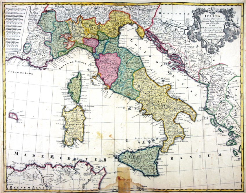
|
465-ITALIA .
The map (cm 52,5 x 70,0), which is contained in the collection of cards Matthäus Seutter entitled Sphaerae artificiales of 1730, was printed in Augsburg in the publishing house of Jeremias Wolff. Cartouche in the upper right corner shows the title Italia secundum observationes Societatis Regiae Scientiarum quae est Parisiis nec non R.P.Riccioli Societatis Iesu aliorumque Astronomorum et diversorum Memorialium concinnata Per G. De L’Isle Geog.Parisiensem prostat nunc in Officina Ierem.Wolfii. Author: Matthäus Seutter
Augusta,1730 |
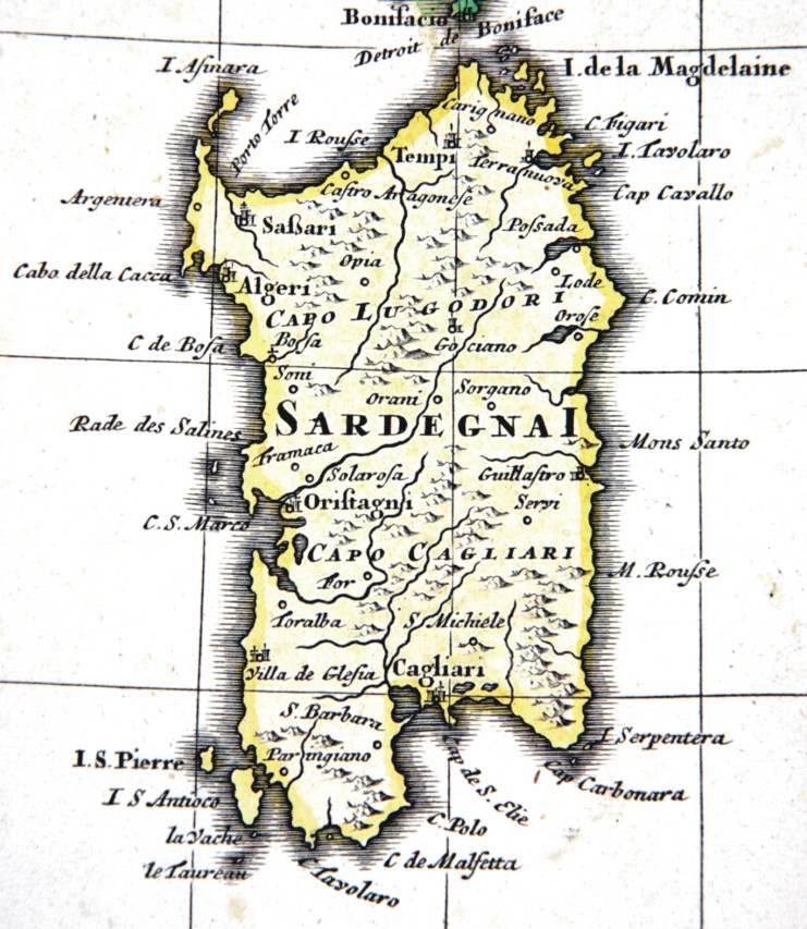
|
466-SARDEGNA .
The name is placed at the center of Sardinia, Cagliari Chief among the signs to the South and the North Cape LOGUDORO. Major cities are marked by their fortifications, with well-placed Cagliari in the south, west and Oristano Sassari in north-west. It is located on the map in scale 1: 2,600,000 designed in 1700 by French geographer Guillaume De L'Isle entitled : L’Italie. Dressee sur les observations de Mrs. de l’Academie Royale des Sciences sur celles du R.P. Riccioli de la Compagnie de Jesus, et autres astronomes du pays, et sur plusieurs autres memoires. Par G. De l’Isle, Geographe. A Paris, chez l’Auteur sur le Quai de l’Horloge, avec Privilege du Roy, pour 20 ans, M.D.CC. Grave par Berey.Top left is a scroll with a range of scales used in the territories represented: Milliaria Principatus Pedemonty, MilliriaAnconitana, Milliria Boniae et Ravennae, Milliria communia Italica, Milliria Florentina, Milliria Genuesia, Milliria Parmensia, Milliria Venetia, Milliria Mutinensia, Milliria Roma, Milliria Mantua, Milliria Ferrarensie, Milliria Gallica commu(nia).
Author: Seutter
Augusta,1730 |

|
Parte meridionale dell'arcipelago greco .
Author: Coronelli
,0 |

|
476-Calaris .
The map, measuring 30.5 x 45.5 cm is located in the large atlas Atlas Maior Sive Cosmographia Blaviana printed in Amsterdam in 1662, a monumental work, certainly the largest collection of maps of the seventeenth century, was widely circulated among the cartographers time, so that we realized numerous editions and was translated into five languages. The paper represents the city of Cagliari with its historic districts of Castle, Marina (Gliapola) Stampace (Stampax) and Villanova (Nova Villa), together some districts that were developing out of town in the eastern and western sectors. Author: Blaeu
Amsterdam,1680 |

|
475-Sardegna e Corsica .
Author:
,1764 |
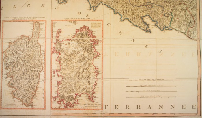
|
479-Corsica e Sardegna .
Author: Andrew Dury
,0 |

|
478-Isole di Corsica e Sardegna .
Author:
,0 |
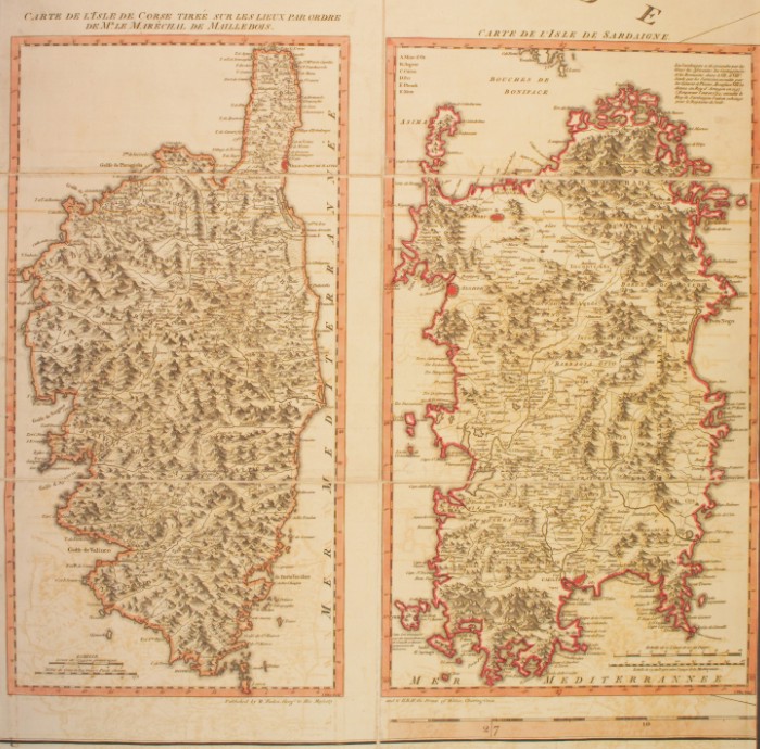
|
480-Corsica e Sardegna .
Author: Andrew Dury
Parigi,1783 |
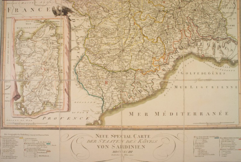
|
481-Francia e Sardegna .
The map measuring 74x69 cm and proposes Liguria, Sardegna in a box and the southern Piedmon Author:
,1793 |

|
483-Corsica e Sardegna .
Author:
,0 |

|
484-Sicilia orientale .
Author:
,0 |

|
485-Sicilia occidentale .
Author:
,0 |

|
Carta dell'isola di Sicilia .
Author: Paris Achille
,1860 |

|
487-Nuova carta della Sicilia .
Author: Peteten
,1810 |
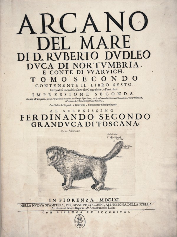
|
537-ARCANO DEL MARE .
Autore : Dudley Author:
Firenze,1661 |
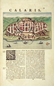
|
488-Calaris .
Author: Blaeu
,1663 |
|
538-CLAVDI PTO LEMAEI GEO .
Author:
,0 |
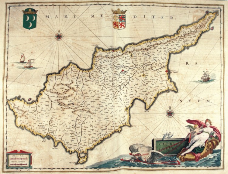
|
489-Cipro .
Author: Blaeu
Amsterdam,1650 |

|
490-Colombia-Castilia .
Author:
,0 |
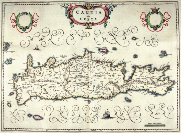
|
491-Candia olim Creta .
Author: Blaeu
Amsterdam,1642 |

|
492-Isole Greche .
Author: Lavrenbergio I.
,0 |
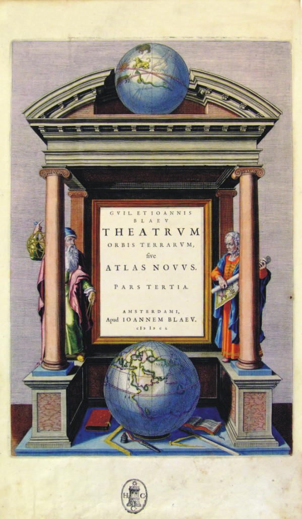
|
539-THEATRUM - ATLAS NOVUS .
Author: Blaeu
Amsterdam,1650 |

|
493-Carte de isles Carolines .
Author: Vaugondy
,1766 |

|
494-Mediterraneo occidentale .
Author: Portolano, Caloiro e Oliva
,0 |

|
495-Planisphere ou carte generale du Monde .
Author: Du Val
,0 |

|
496-Carte Universelle du Commerce .
Author: Du Val
,0 |

|
497-La France .
Author: Du Val
,0 |

|
500-Carte du Royaume de Naples .
Author: Du Val
,0 |
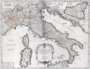
|
501-Carte de l'Italie et des Isles adjacentes .
This map, measuring 37 x 48 cm and drawn by Pierre du Val, was printed in 1663 in Paris. It is a splendid coloured document coming from a fine engraving of I. Lhuilier. It shows an exact subdivision of the Italian states and dukedoms with their blazons at that time. Sicily appears in a square on the top right. In the centre-bottom is a beautiful title picture; on the top left are the graphic scales in Lieues communes de Fra(n)ce; Milles d'Italie. Author: Pierre Du Val
Parigi,1663 |

|
504-sardegna .
Author:
,0 |
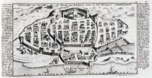
|
503-Cagliari .
The map (18.9 x32 cm size), whose full title is Cagliari oder Calarsi die haupt und residentz Statt des vice Konigs in Sardinien, is located in the Atlas Atlas curieux, oder neuer und compendiuser Atlas
published in Augsburg in1704.
The paper, which is in black and white sets forth the plan of the city of Cagliari and sides of a description in German . Author: Gabriel Bodenehr
Augusta,1704 |
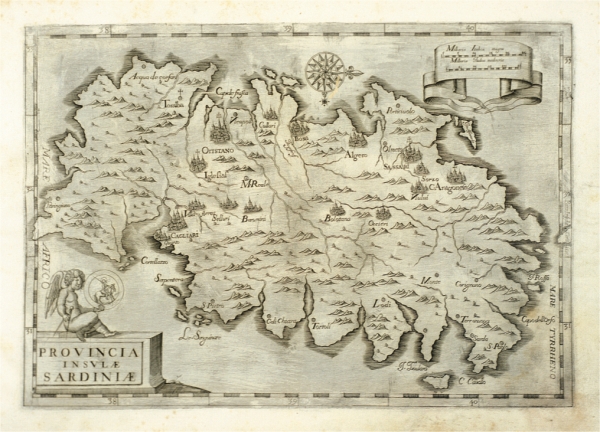
|
643-Provincia Insulae Sardinae .
Author: Bernard Bourdigalensis
Roma,1643 |

|
506-Europa .
Author: Portolano, Caloiro e Oliva
,0 |
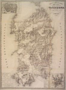
|
507-sardegna .
Map of the island or the kingdom of Sardinia with care reduced by the most accredited materials and proper behind recent news. Map black and white made in 1857 and printed by litho junker Turin Turin. Author: G. Biasioli
Torino,1857 |

|
Golfo di Venezia .
Author:
,0 |
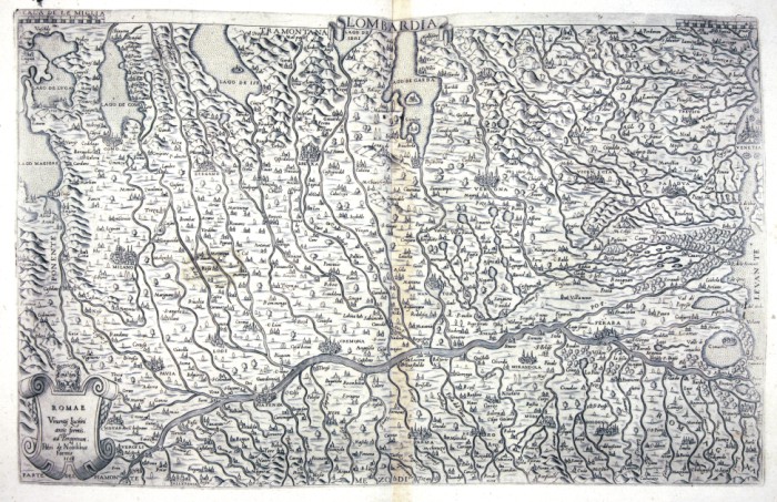
|
Lombardia .
Author:
,0 |
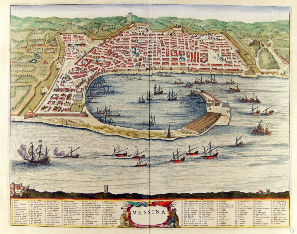
|
795-Messina .
Author: Joan Blaeu
Amsterdam,1663 |

|
Isola di Sicilia .
Author:
,0 |

|
512-Ducato di Savona .
Author:
,0 |

|
513-Austria e Ungheria .
Author:
,0 |

|
514-Magna Germania .
Author:
,0 |

|
515-Galliae Belgicaiae .
Author:
,0 |

|
516-Germania .
Author:
,0 |

|
517-Nova Descriptio Totivis Hvngariae .
Author:
,0 |

|
518-Flandriae .
Author:
,0 |

|
519-Hispaniae Descriptio .
Author:
,0 |

|
520-Totivs Terre Promissionis .
Author:
,0 |

|
521-Africa .
Author:
,0 |

|
522-Graeciae Chorographia .
Author:
,0 |

|
523-bohemia .
Author:
,0 |
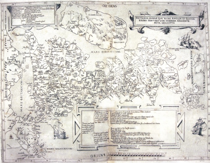
|
524-Britaniae Insulae .
Author:
,0 |

|
525-Toscana .
Author:
,0 |

|
527-Tavola settima dell'Europa - Sardegna e Sicilia .
Author:
,0 |

|
528-Veneto .
Author:
,0 |

|
529-Golfo di Venetia .
Author:
,0 |

|
530-Paesi Bassi .
Author:
,0 |

|
531-Germania del Gastaldo .
Author:
,0 |

|
533-Carta geologica della Sardegna .
Author: Lamarmora
,1856 |

|
534-Corsica .
Author:
,0 |
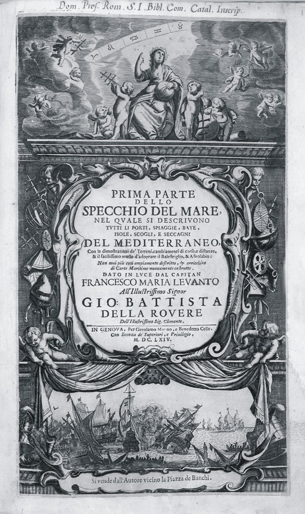
|
541-SPECCHIO DEL MARE .
Author:
Genova,1664 |
|
542-ITALIA DI ANT. MAGNINI .
Autore: Magnini Author:
,1620 |
|
543-ROME ANCIENNE ET MODERNE .
Autore: Mortier Author:
Amsterdam,0 |
|
544-CHOROGRAPHICA .
Author:
,0 |
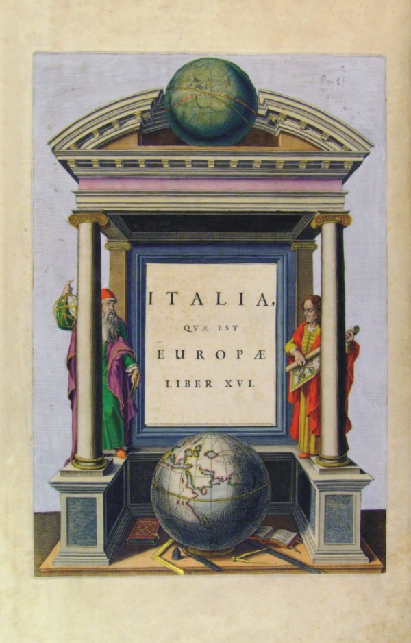
|
545-ITALIA QVAE EST EUROPAE .
Autore: Blaeu Author:
,0 |
|
546-MAGAZZINO ITALIANO - ARTI E SCIENZE .
Author:
Livorno,1752 |
|
547-NOUVEAU THEATRE D' ITALIE .
Author:
,0 |
|
548-ISOLARIO DELL'ATRLANTE VENETO .
Author:
,1696 |
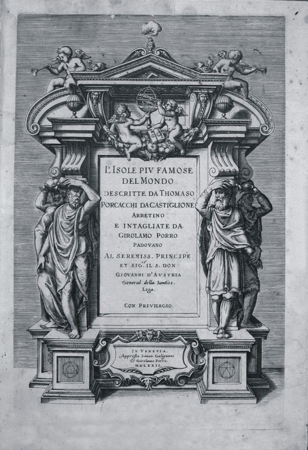
|
549-L'ISOLE PIV FAMOSE DEL MONDO .
Author:
Venezia,1572 |
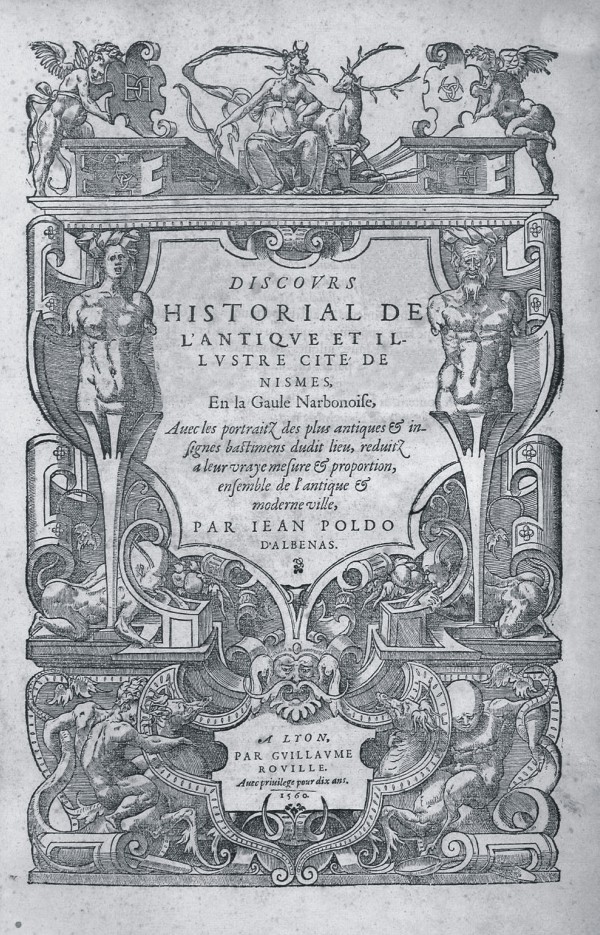
|
550-HISTORIAL DE L'ANTIQVE ET ILLVSTRE CITE' DE NISMES .
Author:
,1560 |
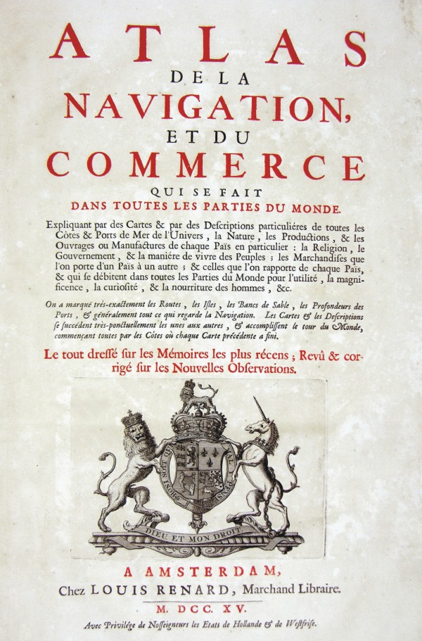
|
551-ATLAS DE LA NAVIGATION ET DU COMMERCE .
Autore : Renard Author: Renard
,1715 |
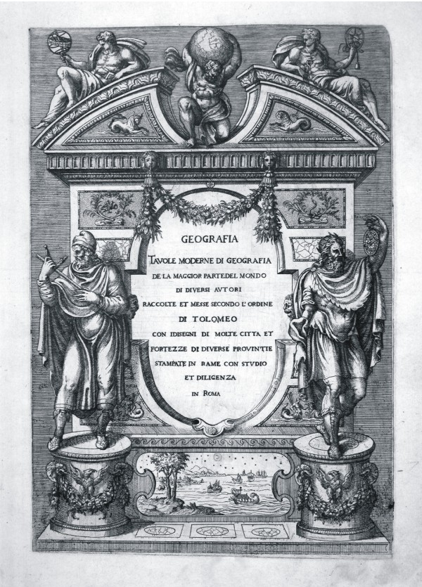
|
552-TAVOLE MODERNE DI GEOGRAFIA .
Author: Tolomeo
,0 |

|
553-URBANO VII PONT OPT MAX .
Author:
,0 |
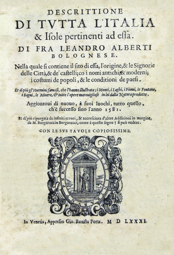
|
554-DESCRITTIONE DI TVTTA L'ITALIA .
Author:
Venezia,1581 |
|
555-EUROPAE TABULA SEPTIMA .
Author:
,0 |
|
556-GEOGRAFIA - DESCRITTIONE DELLA TERRA .
Author: Tolomeo
Venezia,1598 |
|
557-ISOLE APPARTENENTI ALL' ITALIA .
Author: Porta
Venezia,1581 |
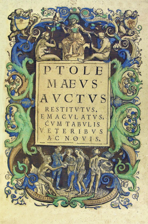
|
558-PTOLE MAEVS AVCTVS .
Author:
,1529 |
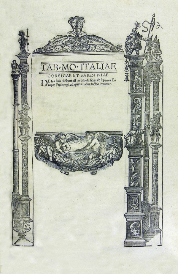
|
559-TAB-MO-ITLAIE Corsicae et Sardiniae .
Author:
,0 |
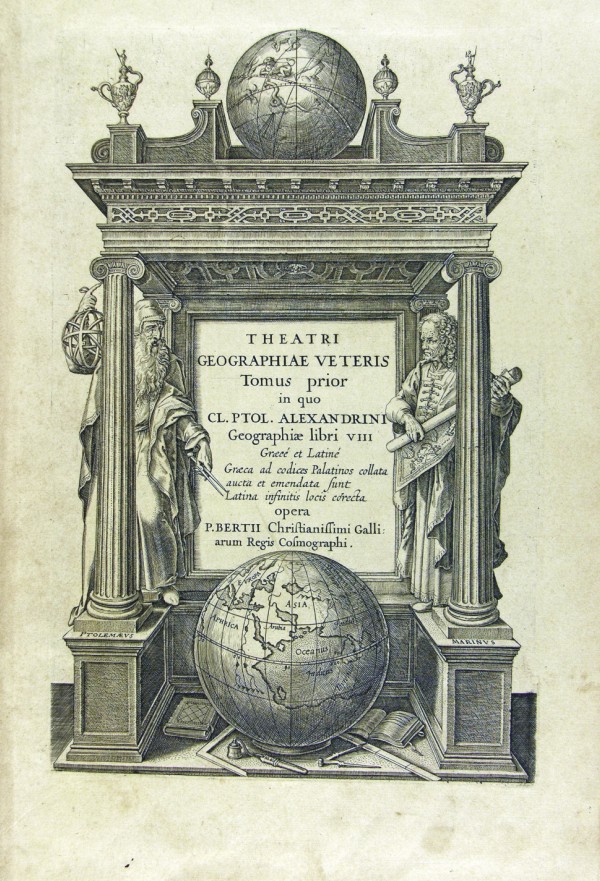
|
560-THEATRI GEOGRAPHIAE VETERIS .
Author:
,0 |
|
561-C.IUILII SOLINI PO .
Author:
,1938 |
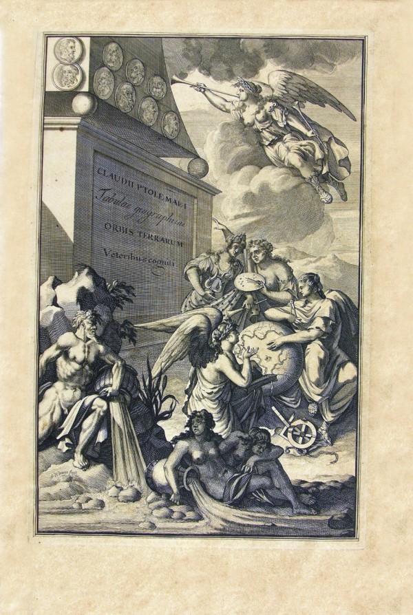
|
562-CLAUDII PTOLE MAEI .
Author:
,0 |
|
563-NUOVO ATLANTE DI GEOGRAFIA UNIVERSALE .
Author: Luigi Rossi
Milano,1820 |
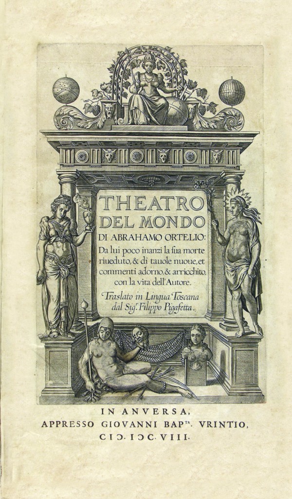
|
564-THEATRO DEL MONDO .
Author: Ortelio
,0 |
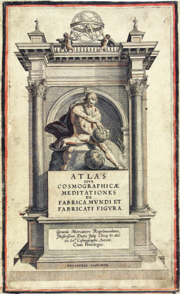
|
565-ATLAS sive cosmographicae meditationes de fabrica Mvndi et fabricati figura .
Author: Mercatore
,0 |
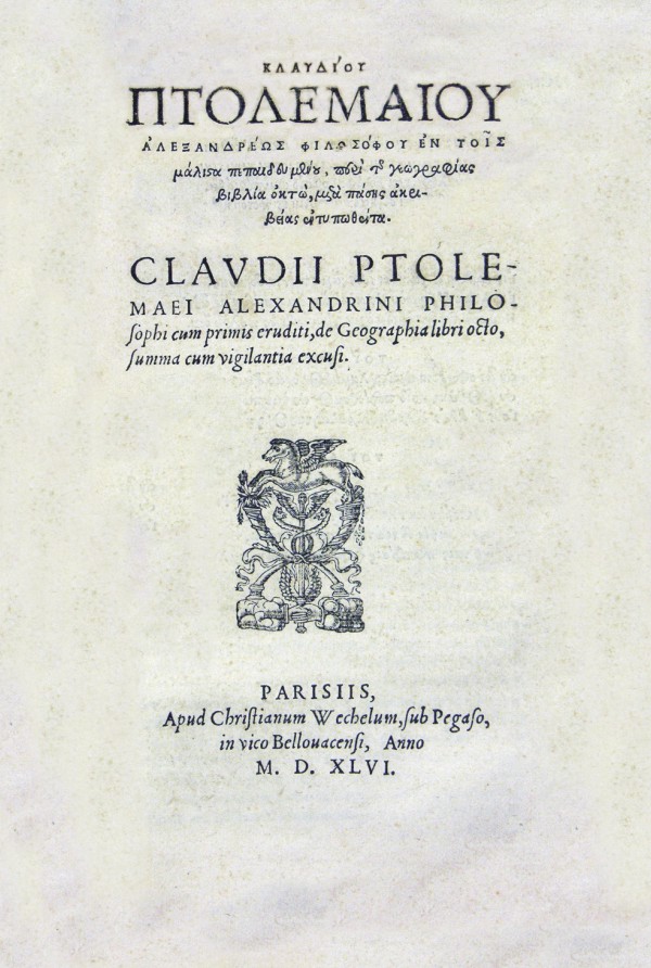
|
566-CLAVDII PTOLE .
Author:
,1546 |
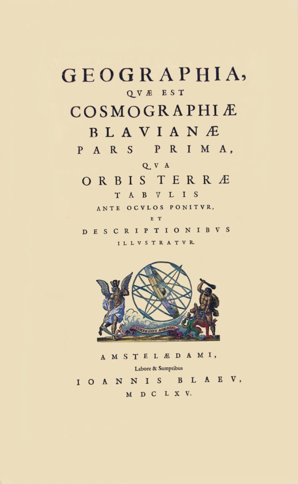
|
567-COSMOGRAPHIAE BLAVIANAE .
Author: Blaeu
,1665 |
|
568-HAKVYTVS POSTHHUMUS .
Author: Purcas S.
Londra,1625 |
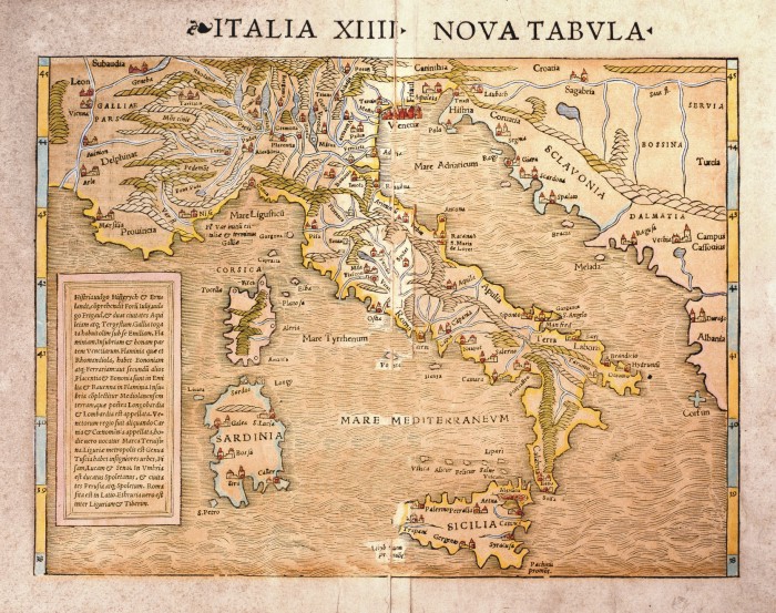
|
599-ITALIA XIIII - NOVA TABVLA - .
Author: Sebastian Münster
Basilea,1540 |
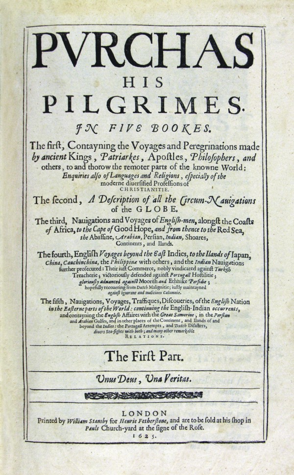
|
569-PVRCHAS HIS PILGRIMES .
Author: Stansby
Londra,1625 |
|
570-TABVLARUM GEOGRAPHICARVM CONTRACRARVM .
Author: Berti P.
,1602 |
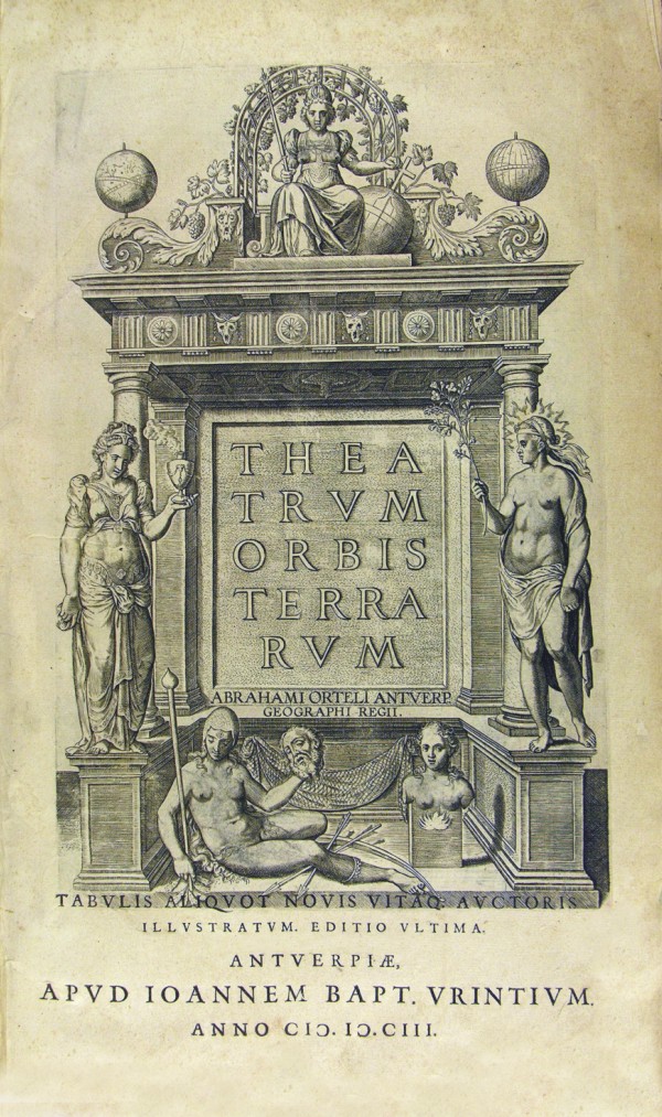
|
571-THEATRUM ORBIS TERRARVM .
Author: Ortelio
,1603 |
|
572-ZEE ATLAS OF THE WATER WAERELD .
Author: Van Keulen
,0 |
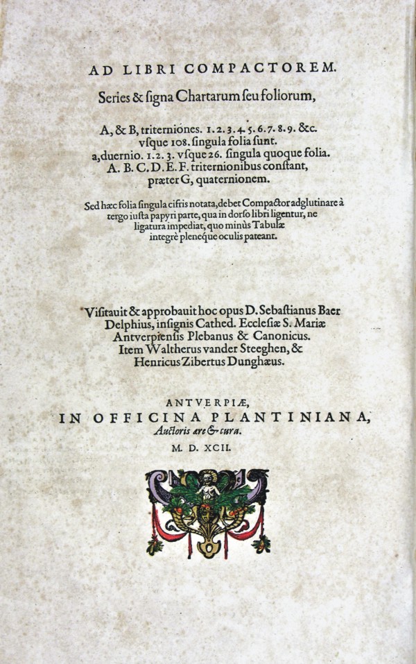
|
573-AD LIBRI COMPACTOREM .
Author:
,1592 |
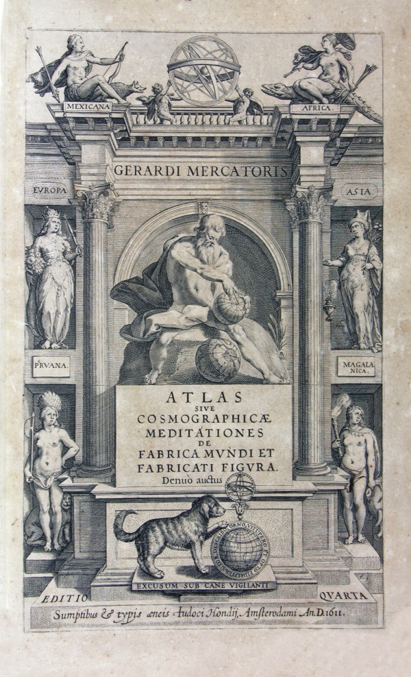
|
574-ATLAS SIVE COSMOGRAPHICAE MEDITATIONES .
Author: Mercatore
,1611 |
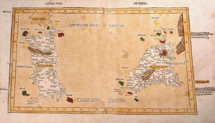
|
598-SARDINIUS E SICILIA .
The map measures 47.5 x 47.9 cm. It 's a rare incunabula which is located in Cosmographia of Ptolemy printed at Ulm in 1482 by Leonardo Holle on tablets carved in wood by J. Schnitzer Author:
Ulma,1482 |
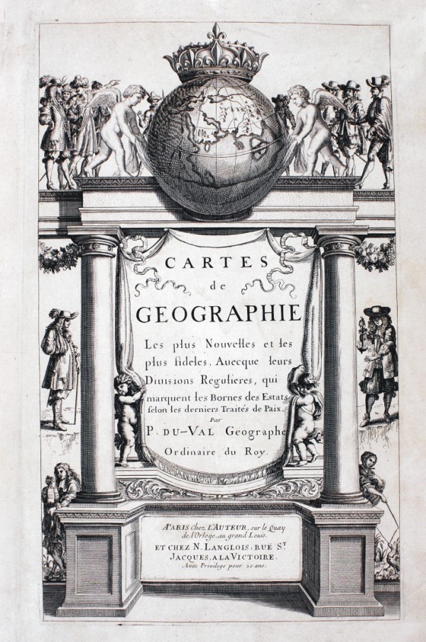
|
575-CARTES DE GEOGRAPHIE .
Author: Du Val P.
,1684 |
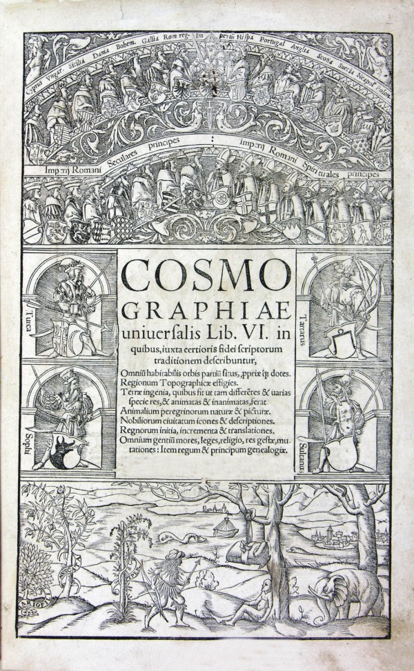
|
576-COSMOGRAPHIAE UNIUERFALIS LIB. VI .
Author:
,0 |
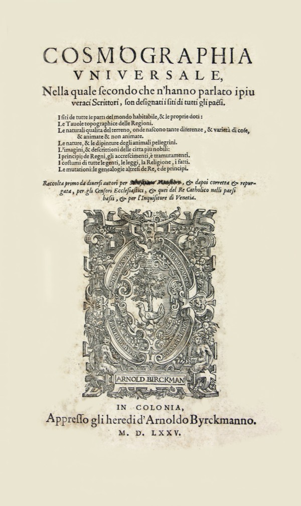
|
577-COSMOGRAPHIA VNIVERSALE .
Author: BYRCKMAN
Venezia,1575 |
|
578-EUROPENS .
Author:
,0 |
|
579-HENRICI MAGNI .
Author:
,0 |
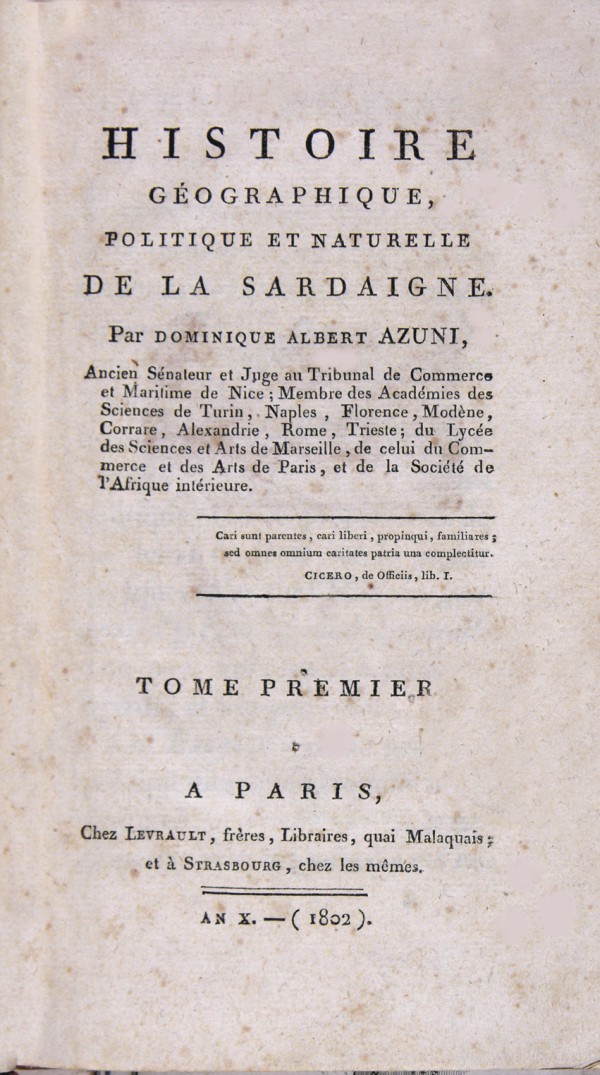
|
580-HISTORIE GEOGRAPHIQUE DE LA SARDIGNE .
Author:
Parigi,1802 |
|
581-SPECTANUM DEDIT ORTELIUS .
Author:
,0 |
|
582-TORONELLI ARAYANAE VERONESIS .
Author: Putelleti A.
Verona,1540 |
|
583-I QUADRUPEDI DI SARDEGNA .
Author:
Sassari,1774 |
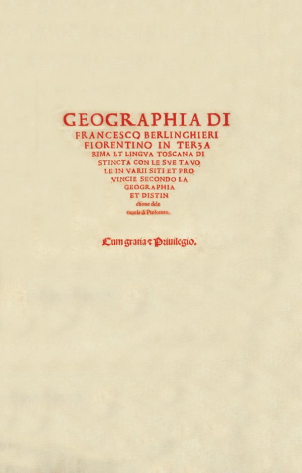
|
584-GEOGRAFIA DI FRANCESCO BERLINGHIERI .
Author: Berlinghieri F.
,0 |
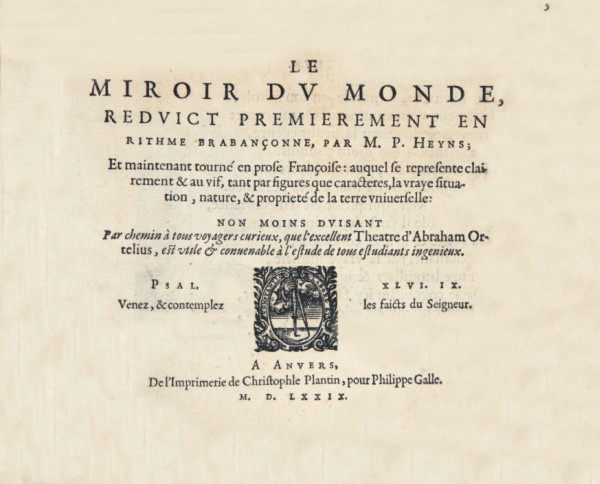
|
585-LE MIROR DU MONDE .
Author:
,1579 |
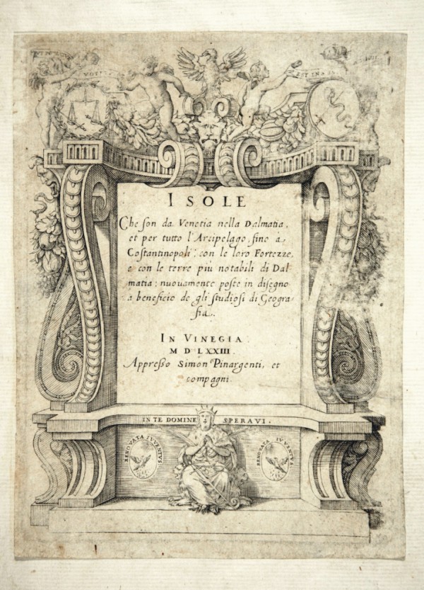
|
586-ISOLE .
Author: Pinargenti S.
Venezia,1753 |
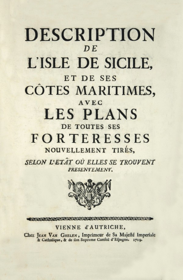
|
587-DESCRIPTION DEL L'ISLE DE SICILE .
Author: Jeam Van Ghelen
Vienna,1719 |
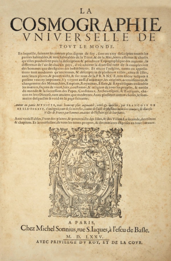
|
588-LA COSMOGRAPHIE VNIVERSELLE DE TOVT LE MONDE .
Author:
Parigi,1575 |

|
597-Antiquarum Itliae e Illyrici .
Author:
,0 |
|
589-CORSO GEOGRAFICO UNIVERSALE .
Author: Coronelli
Venezia,1692 |
|
590-ALLAIN MANESSOS MALLETS .
Author: Mallets A. M.
,1719 |
|
591-ASIA .
Author: Mallets A. M.
,1719 |
|
592-AFRICA .
Author: Mallets A. M.
,1719 |
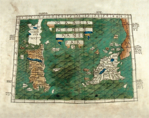
|
641-Sardegna e Corsica .
It is preserved in the National Library of the Linceis and Corsiniana to the repertoire 49. G. 1.
The map measures mm 542 xes 396 and is contained in a sheet of mm 560x 438. It constitutes the table 96 of the atlas Claudius Ptolomaeus Cosmographia, trad. Jacobus Angelus. [It precedes] Jacobus Angelus, Epistle Alexandro V. Curaverunt Girolamo Manfredi, Pietro Bono Avogadro, Galeottus Martius, Nicola Montanus, Philuppus Beroaldus, Bologna, Domenico de' Lapi, 23 giugno1462s (but in reality 1477). On this press bolognese of the Cosmography of Tolomeo, object of study since the antiquity, investigations of particular interest have been conducted by B. Leg (1776 -1841), bibliographer and administrator of the Library Marciana in Venice, and from L. Sighinolfi. Just this last succeeded in establishing as the 1462 date, brought after all to the text, it was wrong; reconstructing the stories of the press, it reached the conclusion that the atlas has seen the light in 1477 and that I/you/he/she am therefore the most ancient edition
Author: Claudio Tolomeo
,1477 |
|
593-GEOGRAFIA DESCRITTIONE VNIVERSALE DELLA TERRA .
Author: Tolomeo
Padova,1621 |
|
594-GEOGRAPHIAE LIBRI OCTO .
Author: Mercatore
,1584 |
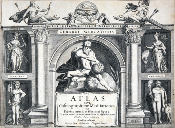
|
596-ATLAS SIVE COSMOGRAPHICAE MEDITATIONES .
Author: Mercatore
,0 |
|
595-L'ATLAS .
Author: Mercatore
,0 |
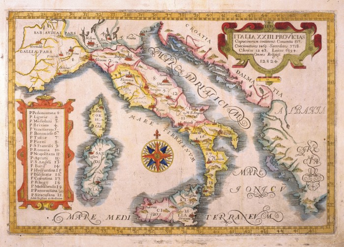
|
600-ITALIA XXIII - PROVICIAS .
This map, measuring 21,4 x 31,7 cm and drawn by P.Massimino da Guechen, is taken from the Atlas delle Province Cappuccine, printed in 1649 in Turin. It is a small, but finely coloured document with a central wind rose and two decorative pictures. One of them on the right contains the title, the other on the left indicates the abbeys' names in the Italian provinces. Author: Massimino da Guechen
Torino,1649 |
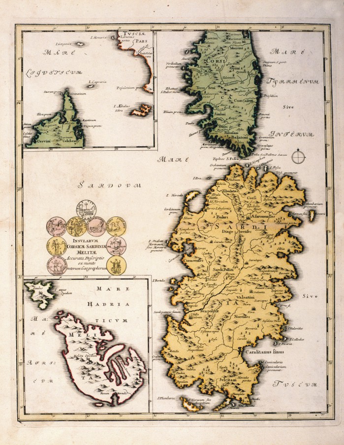
|
601-INSULARUM CORSICAE SARDINIAE MELITAE .
Map of Christoph Weigel printed at Nuremberg in 1720 that measure cm 41x33, 2 and is located in Urbis terrarum veteribus cogniti. The paper offers Sardinia with Corsica, l0 ' island of Malta. The title is in a scroll left.
Author: Cristoph Weigel
Norimberga,1720 |
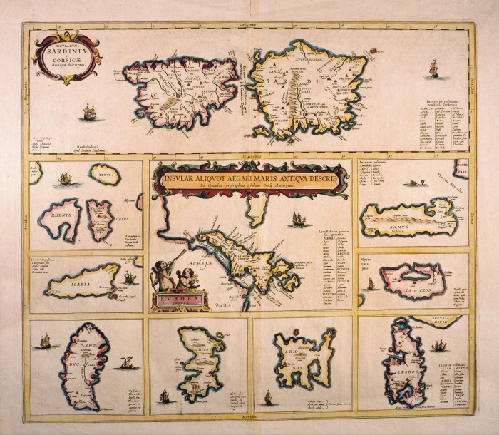
|
602-INSVLAR ALIQVOT AEGAEI MARIS ANTIQVA DESCRIPT .
Map of Abramo ortelio located in Teatrum orbis Terrarum handout to Amsterdam Assembly in 1570 and measure cm 43x49, 5. Offers top Sardinia and corsica and other islands such as Chios 8, Evia, Lesvos and Samos.
Author: Abramo Ortelio
Amsterdam,1570 |
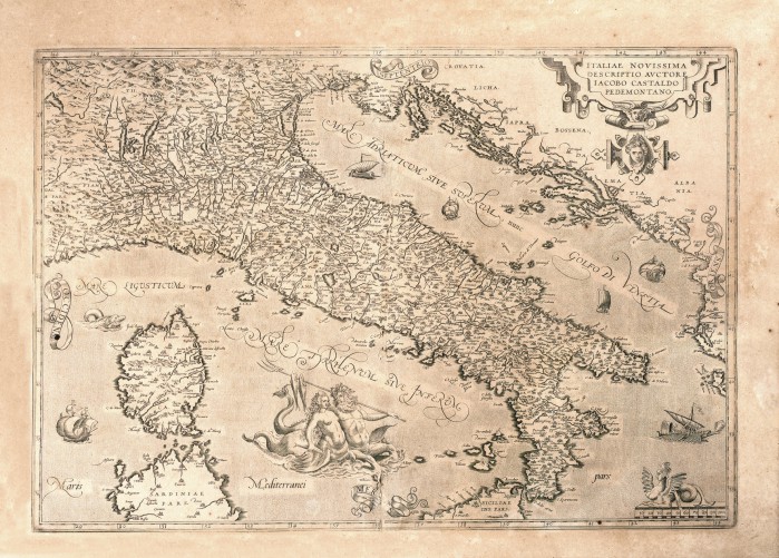
|
603-ITALIAE NOVISSIMA .
Black and white map developed by Giacomo Gastaldi and published in the Theatrum Orbis Terrarum of Ortelio edited to Antwerp in 1570. It is a beautiful rich of information card and with many representations in orography, in hydrography and in built-up areas, also is enriched with different decorations placed by Ortelio as the title block that contains the title, place in the upper right and the bar scale is surmounted by a Sphinx and the different boats in the sea.
Author: Giacomo Gastaldi
Anversa,1570 |
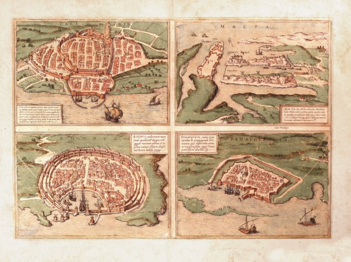
|
604- Calaris - Malta - Rhodus - Famavgvsta .
Colour map printed in Cologne in 1572 and contained in the Opera Civitates Orbis Terrarum by Georg Braun, who wrote the texts and Frans Hogemberg who engraved designs, it's a nice document representing the four cities and has been reproposed in numerous works without alterations whatsoever were used the same plates until consumarono.
Author: George Braun
Colonia,1572 |
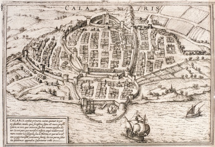
|
605-Calaris .
The map is contained in the Opera Civitates Orbis Terrarum by Georg Braun and Frans Hogemberg, was printed in Cologne in 1572 and derives from the one in Munster's Cosmographia Universalis. Bottom left is a drawing with a brief description of the places. Around the town are represented campaigns cultivated and the Sea some boats
Author: Braun G.
,1752 |
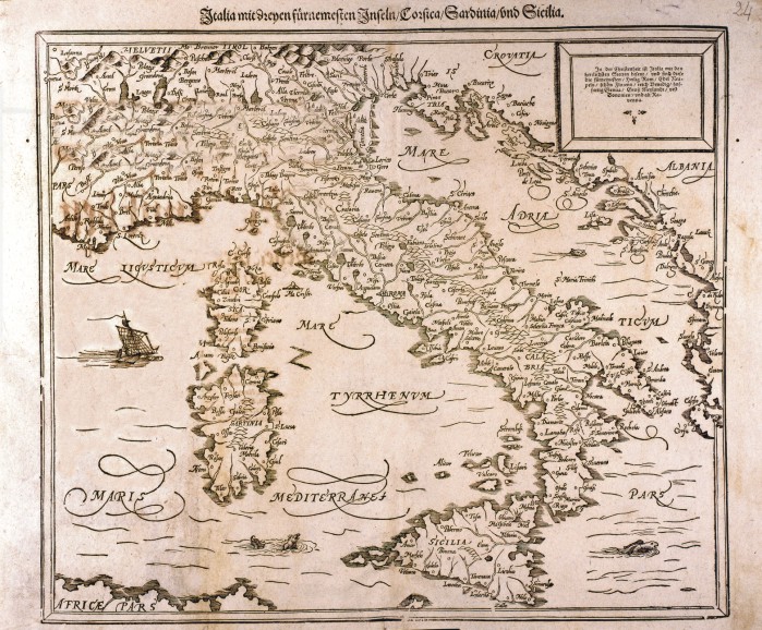
|
606-Italia, Sardinia e Sicilia .
This map, measuring 31 x 36,2 cm, comes from the Sebastian Munster Cosmographia Universalia , printed in 1588 in Bale. The graduated frames and the indication of latitudes, as well as the graphic scales are missing. It is simply a demonstrative document.The title appears off the map. In a square on the top left the most important Italian towns are described in German. Author: Sebastian Münster
Basilea,1588 |
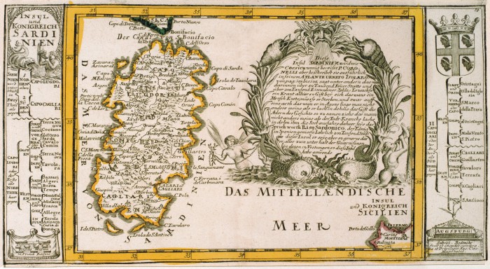
|
609-Sardinien .
Author: Gabriel Bodenehr
Augusta,1704 |
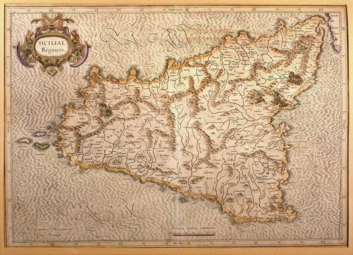
|
608-Siciliae Regnum .
This map, measuring 34 x 48 cm and drawn by Gerardus Mercator, was printed in 1589 in Duisburg. It is a beautiful document of Sicily, its inhabited centres drawn with little circles and the towns with fine perspective designs. The island appears in the centre of the sea, moved by light waves. The mountains are indicated by mole-hill reliefs and the water courses are exactly described. On the top left is a decorative title picture; the graphic scale in Miliaria Italica Communia is at the bottom. Author: Mercatore
Duisburg ,1589 |
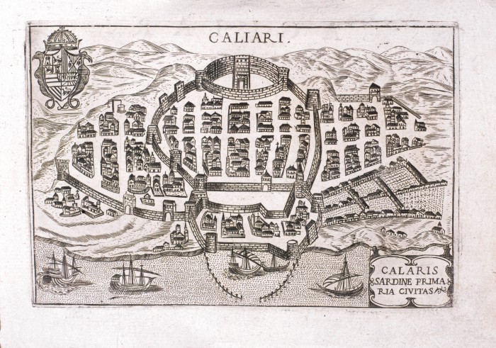
|
610-Calaris Sardine Primaria Civitas .
Author: Bertelli
Padova,1629 |
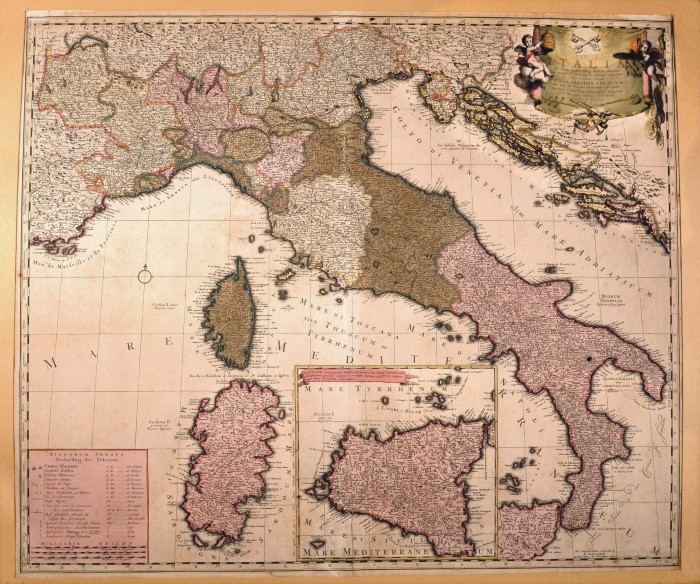
|
611-Italia in fous quoscunq Status divisa .
This map, measuring 50,4 x 59,4 cm and drawn by Carol Allard, was printed at the end of the 17th century in Amsterdam. It shows the Italian Peninsula with its numerous states, and the Islands of Corsica and Sardinia. Sicily appears in a separate square. The mountains are indicated by mole-hill reliefs and there is a description of the most important rivers and woods as well. A festoon on the top right contains the title. The graphic scales in Italic, German and Celtic miles are on the bottom left. Author: Carel Allard
Amsterdam,1697 |
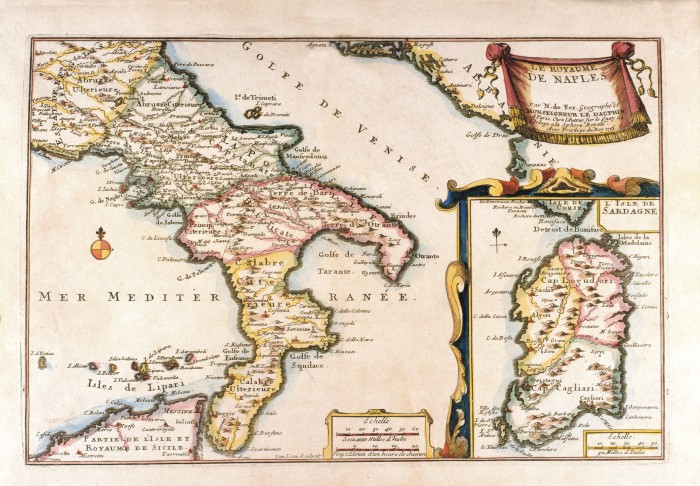
|
612-Le Royame de Naples .
This map, measuring 22 x 32,7 cm and drawn by N. de Fer, Geographe de Monseigneur de Dauphin, is taken from the Atlas curieux ou le Monde représenté dans les cartes générales et particulières du ciel et de la terre (...),printed in 1705 in Paris.
It is a beautiful coloured document. A festoon on the top right contains the title. The graphic scales Echelle Soixante Milles d'Italie and Vingt Lieues d’un heure de chemin are in a square at the bottom. The Sardinia Island with its own graphic scale appears separately on the right. Author: Dauphin
Paris,1705 |
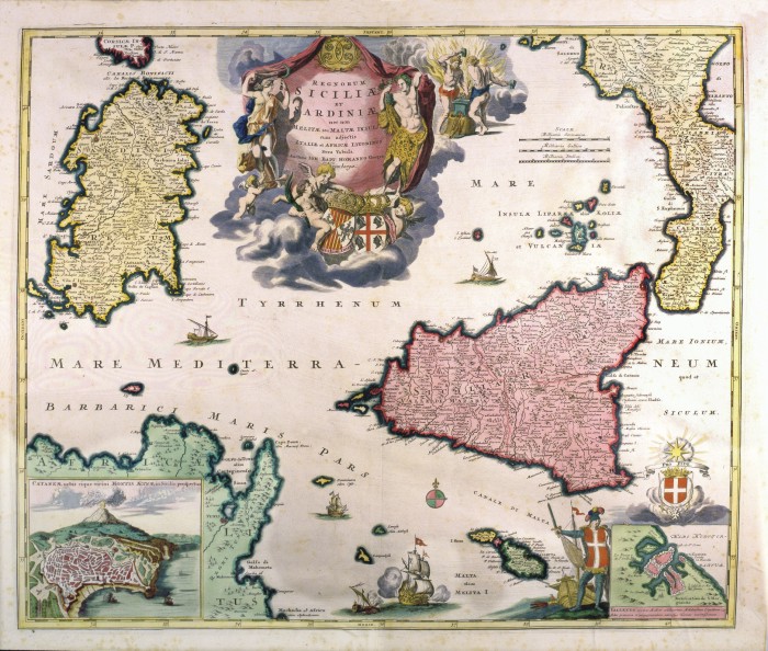
|
613-Siciliae e Srdiniae .
This map, measuring 48,8 x 57,7 cm and drawn by Johann Baptist Homann, was printed in 1705 in Nuremberg. It shows the South Tyrrhenian Sea with the islands and the surrounding territories. The town of Catania with Etna appears in a square on the bottom left; a festoon at the top contains the title; the graphic scales in Milliaria Germanica, Milliaria Italica, Milliaria Gallica are on the right. The mountain ranges are indicated by mole-hill reliefs, a rich river network and the most important towns and theirs fortifications, are described as well. There is a green-pink wind rose, several battleships and boats at sea. Author: Homann
Norimberga,1705 |
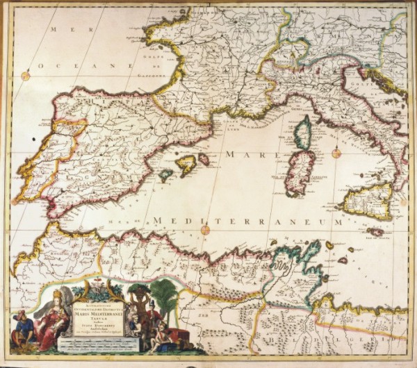
|
614-Maris Meditteranei .
This map, measuring 49,6 x 57,2 cm and drawn by Iusto Danckerts, was printed in 1710 in Amsterdam. It shows the Western Mediterranean basin, from the Strait of Gibraltar to Calabria. The title and the graphic scales in Milliaria Germanica Communia 15 in uno Gradu and Milliaria Gallica sive horae itinersi 20 in uno Gradu, are included in a sumptuous picture, surrounded by human figures and trees. The mountains are indicated by mole-hill reliefs and the towns are drawn with small perspective designs. Author: Danckerts
Amsterdam,1710 |
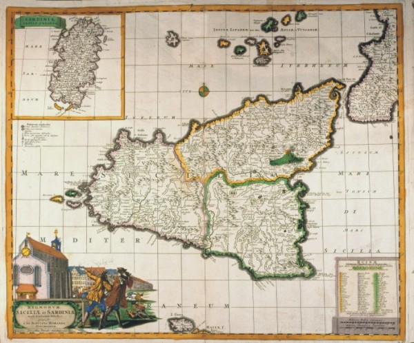
|
615-Regnum Siciliae et Sardeiniae .
his map, measuring 37 x 48 cm and drawn by Johann Baptist Homann, was printed by the editor Funke at the beginning of the 17th century in Nuremberg. It shows Sicily, divided in its three main parts, Etna and the smaller islands. Sardinia with its title of Sardiniae Insula & Regnum appears in a square on the top left. The main title however is included in a picture decorated with beautiful designs of a church, buildings and other scenes at the bottom left. There is also a square on the bottom right containing the names of the inhabited centres, destroyed by the big earthquake in 1693. The graphic scales in Milliaria Italica Communia and Milliaria Germanica Communia are just below it. Author: Homanno
Norimberga,0 |
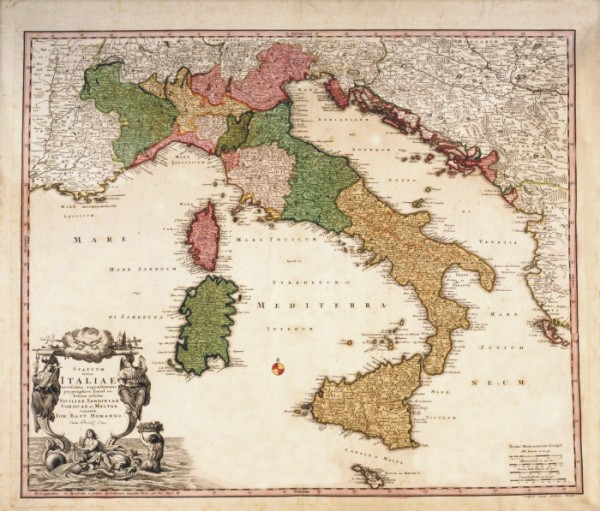
|
616-Statum totius Italiae .
This map, measuring 48,3 x 57 cm and drawn by Johann Baptist Homann, was printed at the beginning of the 18th century in Nuremberg. It shows the Italian Peninsula with the borders of numerous Italian States, Dalmatia, and a large part of the Balkans. The mountain ranges are indicated by mole-hill reliefs and the rivers, lakes and woods are described as well. Many female figures surround the title picture. The graphic scales in Milliaria Germanica, Milliaria Italica, Leuca Gallica are on the right. Author: Iohannes Baptista Homann
Norimberga,1700 |
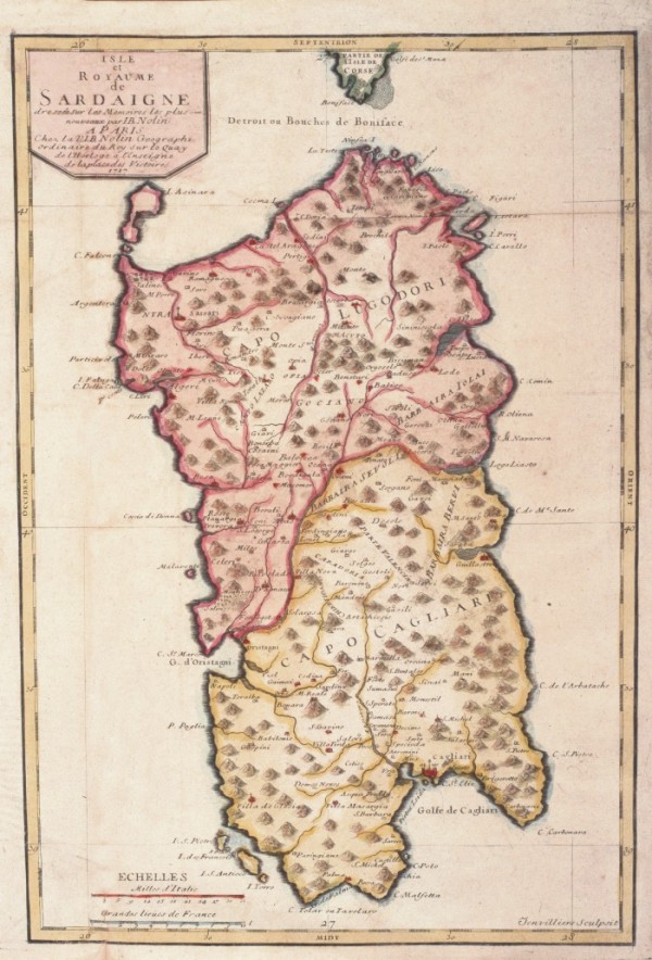
|
619-Isle et Royame de Sardaigne .
Color map, derived from an engraving in copper alloys by Jean baptiste Nolin (1657-1708). L Charter is taken from opera Le Theatre du Mond dedié au Roi pleased the cartes générales et particulieres roiames et des Etats qui le composent avec plusieurs provinces, published since 1700 ... the Charter was also used in other Atlas Nolin (Nouvelle edition du Theatre de la Guerre en Italie ..) The card that offers both Northern and southern areas in different colours, is graduated in low margins, there are 2 scales graphics. The coasts are dashed blue, hydrography represents the main watercourses, whereas I see is a bunch of mole.
Author: Jean Baptiste Nolin
Parigi,1717 |
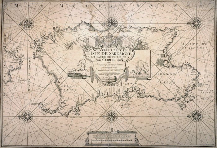
|
621-Novelle carte de l'Isle de Sardigne .
Map nautica and white representing the XIII table Atlas boat Michelot and Bremond. The title is placed at the Centre of Sardinia and is within a lable surmounted by the coat of arms of Louis XV. The map is enriched by 6 rose of the winds to 32-way. The card carries no indications on the island and offers only a few towns, towers coastal ponds and estuaries of major rivers
Author: Henri Michelot e Laurent Bremond
,1715 |
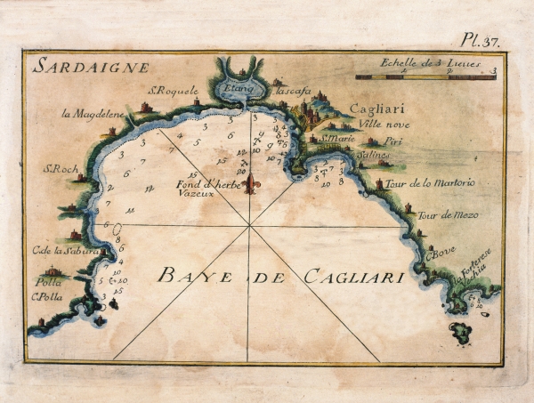
|
638-Baye de Cagliari .
Nautical Map of 1763that isura cm32x18 and it is found in the Petite Atlas Francois And' directed to South, the title is contained in a cartiglio and represents the gulf of Oristano and the damp zones of the southern Sinis.
Author: Joseph Roux
Marsiglia,1764 |
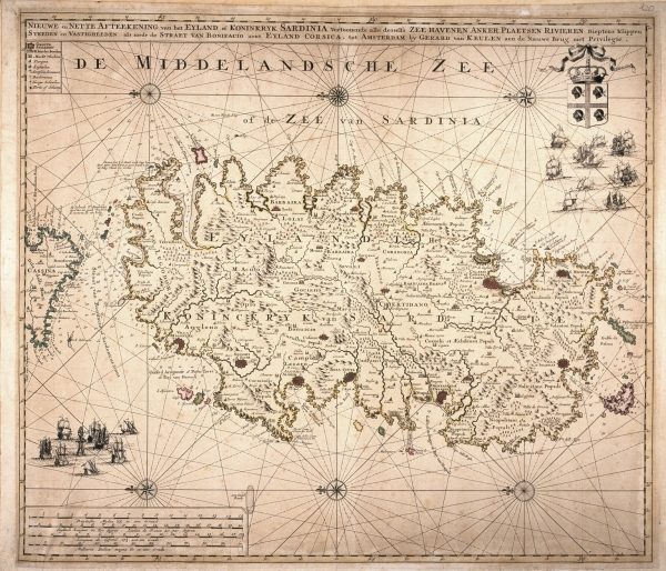
|
623-De Middelandsche Zee of de Zee van Sardinia .
Nieuwe en Nette aftekening van et Eiland of Koninkryk sardinia… it is Found in the Atlas printed maior to Amsterdam in the first decades of the XVIII century.
Author: Van Keulen
Amsterdam,1720 |
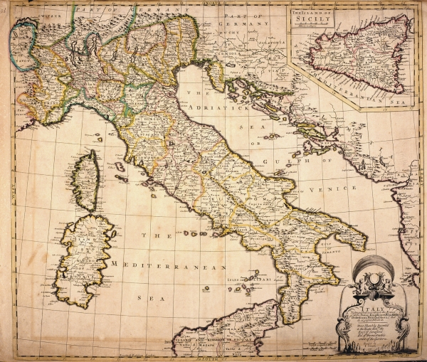
|
624-Italy .
This map, measuring 49 x 56 cm comes from the John Senex atlas A new General Atlas of the World, printed in 1721 in London. It shows the Italian Peninsula with the political subdivisions, Corsica and Sardinia. Sicily appears in a square at the top. The mountains are approximately indicated, the most important water courses and roads however are described more exactly. A decorative black and white picture contains the title and just beside it are two graphic scales in English computed Miles and Italian Miles. Author: John Senex
Londra,1721 |
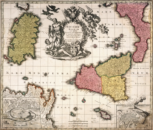
|
625-Siciliae Regnum e Insula di Sardinia .
The map, measuring 49 x 58,2 cm, is taken from the Mattäus Seütter Atlas Geographicus, printed in 1725 in Augsburg. Drawn by Johann Baptist Homann in 1705, it shows the Western Mediterranean basin with the islands of Sicily, Sardinia and Malta, Calabria and the North-Eastern of Tunisia with Cap Bon. The sumptuous title picture with several figurs and the Austrian blazon appears in the centre of the Tyrrhenian Sea. On the bottom left a square contains the town of Messina, on the right, a second one shows the town of Catania with the smoking Etna. Author: Seutter
Augusta,1725 |
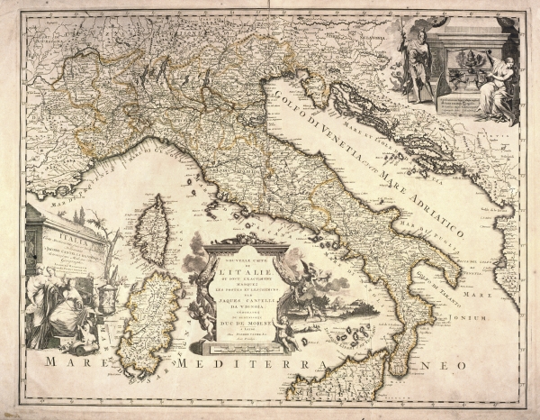
|
627-Nouvelle Carte de L'Italie .
The map was stamped to Leida in 1729 from Pierre Ander Aa.
Thankful arrichita to the center dl cartiglio that brings the title in Italian and to the left from a sefondo with the title in Latin, while aloft a third cartiglio explains to the right the simbologia.
Author: Pierre Ander
Leida,1729 |
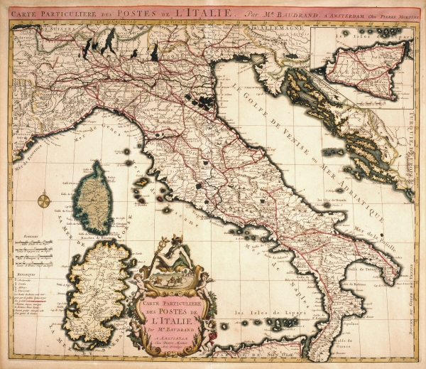
|
626-Carte Particulier des Postes de L'Italie .
This map, measuring 44,5 x 55,1 cm and drawn by Michel Antoine Baudrand, was printed in 1728 in the Pierre Mortier workshop in Amsterdam. It shows the Italian Peninsula, part of Provence, Istria, Dalmatia and the Islands of Corsica and Sardinia. On the top right is a square containing Sicily. The beautifully coloured title picture appears at the bottom. The graphic scales are on the left and a wind rose is over the sea. Author: Michele Antonio Baudrand
Amsterdam,1728 |
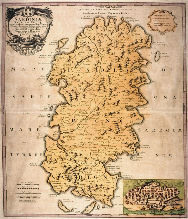
|
628-Sardiniae Regnum et Insula .
It is contained in the atlas "Isolario Geographical descrittione. Historica, Sacred-profane, Ancient-modern, Politics, Natural and Poetic. Seas, Gulfs, Breasts, Piagge, Brings, Boats, Peaches, Promontories, Mountains, Woods, Rivers, Lakes, Ponds, Baths, Volcani, Mines, Gems, Wealths and Coins; Iscrittioni, Languages, Governments, Armed Strengths, Wars, Alliances, Purchases, Losses, Truces, Treated of Peace, Claustral and Equestrian Religions, Concilj and Missions, Bishoprics, Archpriests and Patriarchies; Laws, Customs, Habiti, Coats of arms, Academies, Huomini Illustri and every most exact notitia of all the Islands Coll'osservationi of the rock-clifves, sirti, scagni, shoals of the globe terracqueo. Additional also the Drawn back de Dominators of them. Adorned of Three hundred-ten Geographical tables, Topographical, Corografiche, Iconografiche, Scenografiche, Idrografiche and Potamografiche. To great dilucidazione and use of the Navigatione. It is in supplement of the XIV Volumi of the Bleau. Tome II of the atlas Veneto. Work and study of the
Author: Vincenzo MariaCoronelli
Norimberga,1734 |
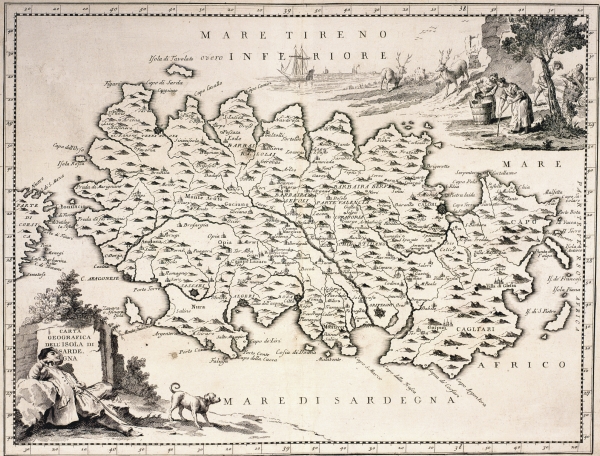
|
629-Carta Geografica della Isola di Sardegna .
The map is found In the work of Guillaume Delisle Atlas Novissimo that contains overall the parts of the momdo in which I/you/they am exactly descritti.stampato to Venice in the 1750. The crta derives from one of the Works of G. sanson
Author: Guillaume Sanson d'Abbeville
Venezia,1750 |
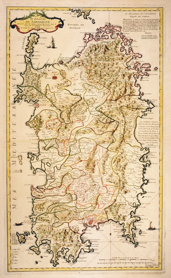
|
630-Le Royaume de Sardigne .
The map stamped in Paris in 1753 and the good cartographic document of the XVIII is considered secoloper how much it concerns the sardegna. And' note also as paper of the Piedmontese Engineers. Tall À a left is found unb cartiglio cn the tittolo and you/he/she is equipped by explanatory text.
Author: George Louis Le Rouge
Parigi,1753 |
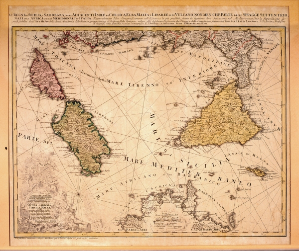
|
631-Li Regni di Sicilia e Sardegna .
The map it is found In the work of Guillaume Delisle Atlas Novissimo that contains overall the parts of the momdo in which I/you/they am exactly descritti.stampato to Venice in the 1750. The crta derives from one of the Works of G. sanson.
Author:
Norimberga,1762 |
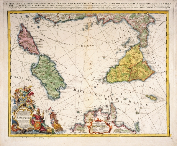
|
632-Li Regni di Sicilia e Sardegna .
The map, measuring 56,6 x 43,4 cm and drawn by Giovanni Antonio Rizzi Zannoni, is taken from the Atlas Maior Scholasticus, printed by the heirs of Homann in 1762 in Nuremberg. It shows the Tyrrhenian Sea with the three most important Mediterranean islands, part of the Italian peninsula and the North of Tunisia. A splendid title picture appears on the bottom left; the graphic scales in Italian and Mediterranean miles are included in a beautiful picture in the centre-bottom. It is an important map introducing considerable improvements in the cartographic precisionof that period. Author: Rizzi Zannoni
Norimberga,1762 |
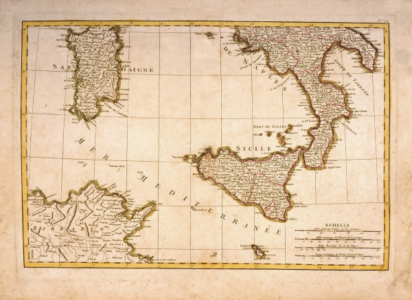
|
633-Sardegna e Sicilia .
Italy divided in you are different States than To. Zannoni lifts up. And' printed stat to Paris in 1762 and it measures cm 53,5 xes 39. It is found in the Atlas Modern ou collection de cartes sur tutes partes du terrestrial globe par plusieurs auteurs.
Author: A. Rizzi Zannoni
Parigi,1762 |
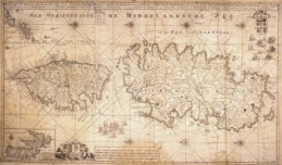
|
634-Sardegna Corsica e Isola d'Elba .
Nieuwe en Nette aftekening van et Eiland of Koninkryk sardinia… it is Found in the Atlas printed maior to Amsterdam in the first decades of the XVIII century.
Author: Van Keulen
,1718 |
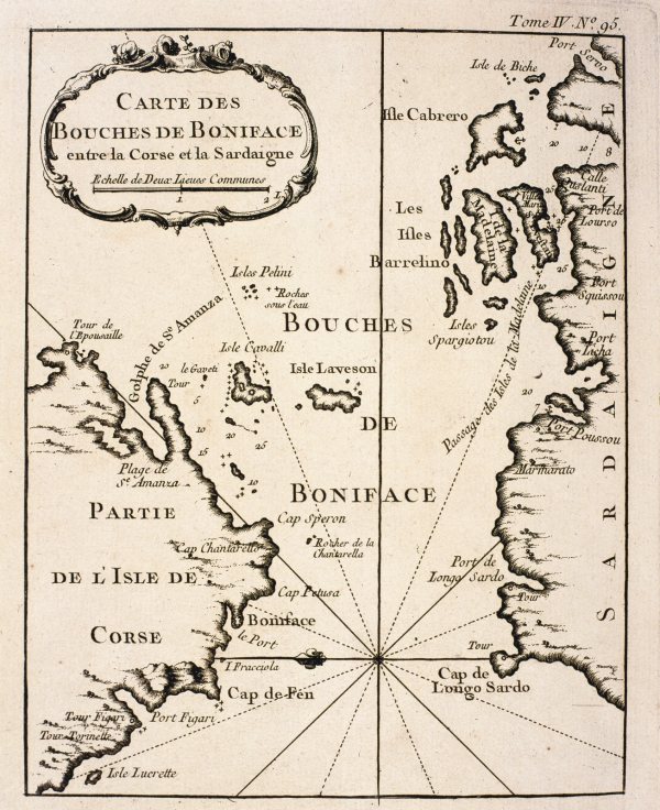
|
635-Carte des Bouches de Boniface .
Carte des Boucjhes de Boniface entre la Corse et la sardigne DI j.n. Bellin, 1763 nautical map, and it is found in the Petite Atlas Francois.
Author:
,0 |
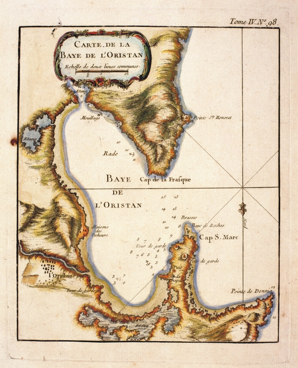
|
636-Carte de la Baye de l' Oristan .
Nautical map of the 1763 that isura cm32x18 and is found in the Petite Atlas Francois
It is oriented to South, the title is contained in a cartiglio and represents the gulf of Oristano and the humid zones of the southern Sinis. Author: J.N. Bellin
,0 |
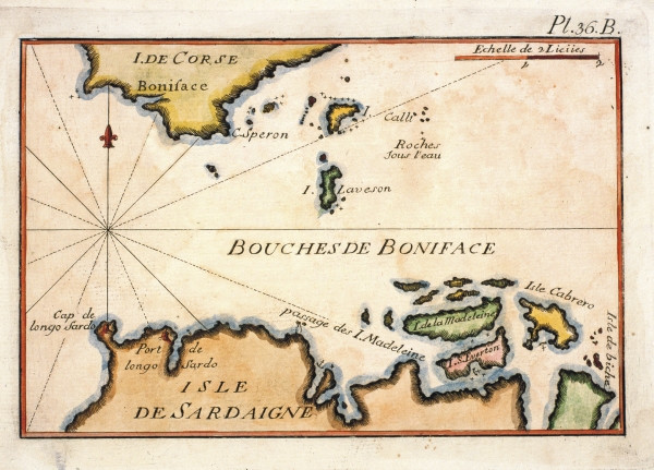
|
637-Bouches de Boniface .
Map of J. Roux stamped to Marsiglia in 1764, is found in Recueil des Principaux Plans and Rades dela Mer Mediterranée. It measures cm 14,6x21 and it proposes the narrow one of the mouths of Bonifacio and some islands of the archipelago of You Maddalena together with the coastal fortifications.
Author: J. Roux
Marsiglia,1764 |
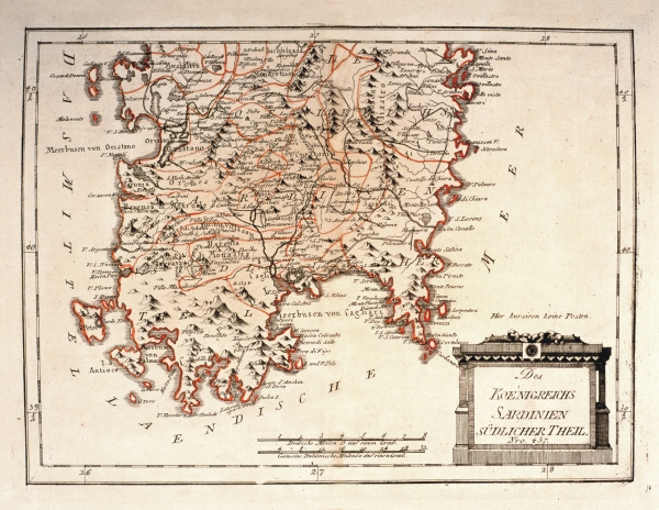
|
639- Des Koenigreichs Sardinien Sudlicher Theil .
Author: Franz Johann Joseph Von Reilly
Vienna,1789 |
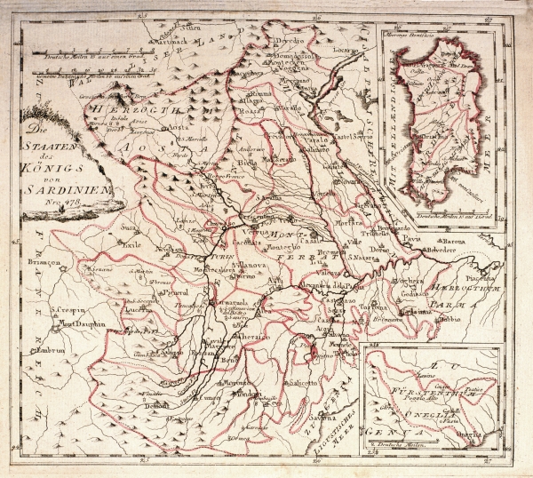
|
640-Die Staaten des Konigs von Sardinien .
This map, measuring 22,5 x 25,1 cm and printed in 1789 in Vienna, was drawn by Franz Johann Joseph von Reilly. It shows the Sardinian Kingdom's territory with the island in a square on the top right. At the bottom appears the Dukedom of Oneglia Genua. The title is on the left, the graphic scales are at the top. Author: Franz Johann Joseph Von Reilly
Vienna. PREZZO € 26.00,1789 |
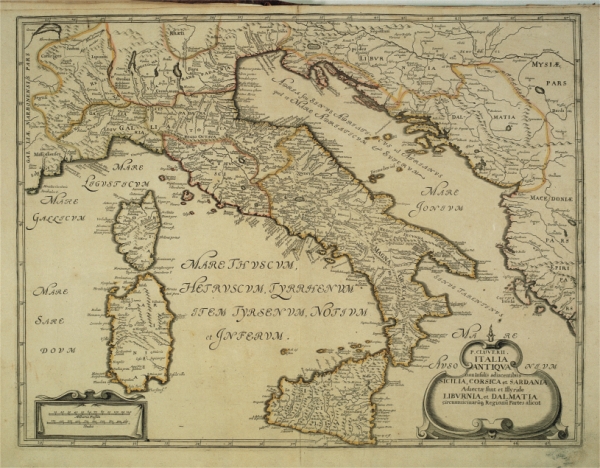
|
642-Italia Antiqua .
Author: Filippo Cluverio
,1624 |
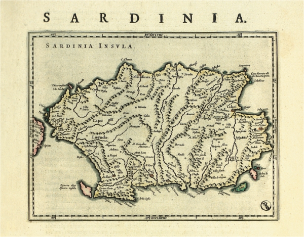
|
644-Sardinia Insula .
The map is contained in the edition in Latin language of the atlas Guil. Et Ioannis Blaeu Theatrum Orbis terrarum sive Atlas Novus. Pars Tertia, Amsterdami Apud Ioh & Cornelium Blaeu 1640. L.atlante was given to the presses in 1640 to Amsterdam from Willem Janszoon Blaeu and you/he/she was republished in numerous editions, also after his/her death, edited by his/her children Joannis and Cornelium. The work is composed of 358 pages and you/he/she is equipped of 61 papers; that of Sardinia is found to page 109. The initial part is reserved to Italy, and he/she understands 220 pages, Greece and Great Britain follow, which 7 and 8 pages are respectively devoted
Author: Guilelmus e Ioannis Blaeu
Amsterdam,1640 |
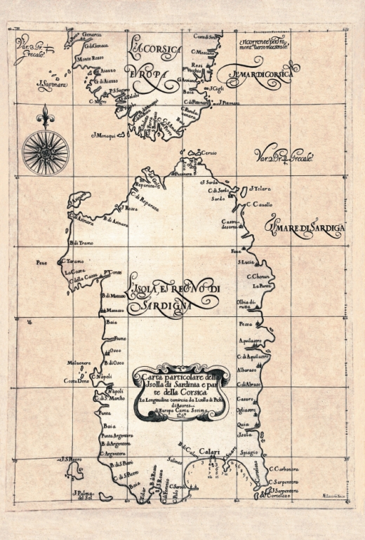
|
645- L'Isola e Regno di Sardegna .
The map, that measures cm 54,7x39,1 and in the sketch cm 34,5x48,7, are found in the Arcane atlas of the Sea of D. Ruberto Dudleo, Duke of Nortumbria and count of Warvich - Tome according to, container the sixth book - In which deals with his/her Maps Geographical, and Particular second Impression, Correct, increased, according to the original one of the same Excellent Signor Duca, that preserves him in the bookstore of the convent in Florence of the Peace, de' Monks of St. Bernard of the order Fuliense. With the index of the Chapters, and of the Figures and Instructions to' Booksellers to tie her. To the serene Ferdinando Secondo Granduca of Tuscany In Fiorenza 1661 In the New Stamperia for Joseph Cocchini, to the Stella's insignia to appeal of Jacopo Bagnoni and Anton Francis Lucini With License de' Superior. The arcane one of the Sea was for the navigators of the epoch a fundamental text, because it brought entirely data new and new methodologies on the navigation, on the naval architecture, on the maritime discipline and mili
Author: Robert Dudley
,1646 |
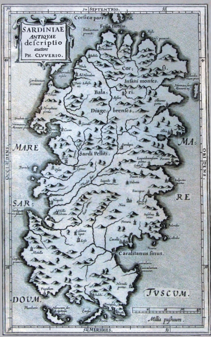
|
646- Sardinae Antiquae Descriptio .
The map is in the atlas Sicily Antiqua cum minoribus insulis ei adiacentibus item Sardinia et Corsica opus post omnium curas elaboratissimum, tabulis geographicis arc' expressis, illustratum. Ludguni Batavorum ex shop elseviriana. Year 1619.
Sardinia, represented to the table 3, you/he/she is accompanied by a description of the island equipped by many data and references of ancient authors that you/they have written some island. The map measures cm 20,5 xes 31,9 and in the sketch cm 28,4 xes 17,5, have been printed to Bologna in 1619 and it propose in the coastal profile of the island the formulation maginiana. The title, Sardiniae Antiquae descriptio, auctore Ph. Cluverio, is found to the left aloft in a situated quadrangular cartiglio, while in low to the right a graphic staircase of 40 millias is present passuum.
Author: Filippo Cluverio
Leyda,1619 |
|
647- Isola e Regno di Sardegna .
The map is in a composite volume that has as title Theater of the War and it is the n. 7 of a harvests of 11 colored presses. This document, that introduces aloft the North and it measures cm 64,6 xes 42,0 and in the sketch cm 61,5 xes 38,8, are part of a General Paper of Italy produced by unknown author at the end of the XVIII century; in the preserved volume in the library Casanatenses are present only some of the ten presses that compose this work, among which the first one represents western Sicily, and the second proposes a part of that oriental and of Calabria and contains a Table of the Longitude and Latitude of the places of the present paper fixed on the most recent astronomic observations and the indication that You latitude is taken by the first meridian of the island of the iron.
Among the other ones they are present the followings data that, he/she is specified, they have fixed above geographical combinations.
Author: Antonio Zatta
Livorno,1752 |
|
648-Sardegna centrale e meridionale .
The map, that center-southern Sardinia represents, as the preceding one is in the volume Theater of the War, it is the n. 10 of the harvest and it belongs to the edition of the General Paper of Italy it dates to the presses in the typography of Anthony Zatta in the 1798.
The document derives from an incision in copper, it is color acquerellato, introduces aloft the North, measure cm 64,3 xes 41,8 and in the sketch cm 61,4 xes 386.
Of this paper another edition is known, in black and white of which the author is not known, that has done reference to the paper called of the Ingenieurses Piemontois published by her Rouge in 1753 for the realization; from this last you/he/she has proposed the simbologia and line the divisions of the feudal districts. The writing Sardinia is set in the tall part of the sketch, the left border is graduated, and introduces a sweaters grid trapezoidal.
On the left side they are present well 18 graphic staircases that pointed out the unities of measure of the principals been Italian and European.
Author: Antonio Zatta
Livorno,1788 |
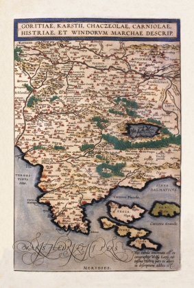
|
649-Goritiae, Karstii, Chacseolae, Carniolae, Historia et Windovum Marchae Descript. .
The map, that measures in the sketch cm 35,6 xes 23,5, is contained in the atlas Theatrum Orbis Terrarum of Abramo Ortelio, in the edition it dates to the presses in 1592 from the shop Plantiniana of Anversa. The document represents good part of western Slovenia and the Croazia Nord-occidentale with the Carso, l.Istria and the islands of the Quarnaro. The paper has been realized on the base of the jobs of Wolfgang Lazy and, as it regards the southern Istria with the data of another author not quoted. The islands are represented in schematic way and with an approximate sketch, with Vigil to West of Arbe instead that to North, North Cherso of Dislocates instead that to East; besides they have been neglected those smaller, despite is numerous a great deal. The island of Vigil (Vegia) is colored in pink, that of Arbe (Arbi) in brown dark color, Cherso (I will Dare) in brown clear and Dislocates (it Squeaks) in Rosa. The Map, graphically pleasant and very colored, introduces a rich orografia, with
Author: Abramo Ortelio
Anversa,0 |
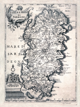
|
650-Isola e Regno di Sardegna .
The Map, that measures cm 24,5 xes 17,5 and in the sketch cm 22 xes 26, are found in the volume 1° of the Italian Store that contains history (...) and other arts and sciences that can be of education and to like for every kind of people, The, Livorno 1752. of education and to like, a periodical printed edited by Anthony Santini and companions in great plaza to Livorno in July of the 1752.
The sketch of the island, inserted among graduated edges, it is of clear formulation maginiana, with the five great oriental inlets and the Gulf of Cagliari opened to East. The title is inserted in a cartiglio set to the right aloft and adorned by shoots of grapevine; in low to the left it is, it foresees the coat of arms of the Kingdom of Sardinia instead with the four, dark and, below, the graphic staircase in miles of Italy. The North is suitable from a lily set above a circle
Author: Antonio Santini
Livorno,1752 |
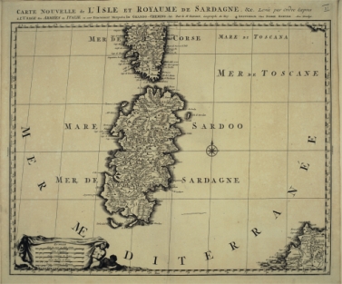
|
651-Carte nouvelle de l'Isale et royame de Sardagne .
It is contained in the atlas Nouveau Theatre of Italy Tom. III. contenant les Royaumes de Naples et de Sicile published to Amsterdam by Pierre Mortier in the 1704.
The atlas contains a harvest taken care of by the bookseller Pierre Mortier (1683 -1761), which used the papers stamped by Joannes Joan Blaeu (.1673), among which this paper of Nicola Sanson (.1667) was inclusive. The paper is graduated to the borders with a subdivision of 5' both for the latitude and for the longitude and it contains an inclusive space among 35°30' and 41°35' of latitude North and among 28°25' and 41°35' of East longitude from the meridian of the Green Head. In the paper the meridians and the parallels are brought and a rose of the winds is present with the North pointed out by a lily; every degree of latitude and longitude, is accompanied besides by the indication of a letter.
Author: Nicola Sanson
Amsterdam,1704 |
|
658 - Foto storica .
Author:
,0 |
|
657 - Foto storica .
Author:
,0 |
|
655 - Foto storica .
Author:
,0 |
|
656 - Foto storica .
Author:
,0 |
|
654 - Foto storica .
Author:
,0 |
|
653 - Foto storica .
Author:
,0 |
|
652 - Foto storica .
Author:
,0 |
|
659 - Foto storica .
Author:
,0 |
|
660 - Foto storica .
Author:
,0 |
|
661 - Foto storica .
Author:
,0 |
|
662 - Foto storica .
Author:
,0 |
|
683-Atlantico Orientale dall' Irlanda a Capo Palmas .
Author: Gerard van Keulen
Amsterdam,0 |

|
Dictionarie de Marine .
Author: Van keulen
,1702 |
|
681-Fluit Ship .
Author:
,1702 |
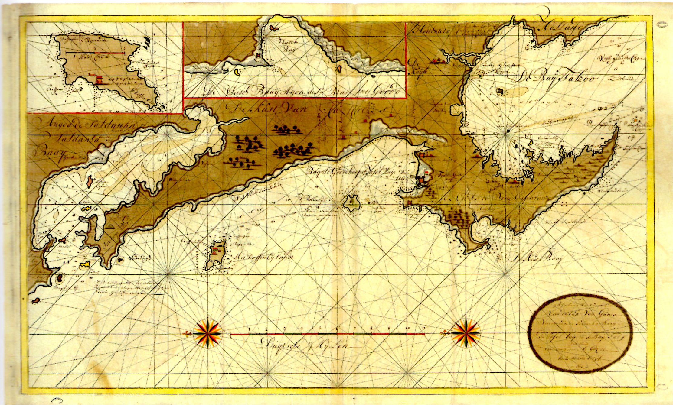
|
ca .
Author: Van Keulen
,0 |
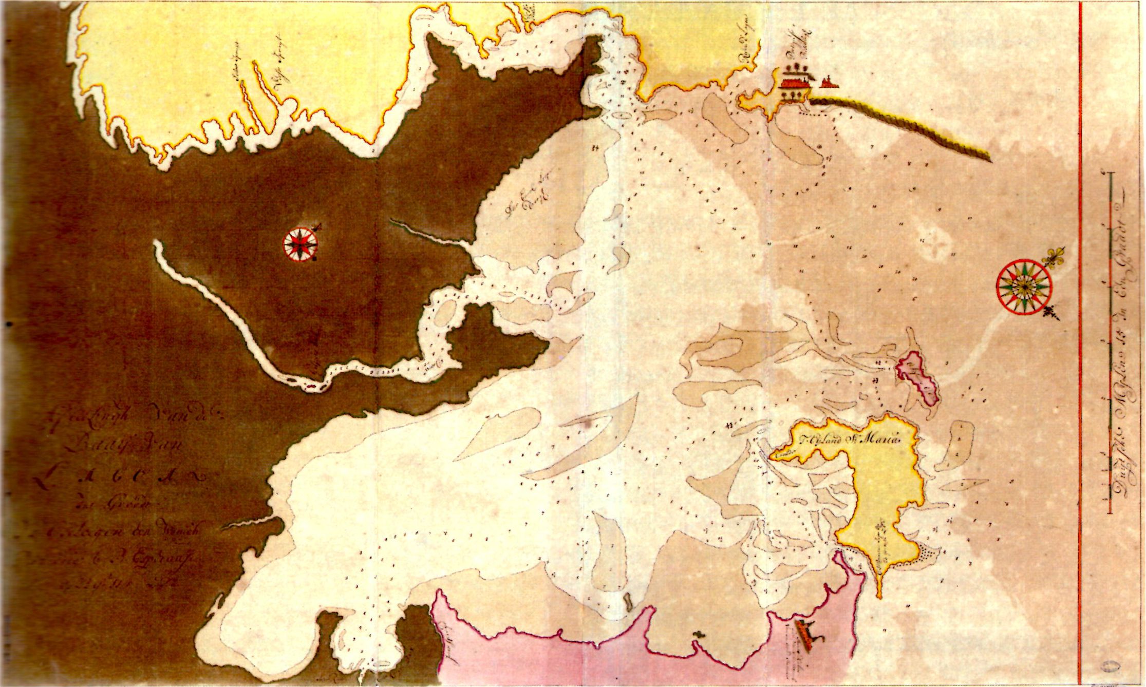
|
685-BAIA DI ALGOA .
Author: Van Keulen
,0 |
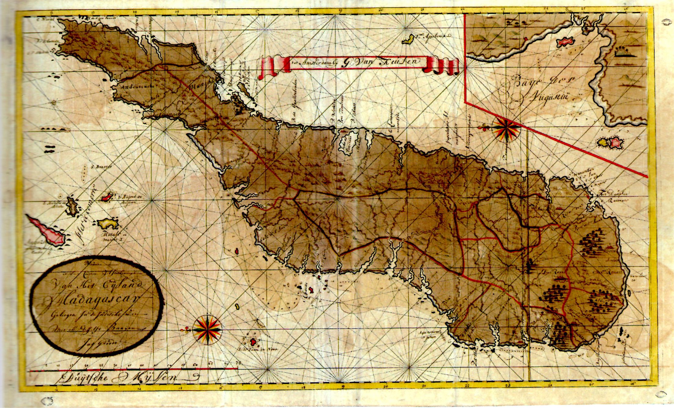
|
686-MADAGASCAR BAIA ST AUGUSTIN .
Author: Van Keulen
,0 |
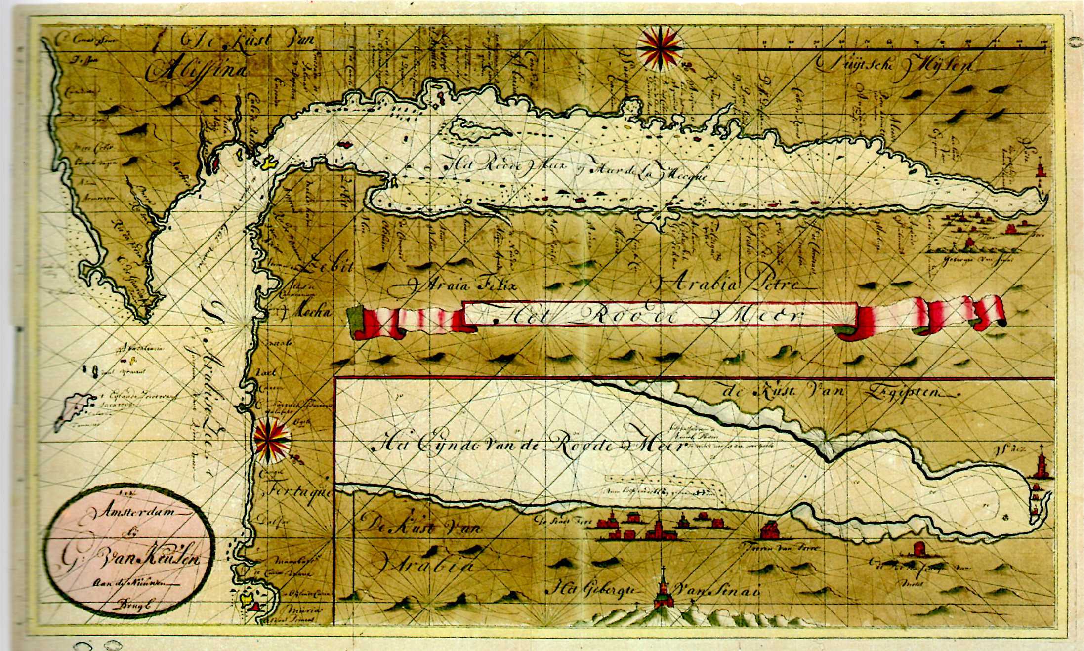
|
687-MAR ROSSO .
Author: Van Keulen
,0 |

|
688-BAIE MAR ROSSO .
Author: Van Keulen
,0 |
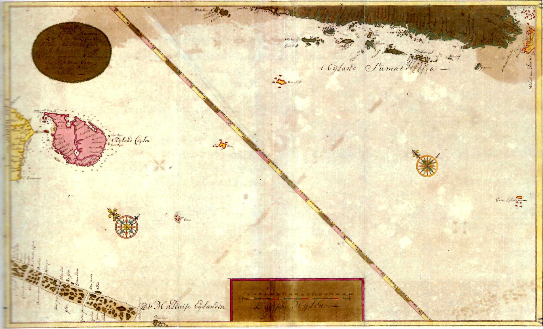
|
689-CEILON OCEANO INDIANO .
Author: Van Keulen
,0 |
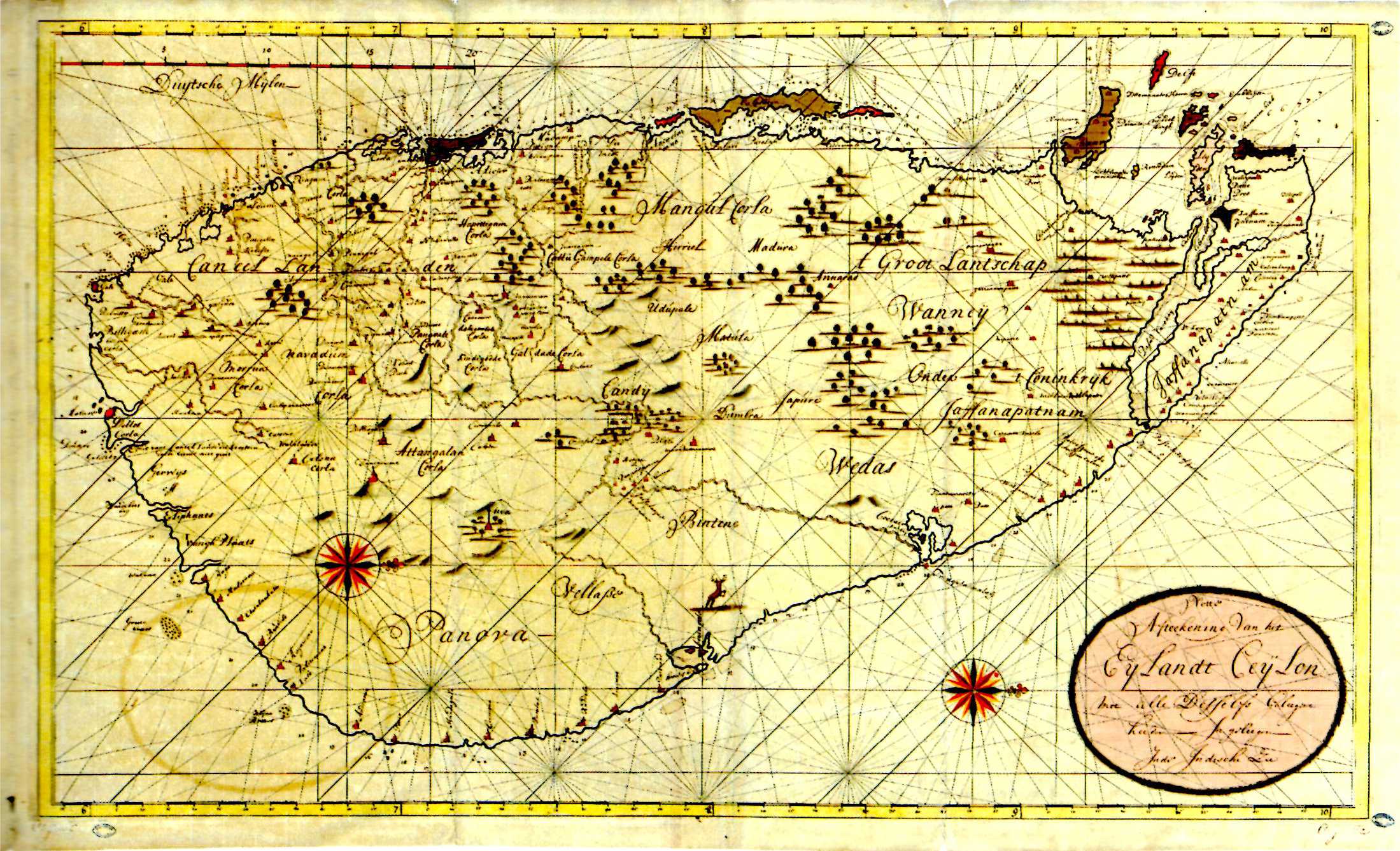
|
690-CEYLON .
Author: Van Keulen
,0 |
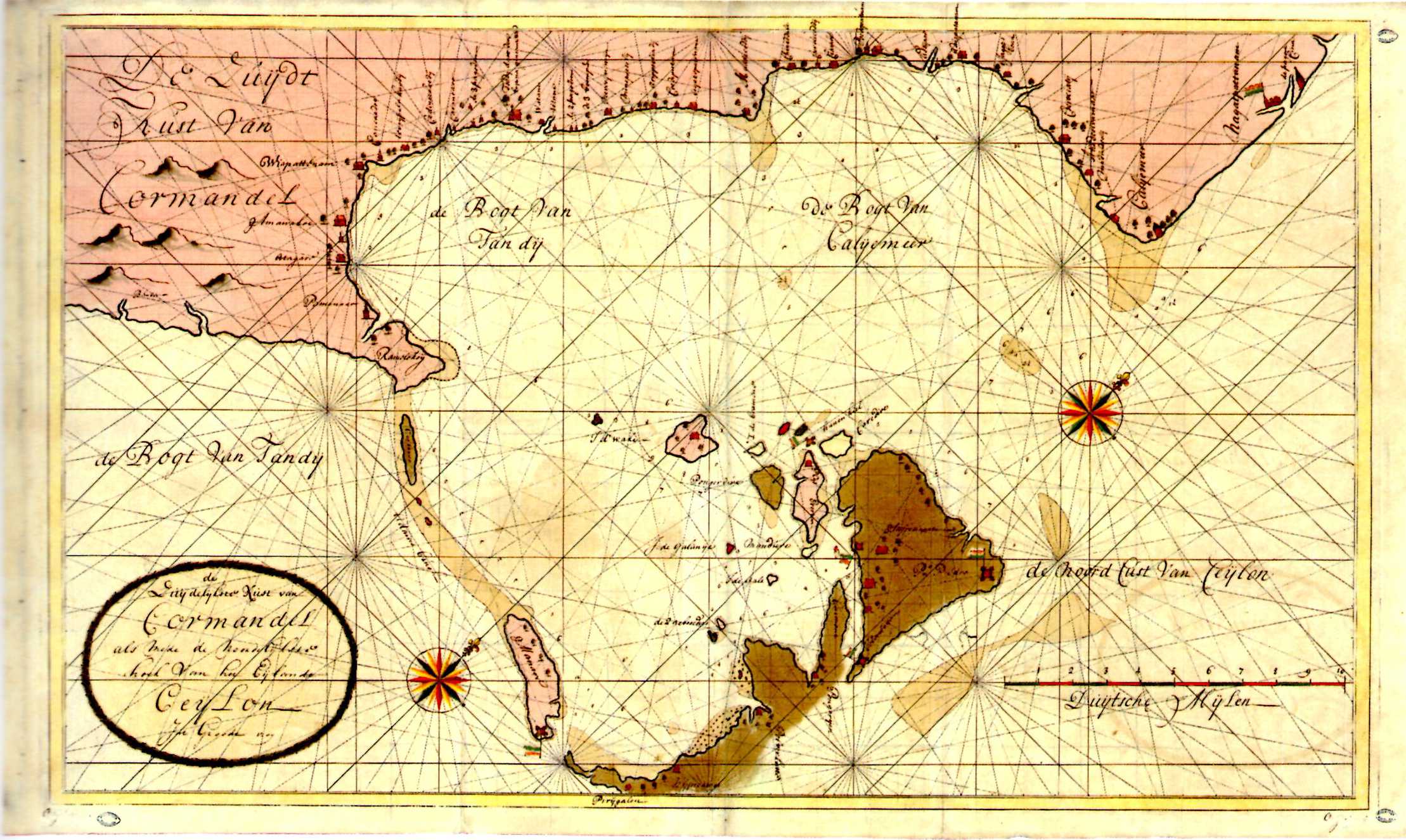
|
691-COSTA MERID. COROMANDELE E SETTENTR. CEYLON .
Author: Van Keulen
,0 |
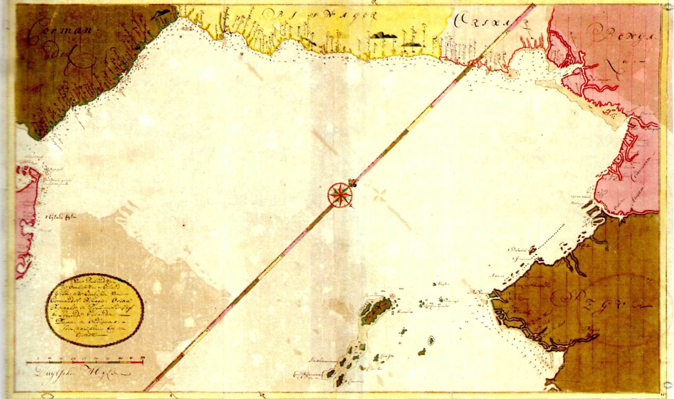
|
692-GOLFO DEL BANGALA .
Author: Van Keulen
,0 |
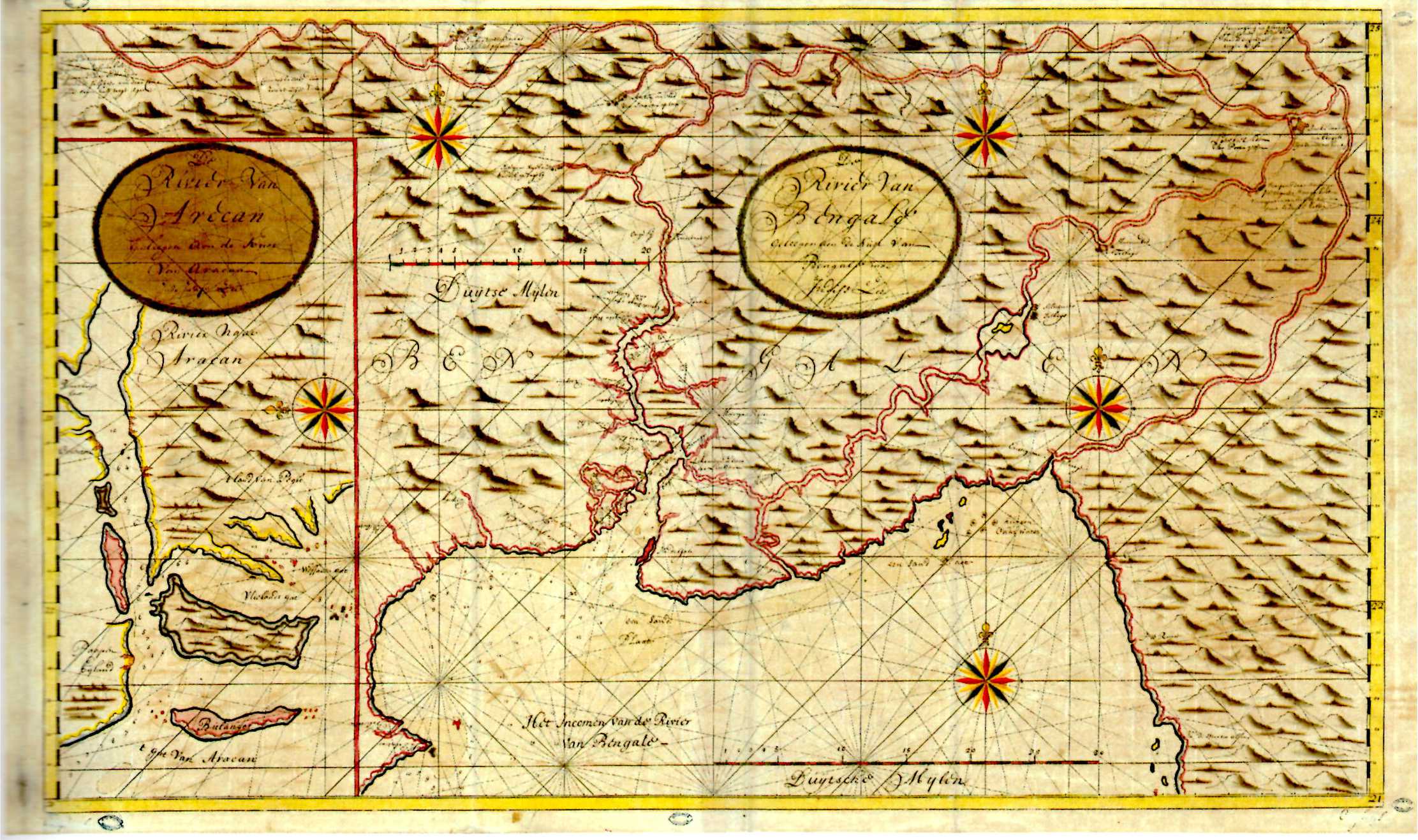
|
693-GOLFO DEL BENGALA DELTA DEL GANGE .
Author: Van Keulen
,0 |
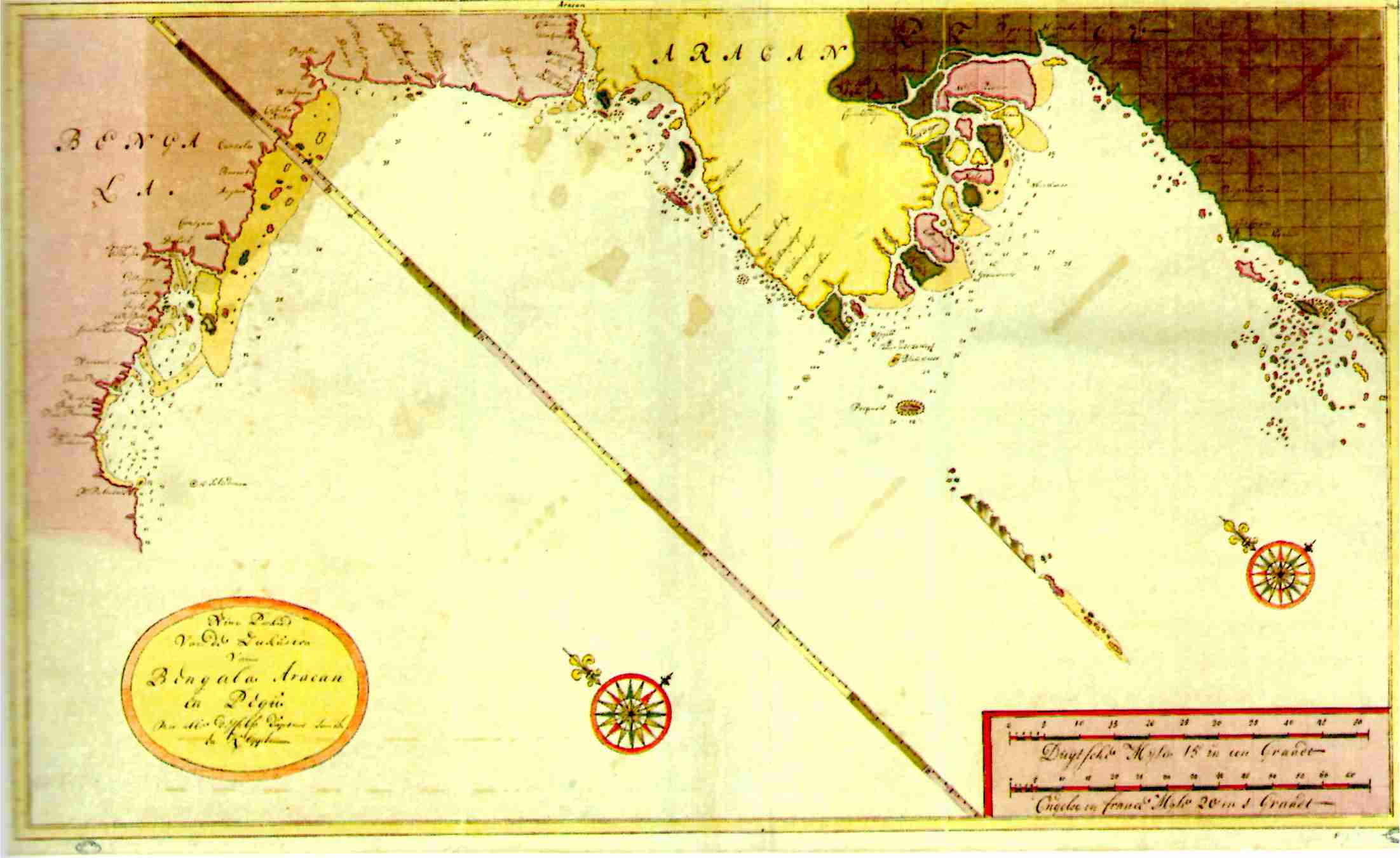
|
694-BENGALA E ARAKAN .
Author: Van Keulen
,0 |
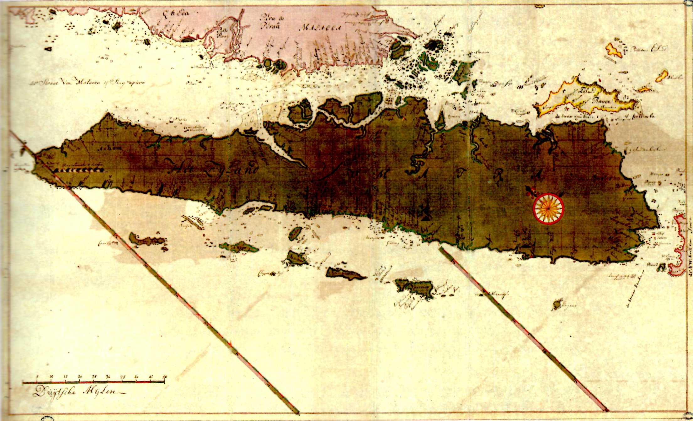
|
695-SUMATRA .
Author: Van Keulen
,1678 |
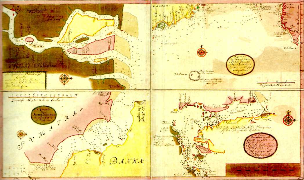
|
696-SUMATRA, SINGAPORE E ALTRI... .
Author: Van Keulen
,1678 |
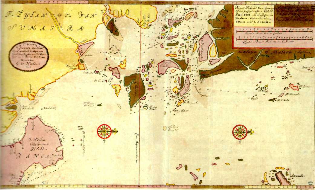
|
697-SUMATRA E LA COSTA MERIDIONALE DI MALACCA, DA BANGKA FINO ALLE ANAMBAS .
Author: Van Keulen
,1678 |
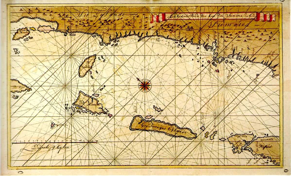
|
698-SUMATRA: COSTA OCCIDENTALE .
Author: Van Keulen
,1678 |
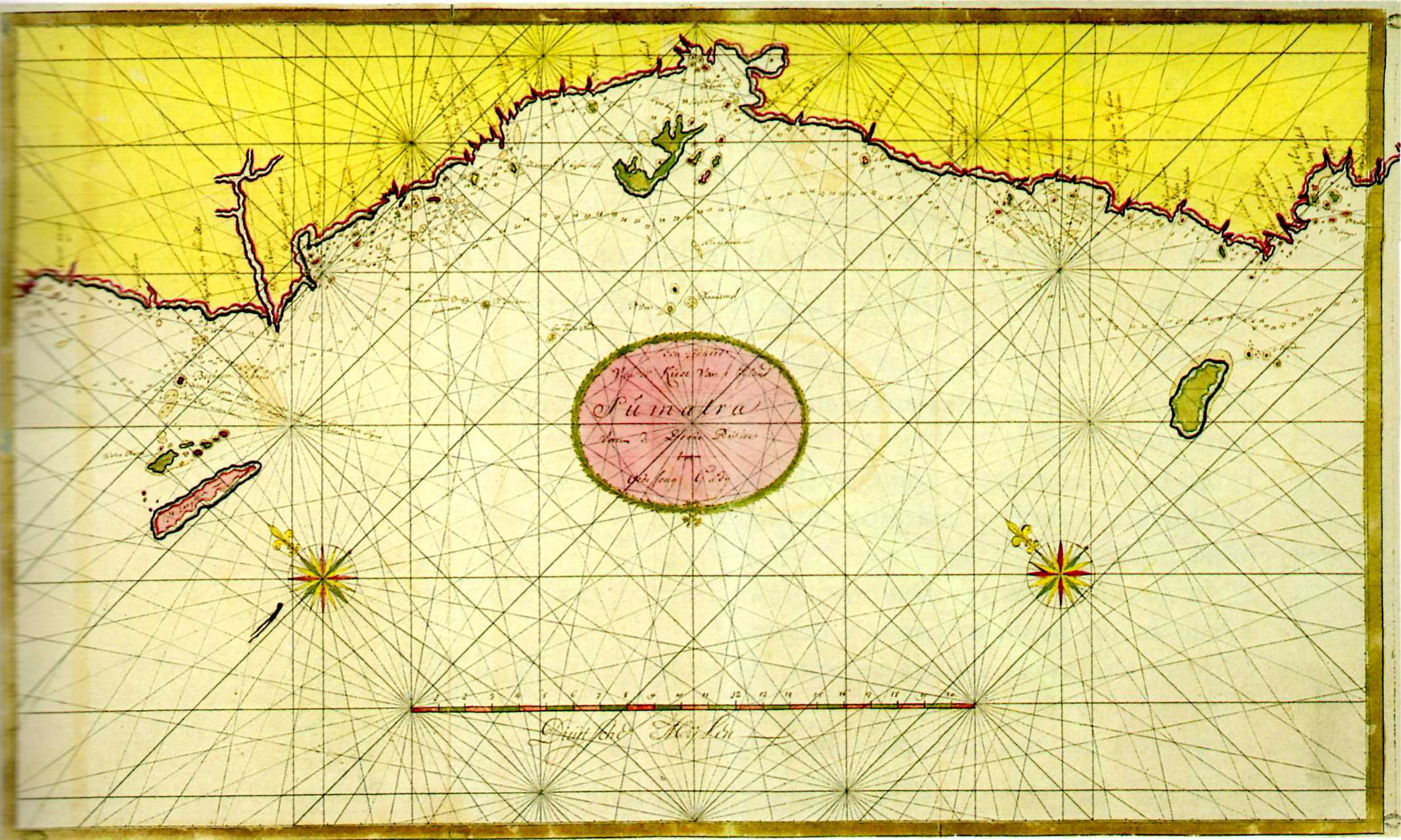
|
699-SUMATRA:COSTA OCCIDENTA.E.DA DOODE RIVER A UDJUNG RADJA .
Author: Van Keulen
,0 |
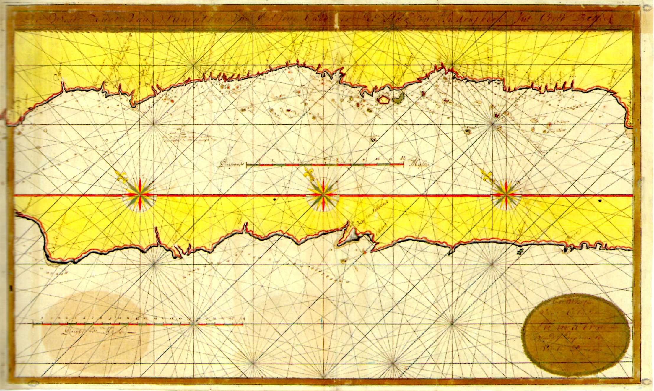
|
700-SUMATRA COSTA OCCIDENTALE .
Author: Van Keulen
,0 |
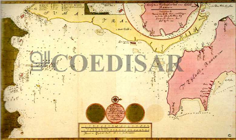
|
701-SUMATRA:COSTA OCCIDENTALE .
Author: Van Keulen
,0 |
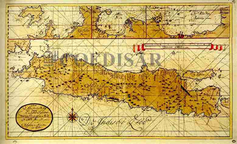
|
702-COSTA SETT DI GIAVA E COSTA SUD OR DI SUMATRA .
Author: Van Keulen
,0 |
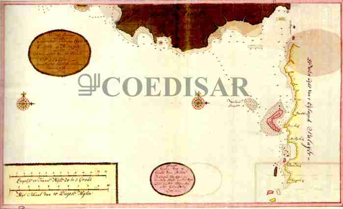
|
704-COSTA SUD-OCC DI CELENES E COSTA OCC DI SALAJAR .
Author: Van Keulen
,0 |
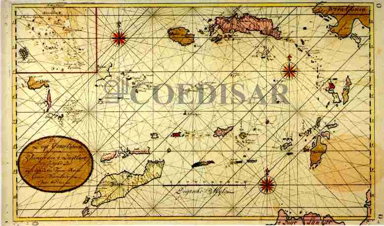
|
702-COSTA SETT DI GIAVA E COSTA SUD OR DI SUMATRA .
Author: Van Keulen
,0 |
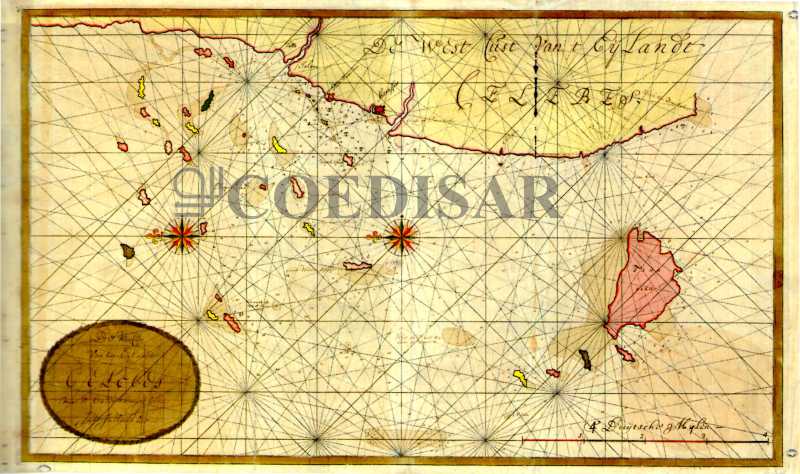
|
705-CELEBRES: COSTA OCC E ISOLE CIRCOSTANTI .
Author: Van Keulen
,0 |
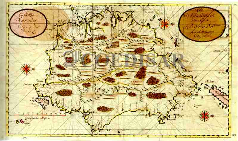
|
706-BORNEO .
Author: Van Keulen
,0 |
|
707-CINA: COSTE SUD-ORIENTALI .
Author: Van Keulen
,0 |
|
708 CINA COSTE SUD-OR ISOLA DI QUEMOY BAIA DI ERASMUS .
Author: Van Keulen
,0 |
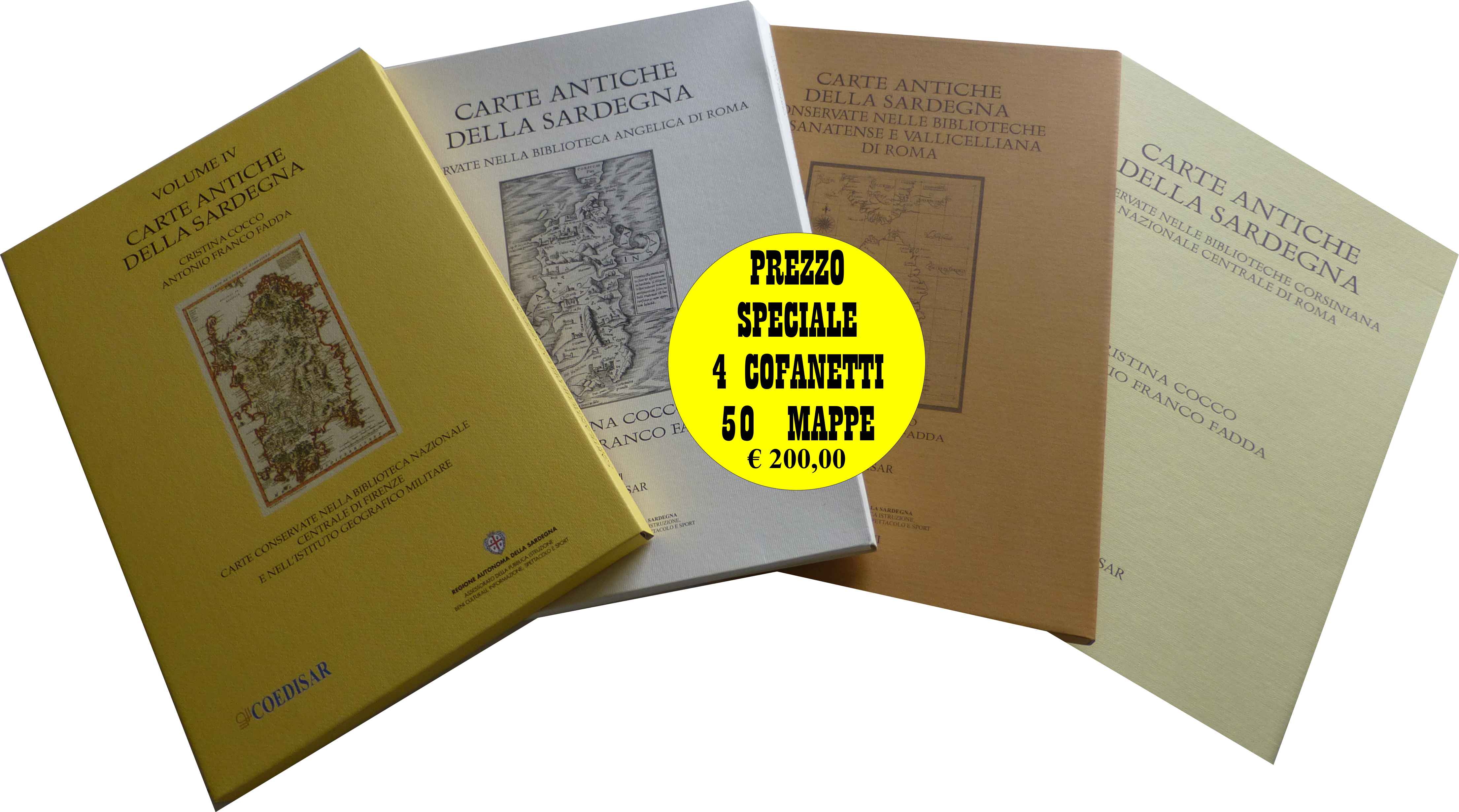
|
709-QUATTRO COFANETTI CARTE ANTICHE .
Author:
,0 |
|
716 - TERRITORIO DI RAVENNA .
Author: Vincenzo Maria Coronelli
Venezia,1690 |
|
713 - RAVENNA .
Author: Vincenzo Maria Coronelli
,0 |
|
717 - Foce del Po e Ravenna .
Author: Vincenzo Maria Coronelli
Venezia,1596 |
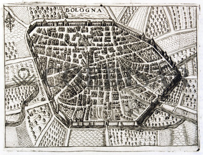
|
718 - Bologna .
Author: Vincenzo Maria Coronelli
,0 |
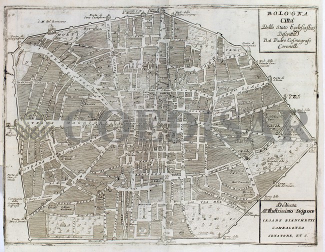
|
719 - Bologna .
Author: Vincenzo Maria Coronelli
,0 |
|
720 - INDIAE OCCIDENTALIS .
Author: ANTONIO DE HERRERA
FRANCOFORTE,1624 |
|
721 - INDIAE OCCIDENTALIS .
Author: ANTONIO DE HERRERA
FRANCOFORTE,1624 |
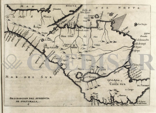
|
722 - Audiencia de Guatimala .
Author: Antonio de Herrera y Tordesillas
Madrid,1601 |
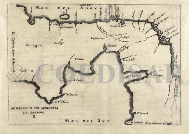
|
723 - Audiencia de Panama .
Author: Antonio de Herrera y Tordesillas
Madrid,1601 |
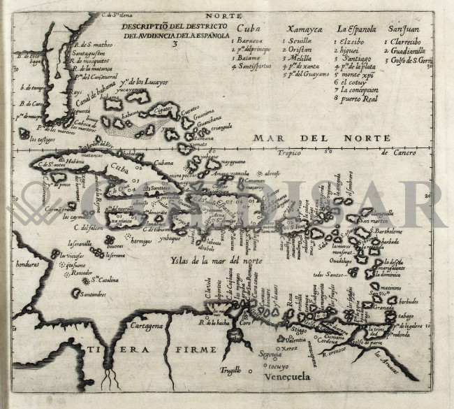
|
724 - Audiencia dela Espanola .
Author: Antonio de Herrera y Tordesillas
Madrid,1602 |
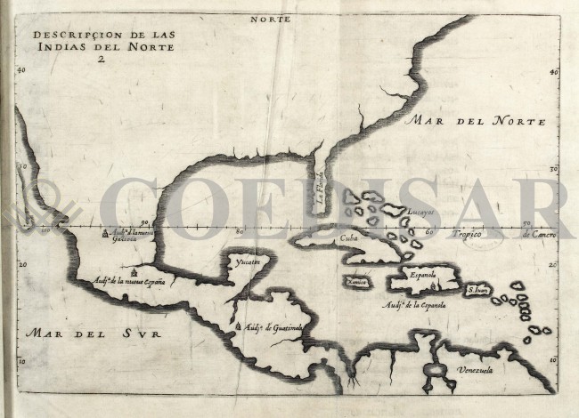
|
725 - Idias del norte .
Author: Antonio de Herrera y Tordesillas
Madrid,1601 |
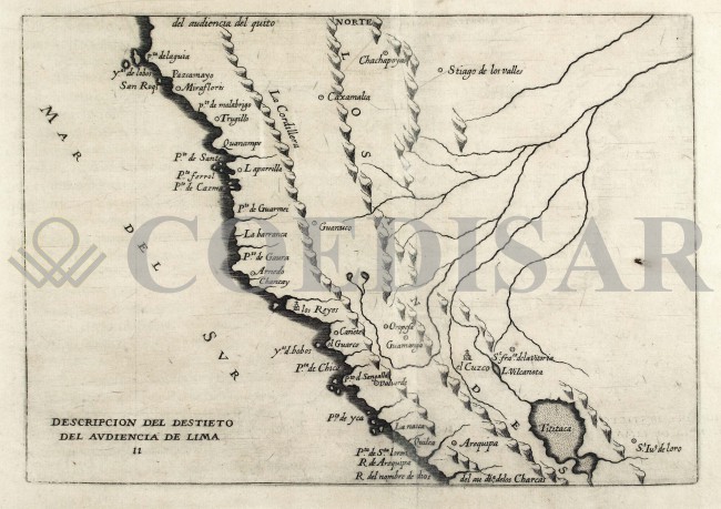
|
726 - Audiencia de Lima .
Author: Antonio de Herrera y Tordesillas
Madrid,1601 |
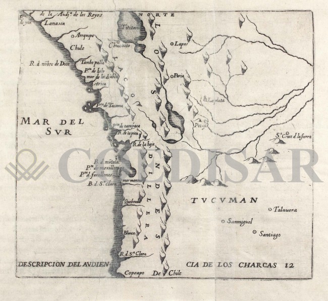
|
727 - Audiencia de los Charcas .
Author: Antonio de Herrera y Tordesillas
Madrid,1601 |
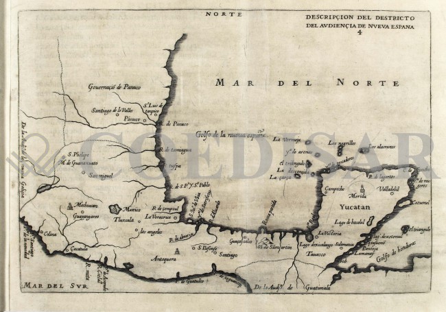
|
728 - Audiencia de Nueva Espana .
Author: Antonio de Herrera
Madrid,1601 |
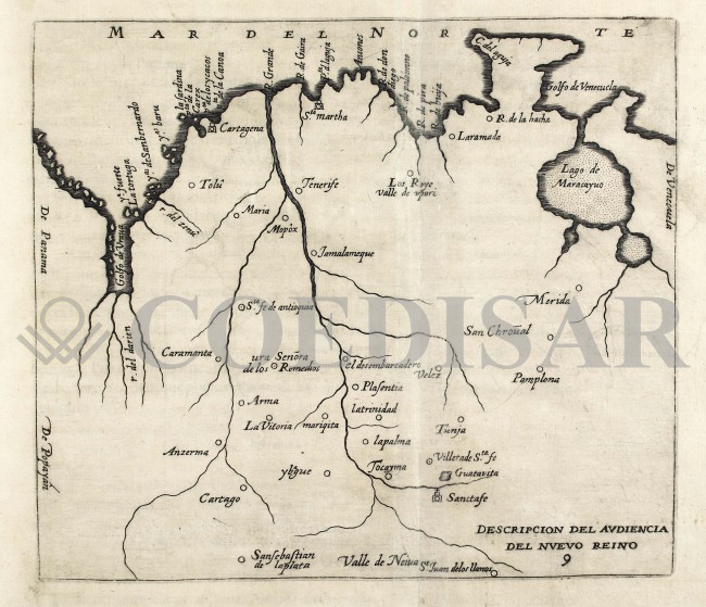
|
729 - Audiencia del Nuevo Reino .
Author: Antonio de Herrera y Tordesillas
Madrid,1601 |
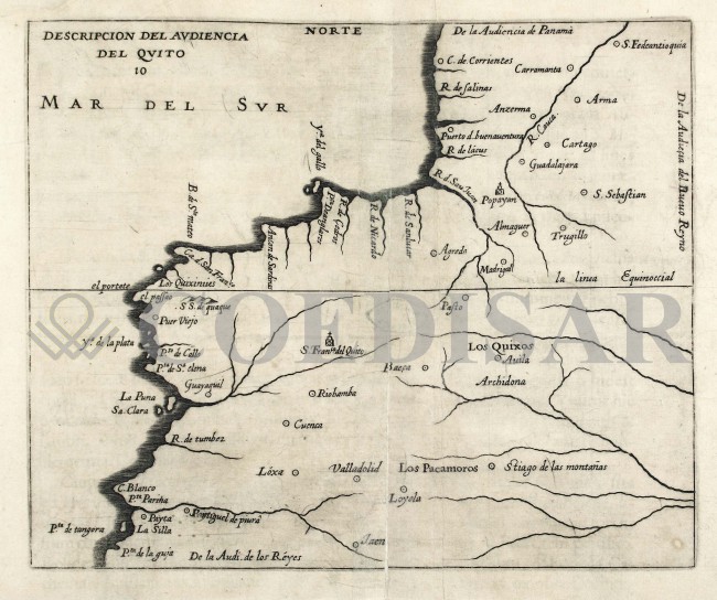
|
730 - Audiencia del Quito .
Author: Antonio de Herrera y Tordesillas
Madrid,1601 |
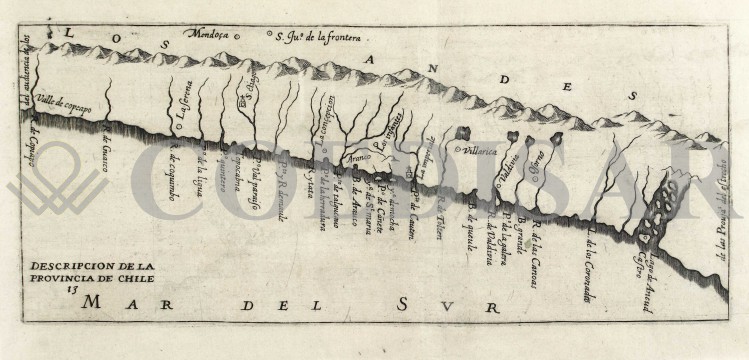
|
731 - Provincia de Lima .
Author: Antonio de Herrera y Tordesillas
Madrid,1601 |
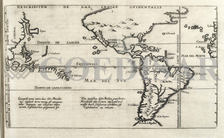
|
734 - Indias ocidentalis .
Author: Antonio de Herrera y Tordesillas
Madrid,1601 |
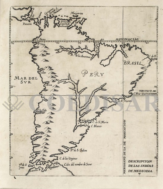
|
732 - Indias de mediodia .
Author: Antonio de Herrera y Tordesillas
Madrid. PREZZO € 25.00,1601 |
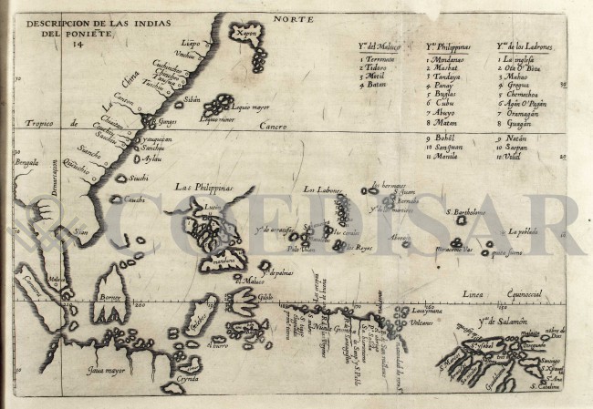
|
735 - Indias del poniete .
Author: Antonio de Herrera
Madrid,1601 |
|
736 - A new map of the dominions of the King of Sardinia .
Author: Francis De Caroly
,1799 |
|
737 - Cina .
Author: Johan Nieuhof
Amsterdam,1655 |
|
738 - Legatio Batavica .
Author: Johan Nieuhof
,1655 |
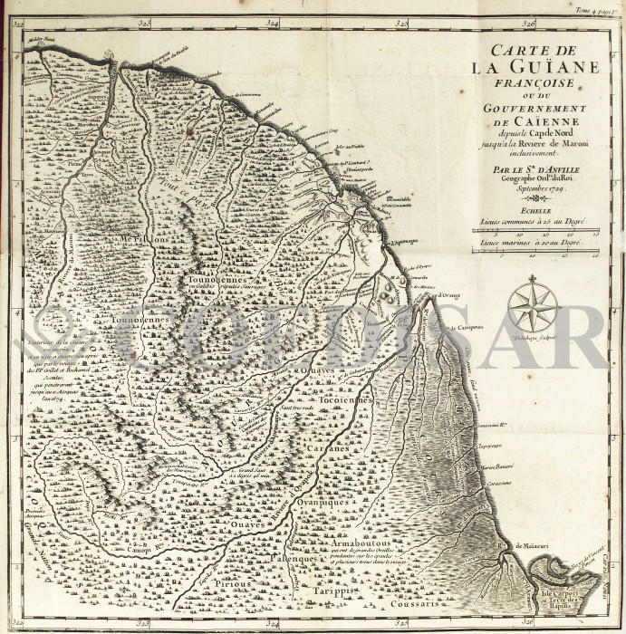
|
744 - Carte de la Guiane françoise ou du Gouvernement de Cayenne .
Author: Jean Baptiste Bourguignon d'Anville
Amsterdam,1729 |
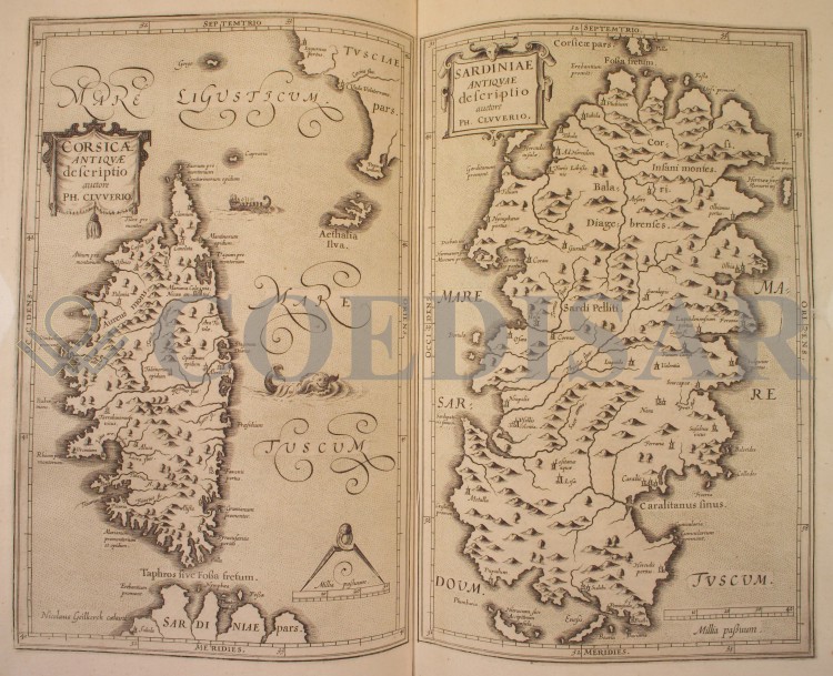
|
739 - Descriptio Legationis Batavica .
Author: Filippo Cluverio
,1619 |
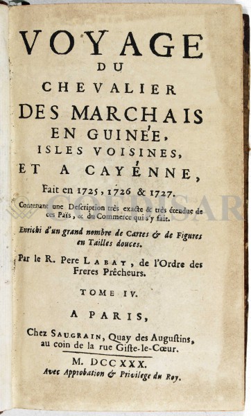
|
743 - Voyage du chevalier des Marchais en Guinée, isles voisines, et a Cayénne .
Author: Per Labat
,1730 |
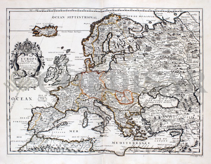
|
741 - L'Europe .
Author: Pierre Du Val
,1686 |
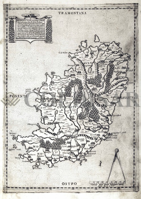
|
745 - Hibernia .
Author: Paolo Forlani
Venezia,1565 |
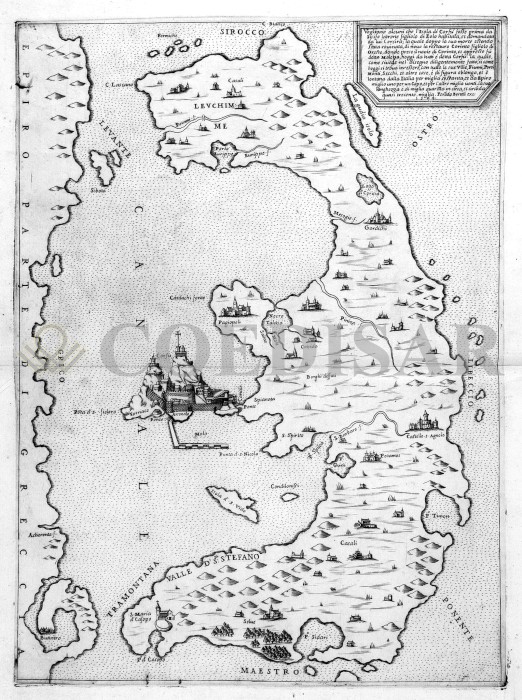
|
746 - Corfù .
Author: Ferdinando Bertelli
Venezia,1564 |
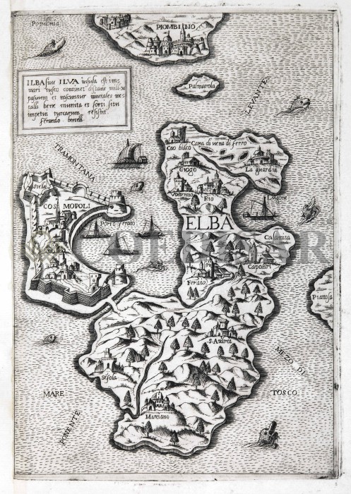
|
747 - Elba .
Author: Ferdinando Bertelli
,1560 |
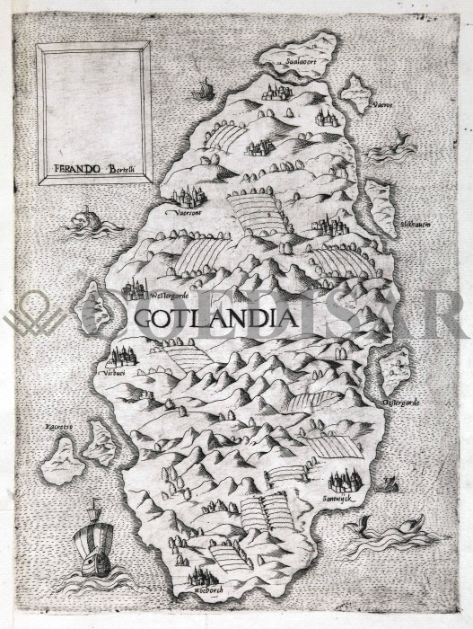
|
748 - Gotlandia .
Author: Ferdinando Bertelli
,1550 |
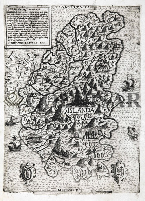
|
749 - De Islanda Insula .
Author: Ferdinando Bertelli
Venezia,1566 |
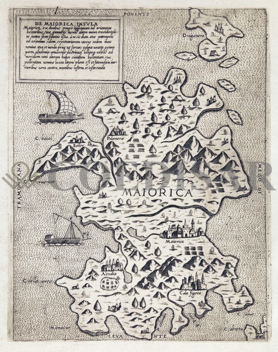
|
750 - De Maiorica Insula .
Author: Ferdinando Bertelli
,1565 |
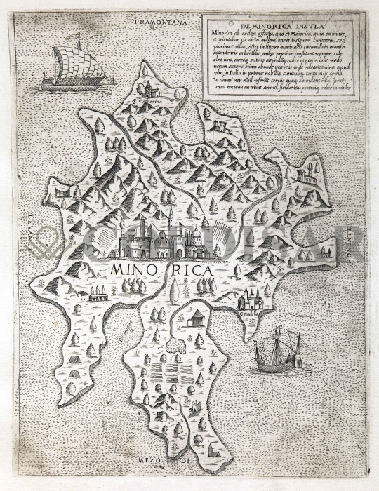
|
751 - De Minorica Insula .
Author: Ferdinando Bertelli
,1565 |
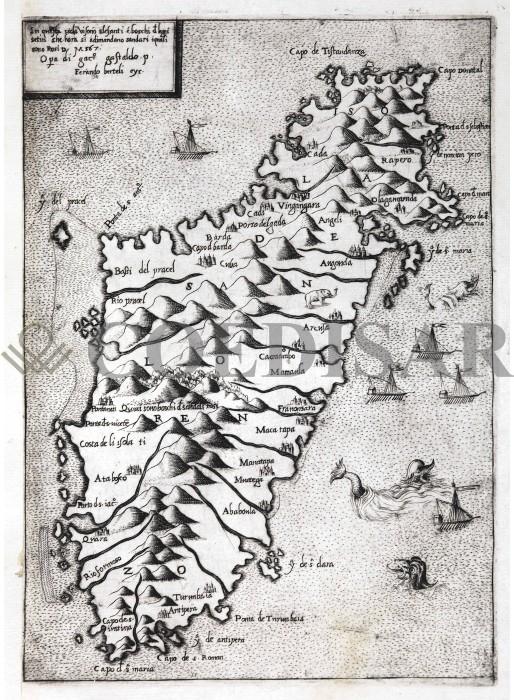
|
752 - Isola di San Lorenzo .
Author: Ferdinando Bertelli
,1567 |

|
753 - Isola de Malta .
Author: Giacomo di castaldi, Fabio Licinio
Venezia,1550 |
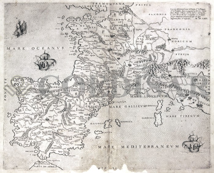
|
754 - La vera descrizione di tutta la Francia, e la Spagna, e la Fiandria .
Author: Ferdinando Bertelli
,1554 |
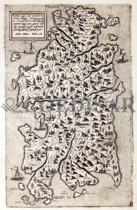
|
755 - Sardegna .
Author: Ferdinando Bertelli
Venezia,1562 |
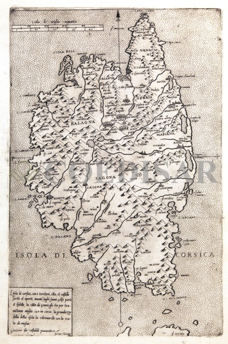
|
756 - Isola di Corsica .
Author: Giacomo di Castaldi, Fabio Licinio
,1560 |
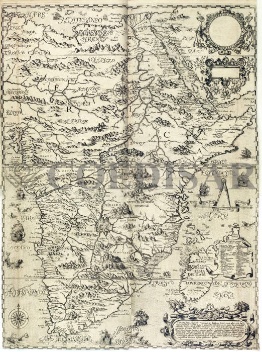
|
757 - Africa .
Author: Filippo Pigafetta
Francoforte,1598 |
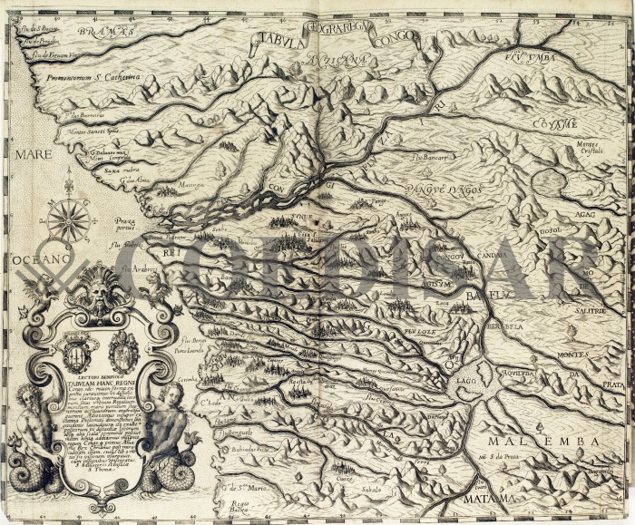
|
758 - Tabula Geografica Regni Congo .
Author: Filippo Pigafetta
,1598 |
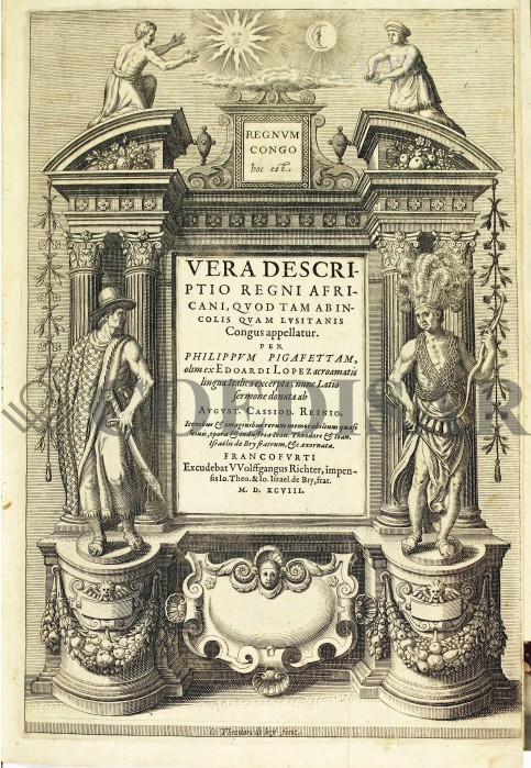
|
759 - Vera Descriptio Regni Africani .
Author: Filippo Pigafetta
,1598 |
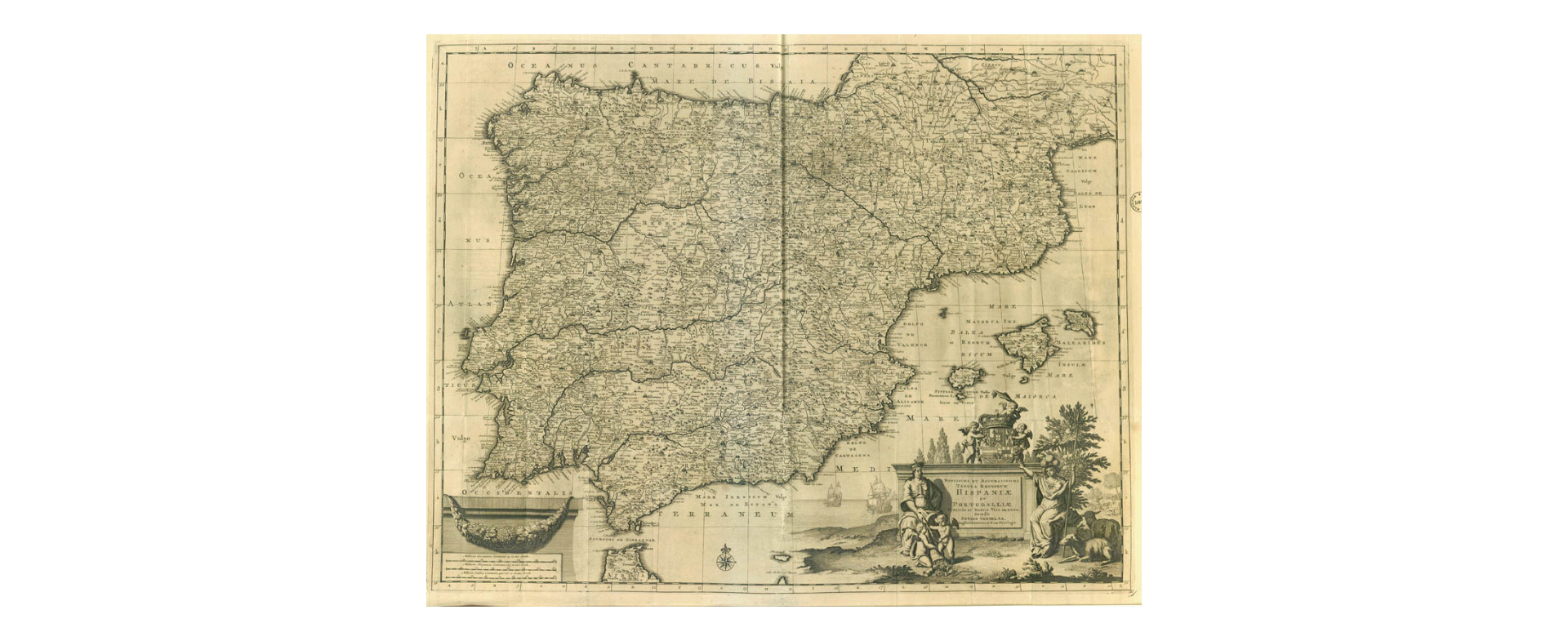
|
860-Hispaniae et Portugalliae .
Author: Pieter Van Der Aa
,1729 |

|
855-Pianta levata della città di Costantinopoli .
Author: Lonati
,0 |
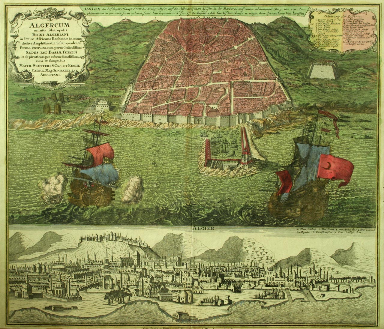
|
854-Algercum munita Metropolis Regni Algeriani…… .
Author: Matthaeus Seutter
,0 |

|
853-Carte des Régences d'Alger, de Tunis, et de Tripoli, avec l'Empire de Maroc .
Author: 1843 Eustache Hérisson
,1843 |

|
852- Carte de la colonie française d'Alger, de la régence de Tunis et de la partie nord .
Author: J.M Darmet
,1836 |
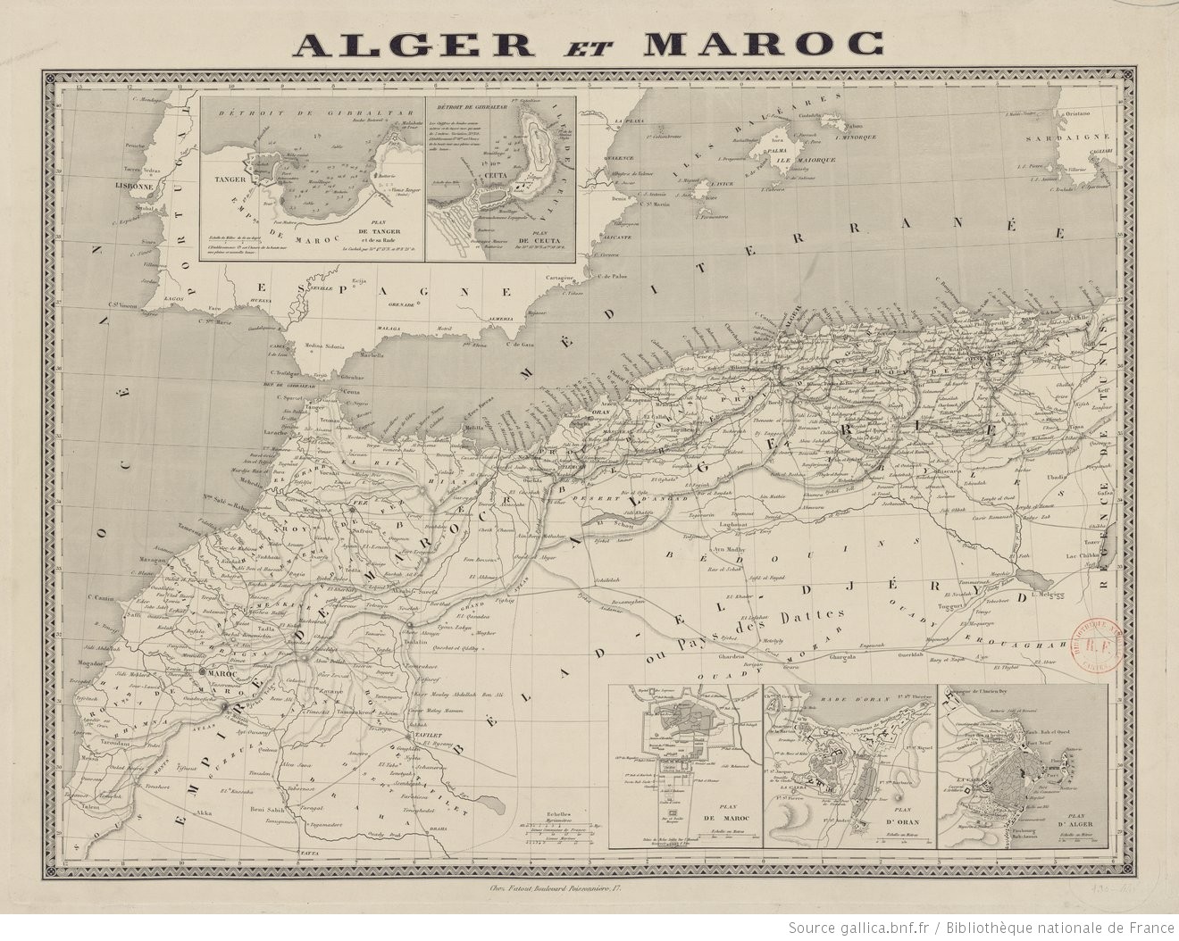
|
851-Alger et Maroc .
Author:
,1844 |
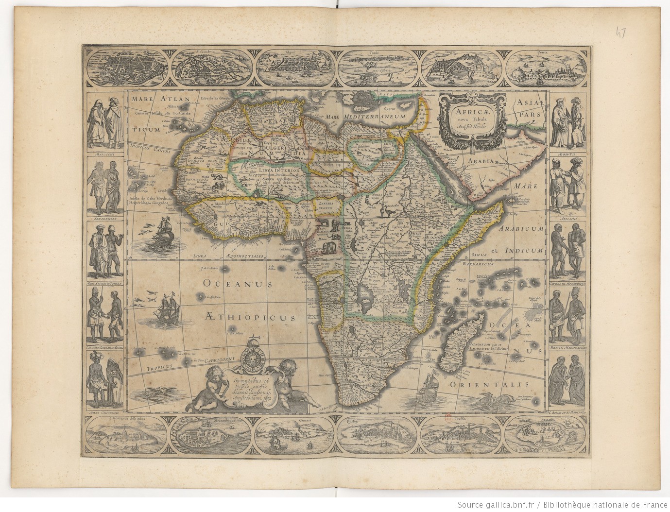
|
850-Africae nova tabula .
Author: Hondius, Jodocus II
,1632 |
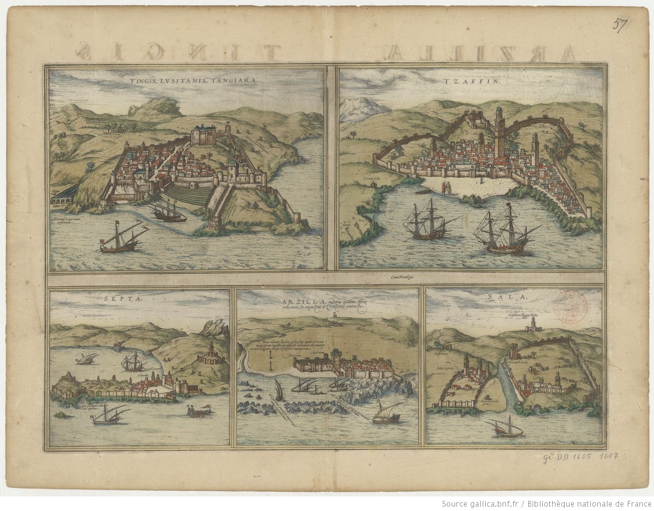
|
849-Tingis Lusitanis Tangiara ; Tzaffin ; Septa ;Arzilla ; Sala .
Author: Georg Braun
,1645 |
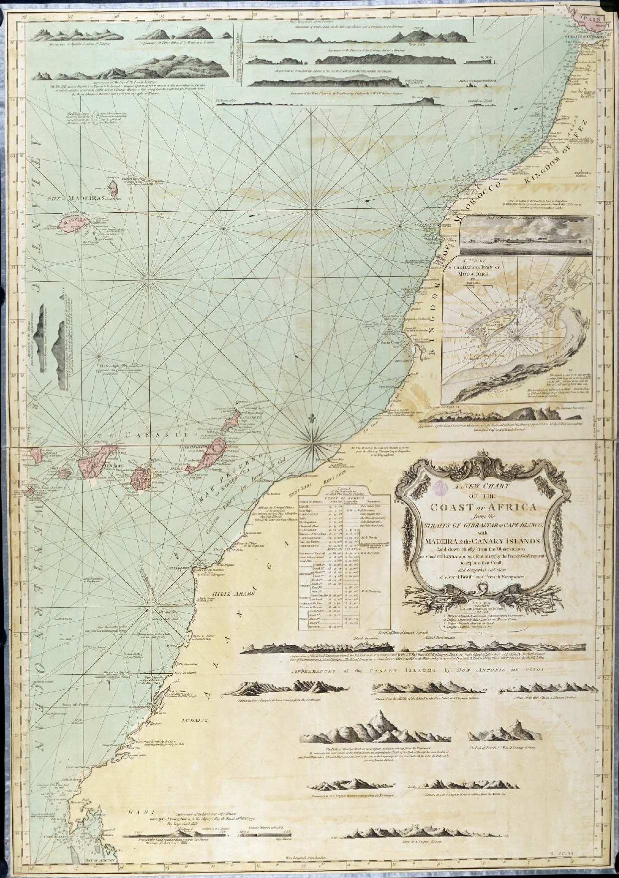
|
848-New Chart of the Coast of Africa .
Author: Antonio de Ulloa
,1794 |
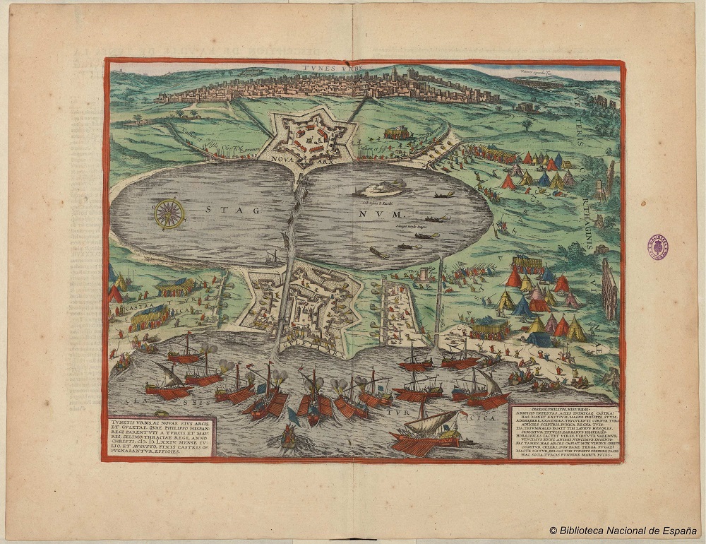
|
847 Tunetis Urbis, ac novae eius arcis et Guletae, quae Philippo Hispan. Regi parent uti a .
Author: Georg Braun
,1575 |
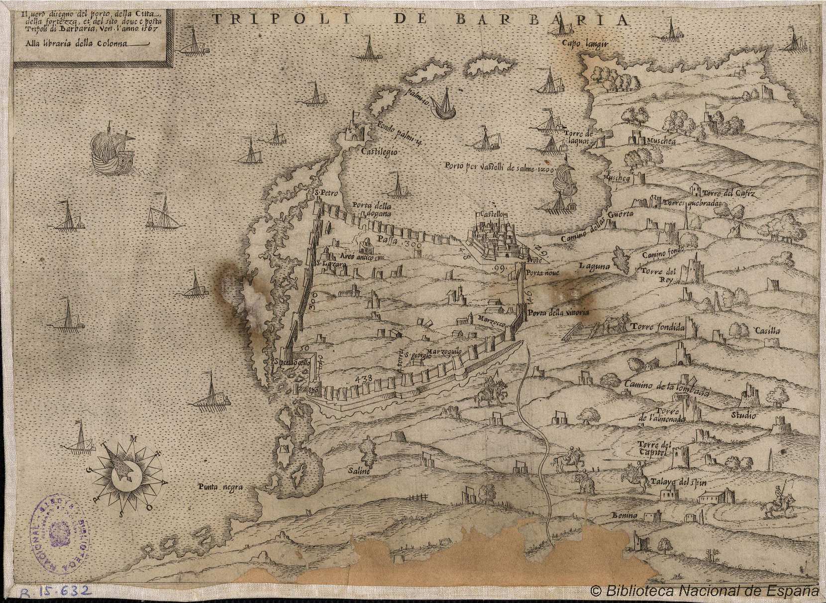
|
846- Tripoli de Barbaria .
Author:
,1567 |
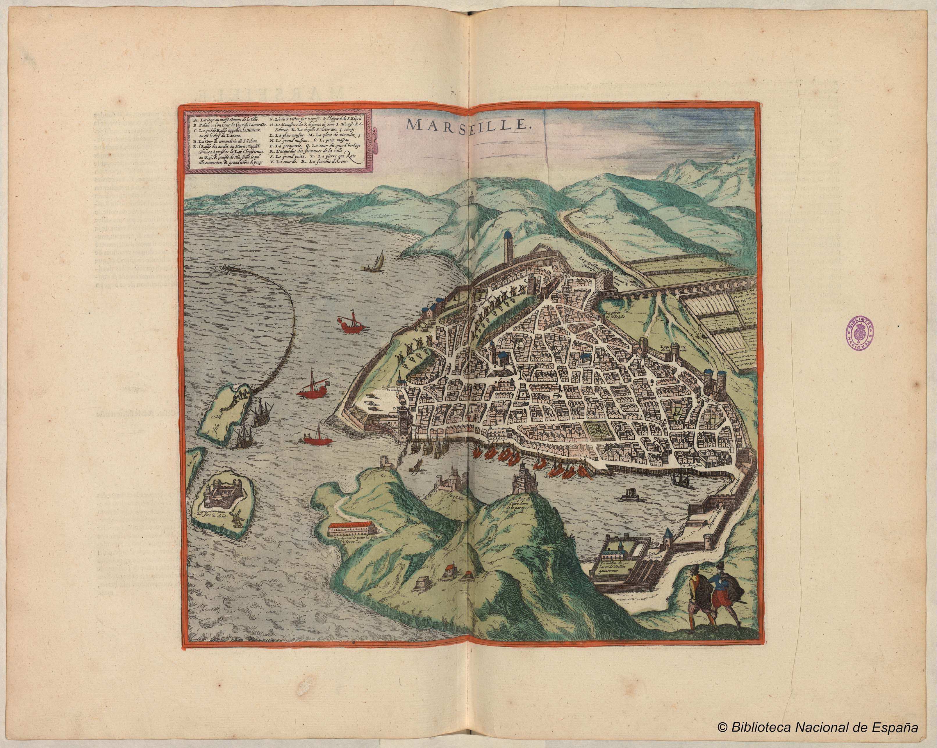
|
845- Marseille .
Author: Georg Braun
,1575 |
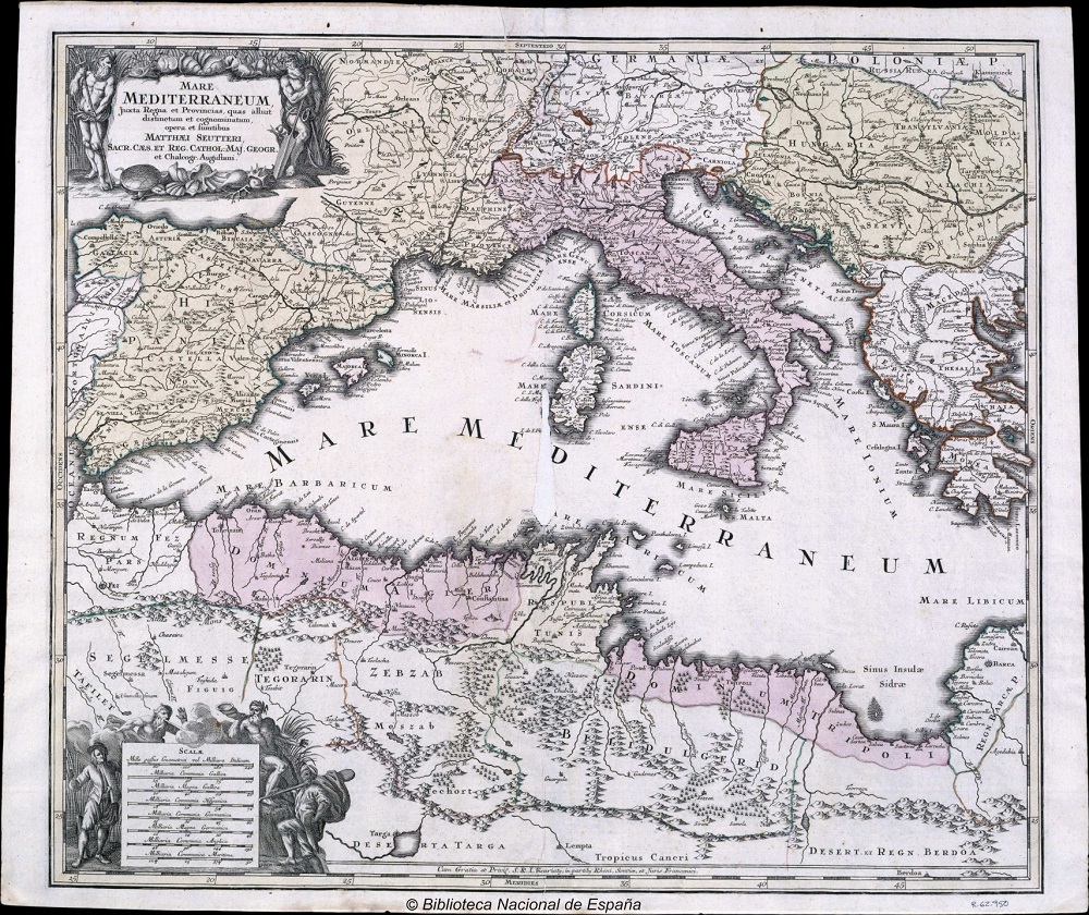
|
844- Mare Mediterraneum .
Author: Matthaeus Seutter
,1730 |
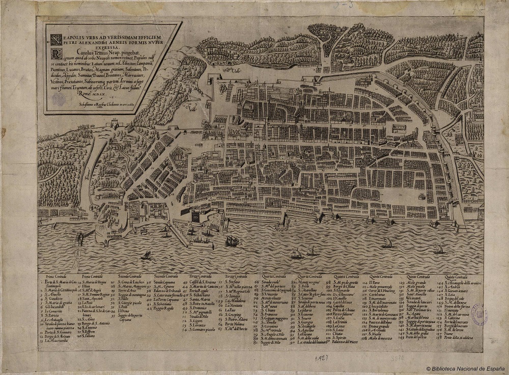
|
843-Neapolis urbs ad verissimam effigiem…. .
Author:
Roma,1560 |
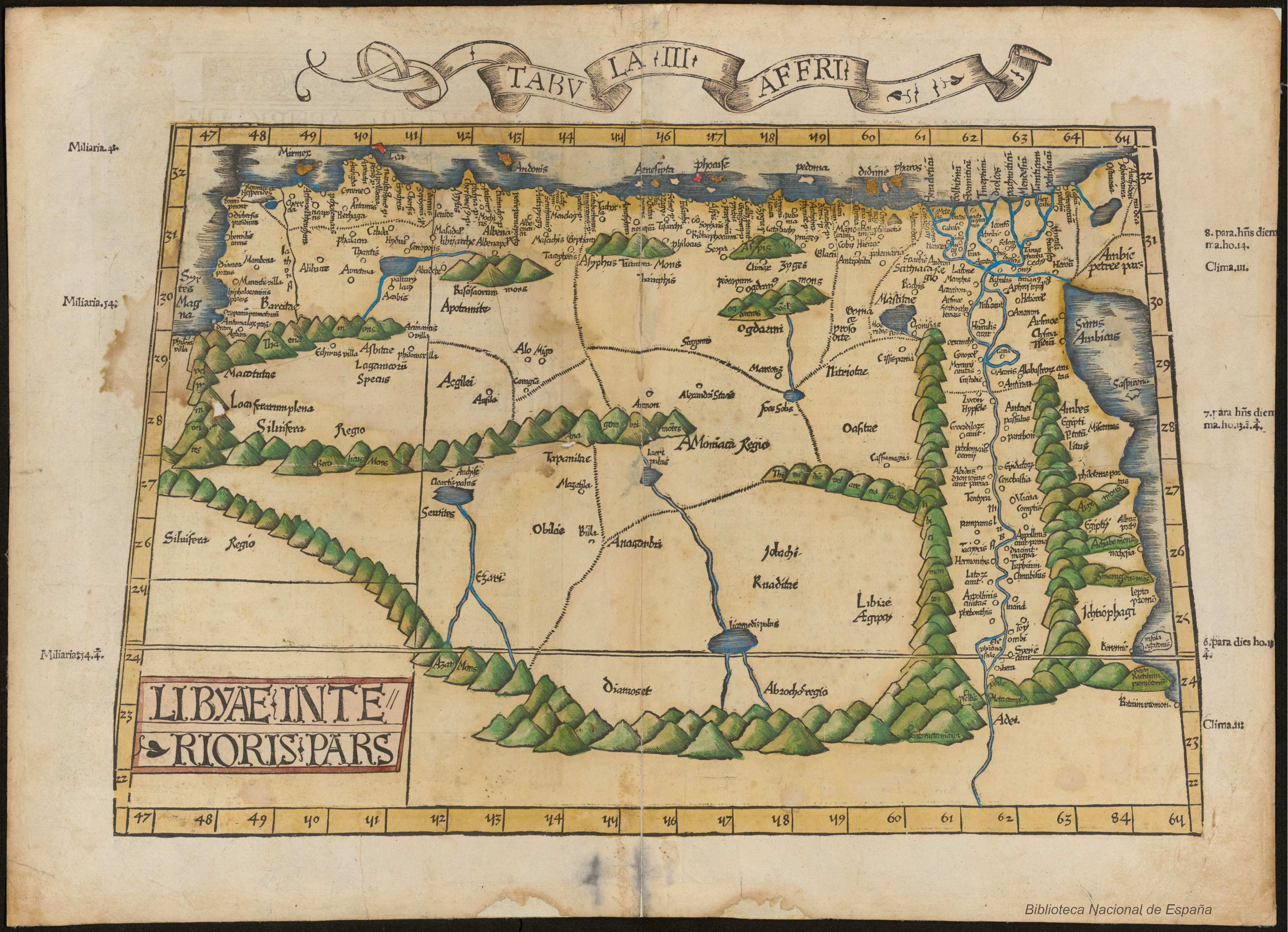
|
843-Neapolis urbs ad verissimam effigiem…. .
Author: Claudio Tolomeo
,1525 |
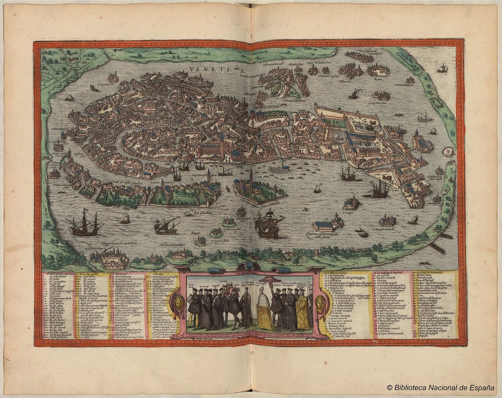
|
842- Libyae Interioris Pars .
Author: Georg Braun
,1572 |
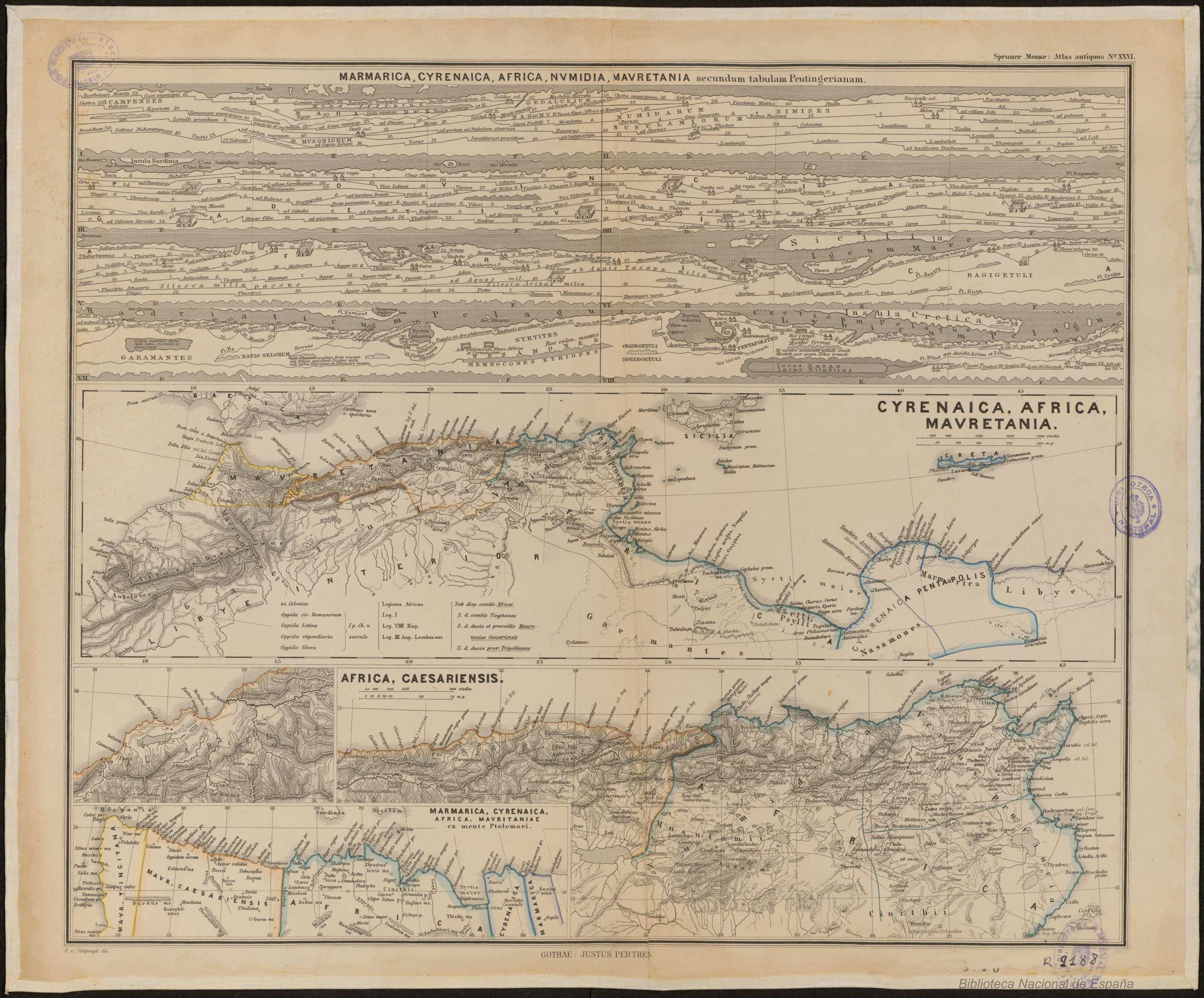
|
841-Venetia .
Author: F.Von Stülphagel,
,1865 |
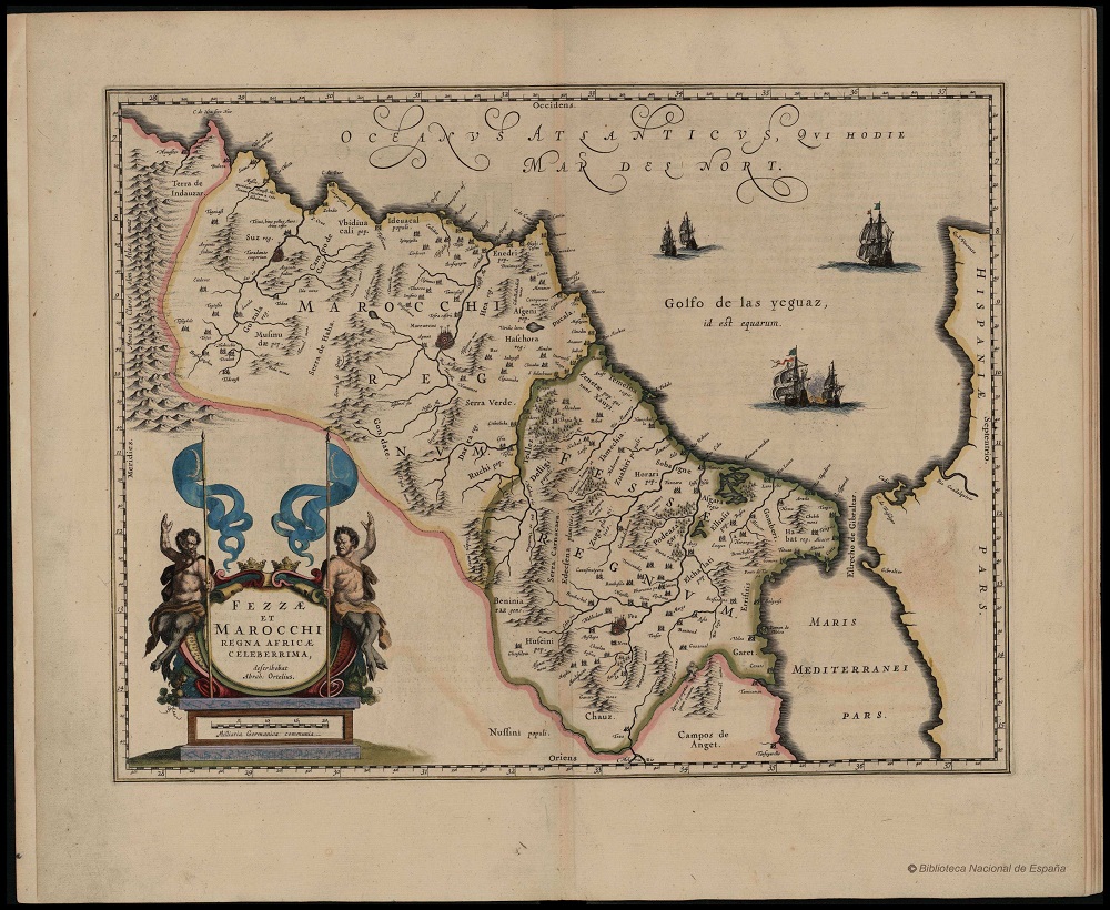
|
840-Marmarica,CYrenaica,Africa,Numidia,Mauretania .
Author: Willem Janszoon Blaeu
,1635 |
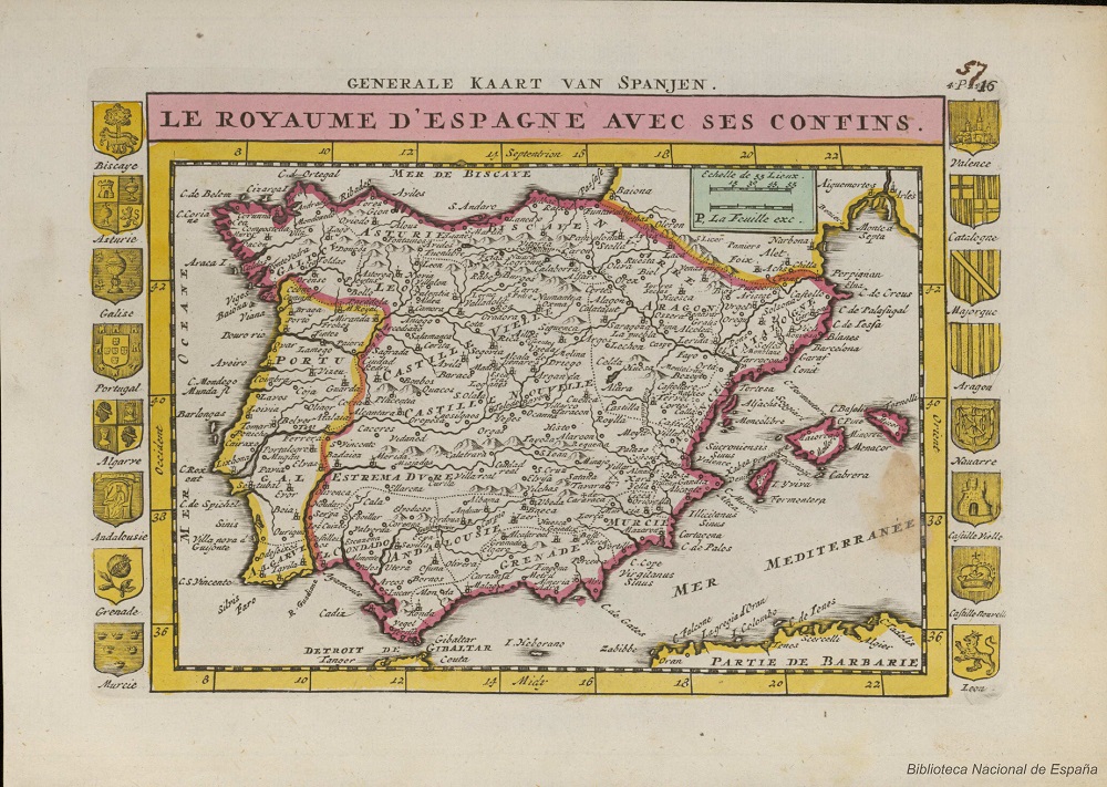
|
839- Fezzae et Marocchi Regna Africae Celeberrima .
Author: Paul La Feuille
,1747 |

|
838- Le Royaume d'Espagne avec ses confins .
Author: Georg Braun
,1598 |
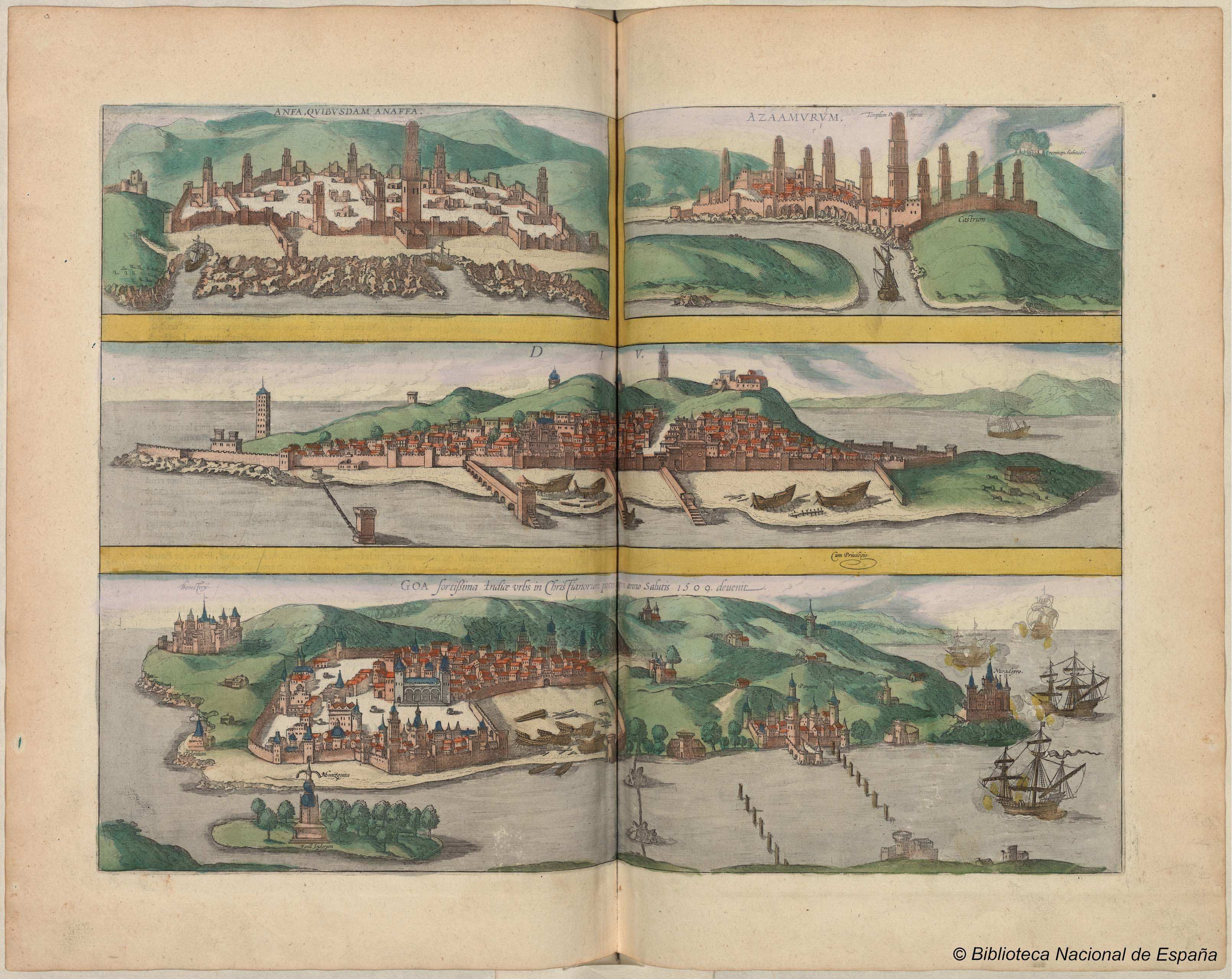
|
837- Catana urbs Siciliae clarissima Patria…. .
Author: Georg Braun
,1572 |
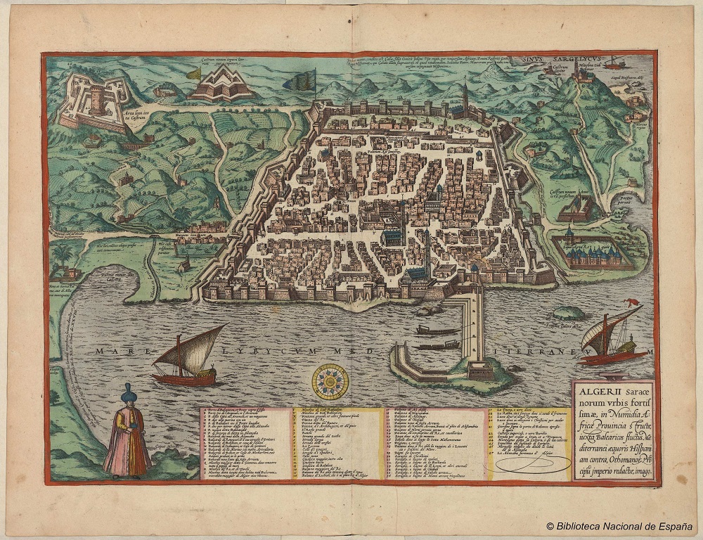
|
836- Anfa, quiusdam Anaffa ;Azaamurum ; Diu ; Goa, fortissima Indiae urbs in Christianorum .
Author: Georg Braun
,1575 |
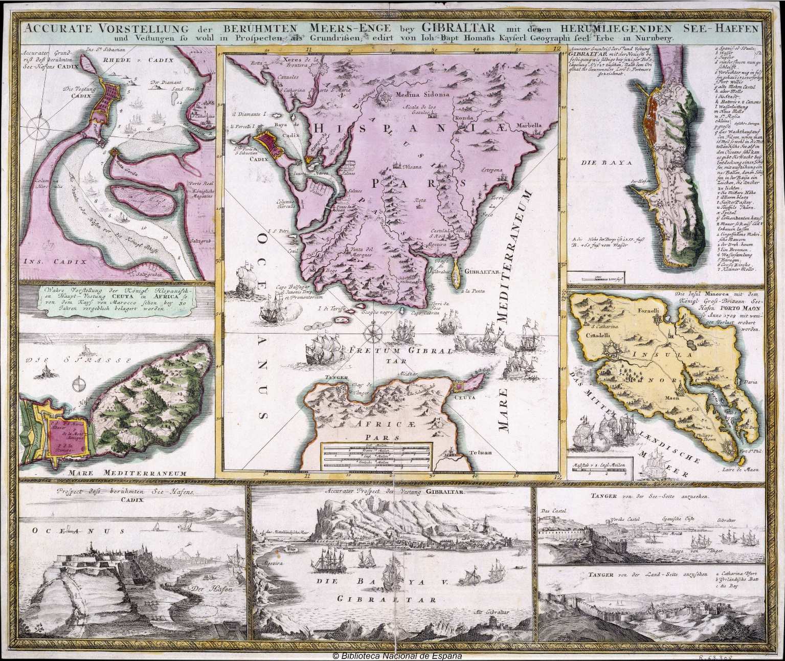
|
835- Algerii Saracenorum urbis fortissimae, in Numidia Africae province…. .
Author: Johann Baptist Homann
,1730 |
|
834- Accurate Vorstellung der Berühmten Meers Enge bey Gibraltar mit denen Herumliegenden .
Author: José Espejo
,1835 |
|
833- Carta Esférica que comprende las Islas de Sicilia y Malta .
Author: Gaspar Massa
,1824 |
|
832-Carta Esferica que comprehende las Costas de Italia…. .
Author:
,0 |
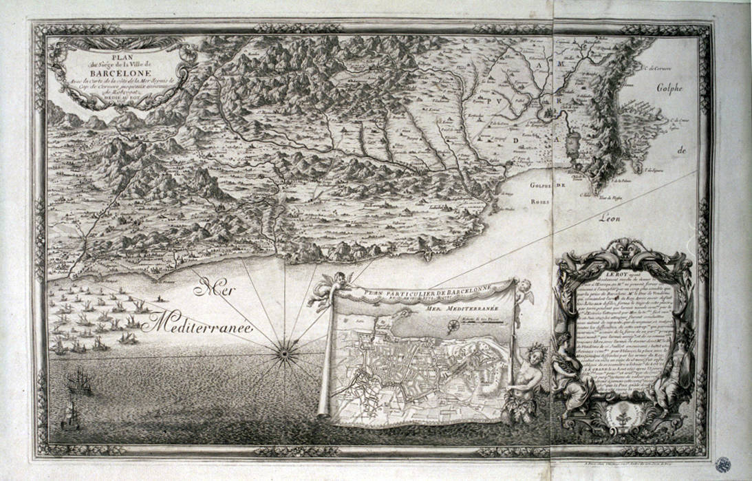
|
830- Plan du siège de la ville de Barcelone avec la Carte de la cote de la Mer depuis le .
Author: Beaulieu
,1698 |
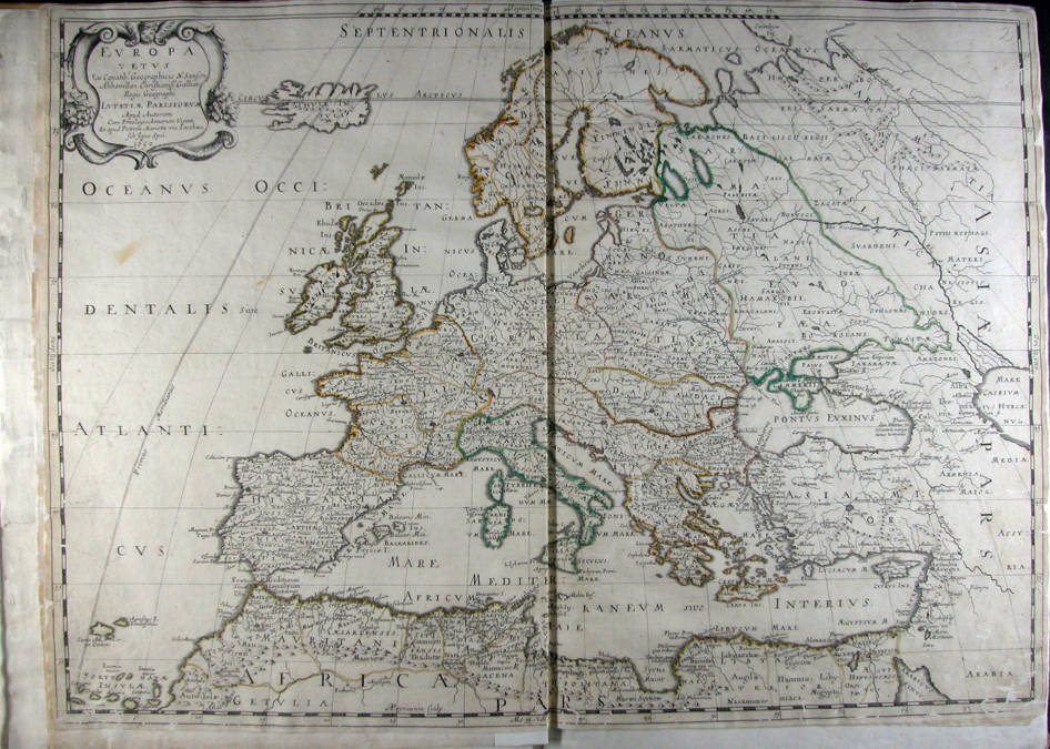
|
829-Europa vetus ex Conatih. Geographicis N. Sanson Abbavillaei. Christianiss. Galhiar. Re .
Author: Nicolas Sanson
,1650 |
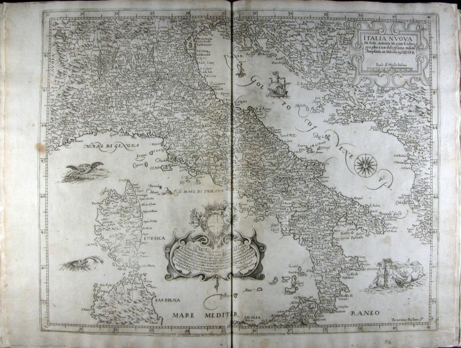
|
828- Italia Nuova .
Author: Giovanni Antonio Magini
Milano,1638 |
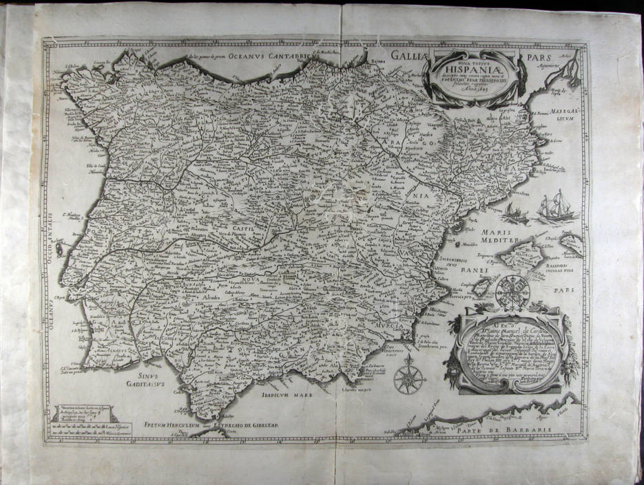
|
827-Nova totius Hispaniae descriptio, cuius omnia regna nunc à Potnetissº rege Philippo .
Author:
,1649 |
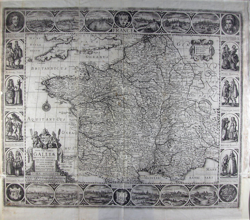
|
826-Nova haec tabula Galliae Lodovico XIII christianissimo regi Franciae et Navarrae humil .
Author: Visscher
,0 |
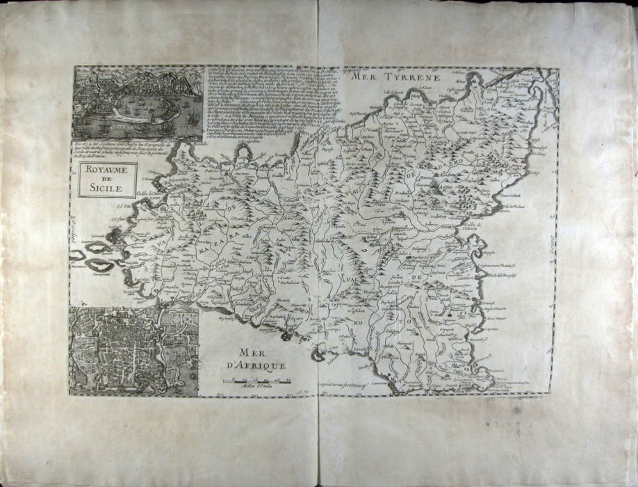
|
825-Royaume de Sicile .
Author:
Parigi,1674 |

|
823- Mediterrància occidental que representa la península Ibèrica i el nord d'Àfrica .
Author: Francesco Oliva
,1658 |
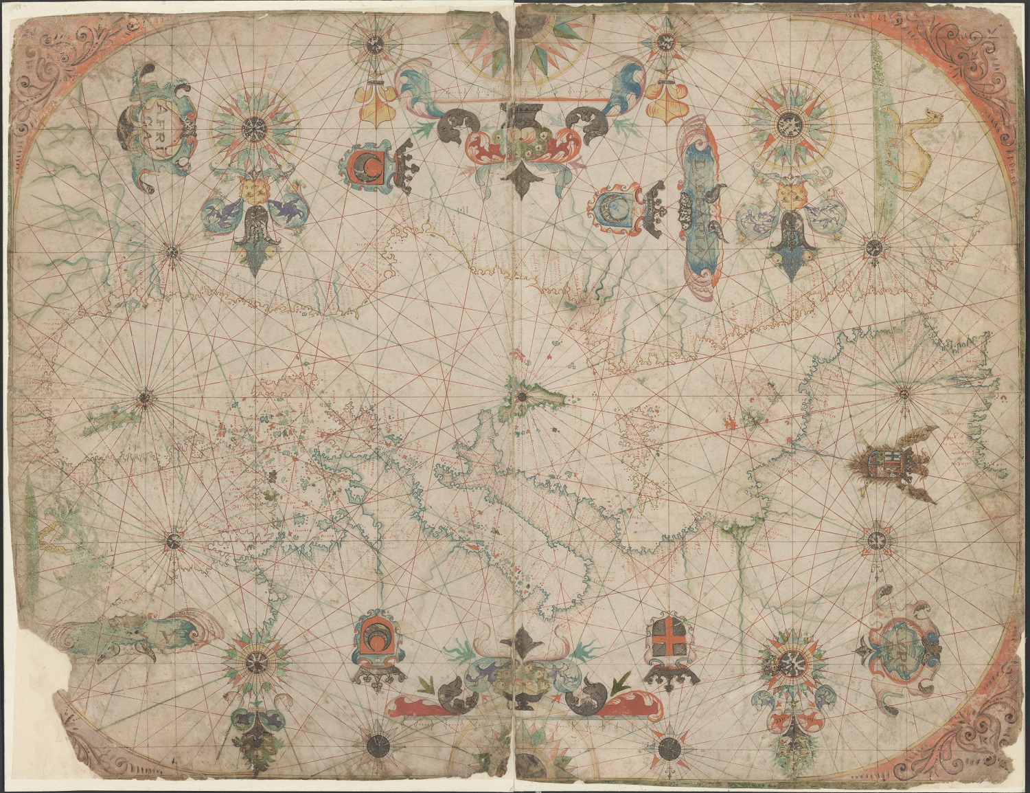
|
822- Mediterrània .
Author: Francesco Oliva
,1658 |

|
821- la Mediterrània occidental i costes atlàntiques de la península Ibèrica i del nor .
Author: Francesco Oliva
,1658 |
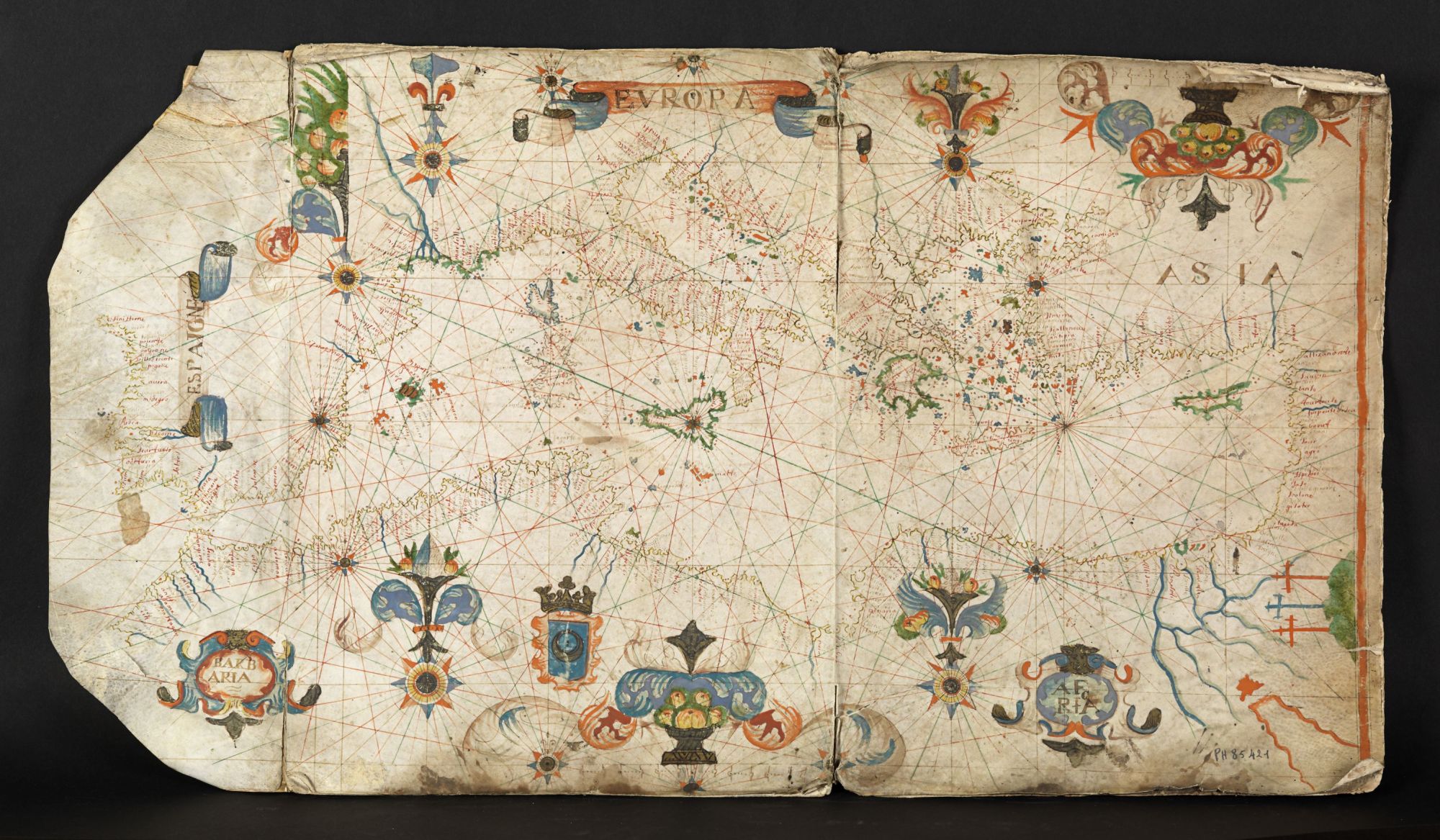
|
820-Mer Méditerranée .
Author: attribuito a François Ollive
Marsiglia,0 |
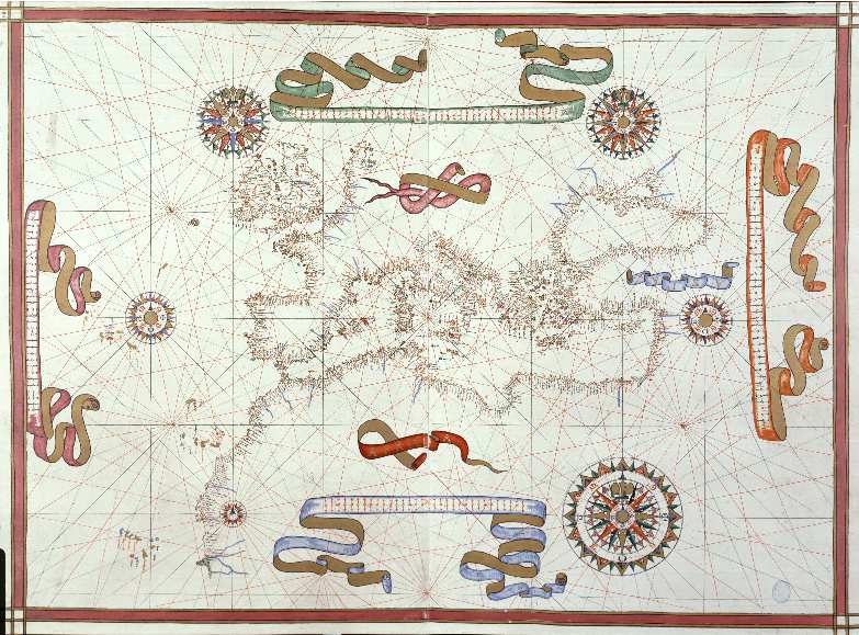
|
819- Mapa del Mar Mediterráneo con el occidente de Europa y Africa .
Author: Joan Martines
Messina,1587 |

|
817-In notitiam ecclesiasticam Africae tabula geographica .
Author: Guillaume De L'isle
,1700 |
|
817- Carta Isola e Regno di Sardegna .
Author: Alberto Lamarmora
Torino,1845 |
|
815- CARTA DELL’ISOLA E REGNO DELLA SARDEGNA COLLE SUE DIVISIONI FEU-DALI .
Author: Anonimo
Torino,0 |
|
814- CARTA DELL’ISOLA E REGNO DELLA SARDEGNA COLLE DIVISIONI FEUDALI .
Author: Anonimo
Torino,0 |
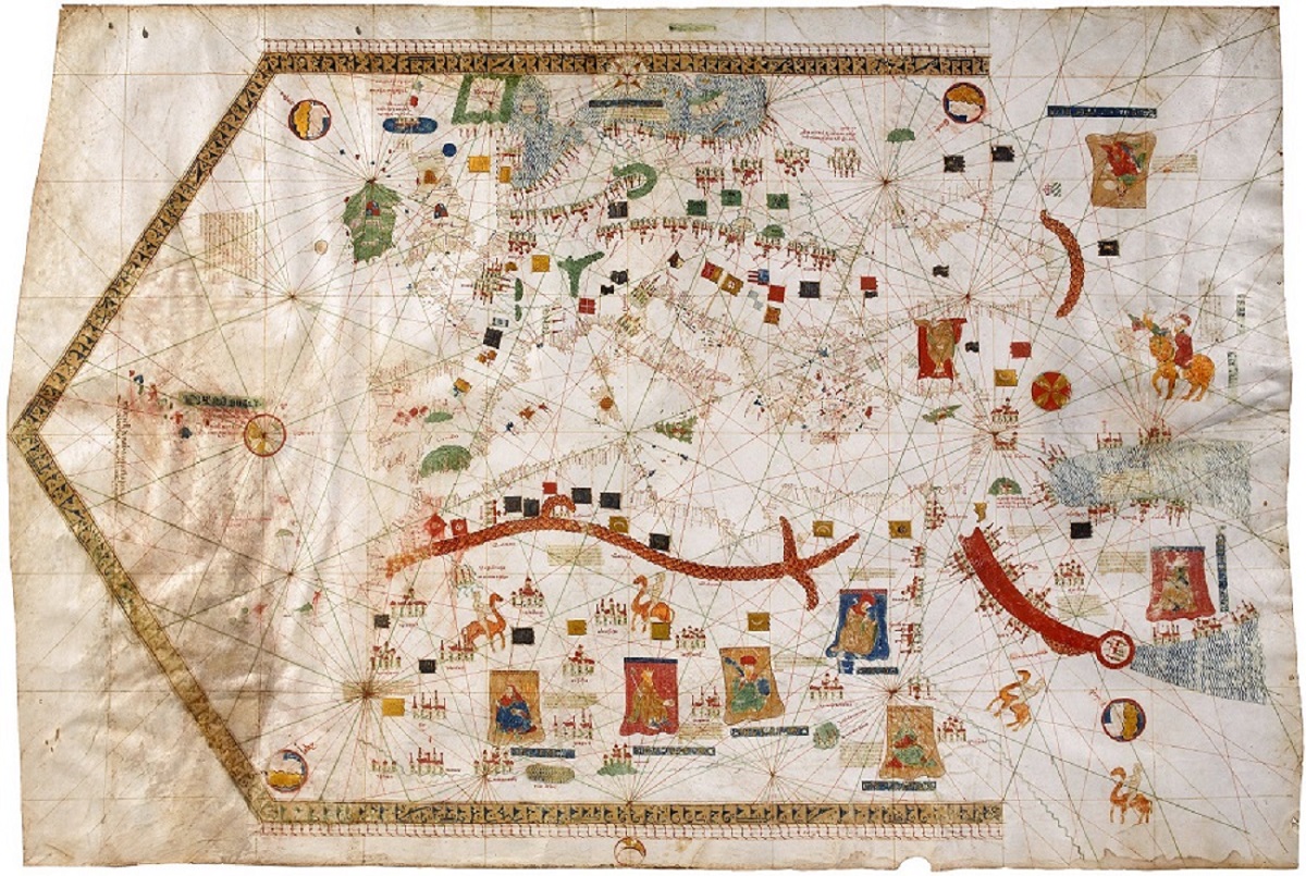
|
810-Carta de Vallseca .
Author: Gabriel de Vallseca
,1430 |
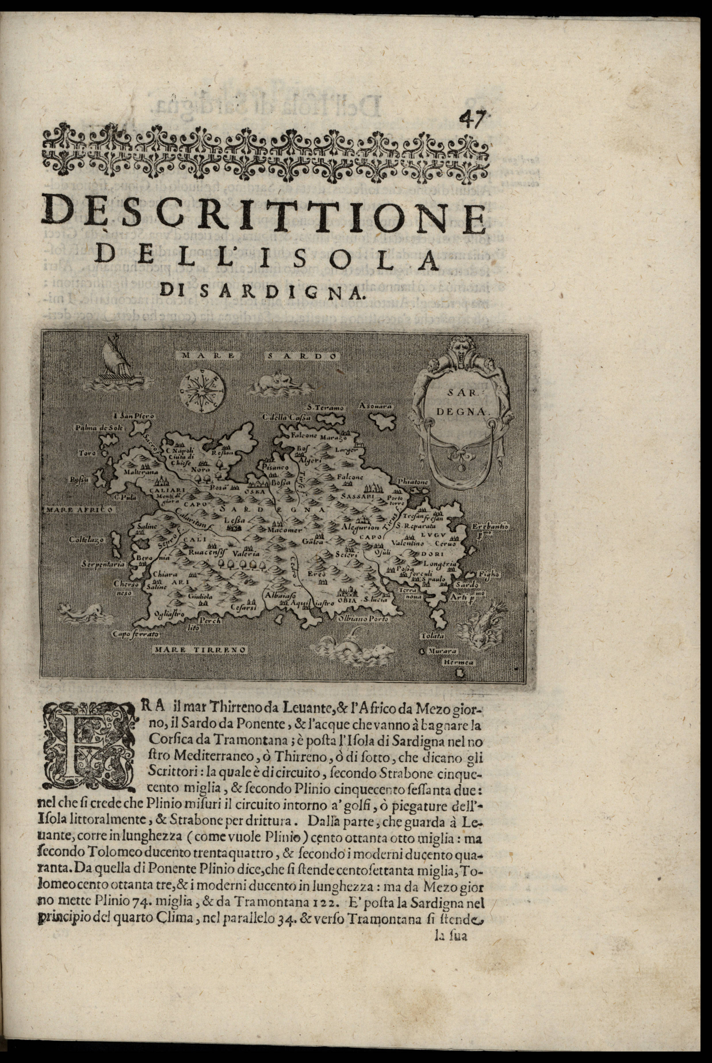
|
809-Sardegna .
Author: Thomaso Porcacchi
Padova,1620 |
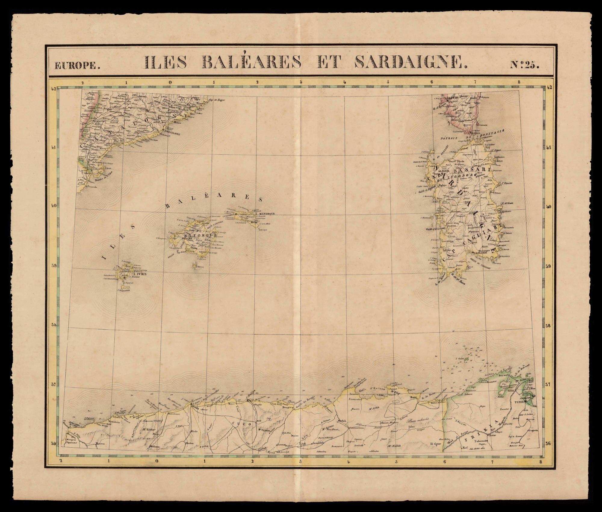
|
808- Iles Baléares et Sardaigne .
Author:
,0 |
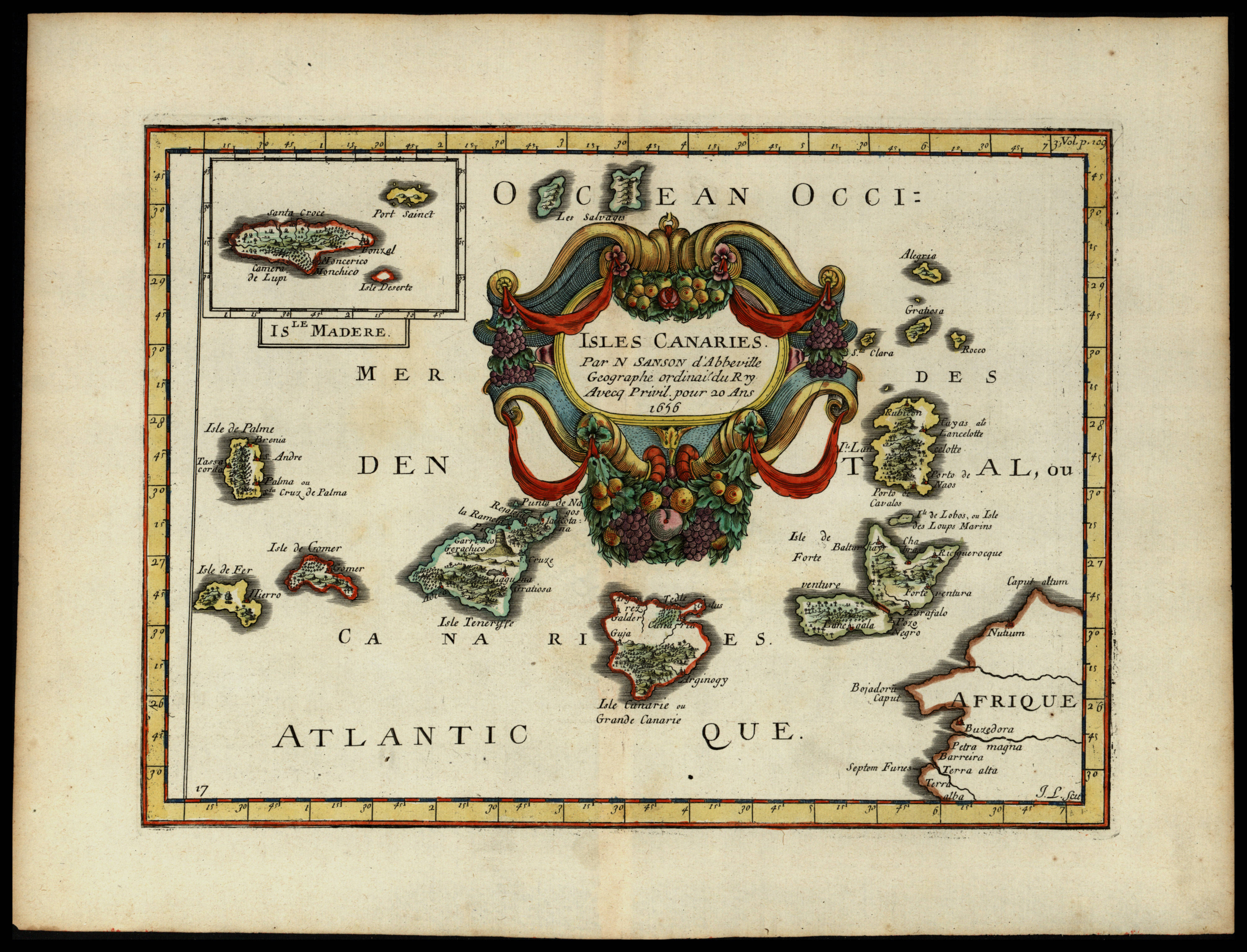
|
807- Isles Canaries .
Author: Nicolas Sanson
Parigi,1656 |
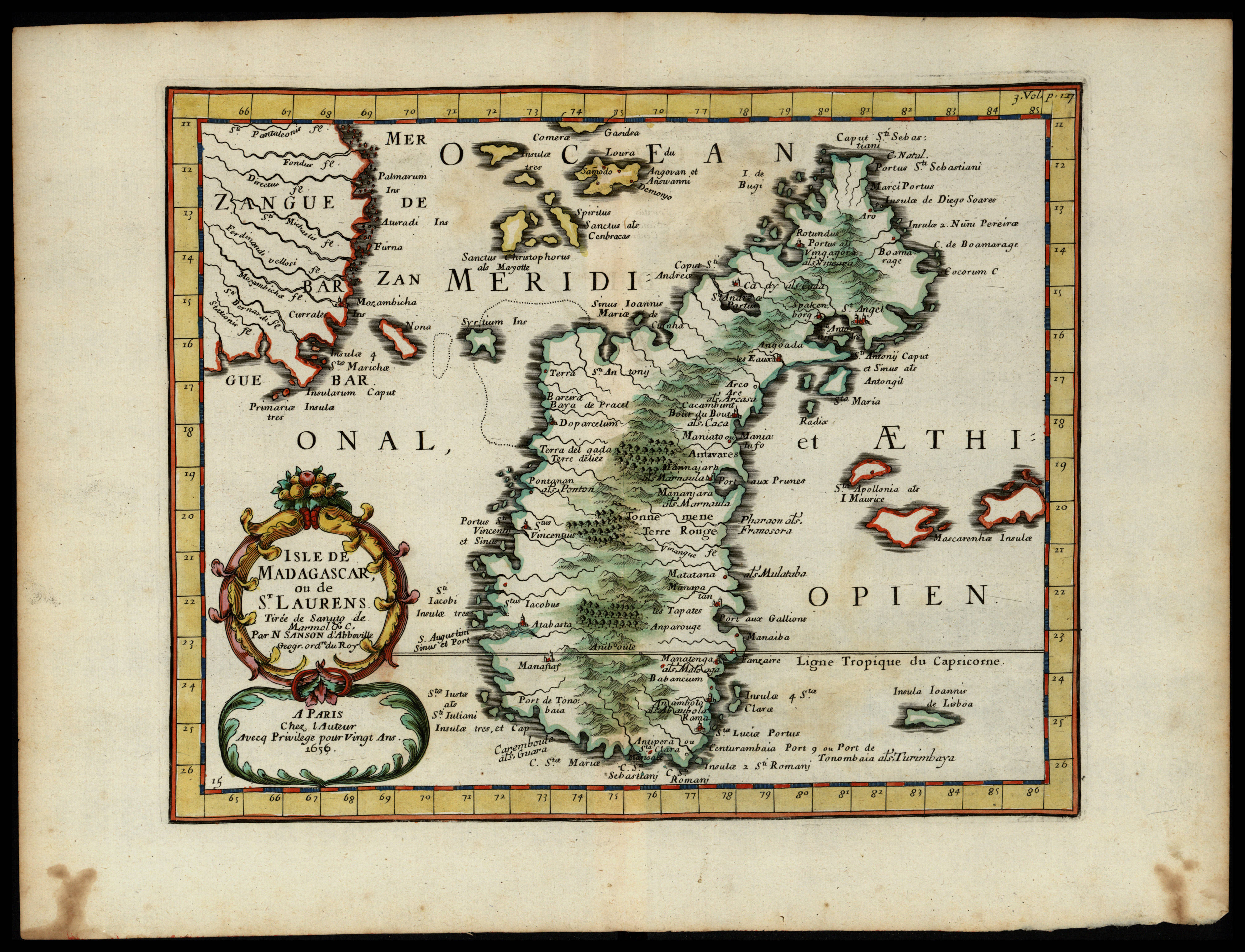
|
806- Isle de Madagascar, ou de St. Laurens tirée de Sanuto de Marmol &c. .
Author: Nicolas Sanson
Parigi,1656 |

|
805- Royaume et desert de Barca, et l'Aegypte divisée en ses principales parties .
Author: Nicolas Sanson
Parigi,1656 |
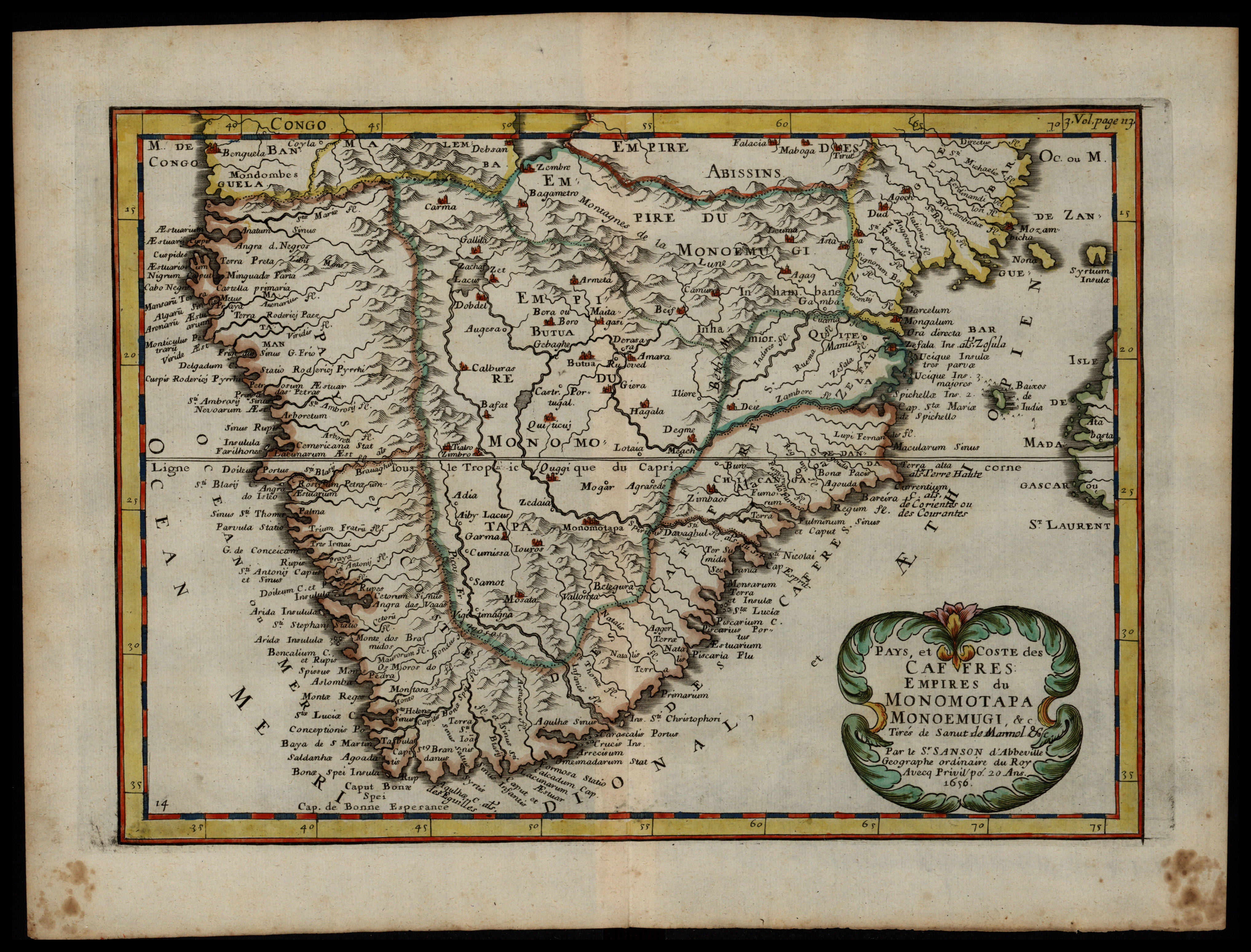
|
804-Pays, et coste des Caffres, empires du Monomotapa, Monoemugi, &c. Tirés de Sanut de M .
Author: Nicolas Sanson
Parigi,1656 |
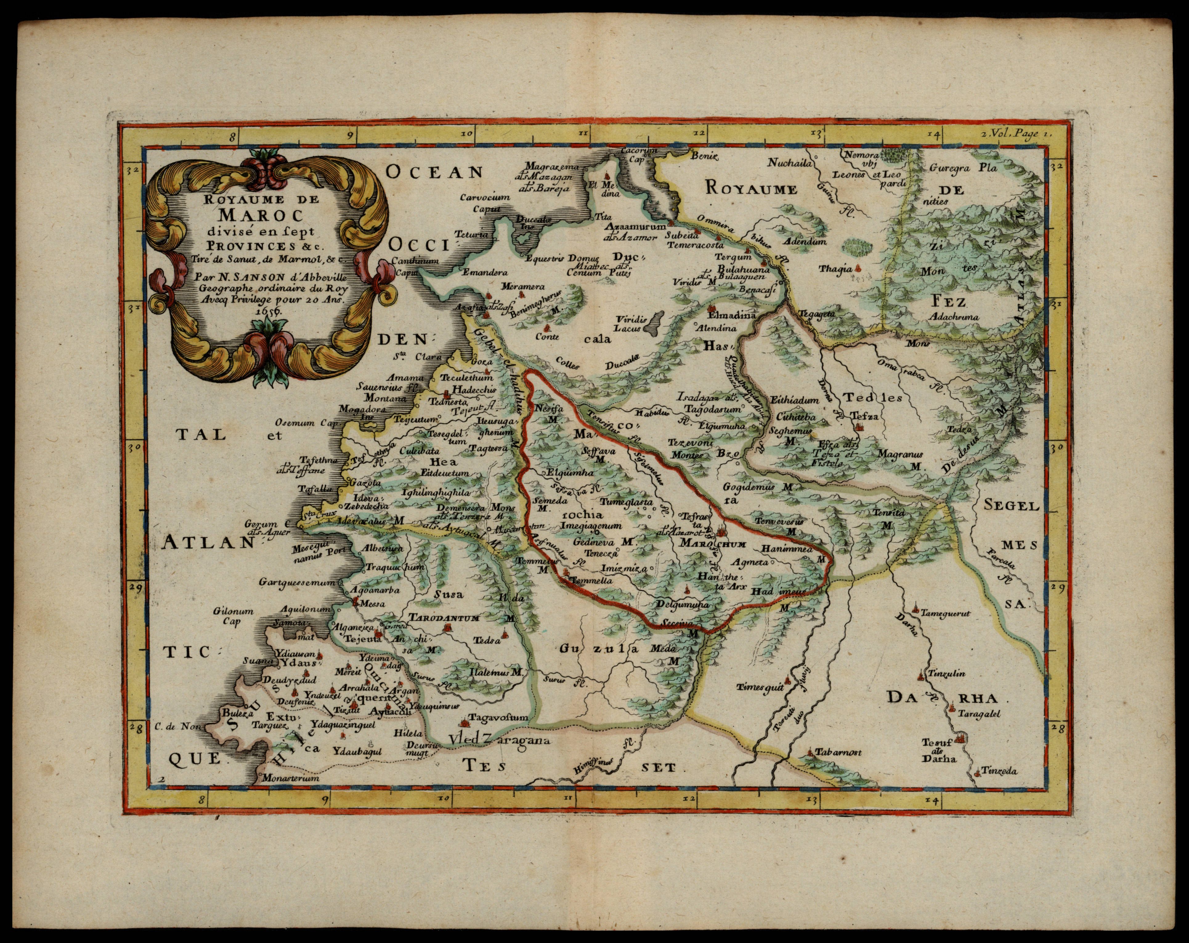
|
803-Royaume de Maroc divisé en sept provinces &c. tiré de Sanut, de Marmol &c .
Author: Nicolas Sanson
Parigi,1656 |
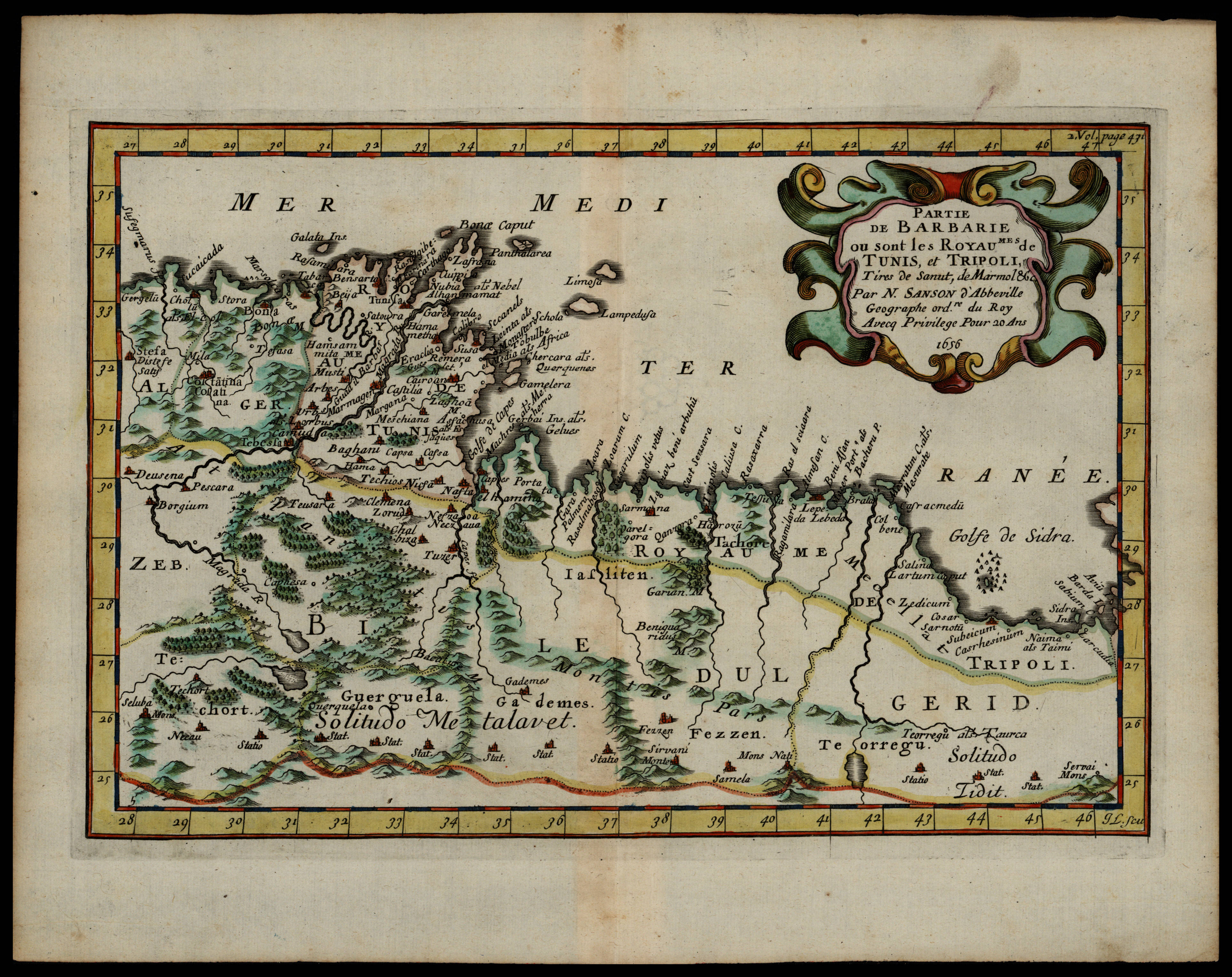
|
802-Partie de Barbarie ou sont les royaumes de Tunis, et Tripoli, tires de Sanut, de Marmo .
Author: Nicolas Sanson
,1656 |
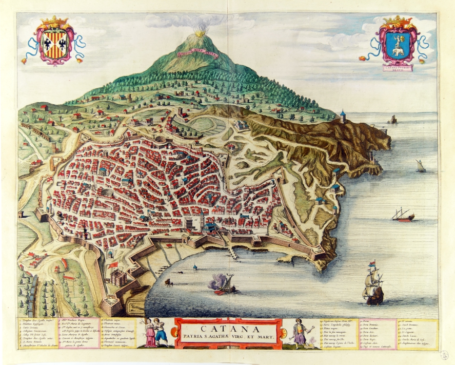
|
798-Catana patria S. Agatae virg. e mart .
Author: Joan Blaeu
Amsterdam,1663 |
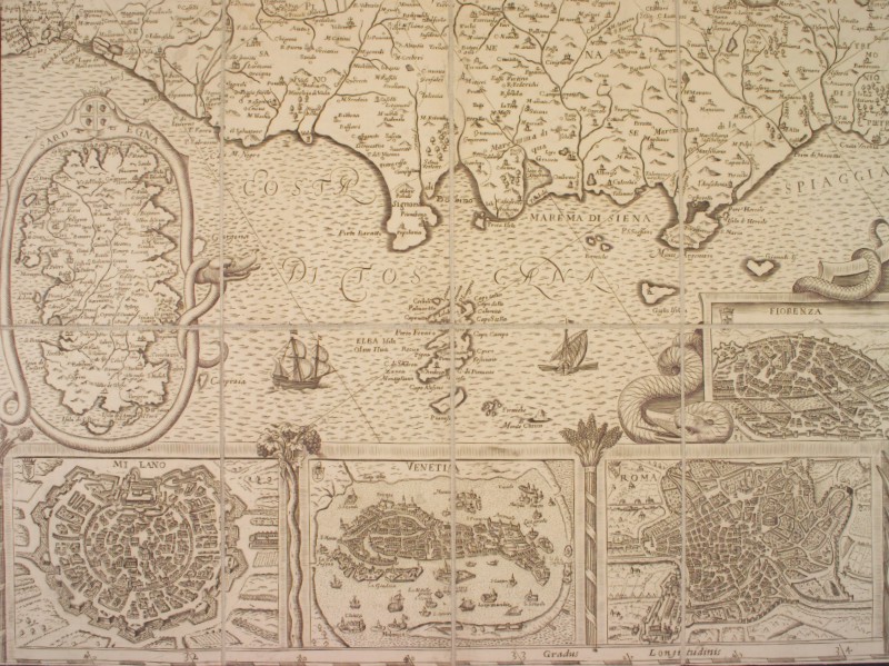
|
482-Sardegna .
Author: Matthäus Greuter
Venezia,1657 |
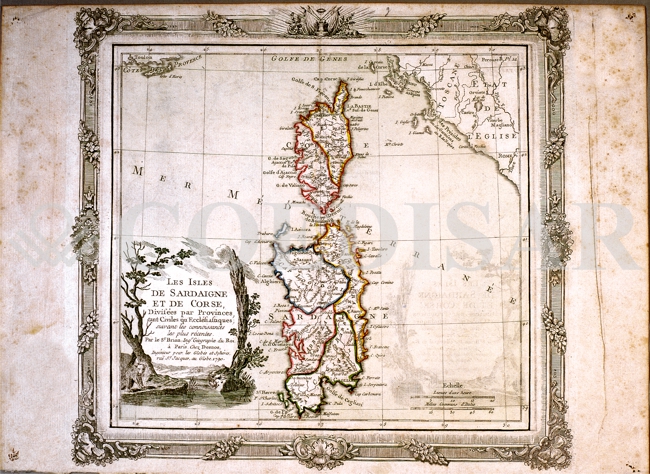
|
762-Sardaigne et Corse .
Author: Louis Brion
Parigi,1790 |
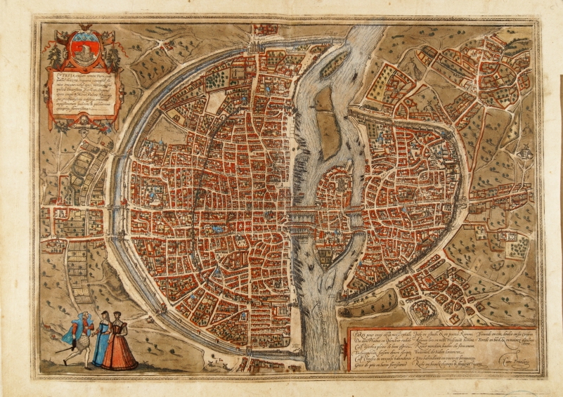
|
788- Lutatia .
Author: Georgii Braun
Colonia,1575 |
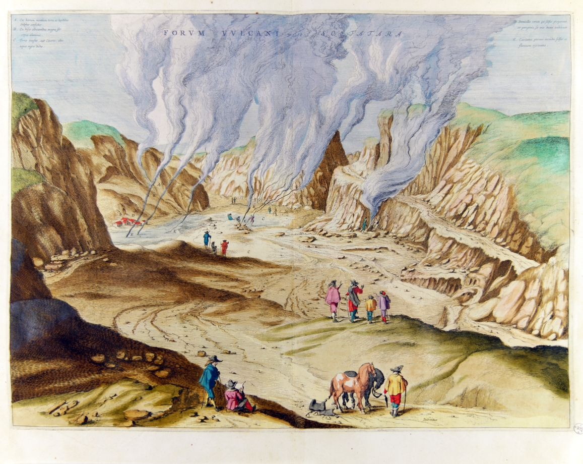
|
794-Forum Vulcani Vulgo Solfatara .
Author: Joan Blaeu
Amsterdam,1663 |
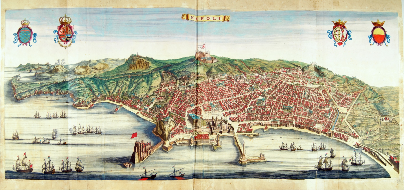
|
792-Neapolis .
Author: Joan Blaeu
Amsterdam,1663 |
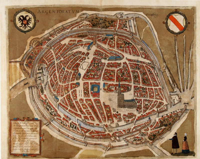
|
791- Argentoratum .
Author: Georgii Braun
Colonia,1575 |
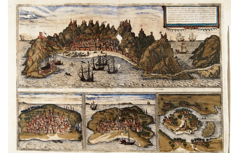
|
790- Aden Arabia felicis emporium, Mombaza, Quila e Cefala... .
Author: Georgii Braun
Colonia,1575 |
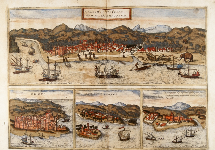
|
789- Chalechut celeberrimum India emporium, Ormus, Canonor, Saint Georgii oppidum.. .
Author:
Colonia,1575 |
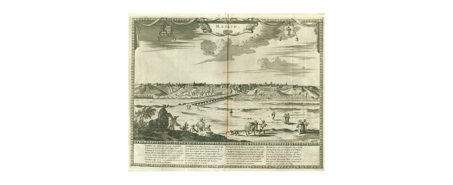
|
862-Madrid .
Author: Pieter Van Der Aa
,1729 |
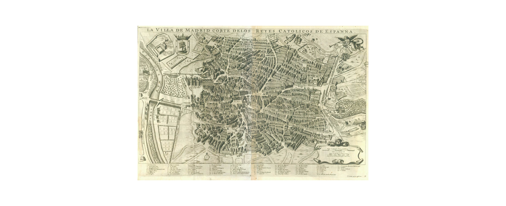
|
861-La villa de Madrid corte delo reies catolicos de Espanna .
Author: Pieter Van Der Aa
,1729 |
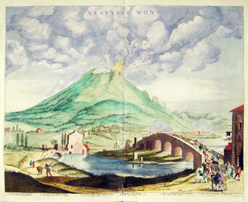
|
793-Vesuvius Mons .
Author: Joan Blaeu
Amsterdam,1663 |
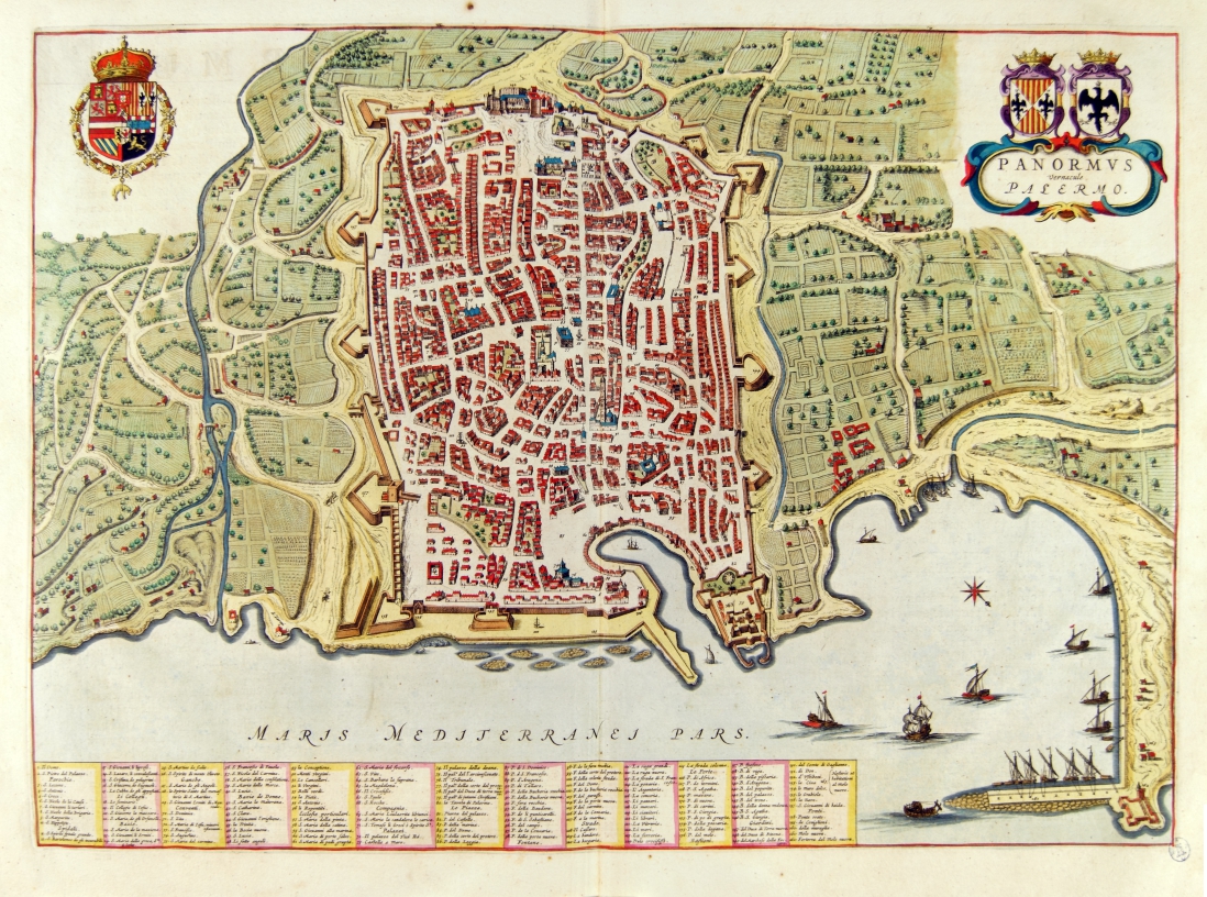
|
796-Panormus Vernacule Palermo .
Author: Joan Blaeu
Amsterdam ,1663 |
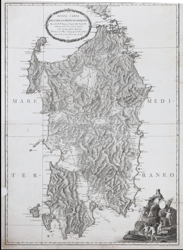
|
813- NUOVA CARTA DELL'ISOLA E REGNO DI SARDEGNA .
Author: Tommaso Napoli
Napoli,1811 |
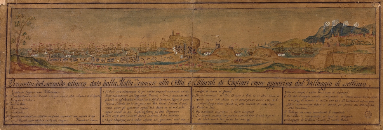
|
812-PROSPETTO DEL SECONDO ATTACCO DATO DALLA FLOTTA FRANCESE ALLA CITTÀ E LITTORALI DI CA .
Author: Victoir Amedé Gusta
Torino,0 |
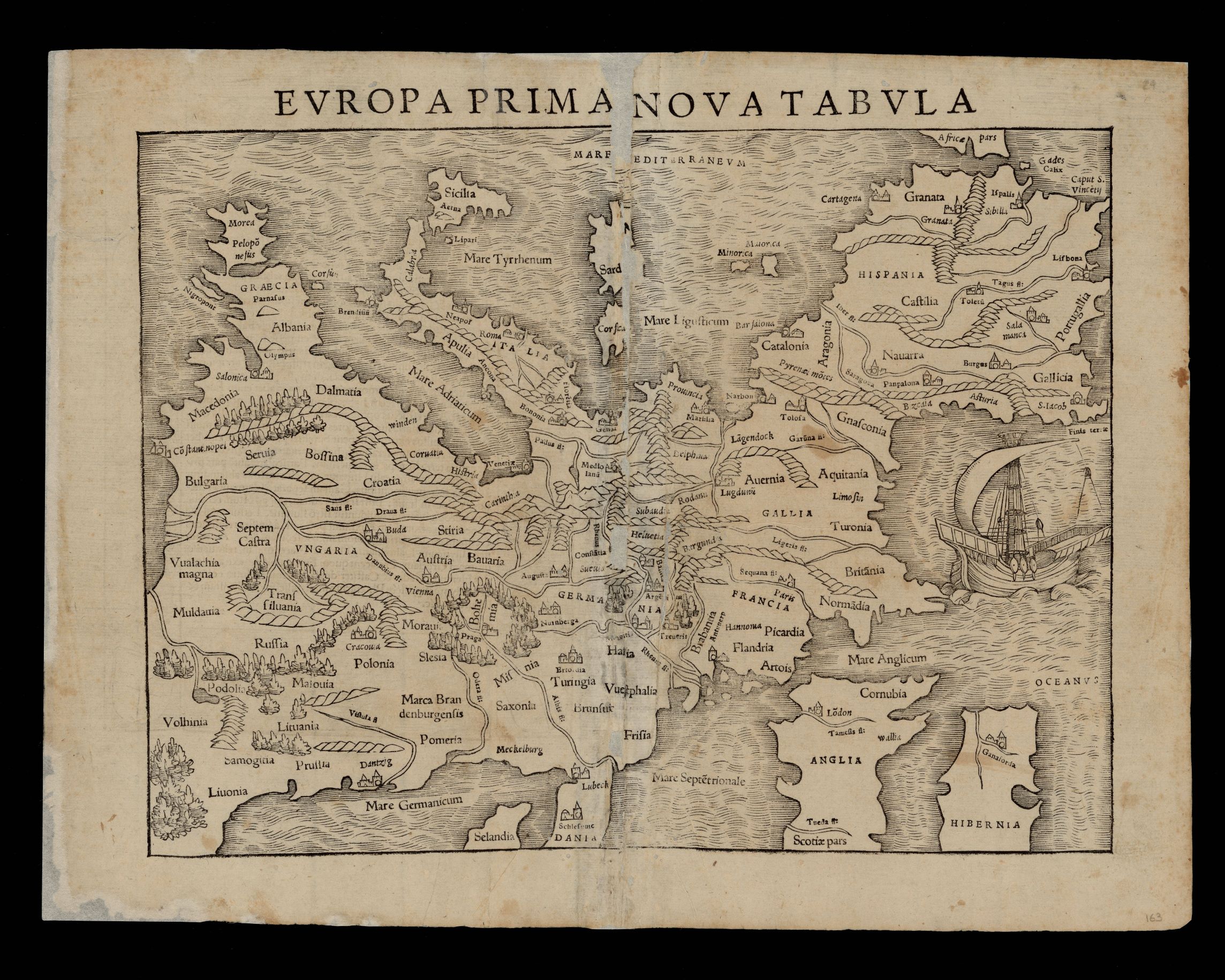
|
934- Europea Prima Nova Tabula .
Author: Munster
,1542 |
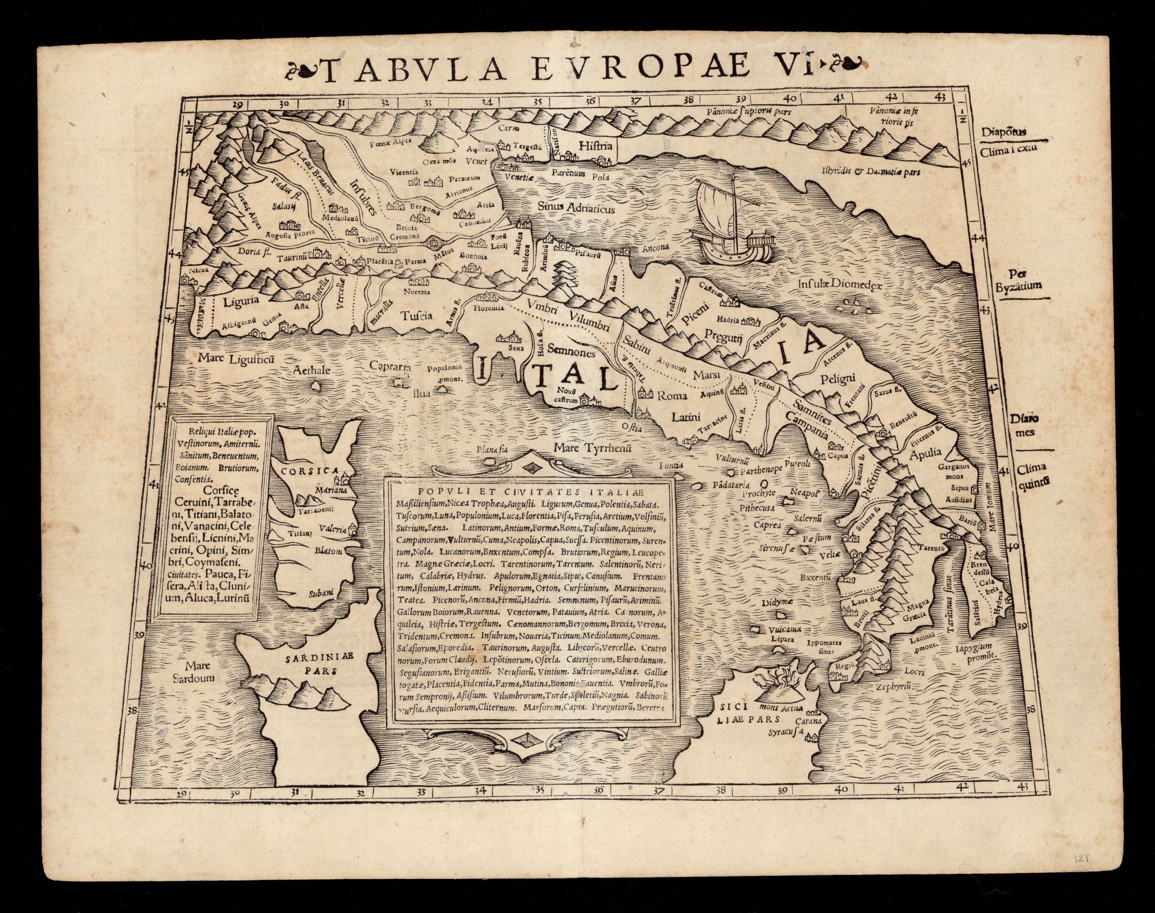
|
933- Tabvla Evropae VI .
Author: Munster
,1542 |
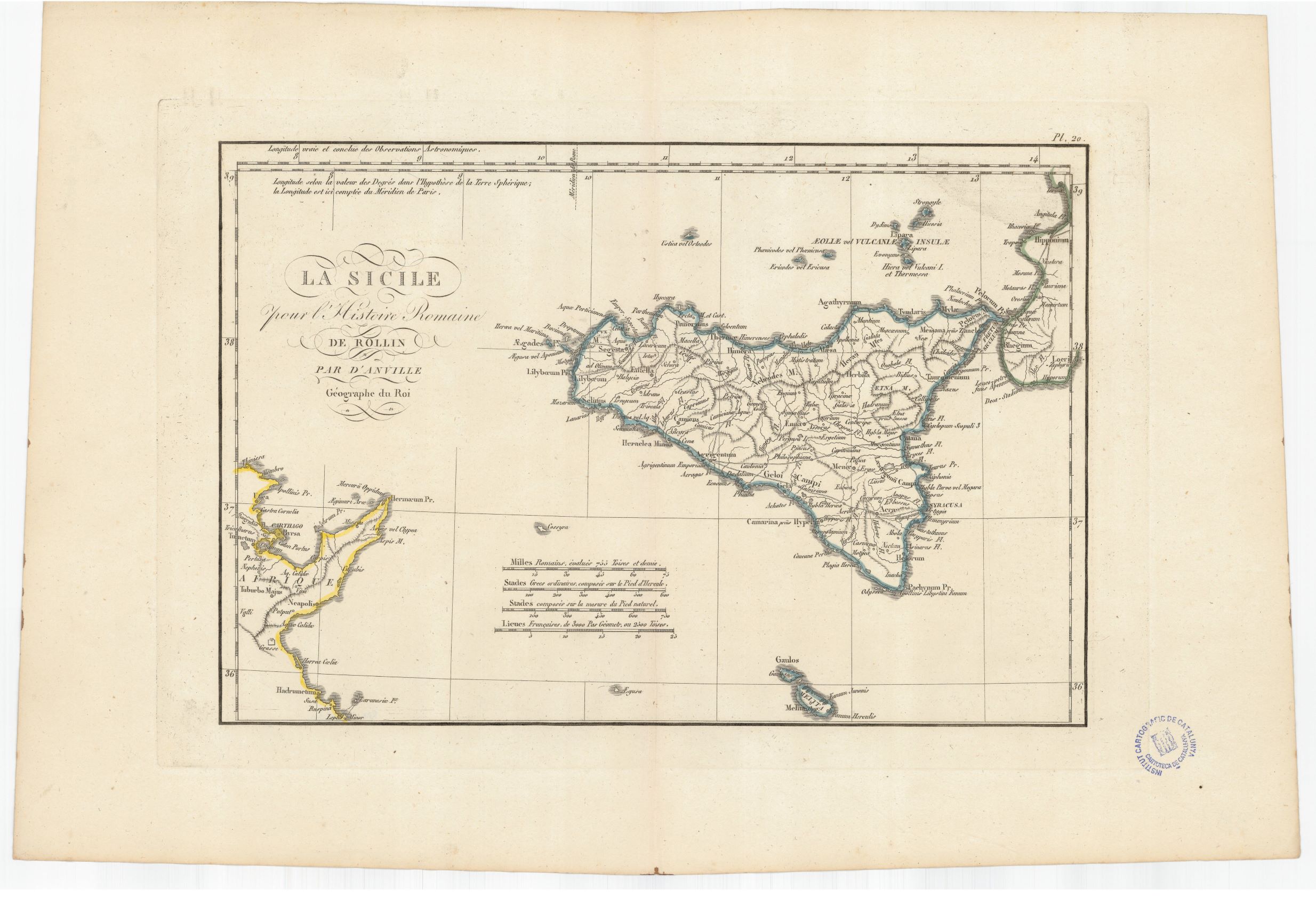
|
932- La Sicilie pour l'Histoire romaine de Rollin .
Author: Anville
,1760 |
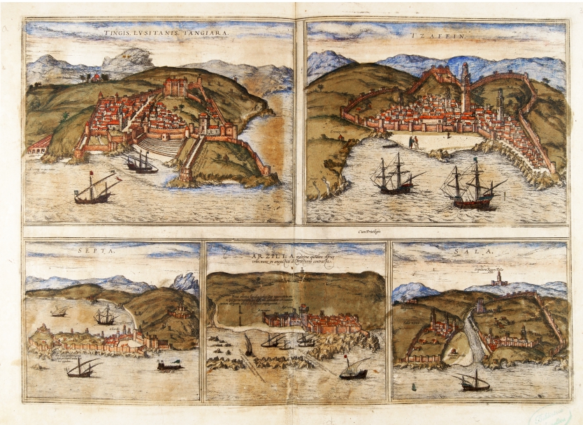
|
786- Tingis Lusitane Tangiara, Izaffin, Septa, Arzilla, Sala .
Author: Georgii Braun
Colonia,1575 |
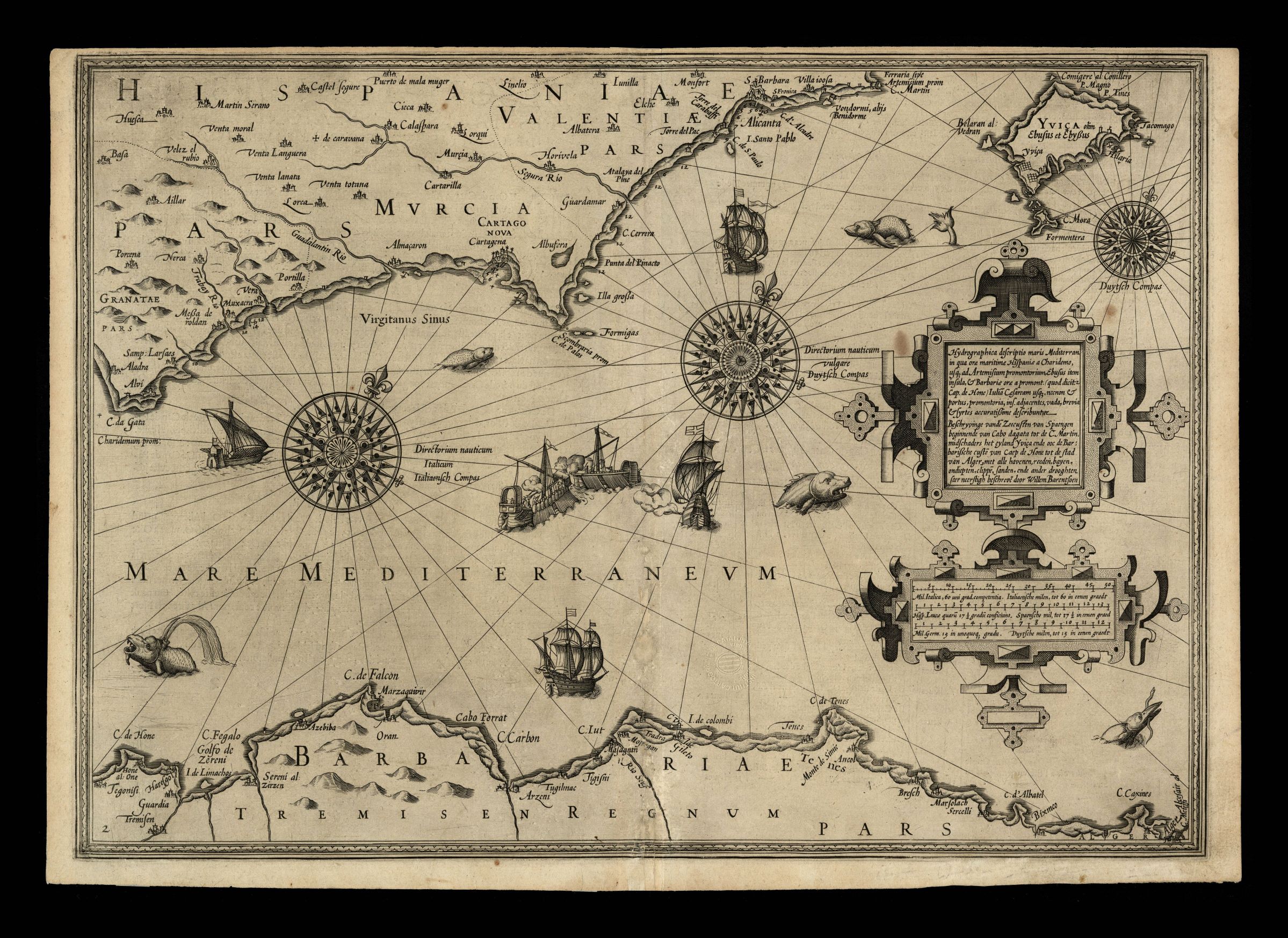
|
935- Hydrographica descriptio maris Mediterran. in qua orae maritimae Hispaniae a Charidem .
Author: Willem Barentsz
Amsterdam,1608 |
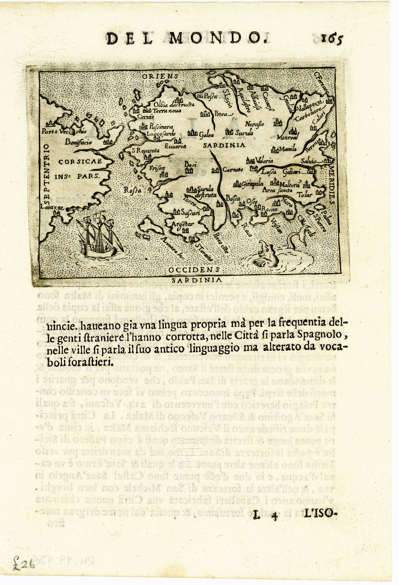
|
931- Sardegna .
Author:
,1500 |
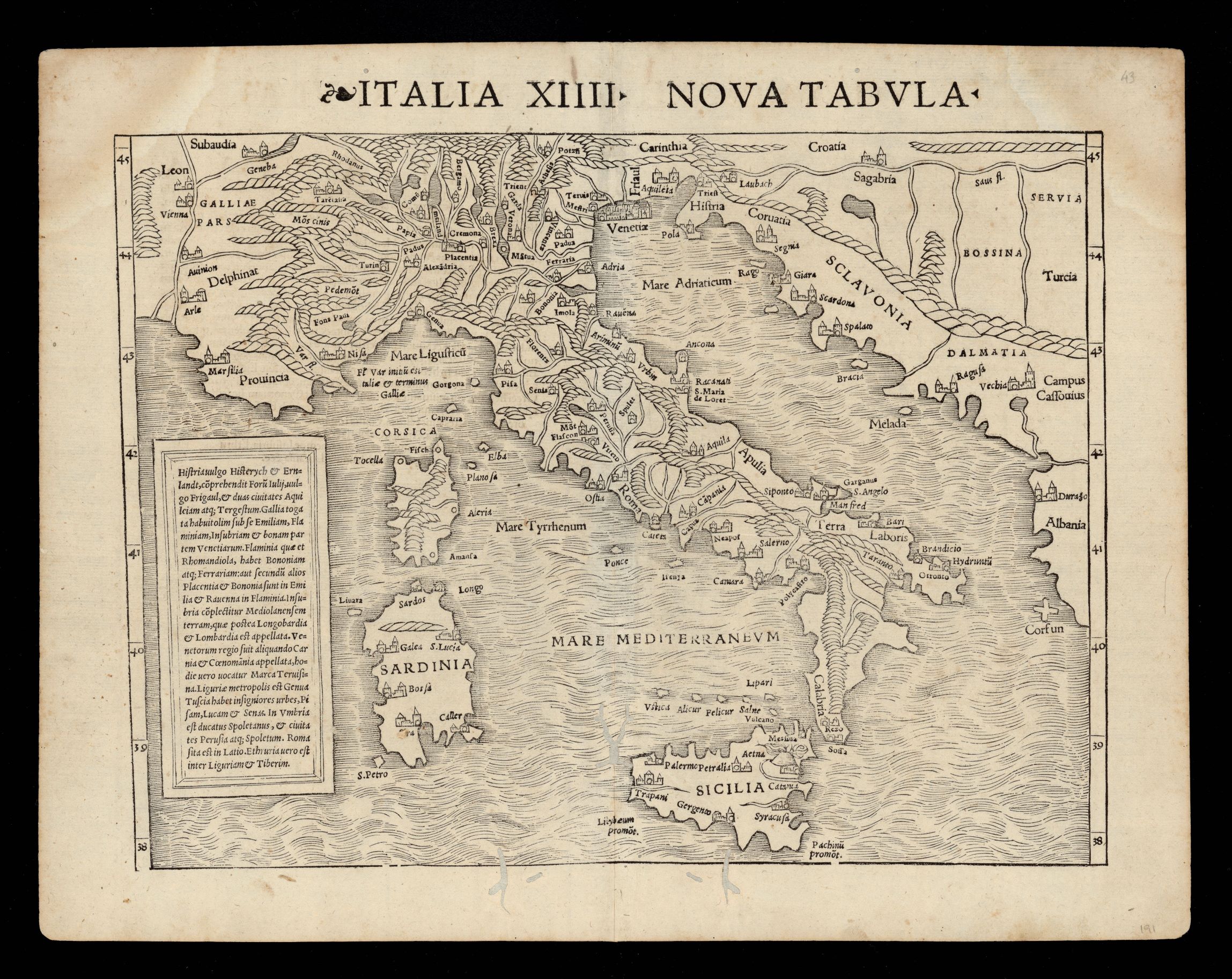
|
930- Nuova tabella Italia XIIII .
Author: Munster
,1542 |
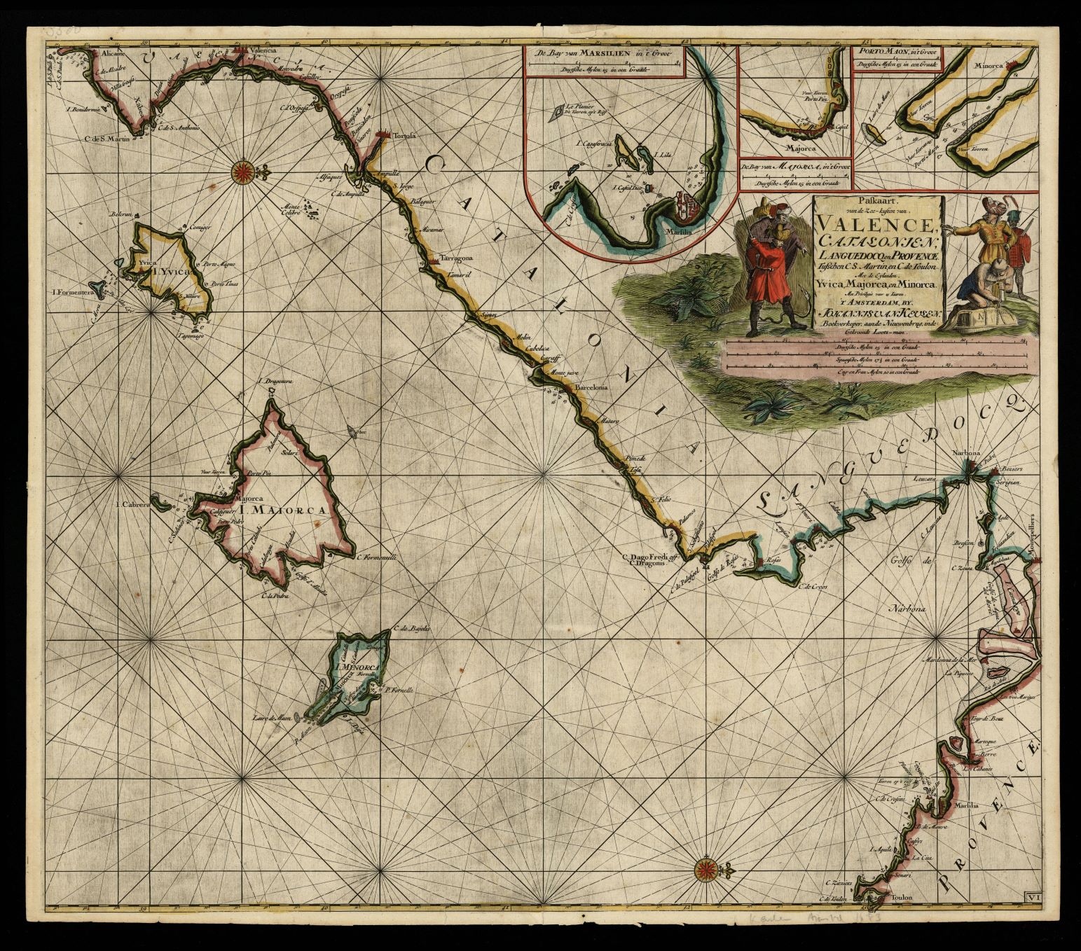
|
929- Paskaart von de Zee-kusten von Valence, Catalonien, Languedocq en Provence tusschen C .
Author: Johannis van Keulen
,1683 |
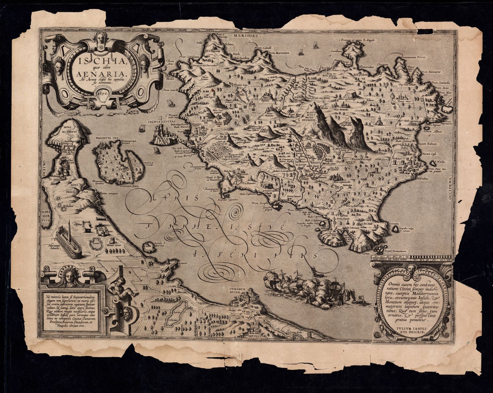
|
928-Ischia quae olim Aenaria ab Aenea classe hic appulsa sic nominata / Ivlivs Iasolinvs d .
Author: 1590 Julius Jasolinus
,1590 |
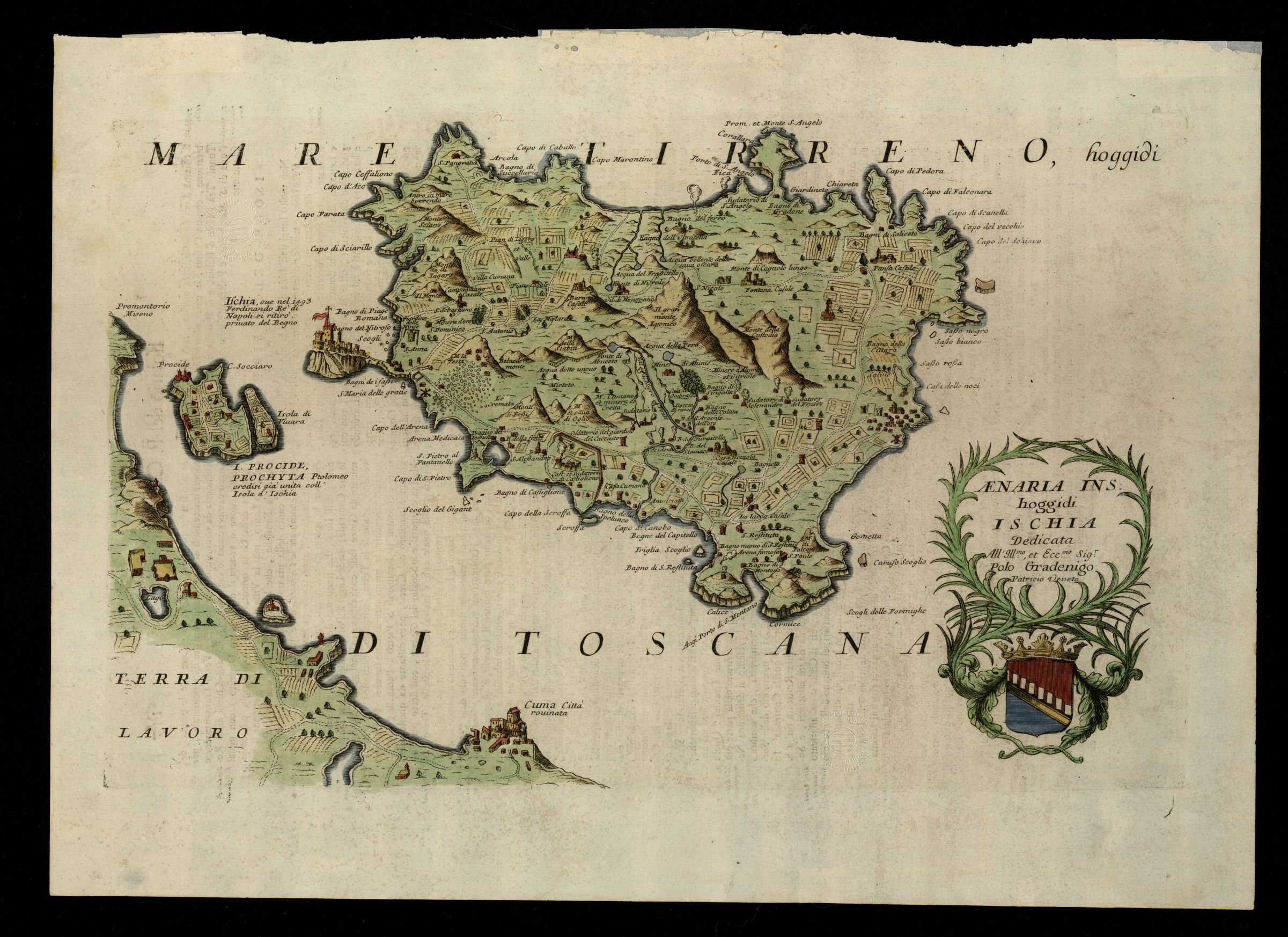
|
927-Aenaria ins. hoggidi Ischia / dedicata all'Illmo., et Eccmo. Sigr. Polo Gradenigo patr .
Author: Coronelli
,1696 |
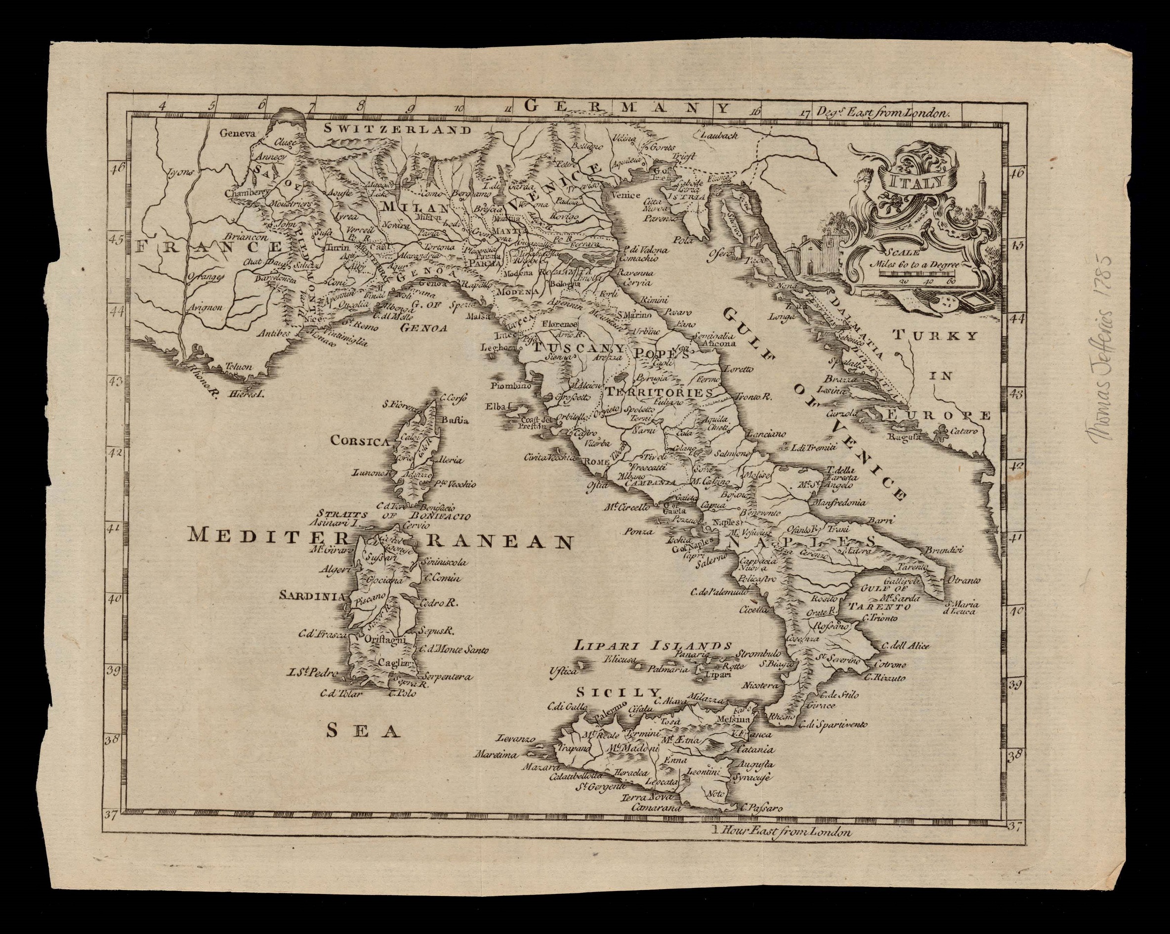
|
926-Italy .
Author: Thomas Jefferys
,1749 |
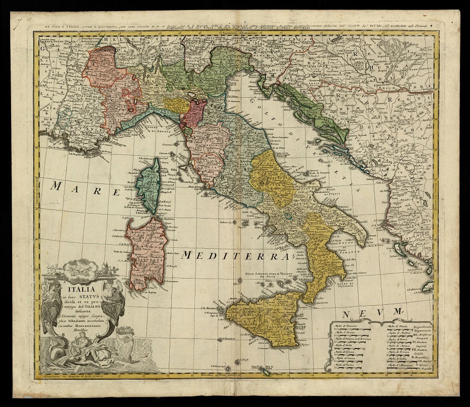
|
922- Italia in suos status divisa et ex prototypo del'Isliano desumta elementis insuper ge .
Author: Homannischen Erben
,1742 |

|
.
Author:
,0 |

|
.
Author:
,0 |
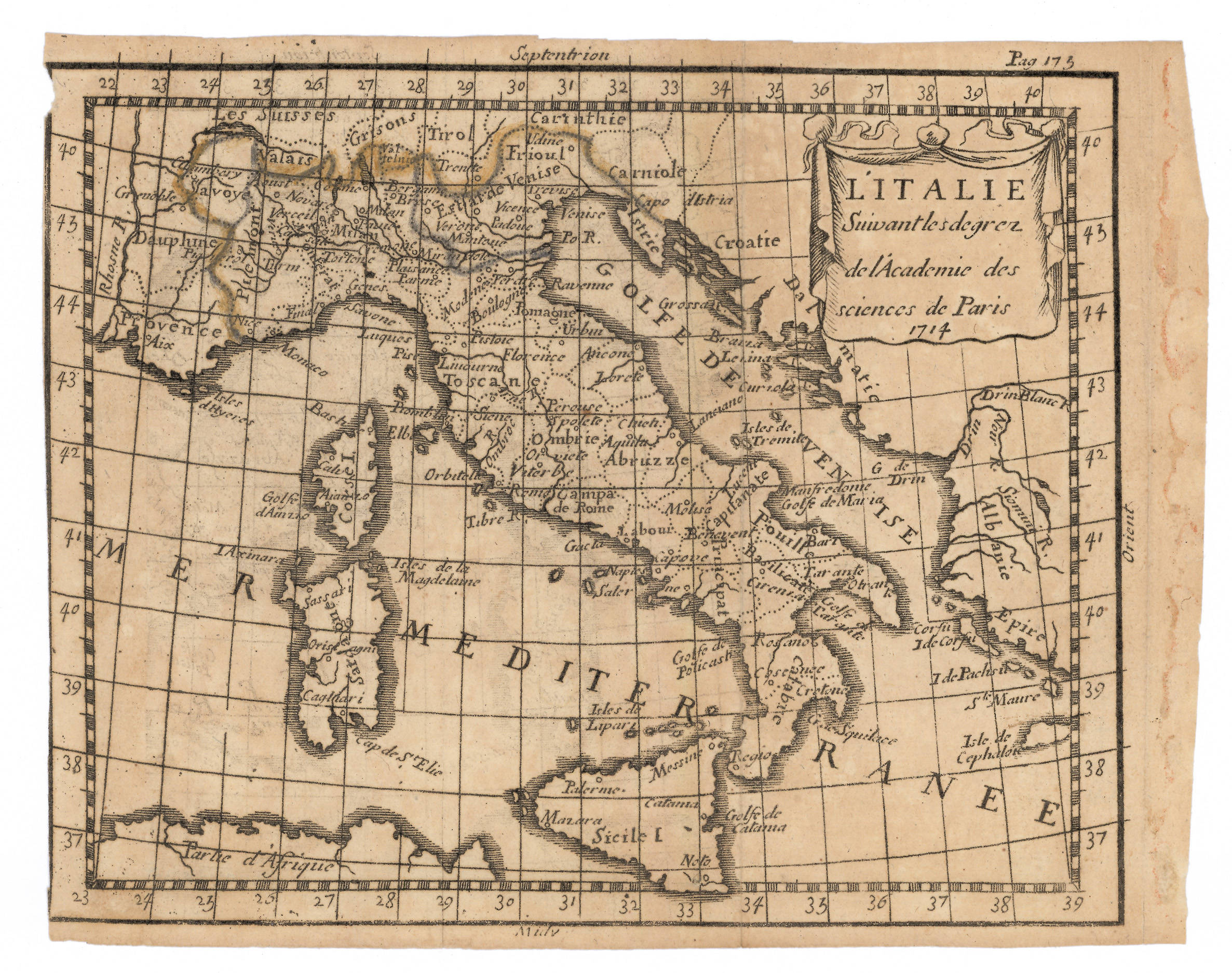
|
921- L'Italia, secondo i diplomi dell'Accademia delle Scienze di Parigi .
Author: Abraham Du Bois
,1714 |

|
.
Author:
,0 |
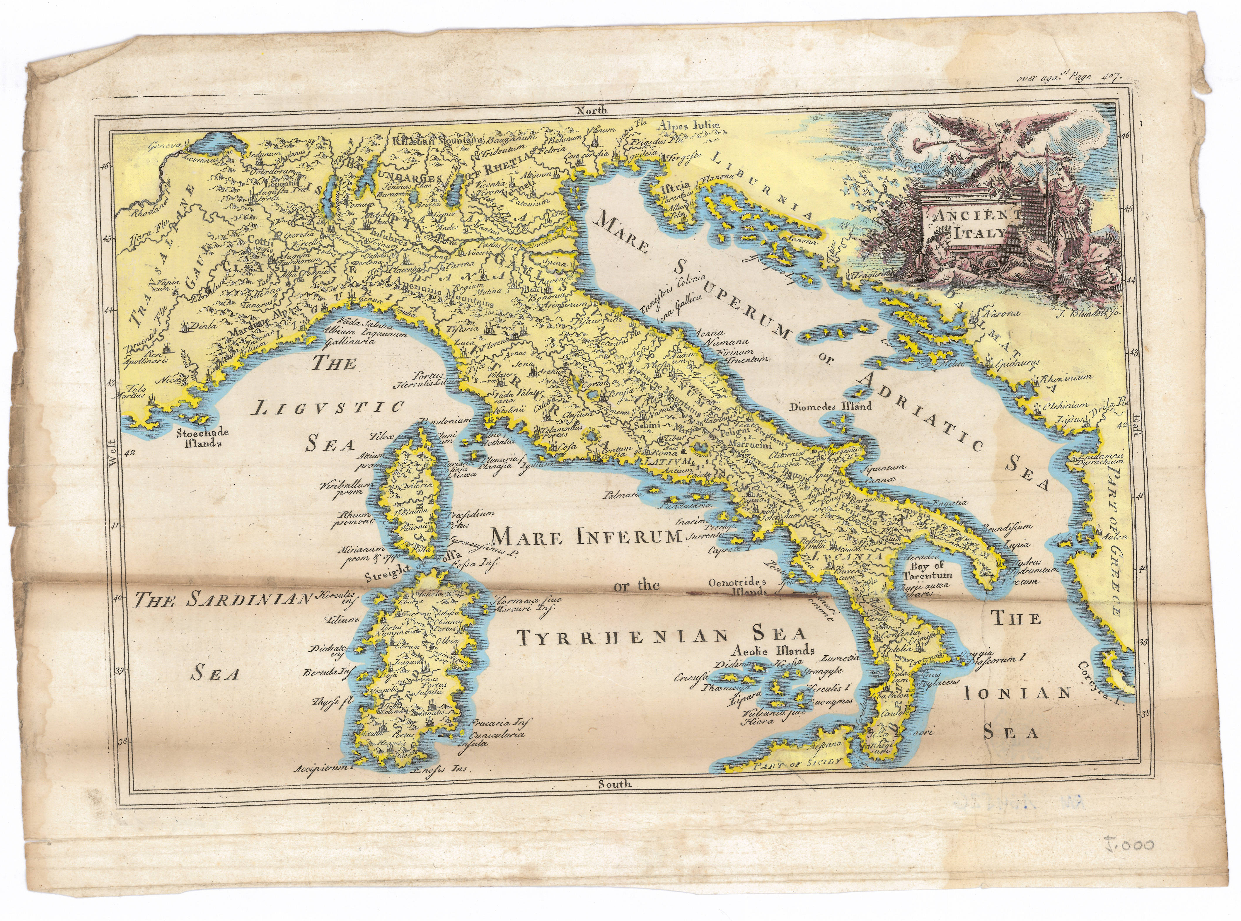
|
919- Antica Italia .
Author:
,1700 |

|
918-Die Insul oder das Kongsreich Sicilien .
Author: Stridbeck Junior
,1710 |
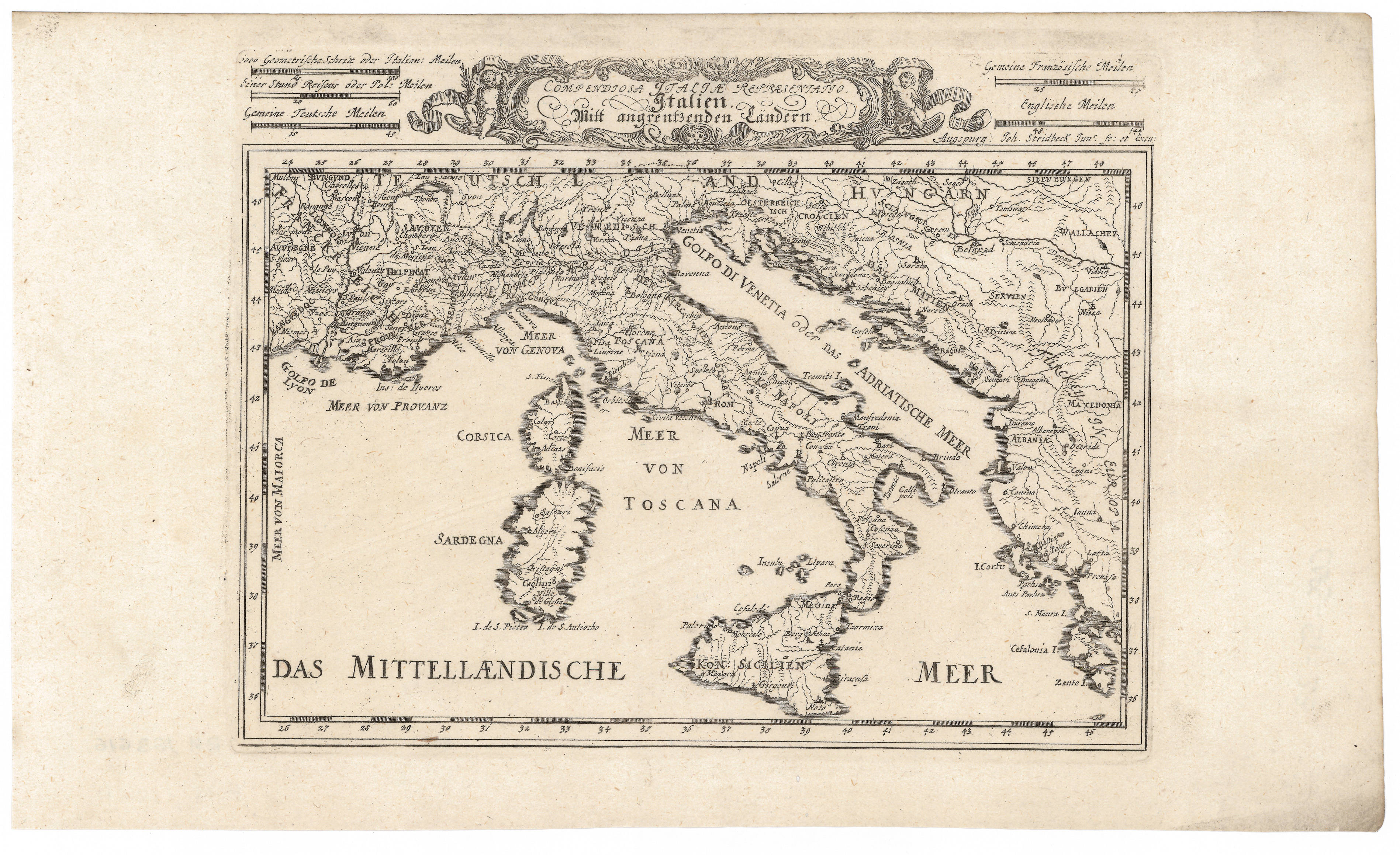
|
917-Rappresentatio Compendiosa Italiae. Italiano Mitt angrentzenben Landen .
Author: Stridbeck Junior
,1710 |
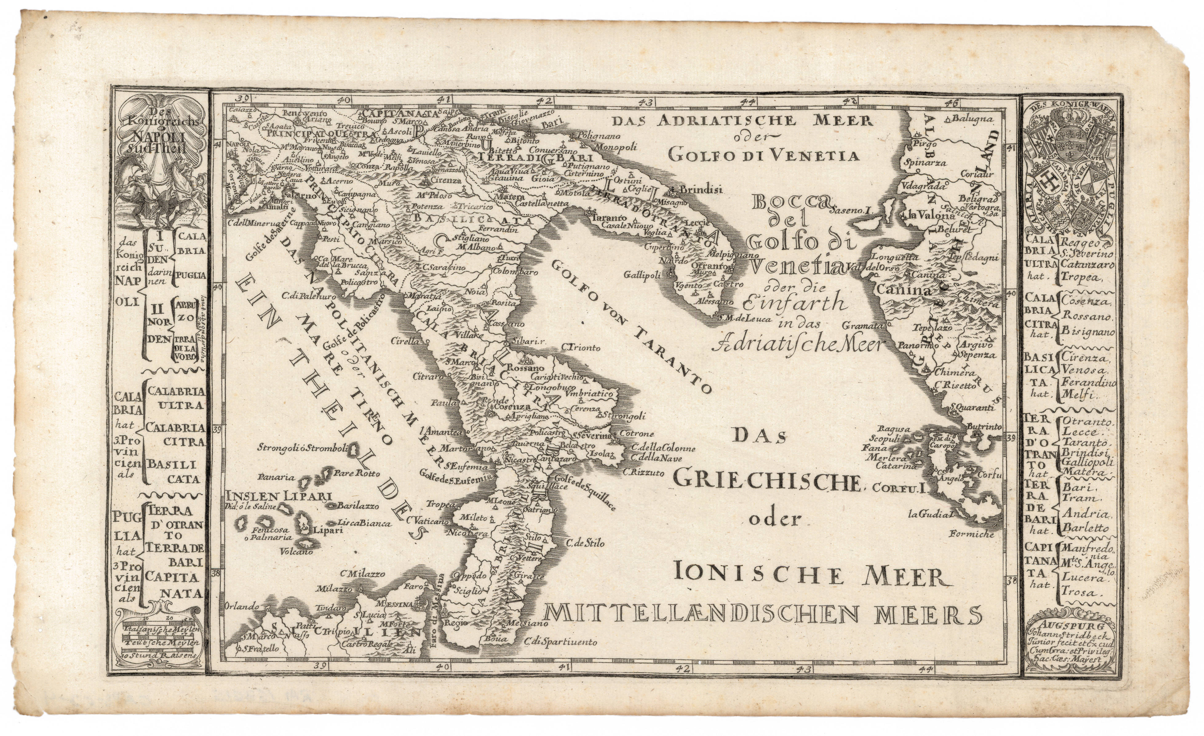
|
916- Das Königreichs Napoli: Sud-Theil .
Author: Stridbeck
,1720 |
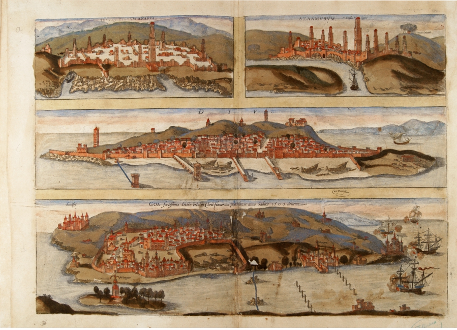
|
776-Goa .
Author: Georgii Braun
Colonia,1575 |

|
915- Carte de la Grande Grece i compris la Sicilie .
Author: Rolli
,1750 |
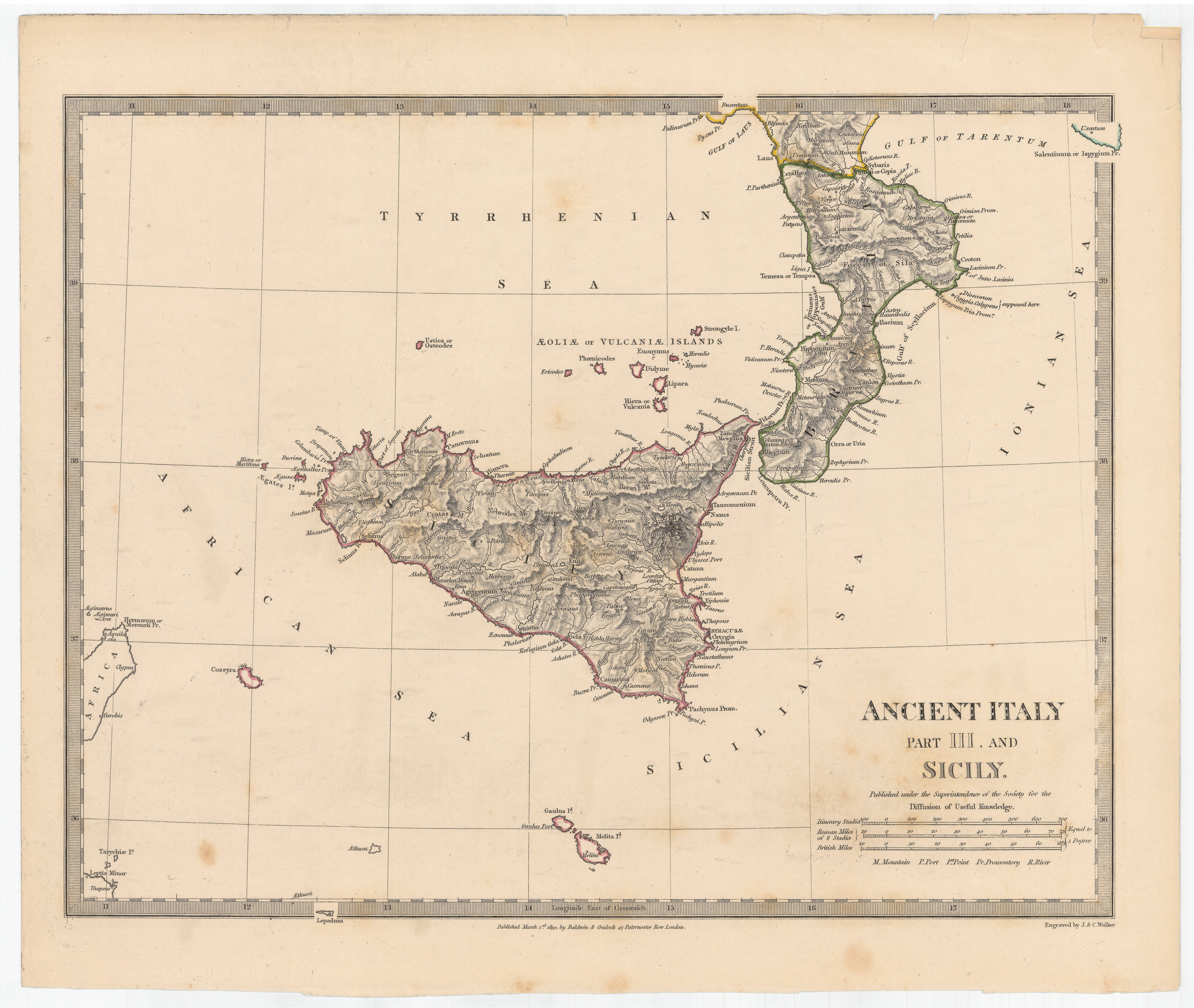
|
914- Ancient Italy : part III and Sicily .
Author: Walker
,1830 |

|
913- Italia con le sue poste e le strade principali .
Author:
,1700 |

|
912-Italia Antiqua .
Author: Seale
,1740 |
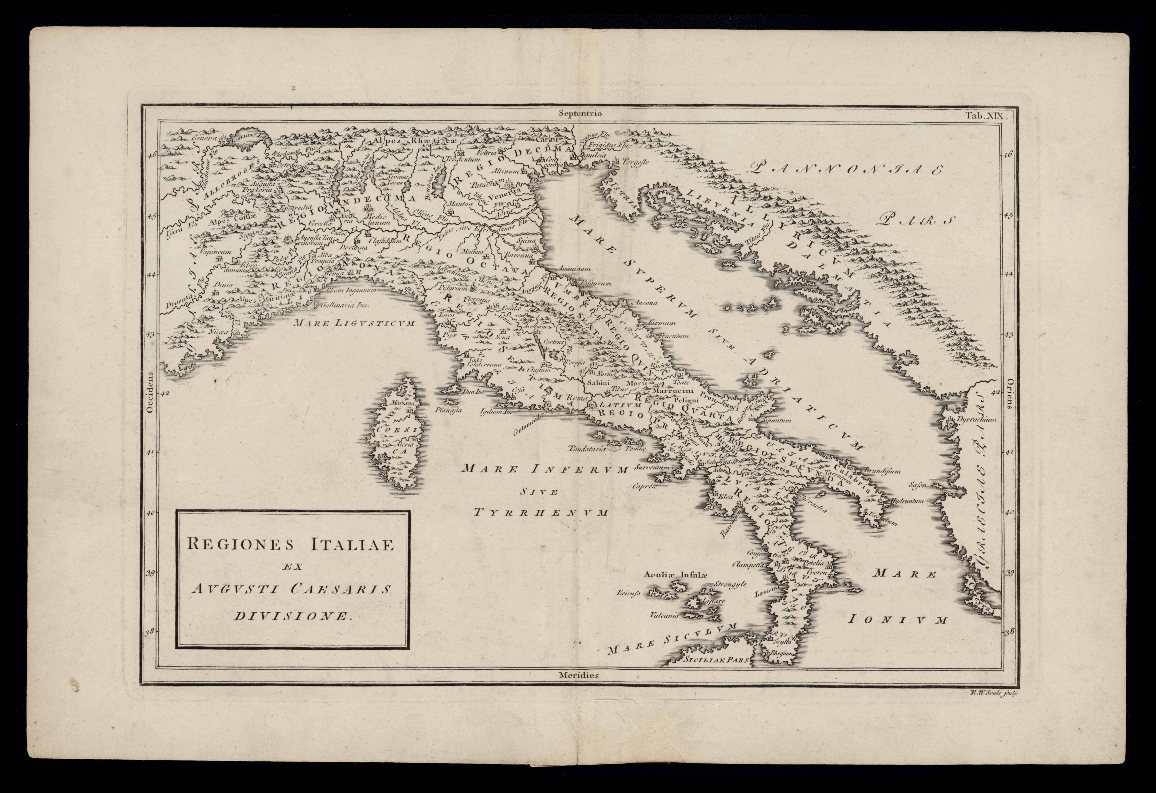
|
911- Regiones italiae ex Augusti Caesaris divisione .
Author: Seale
,1740 |
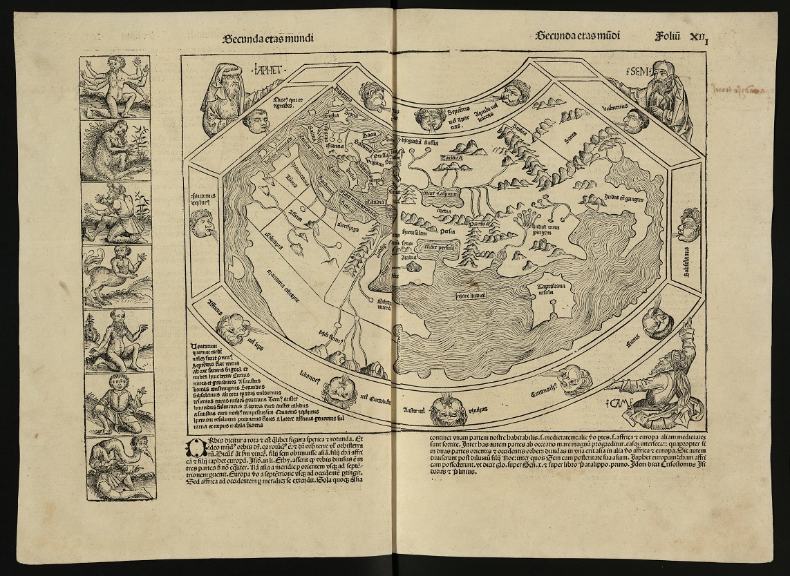
|
910- Mapamundi, inclòs a la Crònica de Nuremberg de 1493 .
Author: Anton Koberger
,1493 |

|
.
Author:
,0 |
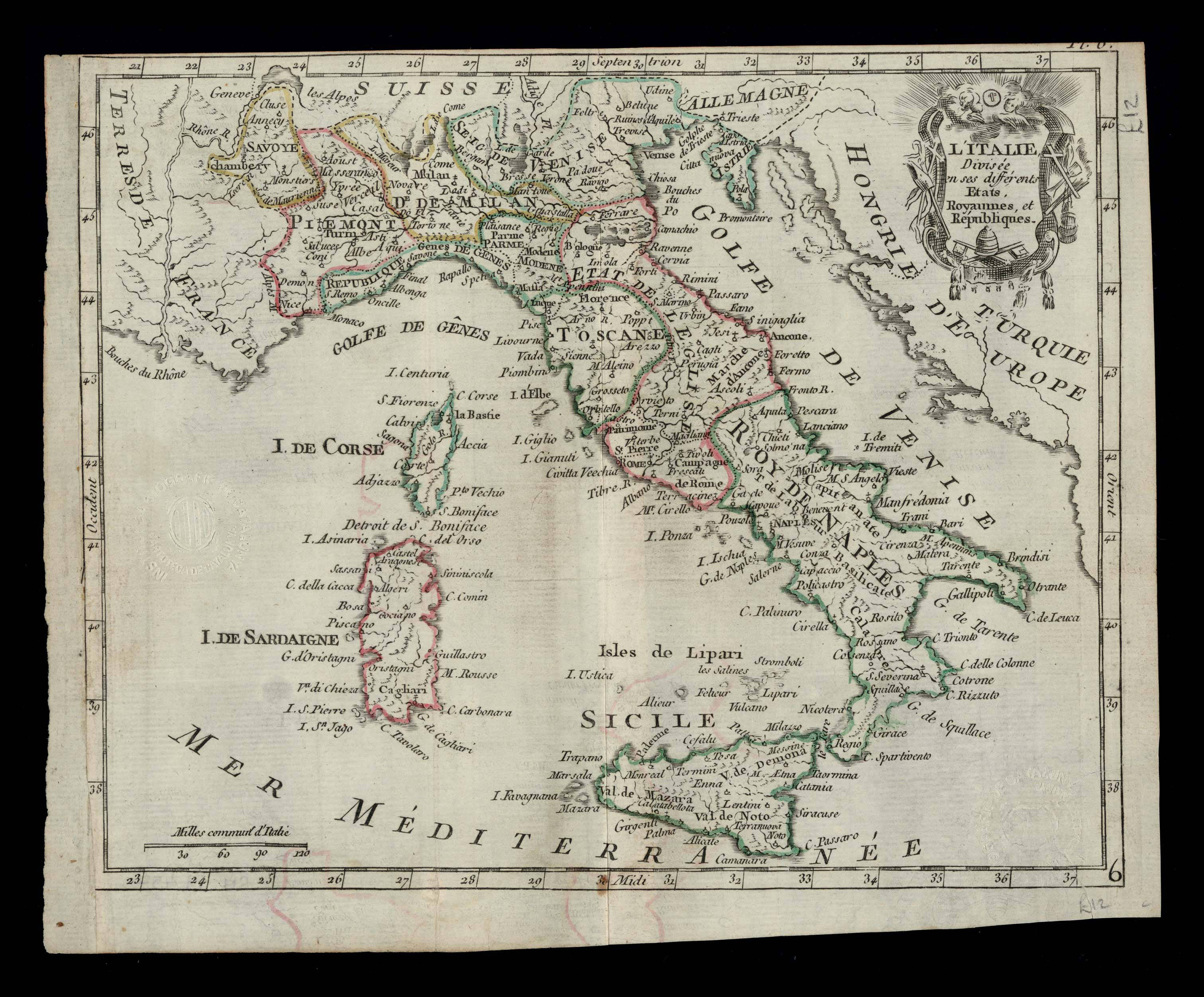
|
908- L'Italie divisée en ses différents etats, royaumes et républiques .
Author:
,1700 |

|
.
Author:
,0 |
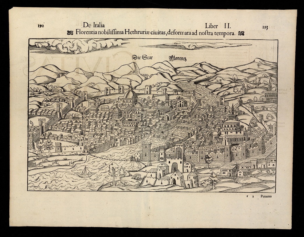
|
906-Florentia nobilissima Hethruriae ciuitas, deformata ad nostra tempora .
Author: Munster
,1550 |

|
.
Author:
,0 |

|
904-Isles Mallorcaque, Minorque et Yvice .
Author: M.Bonne
,1787 |
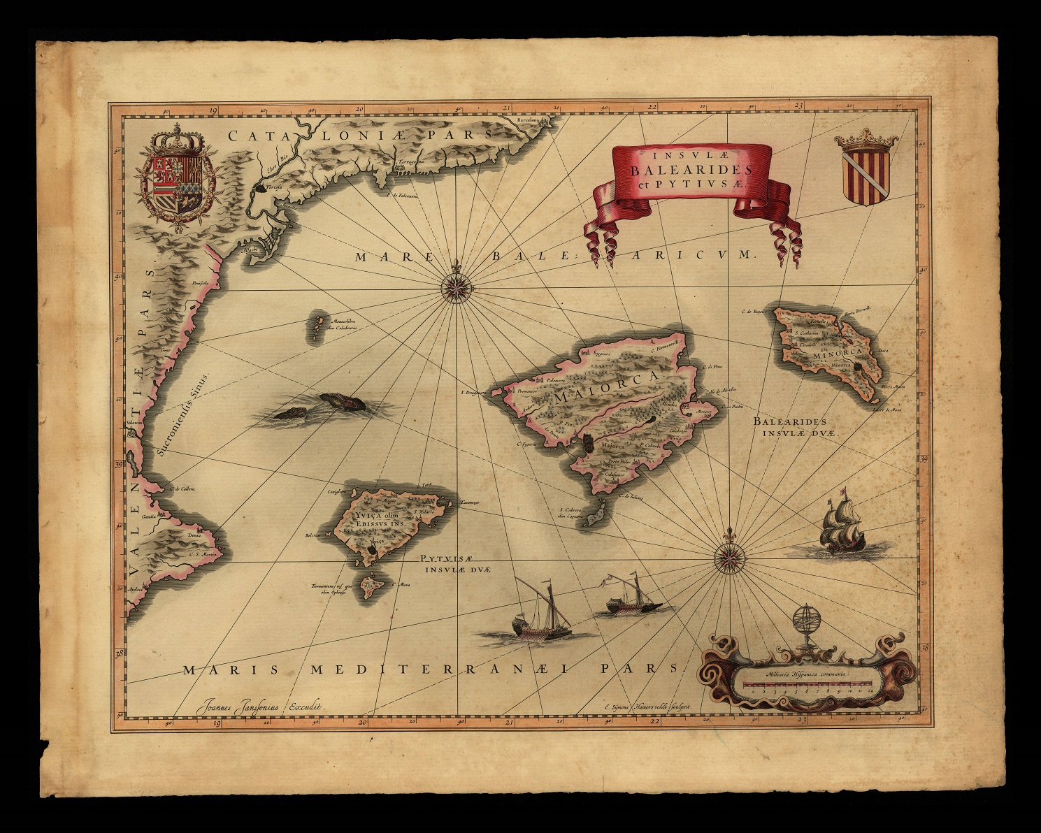
|
903-Insvlae Balearides et Pytivsae .
Author: Iohannes Ianssonium
,1658 |
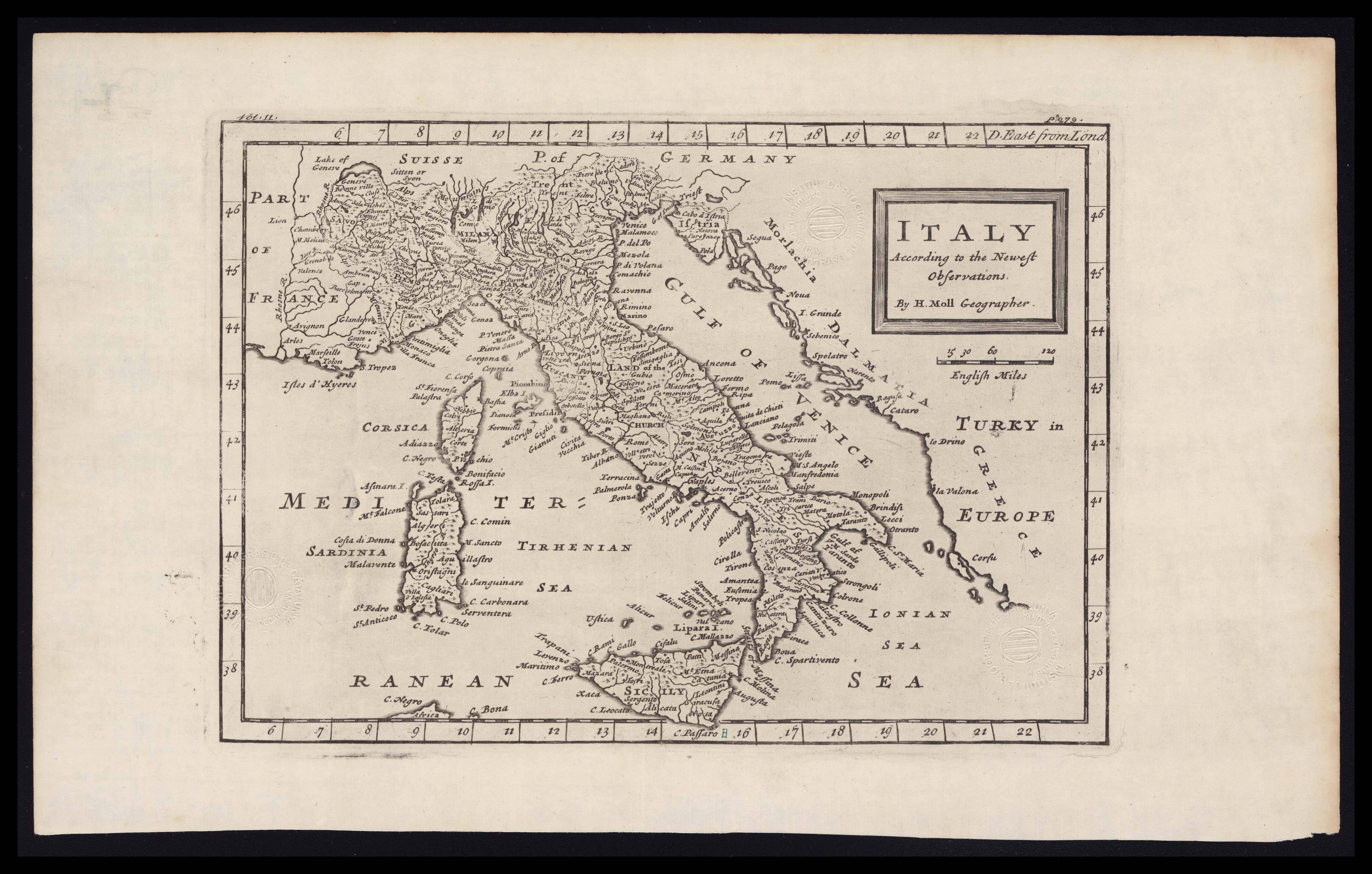
|
902-Italy .
Author: H.Moll
,1740 |
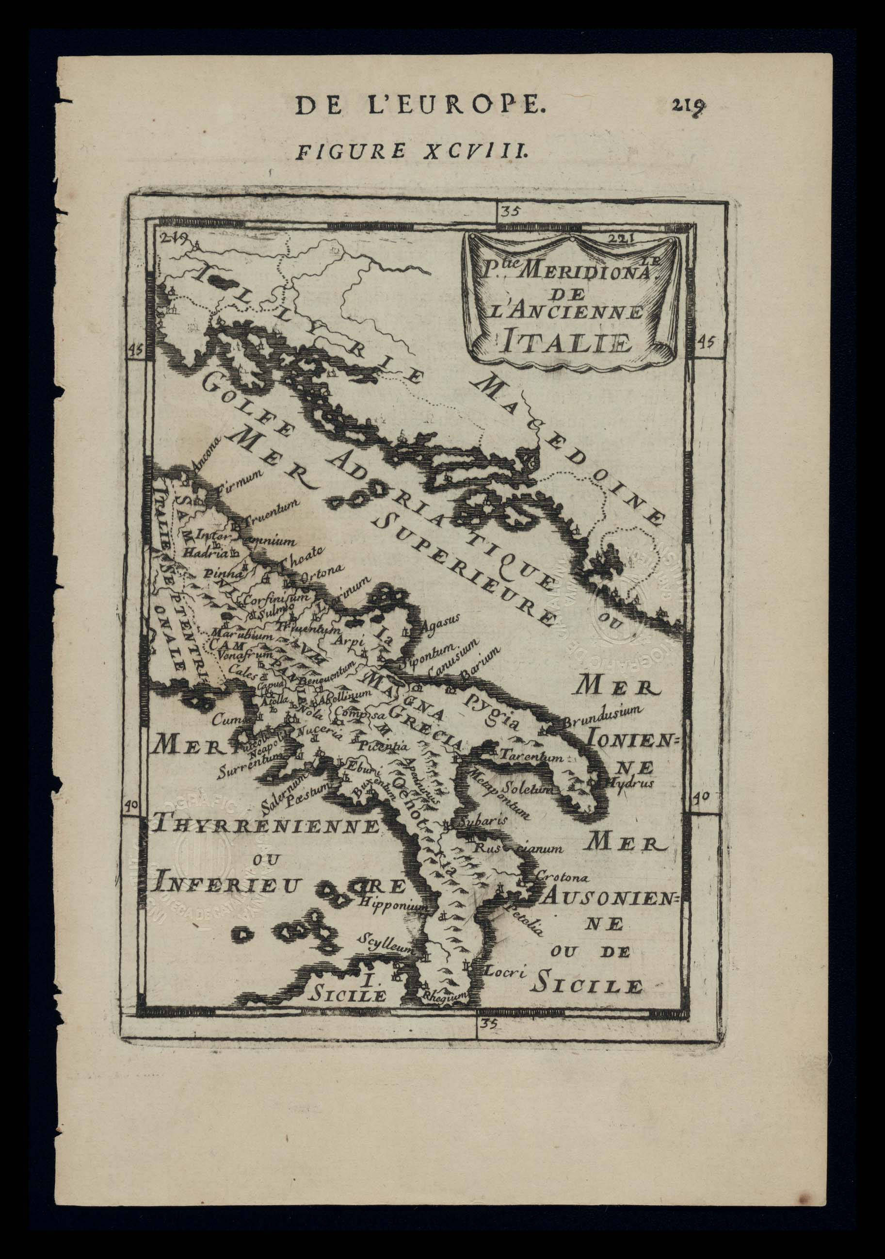
|
901-Parte Meridionale de l’Ancienne Italie .
Author: Manesson
,1683 |
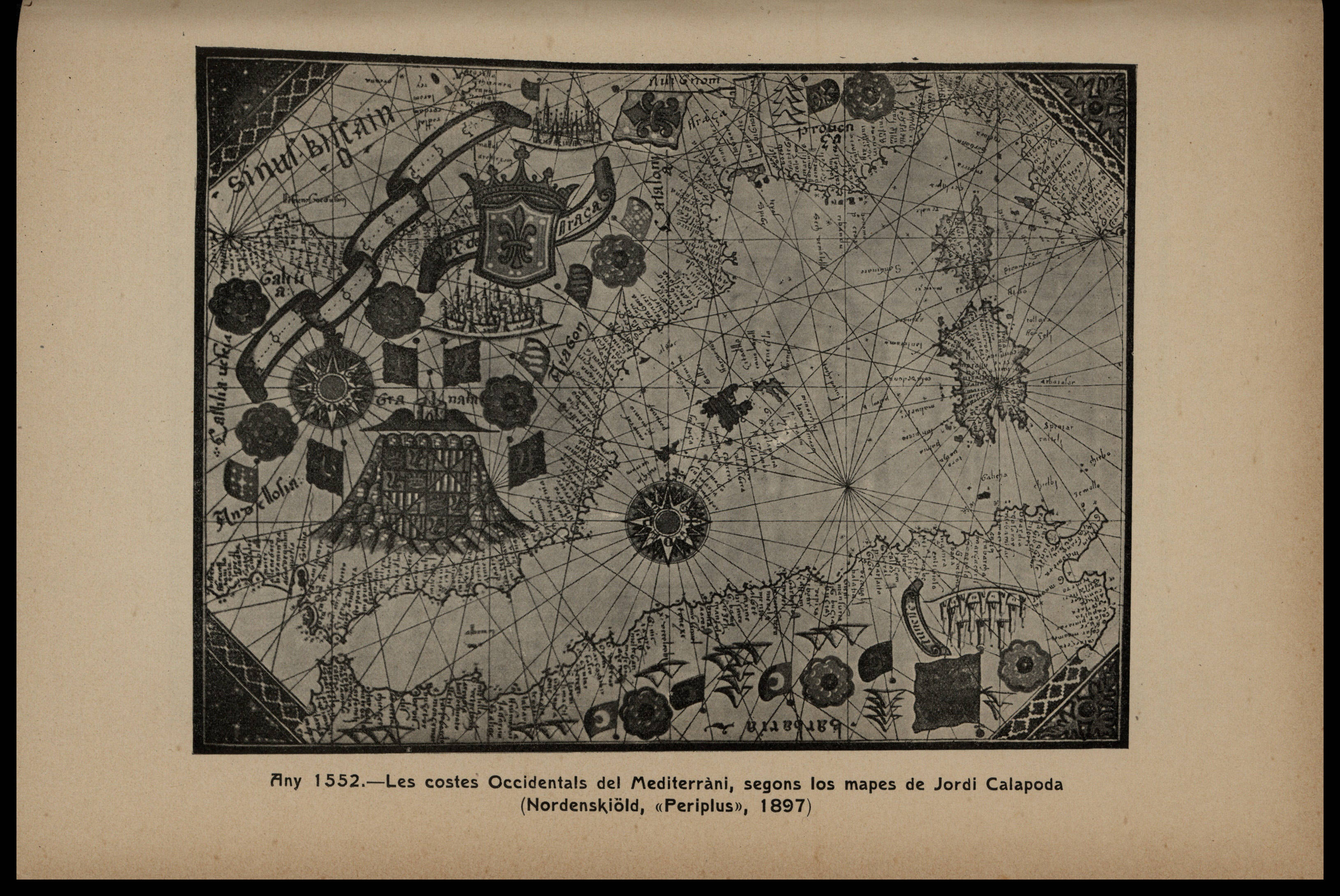
|
900- [Peu] Any 1552. Les costes occidentals del Mediterrani, segons los mapes de Jordi Cal .
Author: Giorgio Calapoda
,1497 |
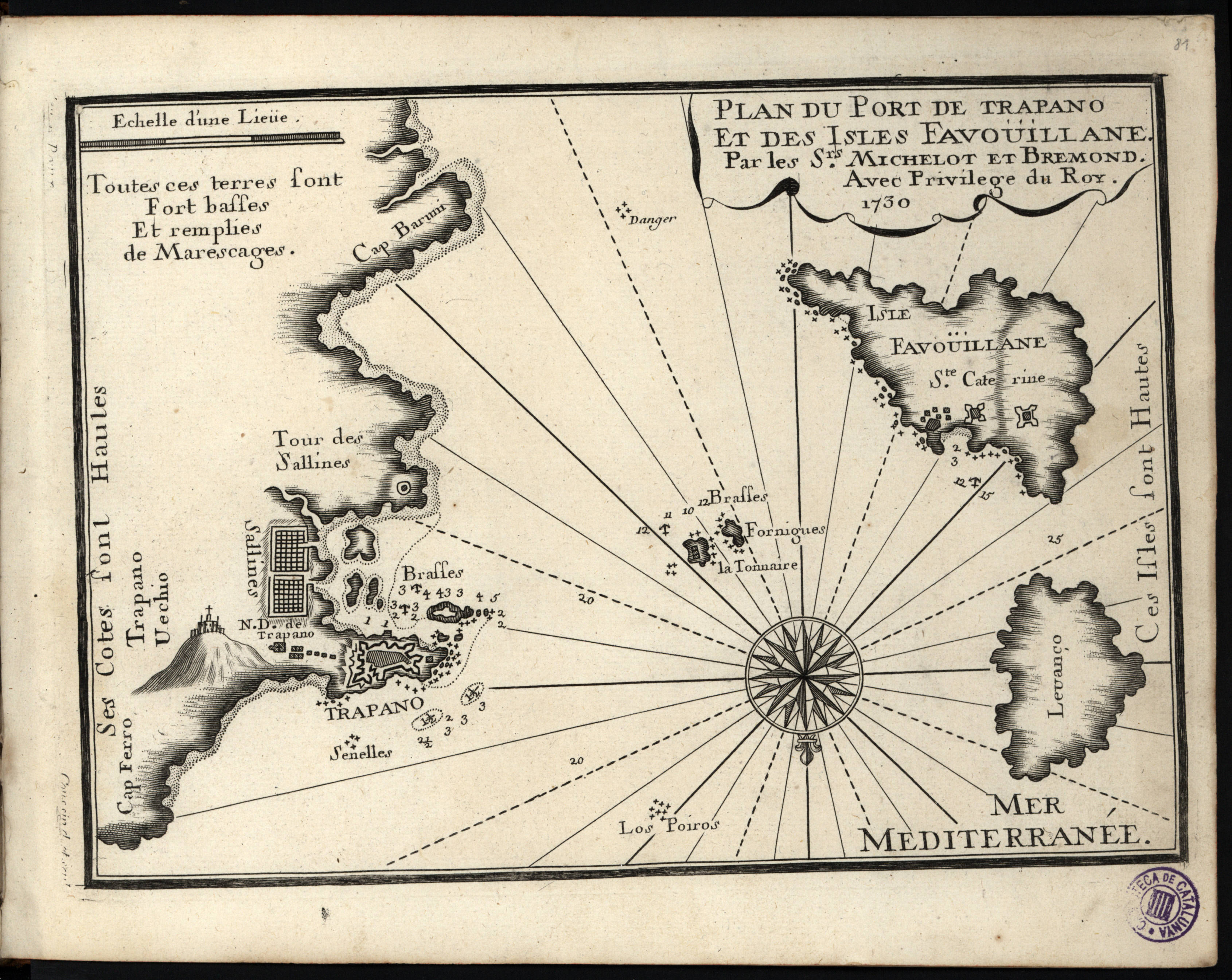
|
899-Plan du Port de Trapano et des Isles Favouiliane .
Author: Henri Michelot
Marsiglia,1730 |
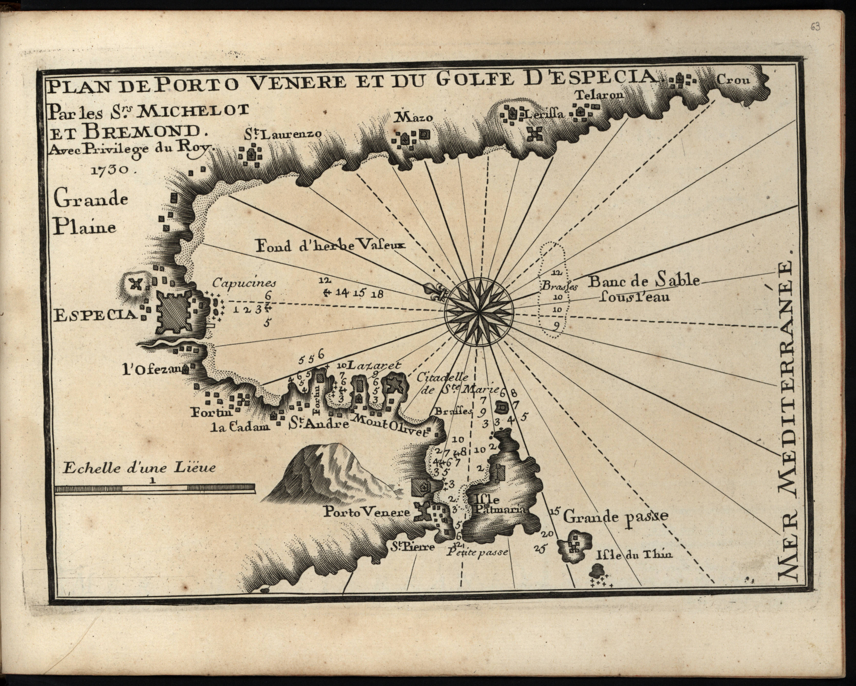
|
898- Plan de Porto Venere et du golfe d'Especia .
Author: Henri Michelot
Marsiglia,1730 |
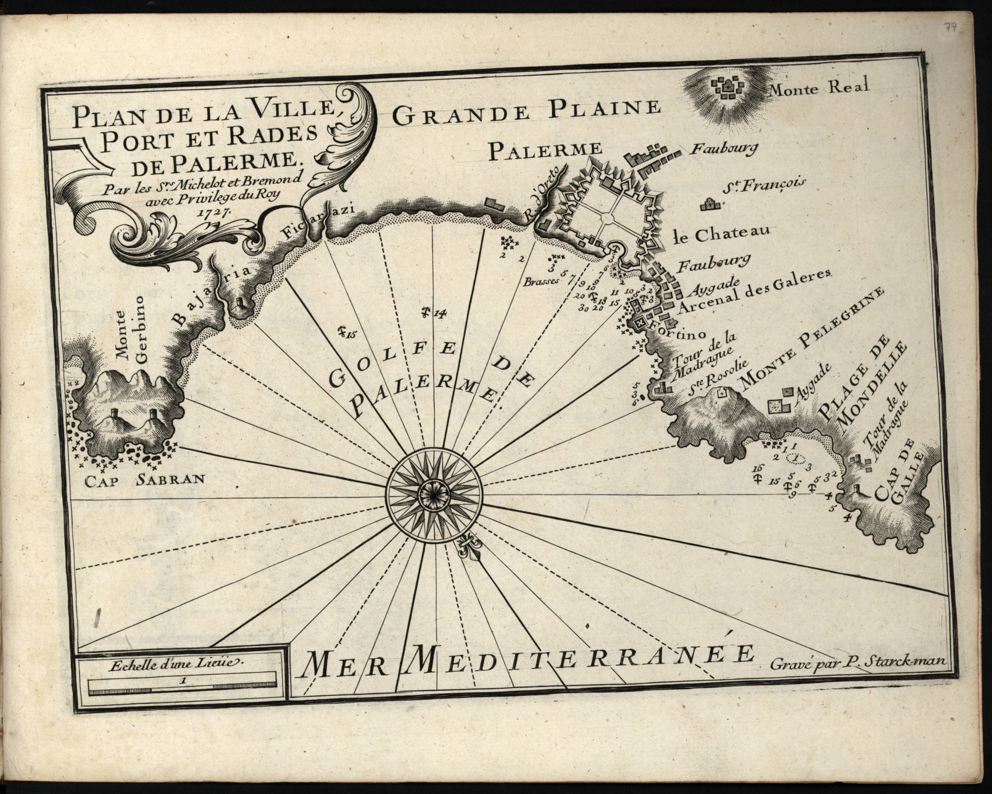
|
897- Plan de la ville, port et rades de Palerme .
Author: Henri Michelot
Marsiglia,1727 |
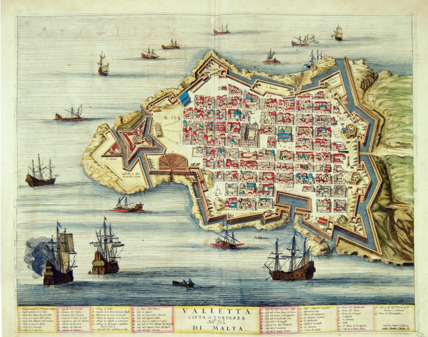
|
801-Valletta citta et fortezza nell’Isola di Malta .
Author: Joan Blaeu
Amsterdam,1663 |
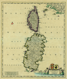
|
654 - Insularum Sardinia et Corsicae Descriptio .
Author: Frederik De Witt
Amsterdam,0 |
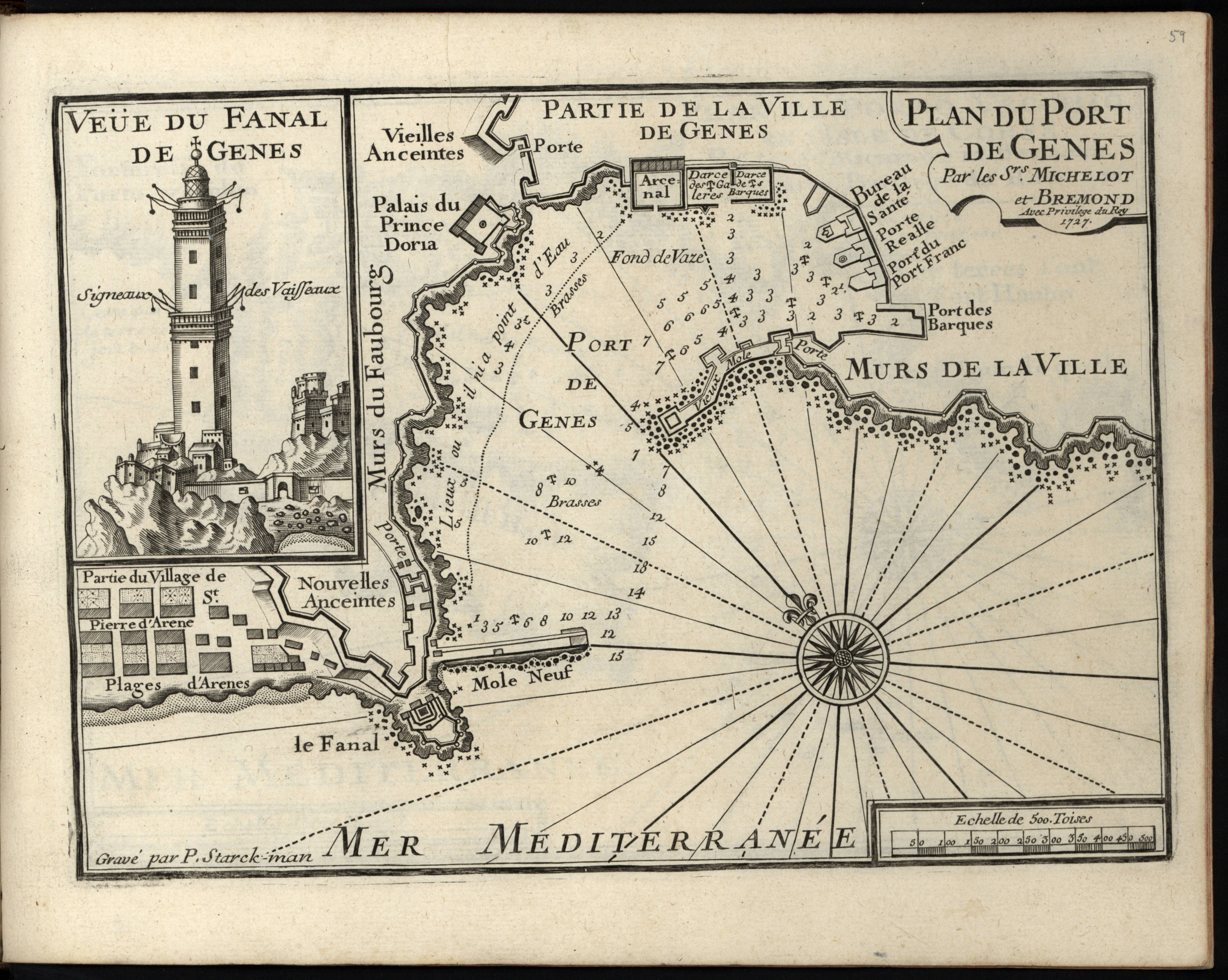
|
895- Plan du port de Genes .
Author: Henri Michelot
Messina,1727 |
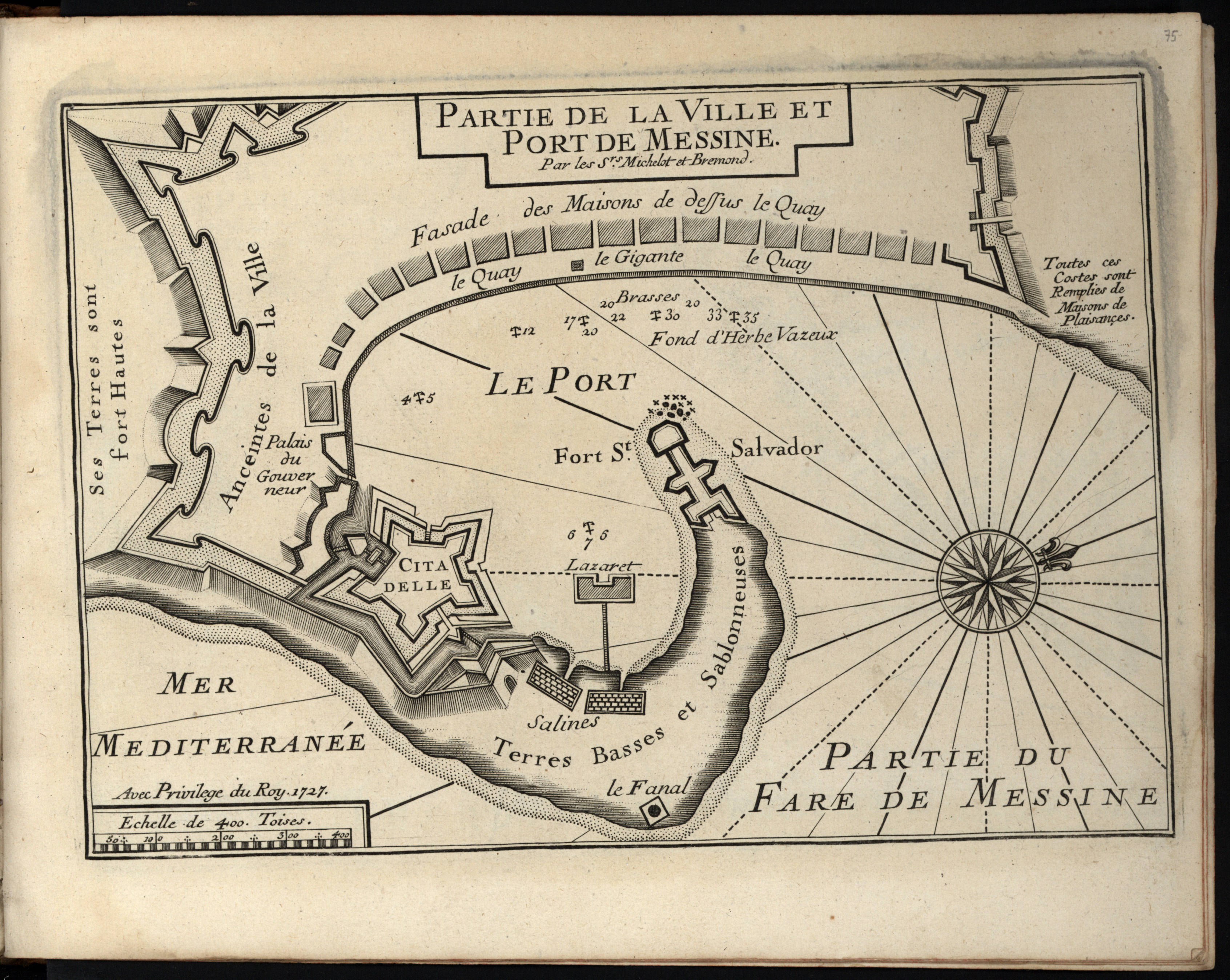
|
894-Partie de la ville et port de Messine .
Author: Henri Michelot
Marsiglia,1727 |
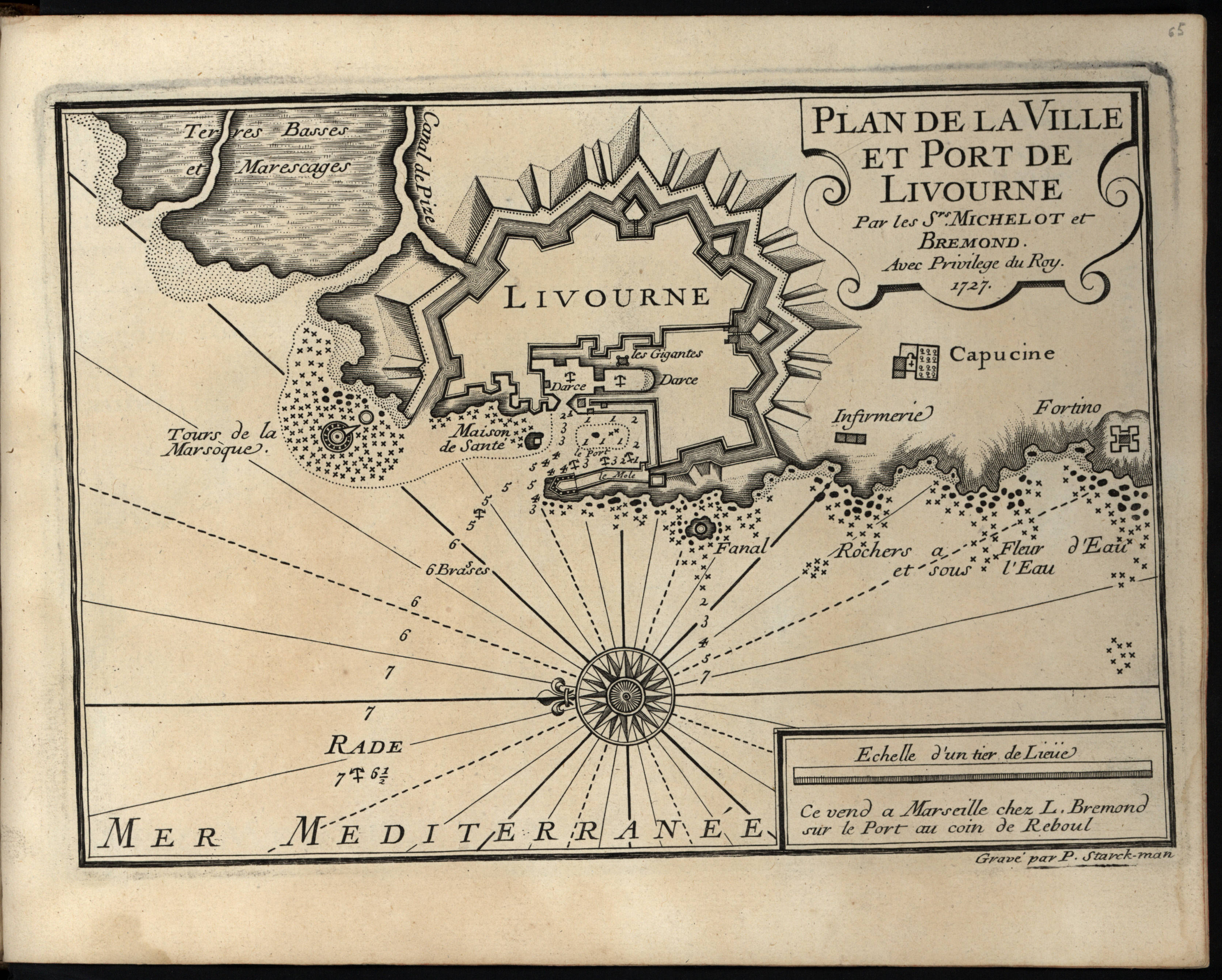
|
893- Plan de la ville et port de Livourne .
Author: Henri Michelot
Marsiglia,1727 |
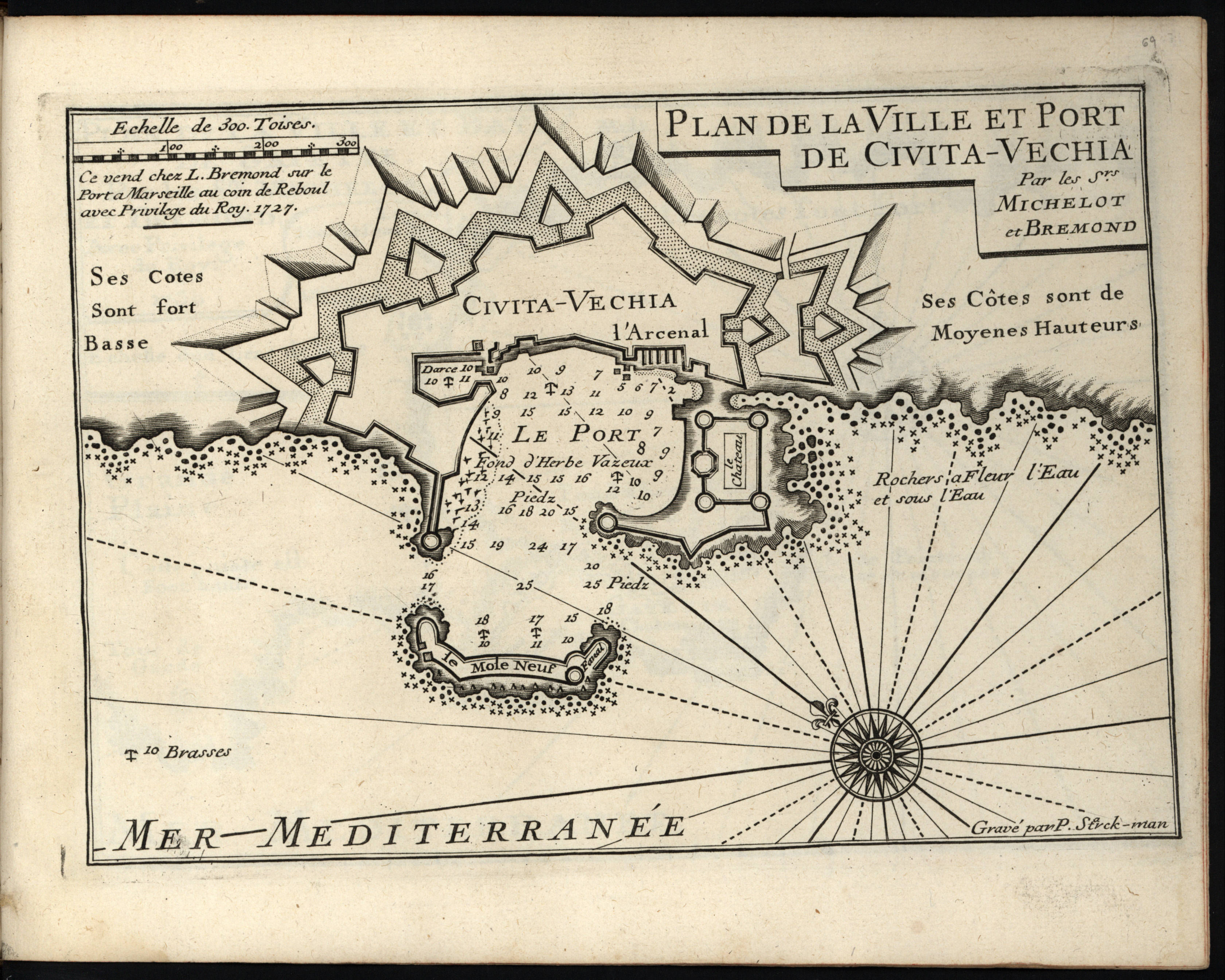
|
892- Plan de la ville et port de Civita-Vechia .
Author: Henri Michelot
Marsiglia,1727 |
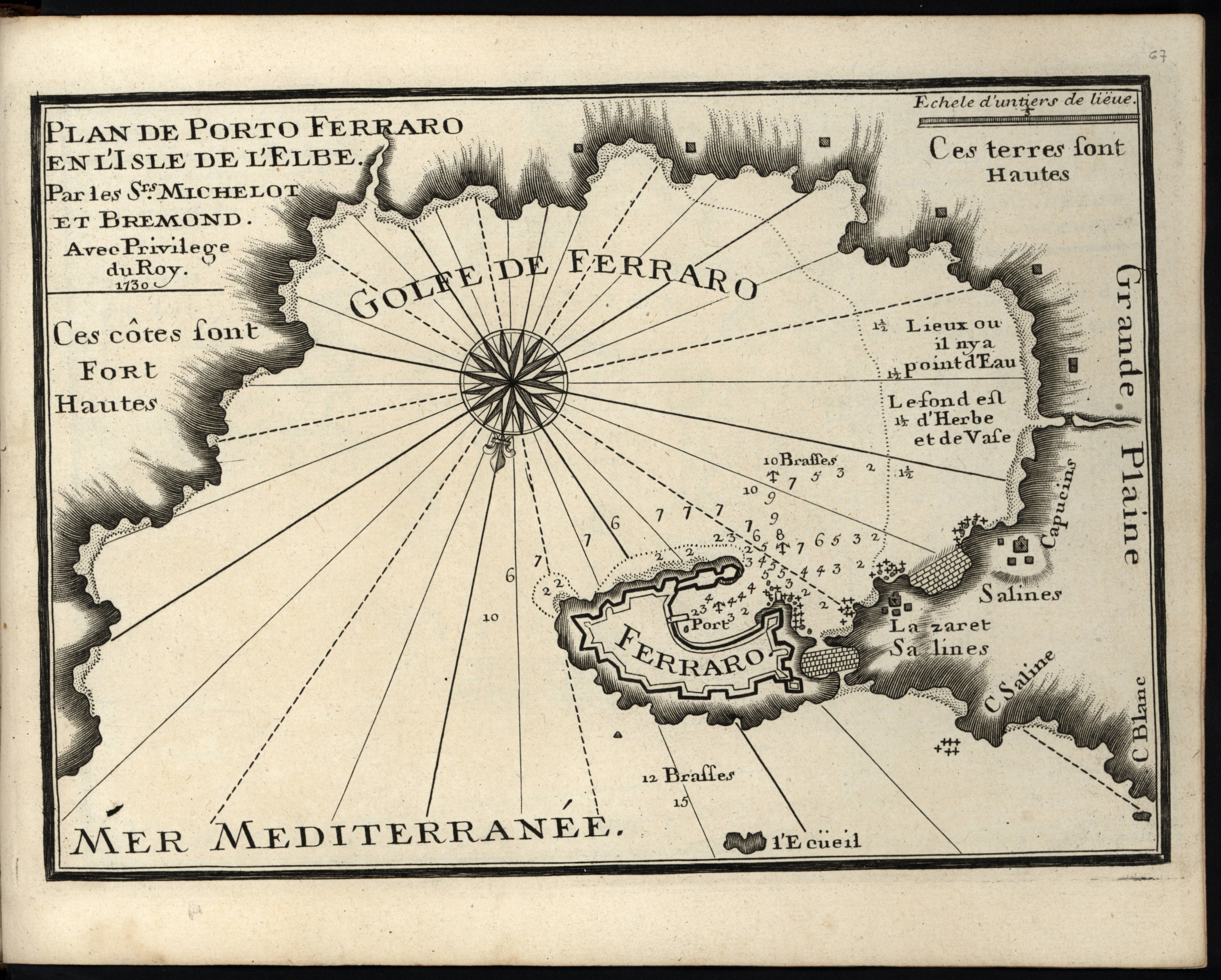
|
891-Plan de Porto Ferraro en l'isle d'Elbe .
Author: Henri Michelot
Marsiglia,1730 |
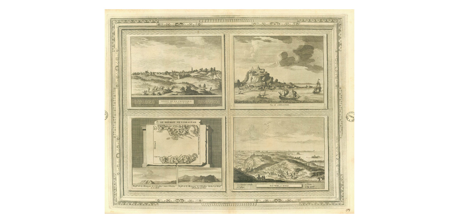
|
890-Xeres de la Frontera ; Le Détroit de Gibraltar ; Vue de Gibraltar ; Vuë de Vegel pr� .
Author: Pieter Van Der Aa
,1729 |
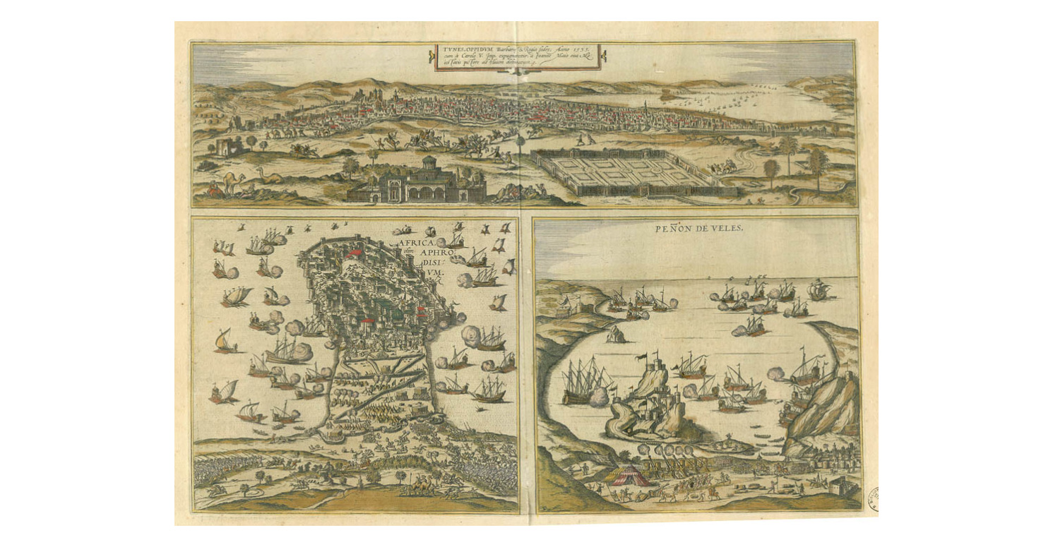
|
889-Tunes oppidum Barbaris... ; Africa Aphrodisium ; Peñon de Veles .
Author:
,1657 |
|
888-Teatro della guerra europea .
Author:
,1916 |
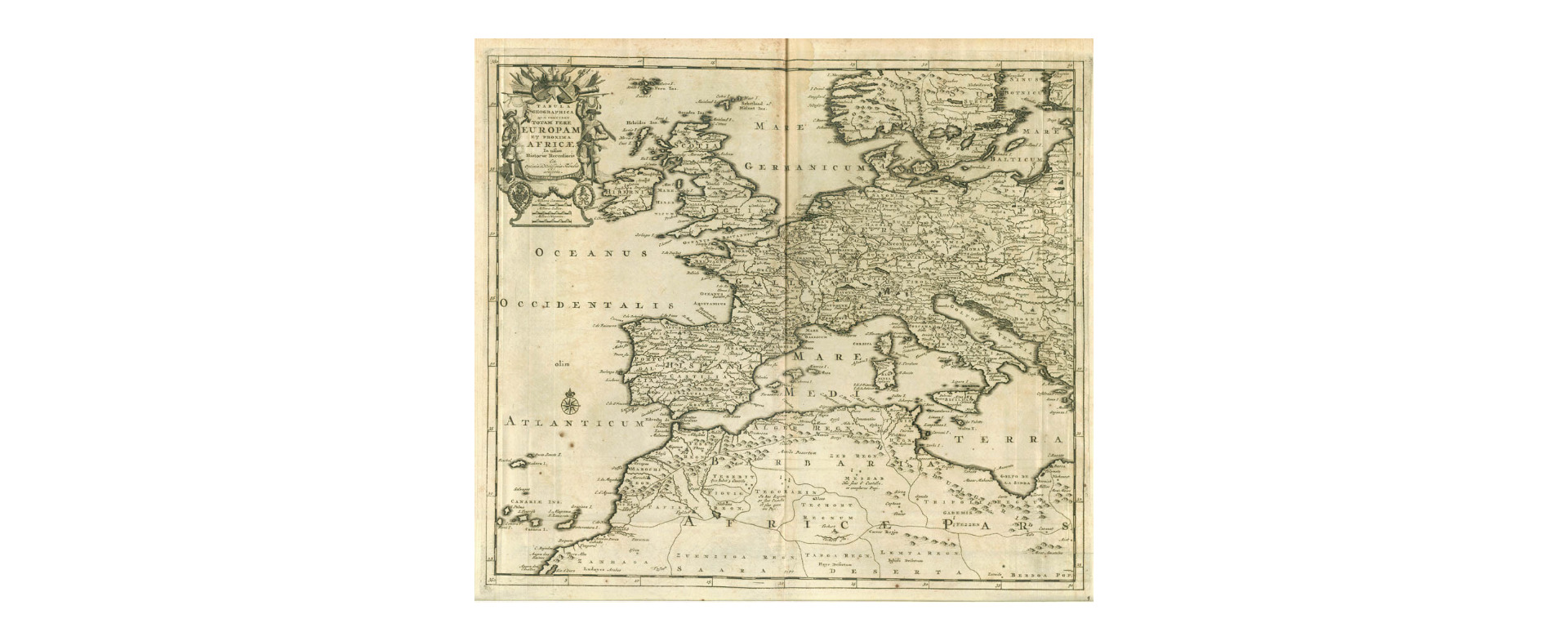
|
887- Tabula geographica que continet totam fere Europam et proxima Africae .
Author: Pieter Van Der Aa
,1729 |
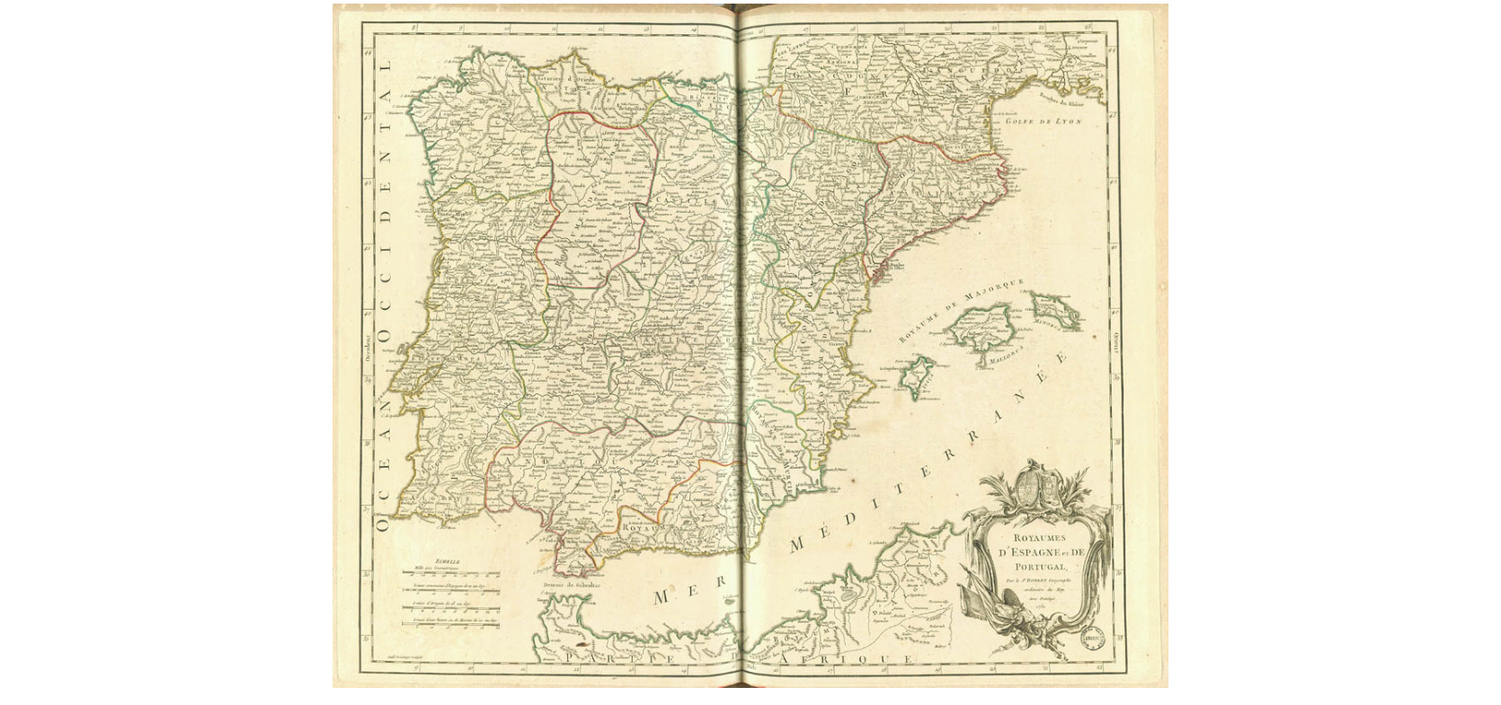
|
886- Royaume d'Espagne et de Portugal... .
Author: Robert de Vaugondy
,1750 |
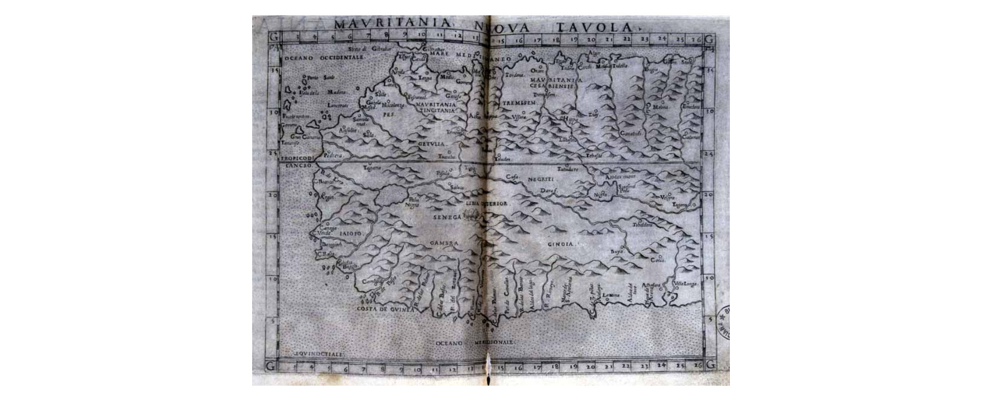
|
885- Mauritania nuova tavola .
Author: Claudio Tolomeo
,1574 |
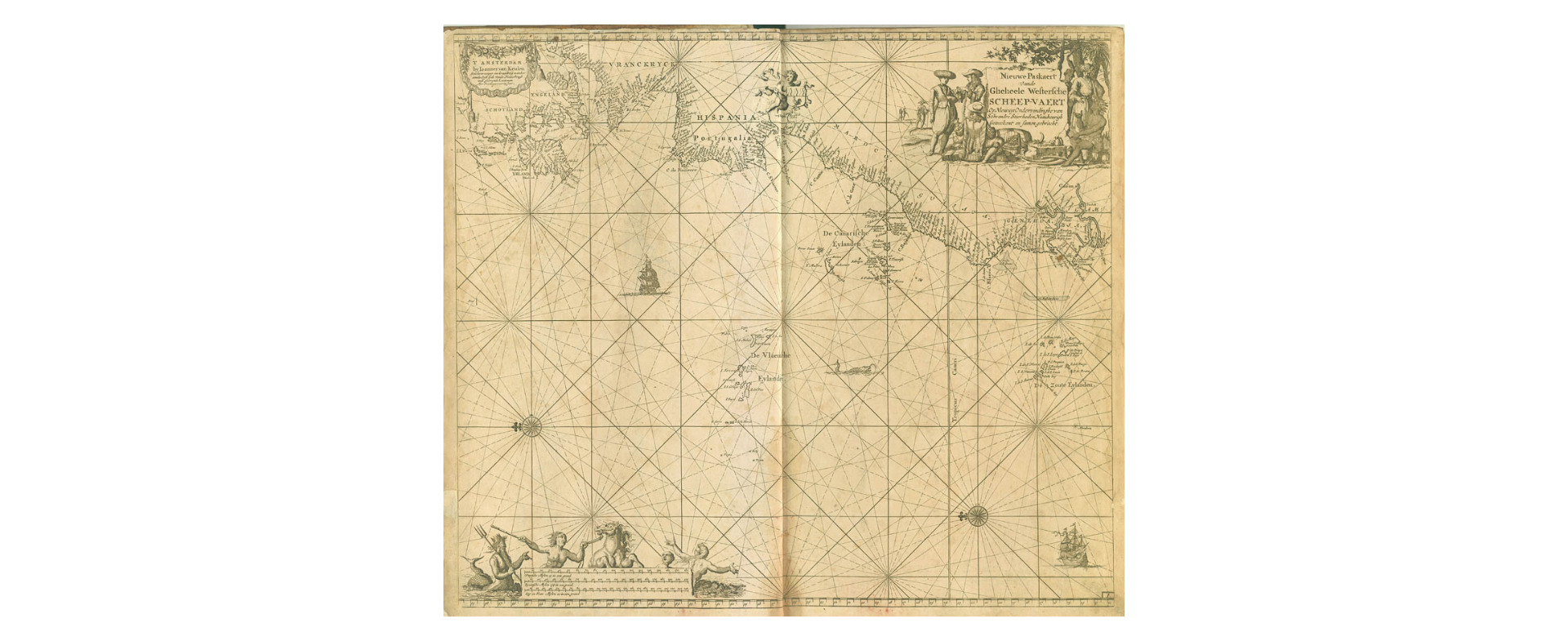
|
884- Nieuwe paskaert vande Gheheele westersche Scheep-Vaert… .
Author: Keulen
,0 |
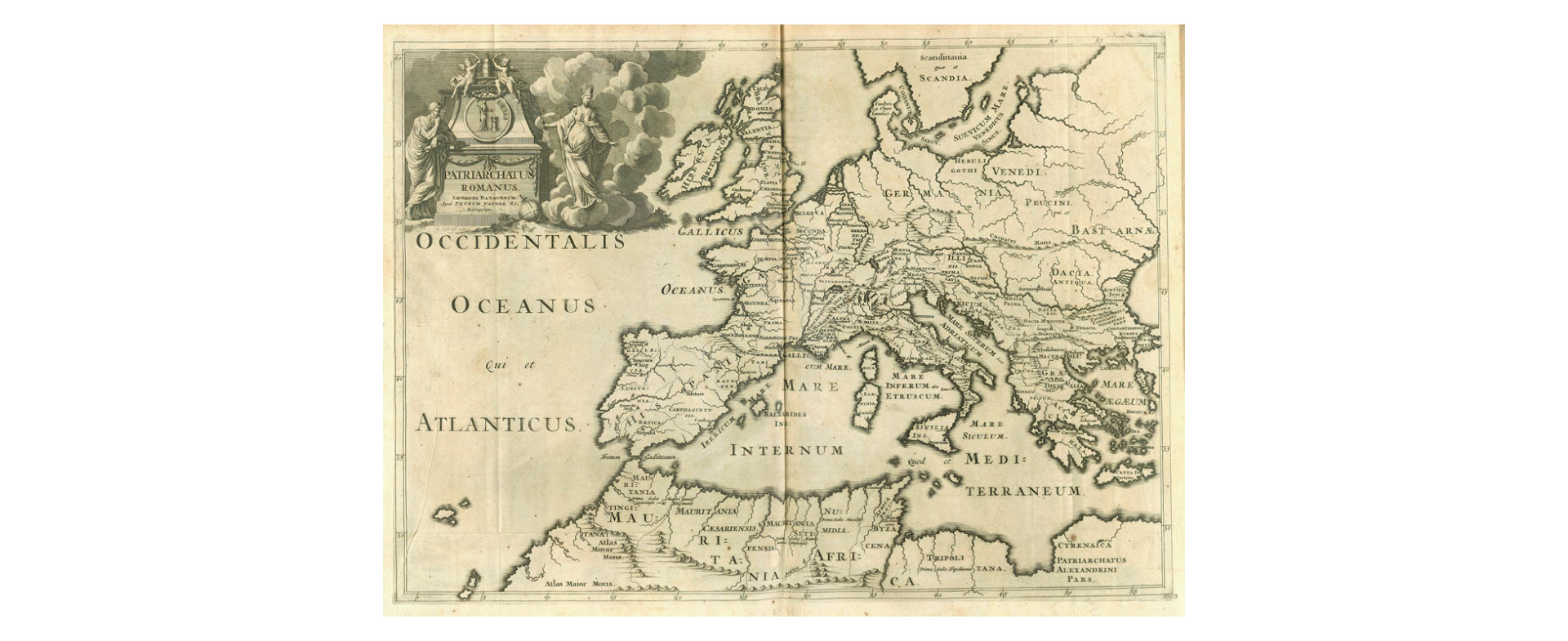
|
883- Patriarchatus Romanus. Lugduni Batavorum, apud Petrum vander Aa, bibliopolani .
Author: Pieter Van Der Aa
,1729 |
|
882- Peutingeriana tabula itineraria. [Europa occidentale, Africa settentrionale] .
Author: Scheyb
,1825 |
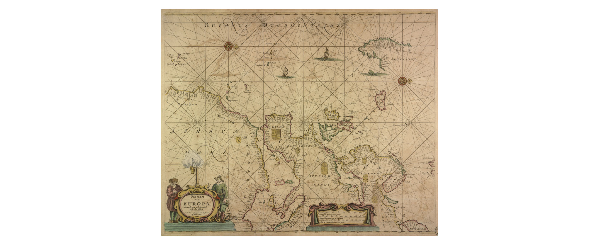
|
881- Pascaart van Europa, als mede een gedeelt vande oust van Africa .
Author: Pieter Goos
,1670 |
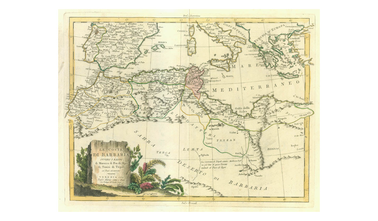
|
880-Le Coste di Barbaria ovvero i regni di Marocco, di Fez, di algeri, di Tunisi, di Tripo .
Author: Antonio Zatta
,1784 |
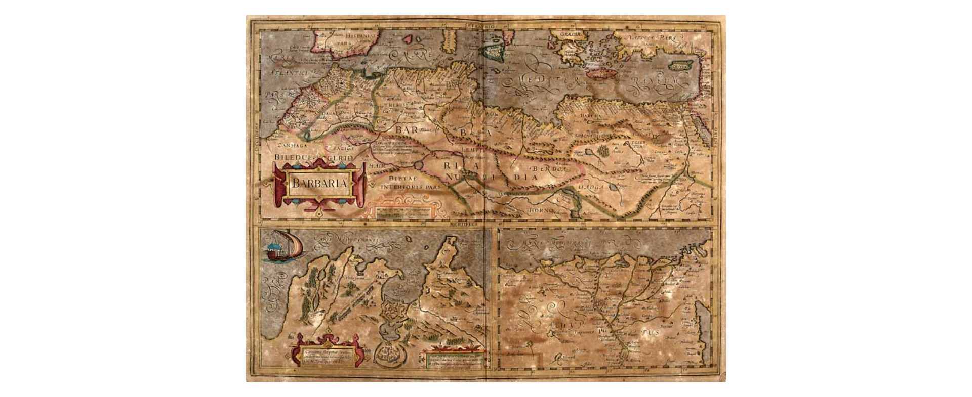
|
879-Barbaria .
Author: Gerardo Mercatore
Amsterdam,1638 |
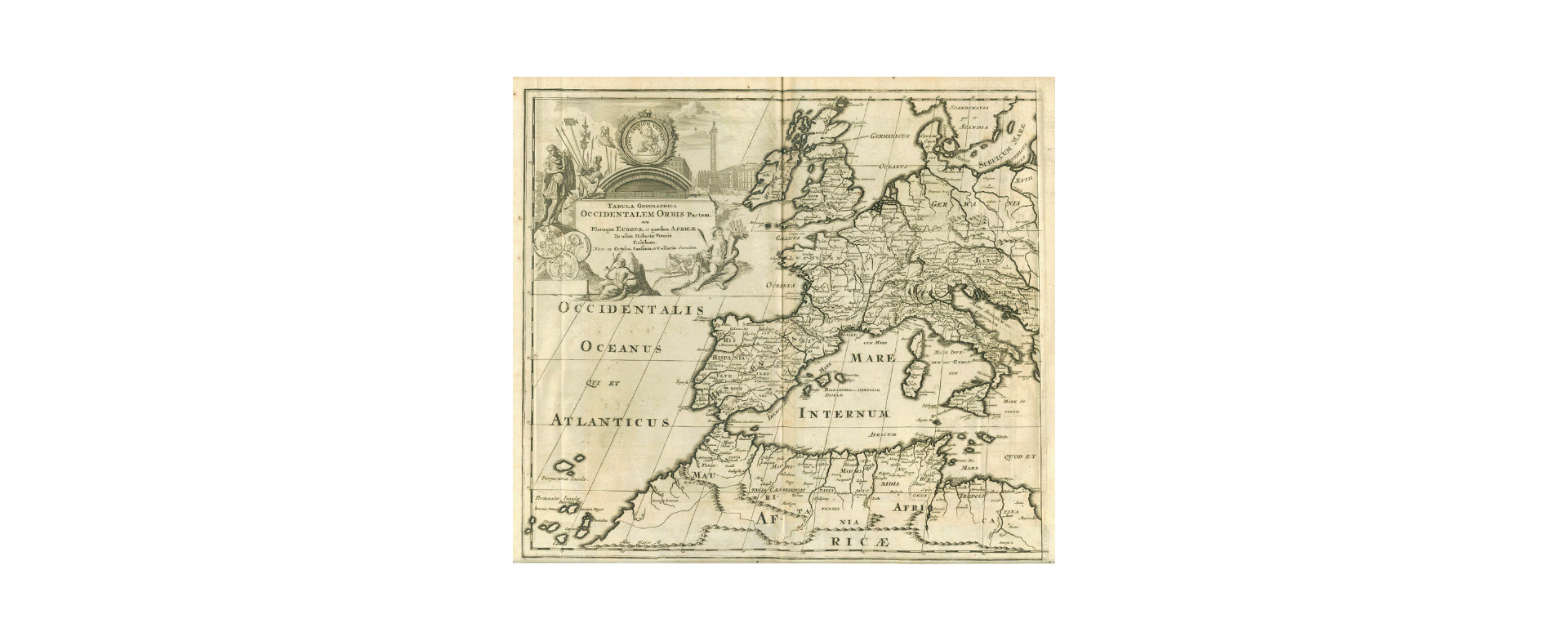
|
878- Tabula geographica occidentalem orbis partem… .
Author:
,1729 |
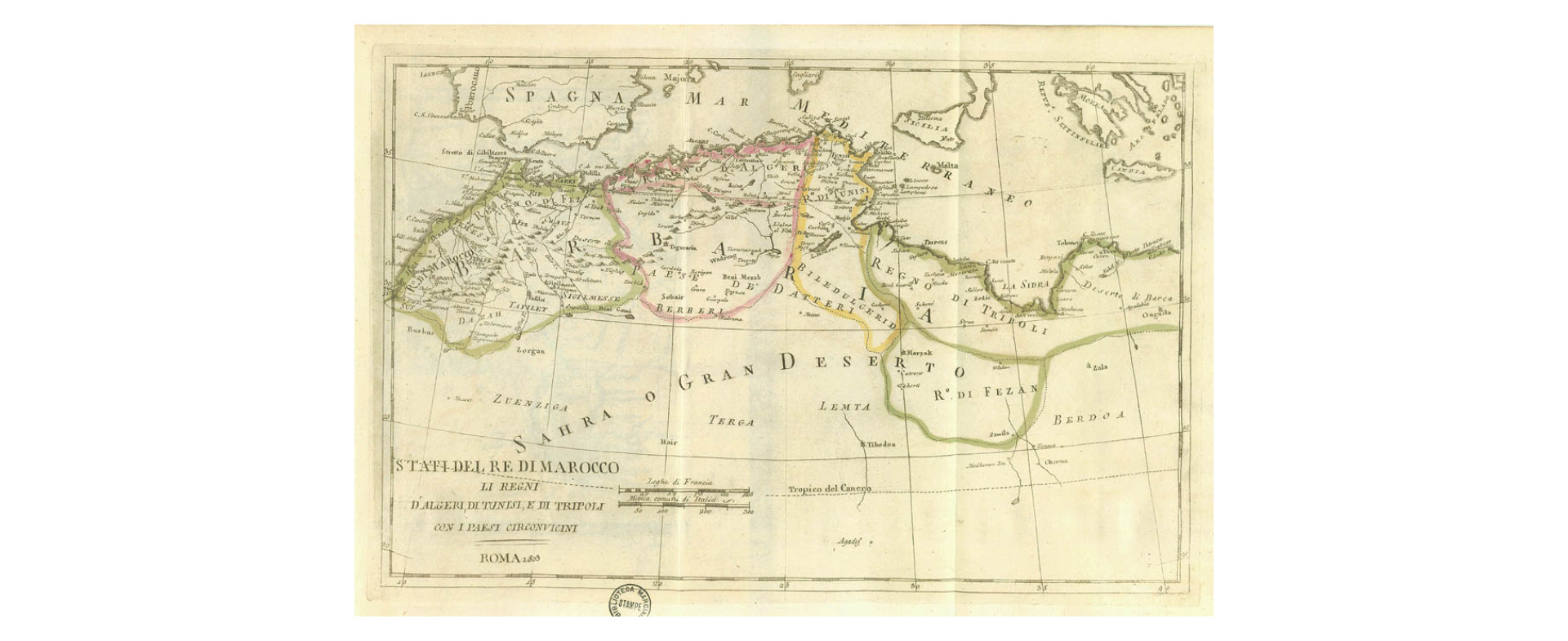
|
877- Stati del Re di Marocco. Li Regni d'Algeri, di Tunisi, di Tripoli con i Paesi circonv .
Author: Guthrie
Roma,1803 |

|
876- Géographie du Moyen Age, principalement des IX.e et X.e siécle... .
Author:
,1809 |
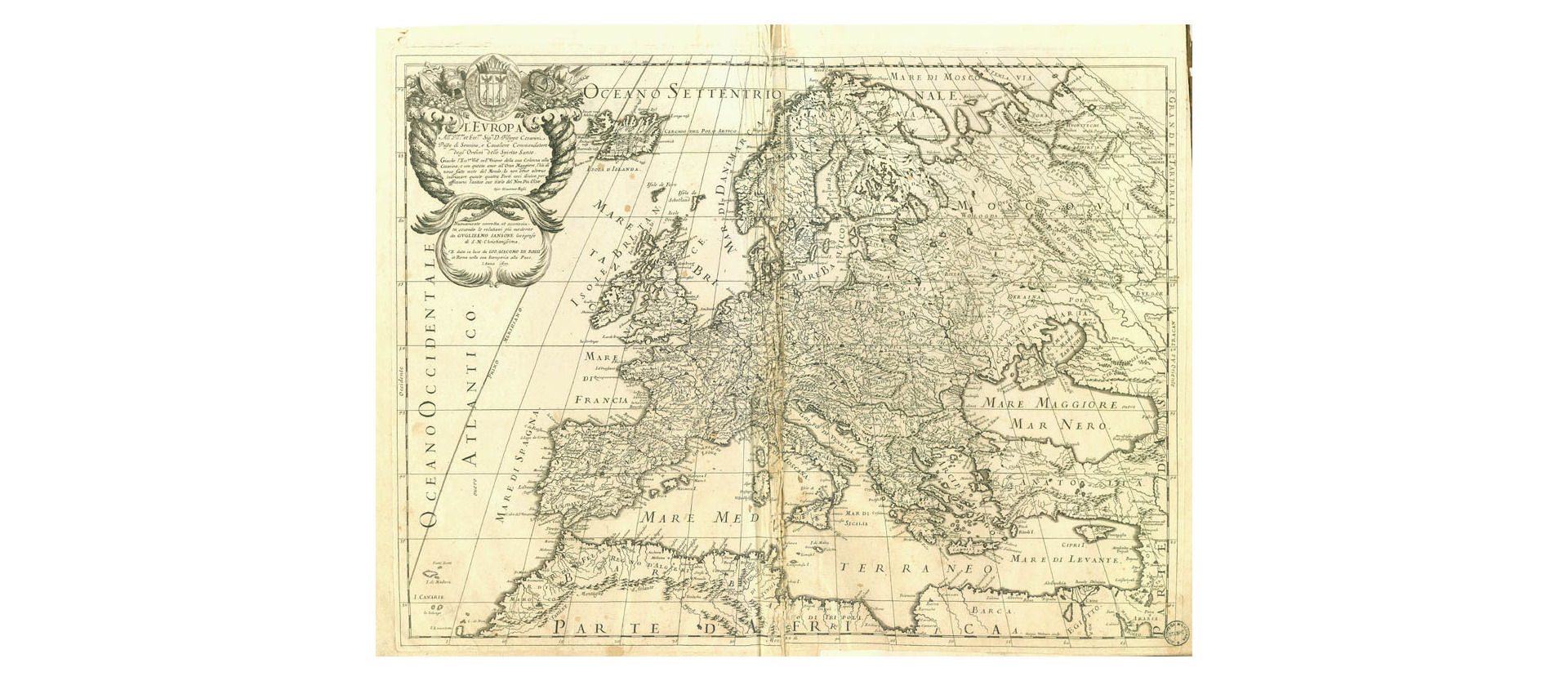
|
875- L' Europa .
Author: Giovanni Giacomo Rossi
,1677 |
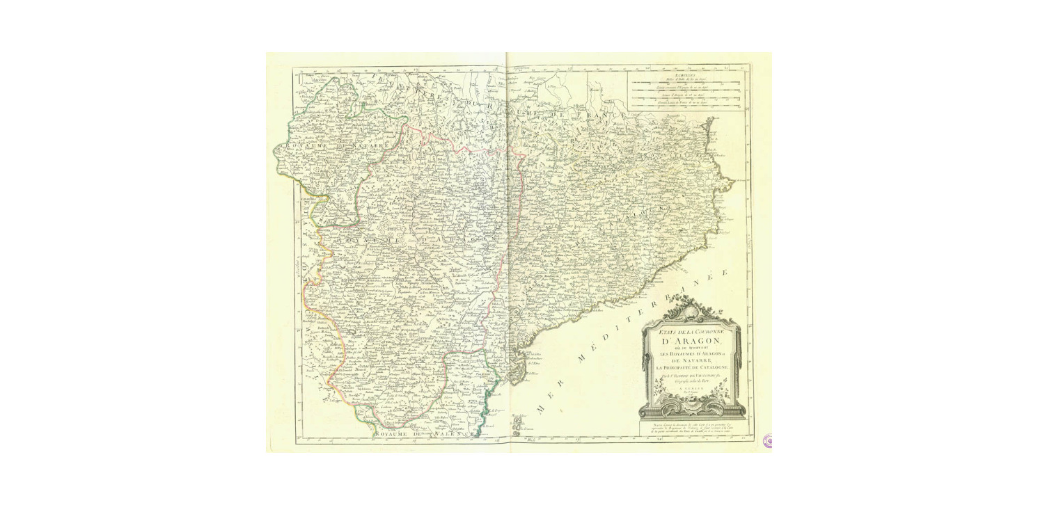
|
874- Etats de la Couronne d'Aragon .
Author: Paolo Santini, Robert de Vaugondy
,1776 |
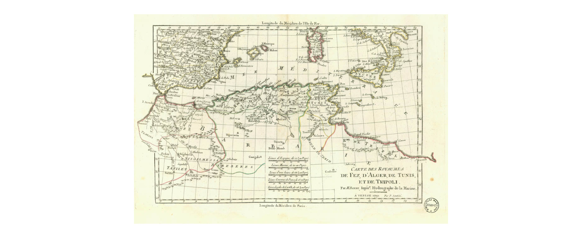
|
873- Carte des Royaumes de Fez, d'Alger, de Tunis, et de Tripoli... .
Author: Rigobert Bonne
,1791 |
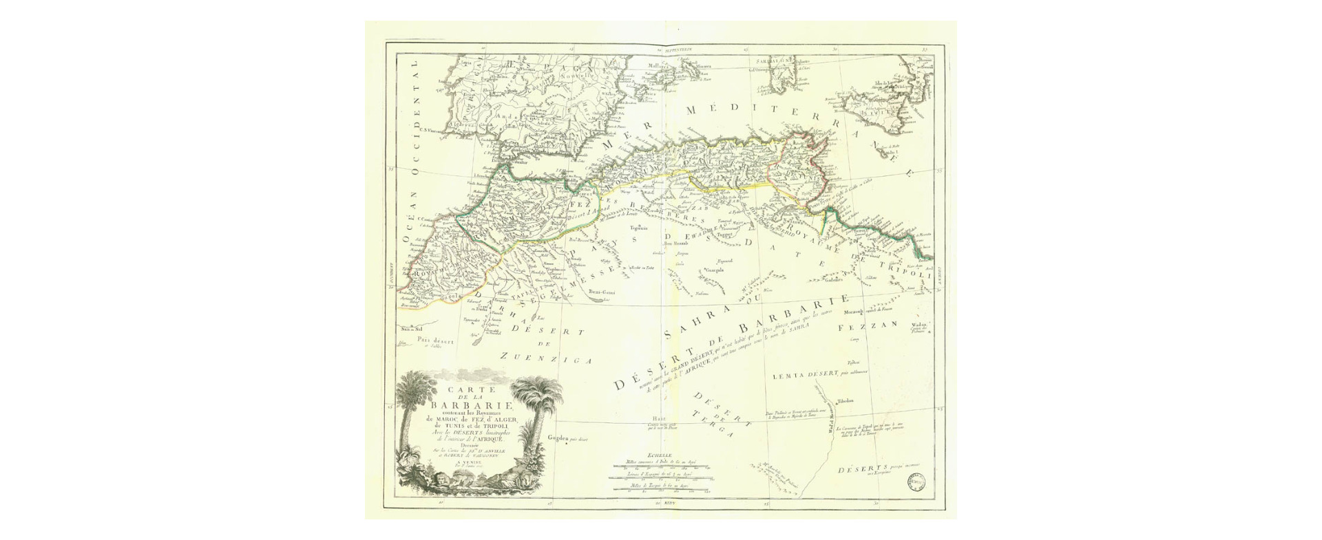
|
872- Carte de la Barbarie contenant les royaumes de maroc, de Fez, d'Alger, de Tunis et de .
Author: Robert de Vaugondy
,1775 |
|
871- Barbarie la Bombe C. Razatin .
Author: Joseph Roux
,0 |
|
870-Bacino del Mediterraneo-Parte Occidentale… .
Author: Francesco Costantino Marmocchi
,1858 |
|
869-In Notitiam Ecclesiasticam Africae Tabula Geographica .
Author: Guillaume De L'isle
Parigi,1700 |
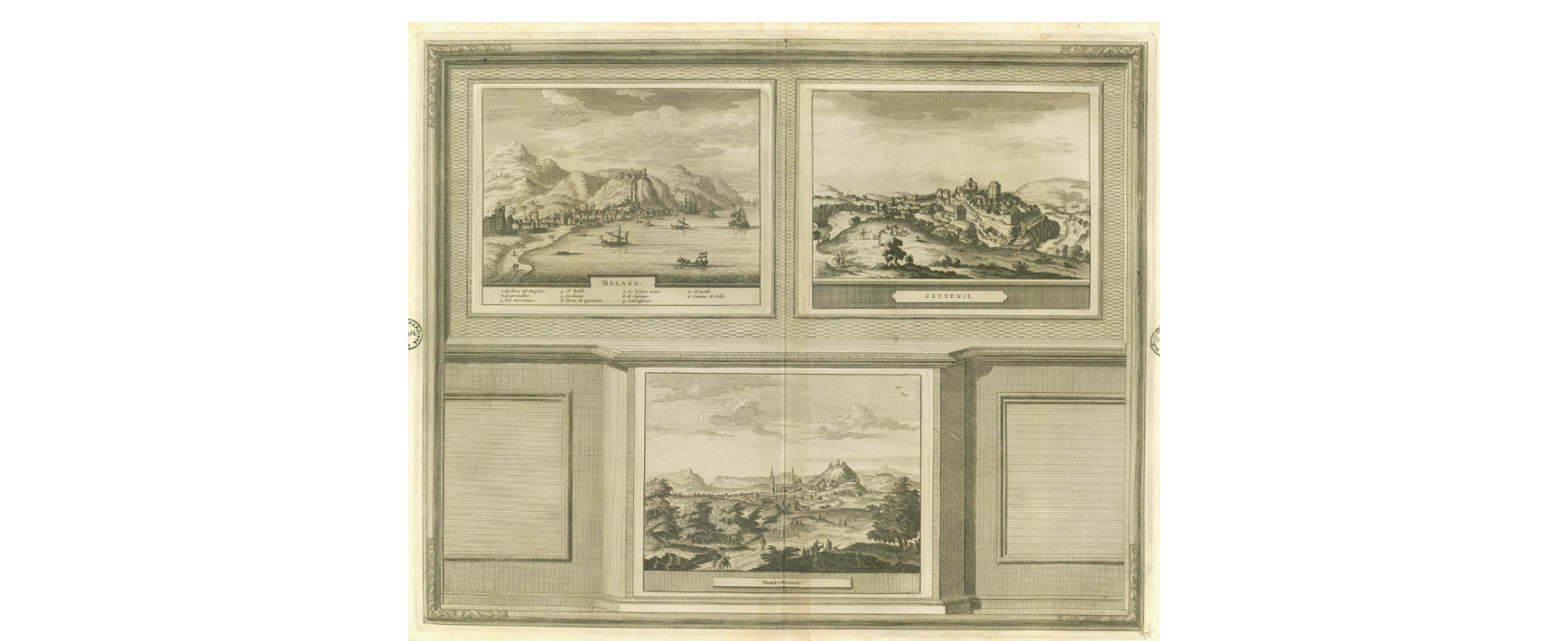
|
868-Malaga,Settenil… .
Author: Pieter Van Der Aa
,1729 |
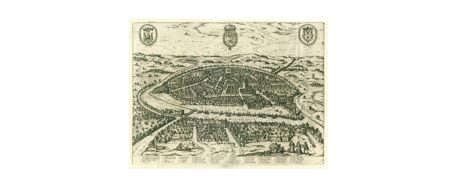
|
867-Sevilla .
Author: Pieter Van Der Aa
,1729 |
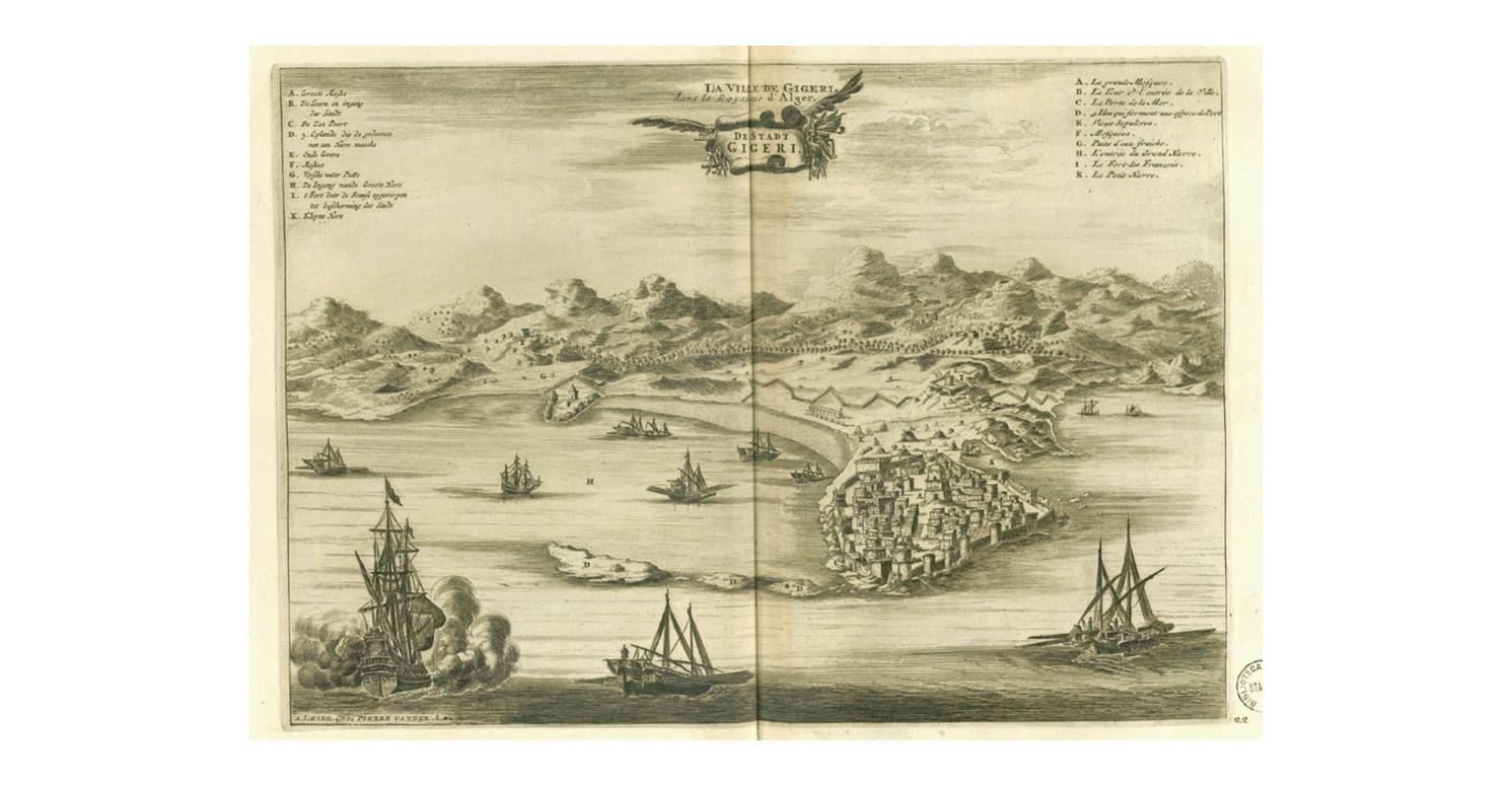
|
866-La ville de Gigeri .
Author: Pieter Van Der Aa
,1729 |
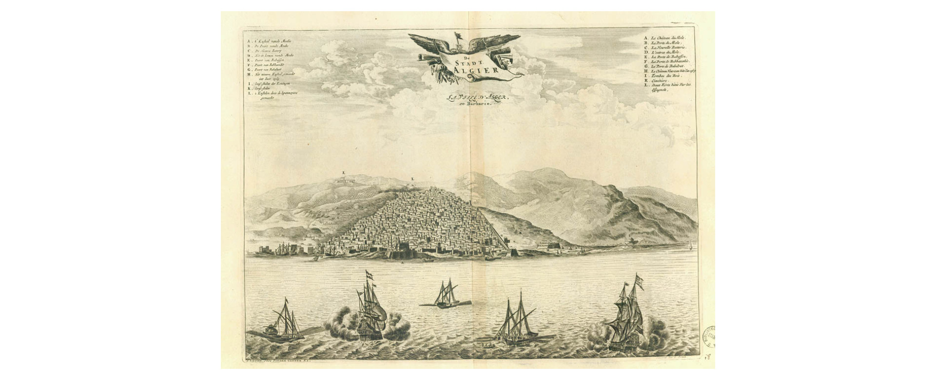
|
865-De Stadt Algier .
Author: Pieter Van Der Aa
,1729 |
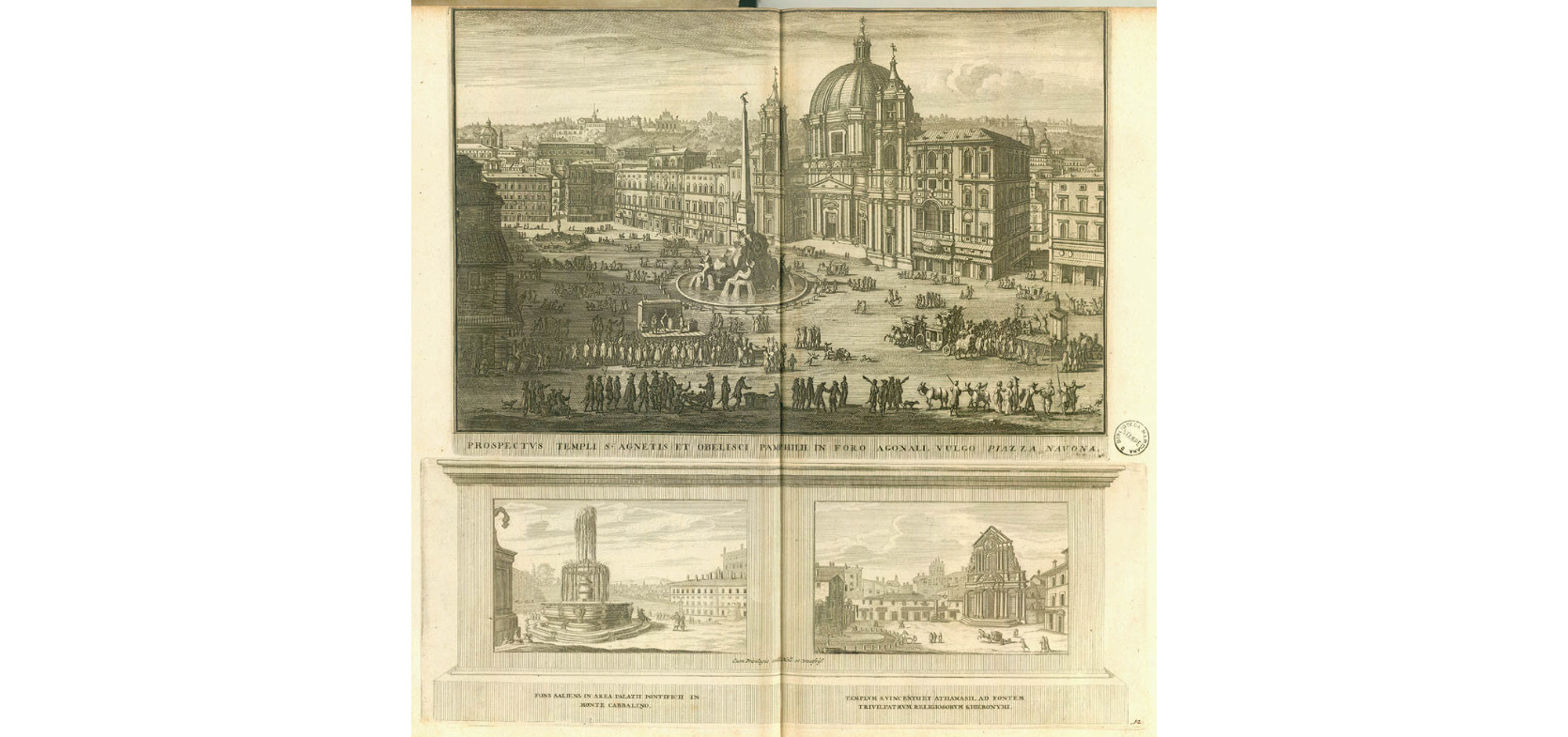
|
859-Prospectus templi S’Agnetis et obelisci….. .
Author: Pieter Van Der Aa
,1729 |
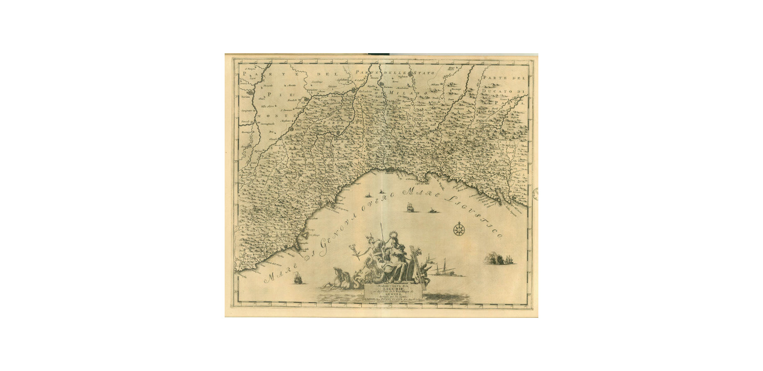
|
858-Carte de la Ligurie .
Author: Pieter Van Der Aa
,1729 |
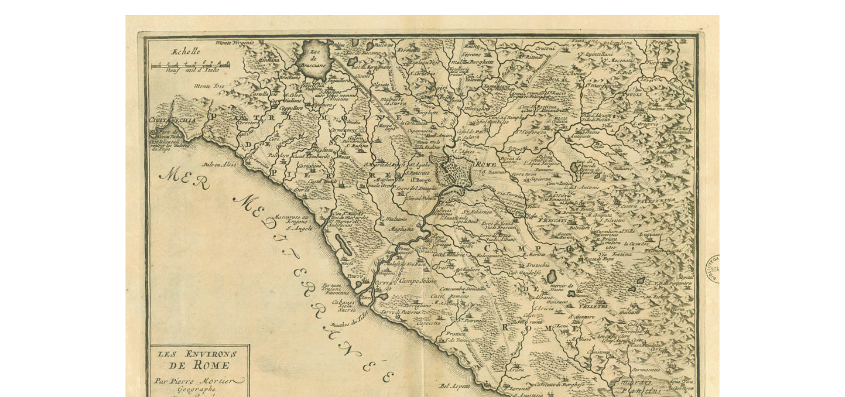
|
857-Les environs de Rome .
Author: Pieter Van Der Aa
,1729 |
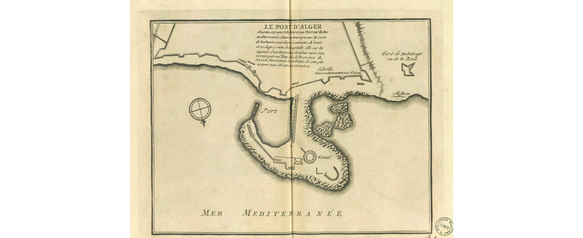
|
856-Le port d’Alger .
Author: Pieter Van Der Aa
,1729 |
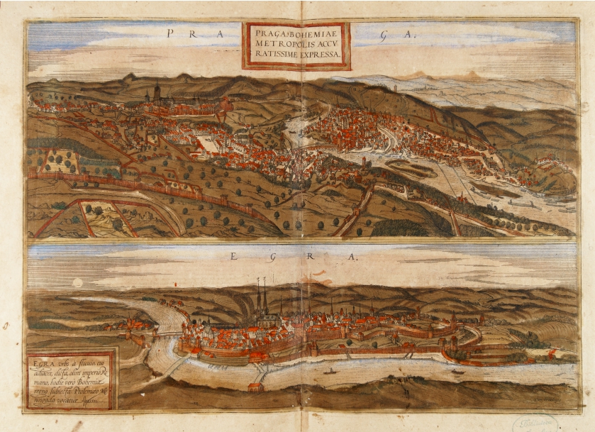
|
787- Praga Bohemiae metropolis accuratissime expressa .
Author: Georgii Braun
Colonia,1575 |

|
655- Isola di Sardegna .
Author: Giovanni Fileti
Palermo,1802 |
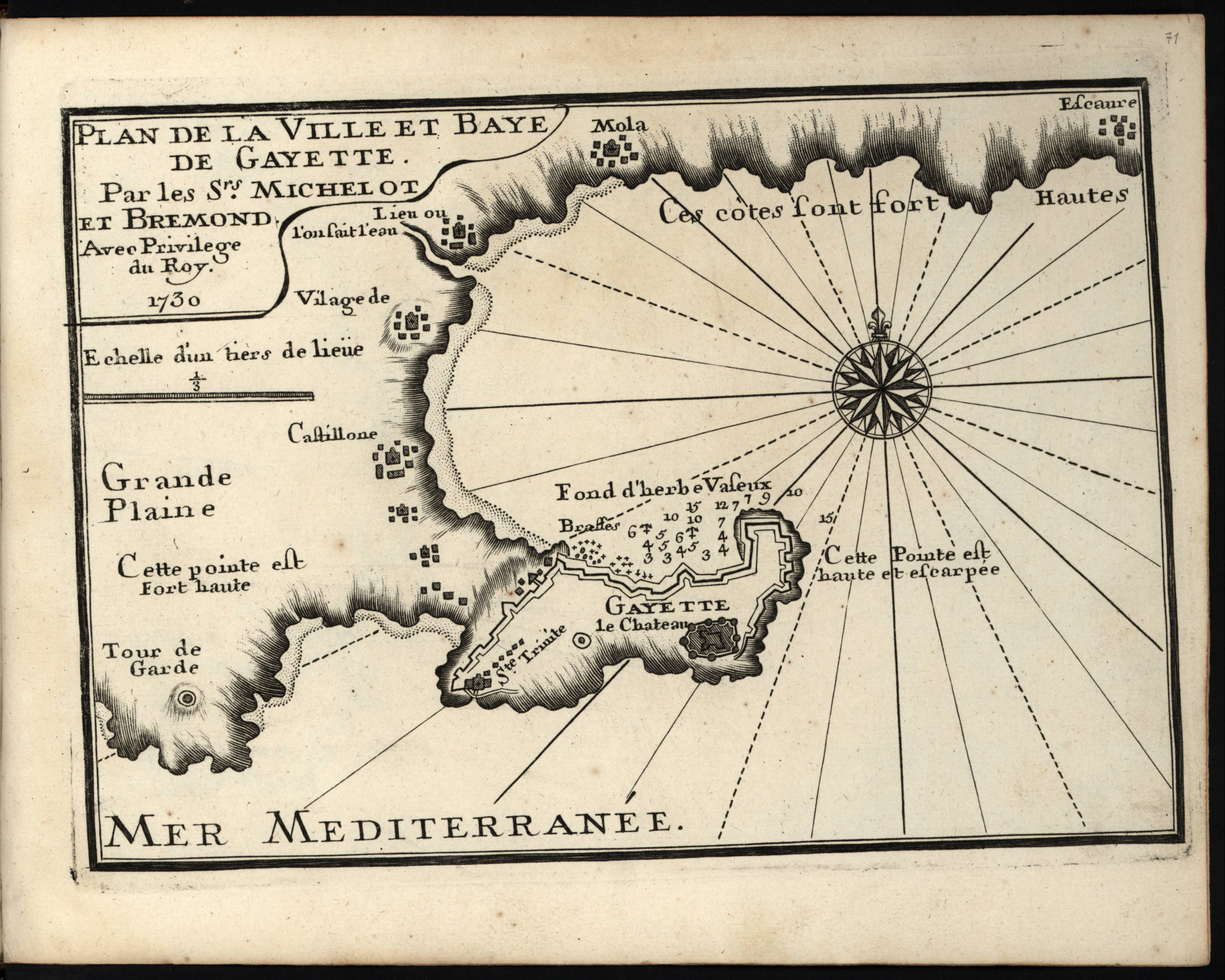
|
896- Plan de la ville et baye de Gayette .
Author: Henri Michelot
Marsiglia,1730 |

|
864-Tunis .
Author: Pieter Van Der Aa
,1729 |
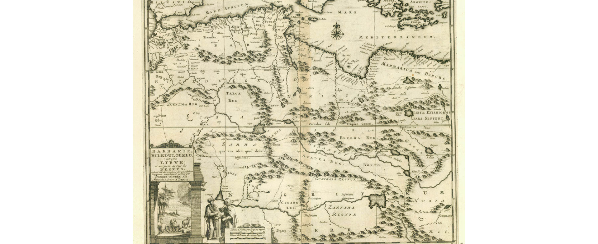
|
863-Barbarie Biledulgerid…… .
Author: Pieter Van Der Aa
,1729 |
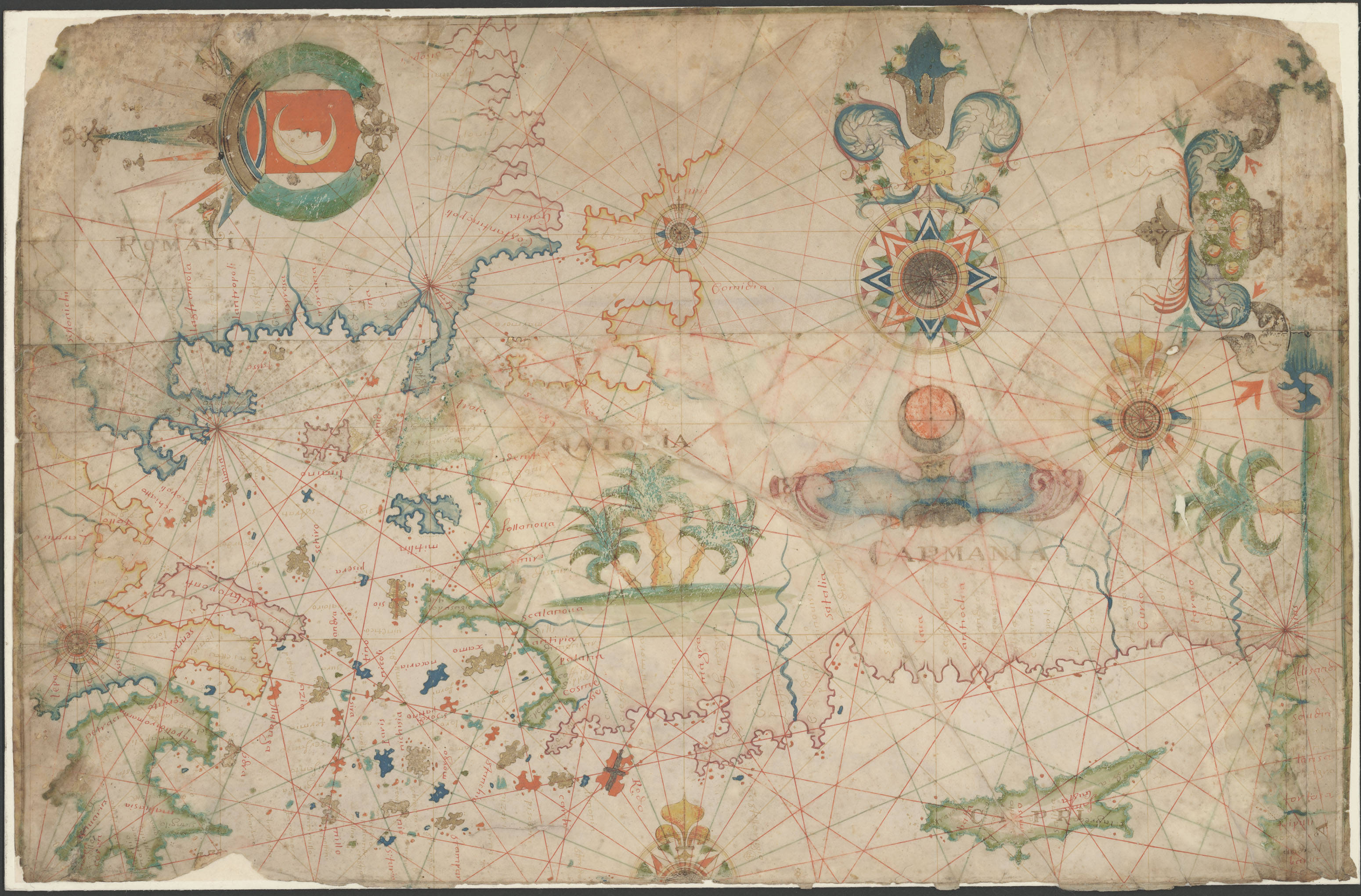
|
824-Mediterrània oriental, part septentrional .
Author: Francesco Oliva
,1658 |
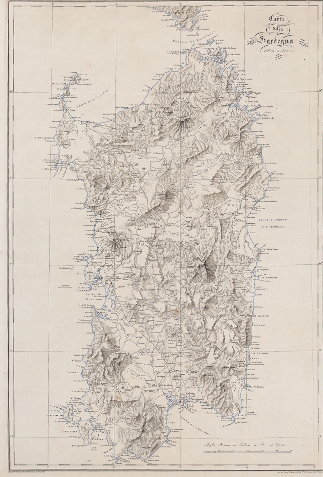
|
816-CARTA DELLA SARDEGNA RIDOTTA A 500 M .
Author: Arnoul
Parigi,1840 |
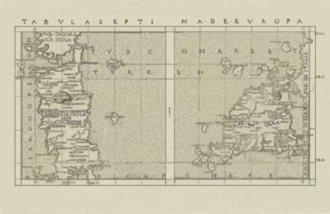
|
765-Tabula Septima de Europa .
Author: Francesco Berlinghieri
,1482 |
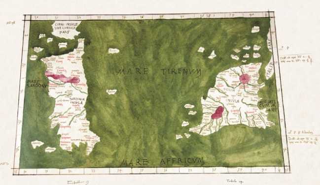
|
766-Sardegna e Sicilia .
Author: Claudio Tolomeo
,1477 |
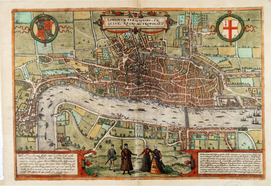
|
784-Londinum feracissimi Angliae regni Metropolis .
Author: Georgii Braun
Colonia,1575 |
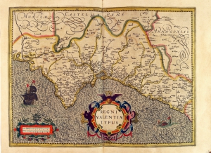
|
775-Regni Valencia Tipus .
Author: Gerardo Mercatore
Amsterdam,1638 |
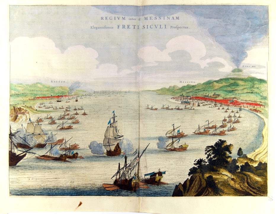
|
797-Regium inter & Messinam elegantissumus Freti Siculi prospectus .
Author: Joan Blaeu
Amsterdam,1663 |
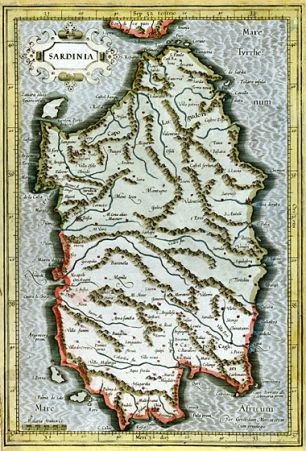
|
767-Sardinia .
Author: Gerardo Mercatore
Duisburg,1589 |
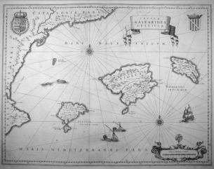
|
768-Insulae Balearides et Pytiusae .
Author: Johannes Janssonius
Amsterdam,1642 |
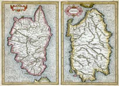
|
769 - Corsica et Sardinia .
Author: Gerardo Mercatore
Amsterdam,0 |
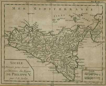
|
770 - Sicile .
Author: Jean Baptiste Nolin
Parigi,1702 |
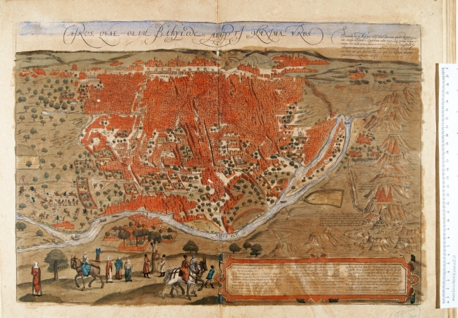
|
785-Kairos…Aegypt Maxima Urbs .
Author: Georgii Braun
Colonia,1575 |
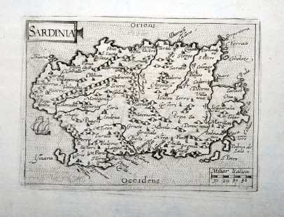
|
771 -Sardinia .
Author: Cyprianus Eichovius
Colonia,1603 |
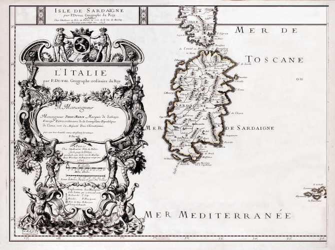
|
772 - Isle De Sardaigne .
Author: Pierre Du Val
Parigi,1675 |
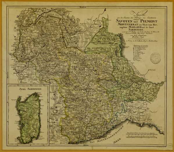
|
773 - Karte von den Staaten des Königs von Sardinien .
Author: Daniel Friedrich Sotzmann
Berlino,1793 |
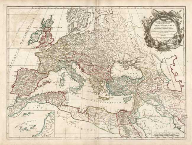
|
774 - Romani Imperii .
Author: Didier Robert De Vaugondy
Parigi,1757 |
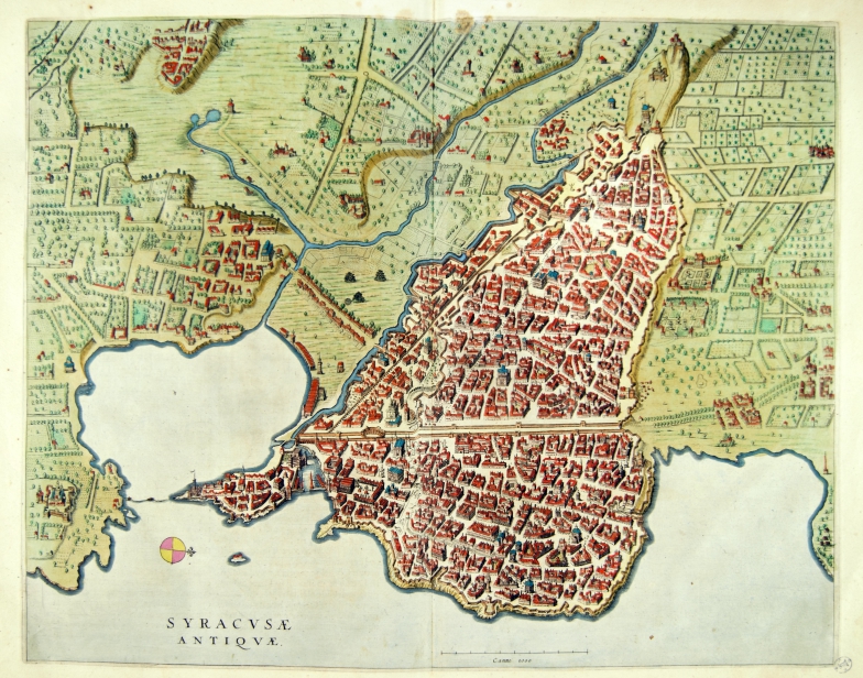
|
800-Siracusae antiquae .
Author: Joan Blaeu
Amsterdam,1663 |
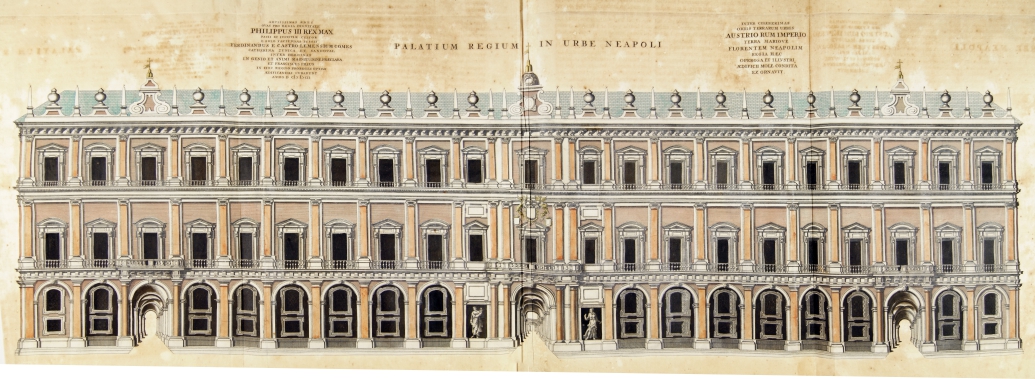
|
799-Palatium Regium in Urbe Neapoli .
Author: Joan Blaeu
Amsterdam,1663 |
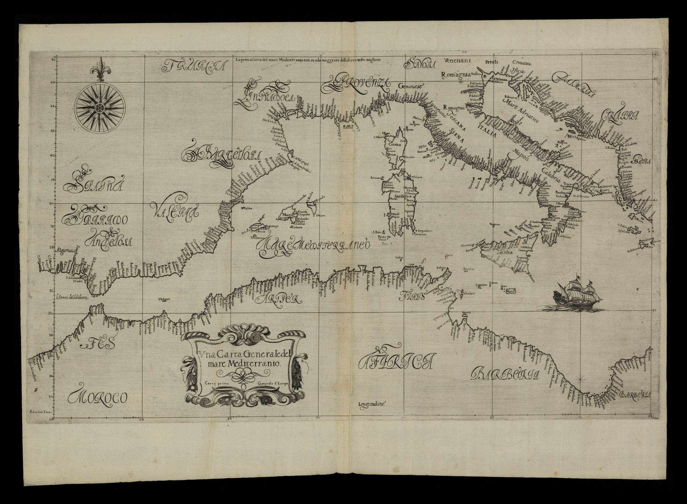
|
936- Vna carta generale del mare Mediterranio: carta prima generale d'Europa / AF Lucini f .
Author: Robert Dudley
Firenze,1646 |
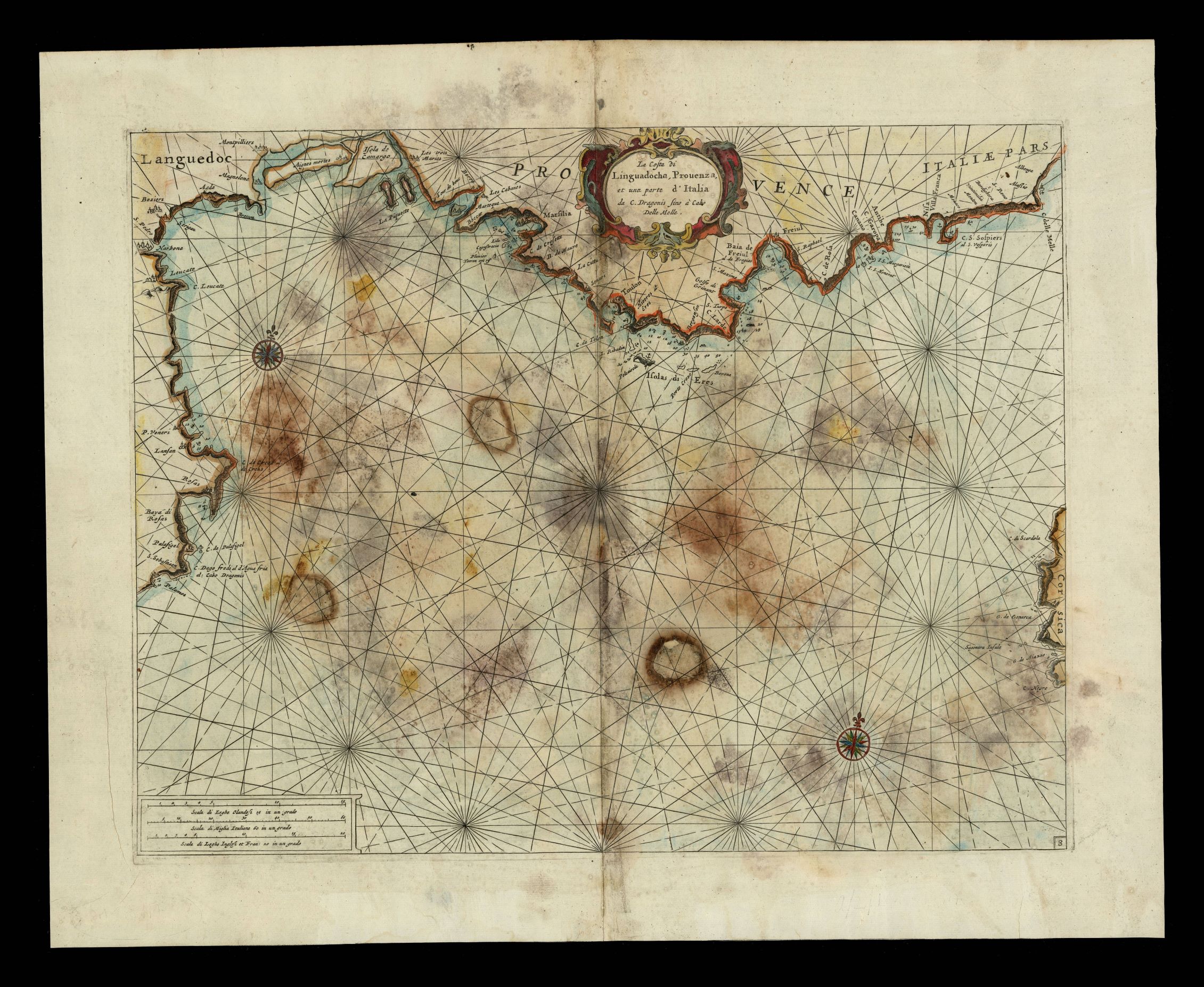
|
937- La costa della Linguadoca, Prouenza e una parte dell'Italia da C. Dragonis a Cabo del .
Author:
,1696 |
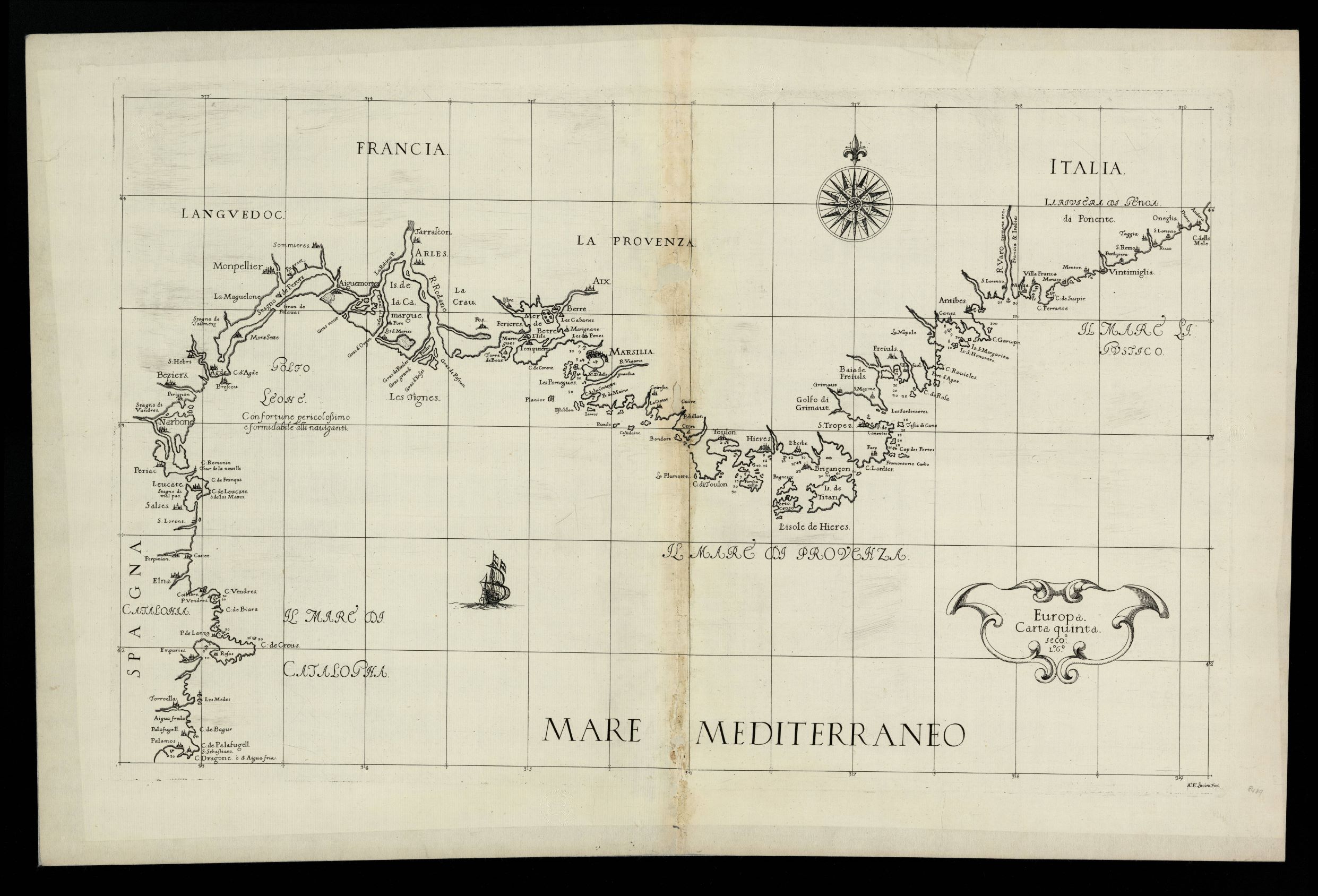
|
938- Europa carta quinta: seco [nda] L [ibro] 6º / AF Lucini feci La carta, che misura cm .
Author: Robert Dudley
Firenze,1646 |
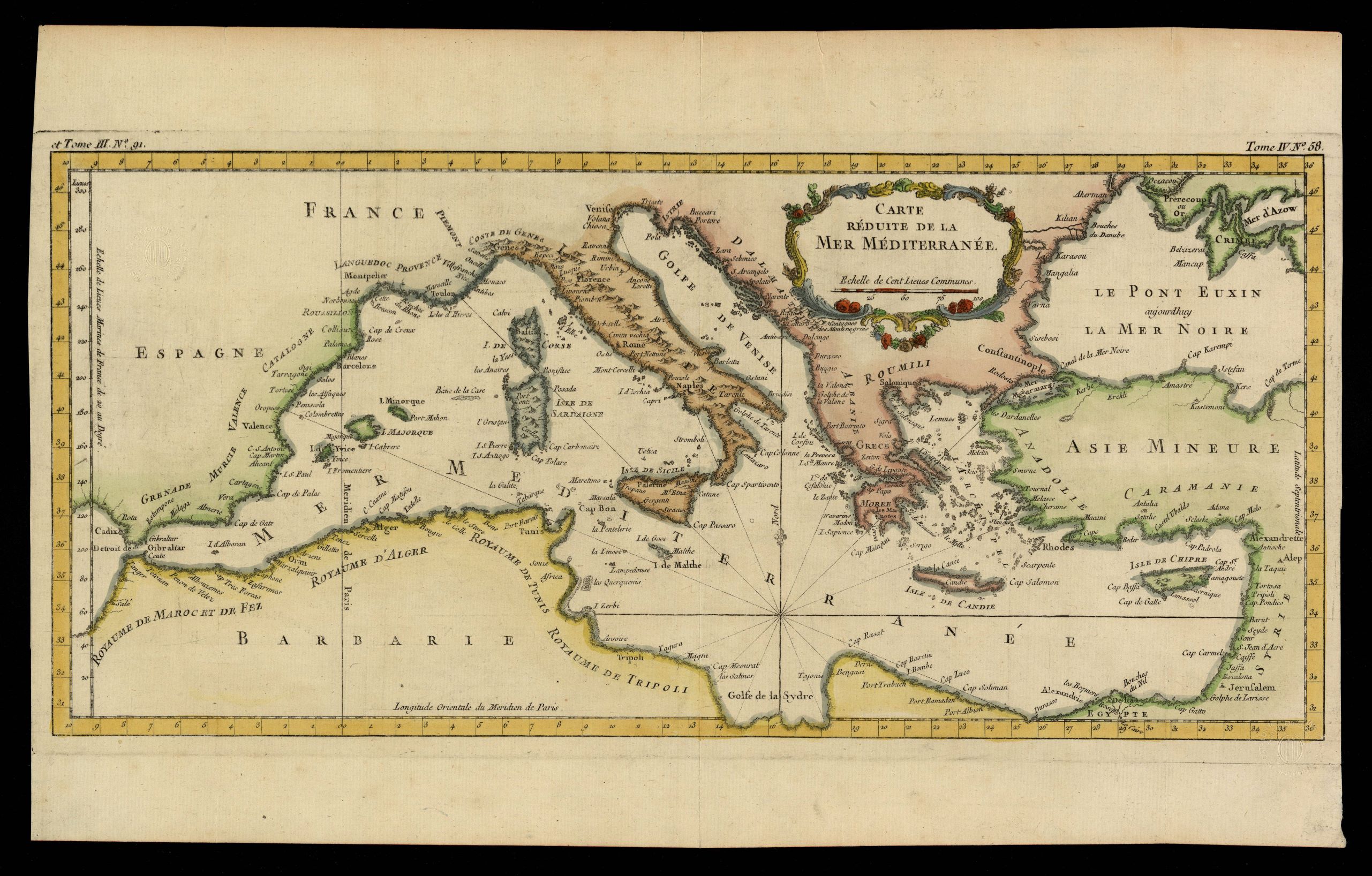
|
939- Carte réduite de la Mer Méditerranée .
Author: Jacques Nicolas Bellin
,1764 |
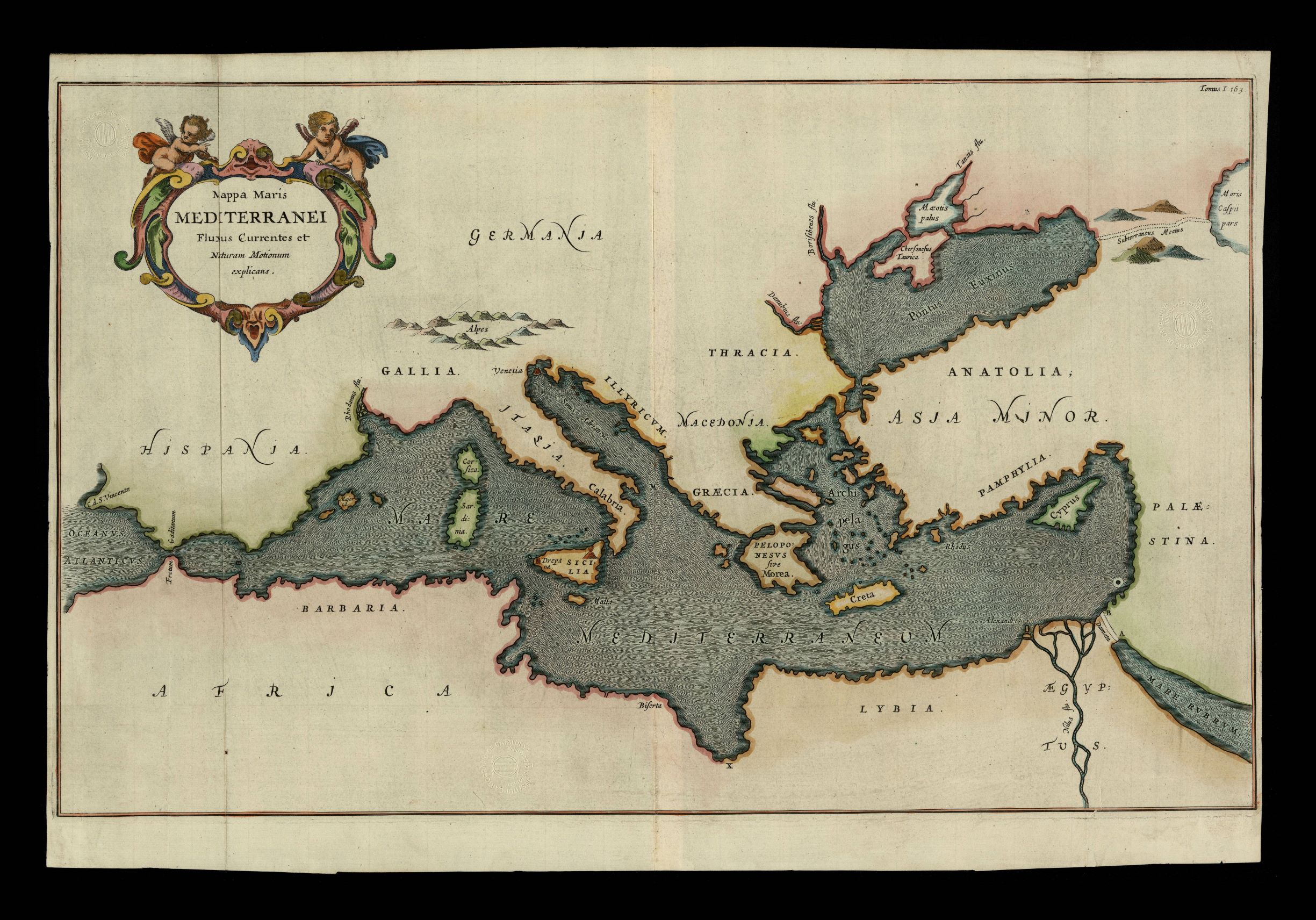
|
940- Mapa maris Mediterranei fluxus currentes et naturam motionum explicans .
Author: Kircher
,1665 |

|
941- Pas-Caart van Hispangien, vertoonende de Custen van Granade, Andaluzie, Algarve, Port .
Author: Pieter Goos
Amsterdam,1669 |
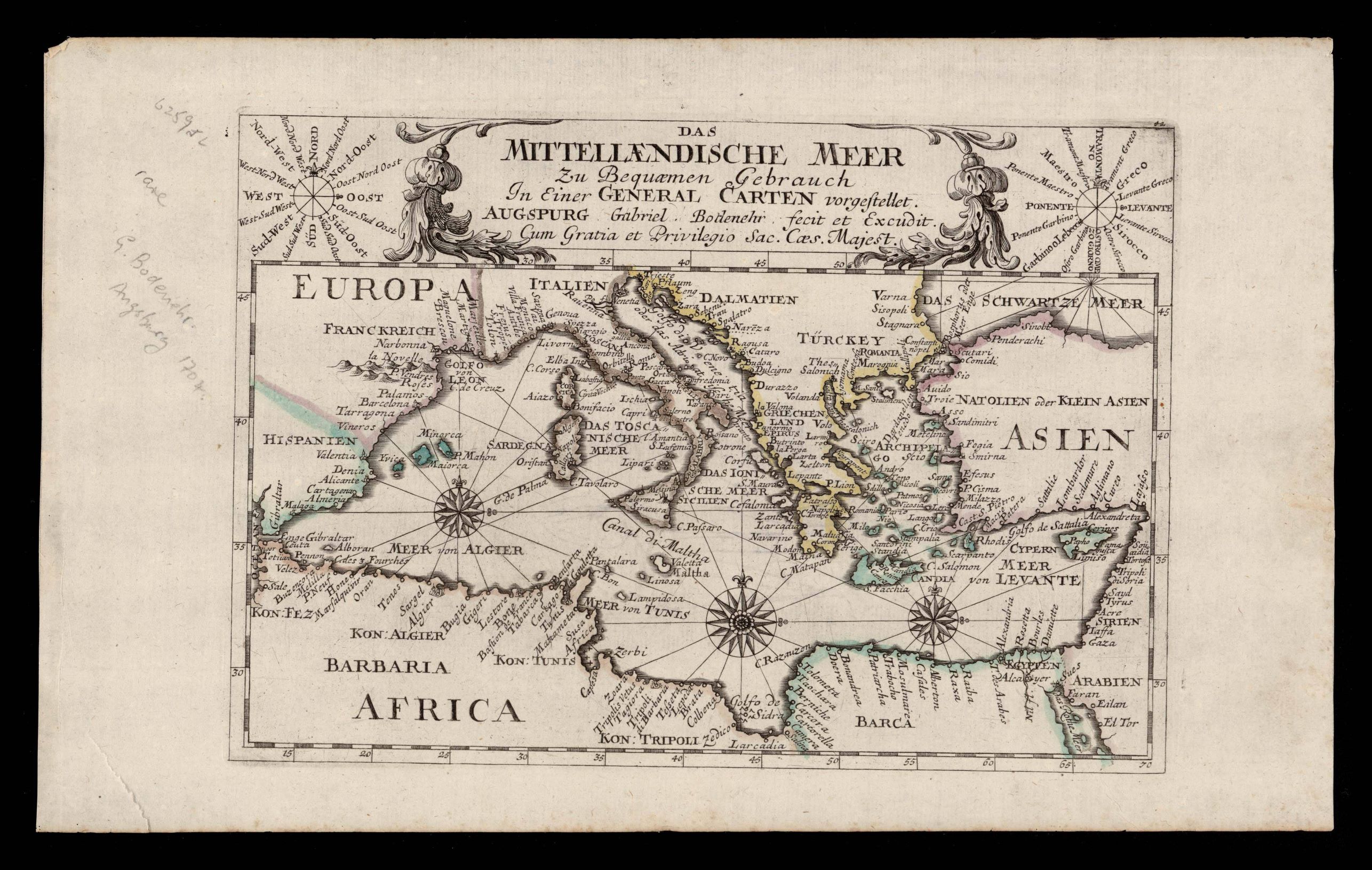
|
942- Das Mittellaendische meer .
Author: Gabriel Bodenehr
,1700 |
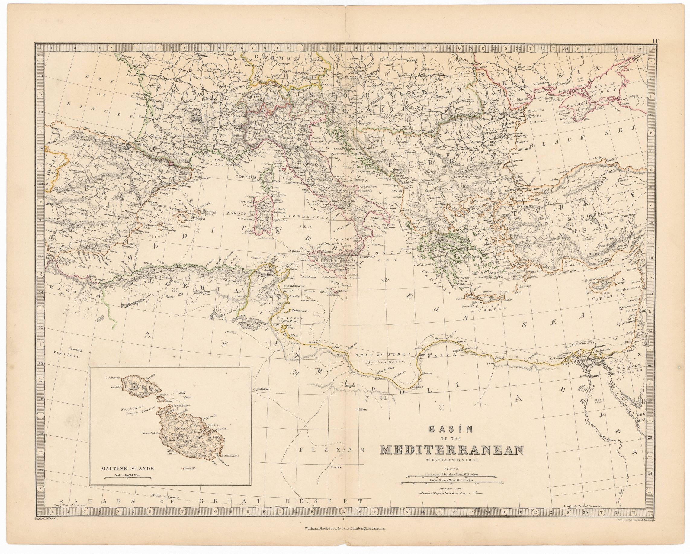
|
943- Basin of the Mediterranean .
Author: Keith Johnston
Edimburgo,1860 |
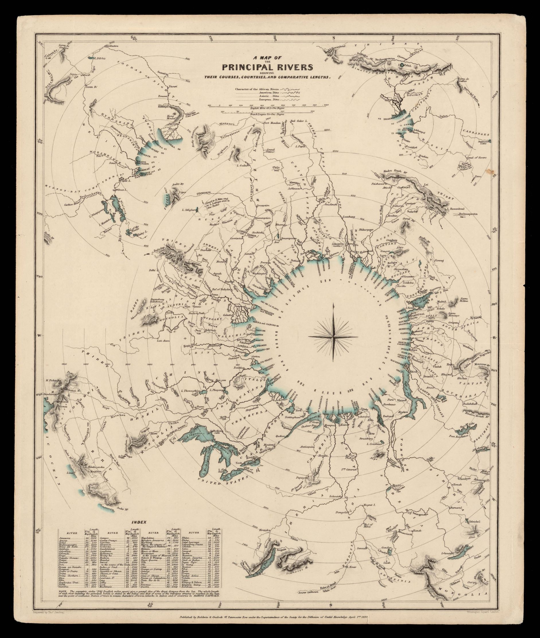
|
944- A map of the principal rivers shewing their courses, countries and comparative length .
Author: Thomas Starling
,1834 |

|
945- Pas-caart van de Middellandsche Zee. Verthoonende alle de Zee-kuften van Granden, Cat .
Author: Johannes van Keulen
Amsterdam,1708 |
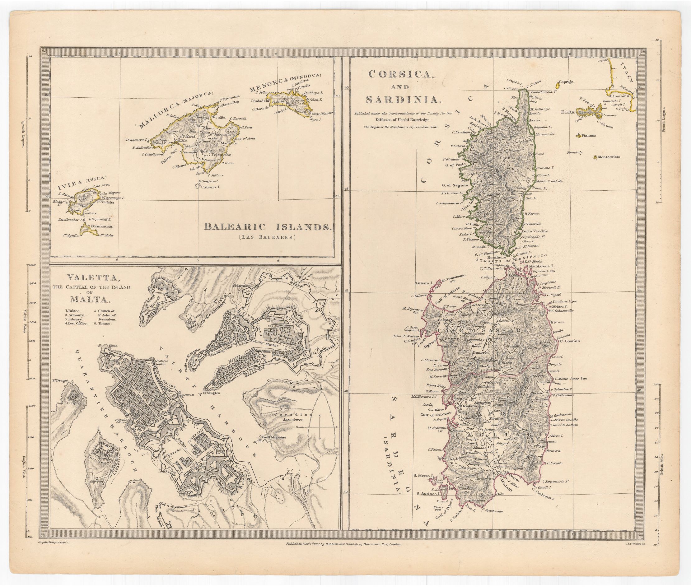
|
946- Balearic islands (Las Baleares) ; Corsica and Sardinia ; Valetta the capital of the I .
Author: Baldwin e altri
,1831 |
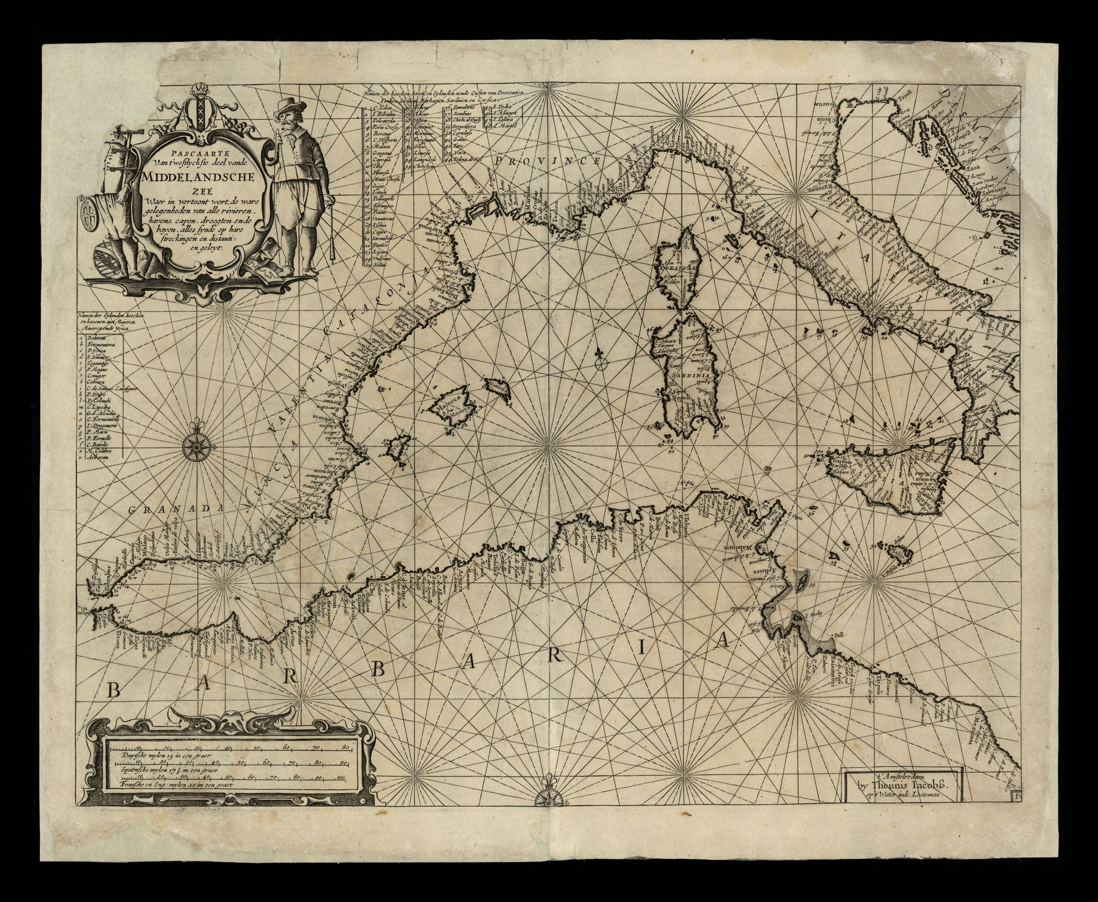
|
947- Pascaarte van ’t westlyckste deel vande Middelandsche Zee waer in vertoont wort, .
Author: Theunis Jacobsz
Amsterdam,1656 |
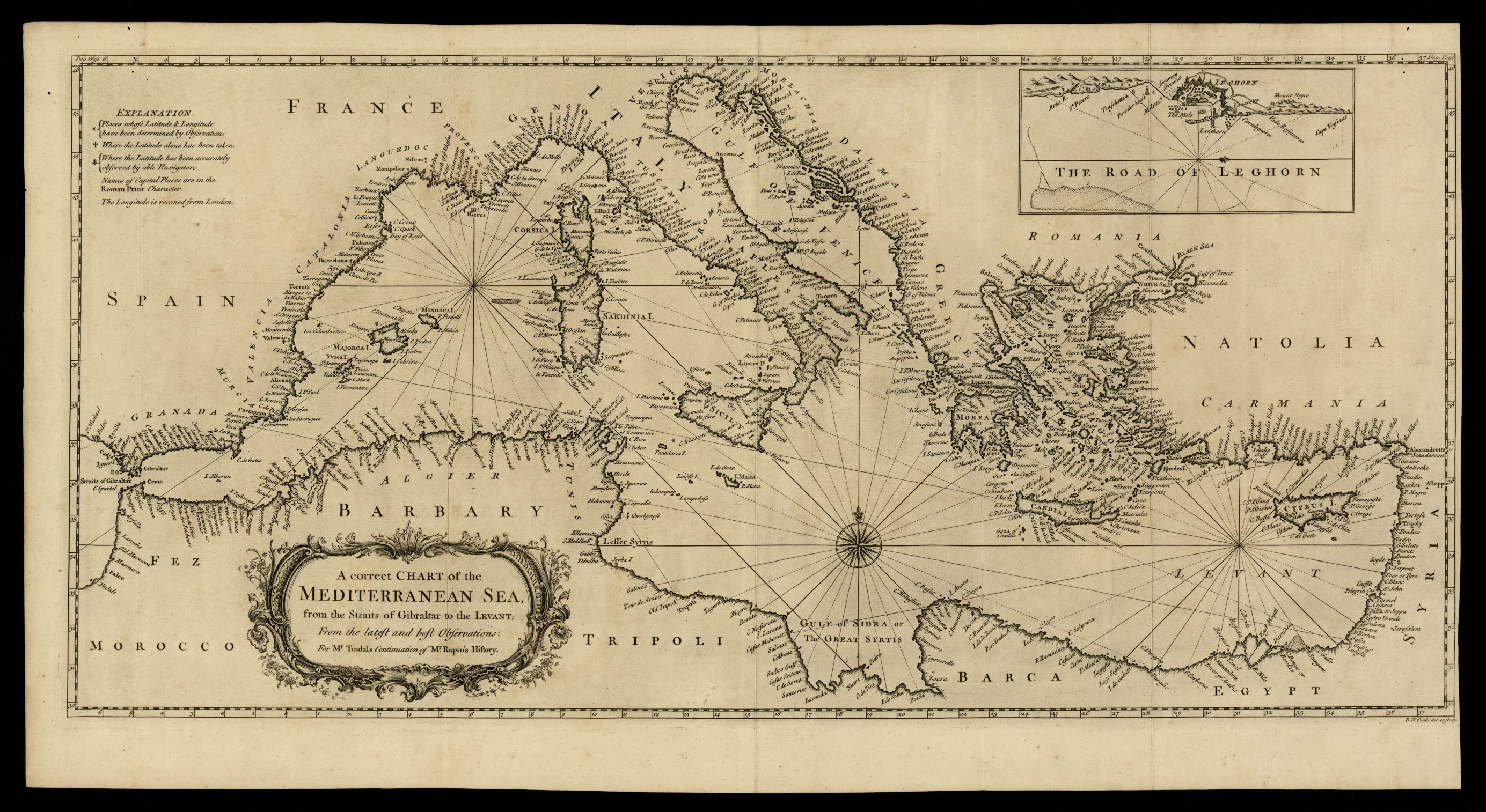
|
948- A correct chart of the Mediterranean sea, from the straits of Gibraltar to the Levant .
Author:
Londra,1744 |
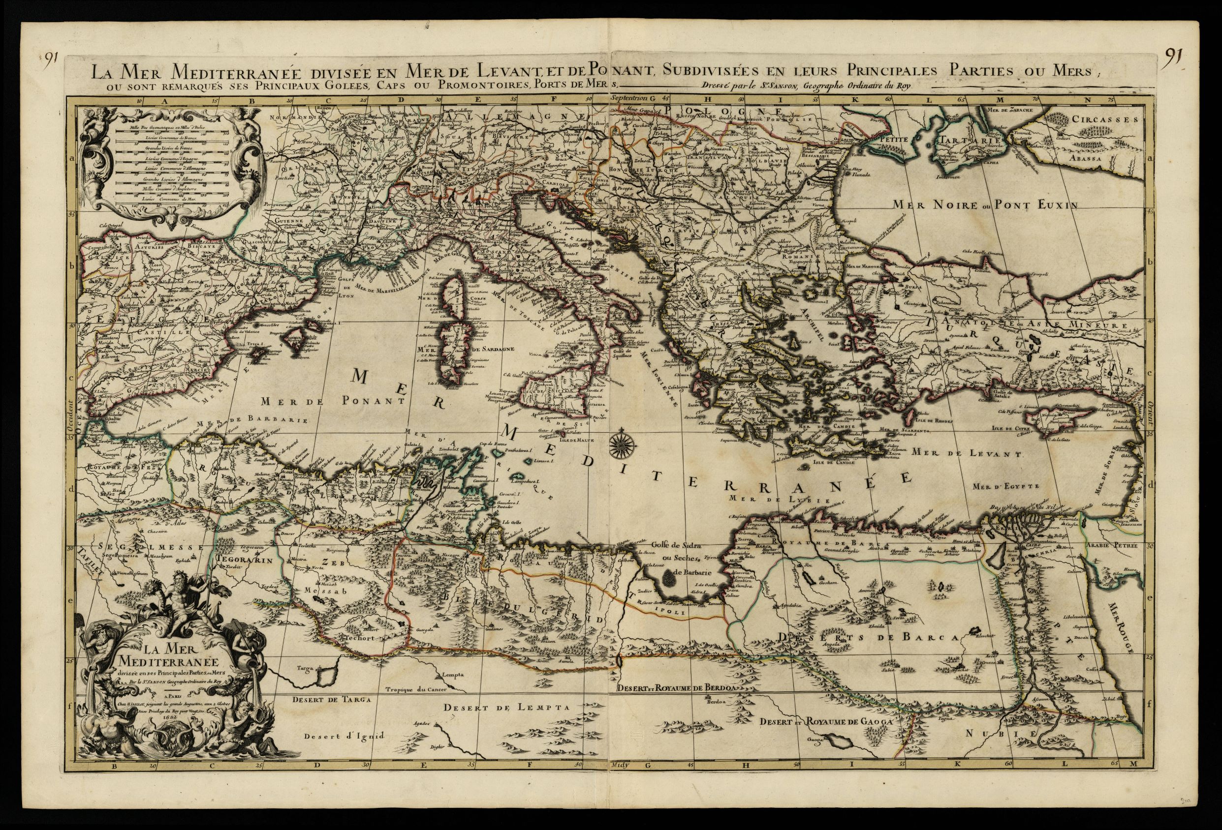
|
949- La mer Mediterranée divisée en Mer de Levant et de Ponant, subdivisées en leurs pr .
Author: Pierre Mortier
Amsterdam,1692 |
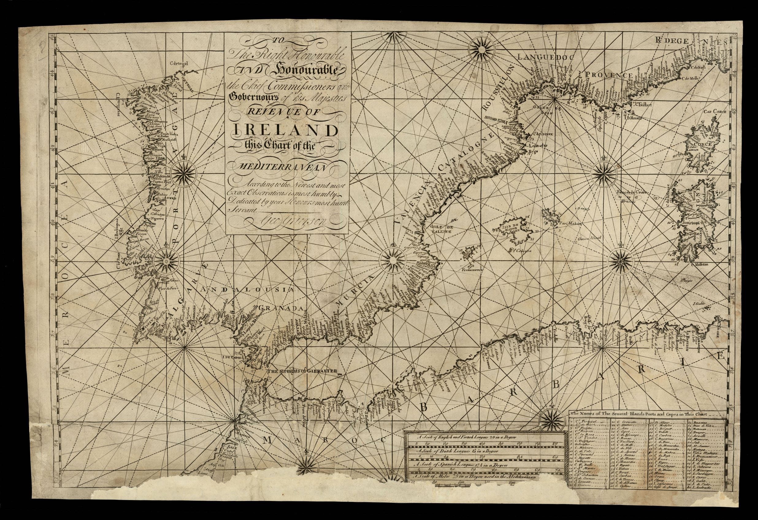
|
950- To the right honourable ... the Chief Commissioners and Gobernours of his Majesties . .
Author: George Grierson
,1750 |
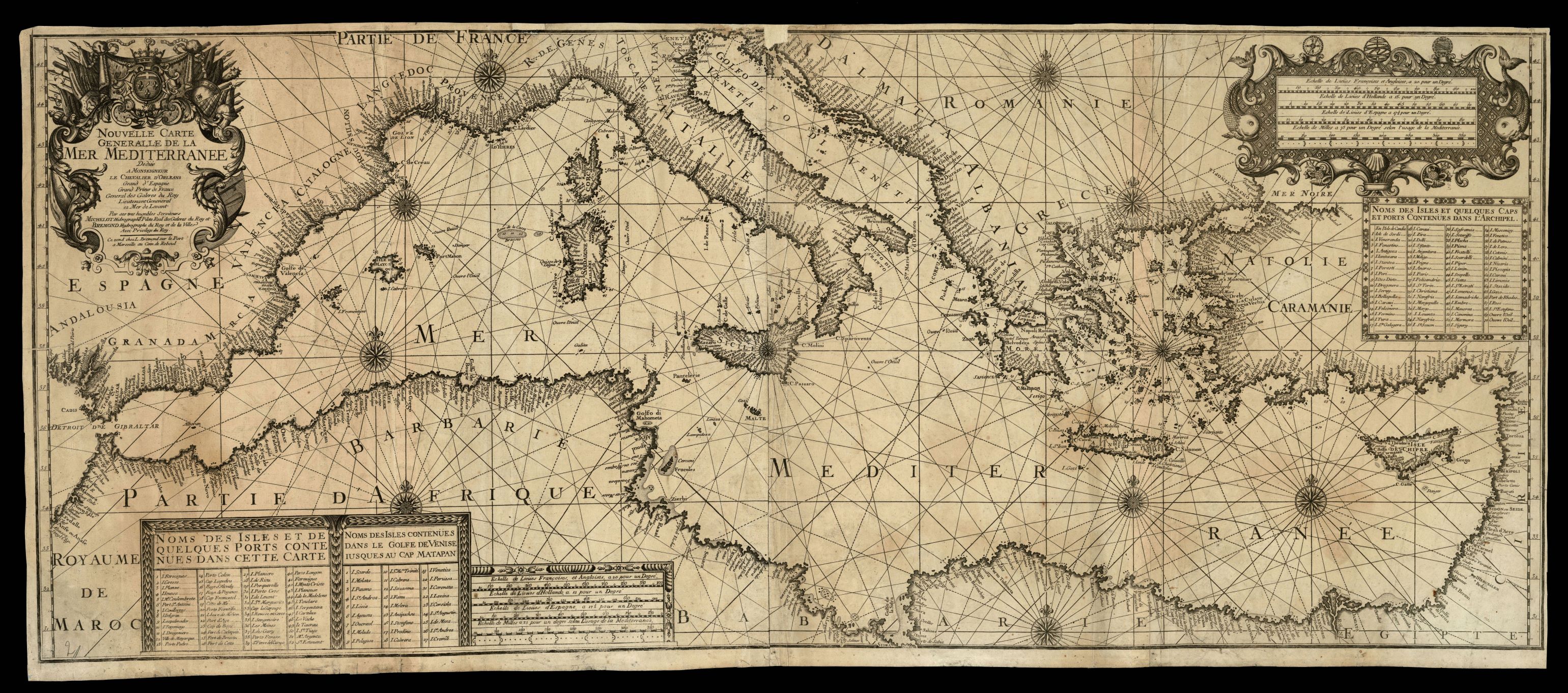
|
951-Nouvelle carte generalle de la Mer Mediterranee / dediée a Monseigneur le Chevalier d .
Author: Henri Michelot
,1718 |
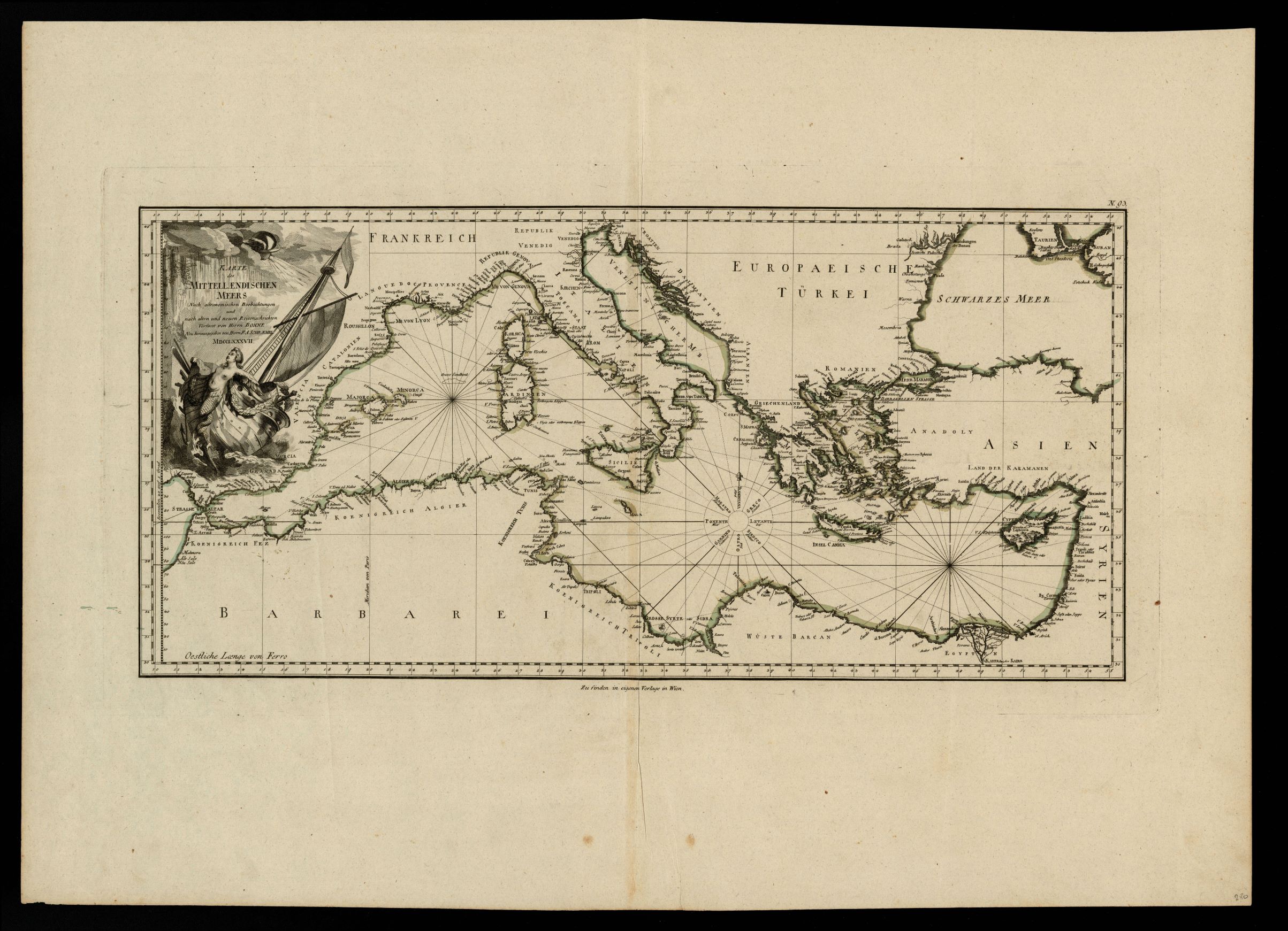
|
952-Karte des Mittellaendischen Meers .
Author: R.Bonne
,1787 |
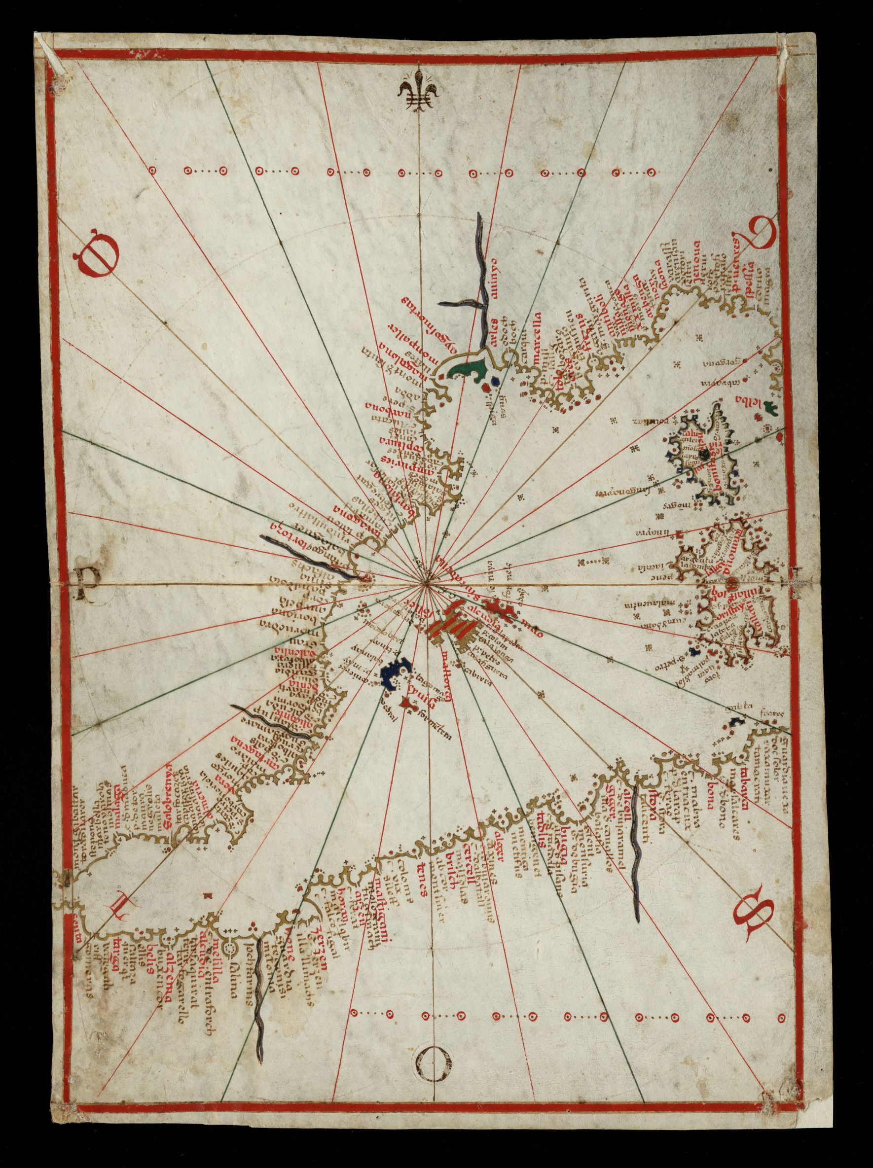
|
953- Portolà: [Atles nàutic fragmentat de la Mediterrània i de les costes atlàntiques .
Author: Bartomeu Olive
Messina,1570 |
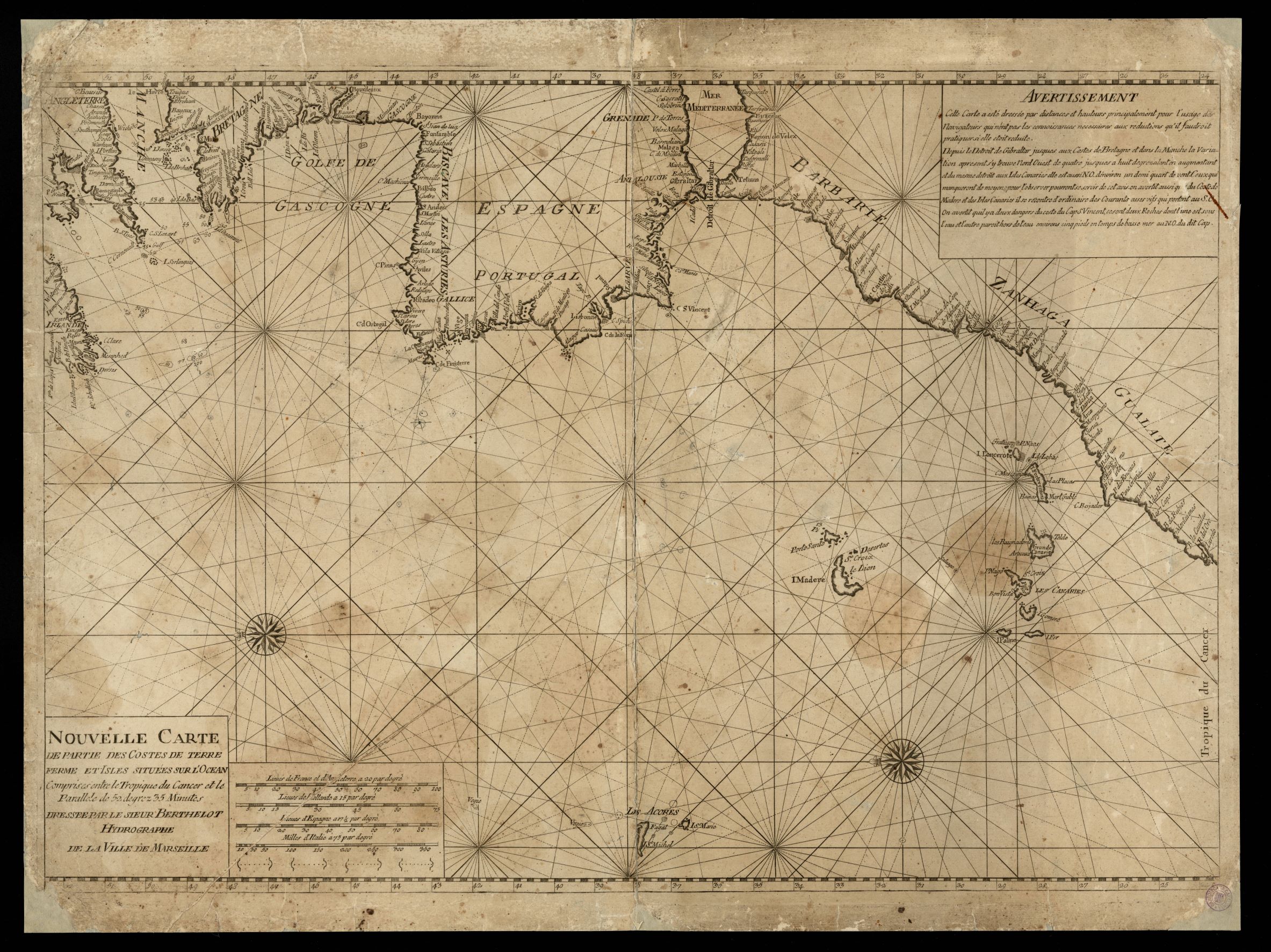
|
954- Nouvelle carte de partie des costes de Terre Ferme et isles situées sur l'ocean, com .
Author: F. Berthelot
,1695 |
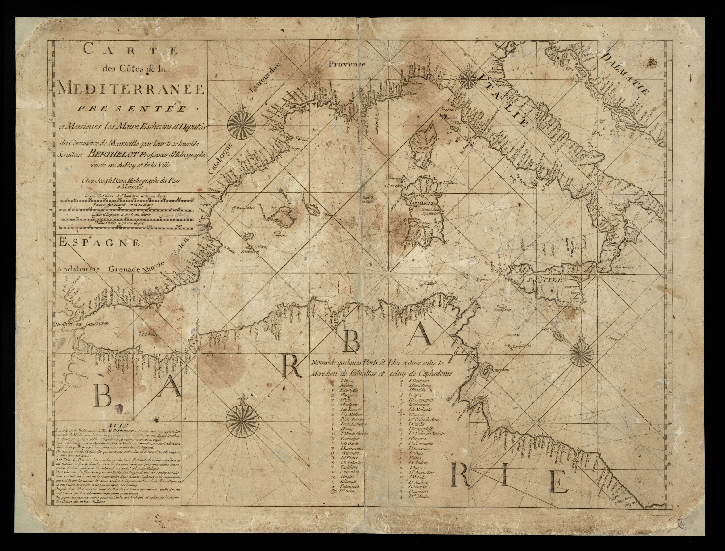
|
955-Carte des côtes de la Mediterranée / presentée a messieurs les maire, eschevins et .
Author: F. Berthelot
,1695 |
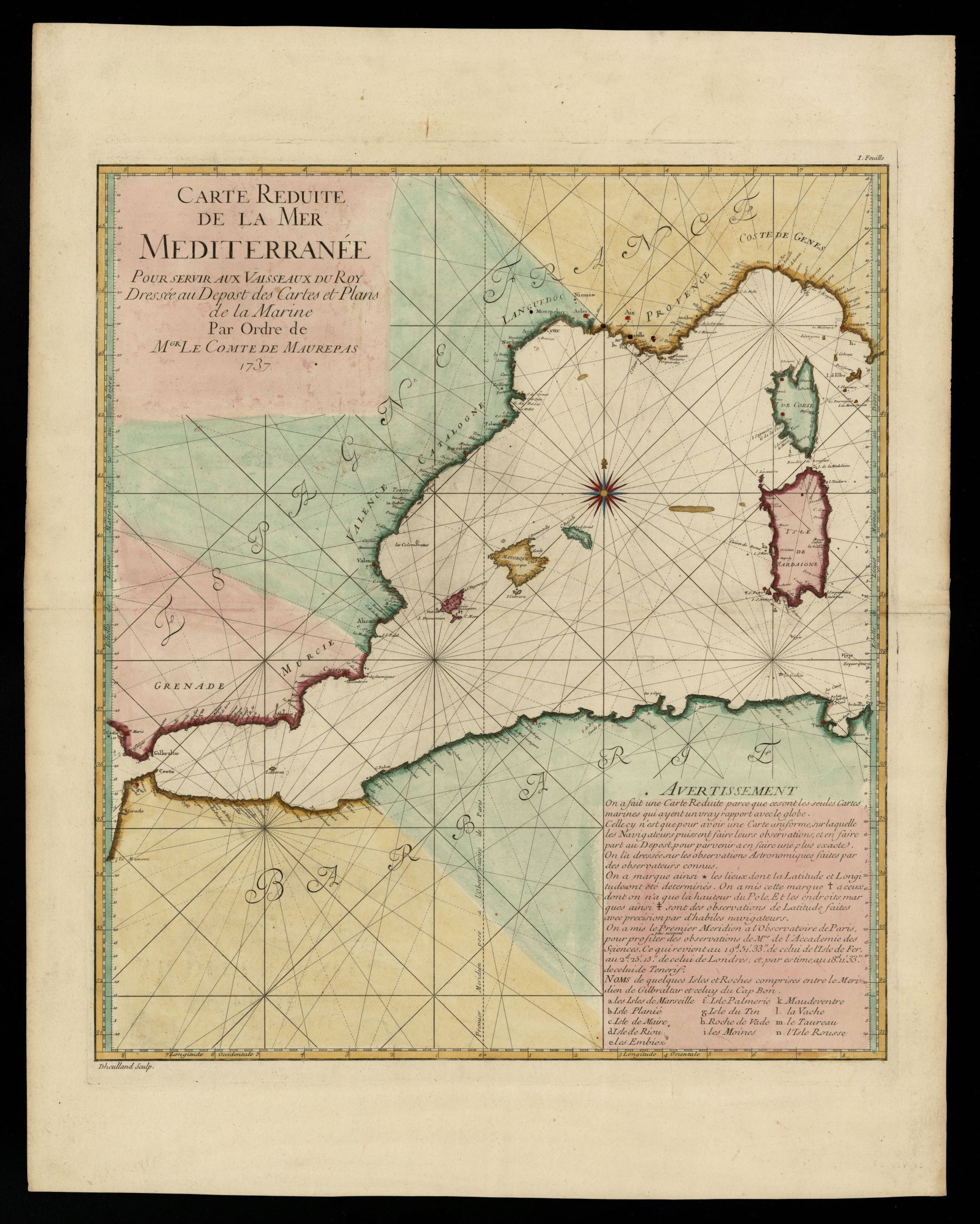
|
956-Carte reduite de la mer Mediterranée pour serv. aux vaisseaux du Roy .
Author: conte di Maurepas
,1737 |
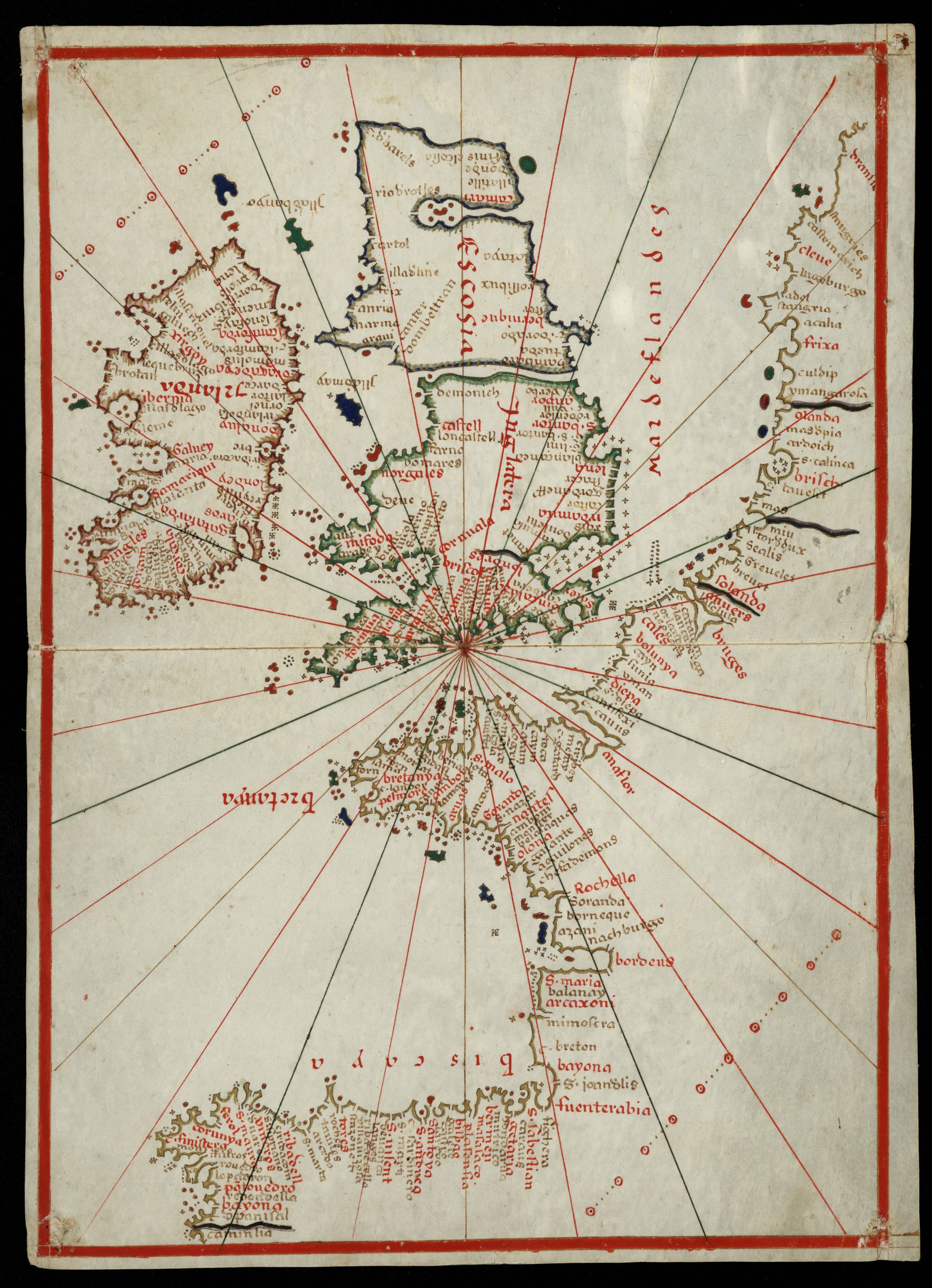
|
957- Portolà: [Atles nàutic fragmentat de la Mediterrània i de les costes atlàntiques .
Author: Bartomeu Olive
Messina,1570 |
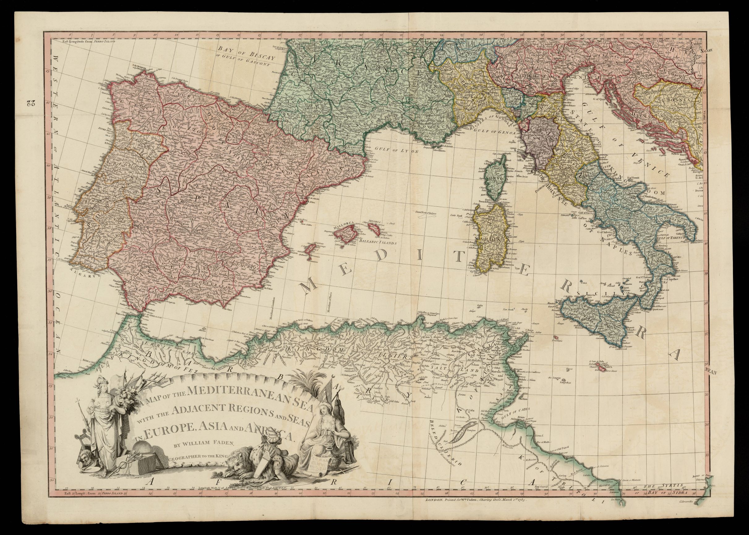
|
958-A map of the Mediterranean sea with the adjacent regions and seas in Europe, Asia and .
Author: William Faden
,1785 |
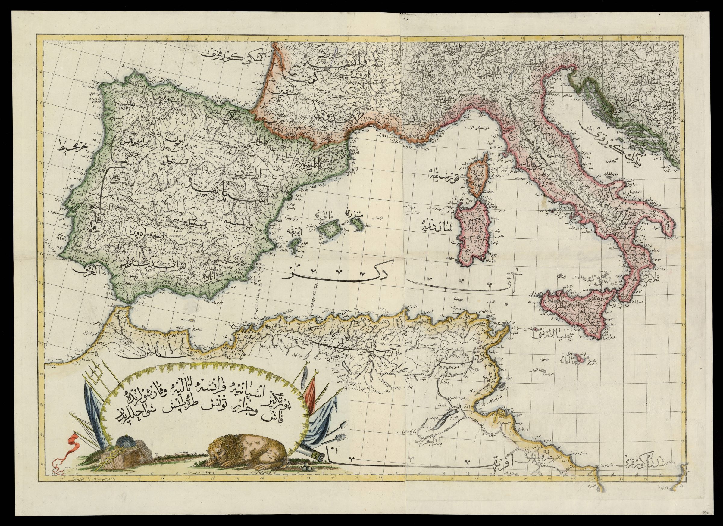
|
959- A map of the Mediterranean sea with the adjacent regions and seas in Europe, Asia and .
Author: William Faden
,1785 |
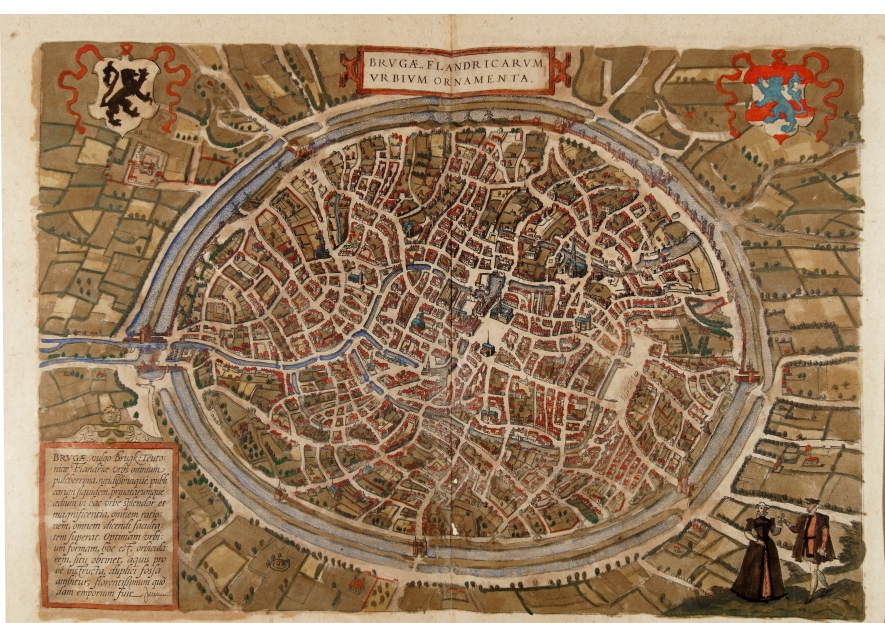
|
968- Brugae Flandicarum urbium .
Author: Georgii Braun
Colonia,1575 |
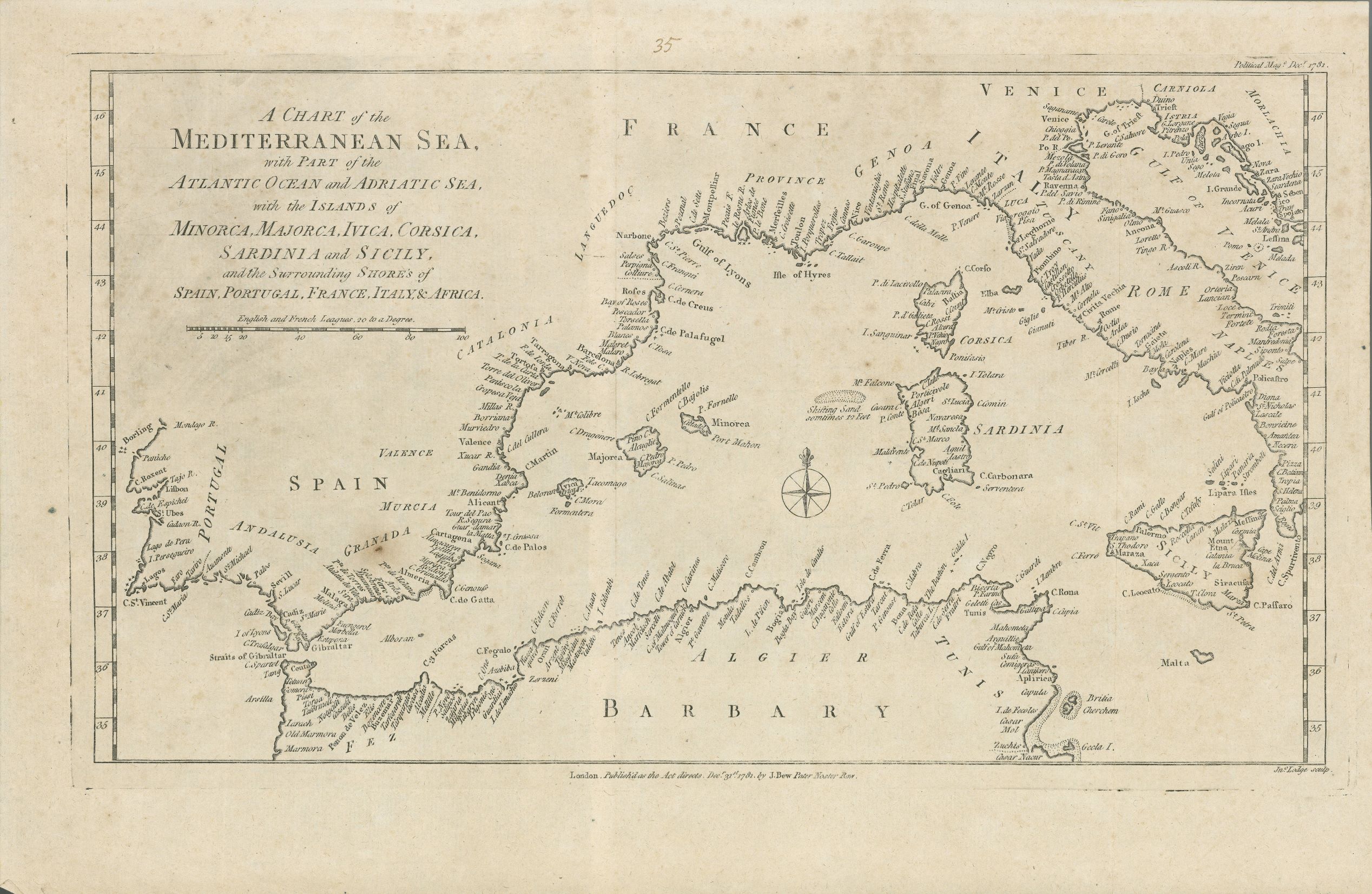
|
960- A chart of the Mediterranean sea, with part of the Atlanthic ocean and Adriatic sea, .
Author: John Bew
Londra,1781 |
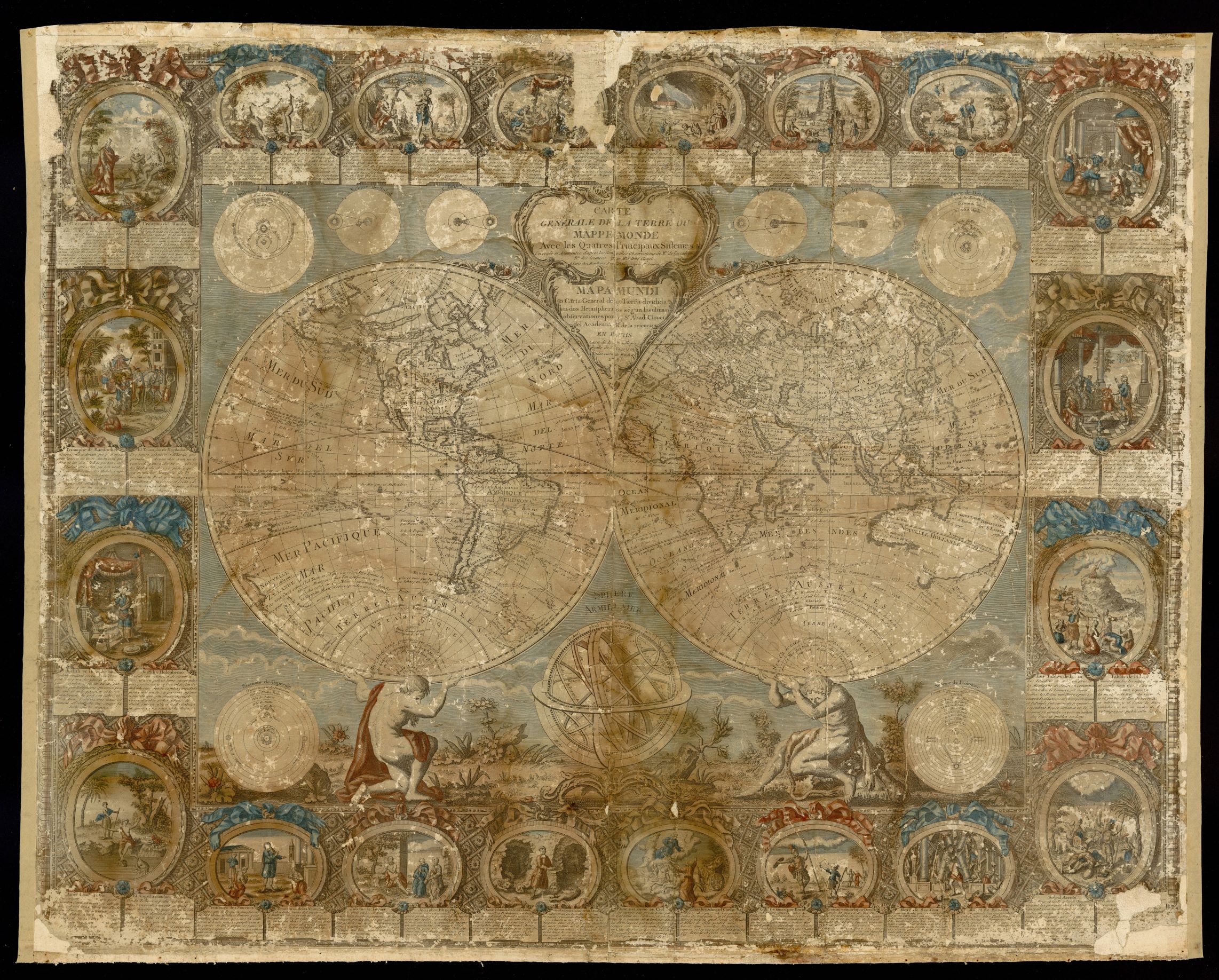
|
961- Carte generale de la Terre ou Mappemonde avec les quatres principaux sistemes .
Author: Jean-Baptiste Clouet
,1785 |
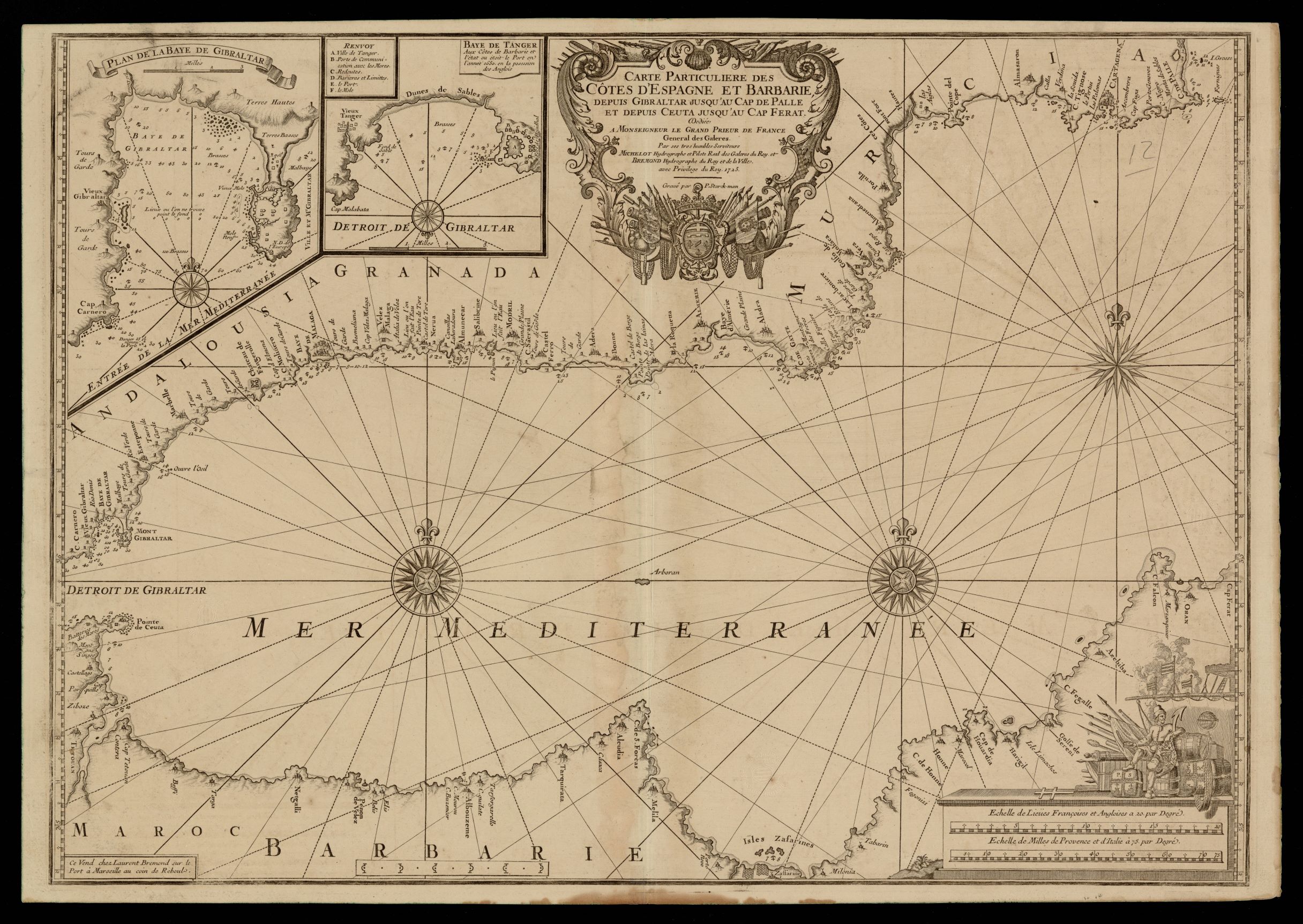
|
962- Carte particuliere des côtes d'Espagne et Barbarie depuis Gibraltar jusqu'au cap de .
Author: Henri Michelot
,1723 |
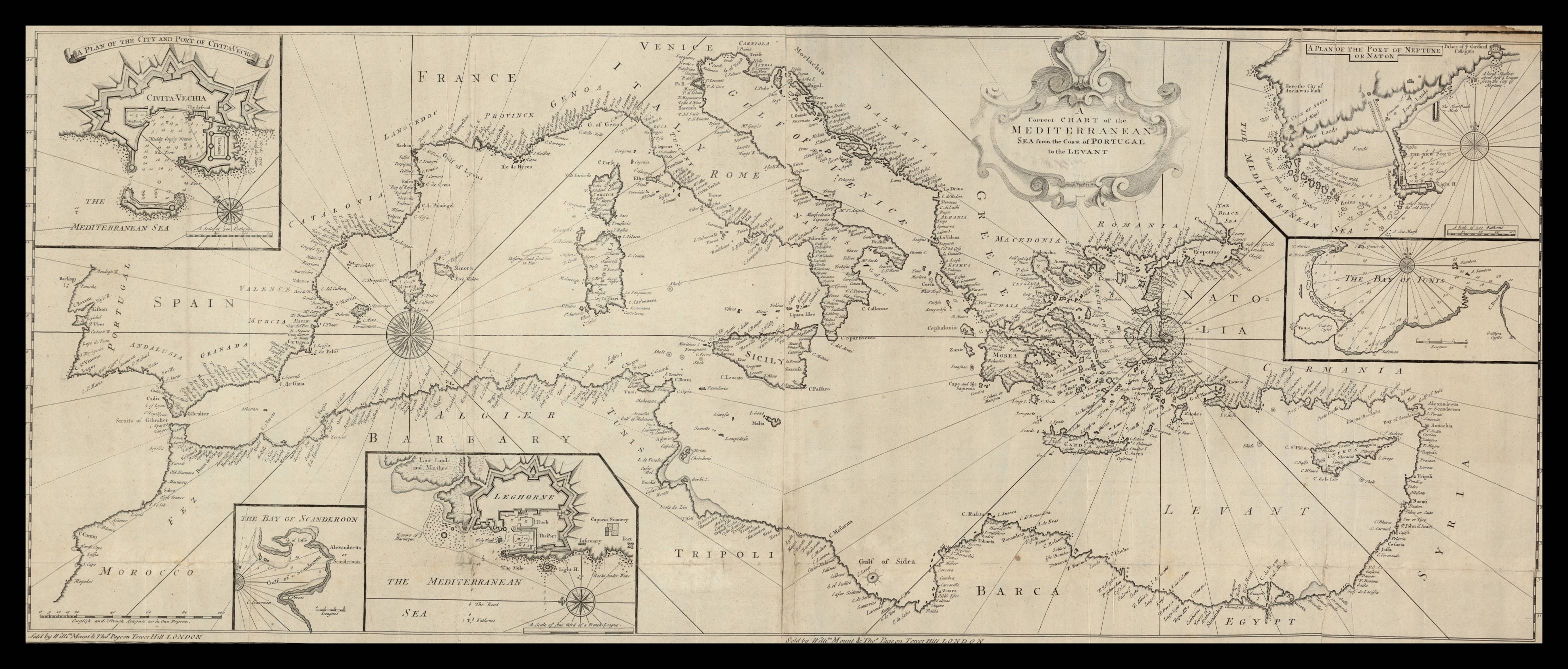
|
963-A correct chart of the Mediterranean sea from the coast of Portugal to the Levant .
Author: Monta & Pagina
,1770 |
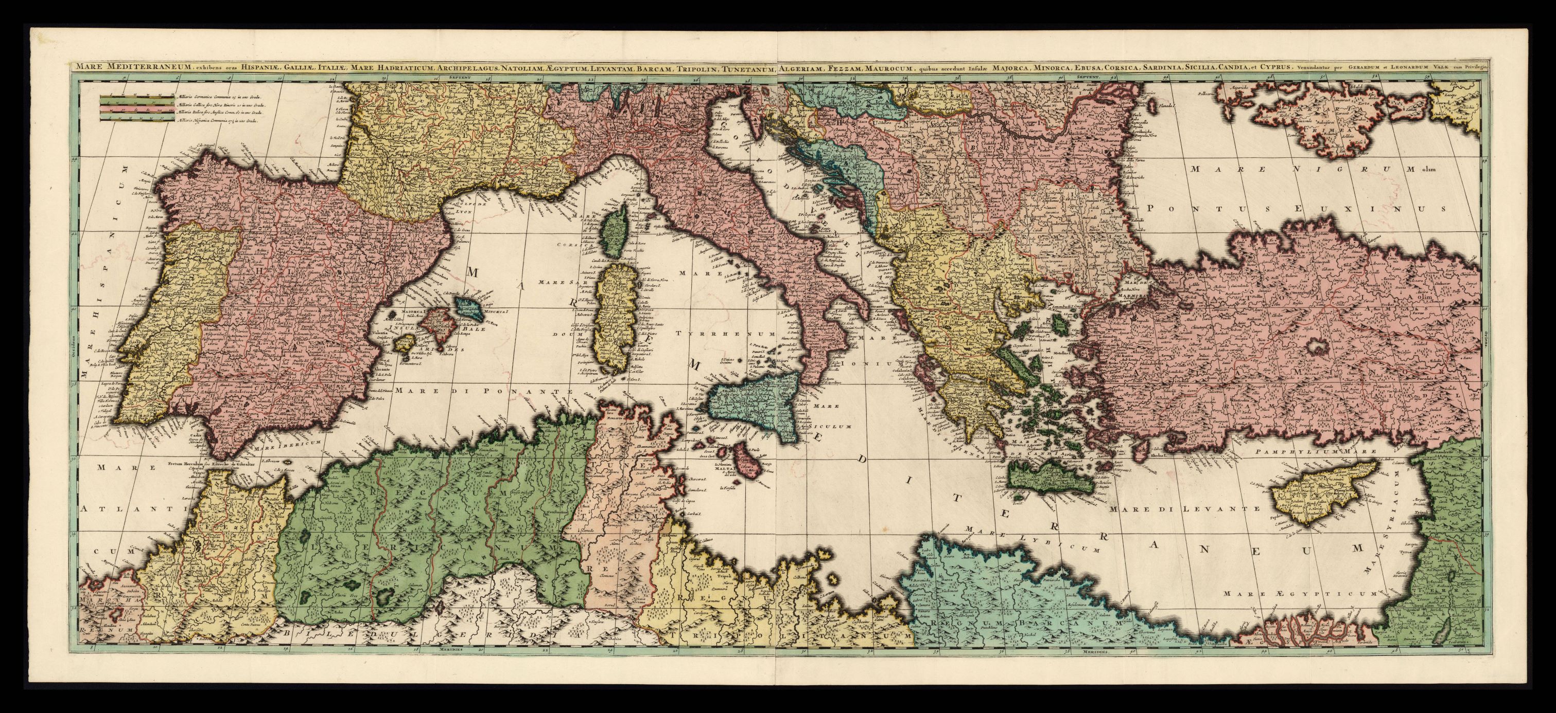
|
964- Mare Mediterraneum, exhibens oras Hispaniae, Galliae, Italiae, Mare Hadriaticum, Arch .
Author: Gerard e Leonard Valk
,1700 |
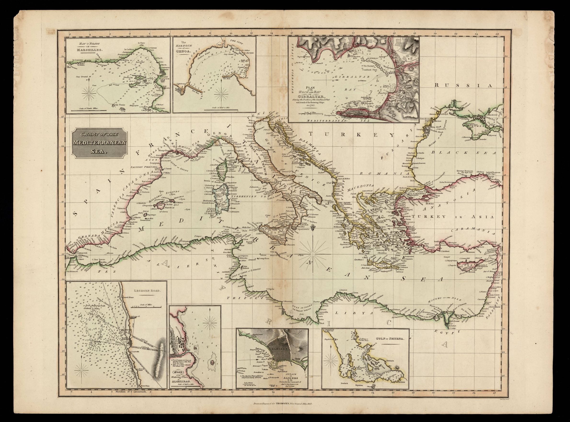
|
965- Chart of the Mediterranean sea / drawn & engraved for Thomson's New General Atlas ; N .
Author: Samuel John Neele
Edimburgo,1817 |
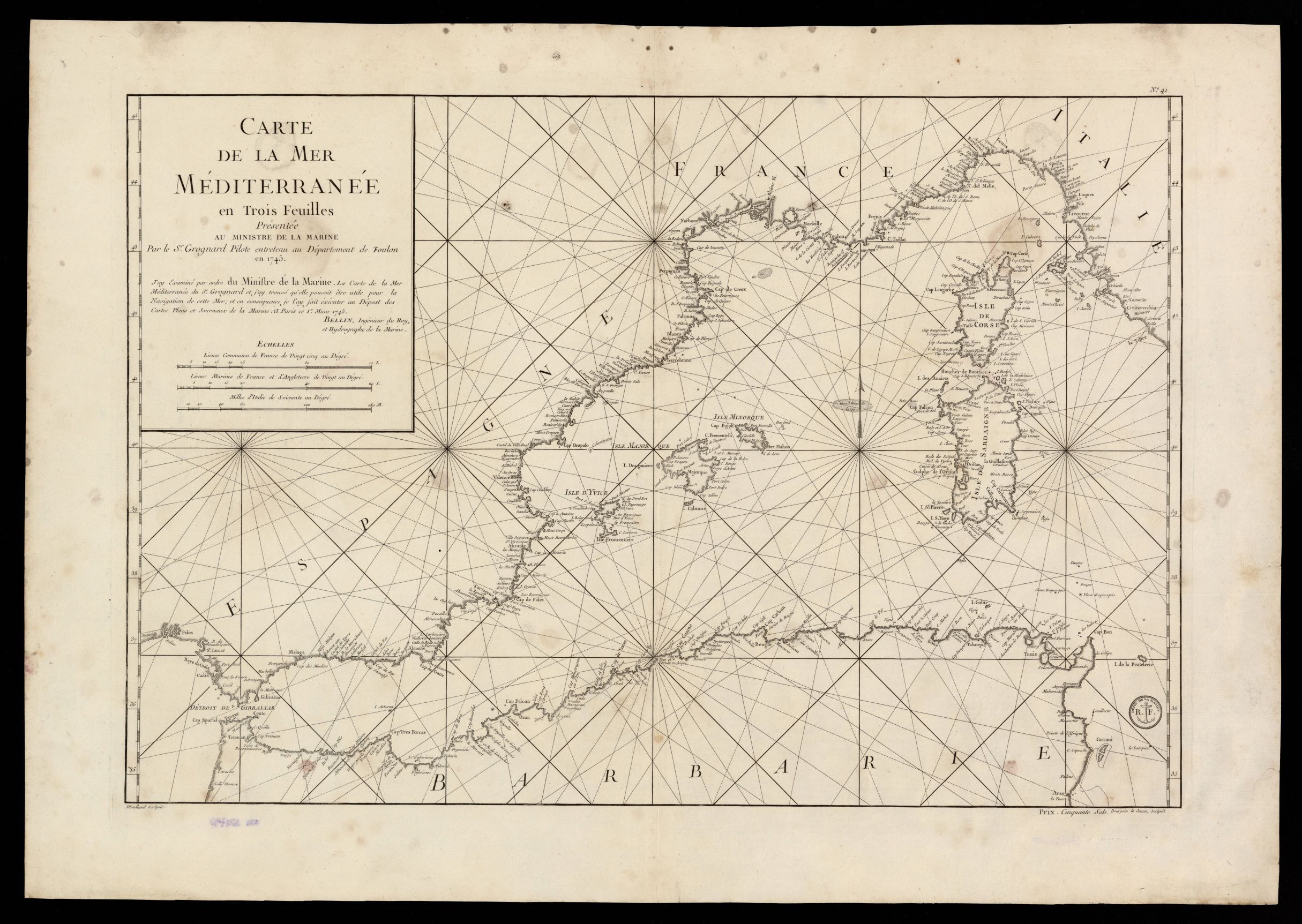
|
966- Carte de la Mer Mediterranée en trois feuilles .
Author: Jacques Nicolas Bellin
,1745 |
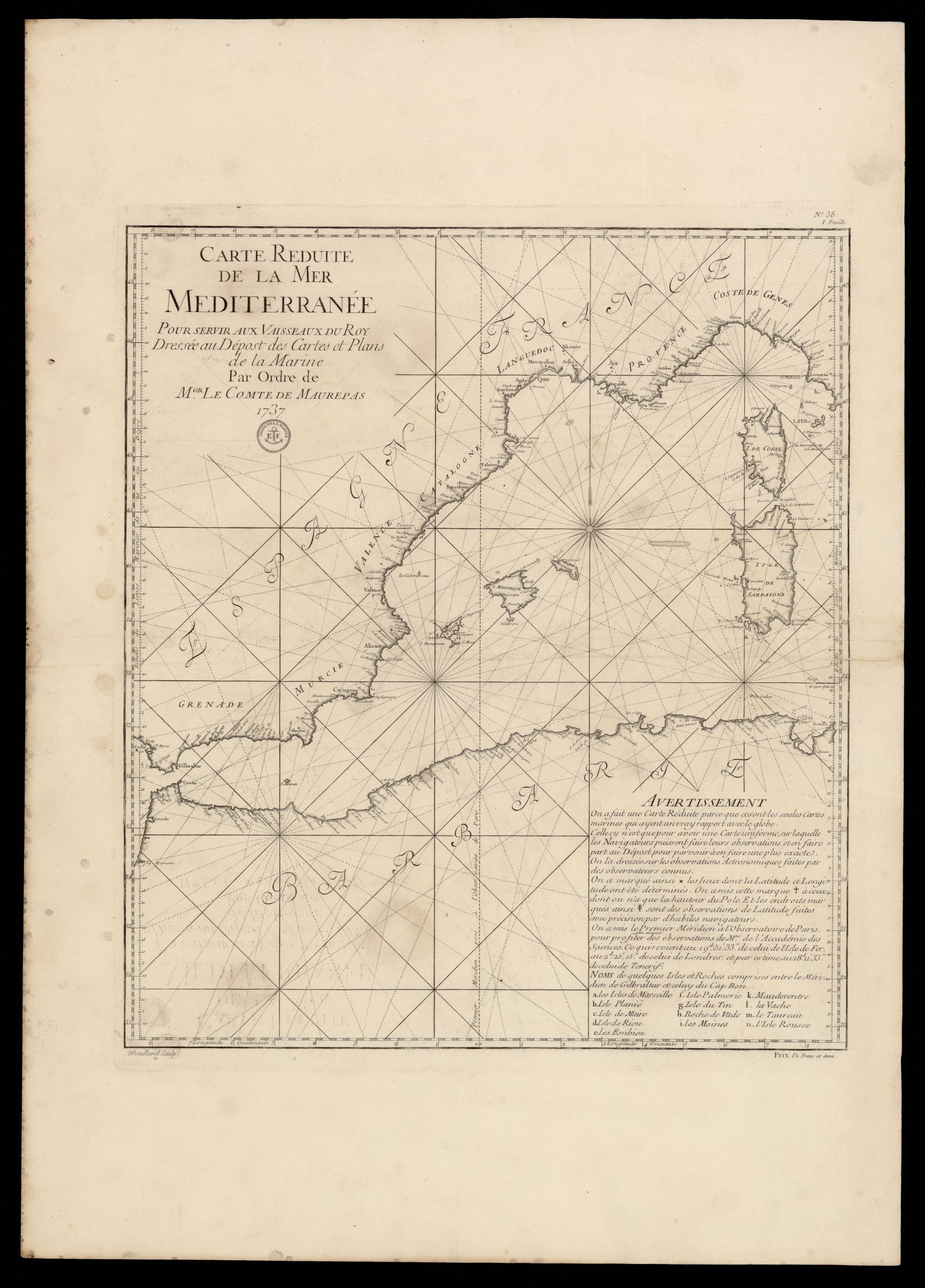
|
967- Carte reduite de la mer Mediterranée pour servir aux vaisseaux du roy .
Author: Depôt de la Marine (Francia)
,1737 |
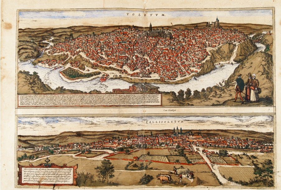
|
969- Toletum, Vallisoletum .
Author: Georgii Braun
Colonia,1575 |
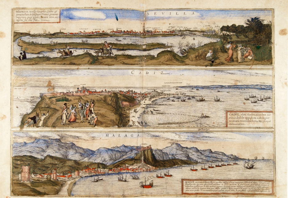
|
970- Sevilla, Cadiz, Malaga .
Author: Georgii Braun
Colonia,1575 |
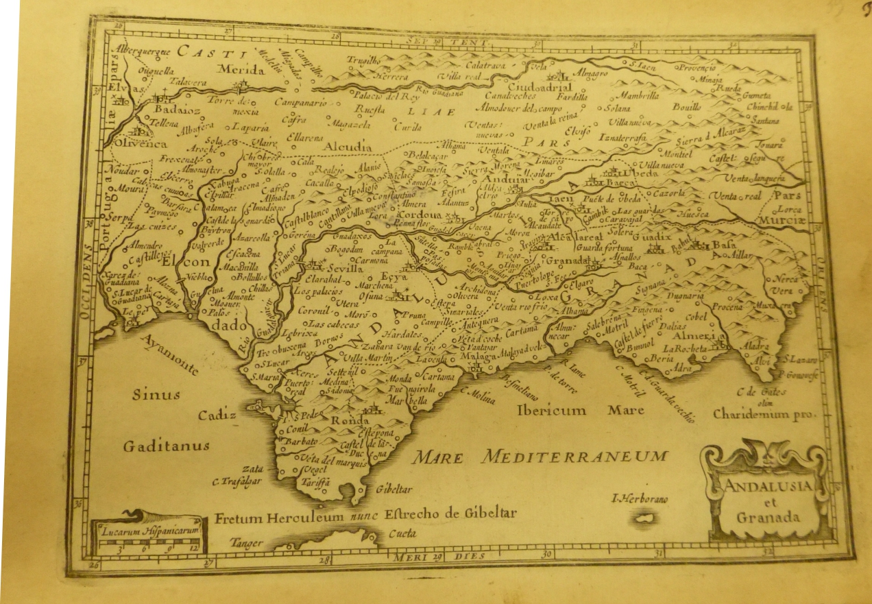
|
971-Andalusia e Granada .
Author:
,0 |
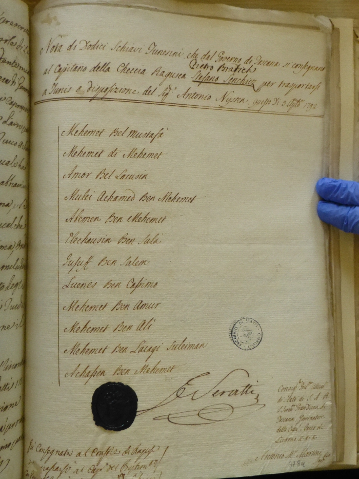
|
972-Document of the captain of the Dubrovnik ship Pietro Bratich .
Document on the transfer of (12) Tunisian slaves who are handed over by the Government of Tuscany to the Captain of the Ragusa ship Stefano Sanchiez (Pietro Bratich) to transport them to Livorno …… at the disposal of Mr. Antonio Nissen … 3 August 1792. The document is preserved in the State Archive of Livorno - location Governatore 45 Author: mediatore livornese
,1792 |
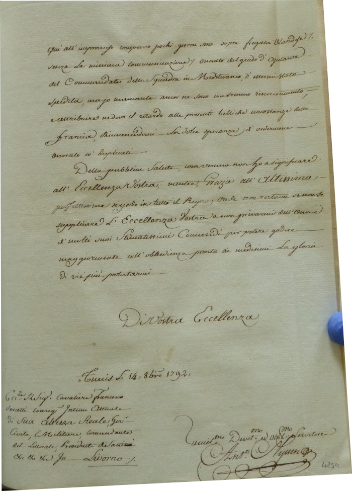
|
973- Documento di Antonio Nyssen .
Author:
,1792 |
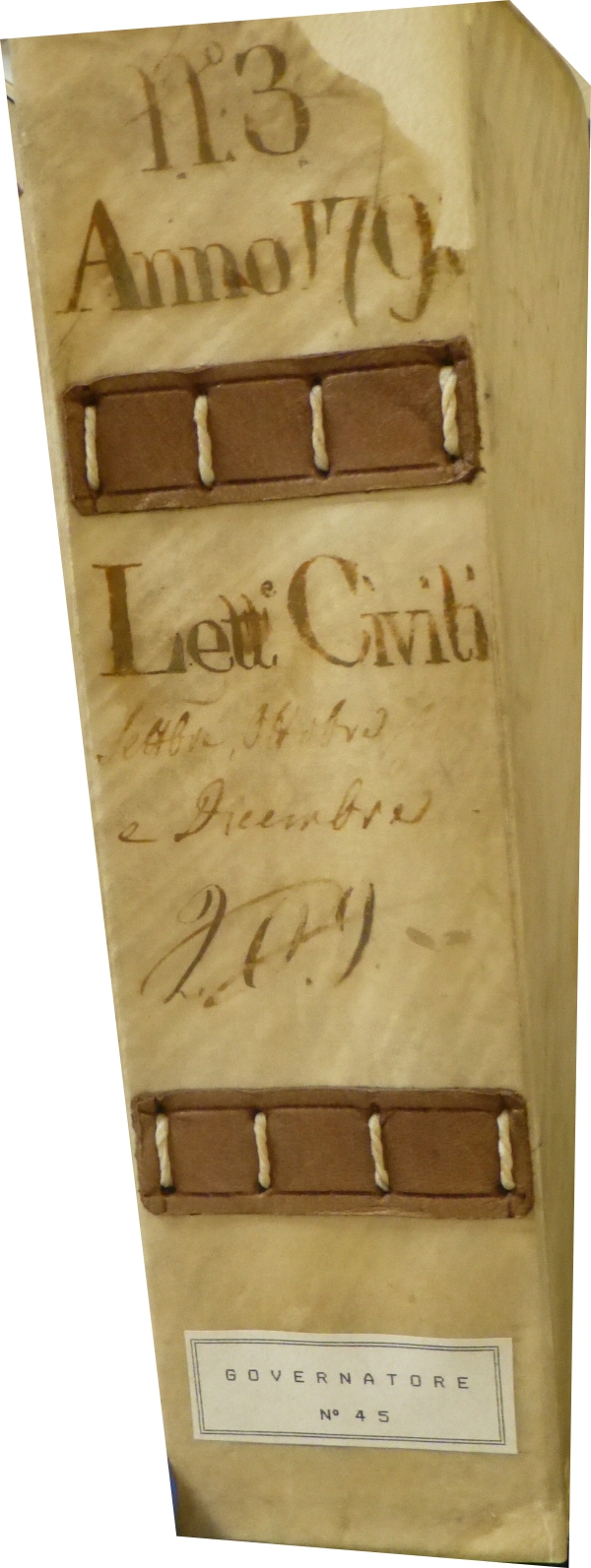
|
974- Volume 113 Anno 1792 .
Author:
,1792 |
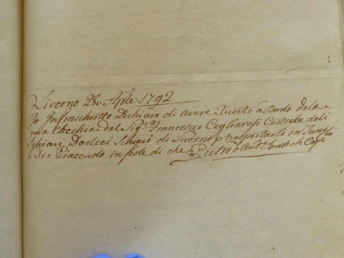
|
975-Ricevuta per la consegna di un carico di schiavi .
Author:
,1792 |
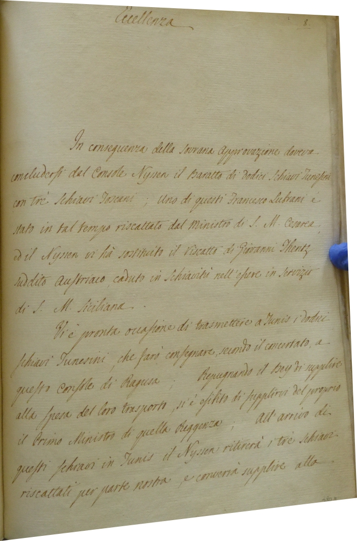
|
976-Documento sullo scambio di schiavi .
Author:
,1792 |
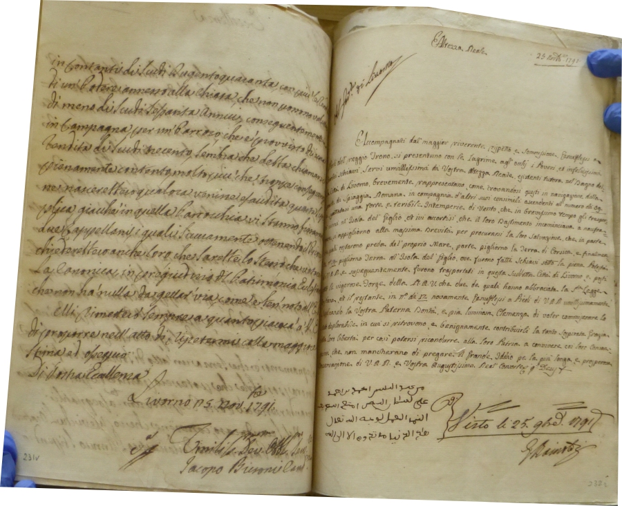
|
977-Supplica di alcuni schiavi per la liberazione .
Author:
,1791 |
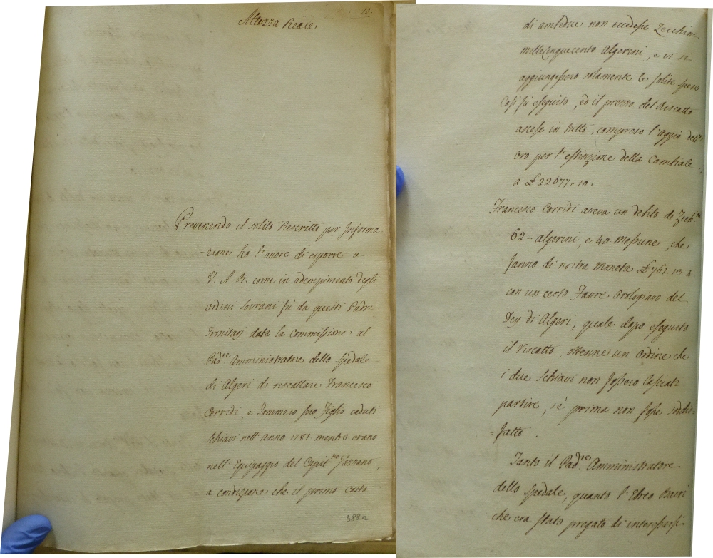
|
978-Supplica di Francesco Corridi a Sua Maestà .
Author:
,1792 |
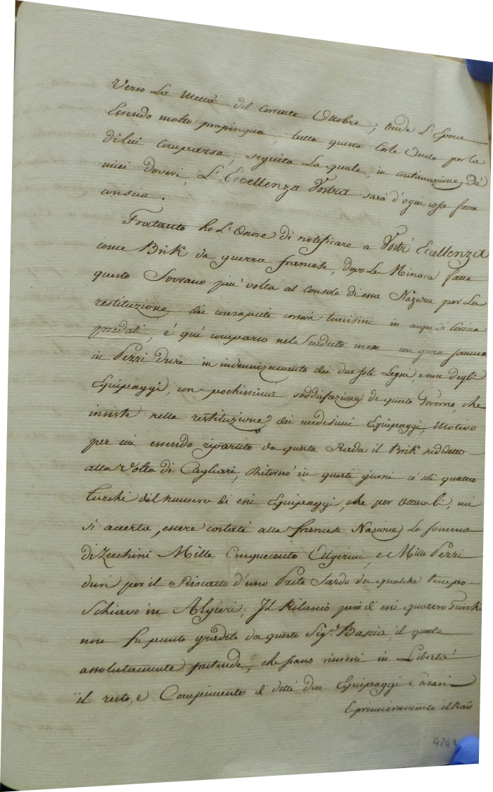
|
979-Lettera del console Antonio Nyssen .
Author:
,1792 |
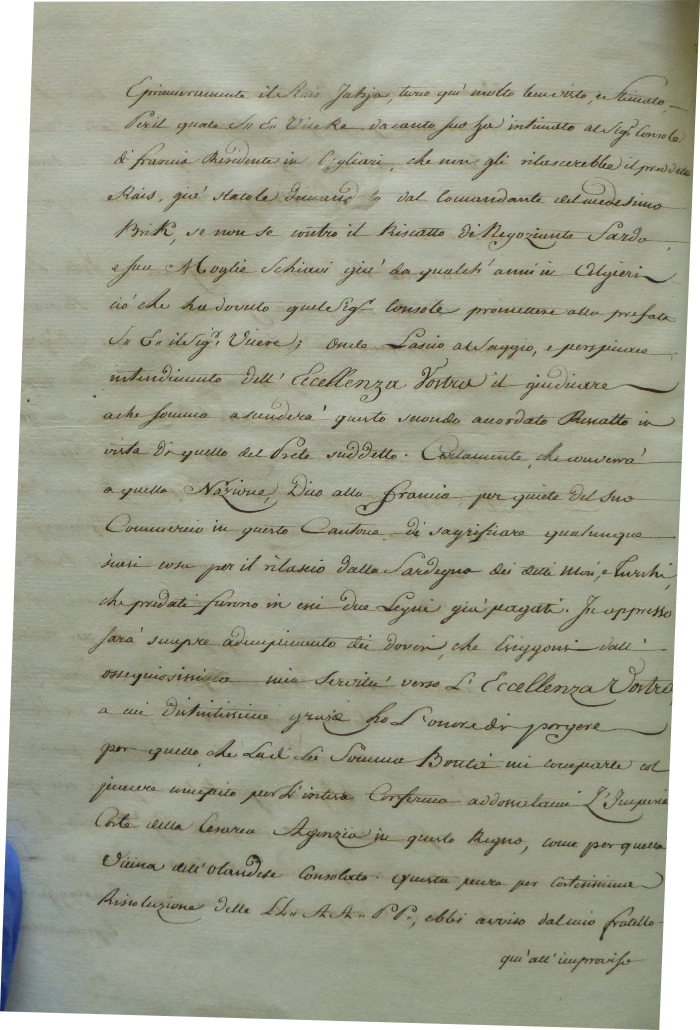
|
980-Richiesta per lo scambio di schiavi tunisini detenuti a Cagliari .
Author:
,1792 |
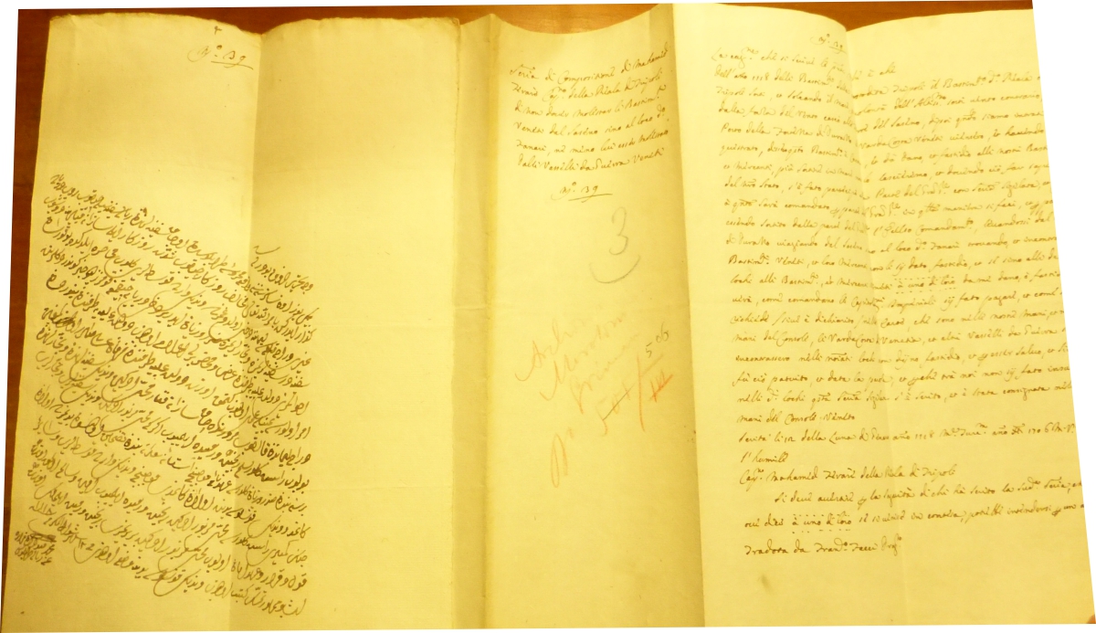
|
981-Supplica per la liberazione di uno schiavo turco .
Author:
,1218 |
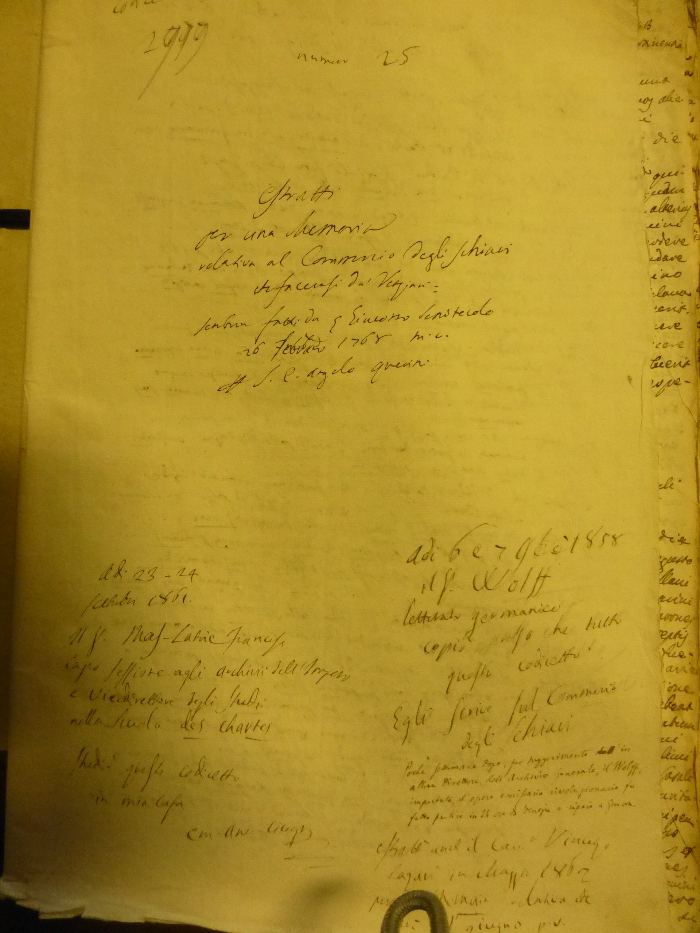
|
982-Atto di vendita di uno schiavo .
Author:
,1768 |
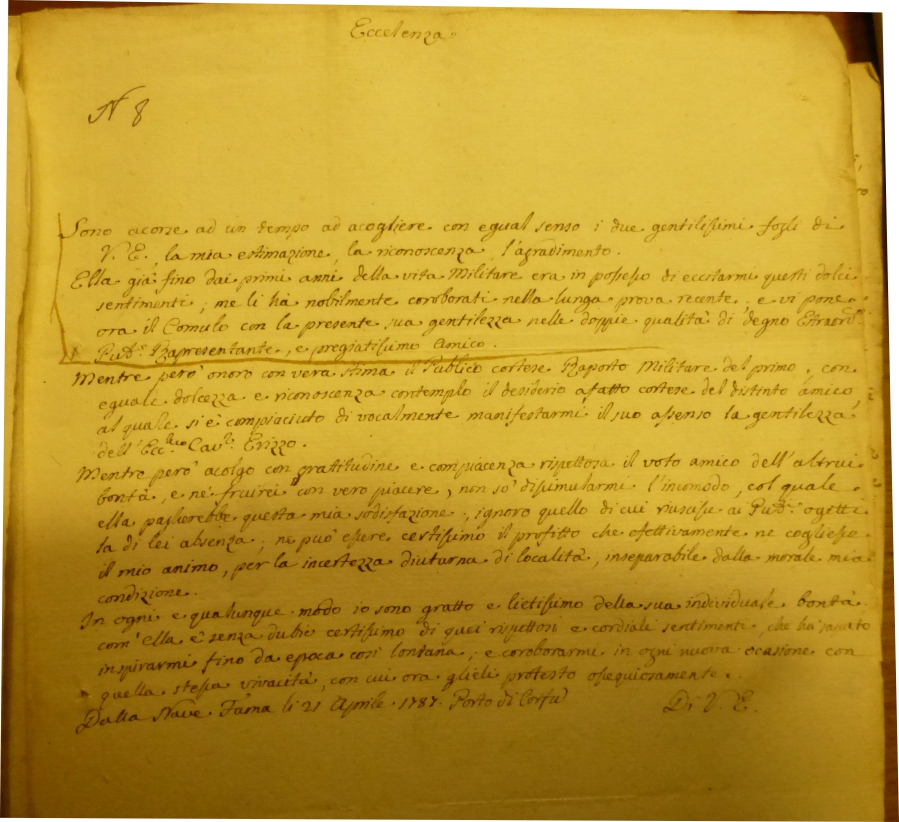
|
983-Lettera del comandate di nave militare veneziana .
Author:
,1787 |
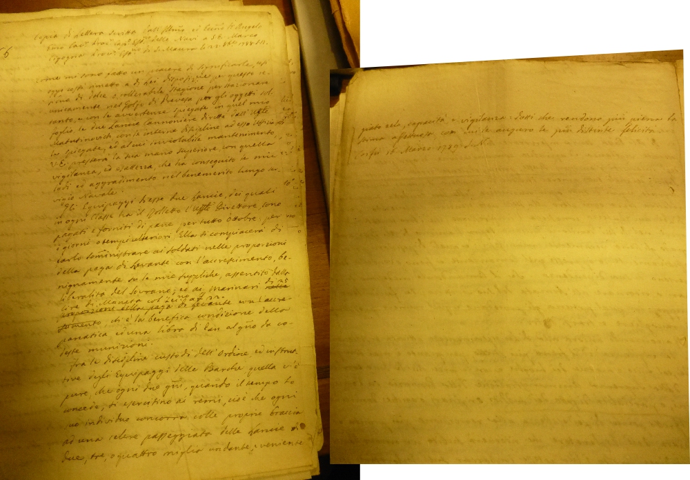
|
984-Lettera con indicazioni per la flotta veneziana di stanza a Preversa .
Author:
,1789 |
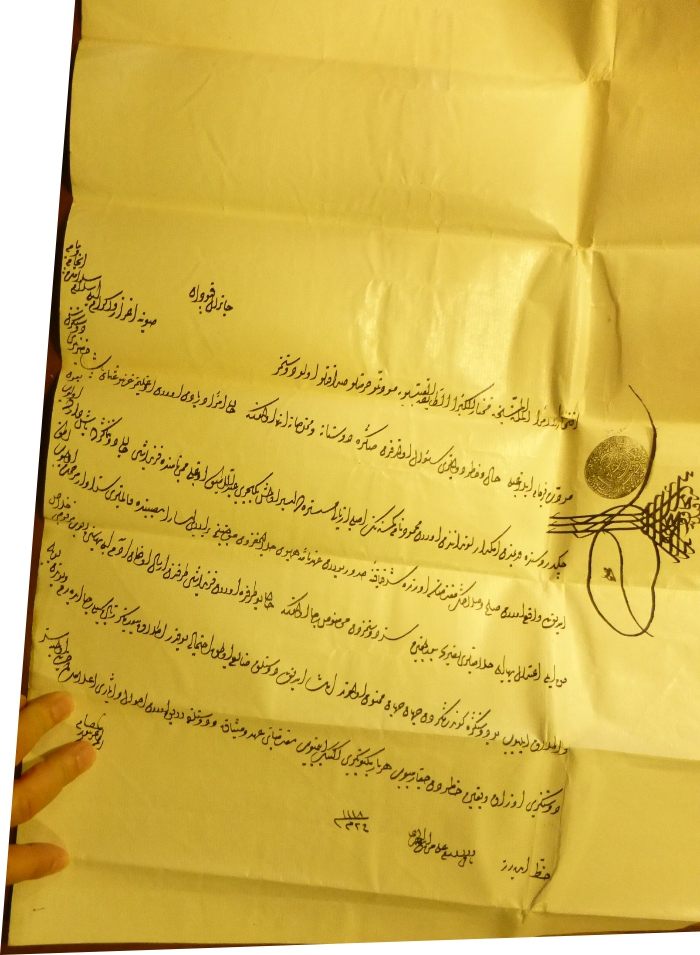
|
985-Supplica per la liberazione di uno schiavo turco .
Author:
,1118 |
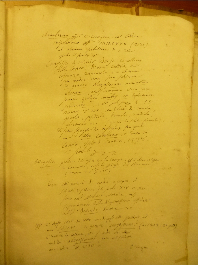
|
986-Contratto per la vendita di una schiava a Venezia .
Author:
,1428 |
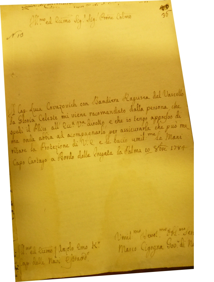
|
987-Lettera di raccomandazione per un Capitano .
Author:
,1784 |
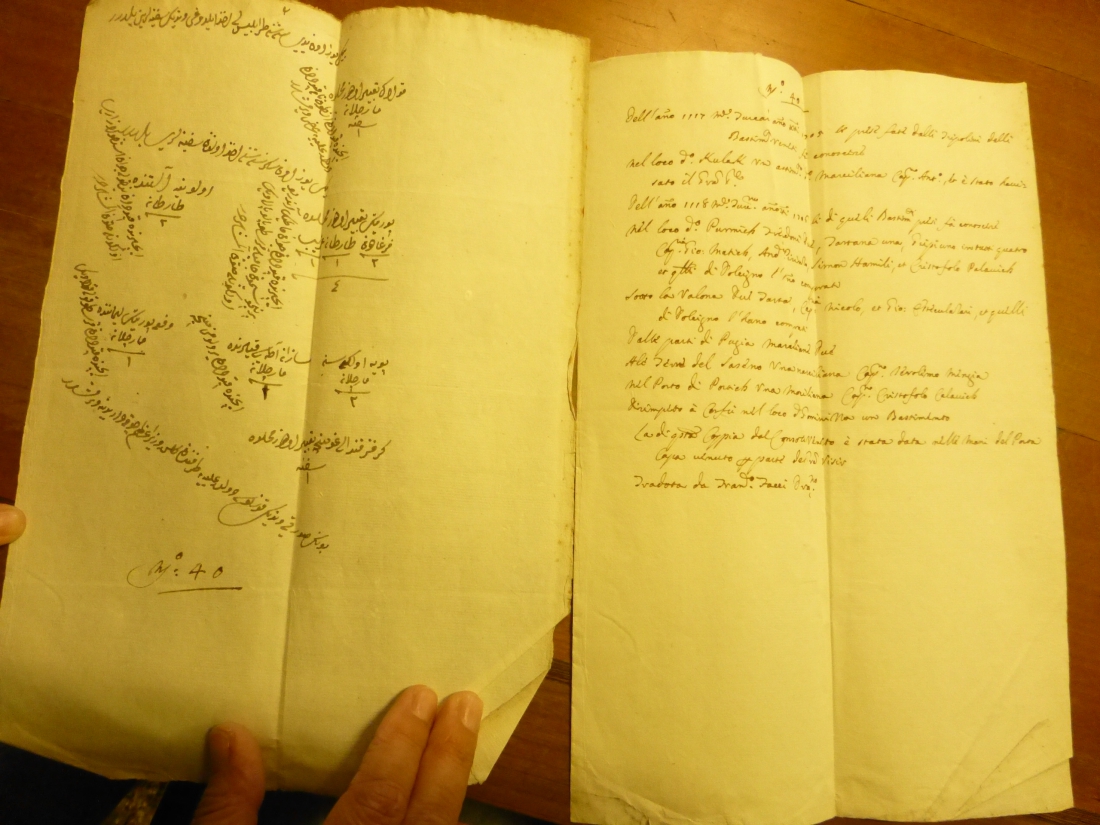
|
988-Documento in arabo con traduzione in italiano a fronte .
Author:
,1118 |
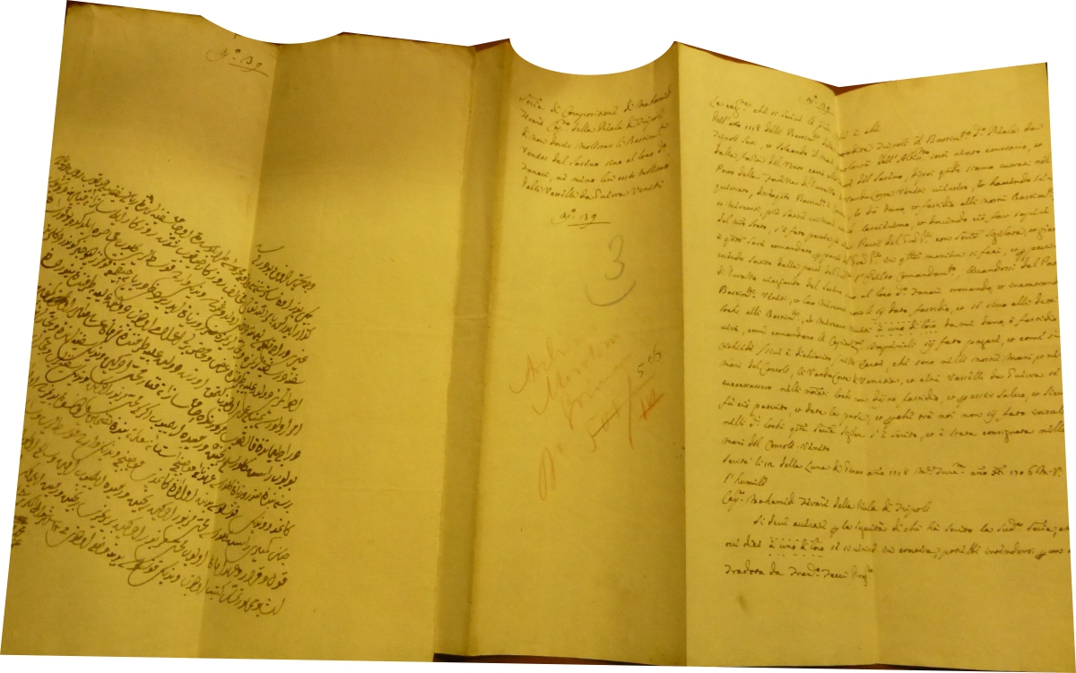
|
989-Documento in arabo con traduzione in italiano a fronte .
Author:
,1118 |
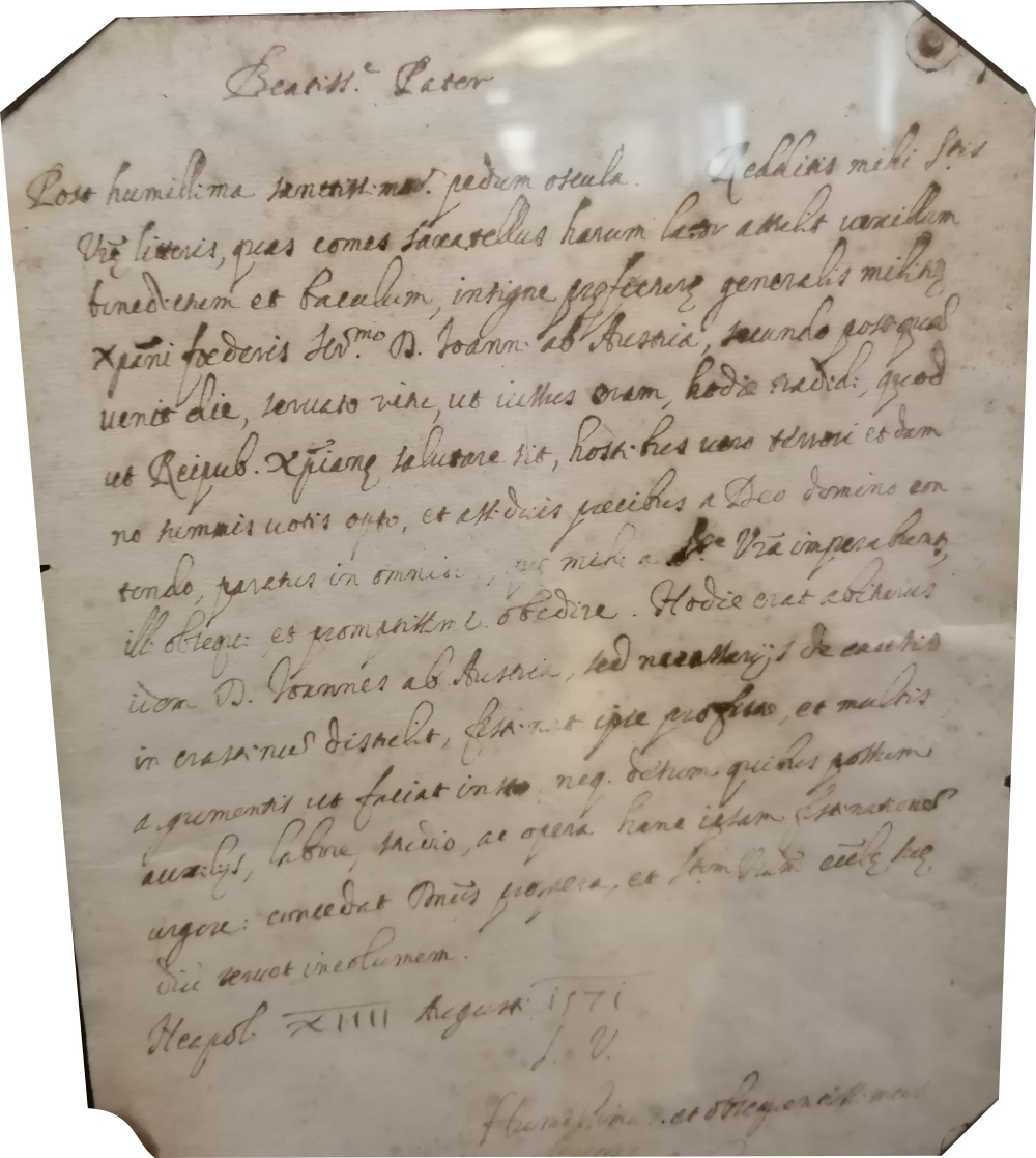
|
990-Lettera autografa del Cardinale Antonio Perrenot di Granvella – anno 1574 .
Author:
,1574 |
|
991-Speculum Orbis Terrae .
Author: Gerardus de Judaeis
Anversa,1593 |
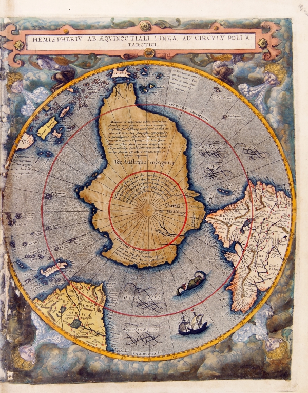
|
992-Hemisperium ab aequinoctiali linea, ad circulum poli antarctici. .
Hemisperium ab aequinoctiali linea, ad circulum poli antarctici. Antwerp 1593
Map of the Southern hemispere, Antwerp 1593. Color print from copper engraving (printer Arnold Coninx), 33 x 52 cm
Author: Gerardus de Judaeis
Anversa,1593 |
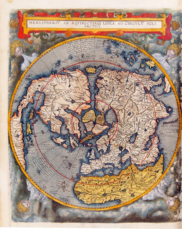
|
993-Hemisperium ab aequinoctiali linea, ad circulum poli arctici. Antwerp 1593 .
Hemisperium ab aequinoctiali linea, ad circulum poli arctici. Antwerp 1593
Map of the Northern hemispere, Antwerp 1593. Color print from copper engraving (printer Arnold Coninx), 33 x 52 cm
The map is an example of the imaginatory powers of early cartographers. Gerard de Jode has visualized the appearance of the Earth as if seen from orbit at a vantage point above the celestial pole.
Author: Gerardus de Judaeis
Anversa,1593 |
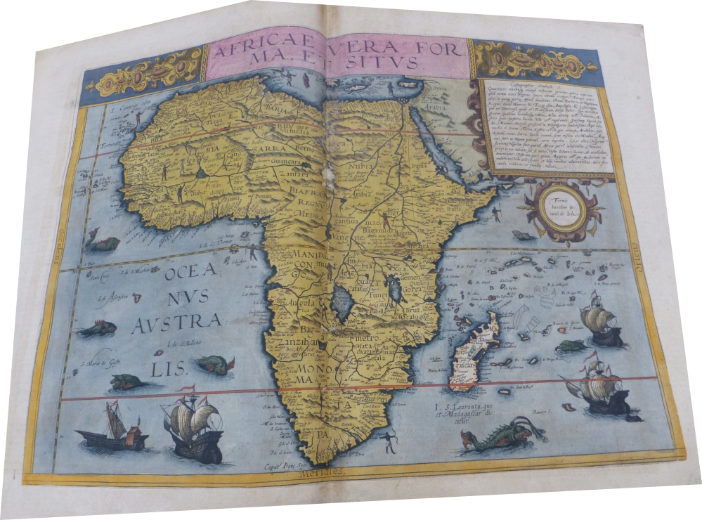
|
994-Africae Vera Forma et situs .
Author: Gerardus de Judaeis
Anversa,1593 |
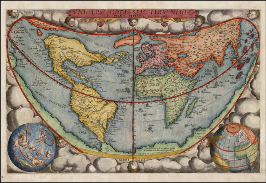
|
995-Universi Orbis Sev Terreni Glob .
Author: Gerardus de Judaeis
Anversa,1593 |
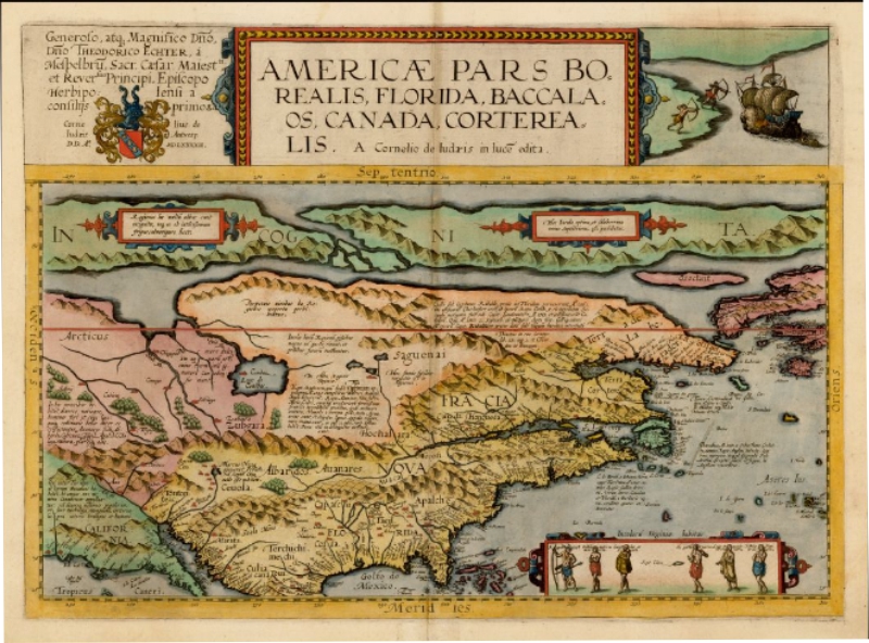
|
.
Author: Gerardus de Judaeis
Anversa,1593 |
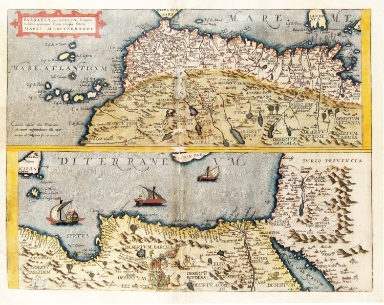
|
997-Barbaria pars Africae .
Author: Gerardus de Judaeis
Anversa,1593 |
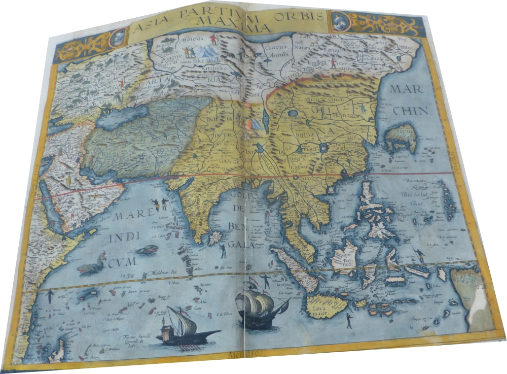
|
998-Asia Partium Orbis Maxima .
Author: Gerardus de Judaeis
Anversa,1593 |
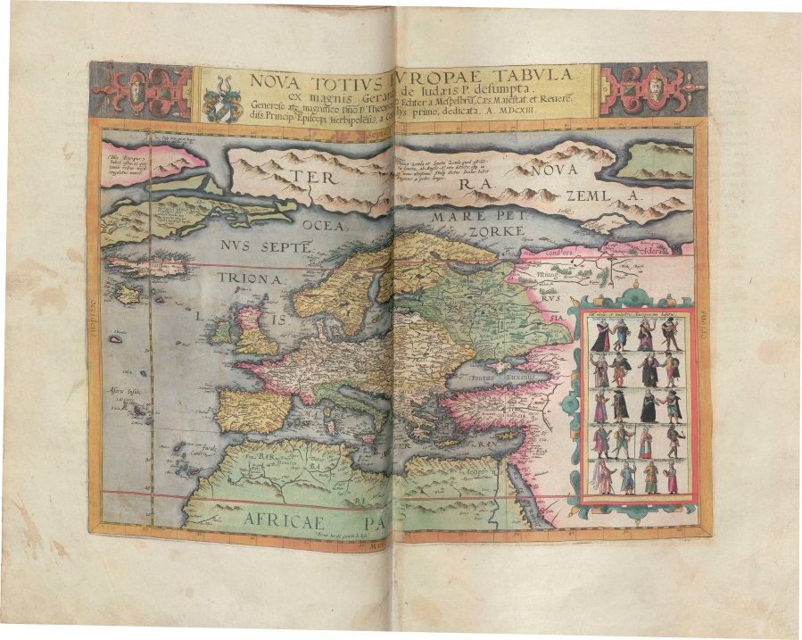
|
999-Nova Totius Europae Tabula .
Author: Gerardus de Judaeis
Anversa,1593 |
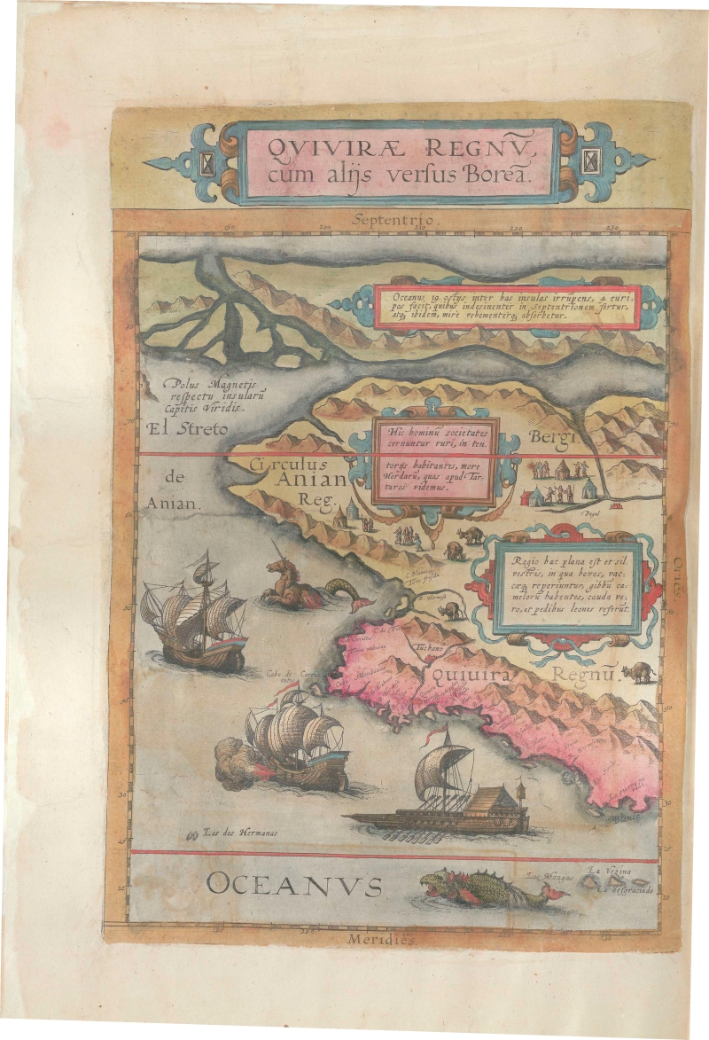
|
1000-Quivirae Regnu, cum alijs versus Borea .
Author: Gerardus de Judaeis
Anversa,1593 |
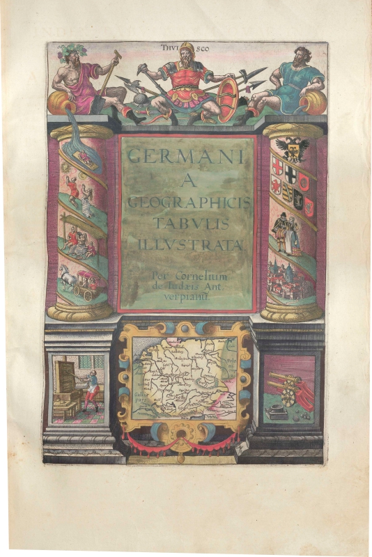
|
1002-Gernamia Geographicis Tabulis Illustrata per Cornelium De Jode .
Author: Gerardus de Judaeis
Anversa,1593 |
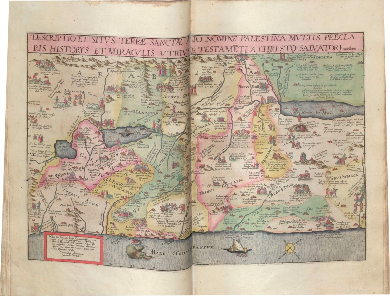
|
1001-Descriptio Et Situs Terrae Sanctae Alio Nomine Palestina Multis Preclaris Historys Et .
Author: Gerardus de Judaeis
Anversa,1593 |
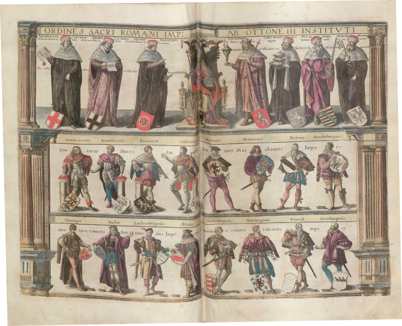
|
1003-Ordines sacri romani imperii ab ottone III istituti .
Author: Gerardus de Judaeis
Anversa,1593 |
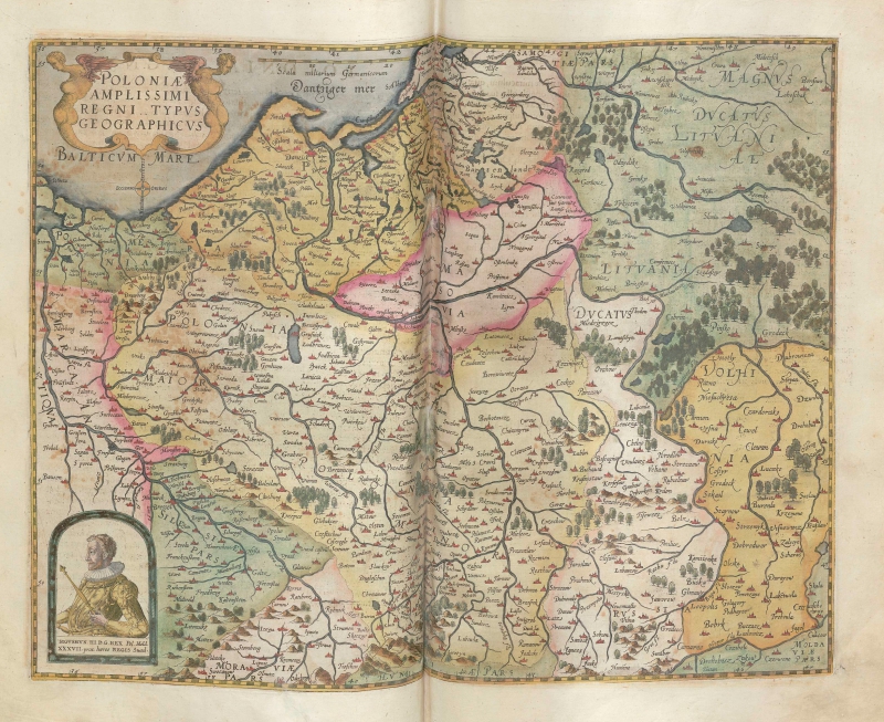
|
1004-Poloniae amplissimi regni typus geographicus .
Author: Gerardus de Judaeis
Anversa,1593 |
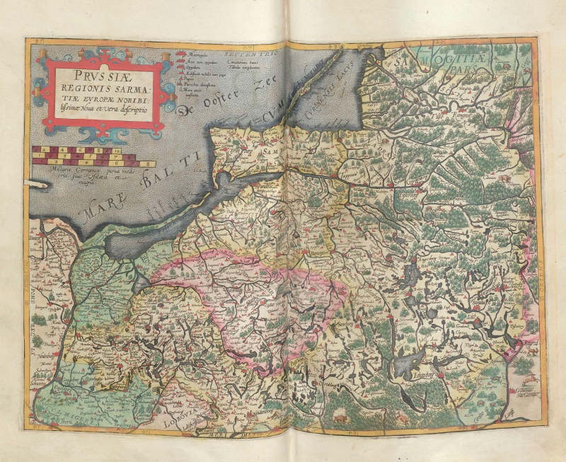
|
1005-Prussiae Regionis Sarmatiae Europae Nobibilis simae nova et vera descriptio .
Author: Gerardus de Judaeis
Anversa,1593 |
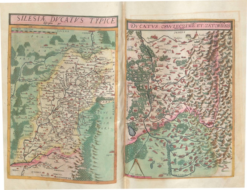
|
1006-Silesia Ducatus Typice descriptus per [and] Ductaus Oswieczime et Zatoriesis descript .
Author: Gerardus de Judaeis
Anversa,1578 |
