![]()
![]()
![]()
![]()
![]()
![]()


MY MAPS
Regions:
![]()
Browse the website:
Latest Acquisitions
A Brief History of Cartography
The Cartographers
Events on ancient maps
Accimo editions
Brochure MB
Contacts
Glossary
Sitemap
|
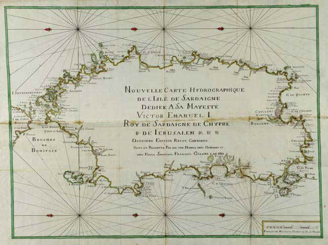
314-Sardaigne Hydrographique Description: The colored map was printed in 1813 and measures 72 x 124 cm. There are neighter graduated margins nor geographic coordinates. Except from the title, the map inside is empty. But the coast contour is rich of names. It's the second edition of a map printed in 1785-88. Autor: Francois Giaume Place: Year: 1813 Quality document:
See online :
Go to verification |

