![]()
![]()
![]()
![]()
![]()
![]()


MY MAPS
Regions:
![]()
Browse the website:
Latest Acquisitions
A Brief History of Cartography
The Cartographers
Events on ancient maps
Accimo editions
Brochure MB
Contacts
Glossary
Sitemap
|
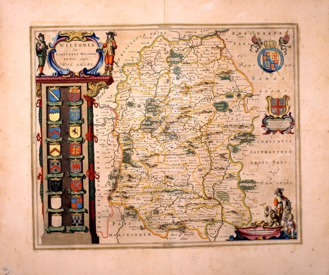
176-Wiltonia. Sive comitatus wiltoniensis; anglis wil shire Description: This map of the 17 thcentury, measures 49,5 x 41 and shows a beautiful title picture standing over a column of sixteen blazons on the left and two decorative pictures and a graphic scale with scenes of that epoch on the right. The water courses are precisely drawn, however the hills are approximatively distributed all over the whole region. Autor: Ioannis Blaeu Place: Amsterdam Year: 0 Quality document:
See online :
Go to verification |

