![]()
![]()
![]()
![]()
![]()
![]()


MY MAPS
Regions:
![]()
Browse the website:
Latest Acquisitions
A Brief History of Cartography
The Cartographers
Events on ancient maps
Accimo editions
Brochure MB
Contacts
Glossary
Sitemap
Last 100 added maps

|
1011-Tetrachia ducatus Geldriae Neomagensis .
Author: Frederick de Wit
,0 |

|
1010-Tetrachia ducatus Geldriae Ruremondana sive Hispanica .
Author: Frederick de Wit
,0 |
|
1008-Utriusque Alsatiae, ducatus Dupontii, et Spirensis episcopatus novissima descriptio .
Author: Frederick de Wit
,0 |

|
1008-Utriusque .
Author: Frederick de Wit
,0 |
|
Rotta del mediterraneo e della costa atlantica .
Author: Caloiro e Oliva, Plácido
,0 |
|
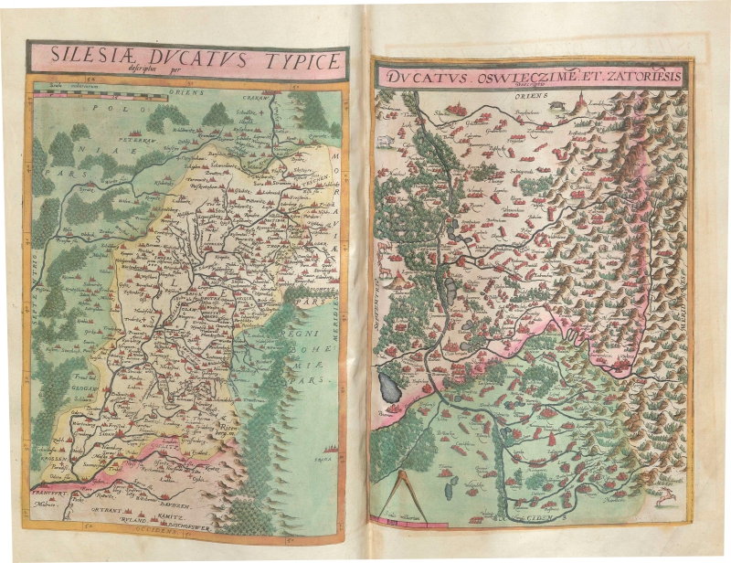
1006-Silesia Ducatus Typice descriptus per [and] Ductaus Oswieczime et Zatoriesis descript .
Author: Gerardus de Judaeis
Anversa,1578 |
|
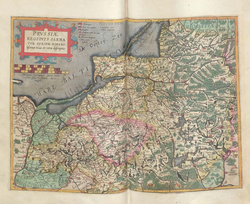
1005-Prussiae Regionis Sarmatiae Europae Nobibilis simae nova et vera descriptio .
Author: Gerardus de Judaeis
Anversa,1593 |
|
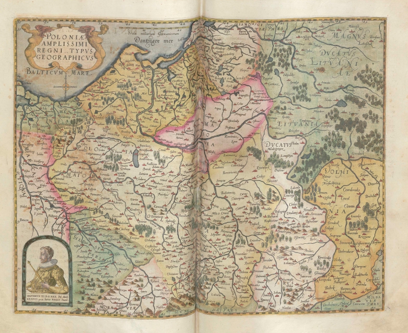
1004-Poloniae amplissimi regni typus geographicus .
Author: Gerardus de Judaeis
Anversa,1593 |
|
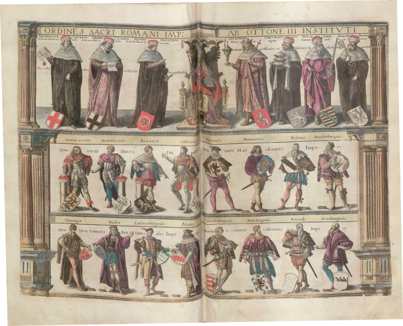
1003-Ordines sacri romani imperii ab ottone III istituti .
Author: Gerardus de Judaeis
Anversa,1593 |
|
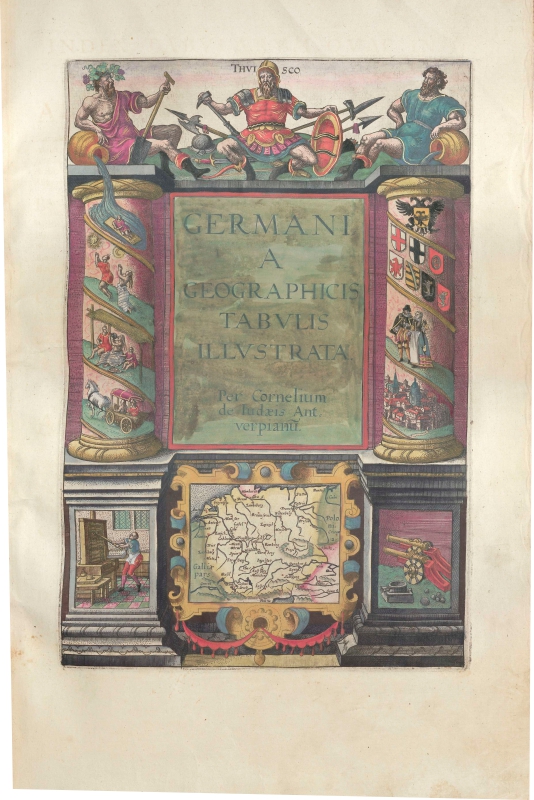
1002-Gernamia Geographicis Tabulis Illustrata per Cornelium De Jode .
Author: Gerardus de Judaeis
Anversa,1593 |
|
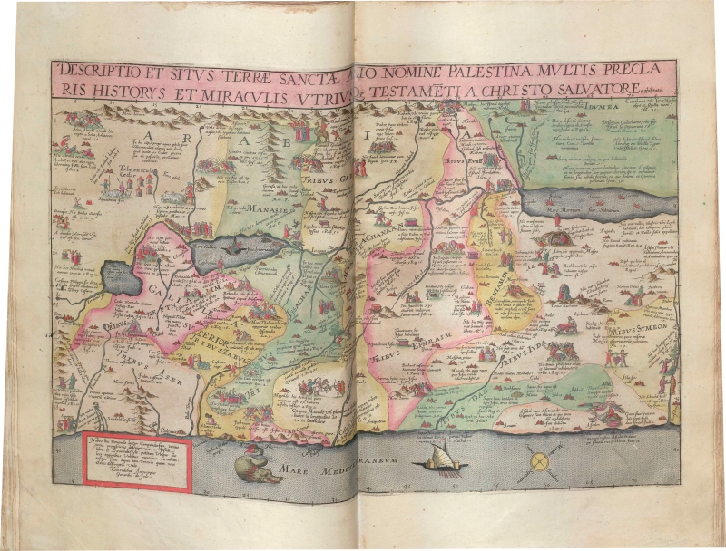
1001-Descriptio Et Situs Terrae Sanctae Alio Nomine Palestina Multis Preclaris Historys Et .
Author: Gerardus de Judaeis
Anversa,1593 |
|
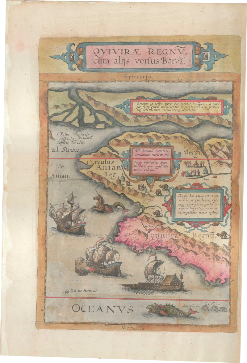
1000-Quivirae Regnu, cum alijs versus Borea .
Author: Gerardus de Judaeis
Anversa,1593 |
|
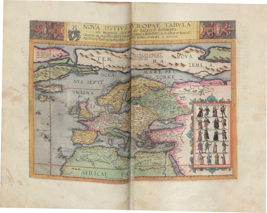
999-Nova Totius Europae Tabula .
Author: Gerardus de Judaeis
Anversa,1593 |
|
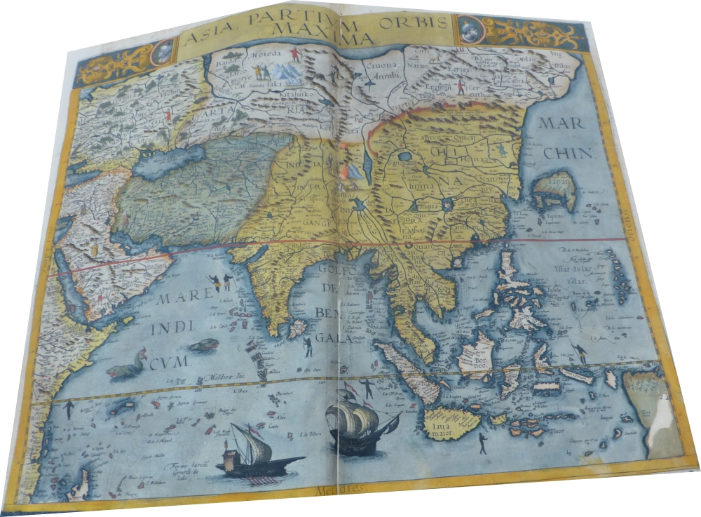
998-Asia Partium Orbis Maxima .
Author: Gerardus de Judaeis
Anversa,1593 |
|
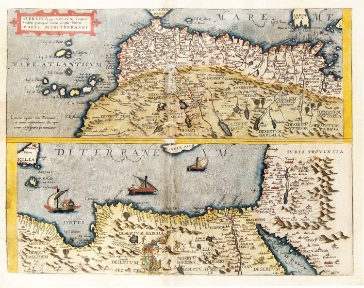
997-Barbaria pars Africae .
Author: Gerardus de Judaeis
Anversa,1593 |
|
.
Author: Gerardus de Judaeis
Anversa,1593 |
|
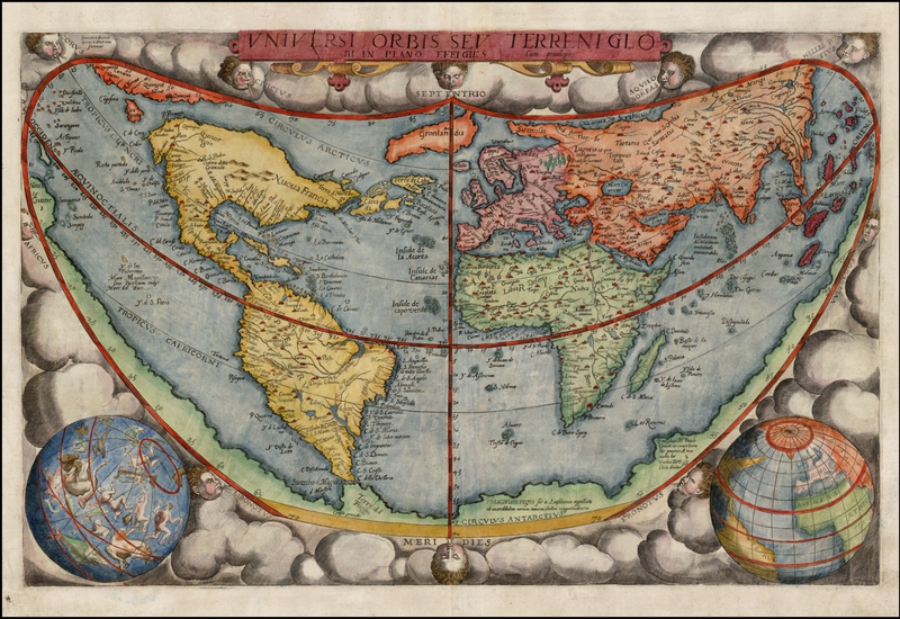
995-Universi Orbis Sev Terreni Glob .
Author: Gerardus de Judaeis
Anversa,1593 |
|
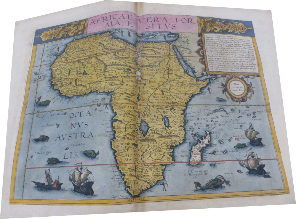
994-Africae Vera Forma et situs .
Author: Gerardus de Judaeis
Anversa,1593 |
|
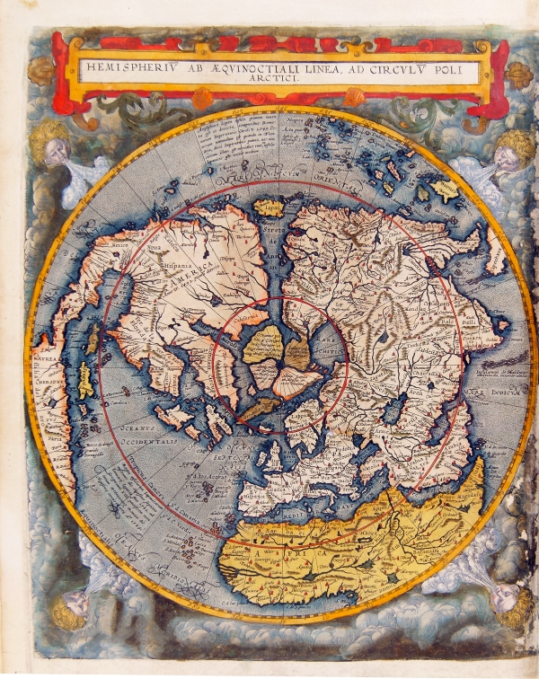
993-Hemisperium ab aequinoctiali linea, ad circulum poli arctici. Antwerp 1593 .
Hemisperium ab aequinoctiali linea, ad circulum poli arctici. Antwerp 1593
Map of the Northern hemispere, Antwerp 1593. Color print from copper engraving (printer Arnold Coninx), 33 x 52 cm
The map is an example of the imaginatory powers of early cartographers. Gerard de Jode has visualized the appearance of the Earth as if seen from orbit at a vantage point above the celestial pole.
Author: Gerardus de Judaeis
Anversa,1593 |
|
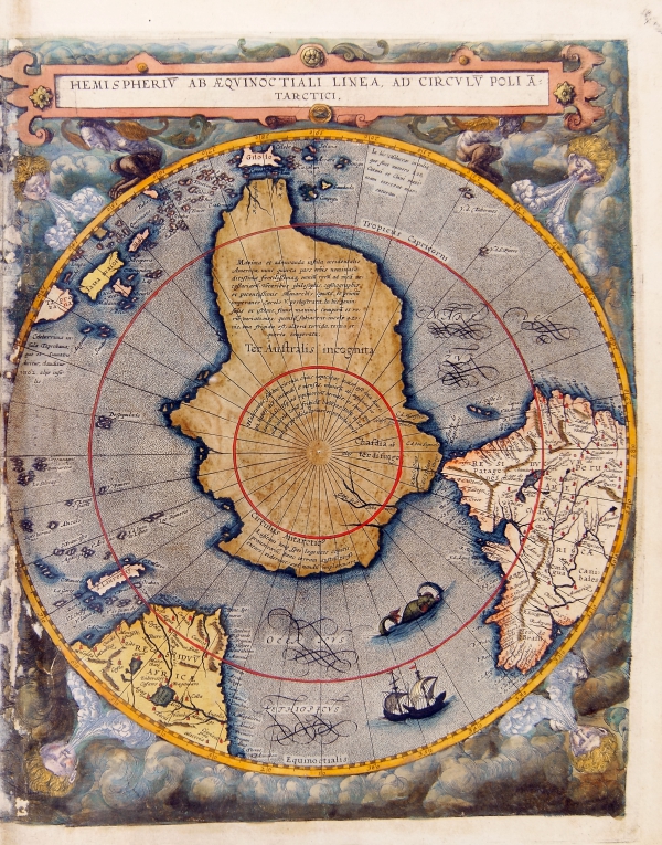
992-Hemisperium ab aequinoctiali linea, ad circulum poli antarctici. .
Hemisperium ab aequinoctiali linea, ad circulum poli antarctici. Antwerp 1593
Map of the Southern hemispere, Antwerp 1593. Color print from copper engraving (printer Arnold Coninx), 33 x 52 cm
Author: Gerardus de Judaeis
Anversa,1593 |
|
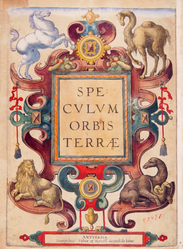
991-Speculum Orbis Terrae .
Author: Gerardus de Judaeis
Anversa,1593 |
|
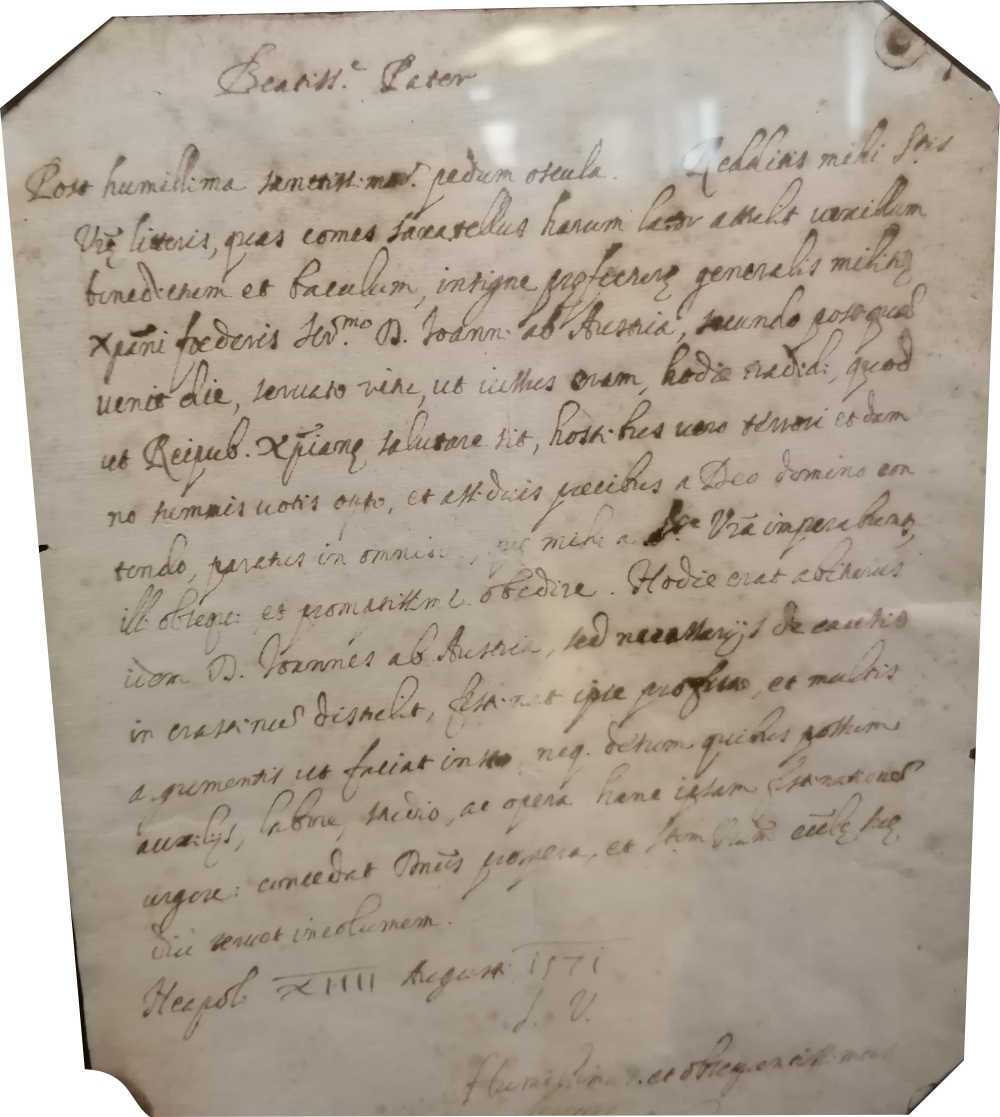
990-Lettera autografa del Cardinale Antonio Perrenot di Granvella – anno 1574 .
Author:
,1574 |
|
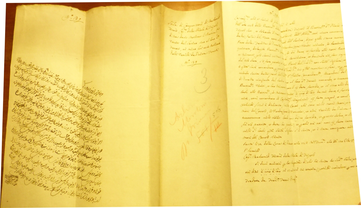
989-Documento in arabo con traduzione in italiano a fronte .
Author:
,1118 |
|
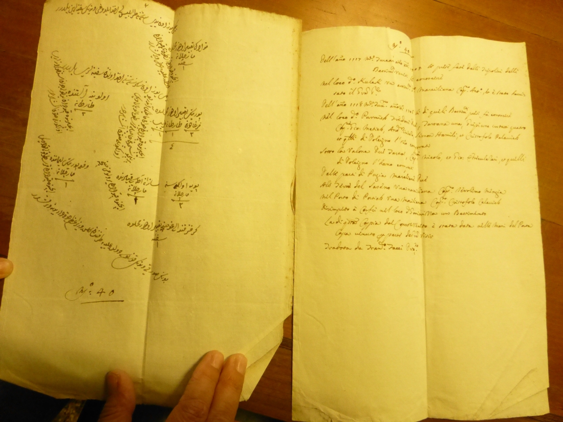
988-Documento in arabo con traduzione in italiano a fronte .
Author:
,1118 |
|
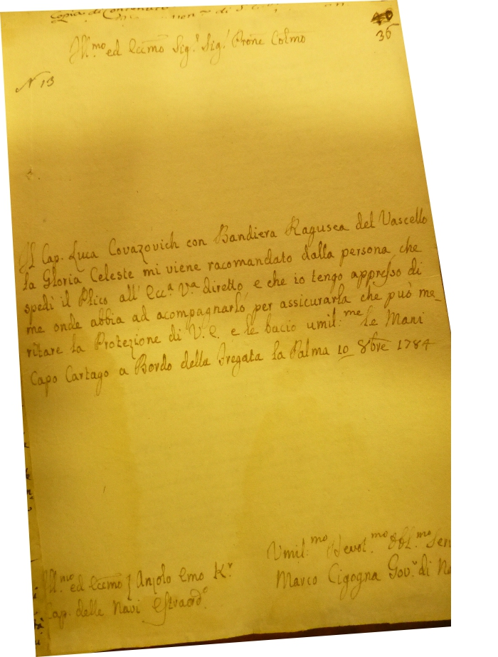
987-Lettera di raccomandazione per un Capitano .
Author:
,1784 |
|
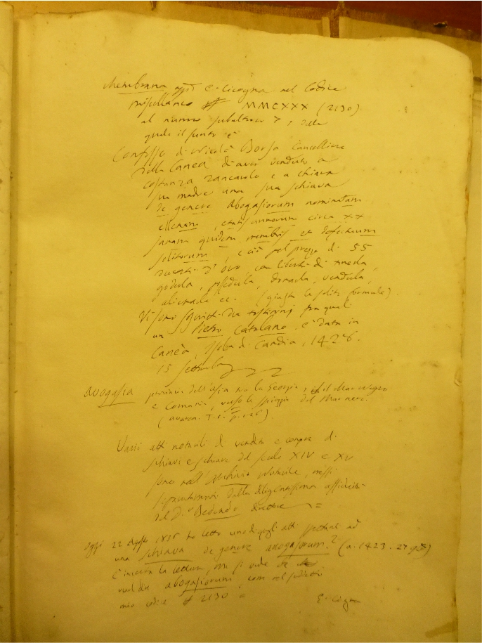
986-Contratto per la vendita di una schiava a Venezia .
Author:
,1428 |
|
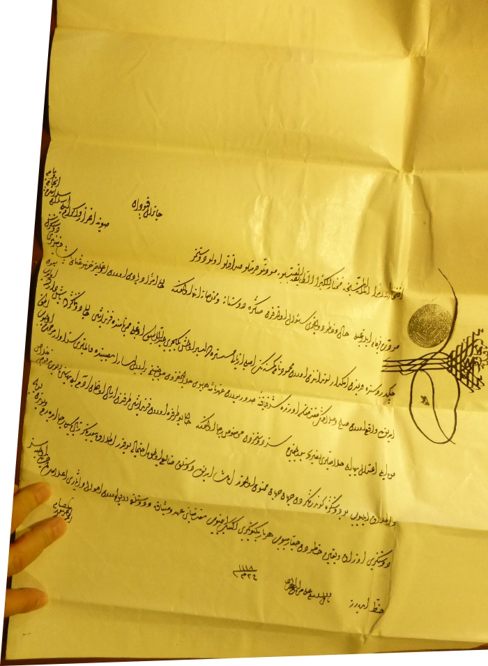
985-Supplica per la liberazione di uno schiavo turco .
Author:
,1118 |
|
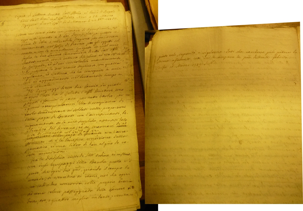
984-Lettera con indicazioni per la flotta veneziana di stanza a Preversa .
Author:
,1789 |
|
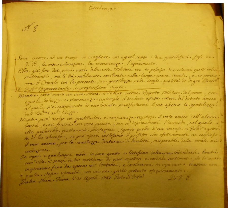
983-Lettera del comandate di nave militare veneziana .
Author:
,1787 |
|
982-Atto di vendita di uno schiavo .
Author:
,1768 |
|
981-Supplica per la liberazione di uno schiavo turco .
Author:
,1218 |
|
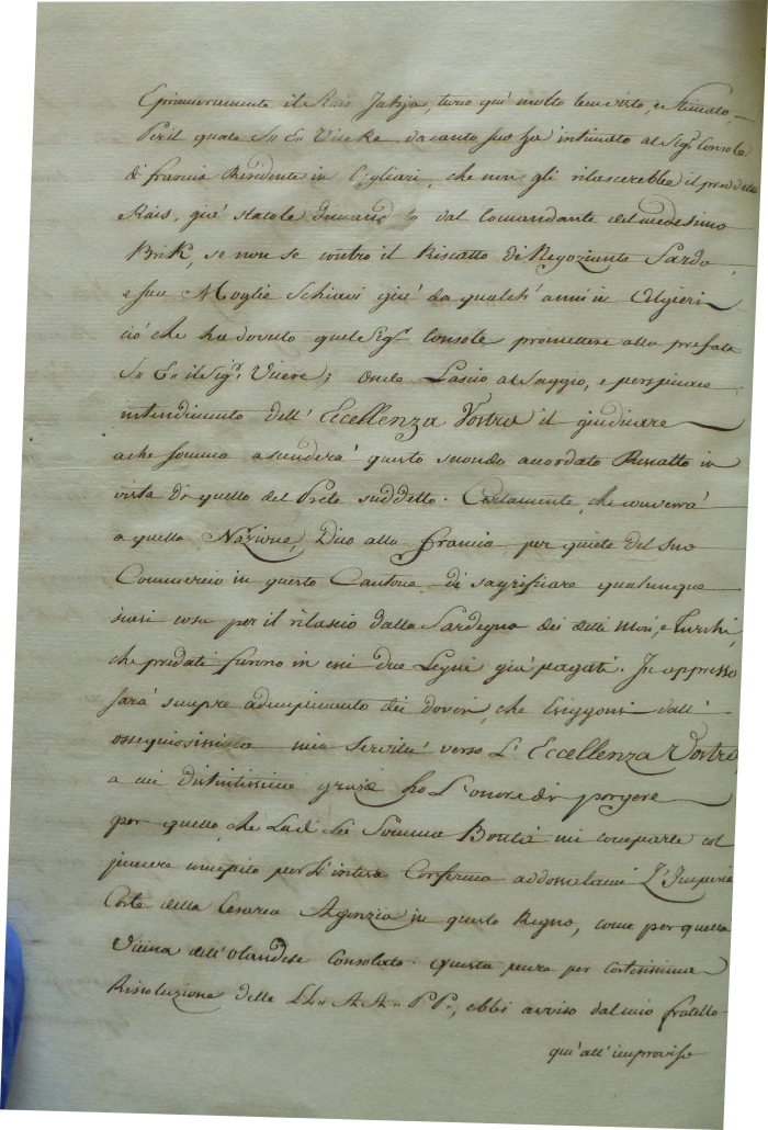
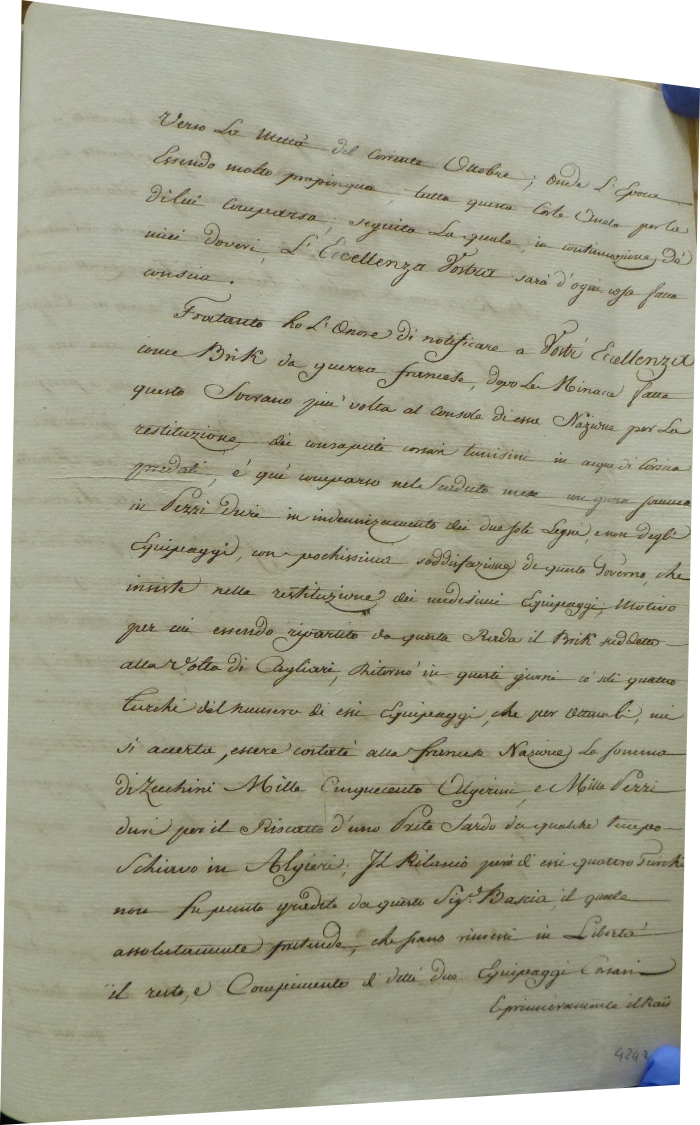
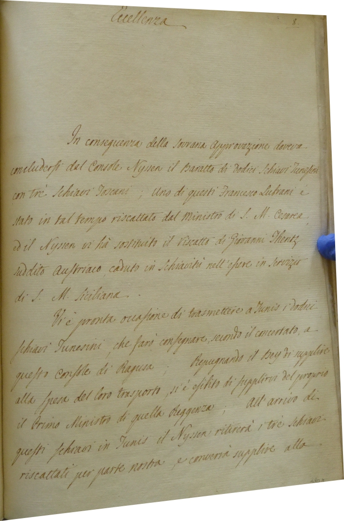
980-Richiesta per lo scambio di schiavi tunisini detenuti a Cagliari .
Author:
,1792 |
|
979-Lettera del console Antonio Nyssen .
Author:
,1792 |
|
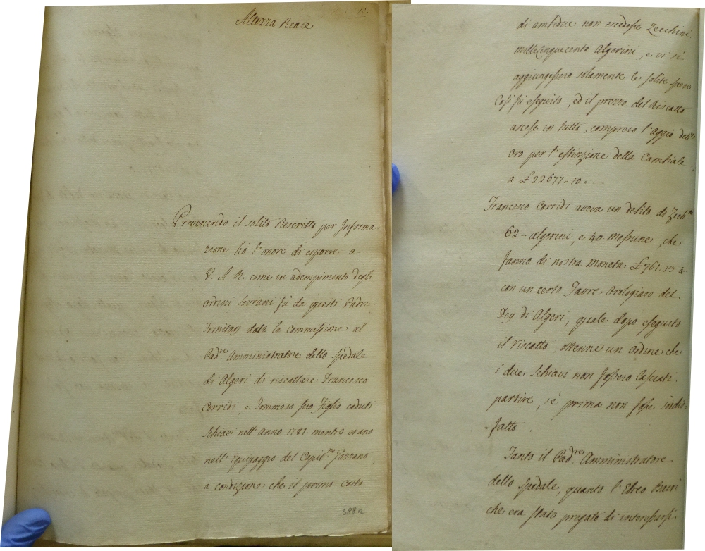
978-Supplica di Francesco Corridi a Sua Maestà .
Author:
,1792 |
|
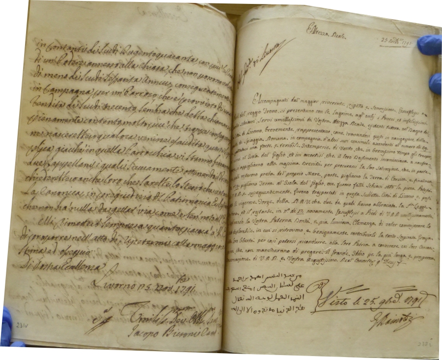
977-Supplica di alcuni schiavi per la liberazione .
Author:
,1791 |
|
976-Documento sullo scambio di schiavi .
Author:
,1792 |
|
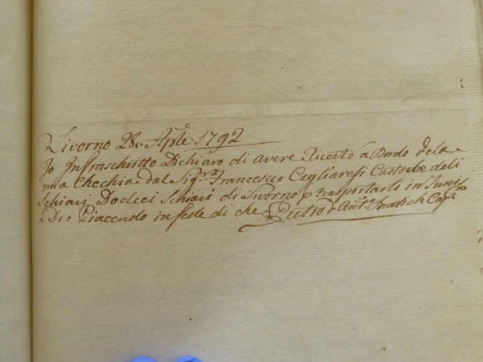
975-Ricevuta per la consegna di un carico di schiavi .
Author:
,1792 |
|
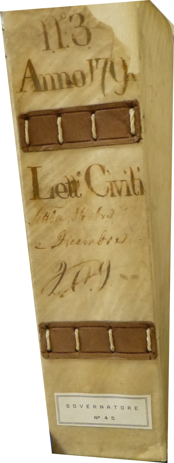
974- Volume 113 Anno 1792 .
Author:
,1792 |
|
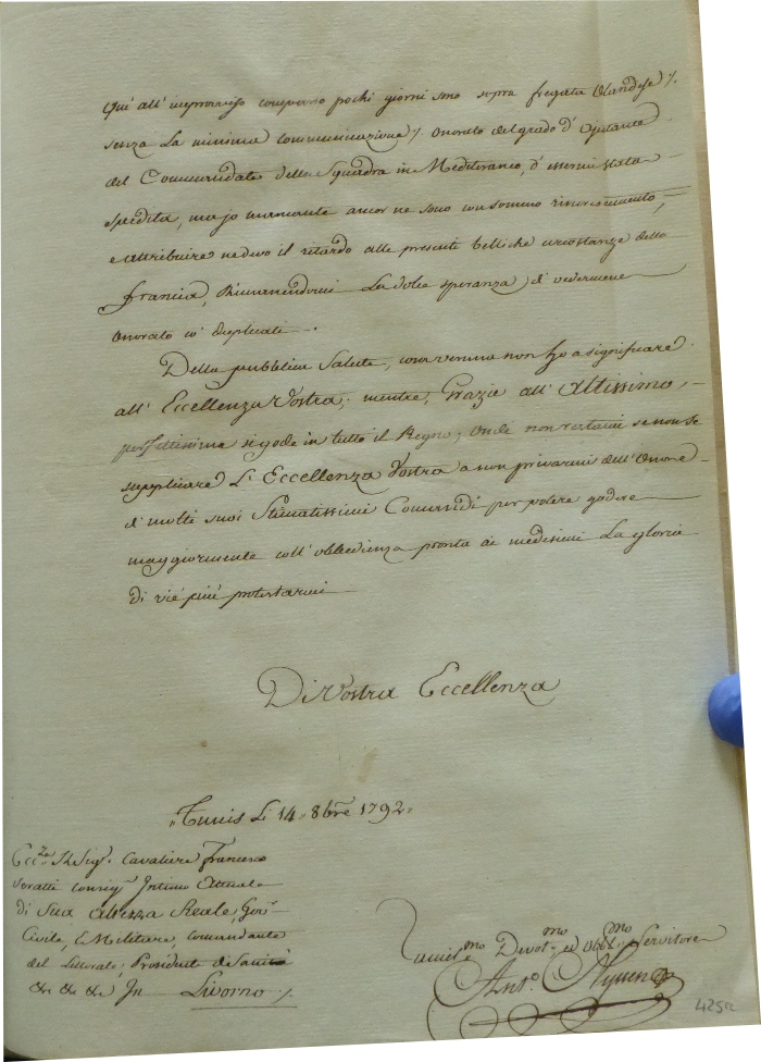
973- Documento di Antonio Nyssen .
Author:
,1792 |
|
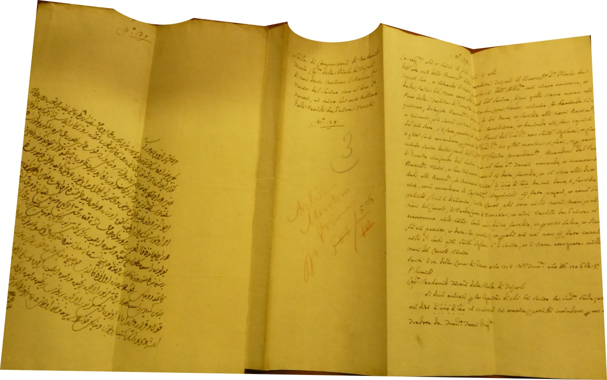
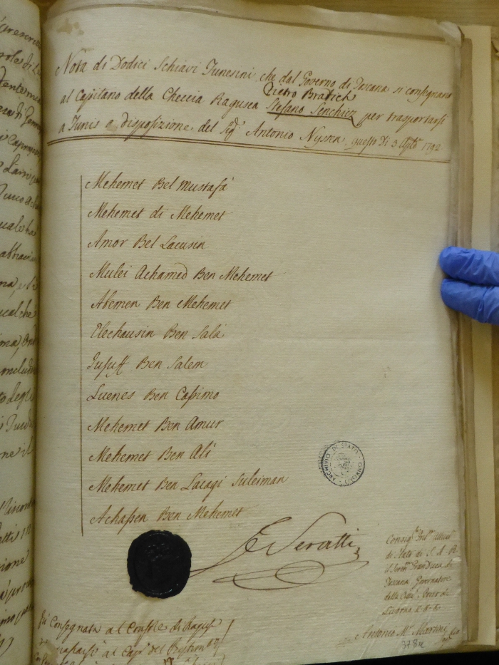
972-Document of the captain of the Dubrovnik ship Pietro Bratich .
Document on the transfer of (12) Tunisian slaves who are handed over by the Government of Tuscany to the Captain of the Ragusa ship Stefano Sanchiez (Pietro Bratich) to transport them to Livorno …… at the disposal of Mr. Antonio Nissen … 3 August 1792. The document is preserved in the State Archive of Livorno - location Governatore 45 Author: mediatore livornese
,1792 |
|
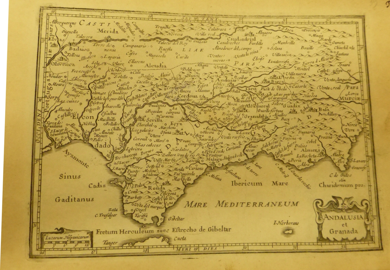
971-Andalusia e Granada .
Author:
,0 |
|
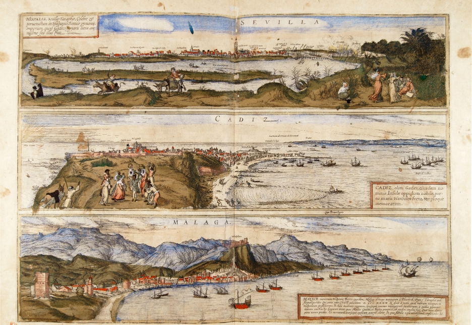
970- Sevilla, Cadiz, Malaga .
Author: Georgii Braun
Colonia,1575 |
|
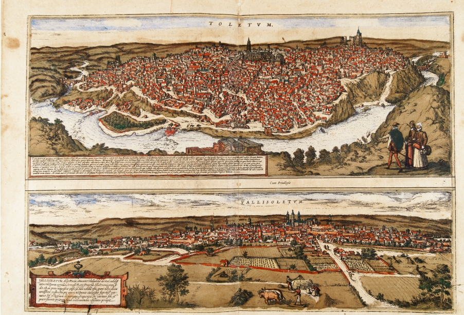
969- Toletum, Vallisoletum .
Author: Georgii Braun
Colonia,1575 |
|
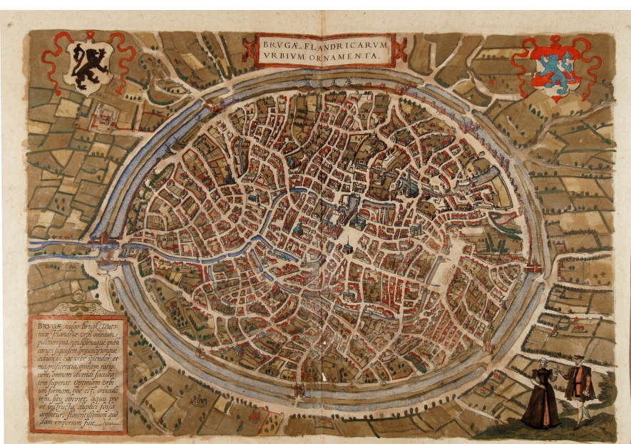
968- Brugae Flandicarum urbium .
Author: Georgii Braun
Colonia,1575 |
|
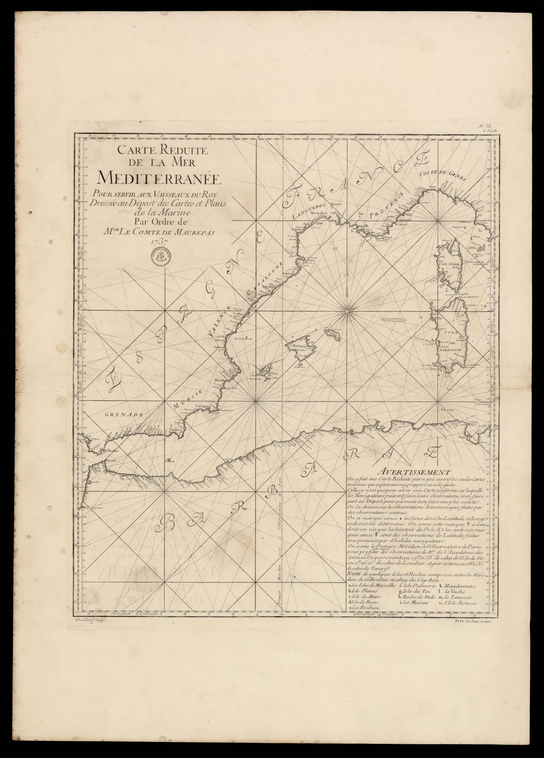
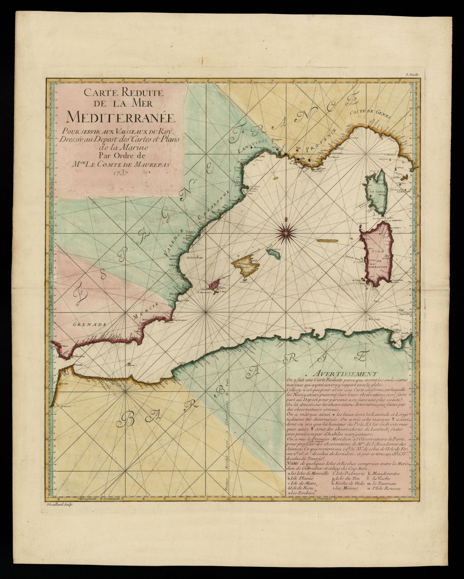
967- Carte reduite de la mer Mediterranée pour servir aux vaisseaux du roy .
Author: Depôt de la Marine (Francia)
,1737 |
|
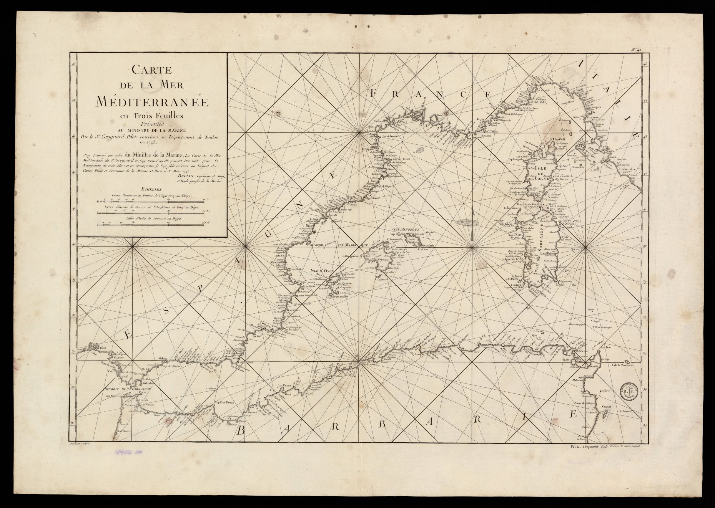
966- Carte de la Mer Mediterranée en trois feuilles .
Author: Jacques Nicolas Bellin
,1745 |
|
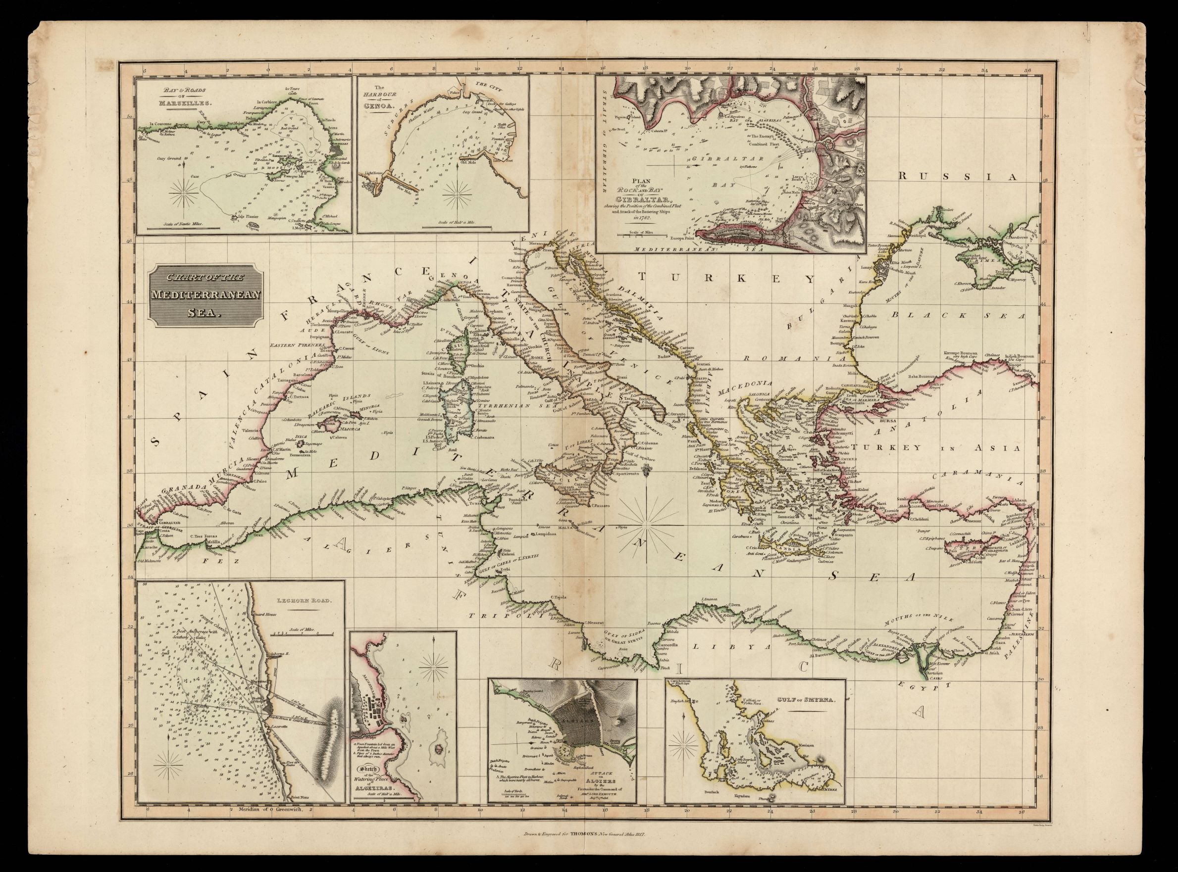
965- Chart of the Mediterranean sea / drawn & engraved for Thomson's New General Atlas ; N .
Author: Samuel John Neele
Edimburgo,1817 |
|
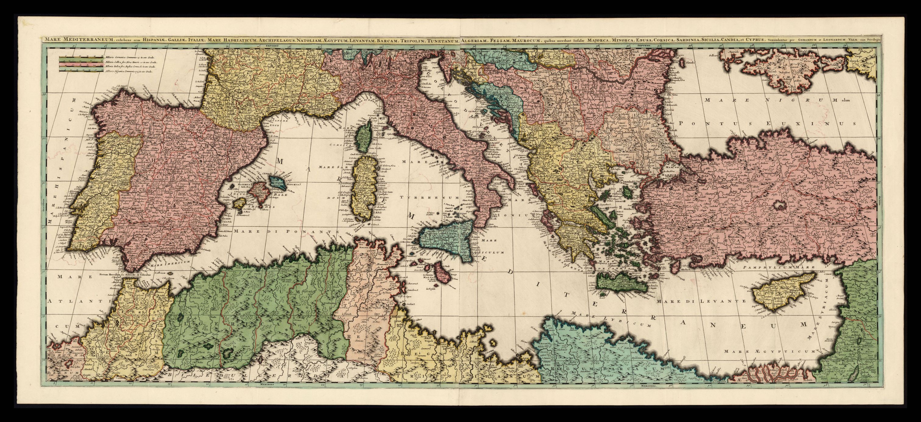
964- Mare Mediterraneum, exhibens oras Hispaniae, Galliae, Italiae, Mare Hadriaticum, Arch .
Author: Gerard e Leonard Valk
,1700 |
|
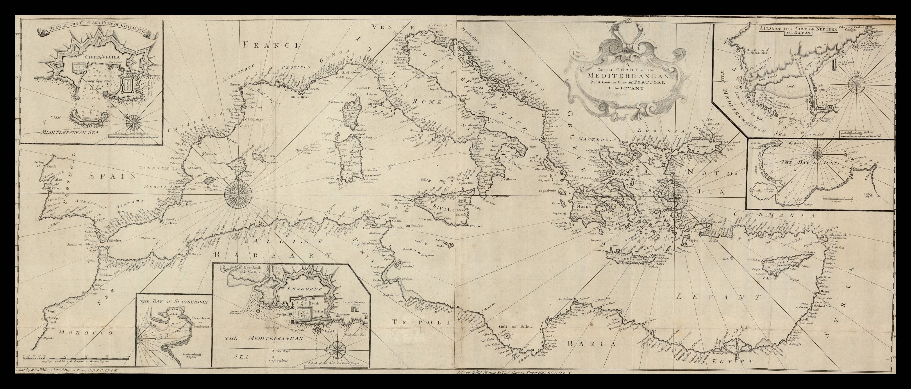
963-A correct chart of the Mediterranean sea from the coast of Portugal to the Levant .
Author: Monta & Pagina
,1770 |
|
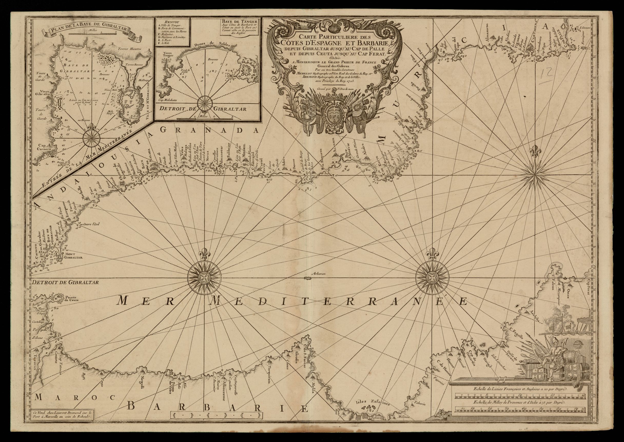
962- Carte particuliere des côtes d'Espagne et Barbarie depuis Gibraltar jusqu'au cap de .
Author: Henri Michelot
,1723 |
|
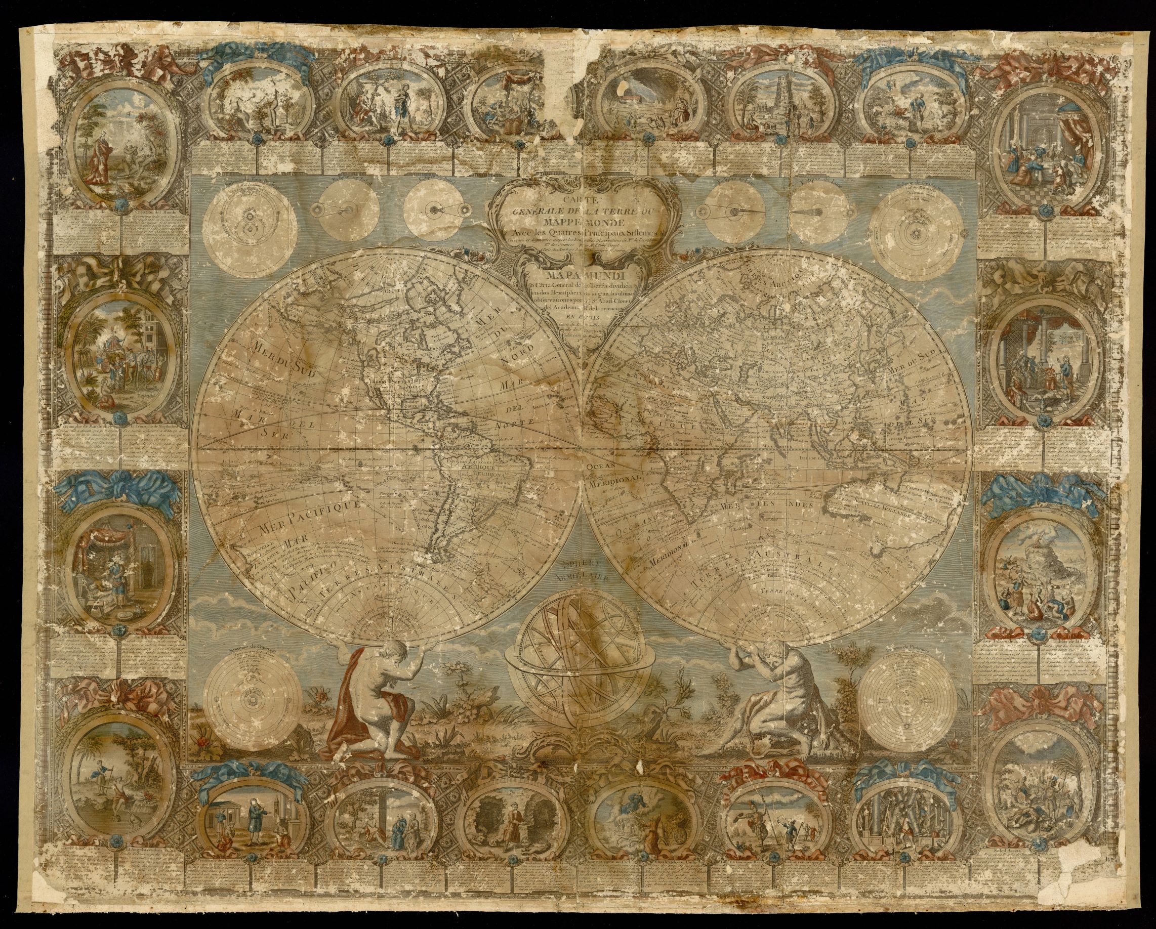
961- Carte generale de la Terre ou Mappemonde avec les quatres principaux sistemes .
Author: Jean-Baptiste Clouet
,1785 |
|
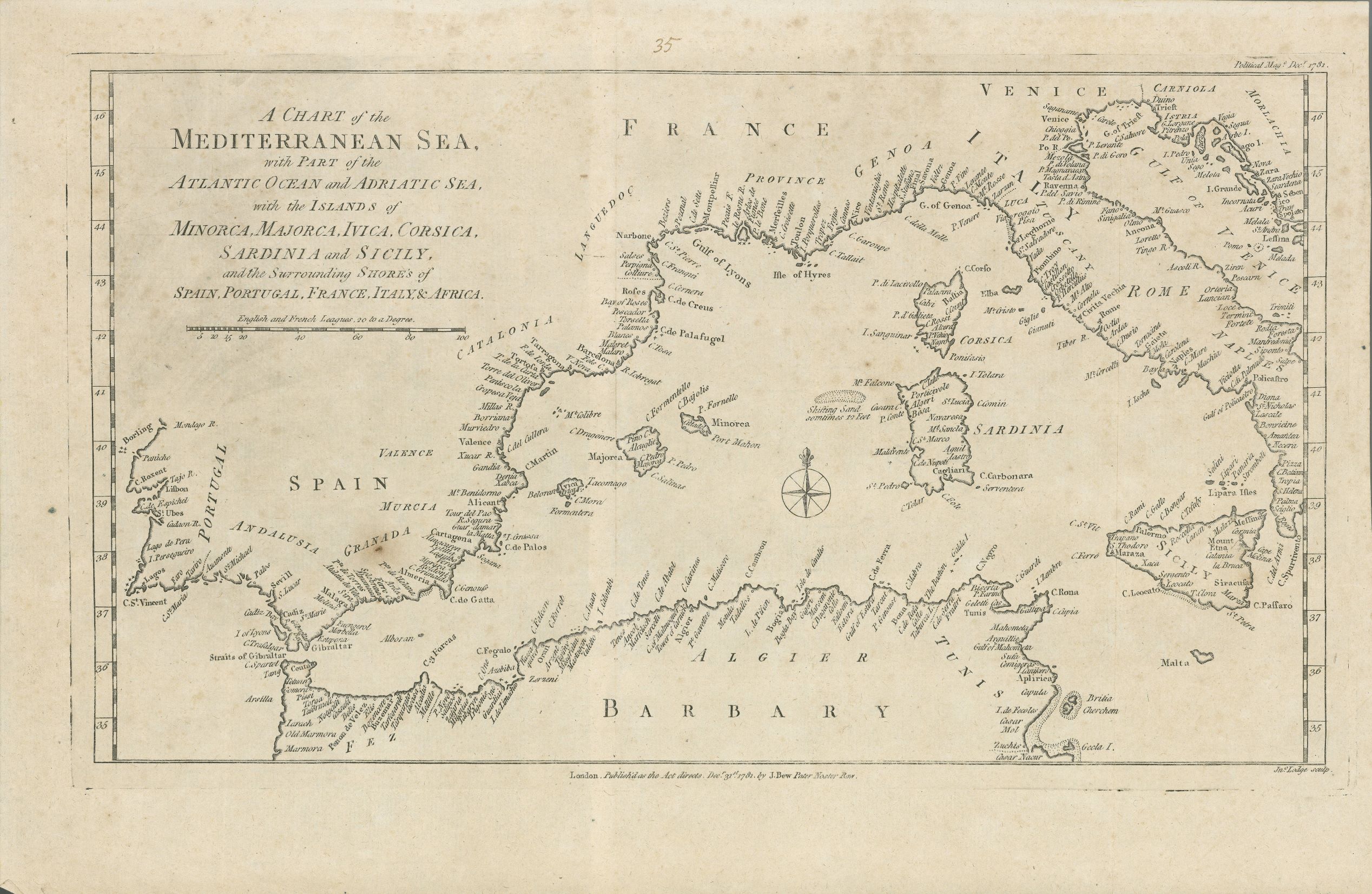
960- A chart of the Mediterranean sea, with part of the Atlanthic ocean and Adriatic sea, .
Author: John Bew
Londra,1781 |
|
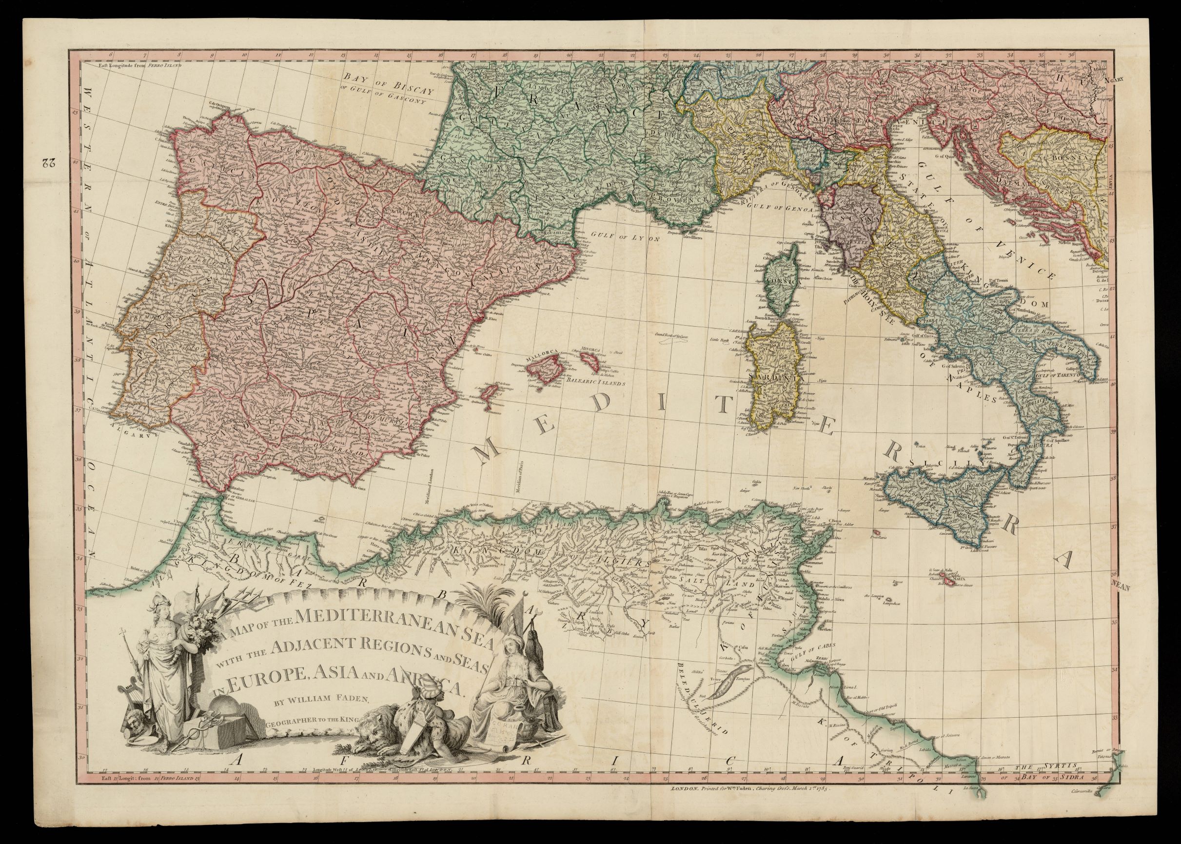
959- A map of the Mediterranean sea with the adjacent regions and seas in Europe, Asia and .
Author: William Faden
,1785 |
|
958-A map of the Mediterranean sea with the adjacent regions and seas in Europe, Asia and .
Author: William Faden
,1785 |
|
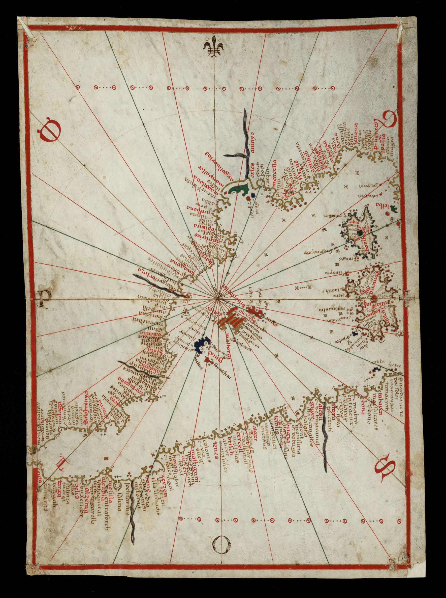
957- Portolà: [Atles nàutic fragmentat de la Mediterrània i de les costes atlàntiques .
Author: Bartomeu Olive
Messina,1570 |
|
956-Carte reduite de la mer Mediterranée pour serv. aux vaisseaux du Roy .
Author: conte di Maurepas
,1737 |
|
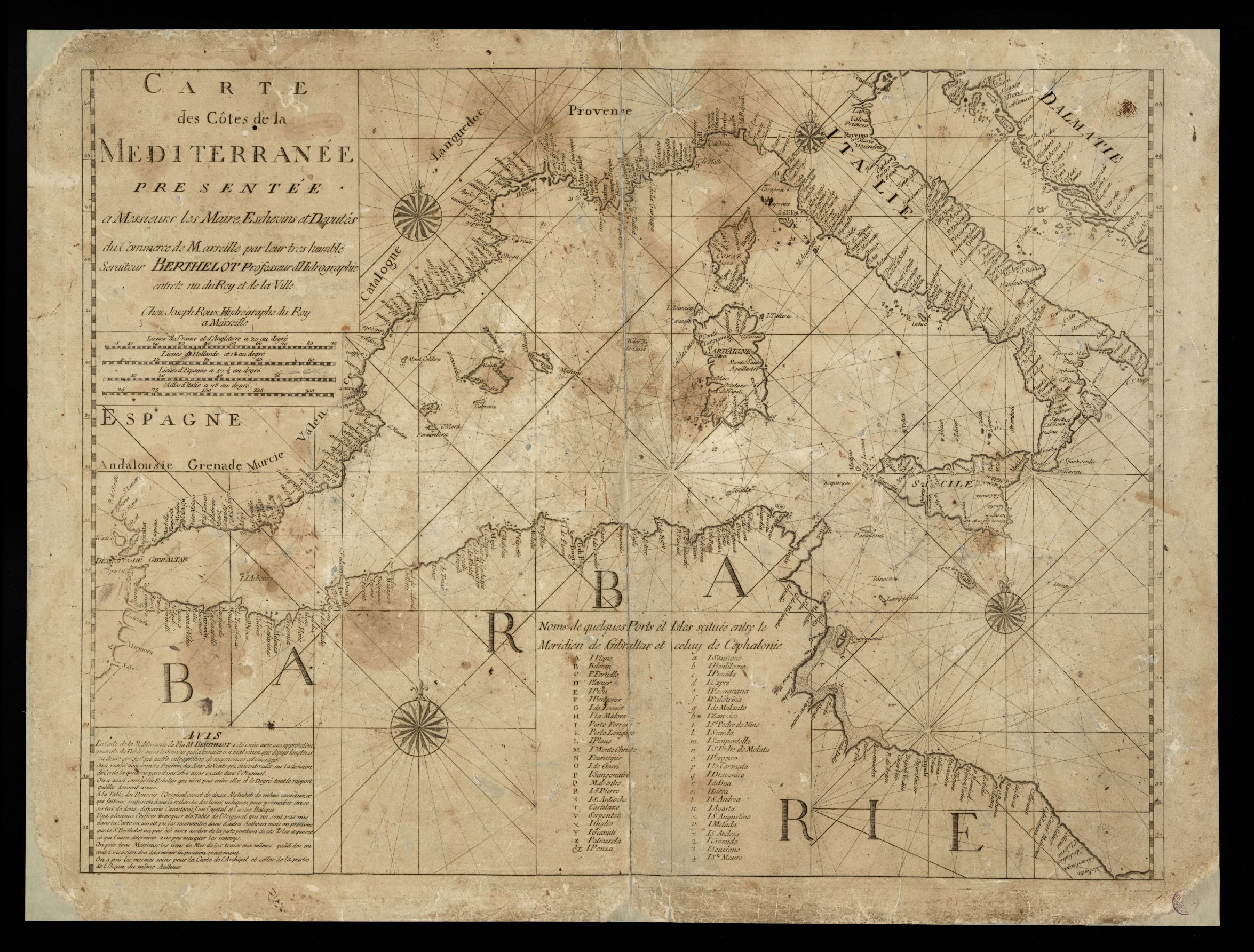
955-Carte des côtes de la Mediterranée / presentée a messieurs les maire, eschevins et .
Author: F. Berthelot
,1695 |
|
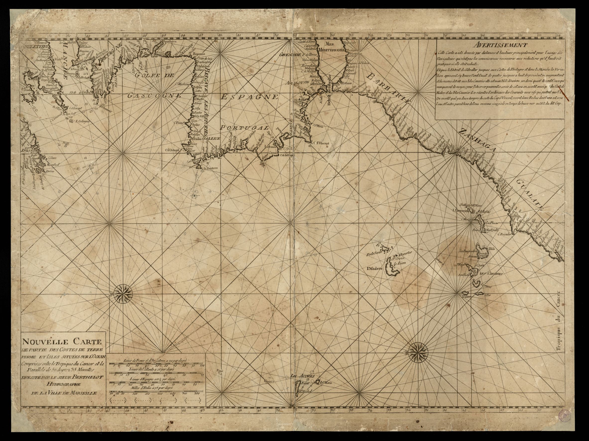
954- Nouvelle carte de partie des costes de Terre Ferme et isles situées sur l'ocean, com .
Author: F. Berthelot
,1695 |
|
953- Portolà: [Atles nàutic fragmentat de la Mediterrània i de les costes atlàntiques .
Author: Bartomeu Olive
Messina,1570 |
|
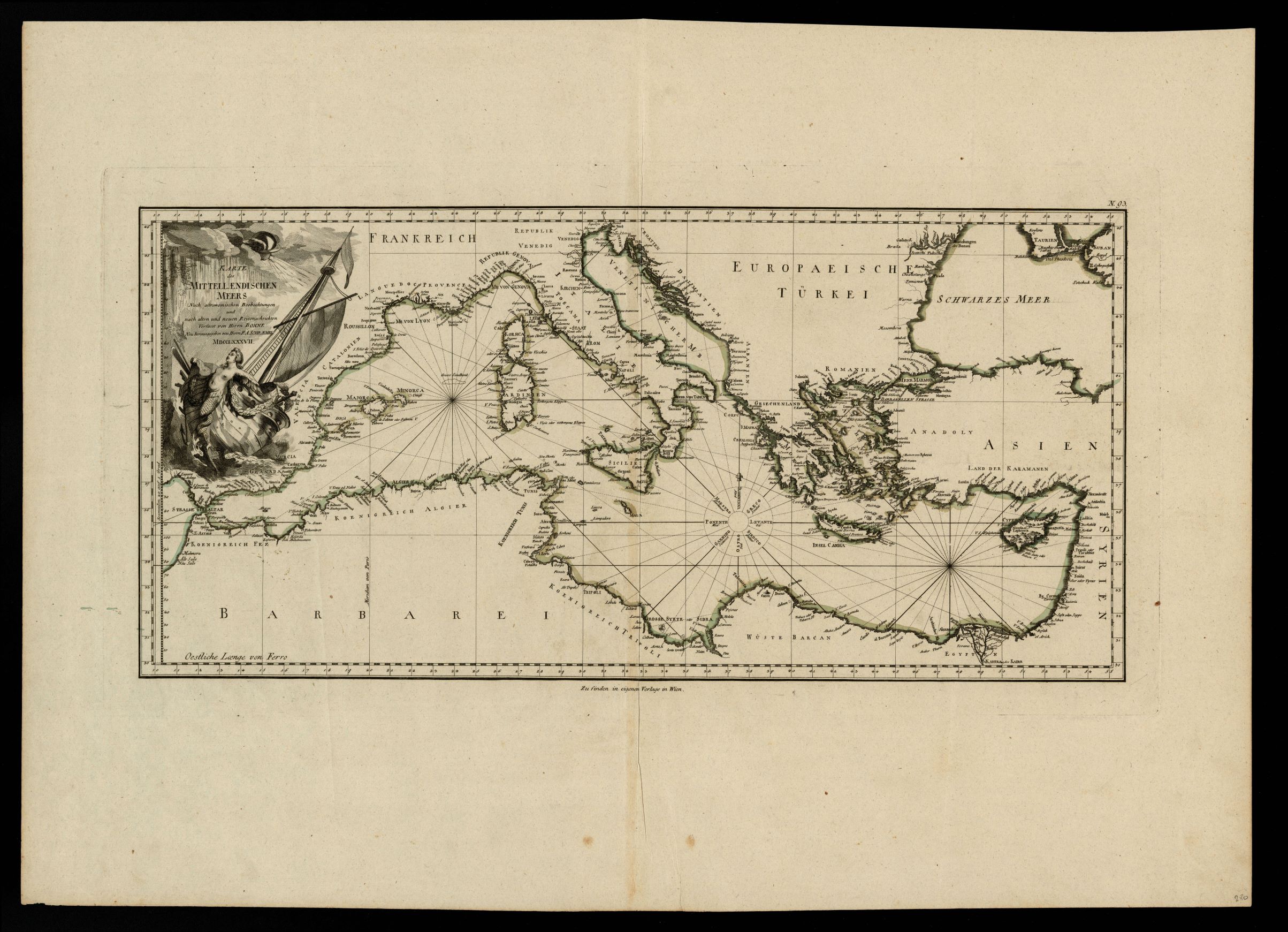
952-Karte des Mittellaendischen Meers .
Author: R.Bonne
,1787 |
|
951-Nouvelle carte generalle de la Mer Mediterranee / dediée a Monseigneur le Chevalier d .
Author: Henri Michelot
,1718 |
|
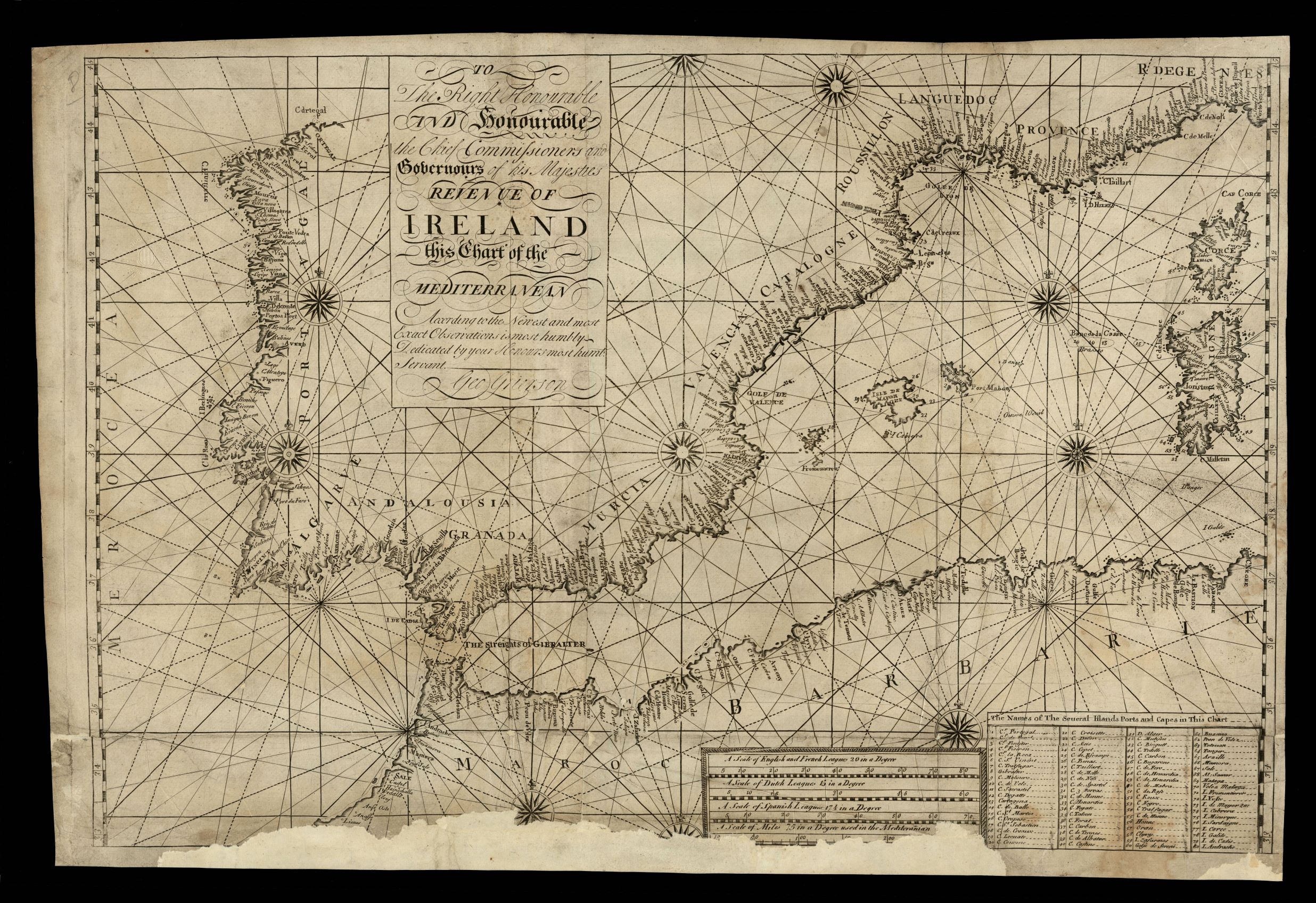
950- To the right honourable ... the Chief Commissioners and Gobernours of his Majesties . .
Author: George Grierson
,1750 |
|
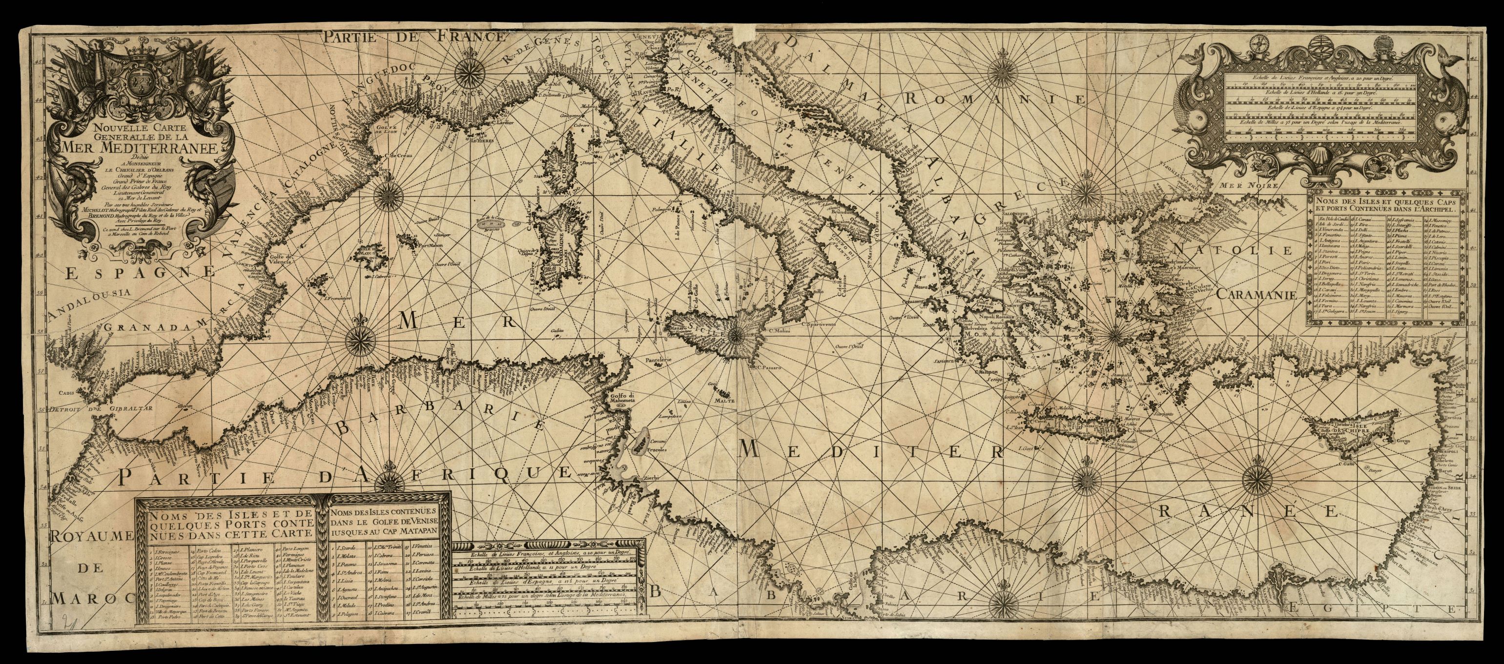
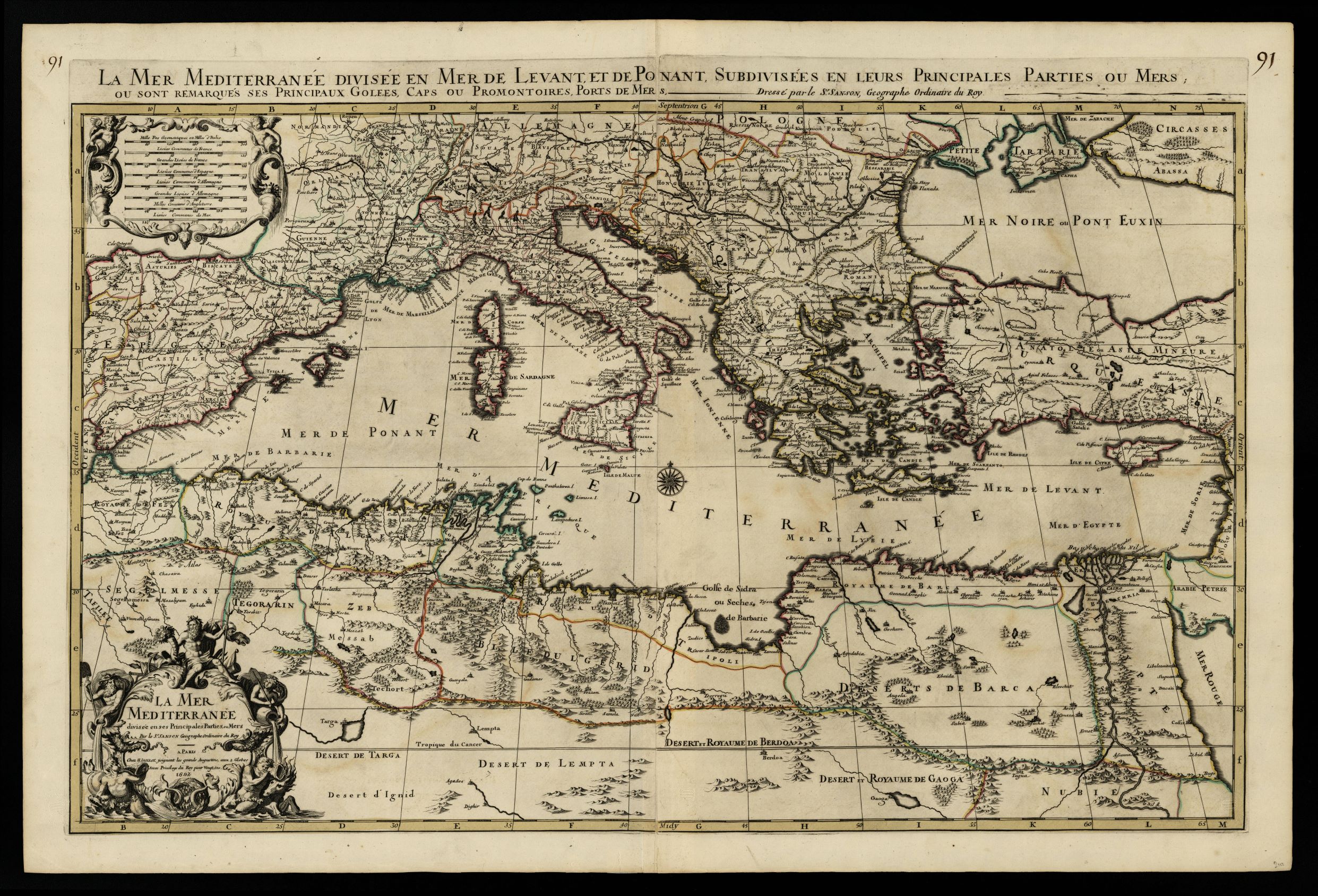
949- La mer Mediterranée divisée en Mer de Levant et de Ponant, subdivisées en leurs pr .
Author: Pierre Mortier
Amsterdam,1692 |
|
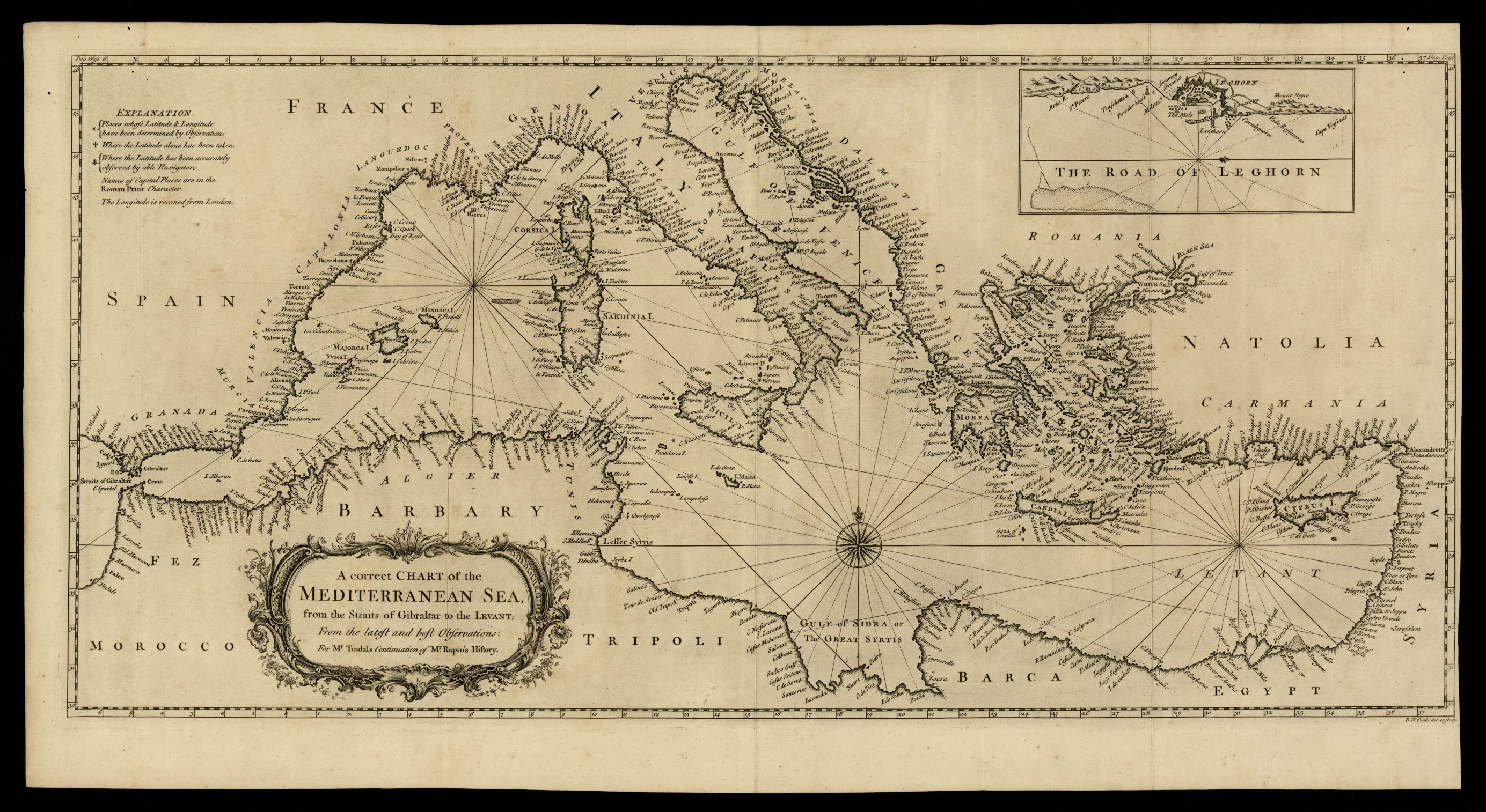
948- A correct chart of the Mediterranean sea, from the straits of Gibraltar to the Levant .
Author:
Londra,1744 |
|
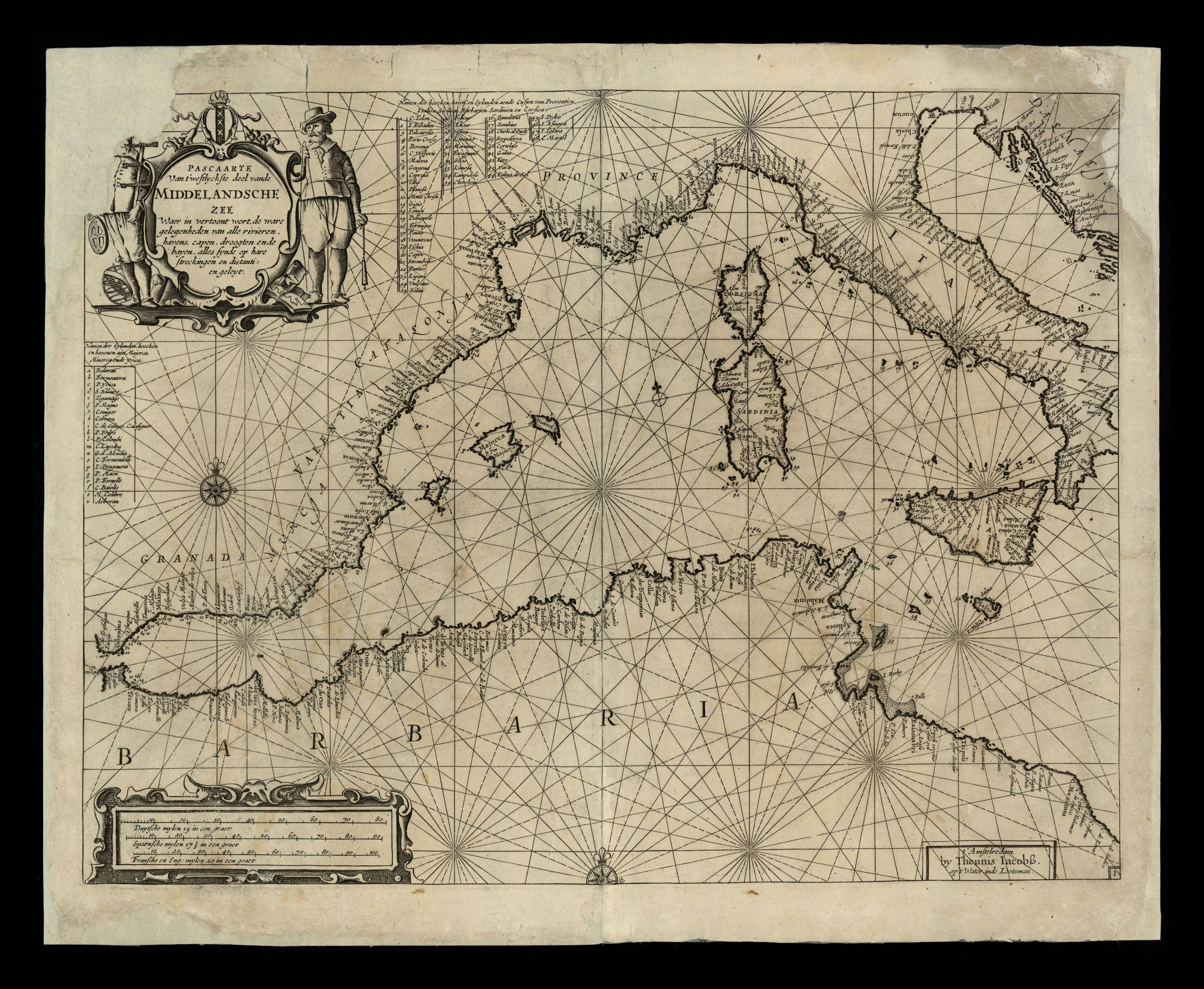
947- Pascaarte van ’t westlyckste deel vande Middelandsche Zee waer in vertoont wort, .
Author: Theunis Jacobsz
Amsterdam,1656 |
|
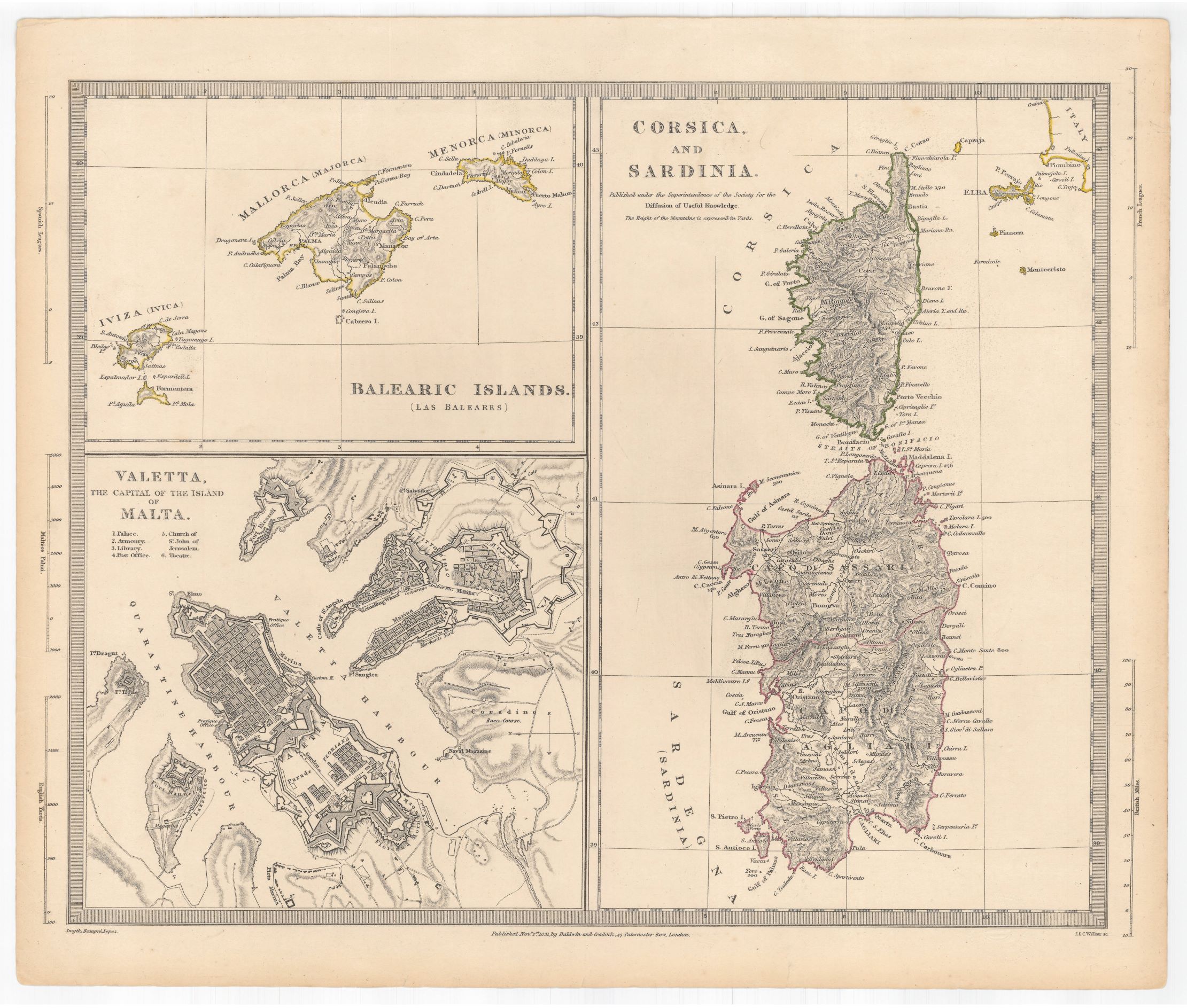
946- Balearic islands (Las Baleares) ; Corsica and Sardinia ; Valetta the capital of the I .
Author: Baldwin e altri
,1831 |

|
945- Pas-caart van de Middellandsche Zee. Verthoonende alle de Zee-kuften van Granden, Cat .
Author: Johannes van Keulen
Amsterdam,1708 |
|
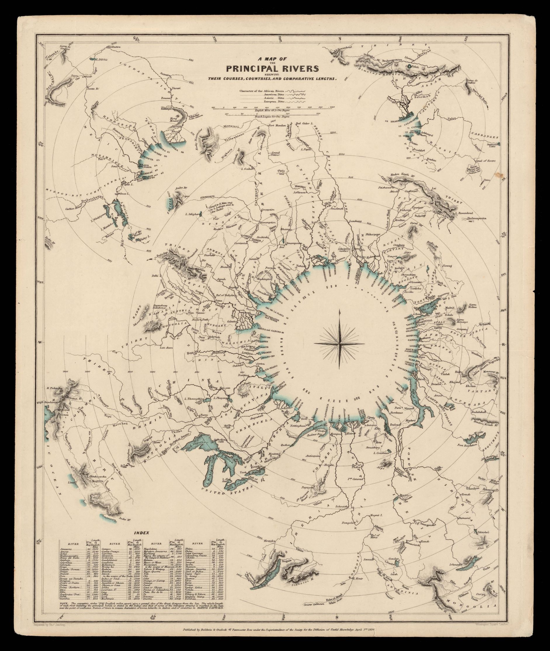
944- A map of the principal rivers shewing their courses, countries and comparative length .
Author: Thomas Starling
,1834 |
|
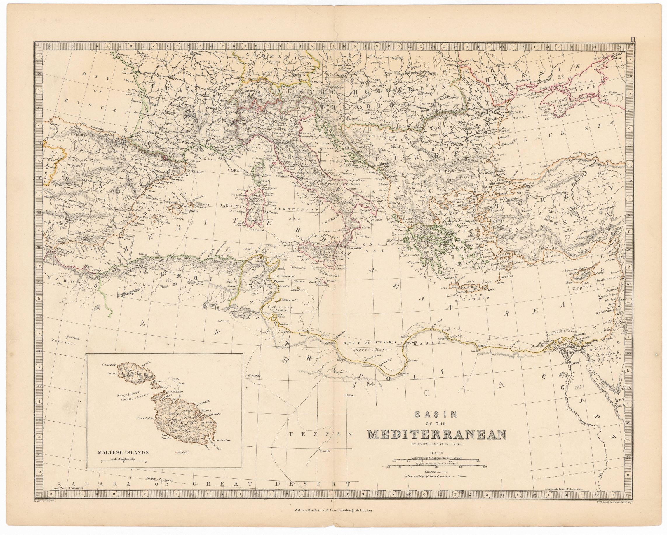
943- Basin of the Mediterranean .
Author: Keith Johnston
Edimburgo,1860 |
|
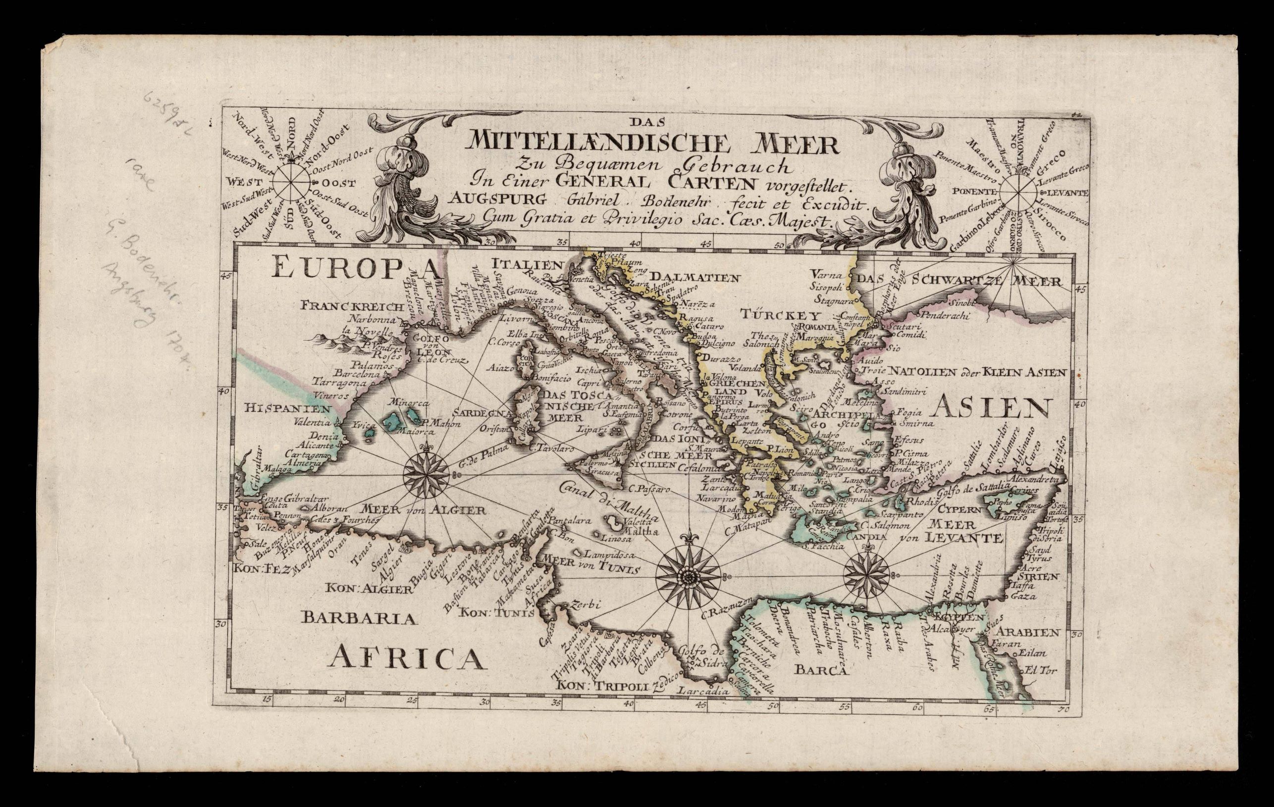
942- Das Mittellaendische meer .
Author: Gabriel Bodenehr
,1700 |

|
941- Pas-Caart van Hispangien, vertoonende de Custen van Granade, Andaluzie, Algarve, Port .
Author: Pieter Goos
Amsterdam,1669 |
|
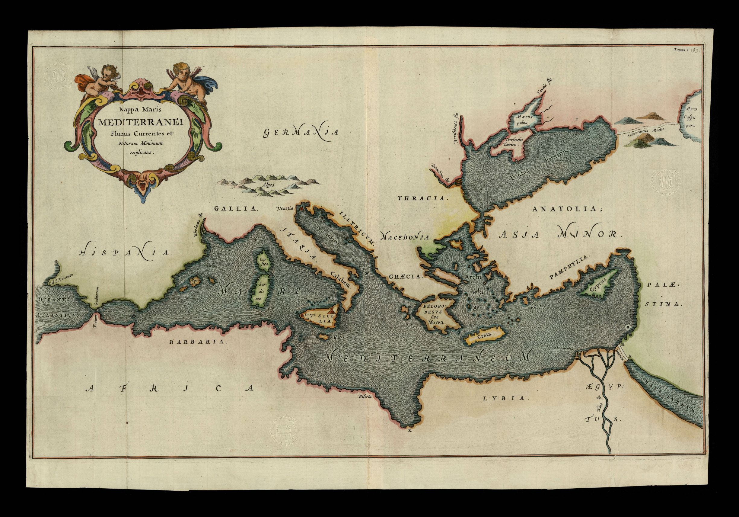
940- Mapa maris Mediterranei fluxus currentes et naturam motionum explicans .
Author: Kircher
,1665 |
|
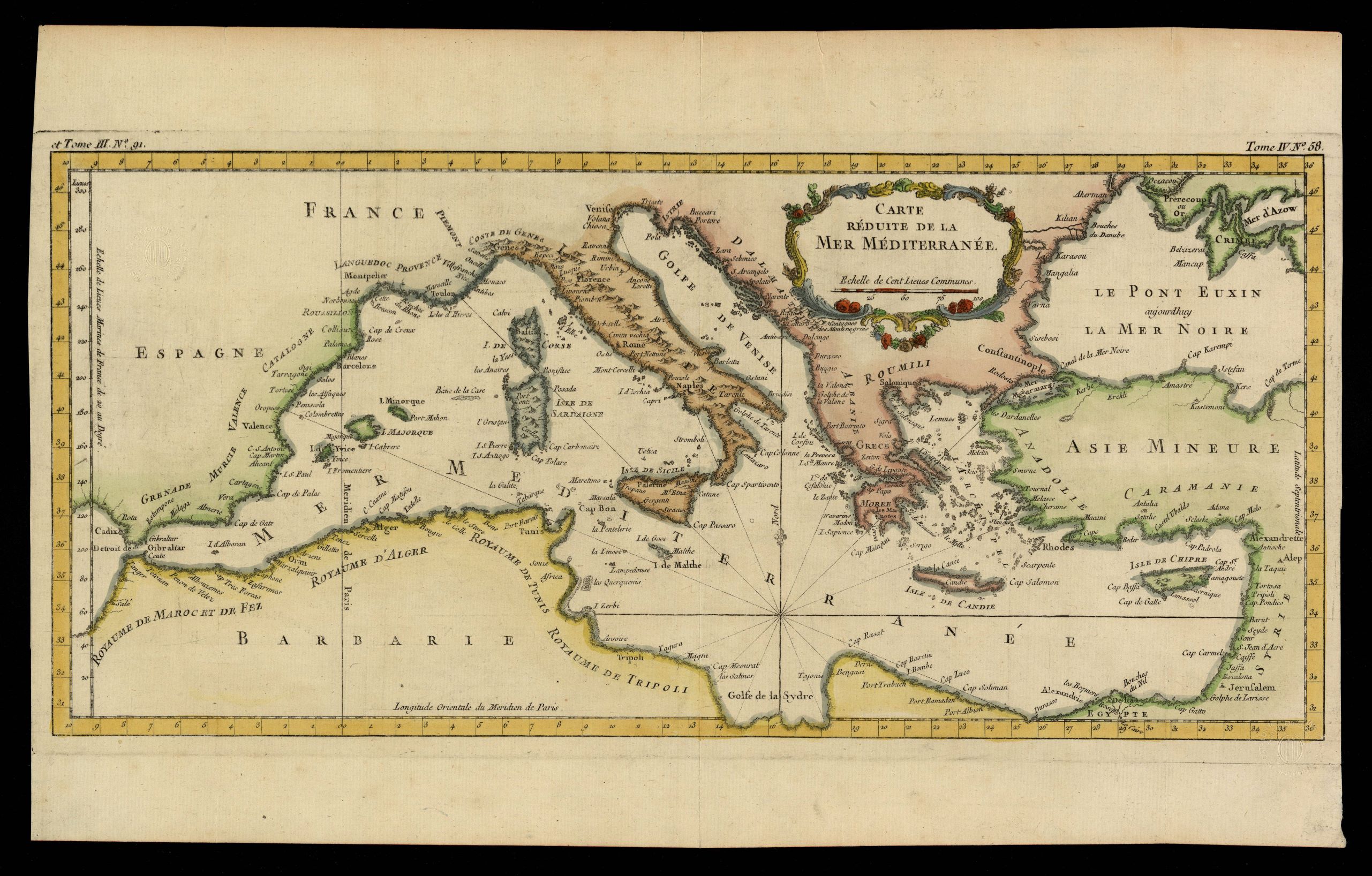
939- Carte réduite de la Mer Méditerranée .
Author: Jacques Nicolas Bellin
,1764 |
|
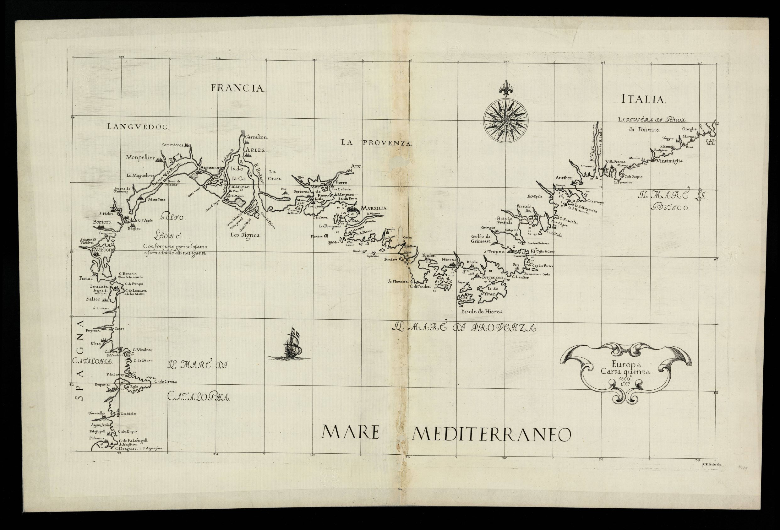
938- Europa carta quinta: seco [nda] L [ibro] 6º / AF Lucini feci La carta, che misura cm .
Author: Robert Dudley
Firenze,1646 |
|
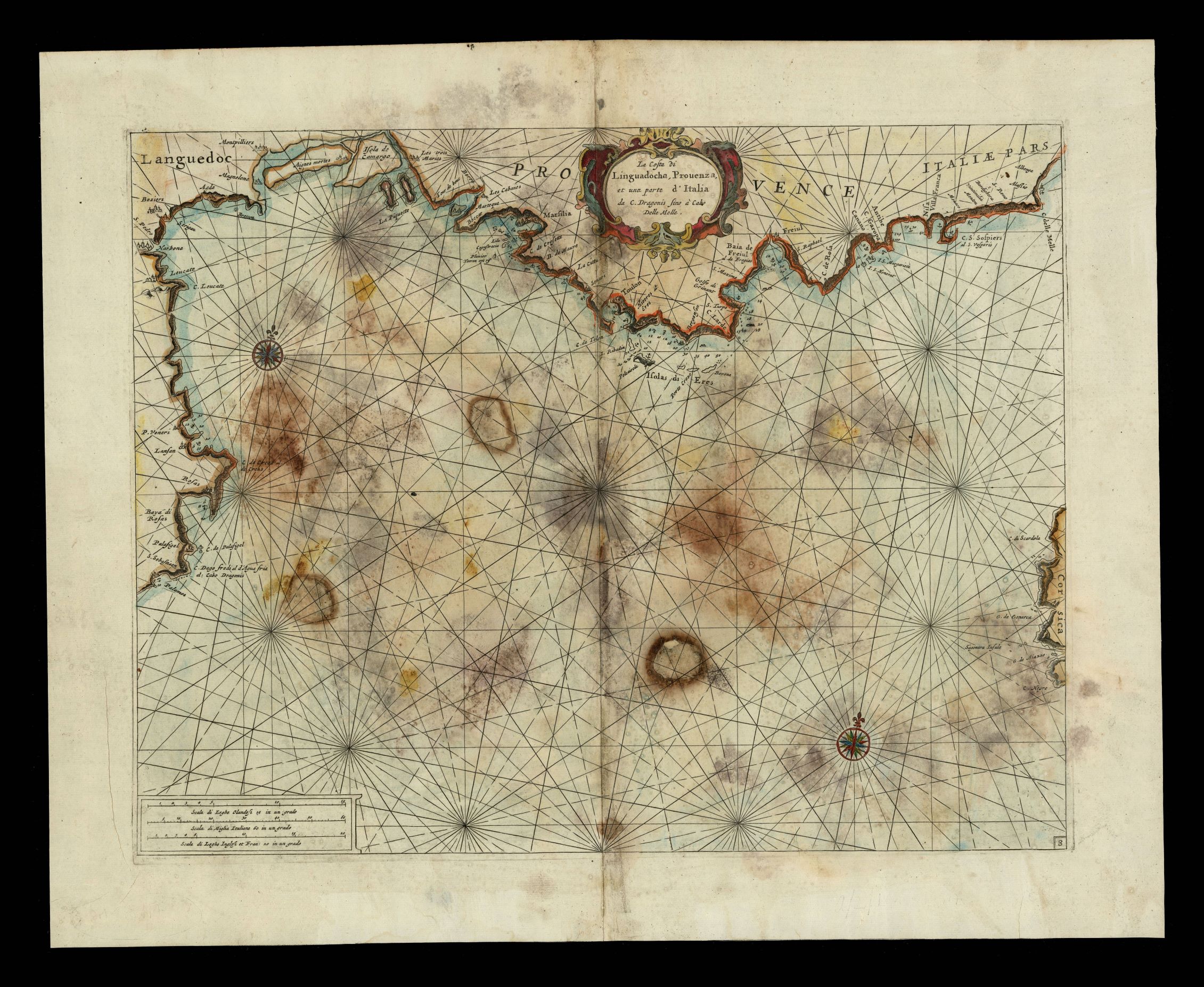
937- La costa della Linguadoca, Prouenza e una parte dell'Italia da C. Dragonis a Cabo del .
Author:
,1696 |
|
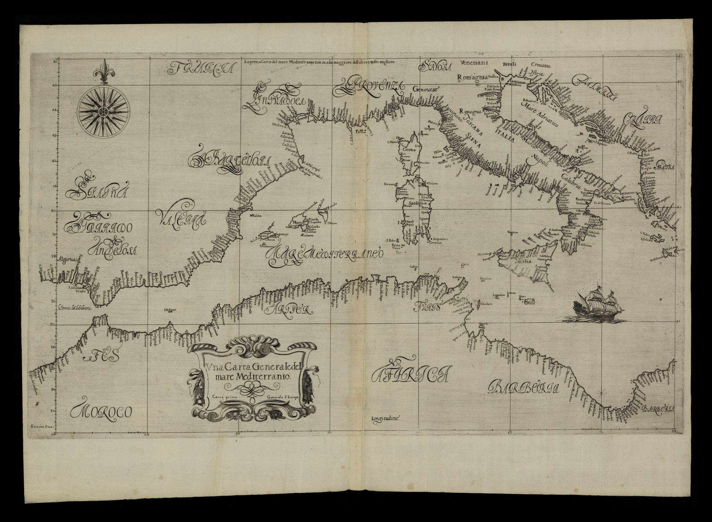
936- Vna carta generale del mare Mediterranio: carta prima generale d'Europa / AF Lucini f .
Author: Robert Dudley
Firenze,1646 |
|
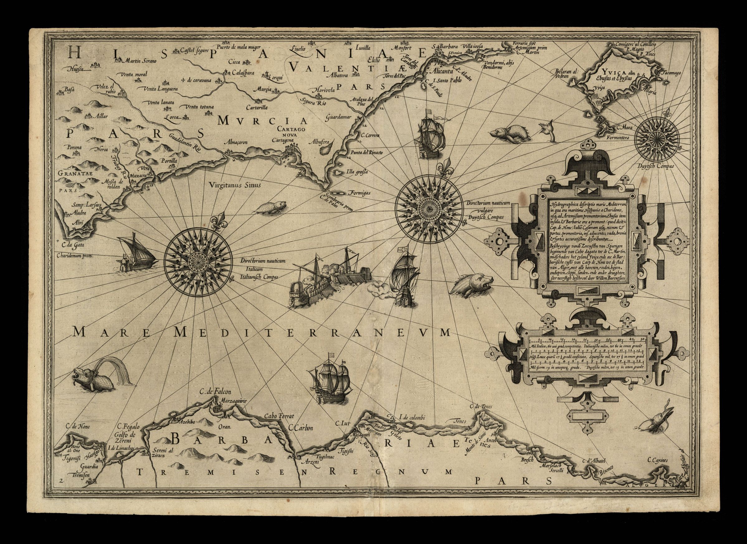
935- Hydrographica descriptio maris Mediterran. in qua orae maritimae Hispaniae a Charidem .
Author: Willem Barentsz
Amsterdam,1608 |
|
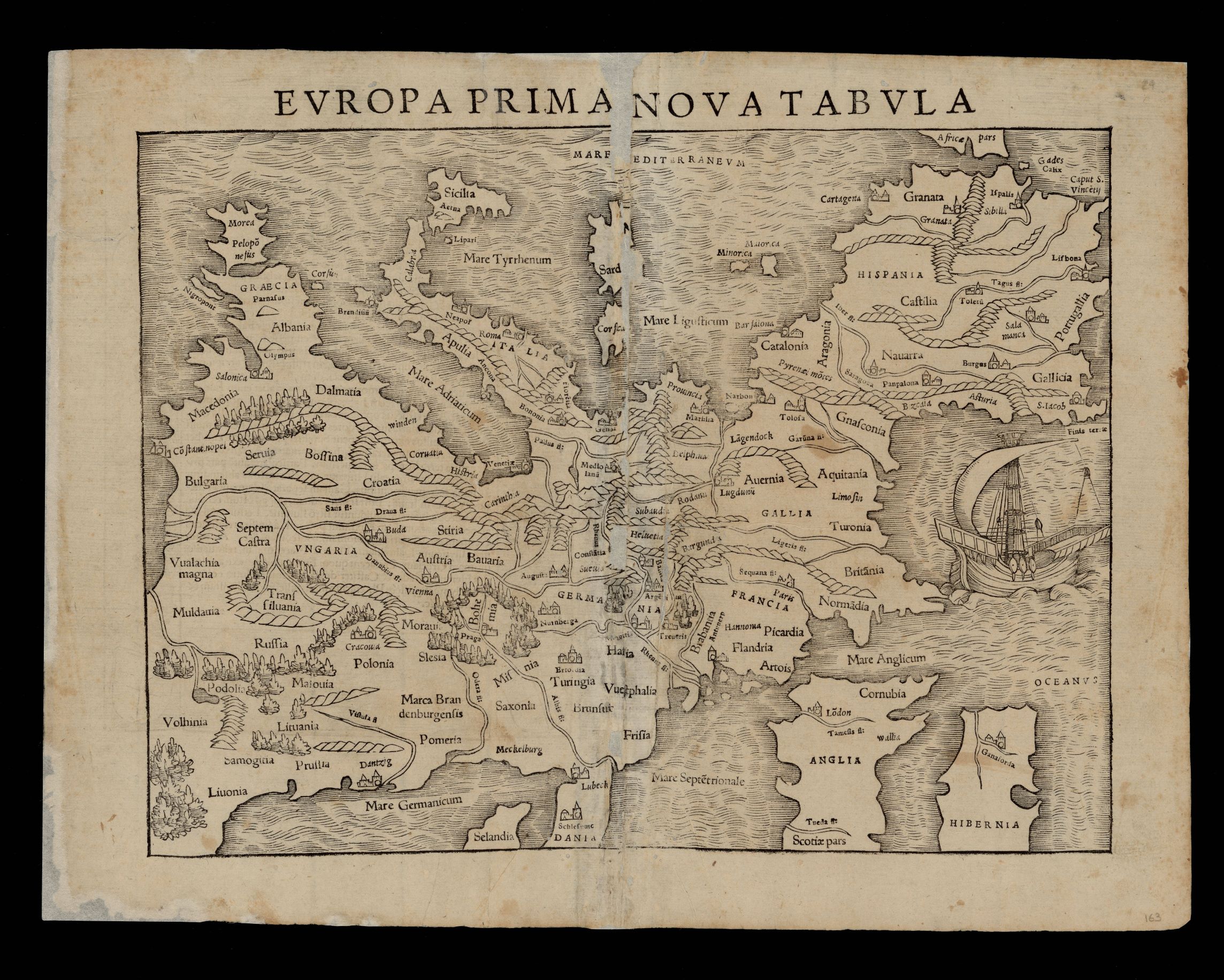
934- Europea Prima Nova Tabula .
Author: Munster
,1542 |
|
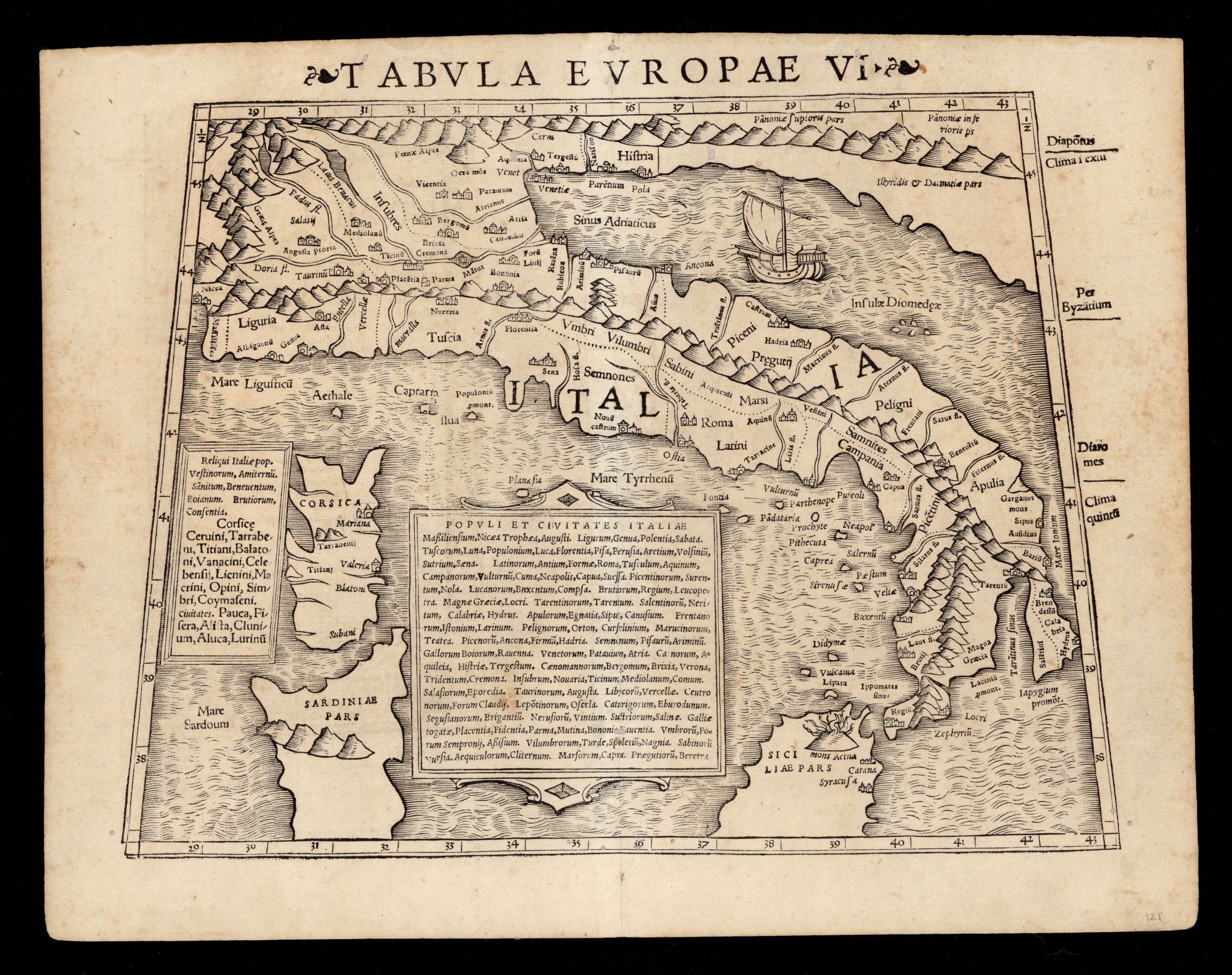
933- Tabvla Evropae VI .
Author: Munster
,1542 |
|
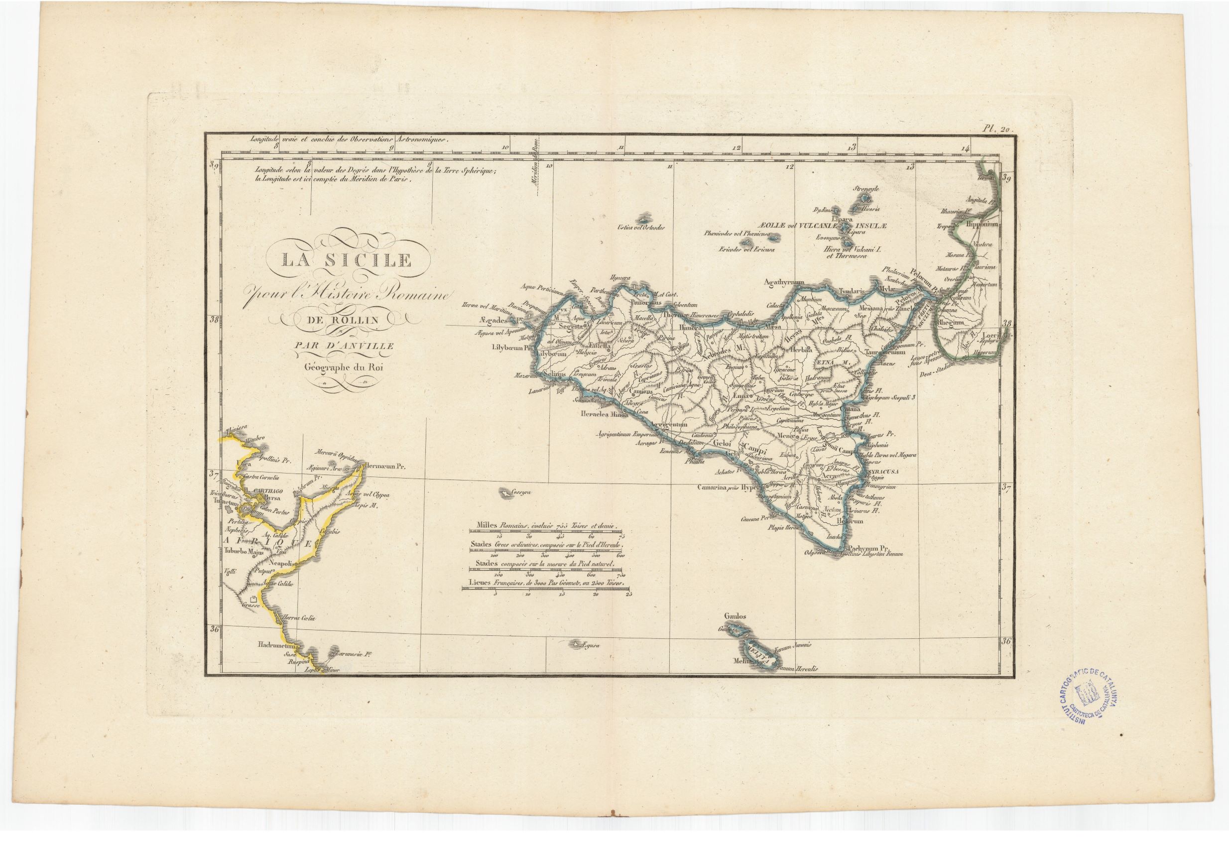
932- La Sicilie pour l'Histoire romaine de Rollin .
Author: Anville
,1760 |
|
931- Sardegna .
Author:
,1500 |
|
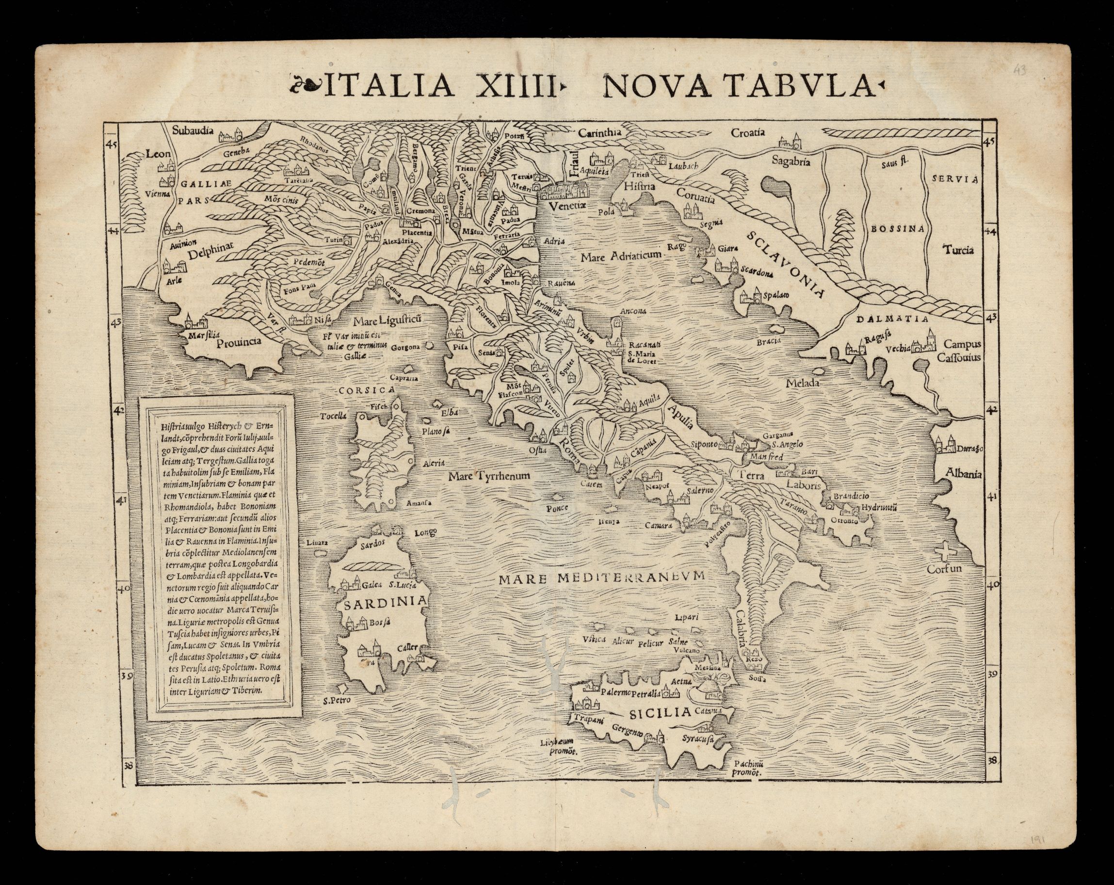
930- Nuova tabella Italia XIIII .
Author: Munster
,1542 |
|
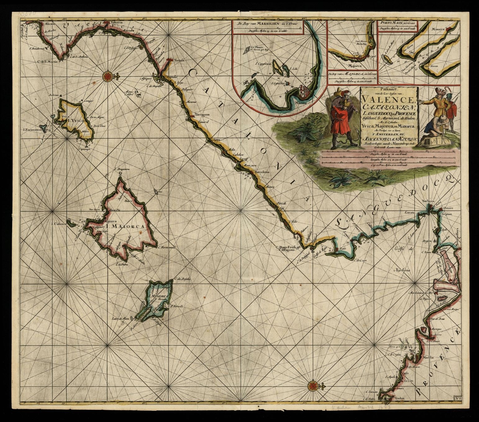
929- Paskaart von de Zee-kusten von Valence, Catalonien, Languedocq en Provence tusschen C .
Author: Johannis van Keulen
,1683 |
|
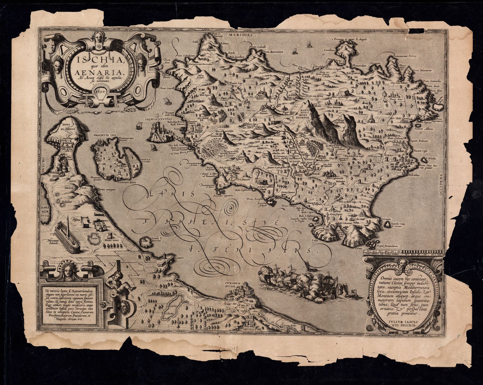
928-Ischia quae olim Aenaria ab Aenea classe hic appulsa sic nominata / Ivlivs Iasolinvs d .
Author: 1590 Julius Jasolinus
,1590 |
|
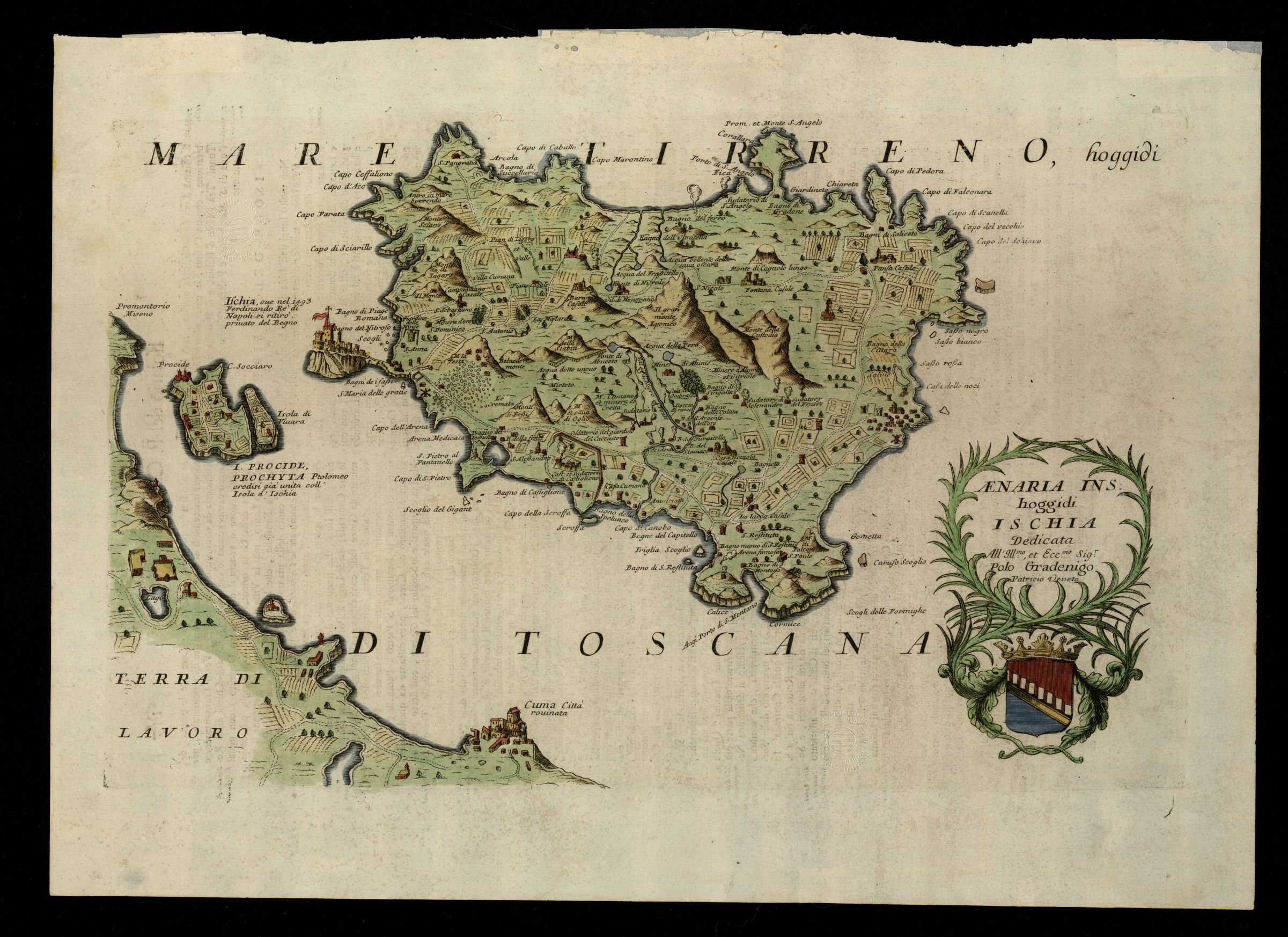
927-Aenaria ins. hoggidi Ischia / dedicata all'Illmo., et Eccmo. Sigr. Polo Gradenigo patr .
Author: Coronelli
,1696 |
|
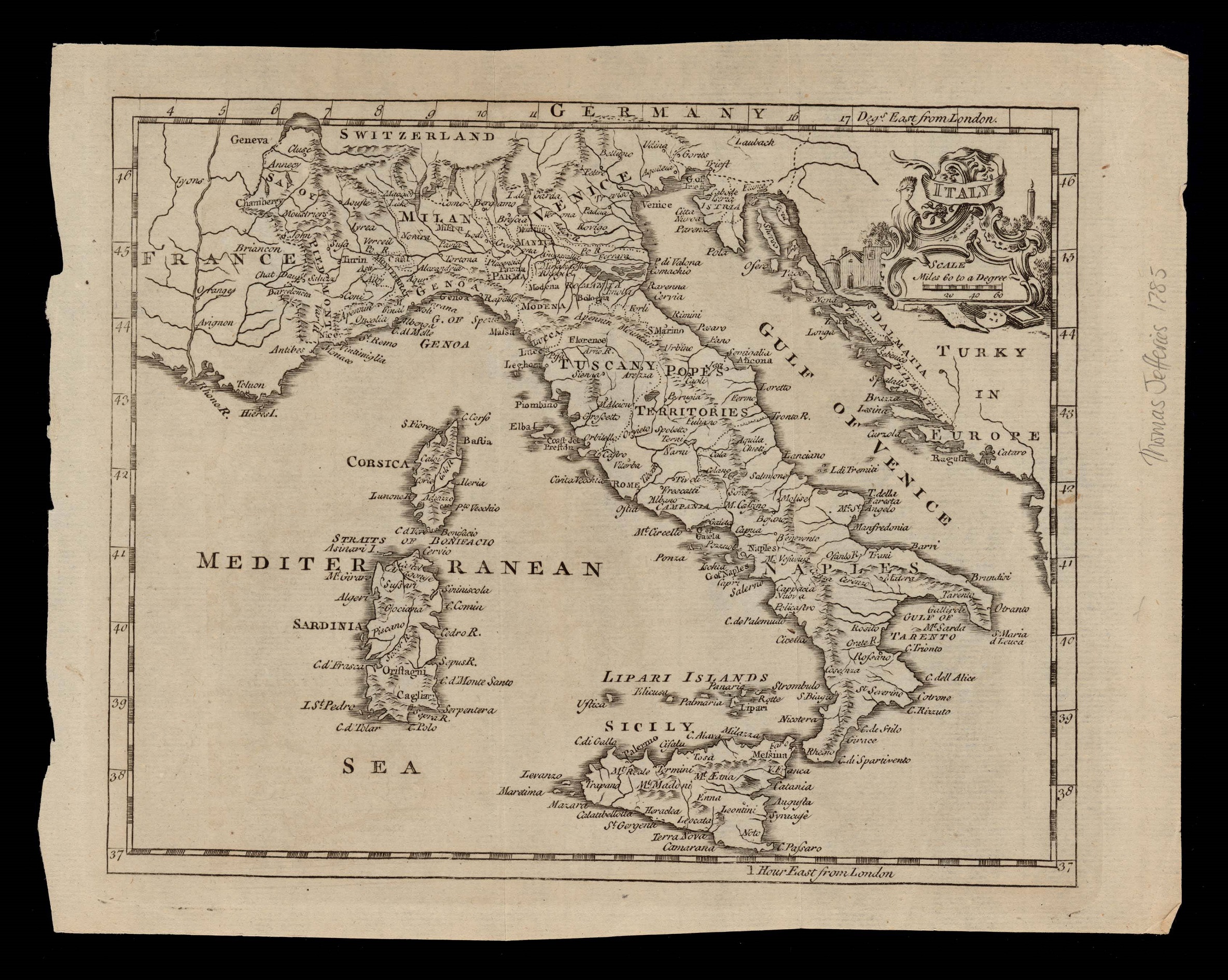
926-Italy .
Author: Thomas Jefferys
,1749 |
|
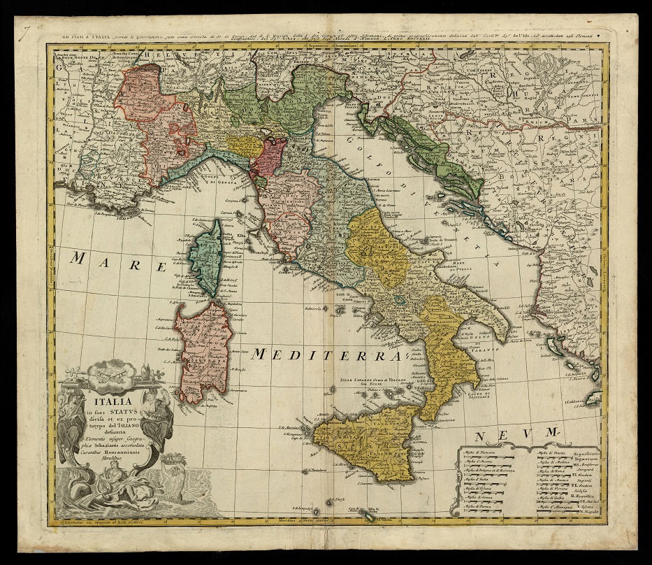
922- Italia in suos status divisa et ex prototypo del'Isliano desumta elementis insuper ge .
Author: Homannischen Erben
,1742 |

|
.
Author:
,0 |

|
.
Author:
,0 |
|
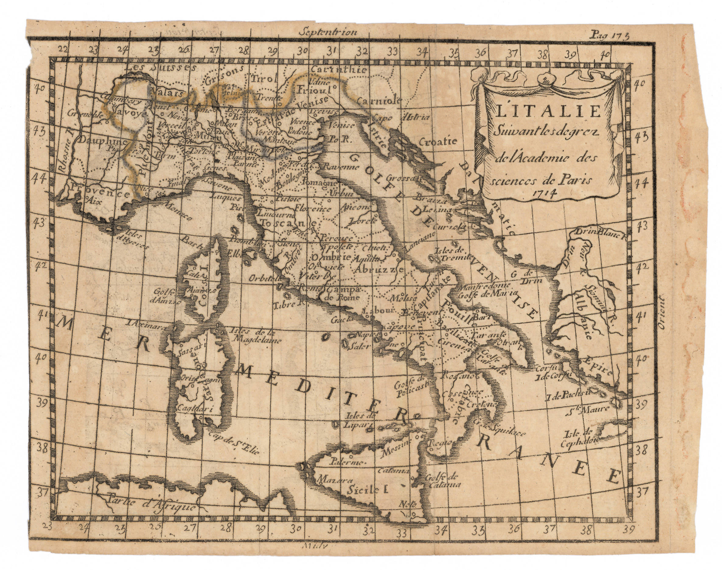
921- L'Italia, secondo i diplomi dell'Accademia delle Scienze di Parigi .
Author: Abraham Du Bois
,1714 |

|
.
Author:
,0 |
|
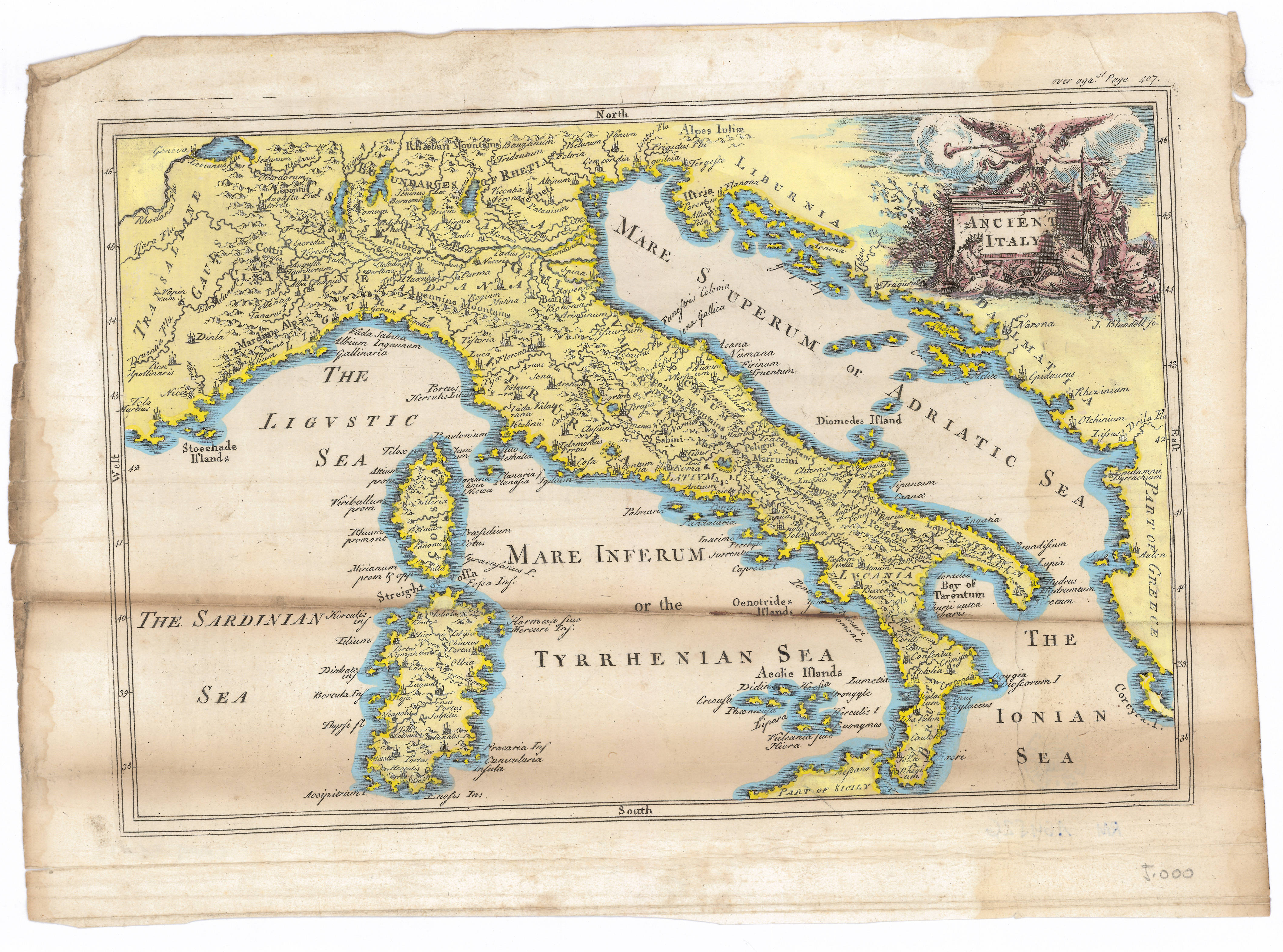
919- Antica Italia .
Author:
,1700 |

|
918-Die Insul oder das Kongsreich Sicilien .
Author: Stridbeck Junior
,1710 |
|
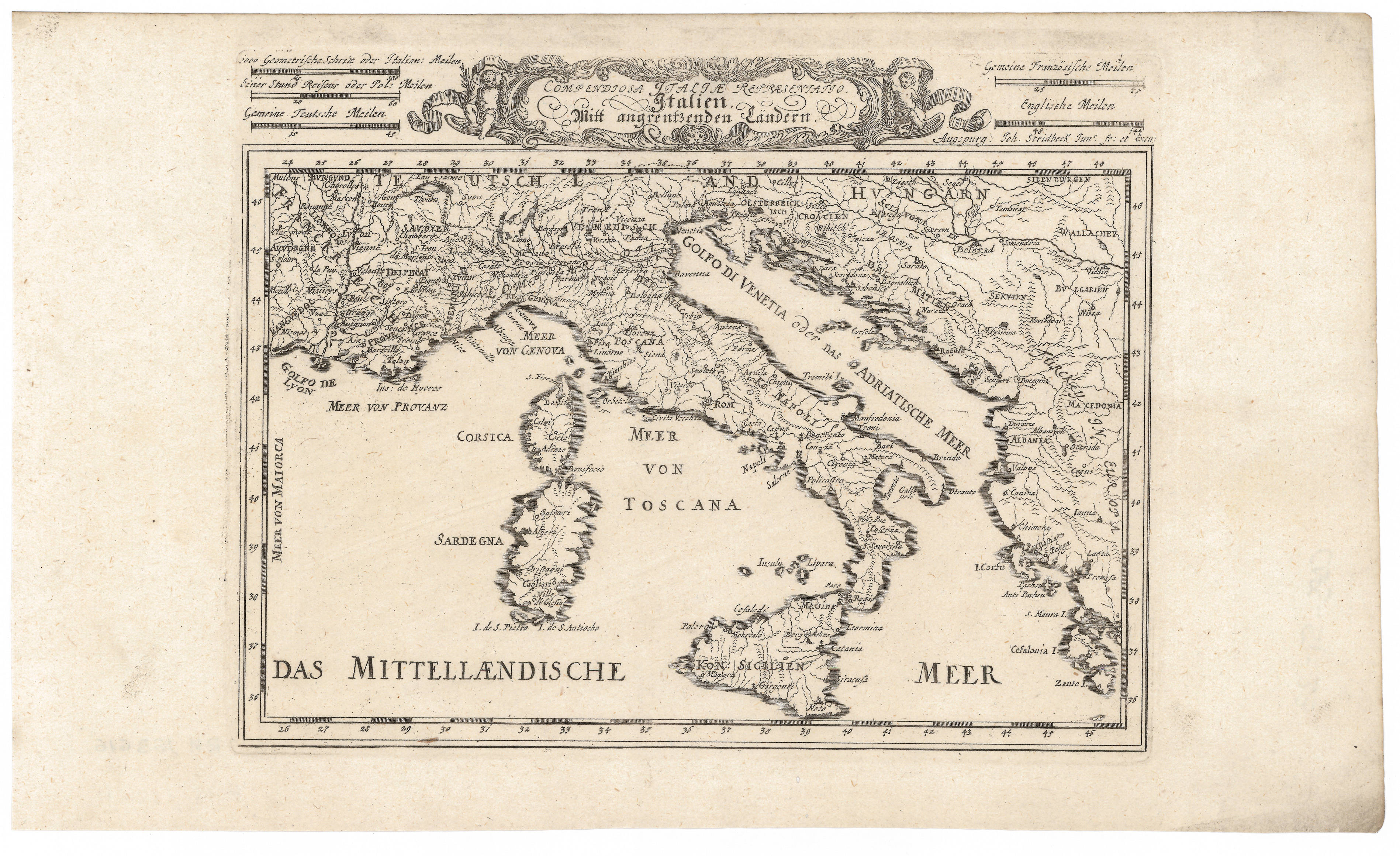
917-Rappresentatio Compendiosa Italiae. Italiano Mitt angrentzenben Landen .
Author: Stridbeck Junior
,1710 |
|
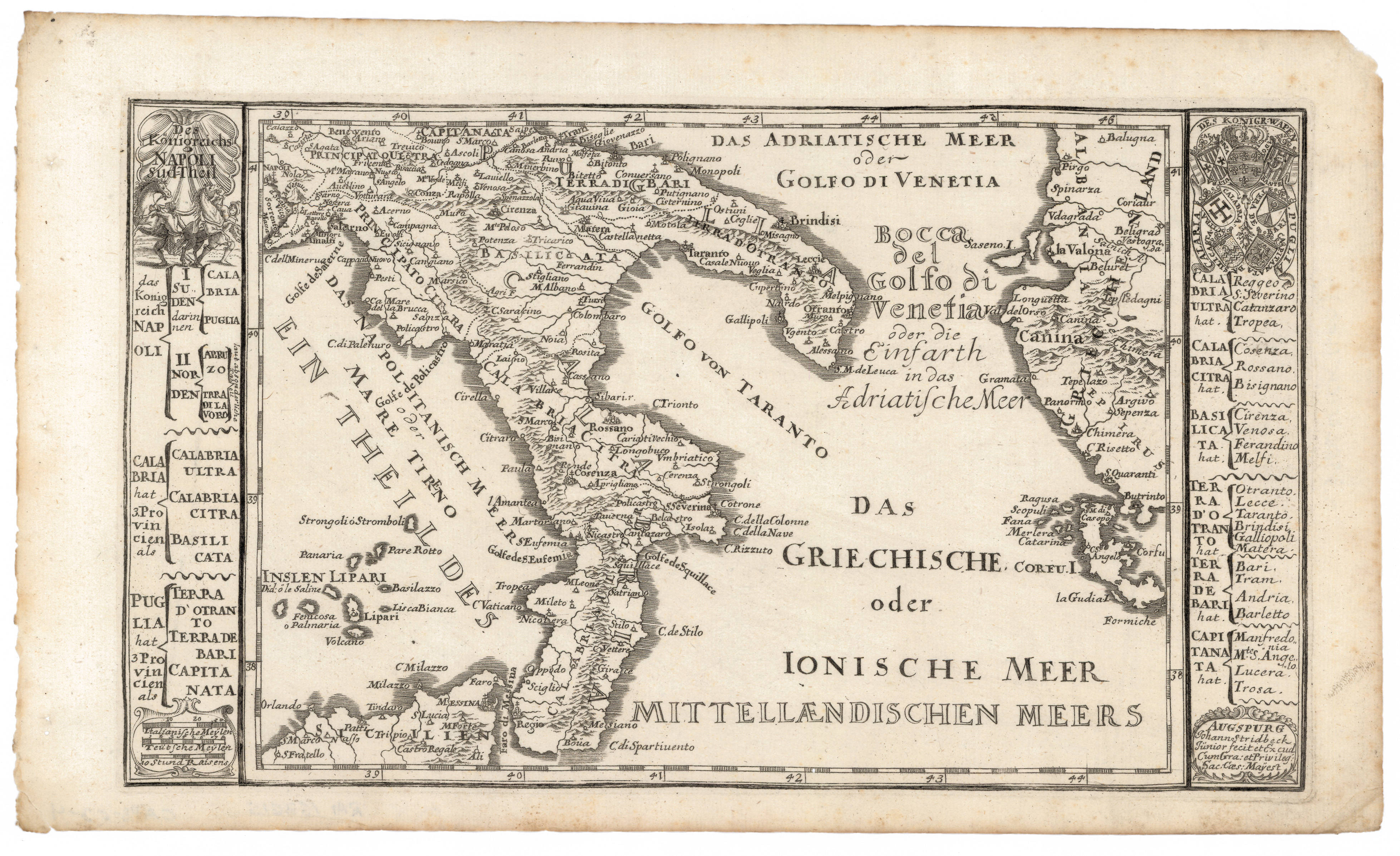
916- Das Königreichs Napoli: Sud-Theil .
Author: Stridbeck
,1720 |

|
915- Carte de la Grande Grece i compris la Sicilie .
Author: Rolli
,1750 |
|
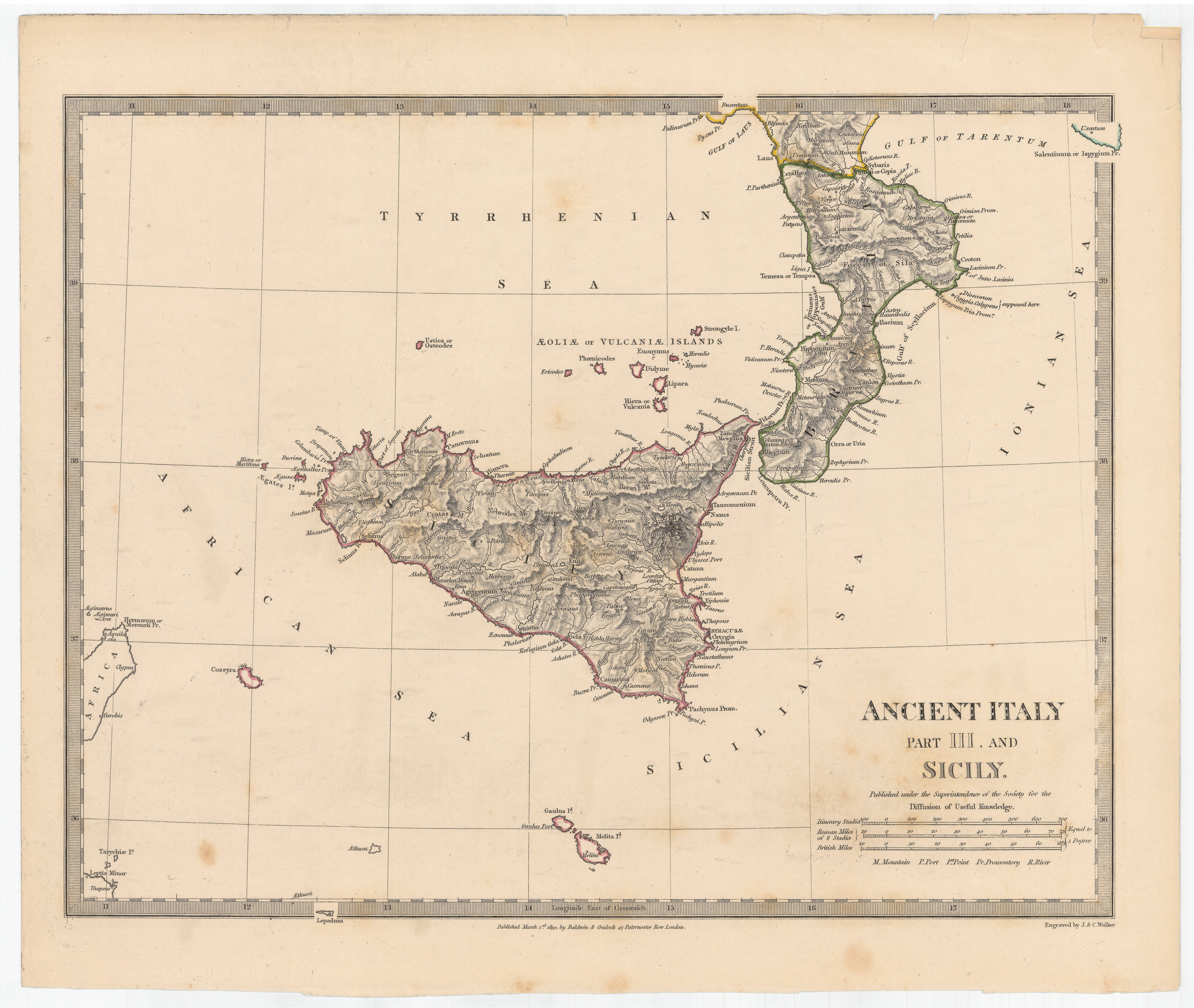
914- Ancient Italy : part III and Sicily .
Author: Walker
,1830 |

|
913- Italia con le sue poste e le strade principali .
Author:
,1700 |

|
912-Italia Antiqua .
Author: Seale
,1740 |
|
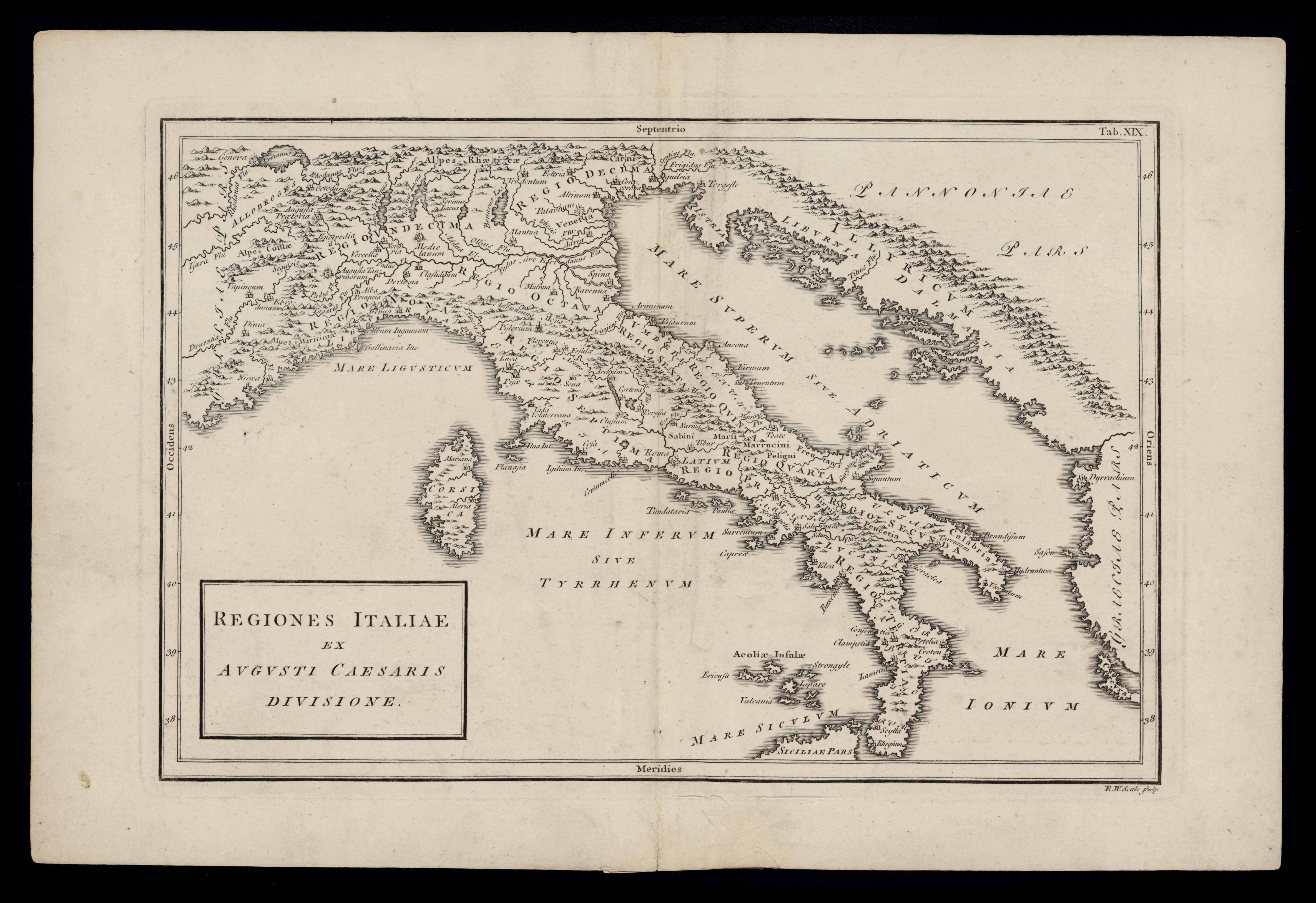
911- Regiones italiae ex Augusti Caesaris divisione .
Author: Seale
,1740 |
