![]()
![]()
![]()
![]()
![]()
![]()


MY MAPS
Regions:
![]()
Browse the website:
Latest Acquisitions
A Brief History of Cartography
The Cartographers
Events on ancient maps
Accimo editions
Brochure MB
Contacts
Glossary
Sitemap
|
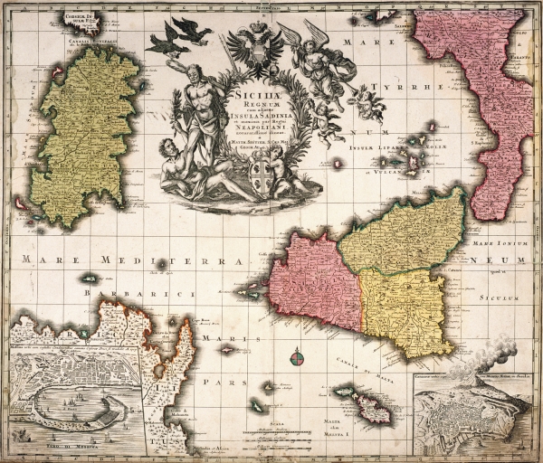
625-Siciliae Regnum e Insula di Sardinia Description: The map, measuring 49 x 58,2 cm, is taken from the Mattäus Seütter Atlas Geographicus, printed in 1725 in Augsburg. Drawn by Johann Baptist Homann in 1705, it shows the Western Mediterranean basin with the islands of Sicily, Sardinia and Malta, Calabria and the North-Eastern of Tunisia with Cap Bon. The sumptuous title picture with several figurs and the Austrian blazon appears in the centre of the Tyrrhenian Sea. On the bottom left a square contains the town of Messina, on the right, a second one shows the town of Catania with the smoking Etna. Autor: Seutter Place: Augusta Year: 1725 Quality document:
See online :
Go to verification |

