![]()
![]()
![]()
![]()
![]()
![]()


MY MAPS
Regions:
![]()
Browse the website:
Latest Acquisitions
A Brief History of Cartography
The Cartographers
Events on ancient maps
Accimo editions
Brochure MB
Contacts
Glossary
Sitemap
|
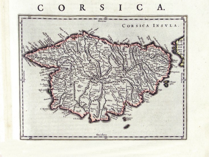
124-Corsica - Francia Description: The map measures 24 x 17,8 cm and belongs to the atlas Theatrum Orbis Terrarum sive Atlas Novus - pars tertia - Guilelmus et Ioannis Blaeu, printed in 1650 in the Blaeu's family workshop in Amsterdam. Corsica is exposed in a small scale, but with plenty of citynames. The island also has a schematic representation of the hydrography and the orography. Autor: Ioannis Blaeu Place: Amsterdam Year: 1650 Quality document:
See online :
Go to verification |

