![]()
![]()
![]()
![]()
![]()
![]()


MY MAPS
Regions:
![]()
Browse the website:
Latest Acquisitions
A Brief History of Cartography
The Cartographers
Events on ancient maps
Accimo editions
Brochure MB
Contacts
Glossary
Sitemap
|
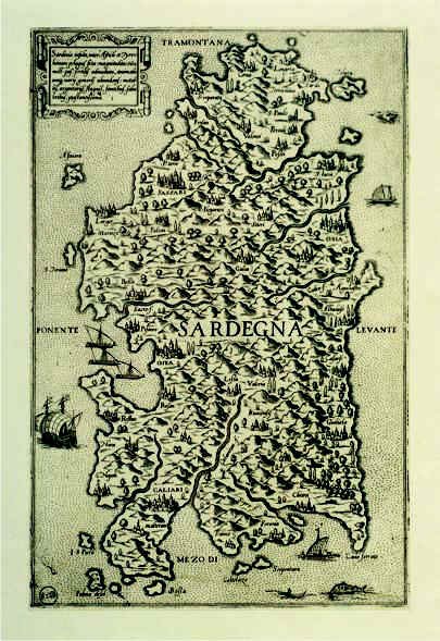
299-Sardinia Insula Description: The map is in a free format and measures 29,8 x 19 cm. It was probably printed in 1550 in Veneto from Fabio Licinio's cupper plate engraving. At tha time the map had a certain success because of its rich graphical contents. Therefore it was often copied and inserted with few variations in other cartographic works of the 16 th century. Autor: Fabio Licinio Place: Veneto Year: 1550 Quality document:
See online :
Go to verification |

See the printed version: Click here
