![]()
![]()
![]()
![]()
![]()
![]()


MY MAPS
Regions:
![]()
Browse the website:
Latest Acquisitions
A Brief History of Cartography
The Cartographers
Events on ancient maps
Accimo editions
Brochure MB
Contacts
Glossary
Sitemap
|
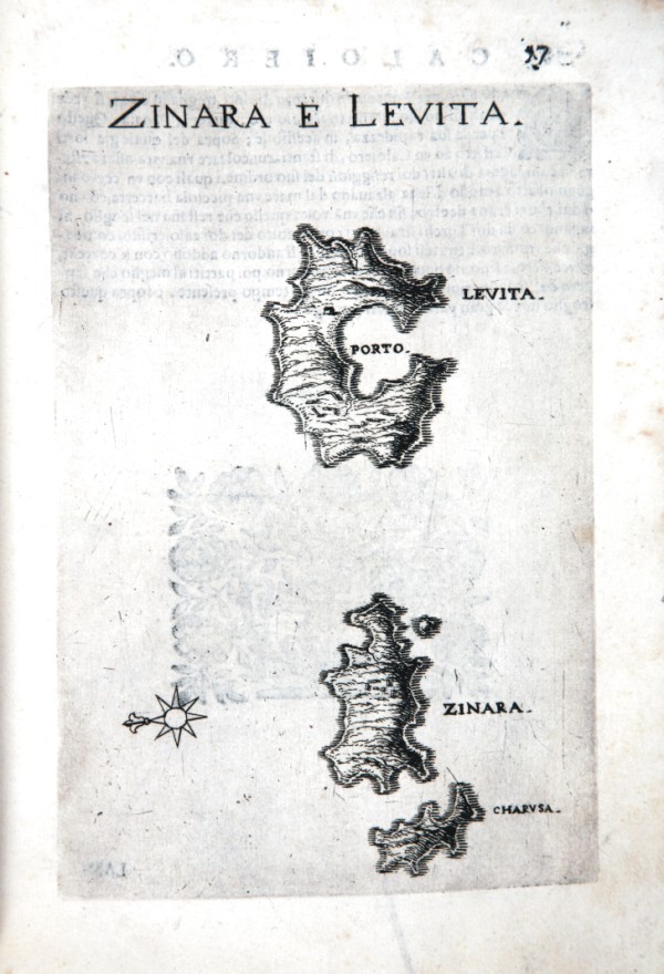
451-Zinara e Levita Description: The map which measures 17x24 cm, represents the Greek island of ZINARA E LEVITA and the work is published in Venice in 1658, the archipelago with the islands, rocks, dry and shallow, with the seas, gulfs, breasts, ports , towns, and castles in form, which can be seen in the present tense, with a succinct narrative Deio their names, stories & historie, ancient and modern. In the drawing above shows the title and right, the scale of 12 miles in a cartouche. The performance is remarkable for the dense and the terrain topography. Autor: Marco Boschini Place: Venezia Year: 1648 Quality document:
See online :
Go to verification |

