![]()
![]()
![]()
![]()
![]()
![]()


MY MAPS
Regions:
![]()
Browse the website:
Latest Acquisitions
A Brief History of Cartography
The Cartographers
Events on ancient maps
Accimo editions
Brochure MB
Contacts
Glossary
Sitemap
|
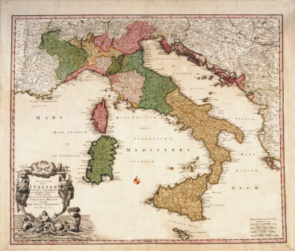
616-Statum totius Italiae Description: This map, measuring 48,3 x 57 cm and drawn by Johann Baptist Homann, was printed at the beginning of the 18th century in Nuremberg. It shows the Italian Peninsula with the borders of numerous Italian States, Dalmatia, and a large part of the Balkans. The mountain ranges are indicated by mole-hill reliefs and the rivers, lakes and woods are described as well. Many female figures surround the title picture. The graphic scales in Milliaria Germanica, Milliaria Italica, Leuca Gallica are on the right. Autor: Iohannes Baptista Homann Place: Norimberga Year: 1700 Quality document:
See online :
Go to verification |

