![]()
![]()
![]()
![]()
![]()
![]()


MY MAPS
Regions:
![]()
Browse the website:
Latest Acquisitions
A Brief History of Cartography
The Cartographers
Events on ancient maps
Accimo editions
Brochure MB
Contacts
Glossary
Sitemap
|
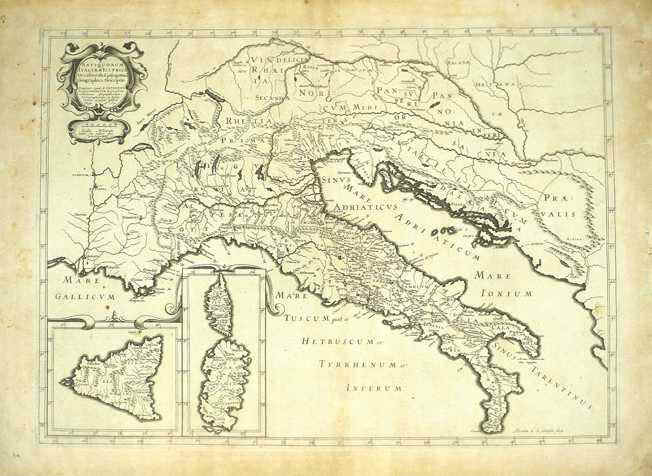
196-Italia Antiqua Description: The map was created in 1640 by Melchior Tavernier and resides in the cartography collection of different authors established in the 18th century. Tavernier worked for a long time for Sanson, Jansson, Hondius, Dankerts, Tassin, Bertius. He also was hydrographer, engraver and typographer of the King of France and produced very fine quality maps. On the let top there is a decorated picture with the title Antiquorum Italiae et Illyrici Occidentalis Episcopatuum Geographica Descriptio Parisiis apud M.Tavernier. Autor: Melchior Tavernier Place: Parigi Year: 1640 Quality document:
See online :
Go to verification |

