![]()
![]()
![]()
![]()
![]()
![]()


MY MAPS
Regions:
![]()
Browse the website:
Latest Acquisitions
A Brief History of Cartography
The Cartographers
Events on ancient maps
Accimo editions
Brochure MB
Contacts
Glossary
Sitemap
2 results
|
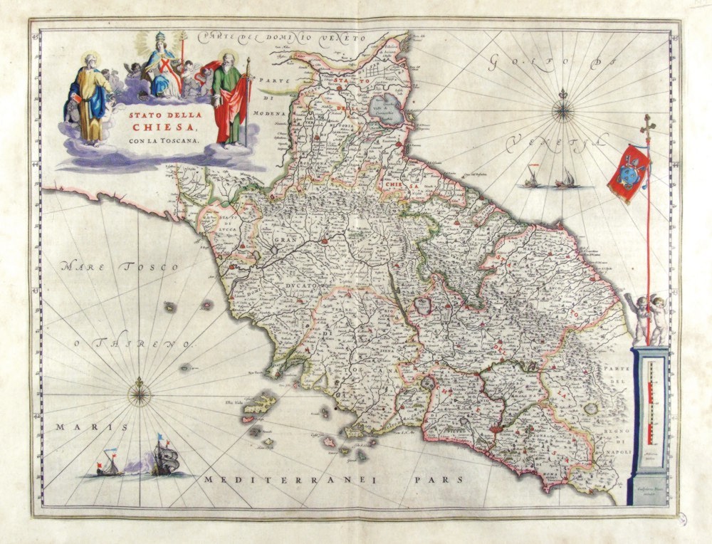
152-Stato della Chiesa .
The Map of the Dukedom of Toscany and the Church States, from Romagna to Latium, showing a picture of sacred images surrounding the title and a metric scale residing in a boundary stone with two babies holding the Papal flag.This map measures 49,2 x 38 cm and is taken from the atlas Theatrum Orbis Terrarum sive Atlas Novus - pars tertia - Guilelmus et Ioannis Blaeu, printed in 1650 in the Blaeu family workshop in Amsterdam.. Author: Ioannis Blaeu
Amsterdam,1650 |
|
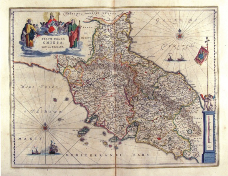
153-Stato della Chiesa .
The Map belongs to the atlas Geographiae Blavianae volumen octavum Quo Italia quae est Europae Liber XVI di Blaeu, printed in 1592 in Amsterdam. Author: Ioannis Blaeu
Amsterdam,1662 |
