![]()
![]()
![]()
![]()
![]()
![]()


MY MAPS
Regions:
![]()
Browse the website:
Latest Acquisitions
A Brief History of Cartography
The Cartographers
Events on ancient maps
Accimo editions
Brochure MB
Contacts
Glossary
Sitemap
|
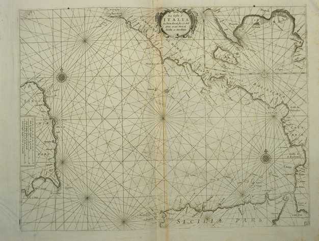
224-La costa d'Italia da Porto Hercole sino a C. dell'Arme Description: The map measures 40 x 50,6 cm and belongs to the atlas Prima parte dello Specchio del Mare, published in 1664 in Genoa by F.M. Levanto. It offers an exhaustive view of the South Thyrrenian Sea. Autor: Francesco Maria Levanto Place: Genova Year: 0 Quality document:
See online :
Go to verification |

