![]()
![]()
![]()
![]()
![]()
![]()


MY MAPS
Regions:
![]()
Browse the website:
Latest Acquisitions
A Brief History of Cartography
The Cartographers
Events on ancient maps
Accimo editions
Brochure MB
Contacts
Glossary
Sitemap
|
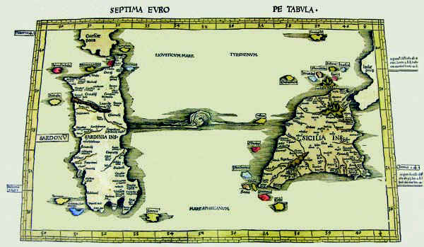
325-Septima Europe Tabula Description: The map resides on table 9 of the atlas Ptolomeus Auctus restitutus et maculatus cum tabulis veteribus ac novis. Typus Joannis Scoti, printed in 1520 in Strassbourg. It also contains the map before.The colored document measures 54,5 x 32 cm, has an accurate and fine graphic art and represents a sector of the Earth with restriction in the North. The map is graduated with 1° intervals and shows the latitude from 35°,30' to 40°,30' and the longitude from 30° to 40°,30'. Autor: Claudio Tolomeo Place: Strasburgo Year: 1520 Quality document:
See online :
Go to verification |
See the printed version: Click here
