![]()
![]()
![]()
![]()
![]()
![]()


MY MAPS
Regions:
![]()
Browse the website:
Latest Acquisitions
A Brief History of Cartography
The Cartographers
Events on ancient maps
Accimo editions
Brochure MB
Contacts
Glossary
Sitemap
6 results
|
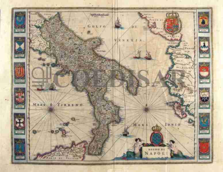
203-Regno di Napoli - Italia .
The Map, that measures the sketch at cm 49,5 xes 38,5, is to be found in the atlas Geographiae Blavianae volume octavum Quo Italy east quae Europae Liber XVI of Blaeu printed in Amsterdam in 1662.
Author: Ioannis Blaeu
Amsterdam ,1662 |
|
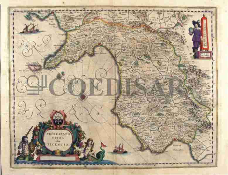
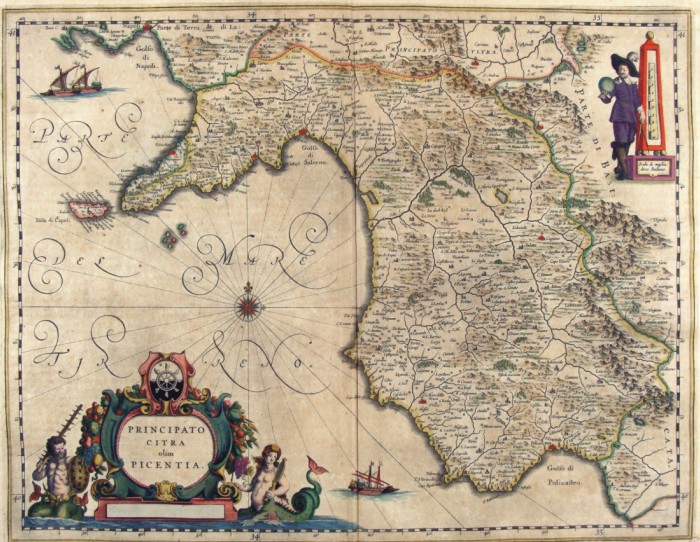
222-Principato Citra olim Picentia - Campania - Italia .
The Charter, which measures 49.2 x 38,5 cm, is to be found in the Atlas Geographiae Blavianae volume octavum Quo Italy quae est Europae Liber XVI of Blaeu printed in Amsterdam in 1662. Author: Ioannis Blaeu
Amsterdam ,1662 |
|
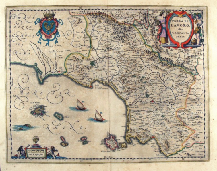
223-Terra di Lavoro olim Campania Felix - Campania - Italia .
The Charter, which measures 48.8 x 38, is to be found in the Atlas Geographiae Blavianae volume octavum Quo Italy quae est Europae Liber XVI of Blaeu printed in Amsterdam in 1662. Author: Ioannis Blaeu
Amsterdam ,1662 |
|
292-Capitanata olim mesapiae et iapygiae pars - Puglia - Italia .
The Charter, which measures in the drawing cm 49.2 x 38, is contained in the Atlas Geographiae Blavianae volumen octavum Quo Italy quae est Europae Liber XVI of Blaeu printed in Amsterdam in 1662.
Author: Jan Jansson
Amsterdam,1640 |
|
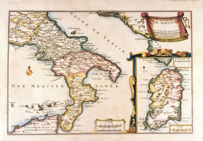
612-Le Royame de Naples .
This map, measuring 22 x 32,7 cm and drawn by N. de Fer, Geographe de Monseigneur de Dauphin, is taken from the Atlas curieux ou le Monde représenté dans les cartes générales et particulières du ciel et de la terre (...),printed in 1705 in Paris.
It is a beautiful coloured document. A festoon on the top right contains the title. The graphic scales Echelle Soixante Milles d'Italie and Vingt Lieues d’un heure de chemin are in a square at the bottom. The Sardinia Island with its own graphic scale appears separately on the right. Author: Dauphin
Paris,1705 |
|
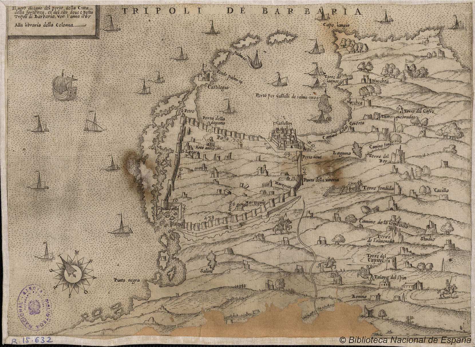
846- Tripoli de Barbaria .
Author:
,1567 |
