![]()
![]()
![]()
![]()
![]()
![]()


MY MAPS
Regions:
![]()
Browse the website:
Latest Acquisitions
A Brief History of Cartography
The Cartographers
Events on ancient maps
Accimo editions
Brochure MB
Contacts
Glossary
Sitemap
|
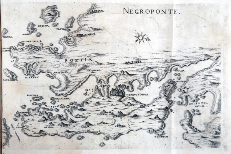
440-Negroponte Description: The map which measures 17x24 cm, represents the Greek island of NEGROPONTE and the work is published in Venice in 1658, the archipelago with the islands, rocks, dry and shallow, with the seas, gulfs, breasts, ports , towns, and castles in form, which can be seen in the present tense, with a succinct narrative Deio their names, stories & historie, ancient and modern. In the drawing above shows the title and right, the scale of 12 miles in a cartouche. The performance is remarkable for the dense and the terrain topography. Autor: Marco Boschini Place: Venezia Year: 1648 Quality document:
See online :
Go to verification |

