![]()
![]()
![]()
![]()
![]()
![]()


MY MAPS
Regions:
![]()
Browse the website:
Latest Acquisitions
A Brief History of Cartography
The Cartographers
Events on ancient maps
Accimo editions
Brochure MB
Contacts
Glossary
Sitemap
|
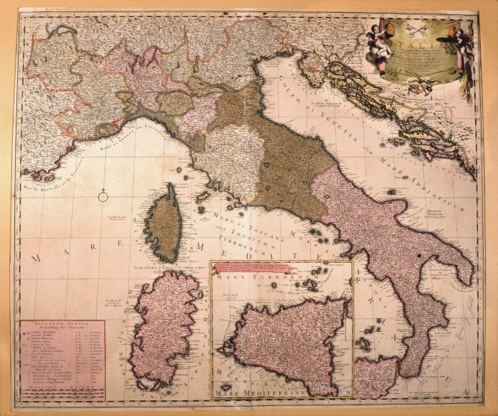
611-Italia in fous quoscunq Status divisa Description: This map, measuring 50,4 x 59,4 cm and drawn by Carol Allard, was printed at the end of the 17th century in Amsterdam. It shows the Italian Peninsula with its numerous states, and the Islands of Corsica and Sardinia. Sicily appears in a separate square. The mountains are indicated by mole-hill reliefs and there is a description of the most important rivers and woods as well. A festoon on the top right contains the title. The graphic scales in Italic, German and Celtic miles are on the bottom left. Autor: Carel Allard Place: Amsterdam Year: 1697 Quality document:
See online :
Go to verification |

