![]()
![]()
![]()
![]()
![]()
![]()


MY MAPS
Regions:
![]()
Browse the website:
Latest Acquisitions
A Brief History of Cartography
The Cartographers
Events on ancient maps
Accimo editions
Brochure MB
Contacts
Glossary
Sitemap
15 results
|
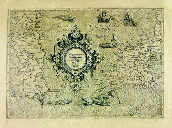
Sardinia .
The map was taken from the atlas Theatri Geographiae Veteris Tomus Prior in quo Cl. Ptol. Alexandrini Geographiae libri VIII, printed in 1619 in Amsterdam.
The map measures 32,3 x 45,8cm and represents Sardinia, South Corsica and a small sector of the South West of Italy which corresponds to South Calabria looking onto the Thyrrenian Sea , Sicily and the Aegadian and Aeolian Islands. Author: Pietro Bertio
Amsterdam,1619 |
|
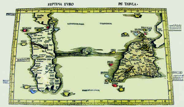
325-Septima Europe Tabula .
The map resides on table 9 of the atlas Ptolomeus Auctus restitutus et maculatus cum tabulis veteribus ac novis. Typus Joannis Scoti, printed in 1520 in Strassbourg. It also contains the map before.The colored document measures 54,5 x 32 cm, has an accurate and fine graphic art and represents a sector of the Earth with restriction in the North. The map is graduated with 1° intervals and shows the latitude from 35°,30' to 40°,30' and the longitude from 30° to 40°,30'.
Author: Claudio Tolomeo
Strasburgo,1520 |
|
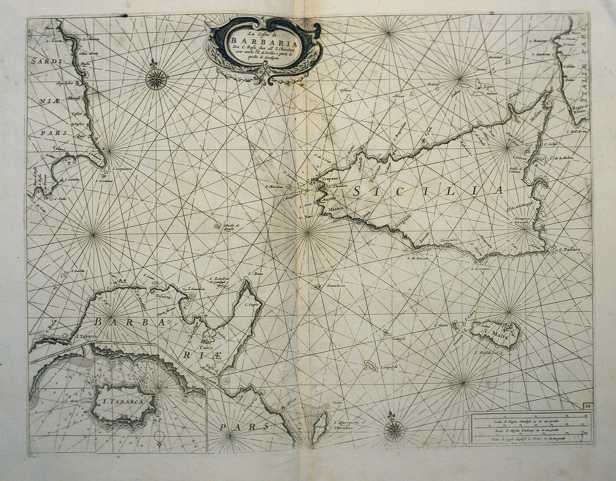
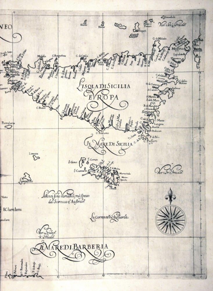
326-Le Coste della Barbaria da Capo Rosafino all'isola Chercheni con anche l'isola di Sic .
The map measures 40 x 50,6 cm and belongs to the atlas Prima parte dello Specchio del Mare, published in 1664 in Genoa by F.M.Levanto. It exposes the South of the Thyrrenian Sea with the channel of Sardinia and Sicily, a sector of Tunisia with Cap Bon, the islands of Sicily, Malta Lampedusa and East Sardinia with the gulf of Cagliari. Tabarca, at that time frequented by the Genoese navigators, is represented with its surrounding sea bed in a very detailed way on the sector below on the left. Author: Francesco Maria Levanto
Genova ,0 |
|
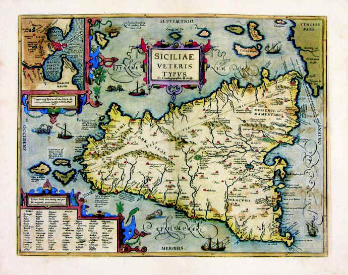
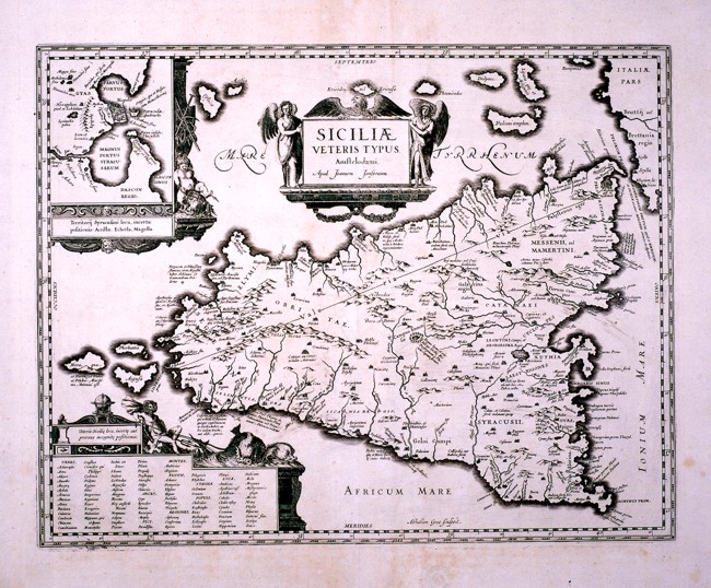
327-Siciliae Veteris .
The drawing of the map measures 36 x 47 cm and belongs to the atlas Theatrum Orbis Terrarum, edition of 1589. It's a very beaultiful and well colored map. Syracuse and its harbour are represented in a square above.
Author: Abramo Ortelio
Anversa,1584 |
|
328-Siciliae e Veteris Tipus .
This map, drawn by Johannes Janssonius, comes from the same matrix as the map in the Ortelius atlas Theatrum Orbis Terrarum and shows only few differences. It measures 44 x 36 cm.
Author: Johannem Janssonium
,1589 |
|
419-Sicilia .
Author: Robert Dudley
Firenze,1661 |
|
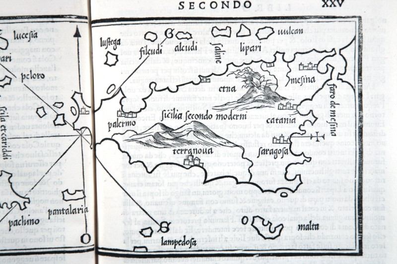
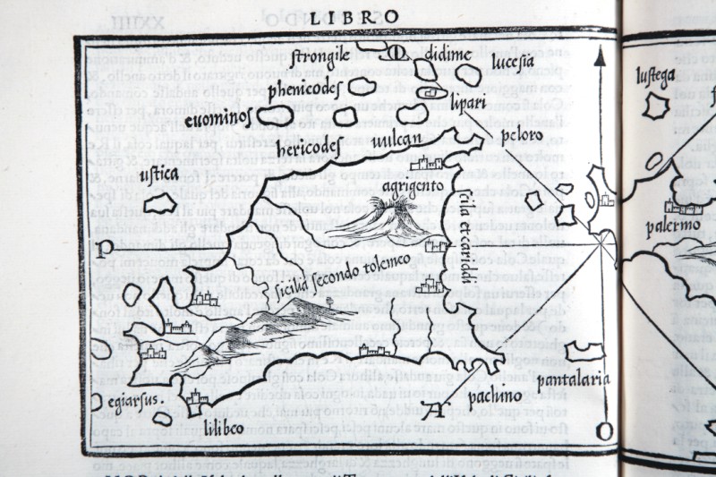
434-ISOLE SICILIA .
The map measures 14.6 x 8.4 cm in the design and the work is published in Venice in 1528 Libro di Benedetto Bordone nel qual si ragiona di tutte l’isole del mondo con li loro nomi antichi et moderni, historie, favole, et modi di loro vivere, et in qual parte del mare stanno, et in qual parallelo et clima giacciono con il breve di Papa Leone et gratia et pri vilegio della Illustrissima Signoria com’in quelli appare. MDXXVIII. Author: Benedetto Bordone
Venezia,1528 |
|
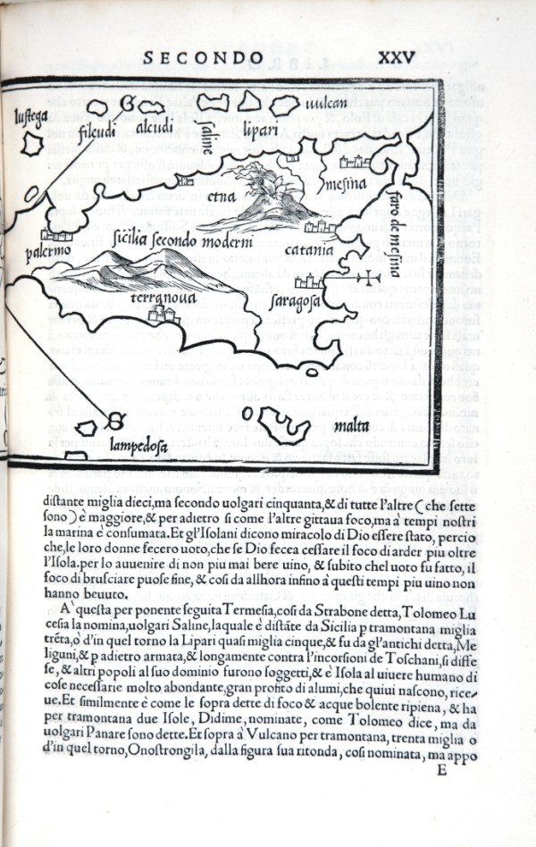
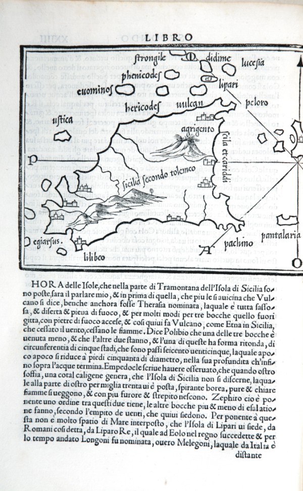
447-Sicilia 2 .
The map measures 8.4 x 14.6 cm in the design and the work is published in Venice in 1547 Libro di Benedetto Bordone nel qual si ragiona di tutte l’isole del mondo con li loro nomi antichi et moderni, historie, favole, et modi di loro vivere, et in qual parte del mare stanno, et in qual parallelo et clima giacciono con il breve di Papa Leone et gratia et pri vilegio della Illustrissima Signoria com’in quelli appare. Author: Benedetto Bordone
Venezia,1528 |
|
448-Sicilia particolare .
The map measures 14.6 x 8.4 cm in the design and the work is published in Venice in 1528 Libro di Benedetto Bordone nel qual si ragiona di tutte l’isole del mondo con li loro nomi antichi et moderni, historie, favole, et modi di loro vivere, et in qual parte del mare stanno, et in qual parallelo et clima giacciono con il breve di Papa Leone et gratia et pri vilegio della Illustrissima Signoria com’in quelli appare. MDXXVIII.
Author: Benedetto Bordone
Venezia,0 |
|
449-Sicilia di Bordone .
The map measures 14.6 x 8.4 cm in the design and the work is published in Venice in 1528 Libro di Benedetto Bordone nel qual si ragiona di tutte l’isole del mondo con li loro nomi antichi et moderni, historie, favole, et modi di loro vivere, et in qual parte del mare stanno, et in qual parallelo et clima giacciono con il breve di Papa Leone et gratia et pri vilegio della Illustrissima Signoria com’in quelli appare. MDXXVIII. Author: Benedetto Bordone
Venezia,1528 |
|
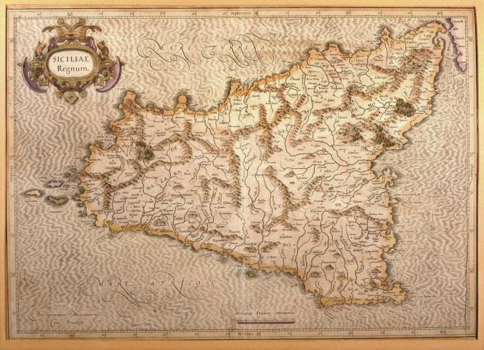
608-Siciliae Regnum .
This map, measuring 34 x 48 cm and drawn by Gerardus Mercator, was printed in 1589 in Duisburg. It is a beautiful document of Sicily, its inhabited centres drawn with little circles and the towns with fine perspective designs. The island appears in the centre of the sea, moved by light waves. The mountains are indicated by mole-hill reliefs and the water courses are exactly described. On the top left is a decorative title picture; the graphic scale in Miliaria Italica Communia is at the bottom. Author: Mercatore
Duisburg ,1589 |
|
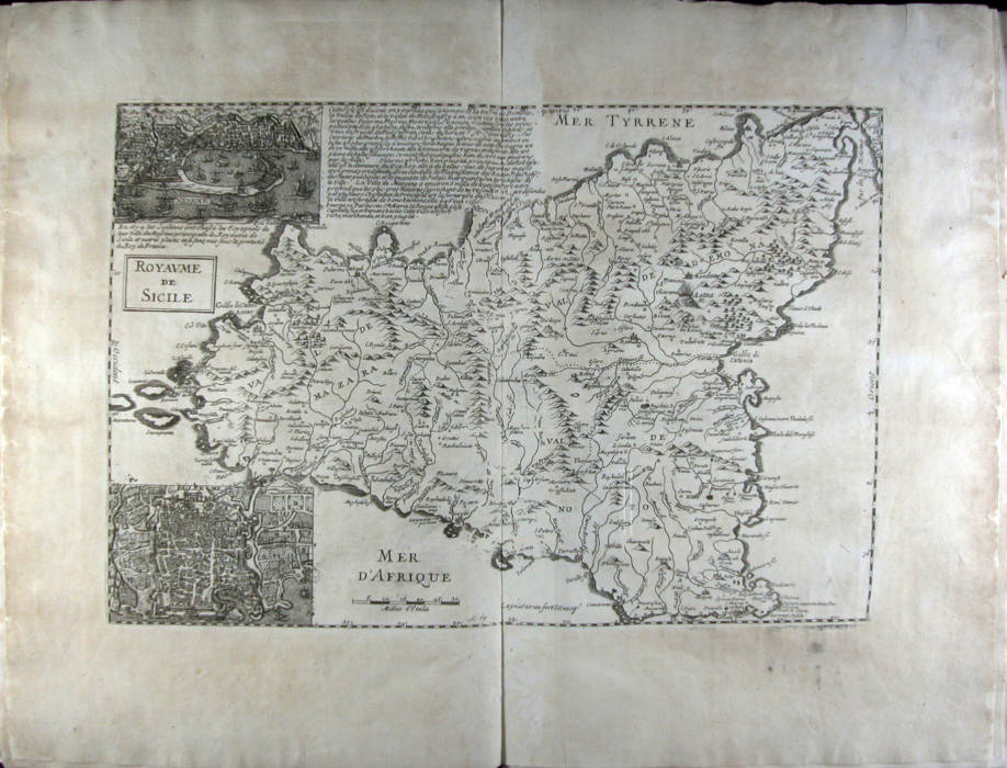
825-Royaume de Sicile .
Author:
Parigi,1674 |
|
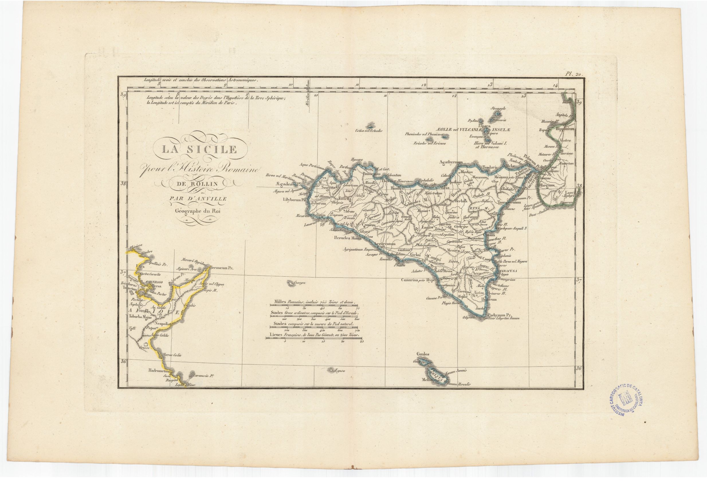
932- La Sicilie pour l'Histoire romaine de Rollin .
Author: Anville
,1760 |

|
918-Die Insul oder das Kongsreich Sicilien .
Author: Stridbeck Junior
,1710 |
|
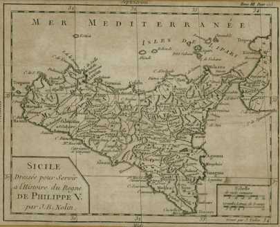
770 - Sicile .
Author: Jean Baptiste Nolin
Parigi,1702 |
