![]()
![]()
![]()
![]()
![]()
![]()


MY MAPS
Regions:
![]()
Browse the website:
Latest Acquisitions
A Brief History of Cartography
The Cartographers
Events on ancient maps
Accimo editions
Brochure MB
Contacts
Glossary
Sitemap
|
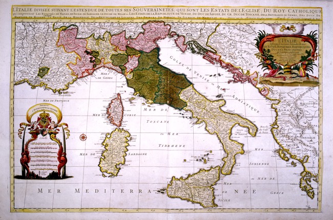
200-L'Italie Description: Part of Europe from the mouth of the Rh�ne in the West to the Island of Zante in the South East of Greece. This map of the 17th century, drawn by Sanson, printed in Paris by H. Jaillot and sold in Amsterdam by Pierre Mortier measures 89 x 50 cm. It shows all the states of Italy at that time. On the top right is a splendid title picture and on the left a decorative picture contains different graphic scales. Autor: Hubert Iaillot Place: Parigi Year: 1669 Quality document:
See online :
Go to verification |

