![]()
![]()
![]()
![]()
![]()
![]()


MY MAPS
Regions:
![]()
Browse the website:
Latest Acquisitions
A Brief History of Cartography
The Cartographers
Events on ancient maps
Accimo editions
Brochure MB
Contacts
Glossary
Sitemap
|
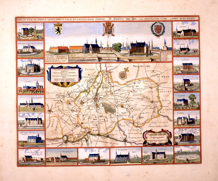
215-Nova et Exacta Tabula Salae et Castellanae Iprensis Description: The region of Ypres in Belgium with its twenty castles, a view of the city and three blazons at the top. This detailed map shows two decorative pictures and a wind rose. Drawn by Antonius Saderus, it measures 48,4 x 39 cm. Autor: Antonius Sanderus Place: Amsterdam Year: 1641 Quality document:
See online :
Go to verification |

