![]()
![]()
![]()
![]()
![]()
![]()


MY MAPS
Regions:
![]()
Browse the website:
Latest Acquisitions
A Brief History of Cartography
The Cartographers
Events on ancient maps
Accimo editions
Brochure MB
Contacts
Glossary
Sitemap
|
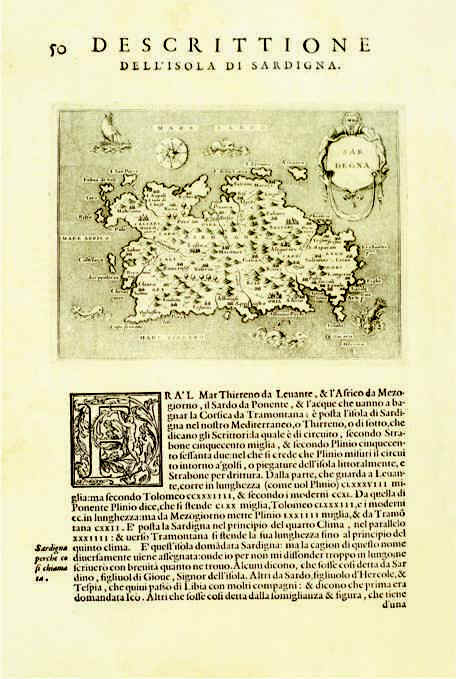
300-Descrittione dell'Isola di Sardegna Description: The map measures 15,5 x19,2 cm, the drawing alone 10,3 x 14 cm. It resides in Porcacchi's and Arretino's atlas L'isole più famose del mondo, edition published in 1572 in Venice. The document was taken from Girolamo Porro's woodcut and proposes Gio. F. Camocio's map of 1571. Autor: Tommaso Porcacchi Place: Venezia Year: 1571 Quality document:
See online :
Go to verification |

See the printed version: Click here
