![]()
![]()
![]()
![]()
![]()
![]()


MY MAPS
Regions:
![]()
Browse the website:
Latest Acquisitions
A Brief History of Cartography
The Cartographers
Events on ancient maps
Accimo editions
Brochure MB
Contacts
Glossary
Sitemap
4 results
|
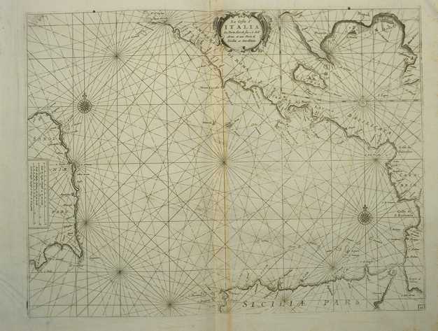
224-La costa d'Italia da Porto Hercole sino a C. dell'Arme .
The map measures 40 x 50,6 cm and belongs to the atlas Prima parte dello Specchio del Mare, published in 1664 in Genoa by F.M. Levanto. It offers an exhaustive view of the South Thyrrenian Sea. Author: Francesco Maria Levanto
Genova ,0 |
|
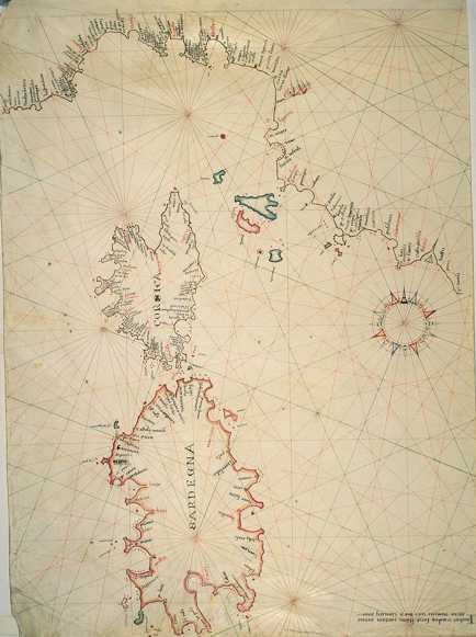
225-Thyrrenian Sea .
The map measures 46,5 x 65,6 cm and represents a large part of the Thyrrenian Sea. Down on the right are reported the author's name, the place and the date of the map's redaction: Iacobus Maiolus fecit cartam Genue anno domini 1567 diem ianuarii XXX. Further on the right we can see a very beautiful wind rose from which depart 32 directions crossing in 9 different points. It's a typical nautical chart, very beatiful even if very schematic. It shows the coast profil and gives a lot of interesting informations for the navigation. There is no description of the inside area.
Author: Jacobus Maiolus
Genova ,1567 |
|
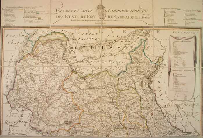
226-New chorographic map of the Sardinian's Empire States .
The map, printed in 1793, measures 74 x 69 cm and is on scale 1:500 000. It exposes Savoy, the Aosta Valley and a sector of the Piedmont. Author: J. B. Bouge
Berlino ,1793 |
|
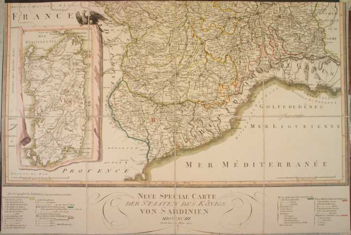
227-New special map of the Sardinia's States .
The map, printed in 1793, measures 74 x 69 cm and shows Liguria with a sector of the South Piedmont. Sardinia is exposed in a square. Author: J. B. Bouge
,1793 |
