![]()
![]()
![]()
![]()
![]()
![]()


MY MAPS
Regions:
![]()
Browse the website:
Latest Acquisitions
A Brief History of Cartography
The Cartographers
Events on ancient maps
Accimo editions
Brochure MB
Contacts
Glossary
Sitemap
|
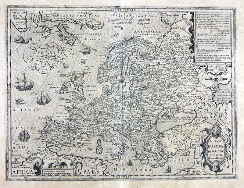
55-Nuova Europa Description: The map was printed in 1611, measures 37 x 49,2 cm and has several sailing-ship decorations. It expose Europe from Greenland to the Mediterranean Sea and, at east, to the Caspian Sea. Autor: Iodoco Hondio Place: Year: 1611 Quality document:
See online :
Go to verification |

