![]()
![]()
![]()
![]()
![]()
![]()


MY MAPS
Regions:
![]()
Browse the website:
Latest Acquisitions
A Brief History of Cartography
The Cartographers
Events on ancient maps
Accimo editions
Brochure MB
Contacts
Glossary
Sitemap
|
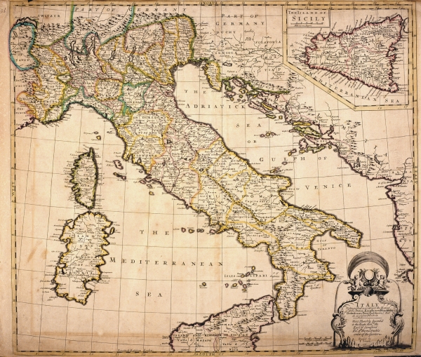
624-Italy Description: This map, measuring 49 x 56 cm comes from the John Senex atlas A new General Atlas of the World, printed in 1721 in London. It shows the Italian Peninsula with the political subdivisions, Corsica and Sardinia. Sicily appears in a square at the top. The mountains are approximately indicated, the most important water courses and roads however are described more exactly. A decorative black and white picture contains the title and just beside it are two graphic scales in English computed Miles and Italian Miles. Autor: John Senex Place: Londra Year: 1721 Quality document:
See online :
Go to verification |

