![]()
![]()
![]()
![]()
![]()
![]()


MY MAPS
Regions:
![]()
Browse the website:
Latest Acquisitions
A Brief History of Cartography
The Cartographers
Events on ancient maps
Accimo editions
Brochure MB
Contacts
Glossary
Sitemap
|
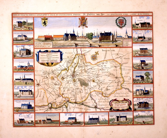
101-Nova et Exacta Tabula Salae et Castellanae Iprensis Description: The map created by Antonius Saderus in 1641, measuring 48.4 x 39 cm. At the top you can see the city and 3 coat of arms. To the inside 2 cartouche and a rose of the winds are found. Map of notable graphic effect. Autor: Antonius Saderus Place: Year: 1641 Quality document:
See online :
Go to verification |

