![]()
![]()
![]()
![]()
![]()
![]()


MY MAPS
Regions:
![]()
Browse the website:
Latest Acquisitions
A Brief History of Cartography
The Cartographers
Events on ancient maps
Accimo editions
Brochure MB
Contacts
Glossary
Sitemap
|
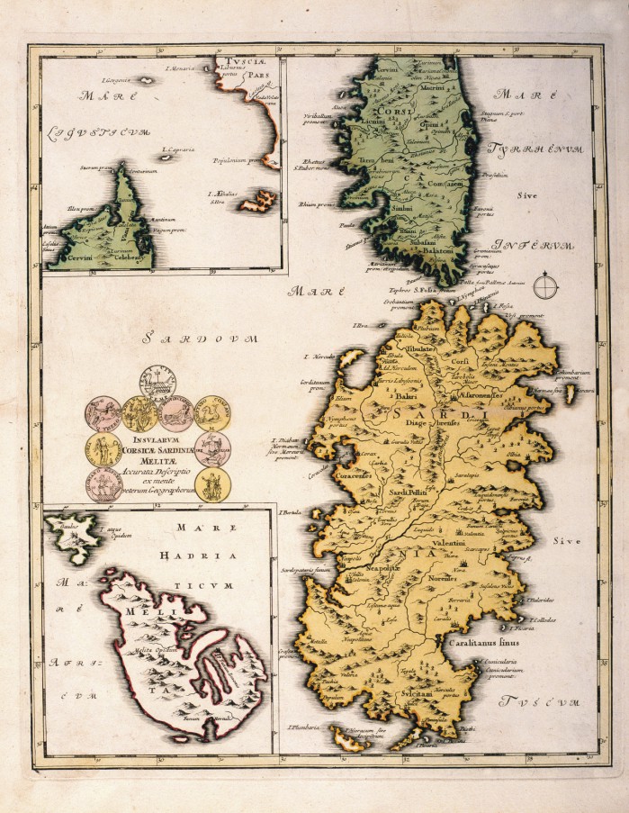
601-INSULARUM CORSICAE SARDINIAE MELITAE Description: Map of Christoph Weigel printed at Nuremberg in 1720 that measure cm 41x33, 2 and is located in Urbis terrarum veteribus cogniti. The paper offers Sardinia with Corsica, l0 ' island of Malta. The title is in a scroll left. Autor: Cristoph Weigel Place: Norimberga Year: 1720 Quality document:
See online :
Go to verification |

