![]()
![]()
![]()
![]()
![]()
![]()


MY MAPS
Regions:
![]()
Browse the website:
Latest Acquisitions
A Brief History of Cartography
The Cartographers
Events on ancient maps
Accimo editions
Brochure MB
Contacts
Glossary
Sitemap
|
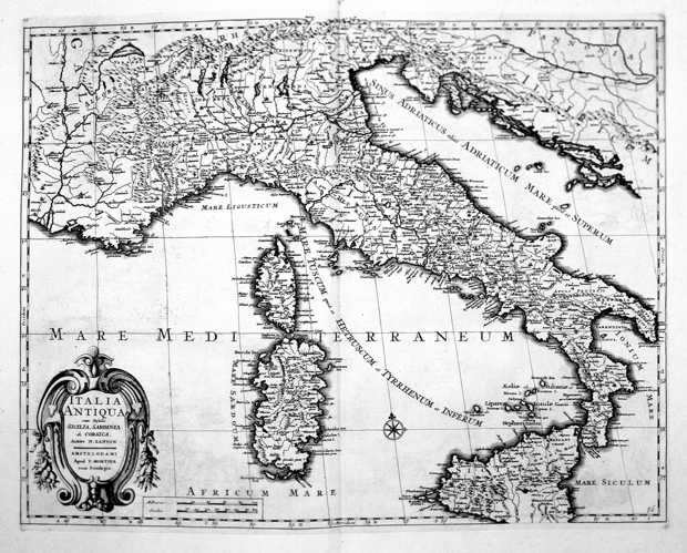
197-Italia Antiqua cum Insulis Sardinia, Sicilia & Corsica Description: The map measures 40,5 x 52,5 cm. It exposes Italy and a part of Europe with in the West, the Rhone Valley and the Alps, and in the East, Istria and the Balkans. Exept from the Balkans, the document proposes the sector of the South Europe according to Cluverius' representation in 1619. But Cluverius exposed Sardinia in a preciser way. This one is the typical drawing of Sanson based on Magini's knowledges. The map has in particular a historical interest. Autor: Nicolas Sanson Place: Amsterdam Year: 1679 Quality document:
See online :
Go to verification |

