![]()
![]()
![]()
![]()
![]()
![]()


MY MAPS
Regions:
![]()
Browse the website:
Latest Acquisitions
A Brief History of Cartography
The Cartographers
Events on ancient maps
Accimo editions
Brochure MB
Contacts
Glossary
Sitemap
|
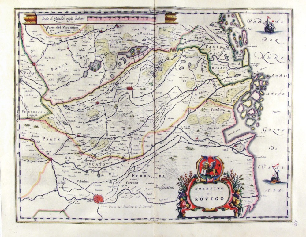
353-Polesino di Rovigo - Veneto Italia Description: The map, which measures 49,7 x 38 cm is located in the Atlas Theatrum Orbis Terrarum sive Atlas Novus-tertia pars of Guilelmus et Ioannis Blaeu, printed in Amsterdam in the workshop of Giovanni Blaeu in 1650. The Charter represents the Polesine, which is the sector most depressed the Po with Rovigo to downtown and the Duchy of Ferrara at the bottom. On top is the proposal a metric scale and lower right a cartouche with the title. Autor: Ioannis Blaeu Place: Amsterdam Year: 1650 Quality document:
See online :
Go to verification |
