![]()
![]()
![]()
![]()
![]()
![]()


MY MAPS
Regions:
![]()
Browse the website:
Latest Acquisitions
A Brief History of Cartography
The Cartographers
Events on ancient maps
Accimo editions
Brochure MB
Contacts
Glossary
Sitemap
|
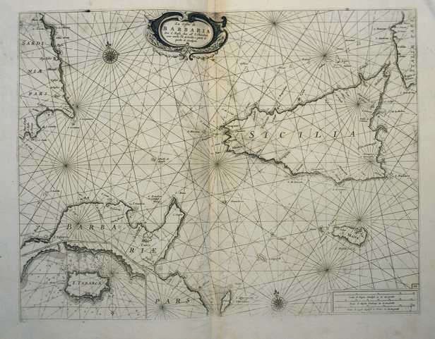
326-Le Coste della Barbaria da Capo Rosafino all'isola Chercheni con anche l'isola di Sic Description: The map measures 40 x 50,6 cm and belongs to the atlas Prima parte dello Specchio del Mare, published in 1664 in Genoa by F.M.Levanto. It exposes the South of the Thyrrenian Sea with the channel of Sardinia and Sicily, a sector of Tunisia with Cap Bon, the islands of Sicily, Malta Lampedusa and East Sardinia with the gulf of Cagliari. Tabarca, at that time frequented by the Genoese navigators, is represented with its surrounding sea bed in a very detailed way on the sector below on the left. Autor: Francesco Maria Levanto Place: Genova Year: 0 Quality document:
See online :
Go to verification |
