![]()
![]()
![]()
![]()
![]()
![]()


MY MAPS
Regions:
![]()
Browse the website:
Latest Acquisitions
A Brief History of Cartography
The Cartographers
Events on ancient maps
Accimo editions
Brochure MB
Contacts
Glossary
Sitemap
|
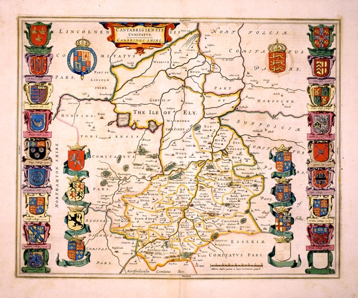
175-Cantabrigiensis Comitatus. Cambridge Shire Description: The region of Cambridge in England. An important historical and geographical map, showing the precise borders of different regions, 28 blazons, a decorative title picture on the top right and a graphic scale at the bottom. This map of the 17th century measures 41,6 x 52cm. Autor: Ioannis Blaeu Place: Amsterdam Year: 0 Quality document:
See online :
Go to verification |

