![]()
![]()
![]()
![]()
![]()
![]()


MY MAPS
Regions:
![]()
Browse the website:
Latest Acquisitions
A Brief History of Cartography
The Cartographers
Events on ancient maps
Accimo editions
Brochure MB
Contacts
Glossary
Sitemap
|
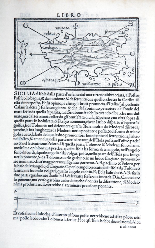
446-Sardegna di Bordone e descrizione di Sicilia Description: The map measures 8.4 x 14.6 cm in the design and the work is published in Venice in 1528 Libro di Benedetto Bordone nel qual si ragiona di tutte l’isole del mondo con li loro nomi antichi et moderni, historie, favole, et modi di loro vivere, et in qual parte del mare stanno, et in qual parallelo et clima giacciono con il breve di Papa Leone et gratia et pri vilegio della Illustrissima Signoria com’in quelli appare. MDXXVIII. the left, while overhead a cross indicates the East, presents the directions of the eight principal winds but does not accompany the graded edges, or to map grid, or of scale. The name of the island lies in the north-east and on the left is represented the extreme southern part of Corsica in the name of that island. Autor: Bordone Place: Venezia Year: 1528 Quality document:
See online :
Go to verification |

See the printed version: Click here
