![]()
![]()
![]()
![]()
![]()
![]()


MY MAPS
Regions:
![]()
Browse the website:
Latest Acquisitions
A Brief History of Cartography
The Cartographers
Events on ancient maps
Accimo editions
Brochure MB
Contacts
Glossary
Sitemap
11 results
|
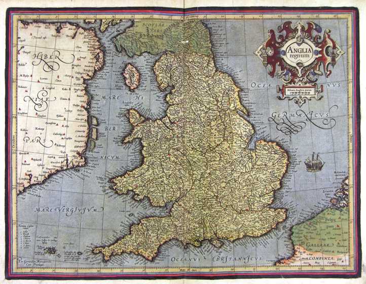
166-Anglia Regnum - Gran Bretagna .
The map belongs to the Atlas sive Cosmographicae Meditationes de Fabrica Mundi et Fabricati Figura, published in 1644 in Duisburg.
Author: Gerardo Mercatore
Duisburg,1644 |
|
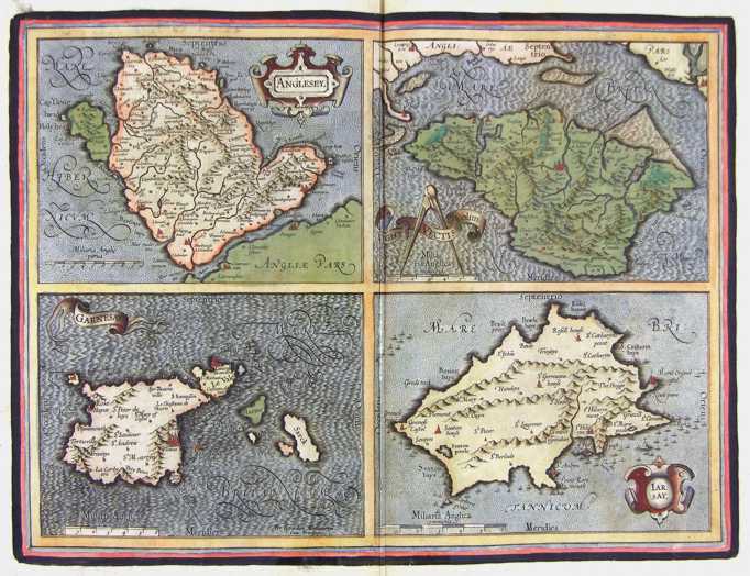
167- Isole Inglesi - Gran Bretagna .
The map belongs to the Atlas sive Cosmographicae Meditationes de Fabrica Mundi et Fabricati Figura, published in 1644 in Duisburg.
Author: Gerardo Mercatore
Duisburg,1644 |
|
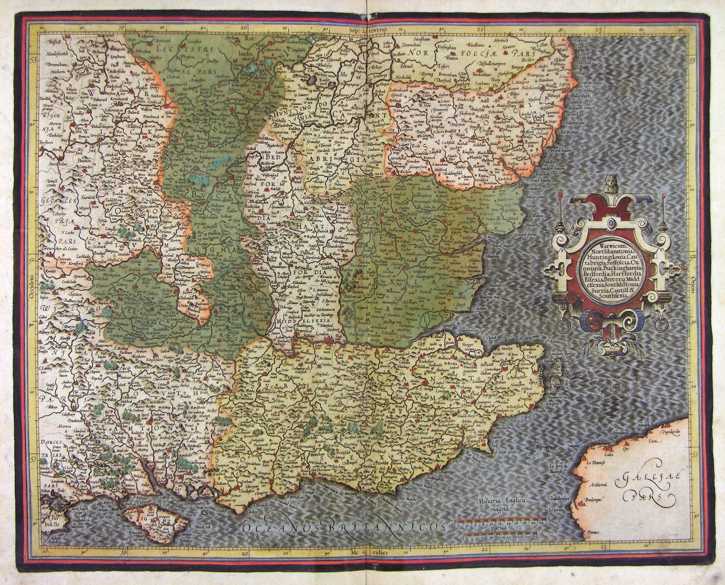
168-Gran Bretagna Sud Orientale .
The map belongs to the Atlas sive Cosmographicae Meditationes de Fabrica Mundi et Fabricati Figura, published in 1644 in Duisburg.
Author: Gerardo Mercatore
Duisburg,1644 |
|
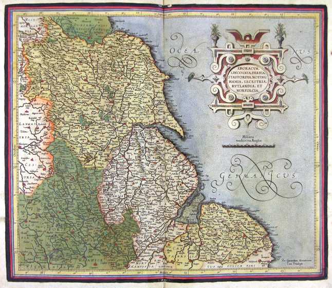
169-Gran Bretagna Centro Orientale .
The map belongs to the Atlas sive Cosmographicae Meditationes de Fabrica Mundi et Fabricati Figura, published in 1644 in Duisburg.
Author: Gerardo Mercatore
Duisburg,1644 |
|
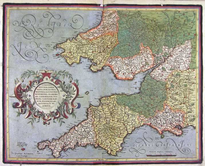
170-Gran Bretagna Centro Occidentale .
The map belongs to the Atlas sive Cosmographicae Meditationes de Fabrica Mundi et Fabricati Figura, published in 1644 in Duisburg.
Author: Gerardo Mercatore
Duisburg,1644 |
|
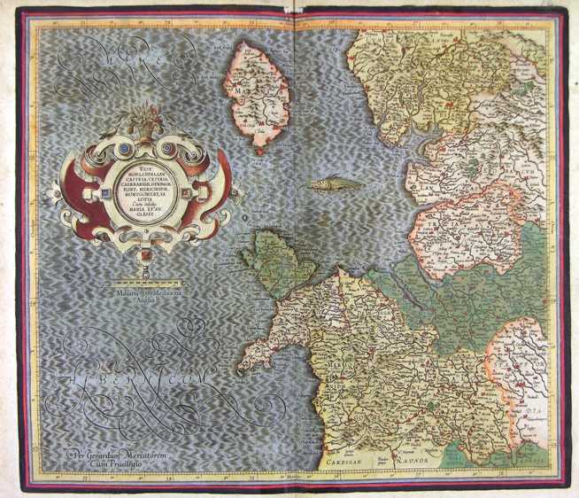
171-Gran Bretagna Sud Occidentale .
The map belongs to the Atlas sive Cosmographicae Meditationes de Fabrica Mundi et Fabricati Figura, published in 1644 in Duisburg.
Author: Gerardo Mercatore
Duisburg,1644 |
|
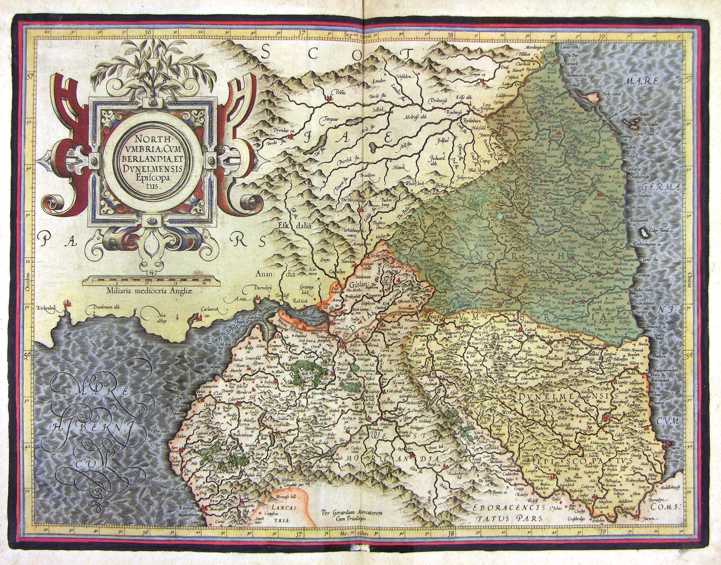
172-North Umbria - Gran Bretagna .
The map belongs to the Atlas sive Cosmographicae Meditationes de Fabrica Mundi et Fabricati Figura, published in 1644 in Duisburg.
Author: Gerardo Mercatore
Duisburg,1644 |
|
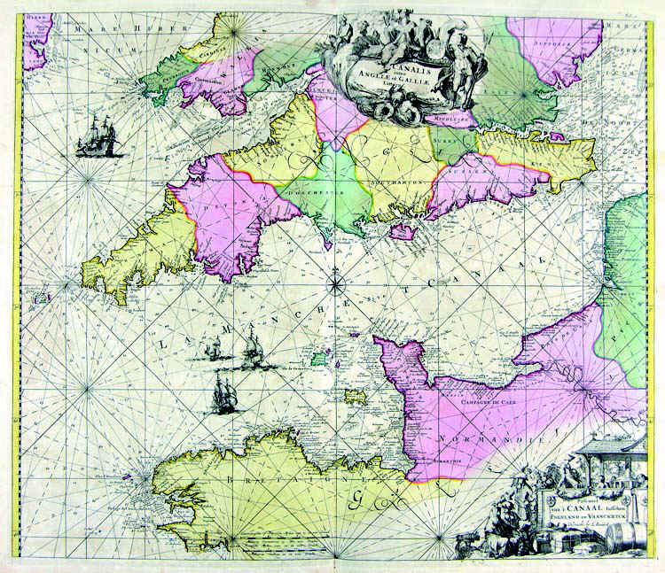
173-Stretto della Manica .
The map belongs to the Atlas de la Navigationet du Commerce qui se fait dans touts le Parties du Monde, published in 1715 in Amsterdam. Author: Louis Renard
Amsterdam,1715 |
|
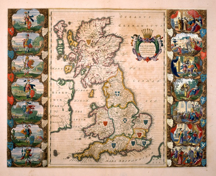
174-Bitannia .
Great Britain and a part of Ireland. This map of the 16thcentury measures 56 x 41 cm and distinguishes the island in seven regions, each of them with a blazon. There are fourteen historical scenes on the sides. The title picture on the right shows the inscription Prout divisa fuit temporibus Anglo-Saxonum praesertim durante illorum Heptarchia. Author: Willem and Ioannis Blaeu
Amsterdam,0 |
|
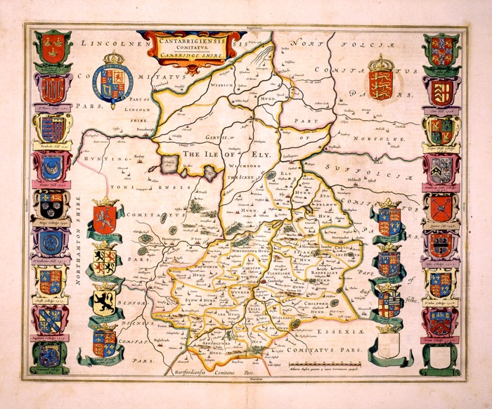
175-Cantabrigiensis Comitatus. Cambridge Shire .
The region of Cambridge in England. An important historical and geographical map, showing the precise borders of different regions, 28 blazons, a decorative title picture on the top right and a graphic scale at the bottom. This map of the 17th century measures 41,6 x 52cm. Author: Ioannis Blaeu
Amsterdam,0 |
|
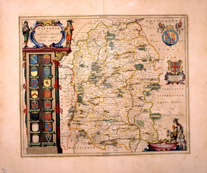
176-Wiltonia. Sive comitatus wiltoniensis; anglis wil shire .
This map of the 17 thcentury, measures 49,5 x 41 and shows a beautiful title picture standing over a column of sixteen blazons on the left and two decorative pictures and a graphic scale with scenes of that epoch on the right. The water courses are precisely drawn, however the hills are approximatively distributed all over the whole region. Author: Ioannis Blaeu
Amsterdam,0 |
