![]()
![]()
![]()
![]()
![]()
![]()


MY MAPS
Regions:
![]()
Browse the website:
Latest Acquisitions
A Brief History of Cartography
The Cartographers
Events on ancient maps
Accimo editions
Brochure MB
Contacts
Glossary
Sitemap
|
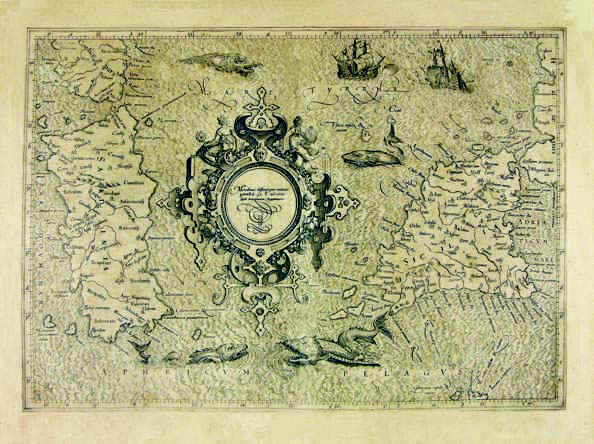
Sardinia Description: The map was taken from the atlas Theatri Geographiae Veteris Tomus Prior in quo Cl. Ptol. Alexandrini Geographiae libri VIII, printed in 1619 in Amsterdam. The map measures 32,3 x 45,8cm and represents Sardinia, South Corsica and a small sector of the South West of Italy which corresponds to South Calabria looking onto the Thyrrenian Sea , Sicily and the Aegadian and Aeolian Islands. Autor: Pietro Bertio Place: Amsterdam Year: 1619 Quality document:
See online :
Go to verification |
See the printed version: Click here
