![]()
![]()
![]()
![]()
![]()
![]()


MY MAPS
Regions:
![]()
Browse the website:
Latest Acquisitions
A Brief History of Cartography
The Cartographers
Events on ancient maps
Accimo editions
Brochure MB
Contacts
Glossary
Sitemap
5 results
|
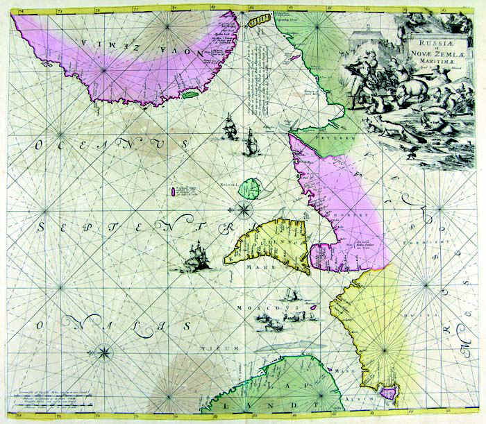
40-Russia e Nova Zemla .
The map belogs to the Atlas de la Navigation et du Commerce qui se fait dans toutes les Parties du Monde, published in 1715 in Amsterdam. It has an elegant design taken from a precious engraving. Dimensions : cm 56,5 x 50 Author: Louis Renard
Amsterdam. ,1715 |
|
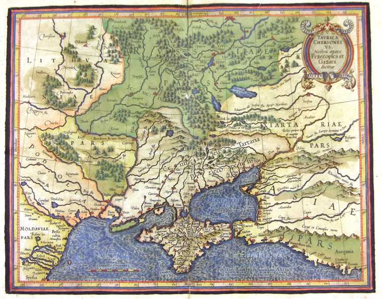
41-Russia e Mar Nero .
The map belongs to the Atlas sive Cosmographicae Meditationes de Fabrica Mundi et Fabricati Figura, published in 1644 in Duisburg. Dimensions: 40,5 x 32 cm. Author: Gerardo Mercatore
Duisburg. ,1644 |
|
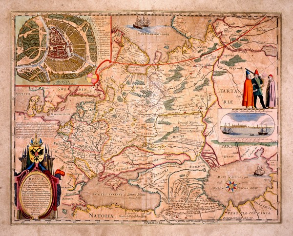
42-Russia .
The European Russia. A picture of Moscou by Fedori Borisowitsi appears at the top and a view of Archangelsckagoroda with a graphic scale in Germanic miles and three exotic figures are on the right. This map of 1614 is dedicated to Hesselo Gerardo and measures 54 x42,5cm. Author: Fedori Borisowitsi
,1614 |
|
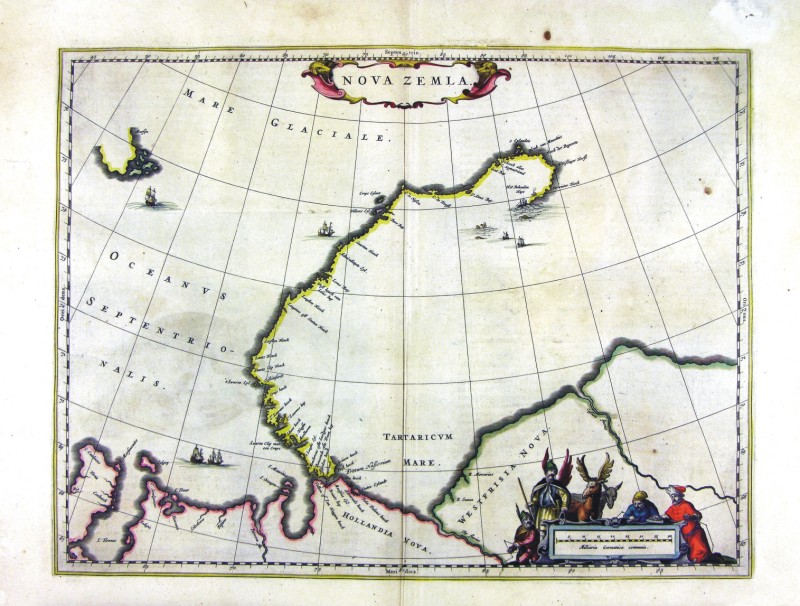
58-Nova Zemla .
The map belongs to the Geographia, quae est cosmographiae Blauianae pars prima, qua orbisterrae tabulis ante oculus ponitus et descriptionibus illustratur, published in 1665 in Amsterdam. Dimensions : cm 49,5 x 37,5 Author: Ioannis Blaeu
Amsterdam,1665 |
|
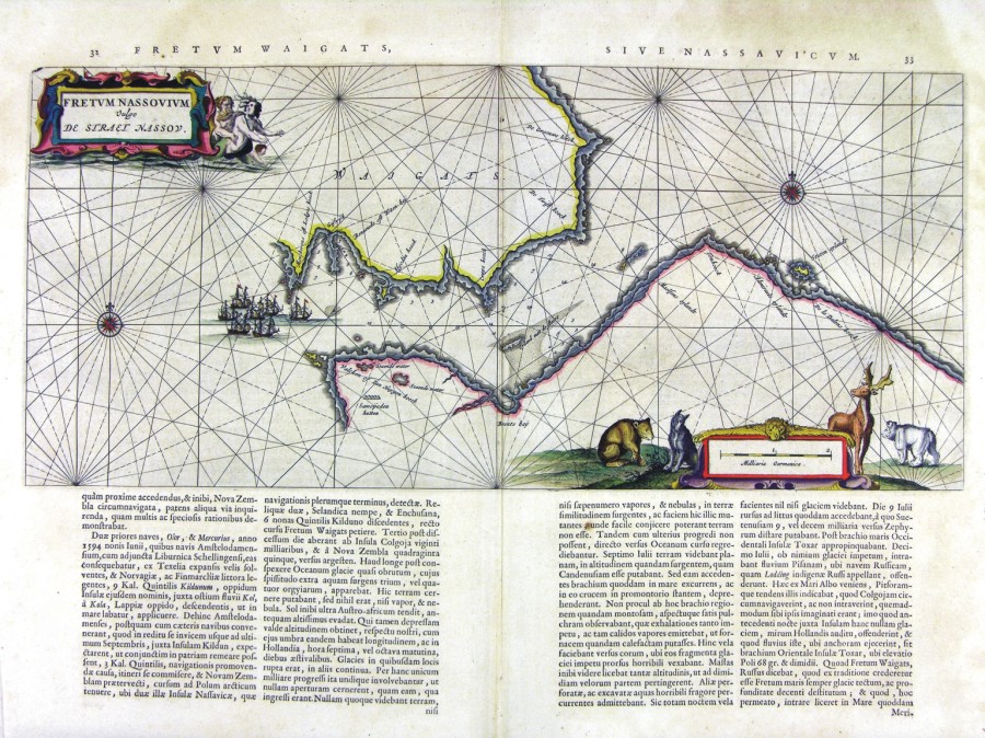
424-Fretum Nassovium .
Author: Ioannis Blaeu
Amsterdam,1660 |
