![]()
![]()
![]()
![]()
![]()
![]()


MY MAPS
Regions:
![]()
Browse the website:
Latest Acquisitions
A Brief History of Cartography
The Cartographers
Events on ancient maps
Accimo editions
Brochure MB
Contacts
Glossary
Sitemap
|
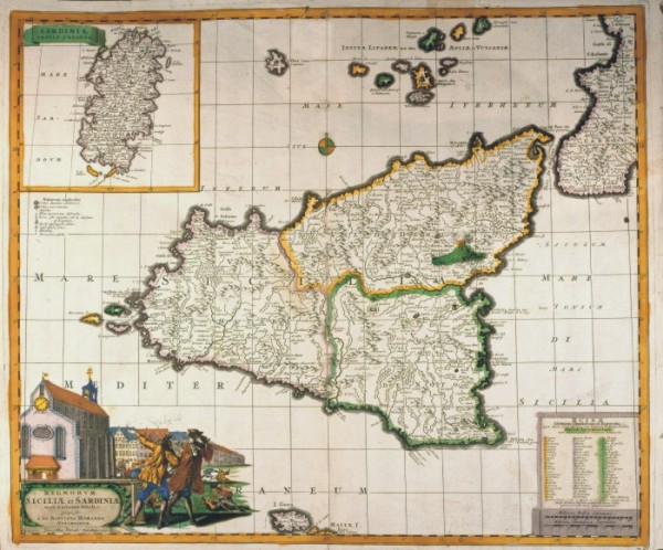
615-Regnum Siciliae et Sardeiniae Description: his map, measuring 37 x 48 cm and drawn by Johann Baptist Homann, was printed by the editor Funke at the beginning of the 17th century in Nuremberg. It shows Sicily, divided in its three main parts, Etna and the smaller islands. Sardinia with its title of Sardiniae Insula & Regnum appears in a square on the top left. The main title however is included in a picture decorated with beautiful designs of a church, buildings and other scenes at the bottom left. There is also a square on the bottom right containing the names of the inhabited centres, destroyed by the big earthquake in 1693. The graphic scales in Milliaria Italica Communia and Milliaria Germanica Communia are just below it. Autor: Homanno Place: Norimberga Year: 0 Quality document:
See online :
Go to verification |

