![]()
![]()
![]()
![]()
![]()
![]()


MY MAPS
Regions:
![]()
Browse the website:
Latest Acquisitions
A Brief History of Cartography
The Cartographers
Events on ancient maps
Accimo editions
Brochure MB
Contacts
Glossary
Sitemap
8 results
|
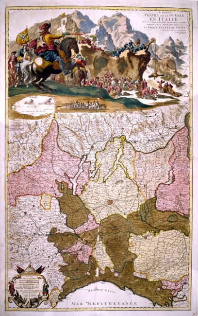
204-Le Grand Theatre de Guerre en Italie .
North Italy, from Liguria to the borders of Switzerland, with Milan in the centre. At the top a coloured picture of war scenes in Cremona shows the entrance of the Prince of Savoy with three thousand men.
The map also includes a fine description of the mountains, of the water courses, of the borders of the states and of the main roads. This splendid vertical map, drawn by the engineers in Eugenio of Savoy’s army, was printed in Amsterdam by Pierre Mortier and measures 97 x 59,5 cm. Author: Pierre Mortier
Amsterdam ,0 |
|
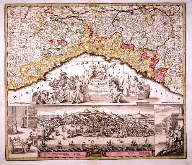
Republicae Genuensis Dominium .
Liguria from Ventimiglia in the West to the Dukedom of Massa in the East. There is a very beautiful title picture in the centre and a splendid drawing of the town of Genoa at the bottom. This well-drawn map is an interesting geographical and historical document and measures 56,8 x 49 cm. Author: Seutter Matteo
Augusta ,1740 |
|
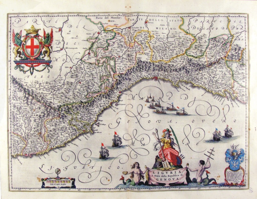
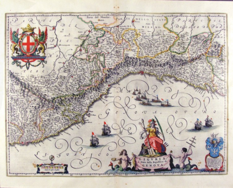
250-Liguria o Stato della Repubblica di Genova - Liguria - Italia .
The Charter, which measures ' 50.5 x 37.5 is located in the Atlas Theatrum Orbis Terrarum sive Atlas Novus-tertia pars of Guilelmus et Ioannis Blaeu, printed in Amsterdam in the workshop of Giovanni Blaeu in 1650. Charter graphically pleasing enriched by l±d and drawing with a large number of vessels sailing in the Gulf of Genoa. Liguria is surrounded by a circle montano and North is a part of Monferrato and the rule of Milan.
Author: Ioannis Blaeu
Amsterdam ,1650 |
|
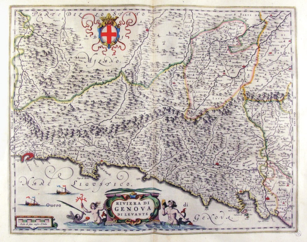
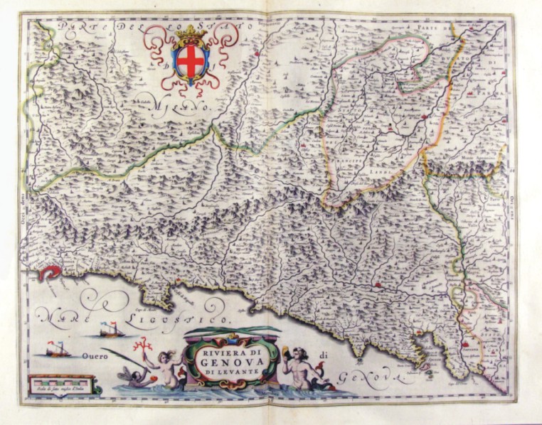
252-Riviera di Genova di Levante - Liguria - Italia .
The Charter, that measure cm 49 x 39 is located in the Atlas Theatrum Orbis Terrarum sive Atlas Novus-tertia pars of Guilelmus et Ioannis Blaeu, printed in Amsterdam in the workshop of Giovanni Blaeu in 1650. Charter graphically pleasing that offers Liguria Eastern scale greater than the previous, the Southern Piedmont. The title is contained in a nice title block adorned by mythological figures. A nice lable top offers the cross of the Republic of Genoa. Author: Ioannis Blaeu
Amsterdam ,1650 |
|
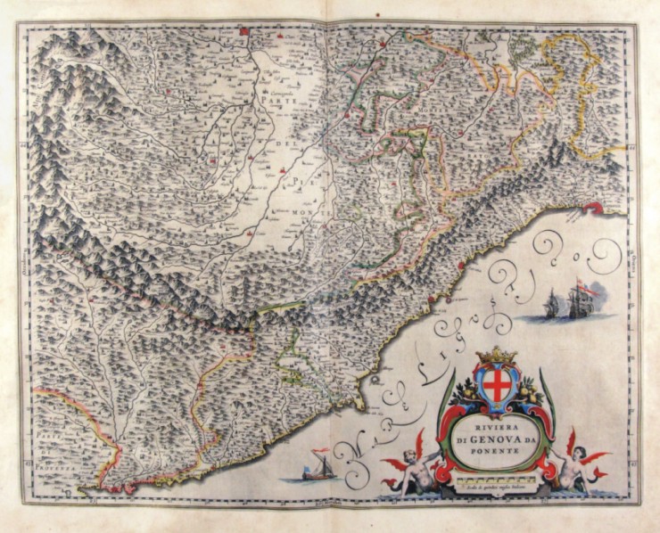
253-Riviera di Genova di Ponente - Liguria - Italia .
The Charter, which measures ' 48.7 x 38 is located in the Atlas Theatrum Orbis Terrarum sive Atlas Novus-tertia pars of Guilelmus et Ioannis Blaeu, printed in Amsterdam in the workshop of Giovanni Blaeu in 1650. Charter graphically pleasing that offers the western Liguria to larger scale than the previous, Piedmont meridioneale. The title is contained in a nice lable. Author: Ioannis Blaeu
Amsterdam ,1650 |
|
254-Riviera di Genova di Ponente - Liguria - Italia .
The Charter, that measure cm 49 x 38, is contained in the Atlas Geographiae Blavianae volumen octavum Quo Italy quae est Europae Liber XVI of Blaeu printed in Amsterdam in 1662. Charter graphically pleasing that offers the western Liguria to larger scale than the previous, Piedmont meridioneale. The title is contained in a nice lable. Author: Ioannis Blaeu
Amsterdam ,1662 |
|
255-Riviera di Genova di Levante - Liguria - Italia .
The Charter, that measure cm 49 x 39, is contained in the Atlas Geographiae Blavianae volumen octavum Quo Italy quae est Europae Liber XVI of Blaeu printed in Amsterdam in 1662. Charter graphically pleasing that offers Liguria Eastern from Genoa up in Sarzana. The title is contained in a nice title block adorned by mythological figures. A nice lable top offers the cross of the Republic of Genoa. Author: Ioannis Blaeu
Amsterdam ,1662 |
|
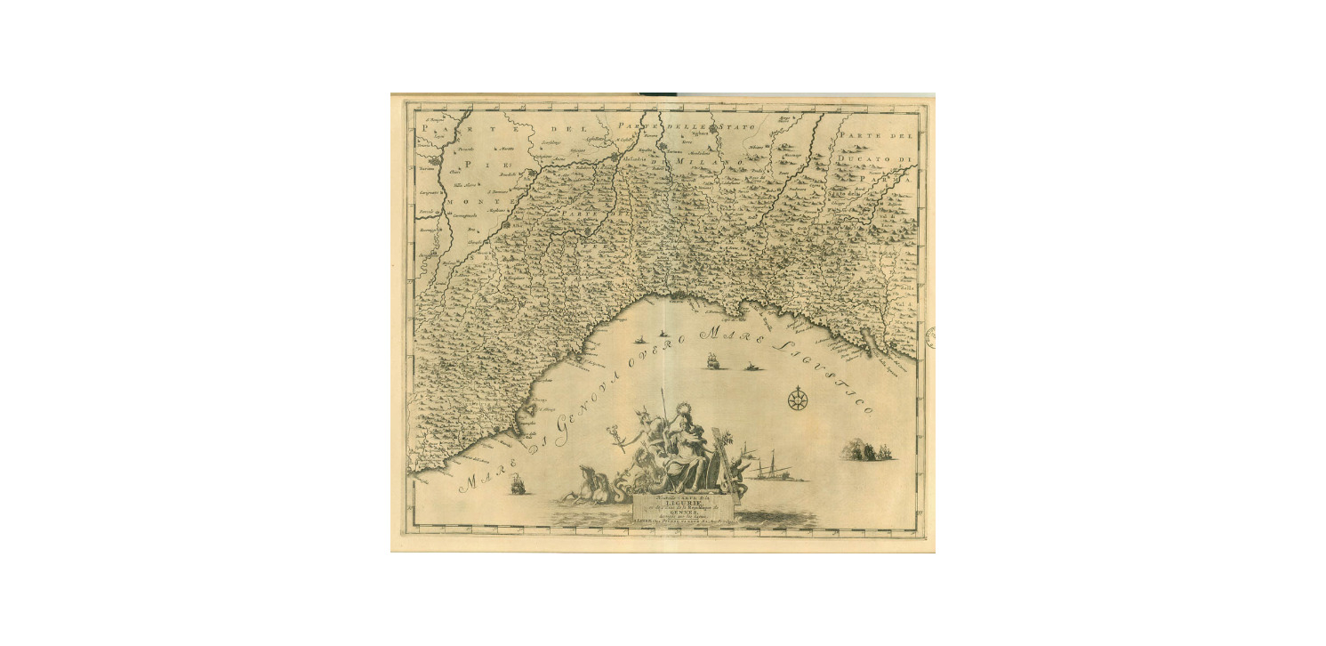
858-Carte de la Ligurie .
Author: Pieter Van Der Aa
,1729 |
