![]()
![]()
![]()
![]()
![]()
![]()


MY MAPS
Regions:
![]()
Browse the website:
Latest Acquisitions
A Brief History of Cartography
The Cartographers
Events on ancient maps
Accimo editions
Brochure MB
Contacts
Glossary
Sitemap
|
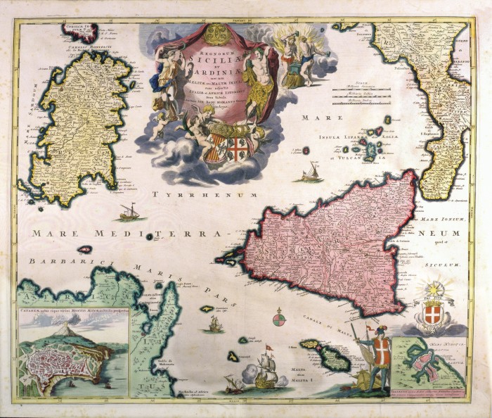
613-Siciliae e Srdiniae Description: This map, measuring 48,8 x 57,7 cm and drawn by Johann Baptist Homann, was printed in 1705 in Nuremberg. It shows the South Tyrrhenian Sea with the islands and the surrounding territories. The town of Catania with Etna appears in a square on the bottom left; a festoon at the top contains the title; the graphic scales in Milliaria Germanica, Milliaria Italica, Milliaria Gallica are on the right. The mountain ranges are indicated by mole-hill reliefs, a rich river network and the most important towns and theirs fortifications, are described as well. There is a green-pink wind rose, several battleships and boats at sea. Autor: Homann Place: Norimberga Year: 1705 Quality document:
See online :
Go to verification |

