![]()
![]()
![]()
![]()
![]()
![]()


MY MAPS
Regions:
![]()
Browse the website:
Latest Acquisitions
A Brief History of Cartography
The Cartographers
Events on ancient maps
Accimo editions
Brochure MB
Contacts
Glossary
Sitemap
|
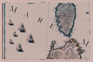
647- Isola e Regno di Sardegna Description: The map is in a composite volume that has as title Theater of the War and it is the n. 7 of a harvests of 11 colored presses. This document, that introduces aloft the North and it measures cm 64,6 xes 42,0 and in the sketch cm 61,5 xes 38,8, are part of a General Paper of Italy produced by unknown author at the end of the XVIII century; in the preserved volume in the library Casanatenses are present only some of the ten presses that compose this work, among which the first one represents western Sicily, and the second proposes a part of that oriental and of Calabria and contains a Table of the Longitude and Latitude of the places of the present paper fixed on the most recent astronomic observations and the indication that You latitude is taken by the first meridian of the island of the iron. Among the other ones they are present the followings data that, he/she is specified, they have fixed above geographical combinations. Autor: Antonio Zatta Place: Livorno Year: 1752 Quality document:
See online :
Go to verification |

See the printed version: Click here
