![]()
![]()
![]()
![]()
![]()
![]()


MY MAPS
Regions:
![]()
Browse the website:
Latest Acquisitions
A Brief History of Cartography
The Cartographers
Events on ancient maps
Accimo editions
Brochure MB
Contacts
Glossary
Sitemap
|
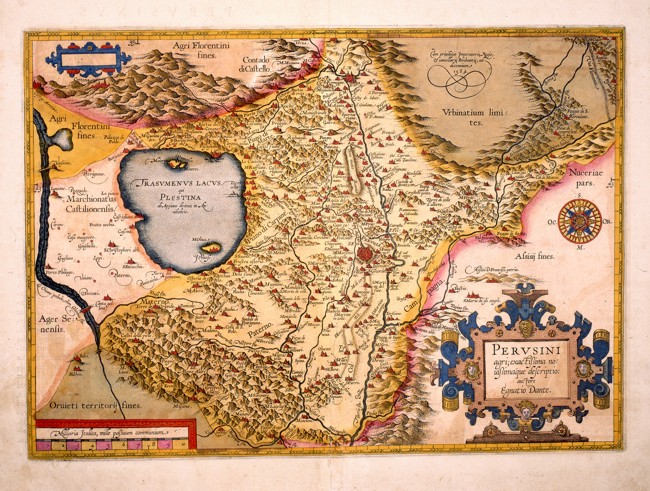
Perusini Agri Description: Umbria with Perugia in the centre and the surrounding places, described with red perspective drawings. The water courses and Lake Trasimeno are intricately drawn, however the hills are approximatively distributed all over the whole region. The borders of the neighbouring territories are more intensively coloured, as are the territories of Urbino in the North East, Florence to the North, Siena to the West and Orvieto in the South. This detailed coloured map of the 17th century, is drawn by the cartographer Ignatius Dante and measures 46,5 x 32,8 cm. Autor: Dante Egnatio Place: Anversa Year: 1584 Quality document:
See online :
Go to verification |
