![]()
![]()
![]()
![]()
![]()
![]()


MY MAPS
Regions:
![]()
Browse the website:
Latest Acquisitions
A Brief History of Cartography
The Cartographers
Events on ancient maps
Accimo editions
Brochure MB
Contacts
Glossary
Sitemap
|
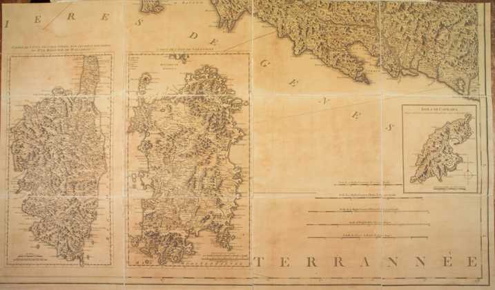
106-Carta di Sardegna e Corsica Description: The map was printed in 1784 and belongs to the cartographic map collection of Genoa's Republic, which is composed of 8 documents. Dimensions: 52 x 47 cm. Autor: Ives Gravier Place: Genova Year: 1784 Quality document:
See online :
Go to verification |

