![]()
![]()
![]()
![]()
![]()
![]()


MY MAPS
Regions:
![]()
Browse the website:
Latest Acquisitions
A Brief History of Cartography
The Cartographers
Events on ancient maps
Accimo editions
Brochure MB
Contacts
Glossary
Sitemap
|
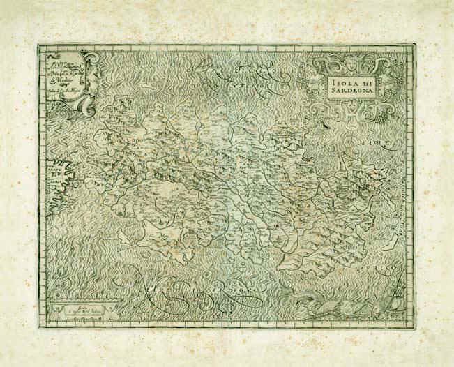
303-Island of Sardinia Description: The map measures 34 x 44,5 cm and belongs to Magini's Atlas Italia, printed in 1620 in Bologna. Considering the long side of the island, the scale is about 1:736 000. The margins are graduated and subdivided in 1', but there are no numeral references.The edge beneath on the right is decorated with a seamonster tracking a sailing vessel. The other edges have three decorated pictures, the one above on the right contains the title Isola di Sardegna Autor: Giovanni Antonio Magini Place: Bologna Year: 1620 Quality document:
See online :
Go to verification |

See the printed version: Click here
