![]()
![]()
![]()
![]()
![]()
![]()


MY MAPS
Regions:
![]()
Browse the website:
Latest Acquisitions
A Brief History of Cartography
The Cartographers
Events on ancient maps
Accimo editions
Brochure MB
Contacts
Glossary
Sitemap
|
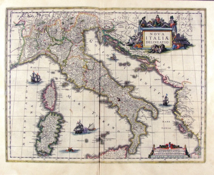
201-Nova Italiae Delineatio di Ioannis Blaeu Description: The map measures 49 x 38 cm and belongs to the atlas Theatrum Orbis Terrarum sive Atlas Novus - pars tertia - Guilelmus et Ioannis Blaeu, printed in 1650 in the Blaeu's family workshop in Amsterdam. The document shows the Italian peninsula with the islands of Sardinia and Corsica, a part of Sicily and Dalmatia. A beautiful decorating picture exposes the title and several sailing ships enrich the graphic aspect. Autor: Giovanni Blaeu Place: Amsterdam Year: 1650 Quality document:
See online :
Go to verification |

