![]()
![]()
![]()
![]()
![]()
![]()


MY MAPS
Regions:
![]()
Browse the website:
Latest Acquisitions
A Brief History of Cartography
The Cartographers
Events on ancient maps
Accimo editions
Brochure MB
Contacts
Glossary
Sitemap
20 results

|
12-Aquitania .
The map is found in the Atlas sive Cosmographicae Meditationes de Fabrica Mundi et Fabricati Figura, published to Duisburg in the 1611. Dimensions: cm 47,5 x 36,3 Author: Gerardo Mercatore
Duisburg. ,1611 |
|
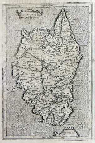
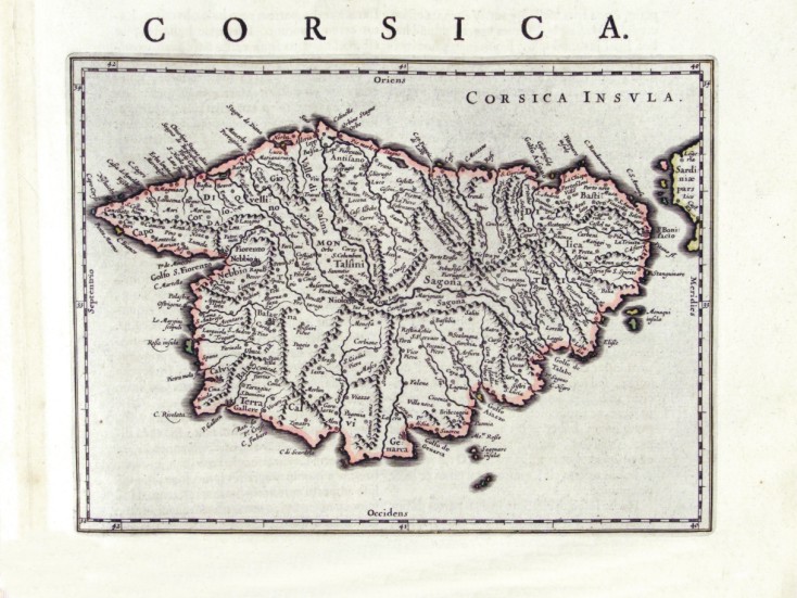
108-Corsica .
The map-drawing measures 22,5 x 38 cm and the whole 27,5 x 44 cm. It can be found on page 280 in the 4th edition of the Atlas sive Cosmographicae Meditationes de Fabrica Mundi et Fabricati Figura, published in 1611 in Duisburg. Author: Gerardo Mercatore
Amsterdam,1611 |
|
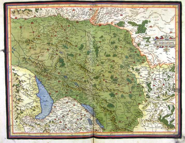
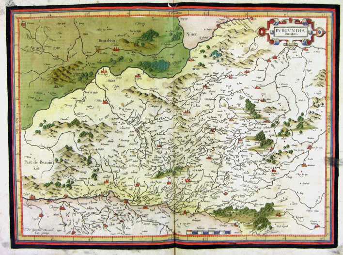
109-Burgundia - Francia .
The map belongs to the Atlas sive Cosmographicae Meditationes de Fabrica Mundi et Fabricati Figura, published in 1611 in Duisburg.
Dimensions: 46,4 x 36,5 cm.
Author: Gerardo Mercatore
Duisburg,1611 |
|
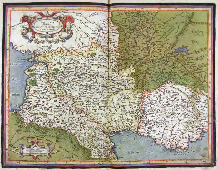
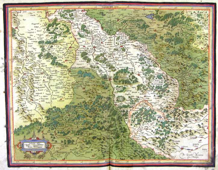
110-Aquitania - Francia .
The map belongs to the Atlas sive Cosmographicae Meditationes de Fabrica Mundi et Fabricati Figura, published in 1611 in Duisburg.
Dimensions: 47,5 x 36,3 cm. Author: Gerardo Mercatore
Duisburg,1611 |
|
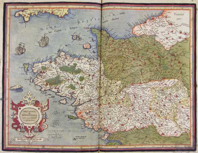
111-Britannia e Normandia - Francia .
The map belongs to the Atlas sive Cosmographicae Meditationes de Fabrica Mundi et Fabricati Figura, published in 1611 in Duisburg.
Dimensions: 47,5 x 36 cm. Author: Gerardo Mercatore
Duisburg,1611 |
|
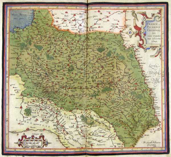
112-Picardie Champagne - Francia .
The map belongs to the Atlas sive Cosmographicae Meditationes de Fabrica Mundi et Fabricati Figura,published in 1611 in Duisburg.
Dimensions: 41 x 37 cm. Author: Gerardo Mercatore
Duisburg,1611 |
|
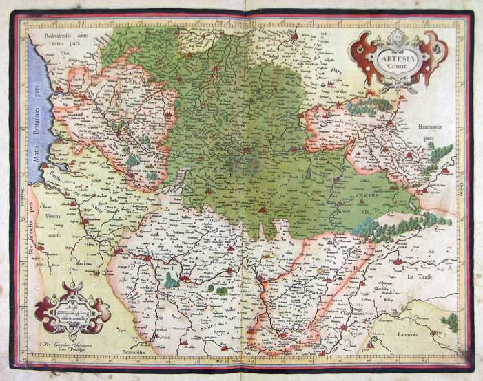
113-Artesia - Francia .
The map belongs to the Atlas sive Cosmographicae Meditationes de Fabrica Mundi et Fabricati Figura, published in 1611 in Duisburg.
Dimensions: 46 x 36 cm.
Author: Gerardo Mercatore
Duisburg,1611 |
|
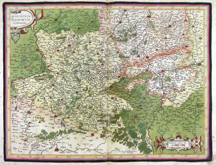
114-Hannonia - Francia .
The map belongs to the Atlas sive Cosmographicae Meditationes de Fabrica Mundi et Fabricati Figura, published in 1611 in Duisburg.
Dimensions: 47,5 x 36,4 cm.
Author: Gerardo Mercatore
Duisburg,1611 |
|
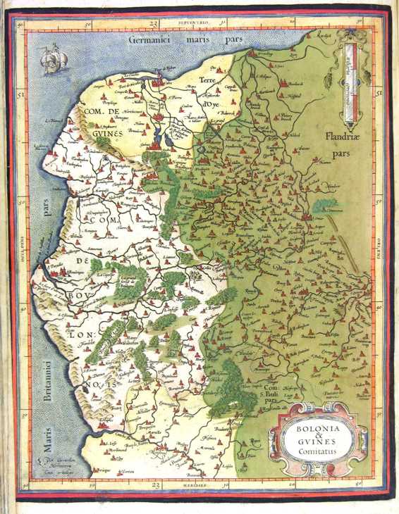
115-Bolonia e Guines - Francia .
The map belongs to the Atlas sive Cosmographicae Meditationes de Fabrica Mundi et Fabricati Figura, published in 1611 in Duisburg.
Dimensions: 33 x 26 cm. Author: Gerardo Mercatore
Duisburg,1611 |
|
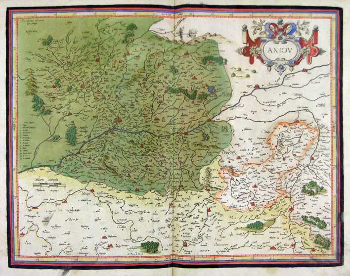
116-Aniou - Francia .
The map belongs to the Atlas sive Cosmographicae Meditationes de Fabrica Mundi et Fabricati Figura, published in 1611 in Duisburg.
Dimensions: 47 x 36,5 cm. Author: Gerardo Mercatore
Duisburg,1611 |
|
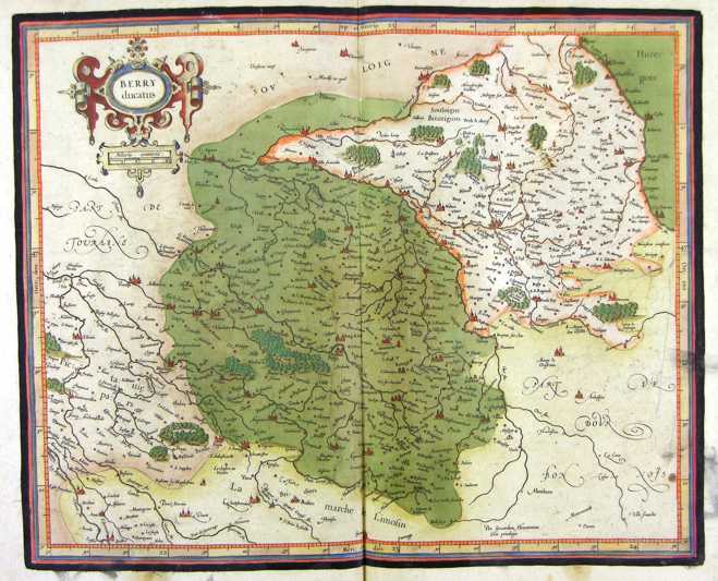
117-Berry - Francia .
The map belongs to the Atlas sive Cosmographicae Meditationes de Fabrica Mundi et Fabricati Figura, published in 1611 in Duisburg.
Dimensions: 42,6 x 36 cm. Author: Gerardo Mercatore
Duisburg ,1611 |
|
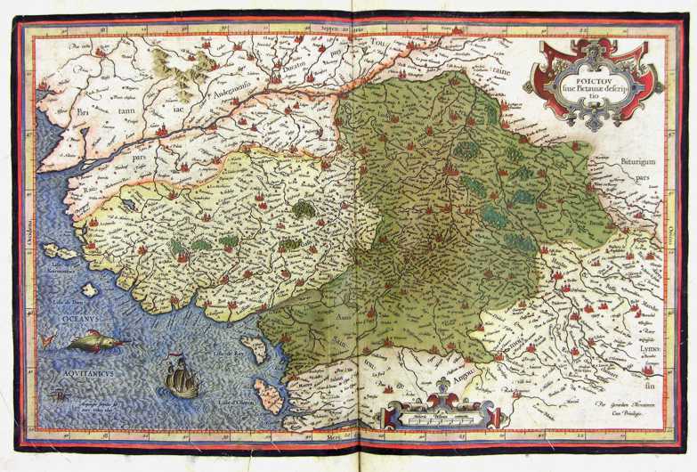
118-Poictou - Francia .
The map belongs to the Atlas sive Cosmographicae Meditationes de Fabrica Mundi et Fabricati Figura, published in 1611 in Duisburg.
Dimensions: 46 x 30 cm. Author: Gerardo Mercatore
Duisburg,1611 |
|
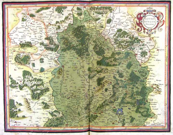
119-Lotharingia - Francia .
The map belongs to the Atlas sive Cosmographicae Meditationes de Fabrica Mundi et Fabricati Figura, published in 1611 in Duisburg.
Dimensions: 47 x 37 cm. Author: Gerardo Mercatore
Duisburg,1611 |
|
120-Lotharingia - Francia .
The map belongs to the Atlas sive Cosmographicae Meditationes de Fabrica Mundi et Fabricati Figura, published in 1611 in Duisburg.
Dimensions: 46,8 x 37 cm. Author: Gerardo Mercatore
Duisburg,1611 |
|
121-Burgundia - Francia .
The map belongs to the Atlas sive Cosmographicae Meditationes de Fabrica Mundi et Fabricati Figura, published in 1611 in Duisburg. Author: Gerardo Mercatore
Duisburg,1611 |
|
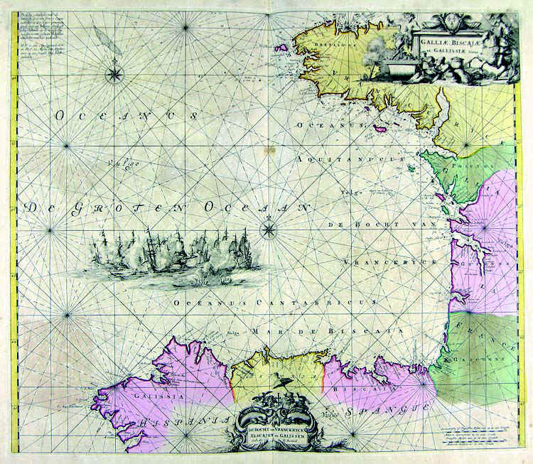
122-Golfo di Biscaglia .
The map belongs to the Atlas de la Navigationet du Commerce qui se fait dans touts le Parties du Monde, published in 1715 in Amsterdam.
Dimensions: 56,6 x 48,5 cm. Author: Louis Renard
Amsterdam,1715 |
|
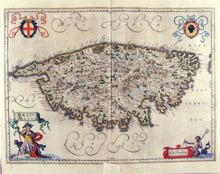
123-Corsica Insula - Francia .
The map belongs to the Atlas Geographiae Blavianae volumen octavum Quo Italia quae est Europae Liber XVI di Blaeu. Published in 1662 in Amsterdam. The map, which is decorated with four cartouches with the Moor at the top right of the flag at the bottom of the scale, the cross at the top right of the republic of Genoa and bottom of a figure with a banner which is contained in the title. The menu offers an island of Corsica full of place names, with the cities represented with red design perspective, many forests and with a good representation of orography and hydrography.
Author: Ioannis Blaeu
Amsterdam,1662 |
|
124-Corsica - Francia .
The map measures 24 x 17,8 cm and belongs to the atlas Theatrum Orbis Terrarum sive Atlas Novus - pars tertia - Guilelmus et Ioannis Blaeu, printed in 1650 in the Blaeu's family workshop in Amsterdam. Corsica is exposed in a small scale, but with plenty of citynames. The island also has a schematic representation of the hydrography and the orography. Author: Ioannis Blaeu
Amsterdam,1650 |
|
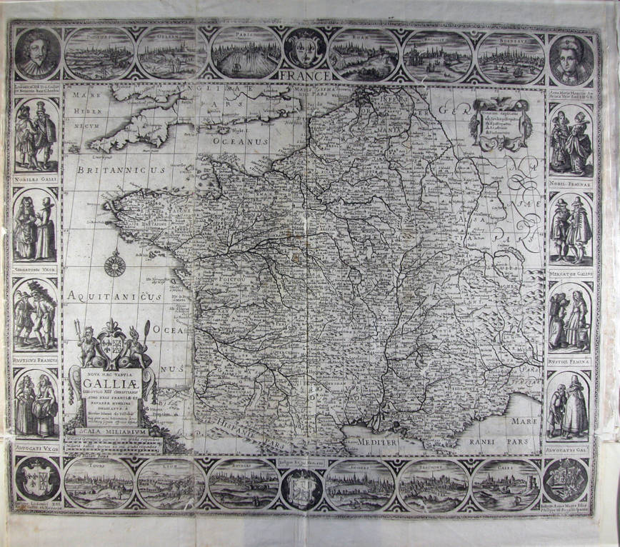
826-Nova haec tabula Galliae Lodovico XIII christianissimo regi Franciae et Navarrae humil .
Author: Visscher
,0 |

|
1008-Utriusque .
Author: Frederick de Wit
,0 |
