![]()
![]()
![]()
![]()
![]()
![]()


MY MAPS
Regions:
![]()
Browse the website:
Latest Acquisitions
A Brief History of Cartography
The Cartographers
Events on ancient maps
Accimo editions
Brochure MB
Contacts
Glossary
Sitemap
|
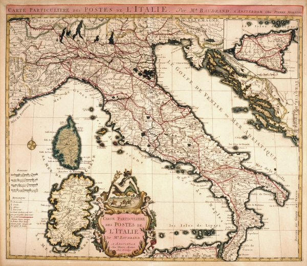
626-Carte Particulier des Postes de L'Italie Description: This map, measuring 44,5 x 55,1 cm and drawn by Michel Antoine Baudrand, was printed in 1728 in the Pierre Mortier workshop in Amsterdam. It shows the Italian Peninsula, part of Provence, Istria, Dalmatia and the Islands of Corsica and Sardinia. On the top right is a square containing Sicily. The beautifully coloured title picture appears at the bottom. The graphic scales are on the left and a wind rose is over the sea. Autor: Michele Antonio Baudrand Place: Amsterdam Year: 1728 Quality document:
See online :
Go to verification |

