![]()
![]()
![]()
![]()
![]()
![]()


MY MAPS
Regions:
![]()
Browse the website:
Latest Acquisitions
A Brief History of Cartography
The Cartographers
Events on ancient maps
Accimo editions
Brochure MB
Contacts
Glossary
Sitemap
|
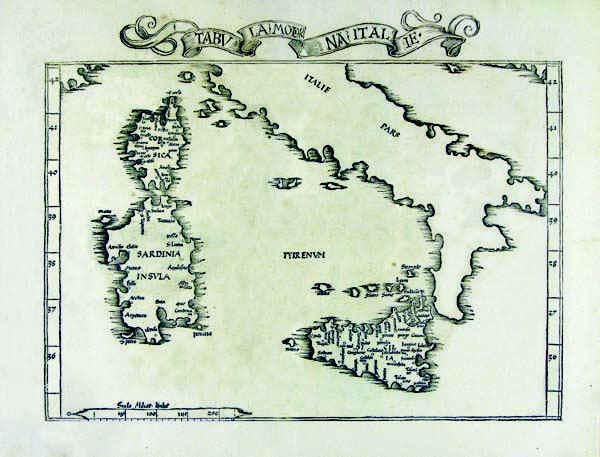
195-Tabula Moderna Italiae Description: The map belongs to the atlas Claudi Ptolomaei Geographicae enarrationis - Libri Octo-Annotationes Ioannis de Regio Monte in errores commissos a Iacobo Angelo in translatione sua. The black and white document was taken from a woodcut and measures 27,6 x 39,8cm. It comes from one of the tolemaic maps contained in the Wilibald Pirchheimer's (1470 - 1530) edition. Autor: Claudio Tolomeo Place: Strasburgo Year: 1525 Quality document:
See online :
Go to verification |

See the printed version: Click here
