![]()
![]()
![]()
![]()
![]()
![]()


MY MAPS
Regions:
![]()
Browse the website:
Latest Acquisitions
A Brief History of Cartography
The Cartographers
Events on ancient maps
Accimo editions
Brochure MB
Contacts
Glossary
Sitemap
|
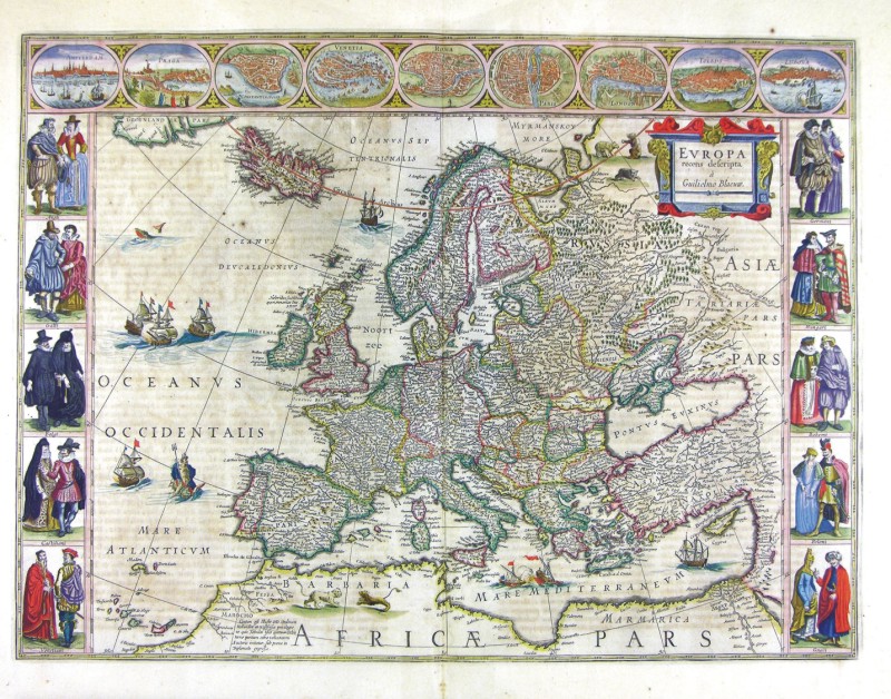
56-Europa recens descripta Description: Measuring 55,5 x 41 cm, this map was printed at the beginning of the 16th century in Amsterdam with the same matrix of the preceding map. It shows some differences in the colours and the figures of the surrounding squares. Autor: Guglielmo Blaeu Place: Amsterdam Year: 0 Quality document:
See online :
Go to verification |

