![]()
![]()
![]()
![]()
![]()
![]()


MY MAPS
Regions:
![]()
Browse the website:
Latest Acquisitions
A Brief History of Cartography
The Cartographers
Events on ancient maps
Accimo editions
Brochure MB
Contacts
Glossary
Sitemap
35 results
|
195-Tabula Moderna Italiae .
The map belongs to the atlas Claudi Ptolomaei Geographicae enarrationis - Libri Octo-Annotationes Ioannis de Regio Monte in errores commissos a Iacobo Angelo in translatione sua.
The black and white document was taken from a woodcut and measures 27,6 x 39,8cm. It comes from one of the tolemaic maps contained in the Wilibald Pirchheimer's (1470 - 1530) edition. Author: Claudio Tolomeo
Strasburgo,1525 |
|
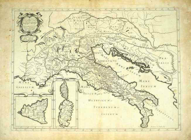
196-Italia Antiqua .
The map was created in 1640 by Melchior Tavernier and resides in the cartography collection of different authors established in the 18th century.
Tavernier worked for a long time for Sanson, Jansson, Hondius, Dankerts, Tassin, Bertius. He also was hydrographer, engraver and typographer of the King of France and produced very fine quality maps. On the let top there is a decorated picture with the title Antiquorum Italiae et Illyrici Occidentalis Episcopatuum Geographica Descriptio Parisiis apud M.Tavernier. Author: Melchior Tavernier
Parigi,1640 |
|
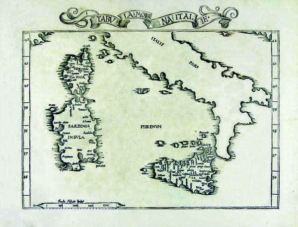
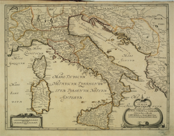
197-Italia Antiqua cum Insulis Sardinia, Sicilia & Corsica .
The map measures 40,5 x 52,5 cm. It exposes Italy and a part of Europe with in the West, the Rhone Valley and the Alps, and in the East, Istria and the Balkans. Exept from the Balkans, the document proposes the sector of the South Europe according to Cluverius' representation in 1619. But Cluverius exposed Sardinia in a preciser way. This one is the typical drawing of Sanson based on Magini's knowledges. The map has in particular a historical interest. Author: Nicolas Sanson
Amsterdam,1679 |
|
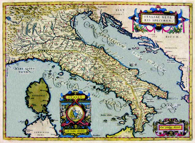
198-Italiae Veteris Specimen .
The drawing of the map measures 40,5 x 52,5 and resides in the atlas Theatrum Orbis Terrarum. It's a very beautiful and well colored map with two decoreted pictures. One of them above contains the inscription: Italiae Veteris Specimen.
Author: Abramo Ortelio
Anversa,1592 |
|
199-Italia .
The map belongs to the Atlas sive Cosmographicae Meditationes de Fabrica Mundi et Fabricati Figura, published in 1644 in Duisburg.
Author: Gerardo Mercatore
Duisburg,1644 |
|
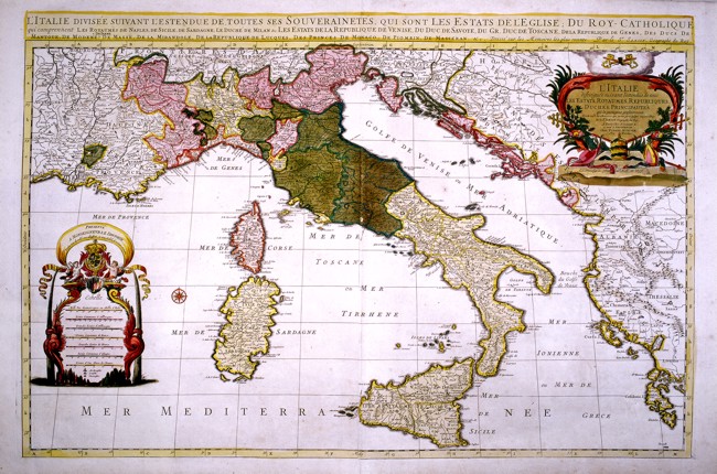
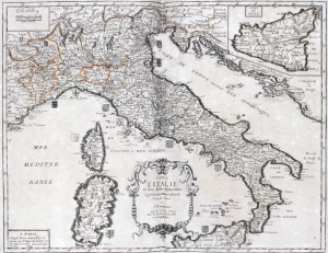
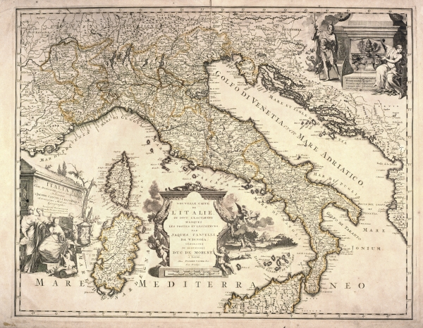
200-L'Italie .
Part of Europe from the mouth of the Rh�ne in the West to the Island of Zante in the South East of Greece. This map of the 17th century, drawn by Sanson, printed in Paris by H. Jaillot and sold in Amsterdam by Pierre Mortier measures 89 x 50 cm. It shows all the states of Italy at that time.
On the top right is a splendid title picture and on the left a decorative picture contains different graphic scales. Author: Hubert Iaillot
Parigi,1669 |
|
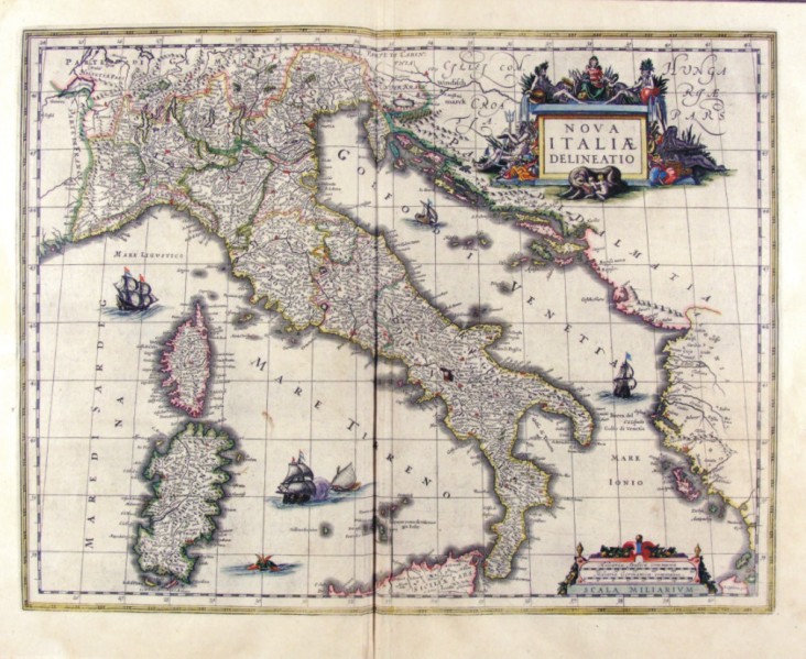
201-Nova Italiae Delineatio di Ioannis Blaeu .
The map measures 49 x 38 cm and belongs to the atlas Theatrum Orbis Terrarum sive Atlas Novus - pars tertia - Guilelmus et Ioannis Blaeu, printed in 1650 in the Blaeu's family workshop in Amsterdam. The document shows the Italian peninsula with the islands of Sardinia and Corsica, a part of Sicily and Dalmatia. A beautiful decorating picture exposes the title and several sailing ships enrich the graphic aspect. Author: Giovanni Blaeu
Amsterdam,1650 |
|
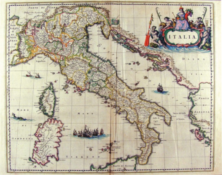
202-Italia .
The Map belongs to the atlas Geographiae Blavianae volumen octavum Quo Italia quae est Europae Liber XVI di Blaeu, printed in 1662 in Amsterdam. The title is contained in a cartouche decorated with mythological figures, while the seas are several astimenti and sea monsters.
Author: Ioannis Blaeu
Amsterdam,1662 |
|
416-Italia settentrionale .
Author: Robert Dudley
Firenze,1661 |
|
418-Mar Ligure .
Author: Robert Dudley
Firenze,1661 |
|
421-Sicilia e Tunisia .
Author: Robert Dudley
Firenze,1661 |
|
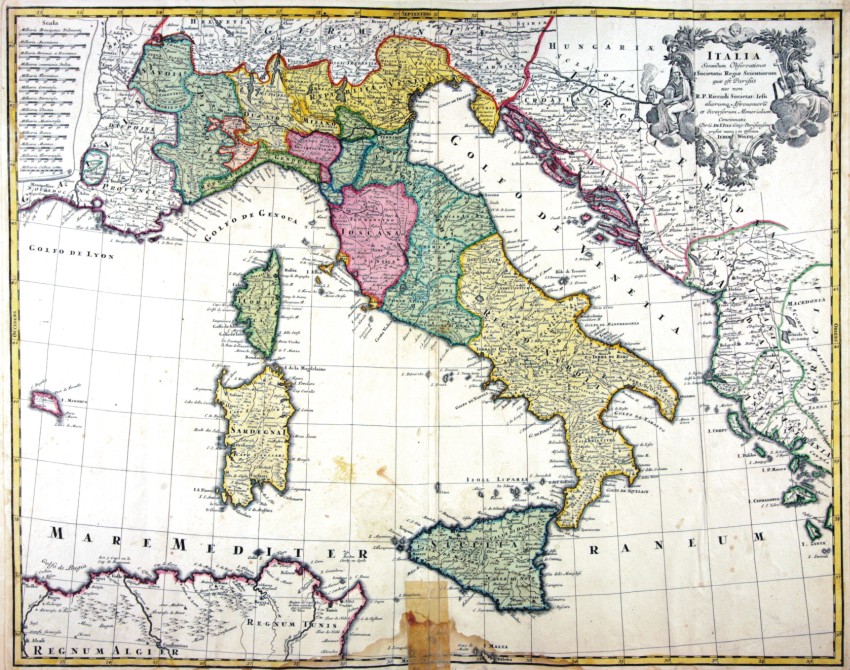
465-ITALIA .
The map (cm 52,5 x 70,0), which is contained in the collection of cards Matthäus Seutter entitled Sphaerae artificiales of 1730, was printed in Augsburg in the publishing house of Jeremias Wolff. Cartouche in the upper right corner shows the title Italia secundum observationes Societatis Regiae Scientiarum quae est Parisiis nec non R.P.Riccioli Societatis Iesu aliorumque Astronomorum et diversorum Memorialium concinnata Per G. De L’Isle Geog.Parisiensem prostat nunc in Officina Ierem.Wolfii. Author: Matthäus Seutter
Augusta,1730 |
|
501-Carte de l'Italie et des Isles adjacentes .
This map, measuring 37 x 48 cm and drawn by Pierre du Val, was printed in 1663 in Paris. It is a splendid coloured document coming from a fine engraving of I. Lhuilier. It shows an exact subdivision of the Italian states and dukedoms with their blazons at that time. Sicily appears in a square on the top right. In the centre-bottom is a beautiful title picture; on the top left are the graphic scales in Lieues communes de Fra(n)ce; Milles d'Italie. Author: Pierre Du Val
Parigi,1663 |
|
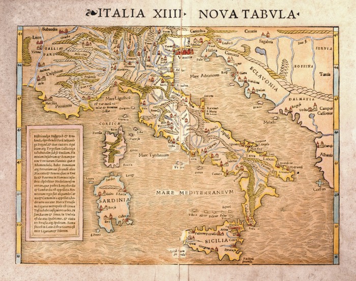
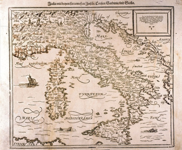
599-ITALIA XIIII - NOVA TABVLA - .
Author: Sebastian Münster
Basilea,1540 |
|
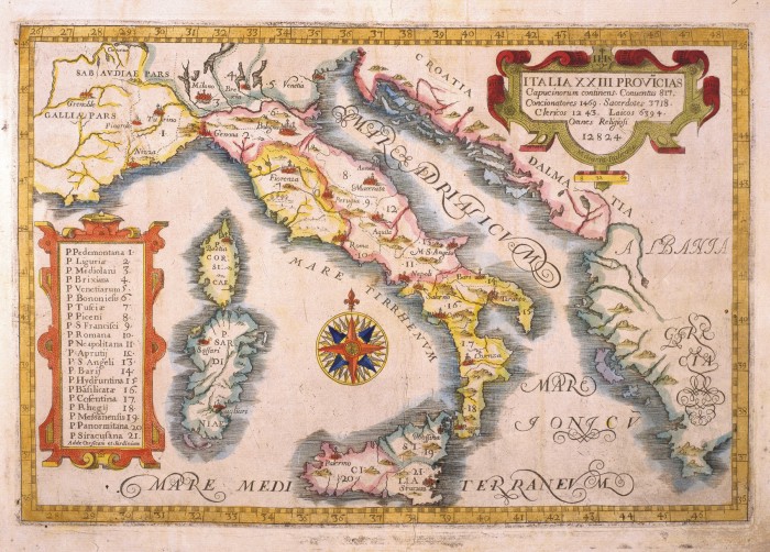
600-ITALIA XXIII - PROVICIAS .
This map, measuring 21,4 x 31,7 cm and drawn by P.Massimino da Guechen, is taken from the Atlas delle Province Cappuccine, printed in 1649 in Turin. It is a small, but finely coloured document with a central wind rose and two decorative pictures. One of them on the right contains the title, the other on the left indicates the abbeys' names in the Italian provinces. Author: Massimino da Guechen
Torino,1649 |
|
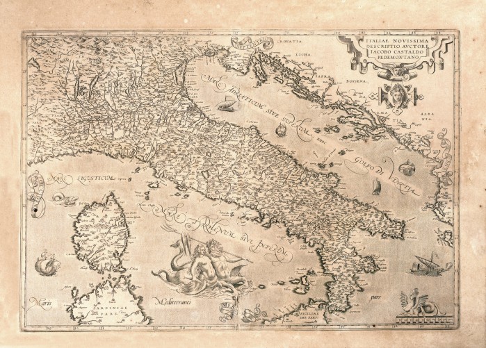
603-ITALIAE NOVISSIMA .
Black and white map developed by Giacomo Gastaldi and published in the Theatrum Orbis Terrarum of Ortelio edited to Antwerp in 1570. It is a beautiful rich of information card and with many representations in orography, in hydrography and in built-up areas, also is enriched with different decorations placed by Ortelio as the title block that contains the title, place in the upper right and the bar scale is surmounted by a Sphinx and the different boats in the sea.
Author: Giacomo Gastaldi
Anversa,1570 |
|
606-Italia, Sardinia e Sicilia .
This map, measuring 31 x 36,2 cm, comes from the Sebastian Munster Cosmographia Universalia , printed in 1588 in Bale. The graduated frames and the indication of latitudes, as well as the graphic scales are missing. It is simply a demonstrative document.The title appears off the map. In a square on the top left the most important Italian towns are described in German. Author: Sebastian Münster
Basilea,1588 |
|
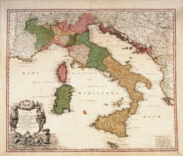
611-Italia in fous quoscunq Status divisa .
This map, measuring 50,4 x 59,4 cm and drawn by Carol Allard, was printed at the end of the 17th century in Amsterdam. It shows the Italian Peninsula with its numerous states, and the Islands of Corsica and Sardinia. Sicily appears in a separate square. The mountains are indicated by mole-hill reliefs and there is a description of the most important rivers and woods as well. A festoon on the top right contains the title. The graphic scales in Italic, German and Celtic miles are on the bottom left. Author: Carel Allard
Amsterdam,1697 |
|
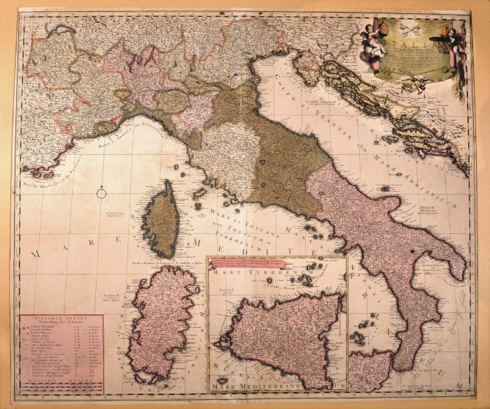
616-Statum totius Italiae .
This map, measuring 48,3 x 57 cm and drawn by Johann Baptist Homann, was printed at the beginning of the 18th century in Nuremberg. It shows the Italian Peninsula with the borders of numerous Italian States, Dalmatia, and a large part of the Balkans. The mountain ranges are indicated by mole-hill reliefs and the rivers, lakes and woods are described as well. Many female figures surround the title picture. The graphic scales in Milliaria Germanica, Milliaria Italica, Leuca Gallica are on the right. Author: Iohannes Baptista Homann
Norimberga,1700 |
|
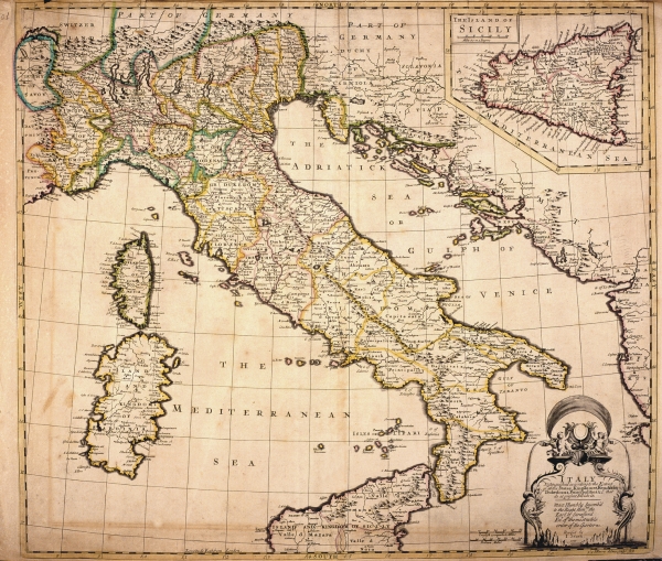
624-Italy .
This map, measuring 49 x 56 cm comes from the John Senex atlas A new General Atlas of the World, printed in 1721 in London. It shows the Italian Peninsula with the political subdivisions, Corsica and Sardinia. Sicily appears in a square at the top. The mountains are approximately indicated, the most important water courses and roads however are described more exactly. A decorative black and white picture contains the title and just beside it are two graphic scales in English computed Miles and Italian Miles. Author: John Senex
Londra,1721 |
|
627-Nouvelle Carte de L'Italie .
The map was stamped to Leida in 1729 from Pierre Ander Aa.
Thankful arrichita to the center dl cartiglio that brings the title in Italian and to the left from a sefondo with the title in Latin, while aloft a third cartiglio explains to the right the simbologia.
Author: Pierre Ander
Leida,1729 |
|
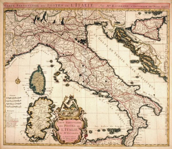
626-Carte Particulier des Postes de L'Italie .
This map, measuring 44,5 x 55,1 cm and drawn by Michel Antoine Baudrand, was printed in 1728 in the Pierre Mortier workshop in Amsterdam. It shows the Italian Peninsula, part of Provence, Istria, Dalmatia and the Islands of Corsica and Sardinia. On the top right is a square containing Sicily. The beautifully coloured title picture appears at the bottom. The graphic scales are on the left and a wind rose is over the sea. Author: Michele Antonio Baudrand
Amsterdam,1728 |
|
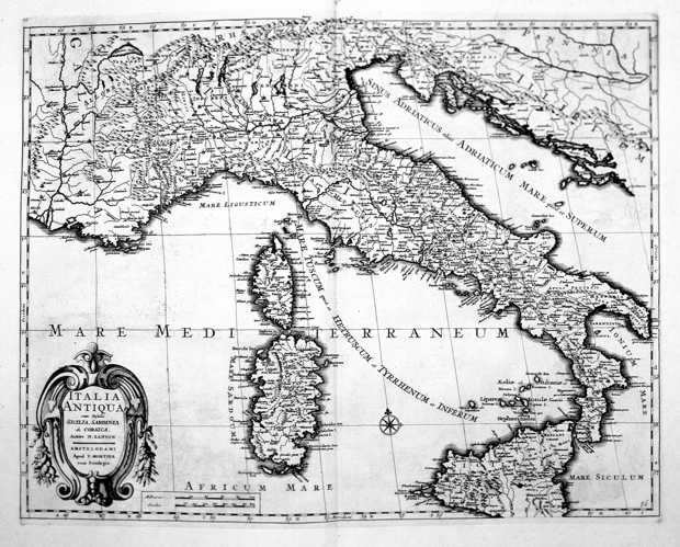
642-Italia Antiqua .
Author: Filippo Cluverio
,1624 |
|
828- Italia Nuova .
Author: Giovanni Antonio Magini
Milano,1638 |
|
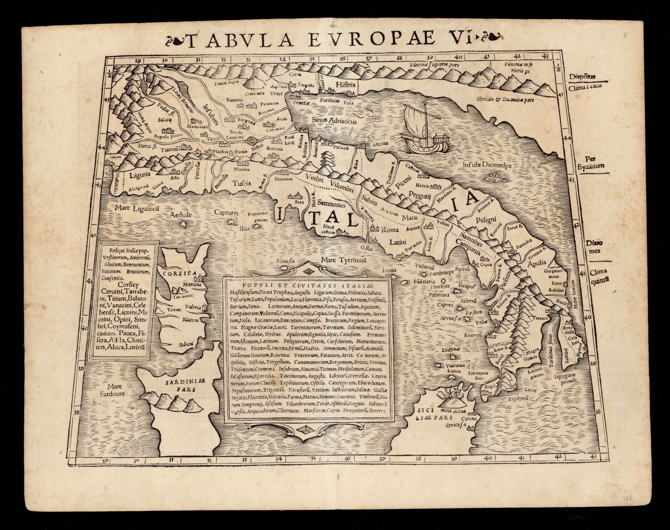
933- Tabvla Evropae VI .
Author: Munster
,1542 |
|
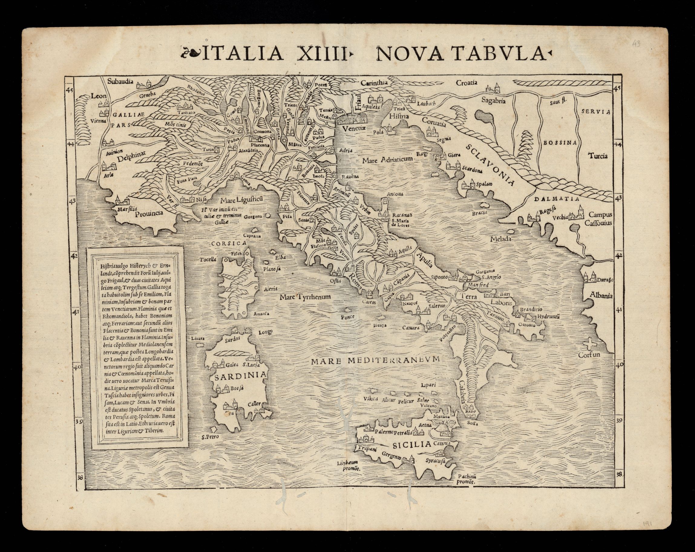
930- Nuova tabella Italia XIIII .
Author: Munster
,1542 |
|
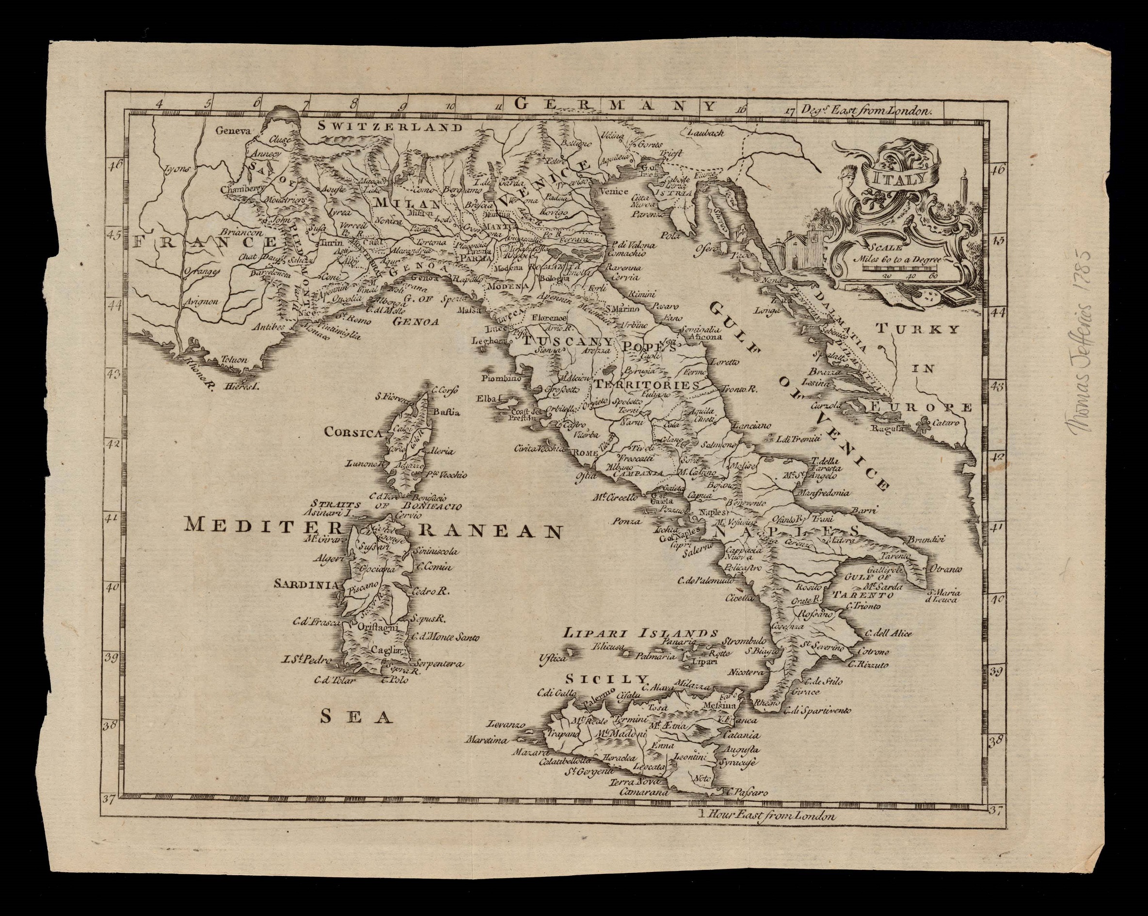
926-Italy .
Author: Thomas Jefferys
,1749 |
|
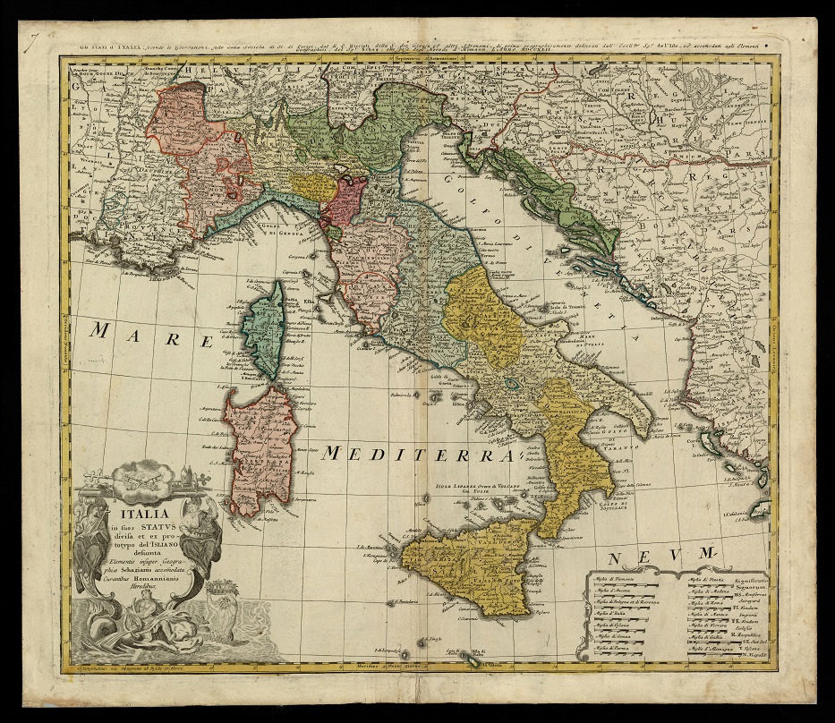
922- Italia in suos status divisa et ex prototypo del'Isliano desumta elementis insuper ge .
Author: Homannischen Erben
,1742 |
|
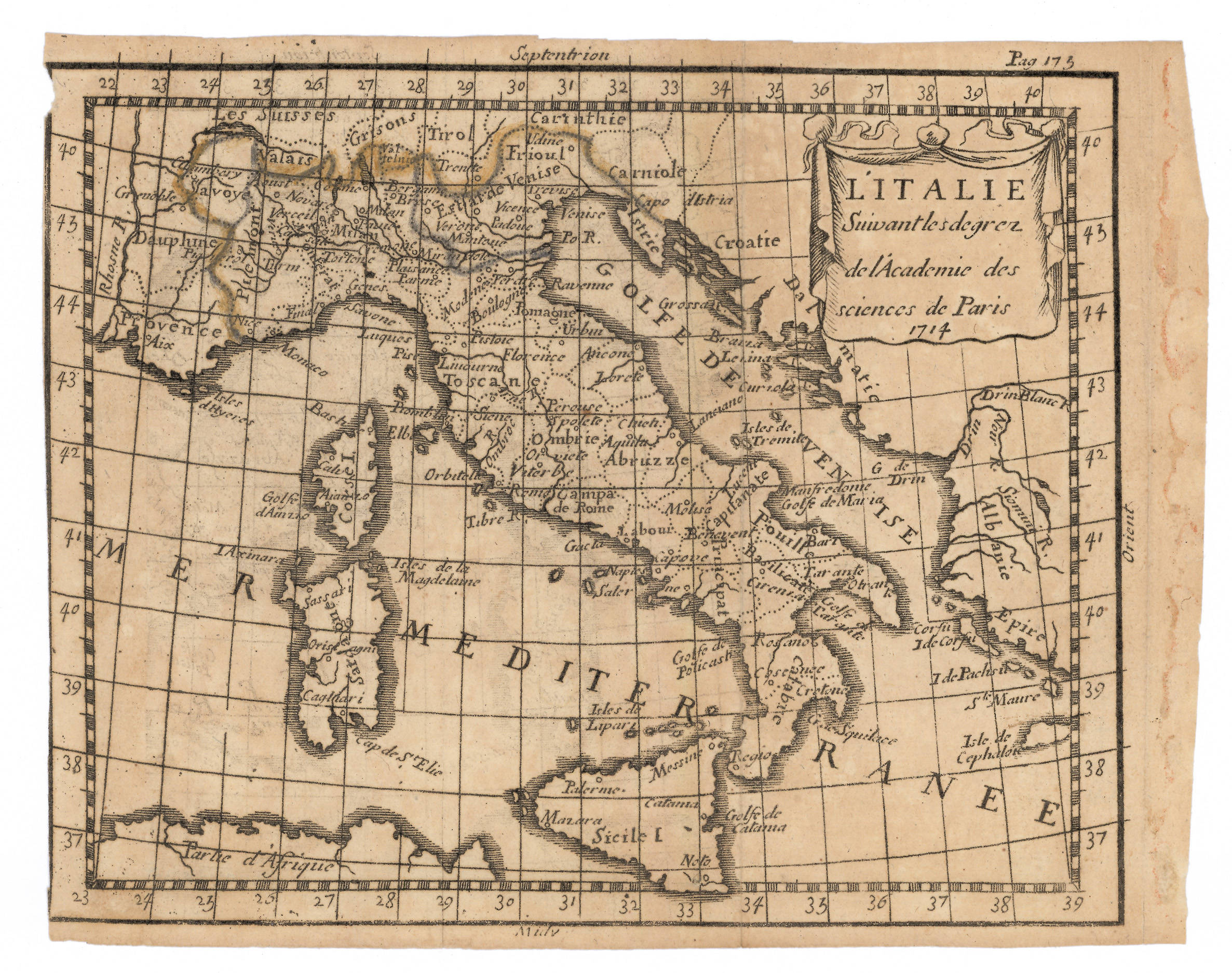
921- L'Italia, secondo i diplomi dell'Accademia delle Scienze di Parigi .
Author: Abraham Du Bois
,1714 |
|
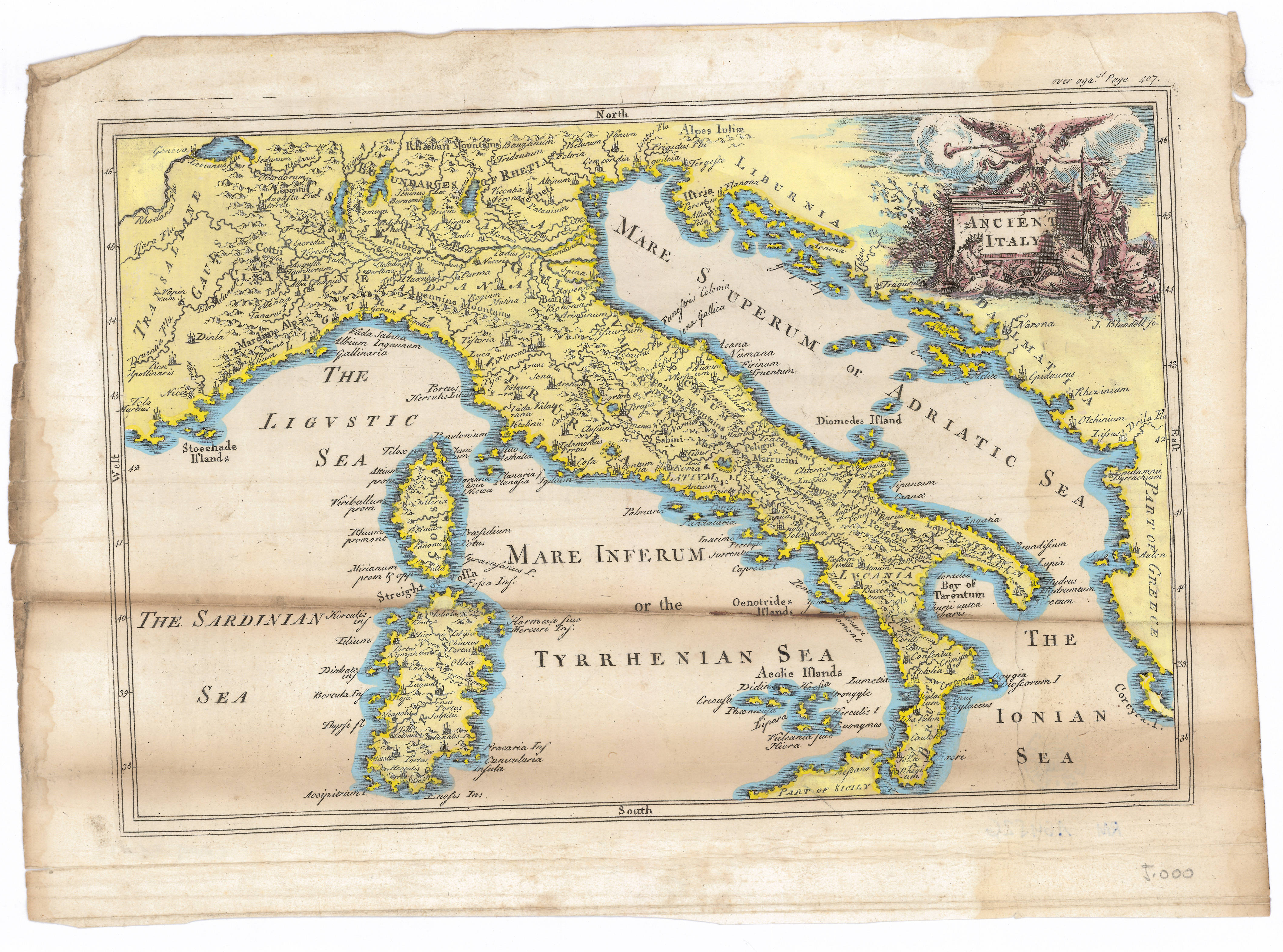
919- Antica Italia .
Author:
,1700 |
|
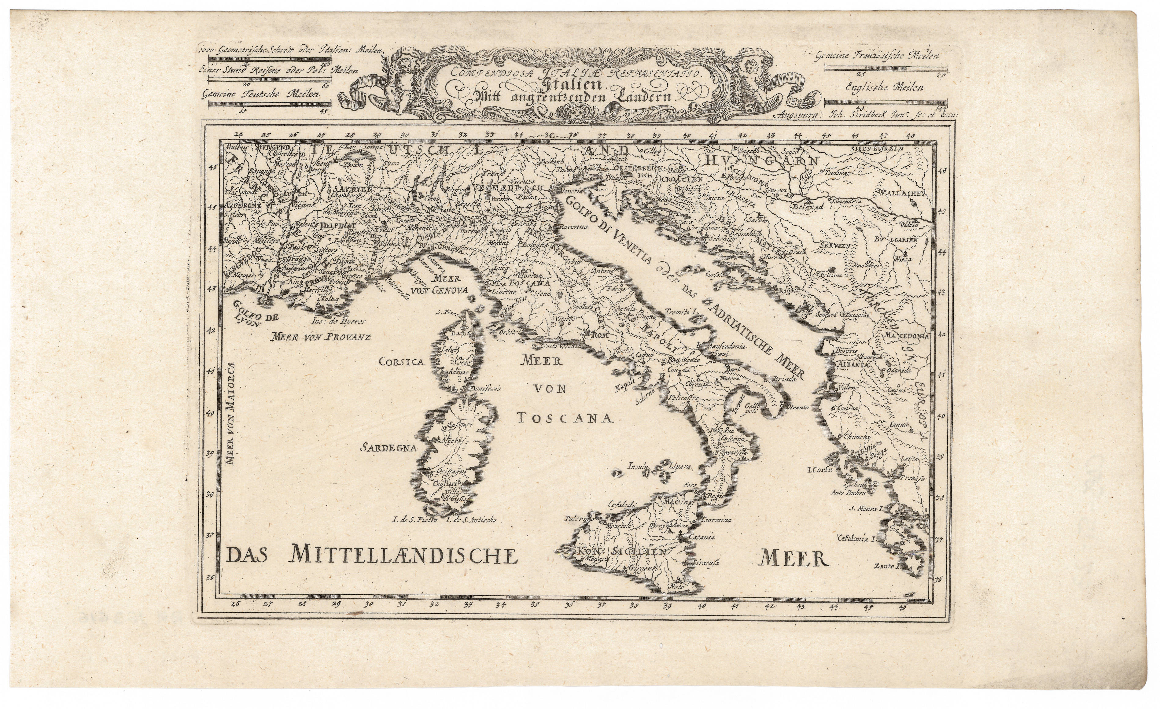
917-Rappresentatio Compendiosa Italiae. Italiano Mitt angrentzenben Landen .
Author: Stridbeck Junior
,1710 |

|
913- Italia con le sue poste e le strade principali .
Author:
,1700 |

|
912-Italia Antiqua .
Author: Seale
,1740 |
|
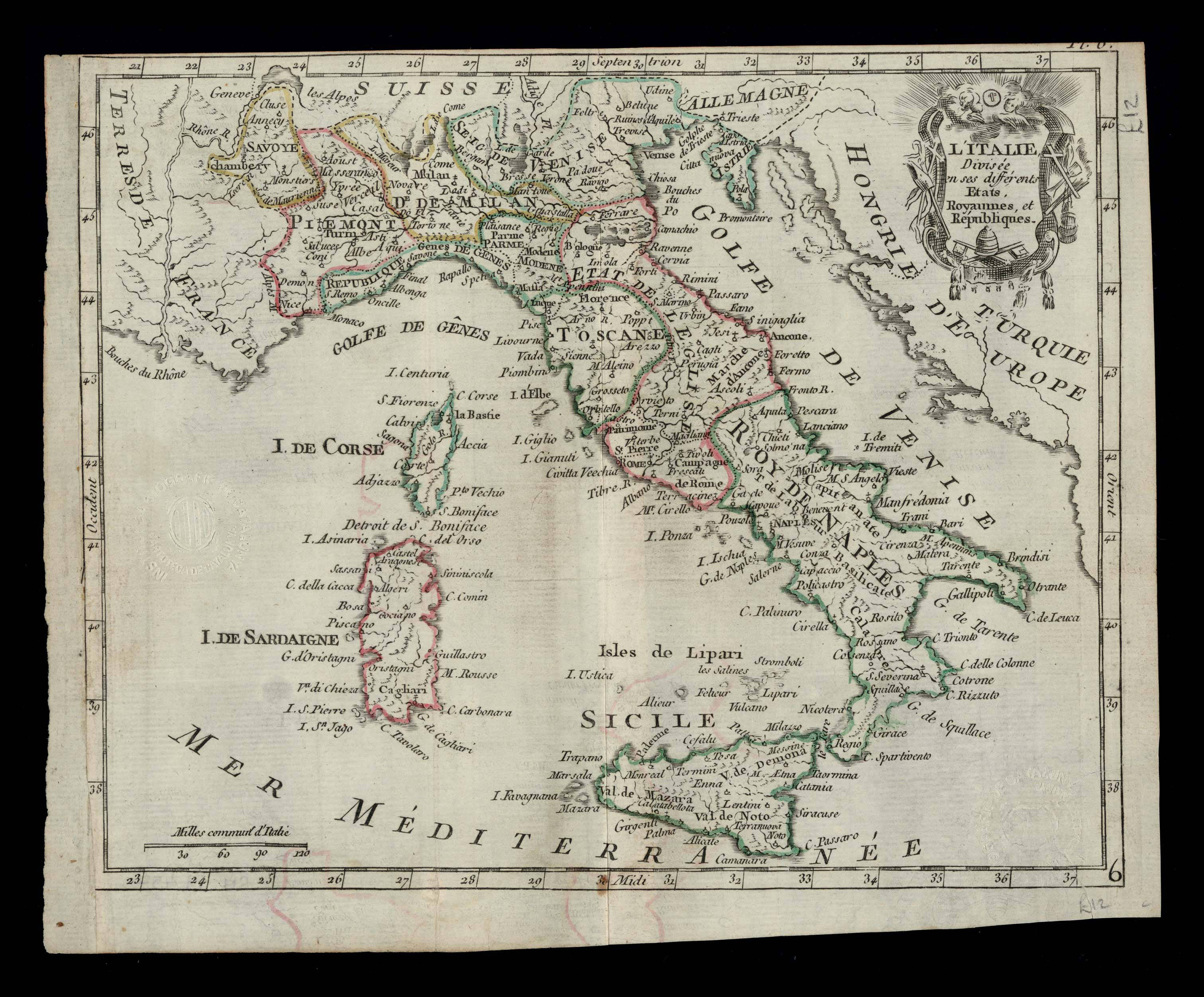
908- L'Italie divisée en ses différents etats, royaumes et républiques .
Author:
,1700 |
|
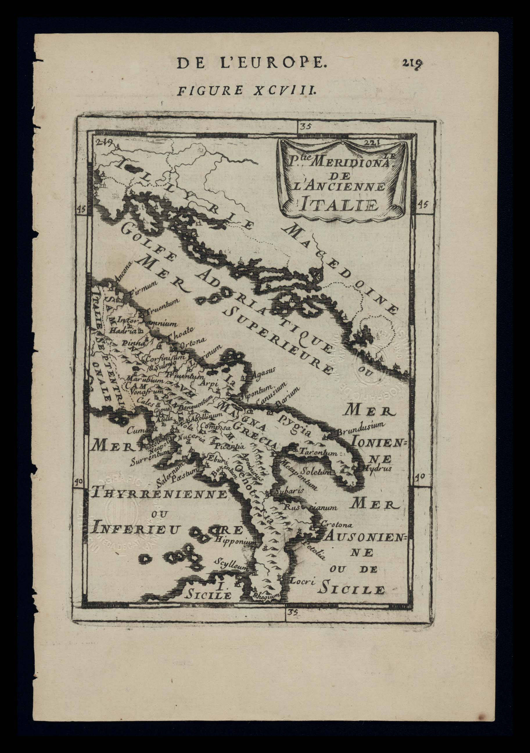
901-Parte Meridionale de l’Ancienne Italie .
Author: Manesson
,1683 |
