![]()
![]()
![]()
![]()
![]()
![]()


MY MAPS
Regions:
![]()
Browse the website:
Latest Acquisitions
A Brief History of Cartography
The Cartographers
Events on ancient maps
Accimo editions
Brochure MB
Contacts
Glossary
Sitemap
6 results
|
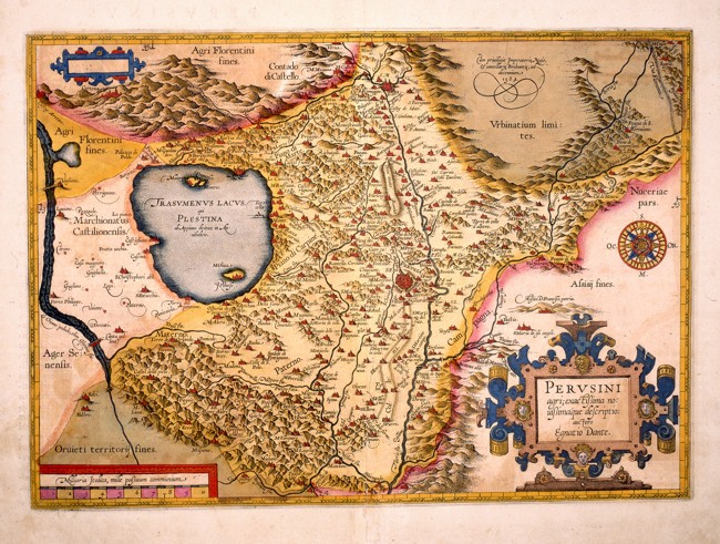
Perusini Agri .
Umbria with Perugia in the centre and the surrounding places, described with red perspective drawings. The water courses and Lake Trasimeno are intricately drawn, however the hills are approximatively distributed all over the whole region. The borders of the neighbouring territories are more intensively coloured, as are the territories of Urbino in the North East, Florence to the North, Siena to the West and Orvieto in the South. This detailed coloured map of the 17th century, is drawn by the cartographer Ignatius Dante and measures 46,5 x 32,8 cm.
Author: Dante Egnatio
Anversa,1584 |
|
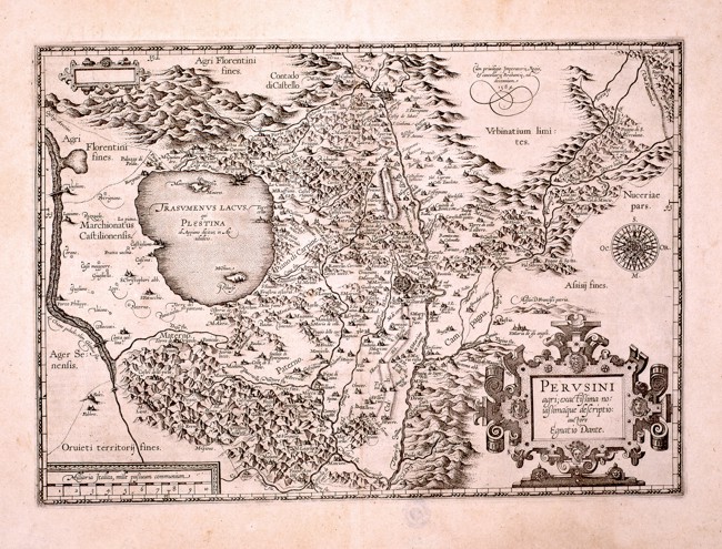
342-Perusini Agri .
This black and white map measures 40 x 33 cm and comes from the same matrix as the preceding map. On the top right appears the inscription Cum privilegio Imperatoris, Regis cancellerie Brabantie, ad decennium 1584. Author: Dante Egnatio
Anversa,1584 |
|
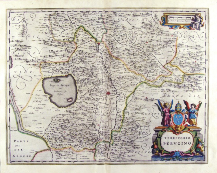
344-Territorio Perugino - Umbria - Italia .
The Charter, which measures 49,7 x 38 cm is located in the Atlas Theatrum Orbis Terrarum sive Atlas Novus is tertia pars of Guilelmus et Ioannis Blaeu, printed in Amsterdam in the workshop of Giovanni Blaeu in 1650 Author: Ioannis Blaeu
Amsterdam,1650 |
|
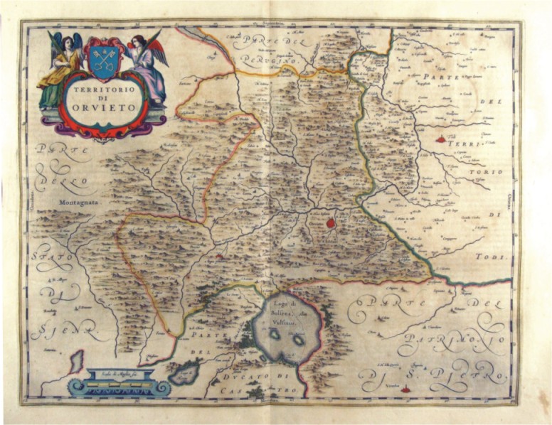
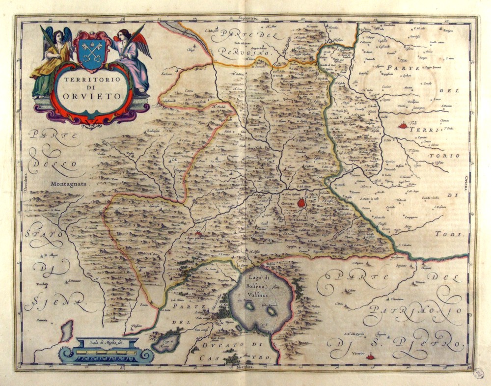
345-Territorio di Orvieto - Umbria - Italia .
The Charter, which measures in the drawing cm 49,5 x 38, is contained in the Atlas Geographiae Blavianae volumen octavum Quo Italy quae est Europae Liber XVI of Blaeu printed in Amsterdam in 1662. Author: Ioannis Blaeu
Amsterdam,1662 |
|
346-Territorio Perugino - Umbria - Italia .
The Charter, which measures in the drawing 49.2 x 38 cm, is contained in the Atlas Geographiae Blavianae volumen octavum Quo Italy quae est Europae Liber XVI of Blaeu printed in Amsterdam in 1662. Author: Ioannis Blaeu
Amsterdam,1662 |
|
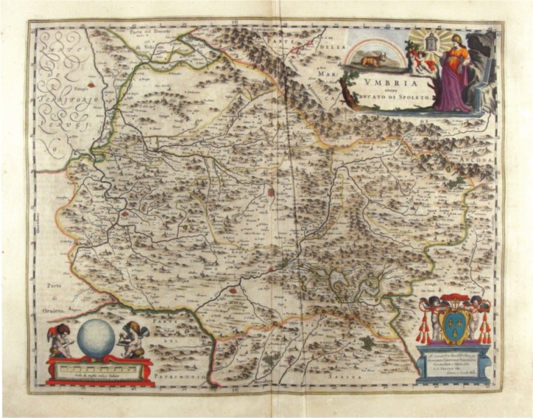
347-Umbria - Italia .
The Charter, which measures in the drawing cm 50 x 39, is contained in the Atlas Geographiae Blavianae volumen octavum Quo Italy quae est Europae Liber XVI of Blaeu printed in Amsterdam in 1662. Author: Ioannis Blaeu
Amsterdam,1662 |
